
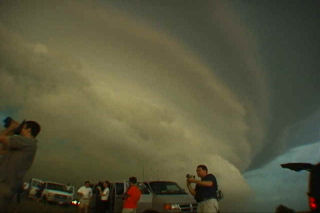
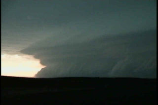
May 27th, 2001 Barber County, KS Weak Tornado & Supercell
May 27 was a potentially violent day for the plains. A frontal boundary was draped across southern Kansas, and elevated severe storms developed north of this boundary. We decided to wait for any surface based convection to develop south of the front, and finally we were treated to a very violent, hail producing supercell that eventually went upscale into an incredible MCS that blasted Oklahoma that night. Pics of the supercell, weak tornado near Sitka, and incredible “outer space” shelf cloud are shown below.
No comments yet.