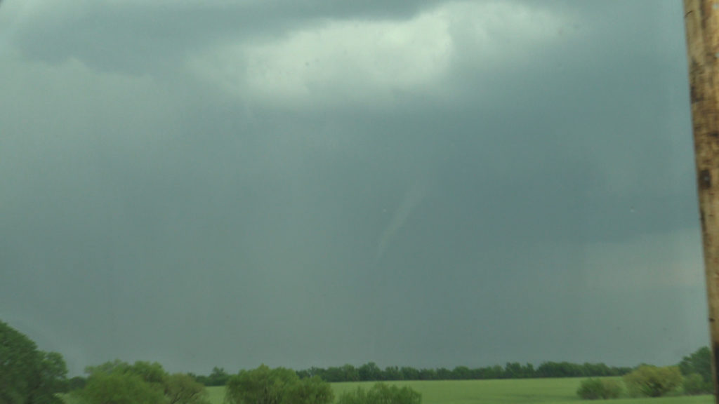
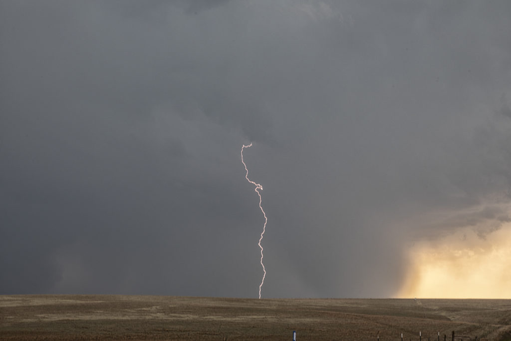
May 14th took the May Minitour to southern Kansas. A storm formed near Arkansas City and anchored itself. Due to extremely high dew points and CAPE, the storm grew very large quickly. Wind shear was enough to start it spinning as well. It became severe and soon also was tornado warned. As the base lowered and a wall cloud formed, an elephant trunk shaped funnel dropped down and touched down for a couple of minutes before roping out. The storm maintained its structure for a couple more hours before it merged with a line of storms coming in from the west. A surprise event as it wasn’t forecasted, but nonetheless was pretty intense. Large hail also accompanied this supercell during its lifetime.
May 13th Texas Panhandle Supercells
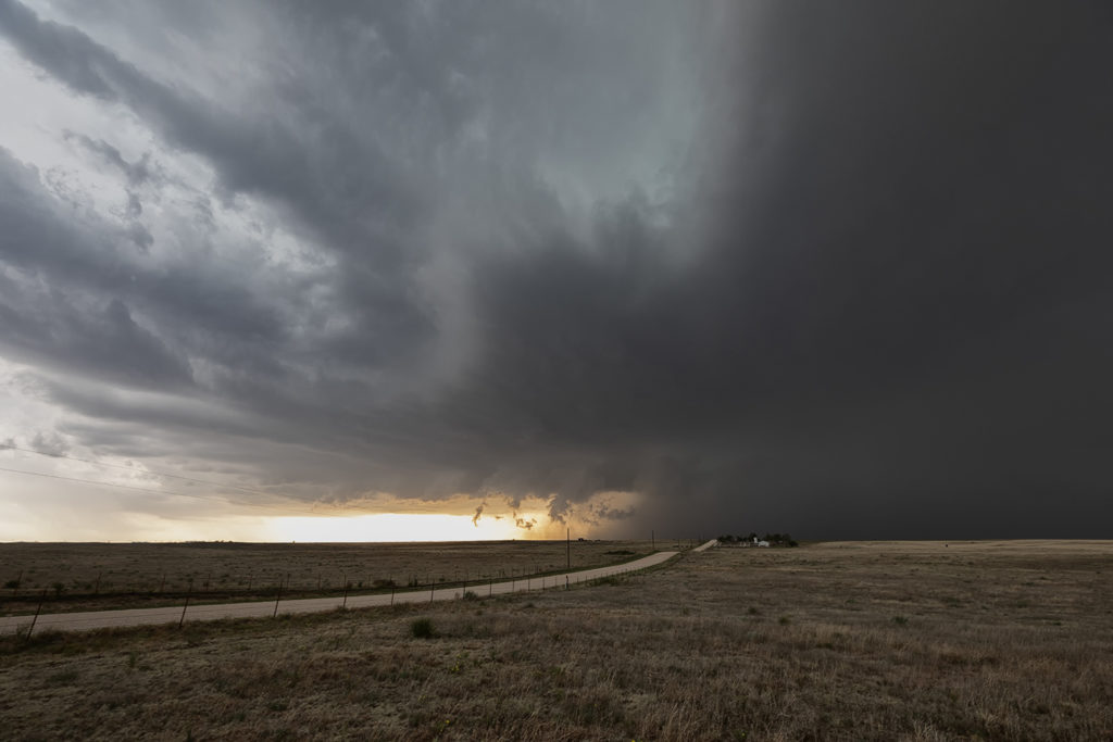
May 13th brought a good set up with strong convergence, good instability and moisture, but weak shear. This would result in high precipitation storms nearly anchoring across the Texas panhandle into south central Kansas. These storms would produce copious amounts of huge hail, high winds and especially flash flooding. Due to weak low level shear, they would not produce tornadoes. One particular supercell grew to a very large storm. A second storm was south of it and the inflow was so strong from the main supercell it pulled to southern storm into it and completely destroyed it! Crazy to see this happen! The large storm became a formidable high precipitation supercell as it slowly moved east towards the Oklahoma border. Lightning was also intense in many of the storms and we were treated to quite a light show as we drove back to Oklahoma City.
May 1st Kansas Tornadic Supercells
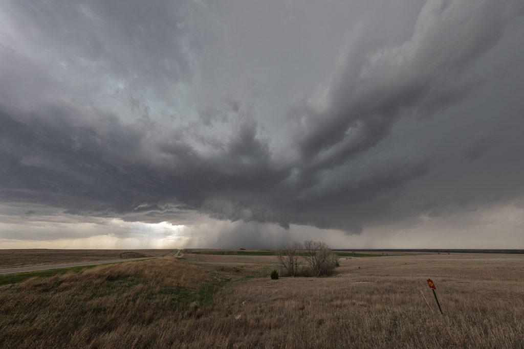
May 1st had a lot of promise. However there were certainly some issues with the set up. Storm mode was unclear near the front in northern Kansas and a strong capping inversion southward along the dryline could result is very short storm lives in that area. We started near Great Bend and jumped on a storm that formed northeast of Dodge City. It quickly became tornado warned. Based on initial visuals of the storm, it had little tornadic threat at that time. As the storm moved northeast towards Interstate 70 it really ramped up, getting tornado warned for nearly 3 hours. Rotation was visibly increasing and the structure of the supercell became quite nice. Unfortunately a left moving split further south came crashing into it and basically killed it. Other storms formed north and south, and opting for the usual tail end storm this day proved to be the wrong play. As the tail end supercell moved east away from the dryline, it showed a nice hook on radar and became tornado warned. As we raced south, leaving the messy northern play to get on the tail end storm, it weakened and eventually died. Before dying, it gave us a very nice look at the updraft as it became a low precipitation supercell. 9 out of 10 times this play works. However this day it did not as a cluster of storms north of the interstate rotated and one dropped a significant tornado.
Enjoy the photos as it was a pretty supercell!
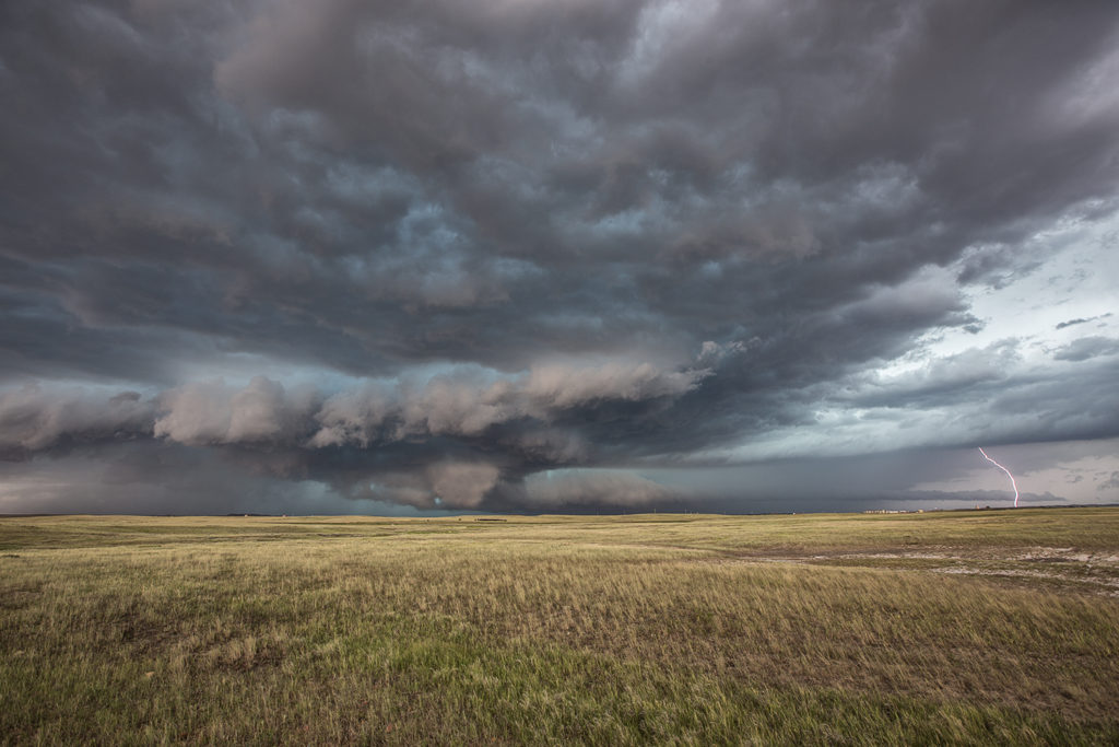
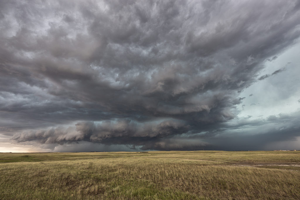
July 10th Eastern Montana Tornado Warned Supercell
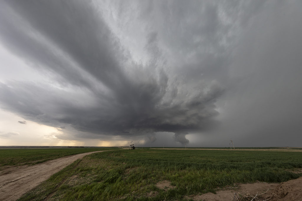
July 10th was day one for the Great North Tornado Hunt. A strong area of low pressure over southern Montana and an associated warm front extending east of there would provide the lift to produce numerous storms, including a few supercells. We intercepted the only tornado warned supercell in the country near Baker, Montana and followed it eastward along the boundary as it spun wildly. A few of times it appeared to produce a couple of funnels and even a brief dirt swirl under one, but the story with this beast was the pretty structure and amazing green colors. This supercell produced very large baseball sized hail and had long inflow bands eastward from the updraft. The open prairieland of eastern Montana always gives a great foreground for one of nature’s most violent storms, the supercell. A fun way to start off the final tour of the year!