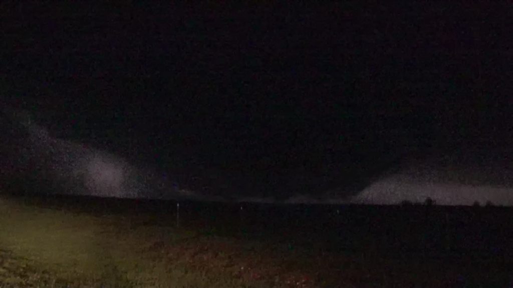
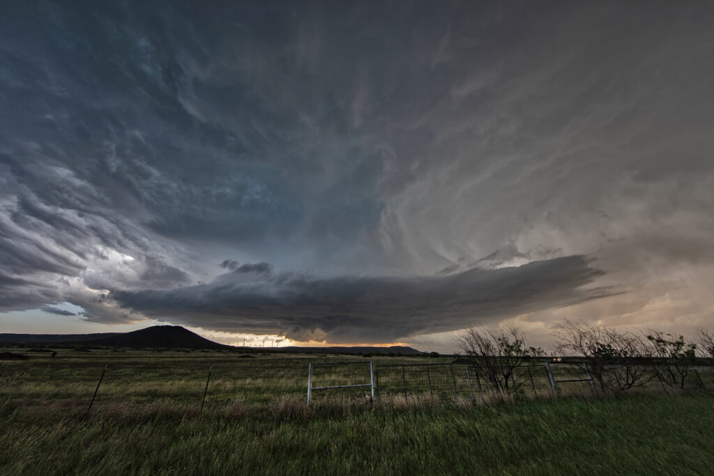
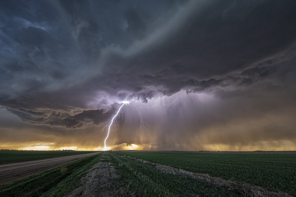
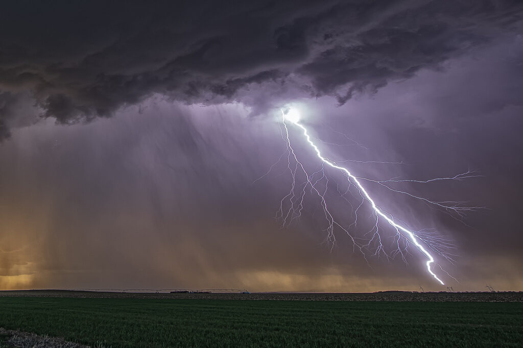
April 19th was a long drive. Up at 4am to hit the road, we blasted nearly 700 miles, only to miss the best tornado of the day by 20 minutes. Talk about frustration! Models/NWS/SPC stated the tornado threat wouldn’t ramp up until after 6pm when the low level jet kicked in. All were wrong! Before 4pm a supercell hit the boundary and became tornadic. By the time we arrived, that storm had weakened so we targeted another supercell west/northwest of San Angelo. It also became briefly tornadic as the main meso wrapped up and dropped a cone funnel to the ground! It was only down a couple of minutes before lifting back up. A long drive, but we at least were able to capture a tornado!


April 2-4 Arkansas, Tennessee and Texas Tornado Warned Supercells
We ran an on call storm chasing tour in TN/AR/TX during the April 2-4 period. We caught numerous tornado warned supercells, however on the Lake City, AR day (4/2), we debated whether to play west of the MS river or east. (Very few crossings!) Parameters were pretty sweet. We ultimately chose east (ugh) due to several discrete cells and at that time nothing west of the river. Sooo, no tornado for us! Chased a half dozen tor warned storms, but nothing produced in TN, till after midnight of course.
Second day we chased southwest AR/NW LA. Storms formed southwest of us (Ida, LA) and became tor warned. As they approached and crossed the front into wet, cool, stratus filled skies that was the end. Elevated for certain.
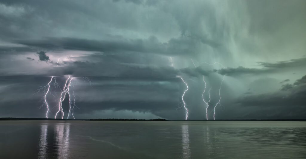
Last day (4./4), after spending the night in Texarkana, we stayed close. We were torn between the ne TX play or venturing up towards Little Rock as models were producing isolated supercells ahead of the front. We started towards Little Rock (Thinking of the Lake City event and hoping for Part 2!) and turned back around as several supercells emerged out of junky clusters in northeast Texas. We managed to catch one tornadic supercell between Texarkana and Douglassville, TX. A couple tornado reports came across, but appeared to be buried back in the Rear flank core around the hook. We found a spot by a lake as the storm approached. It was INSANELY electrified. You could see a VERY low wall cloud (possible messy circulation?) that persisted for many minutes before CGs hitting on the other side of us ran us back in to the van.
Fun trip, a bit disappointing that we didn’t catch the Lake City tornado, but you have to make choices and with several developing supercells east of the river, there was no way we were staying west. Even SPC’s MD hit western TN the hardest. Funny thing, we actually drove through Jonesboro and Lake City coming down from Springfield, MO that day. Ironic as can be…….

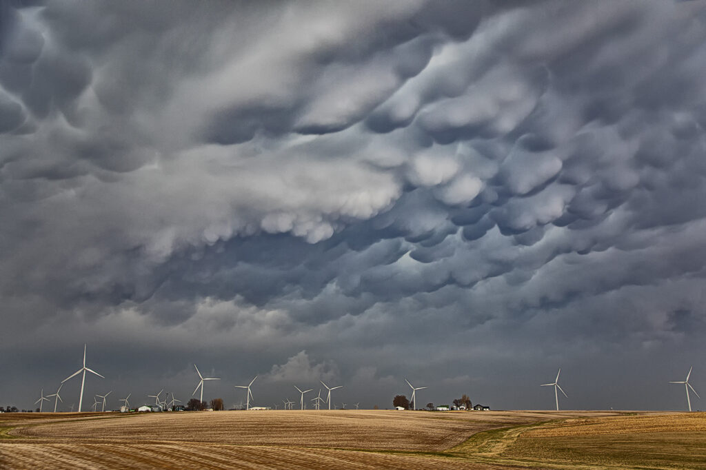
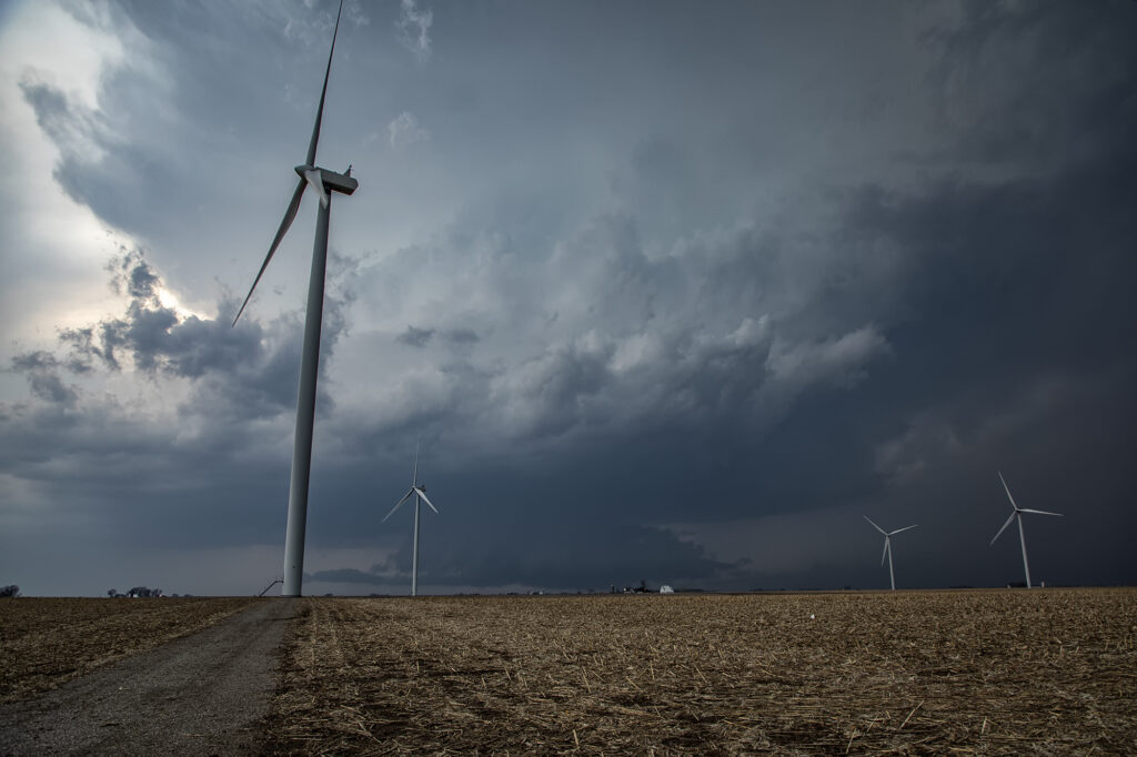
April 30th Red Oak, Iowa Tornado Warned Supercell
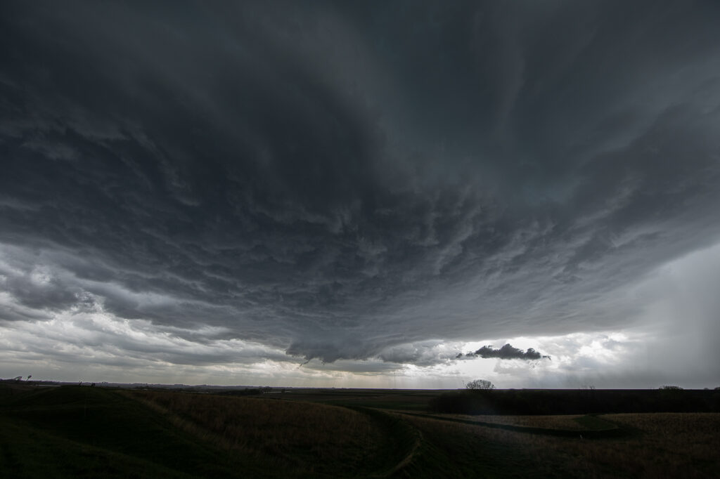
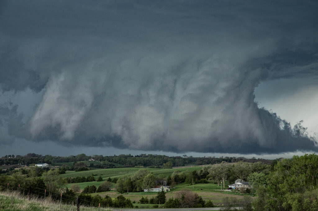
April 30th provided a fast moving, but strong upper level system across the central states. Moisture was sparse, but racing north of southerly low let jet winds. We knew it would be close to get enough good moisture to allow cloud bases to be low enough to produce tornadoes in Iowa. By mid afternoon clusters of storms for in southeast Nebraska. One such storm intensified as it moved into southwest Iowa. It became severe as it moved further east and eventually became tornado warned. On radar it looked like a classic tornadic supercell, but in real life, it’s base was just a tad too high to produce tornadoes. It was a prolific hailer and had nice structure. At one point it had a very large wall cloud that had the look. However, it could never maintain tightened rotation, only broad slow motion. A pretty storm, but just couldn’t produce any tornadoes. A fun day nonetheless!
April 26th Iowa Violent Tornado Outbreak
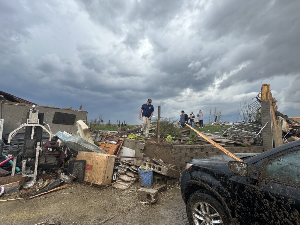
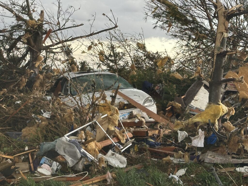
April 26th had the appearance of a major tornado outbreak. It certainly lived up to the hype! We had spent the night in Salina, Kansas and targeted Nebraska City, NE to Creston, Iowa for tornadic supercells. Strong wind shear, with dew points in the lower 60s and surface based instability of 2500 CAPE would set the stage for the event. We arrived in the Nebraska City area mid afternoon, as a supercell produced a couple of tornadoes between Lincoln and Omaha, Nebraska. Due to storm motion and speed, we could not catch up to it, so we decided to stay put. An hour later storms erupted along a confluence line near the Missouri river and quickly gained rotation. Near Council Bluffs we decided to go east and get in front of a tornado warned storm. When we saw it, it was ready to produce a tornado. As it approached a cone shaped tornado formed, turning into an 800 yard wide EF3 wedge tornado as it crossed the road within a half mile of us. It completely destroyed 2 farmsteads along highway 92 and as we approached them, nobody was there to help the residents. We immediately stopped and went into search and rescue mode. We found a family trapped in their storm shelter as their home collapsed on them. After removing a lot of debris as a few other chasers stopped to help, we were able to get them freed. Shook up, but healthy, attention turned to the other farm. An elderly woman and her dog were buried in debris as her house was demolished except for the walls. They also were able to be rescued. Soon paramedics and the local fire department arrived as we directed them to the residents and told them about propane tank leaks. At that point, it was time for us to leave and let the authorities do their jobs they did so well!
By the time we were able to depart the scene, it was too late to keep chasing as the tornadic supercell was 15 miles north moving away. It went on and produced more strong tornadoes near Minden and Harlen as we turned south to make the journey back to Oklahoma City. I do NOT regret missing the other tornadoes to stop and render help to those in need. Given the opportunity to do it again, there would be no hesitation!!! People are far more important than weather. Thanks to all who stopped that day to help families in desperate need of assistance.
April 23rd Sweetwater, Texas High Based Supercell
April 23rd promised some decent severe weather opportunities. However due to lack of good moisture, storms were high based. We intercepted one storm northwest of Sweetwater and stayed with it all the way south of Abilene where it gusted out. Structure was pretty and the hail up to golfball sized. It was also a pretty decent lightning producer. As it reached maturity and started weakening an haboob developed spewing red dirt all over. Winds were gusting over 70mph. All in all a decent day for the ingredients available to produce intense storms. Enjoy the pics!

April 25th Sweetwater, Texas Stunning Supercell!!
April 25th featured a short wave trough approaching Texas. This lead to a surface trough in eastern New Mexico that helped bring moisture northward from the gulf of Mexico. Southeasterly surface winds raced northwest towards a dryline in west Texas where a weak low had developed. Models were fairly consistent developing storms, some supercells, near the Snyder/Sweetwater area and they nailed it. We approached Sweetwater later in the afternoon as cumulus towers were seen. A high based severe thunderstorm produced a couple shear funnels due to strong motion at cloud base. This storm became a prolific hailer as it moved towards town and eventually to the southeast.
South of town, the structure was magnificent! A sculpted updraft with striations showed just how well organized this supercell was. As darkness fell, the storm maintained its intensity as it moved southeast. Lightning illuminated the structure in the dark and made for quite the scene. Finally, about 10pm we let it go as it weakened and we drove towards Abilene where we spent the night. We came across copious amounts of hail, some close to tennisball sized. A fun day and it’s always amazing to see nature’s artistic side in a gorgeous sculpted supercell! Enjoy the pics!
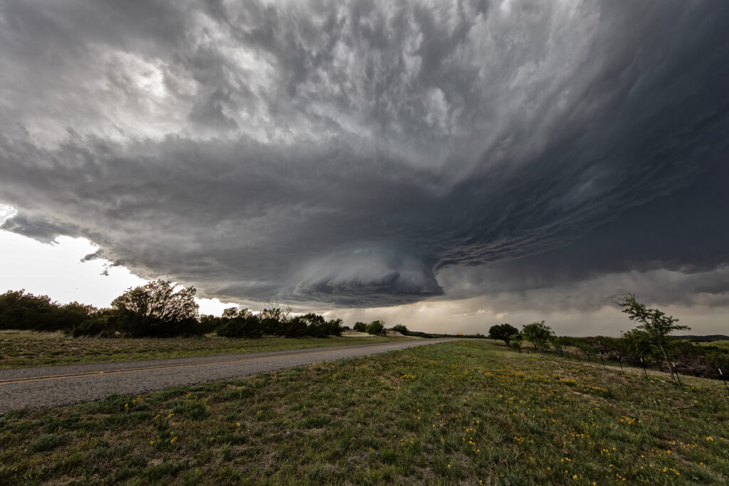
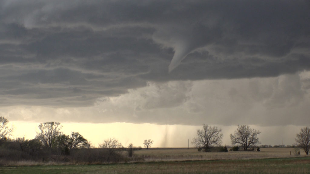
April 22nd Doole, Texas Potentially Tornadic Supercell
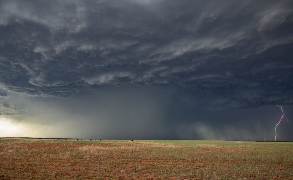
An interesting set up with northwest flow aloft on April 22nd. A weak low along with a sharpening dryline and warm front, set up a triple point northwest of San Angelo, Texas. Moisture would be the issue as dewpoints were in the 50s. Shear was good and convergence at the triple point would fire off a storm that became a long lived supercell. As the storm turned along the boundary, it started spinning strongly. After an interaction with another weak cell which it destroyed, it developed intense rotation, and on radar a classic scorpion tail hook echo formed with a good velocity couplet. RFD dirt was seen wrapping around the southern periphery of the storm and soon a large dirt bowl formed and persisted for about 5 minutes. Tornado? Possibly. But the storm also had hail the size of softballs. It soon moved east into less unstable air with lower dewpoints and it slowly decayed over the next couple of hours. A GREAT way to start the 2023 official tour season with Tour #1, the Close Encounters tour, witnessing this supercell. Enjoy the pics!!!
April 14th Medicine Lodge, Kansas Severe Thunderstorm
April 14th had plenty of shear, decent instability and a dryline in place. However, moisture was lacking, but enough of present to fire severe storms along the dryline late afternoon into the evening. I took the group the furthest south we could to get closer to better moisture, but still have enough forcing to help maintain storms as they moved off the dryline. Several storms formed and most went severe warned. However the tail end storm, as is often the case, became the strongest. Near sunset it started producing numerous lightning strikes, some starting fires. The structure was pretty good with the shear in place and it gave us a nice show as it rolled east towards Wichita. A fun day, we got about what we thought we would and had some very pretty scenes in the gypsum hills south of Pratt. Enjoy the pics!
April 4th Pleasantville, IA Tornadic Supercell
April 4th was a complicated day. A powerful upper level low would pivot out onto the plains late in the period. Low level moisture was fairly shallow for a big event, with pockets of dry air mixing out the better moisture. It seemed like two areas would be the best targets: 1) southwest Iowa as the forcing came out, however moisture was forecast to mix (and did!), 2) southeast Iowa and western Illinois in the free warm sector. We sat in Ottumwa for a couple hours waiting for one target to become clear. It never really did. A cluster of storms formed in eastern Missouri and consolidated into a few supercells as they moved into western IL. We started to head that way to chase, but it would have been a long way back to Kansas City that night as several guests had to be back in Denver by late afternoon the next day. Shortly after we headed out to go to IL, the Iowa play started forming. A line of storms, now severe, formed along the dryline west of Osceola and moved east. The tail end storm really started getting it’s act together so we quickly turned around and headed toward Pella (where we saw a tornado 2 years ago!). As we approached Pella, a tornado warning came out with a confirmed tornado towards Pleasantville, which was another 15 miles west. We did all we could to get there, but were only able to get a glimpse of the pretty tornado before it dissipated. We stayed with the supercell as it approached the warm front and became tornado warned again. A brief spin up happened south of Malcom. The storm continued its path across the warm front, weakening in the colder air. Here’s a few pics of what we saw with the supercell, distant tornado and the second spin up. Enjoy!!!!
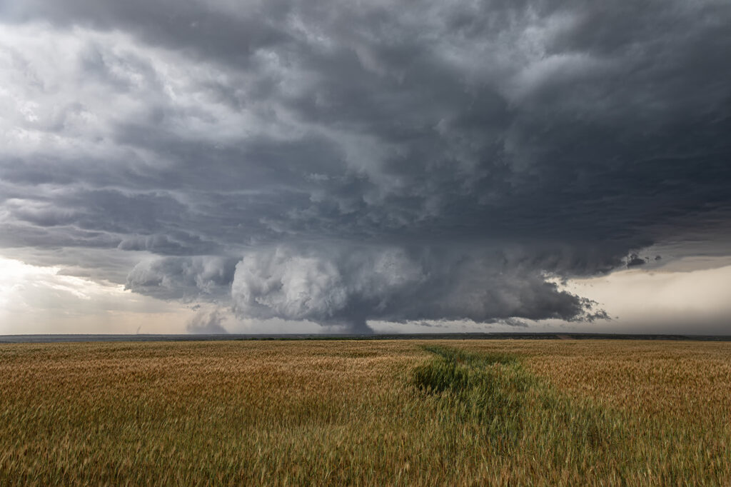
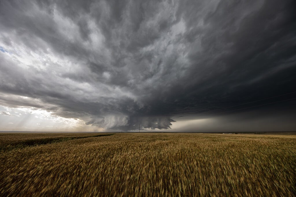
April 29th Central and Southern Kansas Tornadoes
A big day was in store for Kansas. Supercells with tornadoes were possible as a combination of wind shear, moisture and instability were present with an approaching trough. By mid afternoon the dryline sharpened and soon cumulus towers formed. A cluster of storms had formed northeast of McPherson and the tail end storm started spinning. One small tornado formed as the cell moved north towards the warm front. As it approached it, other storms started forming on an advancing cold front and also became severe. We decided to leave the first storm as storm mergers made things too messy. As we blasted south towards Wichita, a landspout tornado formed underneath an updraft in the line and stayed on the ground for 12 minutes. When is dissipated, when then turned our attention to a supercell near Wichita. It had just spawned the Andover tornado and continued to cycle and become tornadic again near El Dorado. We blasted down to town, now in the dark and headed east towards the supercell’s updraft base. Quickly a tapered cone tornado formed and became visible through power flashes and lighting. It crossed the road in front of us and dissipated. Another one formed within a couple minutes and stabbed down to the ground and lifted. We continued to drift east with the storm and turned north at Rosalia. As we did a massive bowl formed and dropped to the ground! A wedge type tornado formed with multiple vortices. We got blasted with RFD winds wrapping around the tornado and had to vacate the area. As we continued east the tornado lifted as a line of storms merged with it ending the tornado threat. A crazy day with 5 tornadoes! Enjoy the pics!