
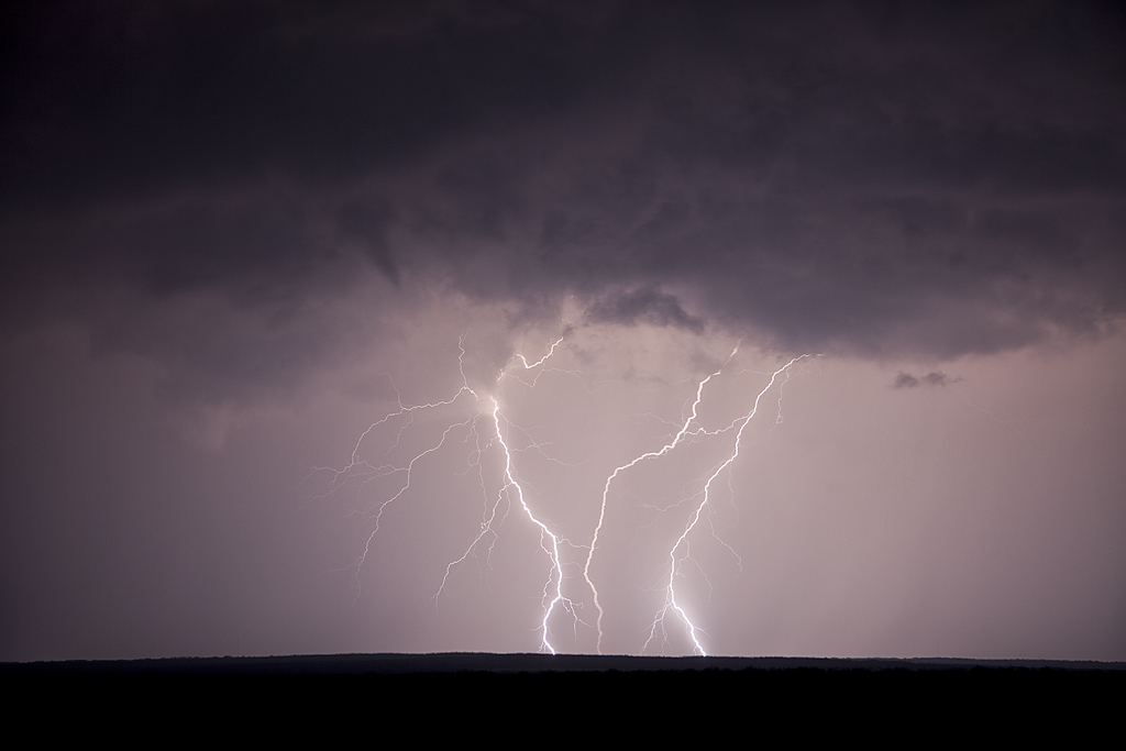
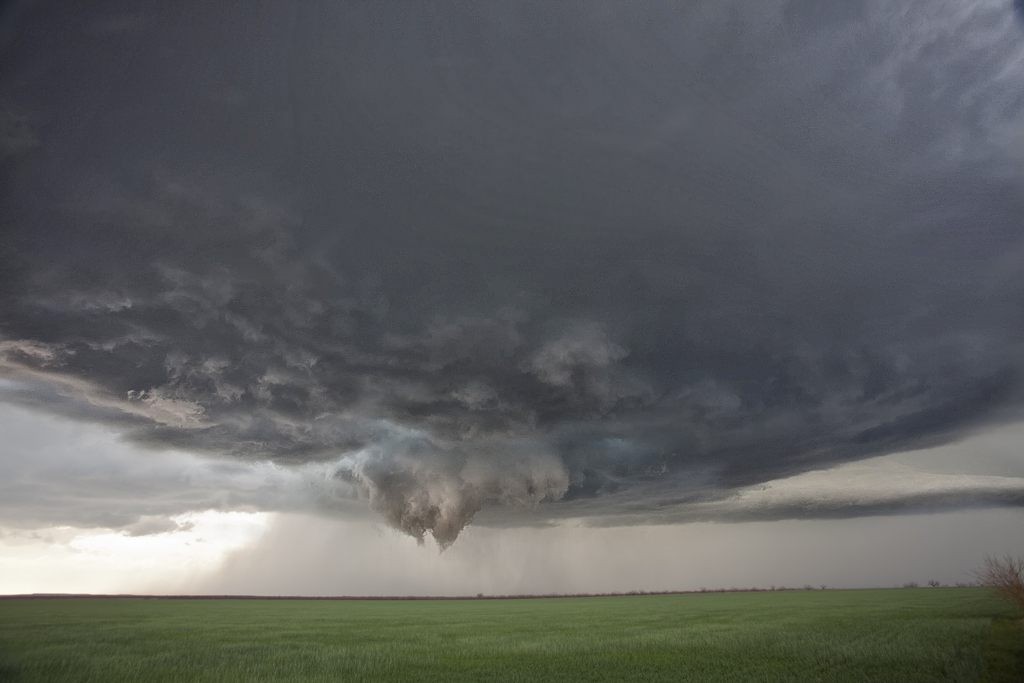
March 18th Crowell, TX Tornado Warned Supercell
March 18th wasn’t a very clear day to me. We knew we had to hit the dryline in northwest Texas/southwest Oklahoma. The first cell of the day developed southwest of Childress and quickly became severe. As we approached it, the base was insanely high. It weakened as it crossed into southwest Oklahoma, where later that evening, it would spawn at least 3 tornadoes. We weren’t there. Instead we dropped south to the tail end storm, now southwest of Crowell, TX. This cell had great structure, produced baseball sized hail, a couple of funnels and tried very hard to produce a legit tornado. It just couldn’t do it. It later shriveled up into a photogenic LP supercell. Analysis showed that the 850 MB winds were weak during its lifetime, and then increased significantly by early evening when it died, and the original high based storm lowered and interacted with the increasing low level shear and produced its tornadoes. If I had to do it all over again, we still would have chosen the storm we did.
No comments yet.