
June 4th, 2003 Quay County, NM Incredible Supercell!
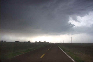
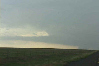
June 4 was to be a day I would not soon forget. Northwest flow aloft would be the set up for this day. A nice highly striated supercell developed near Raton, NM and tracked due south along the foothills. This storm was very hard to stay with as the road network was not conducive to a successful intercept. However I was able to catch it and take some pretty video of this nearly 2 hour tornado warned storm. The next beast that I will not soon forget developed south of Tucumcari and tracked southward along an outflow boundary. This supercell, also tornado warned for several hours did not produce a significant tornado, however it did have INCREDIBLE structure, phenomenal 60 mph plus inflow and hail baseball size that destroyed my windshield. Check out the photos below of this beast. The first photos are of the first supercell.
No comments yet.