
May 4th took us deep into the southeastern US. Very strong shear, 70 dewpoints, 2500 CAPE and an advancing cold front would set the stage for intense storm development. We chased a cluster of supercells over west central Mississippi and merged into a raging bow echo as it ripped through the Jackson, MS area. Extreme lightning, high winds and a couple of tornadoes occurred as storm approached Jackson. Sometimes it is hard to see in the southeast due to trees, hills and hazy conditions due to close proximity to the gulf. We managed to find farmland and breaks in the tree cover to watch these intense storms roll through. Enjoy the pics!
May 2nd Northwest Kansas Severe Thunderstorms
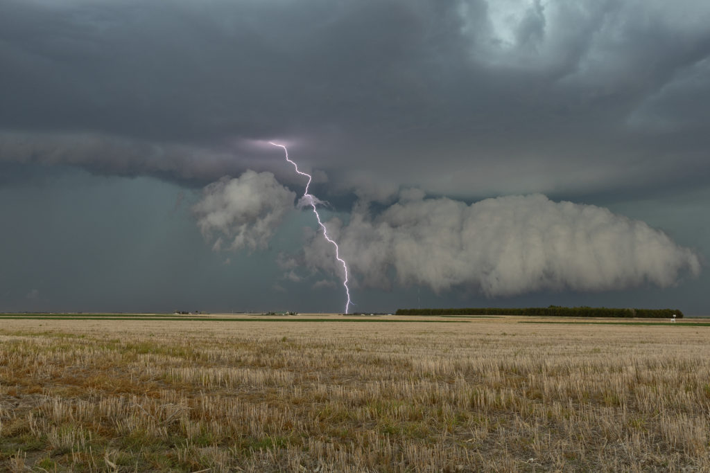
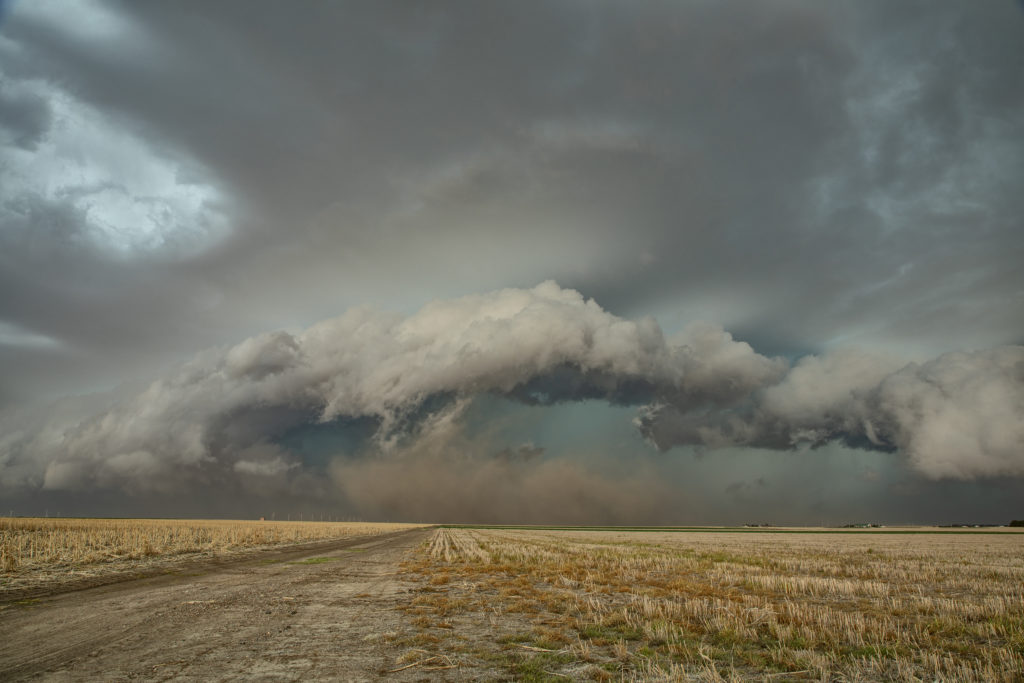
Day 1 of Tour 2 took us north from Oklahoma City to western Kansas. Shear was good this day, however moisture was lacking. This resulted in higher based severe thunderstorms with hail and high winds. Some of the areas of northwest Kansas near the Smoky Hill River bottoms are full of badlands type formations and make for a great photo! Lots of lightning also occurred with these storms as the built southward along an advancing cold front. Fun first day for Tour 2!! Enjoy the pics!
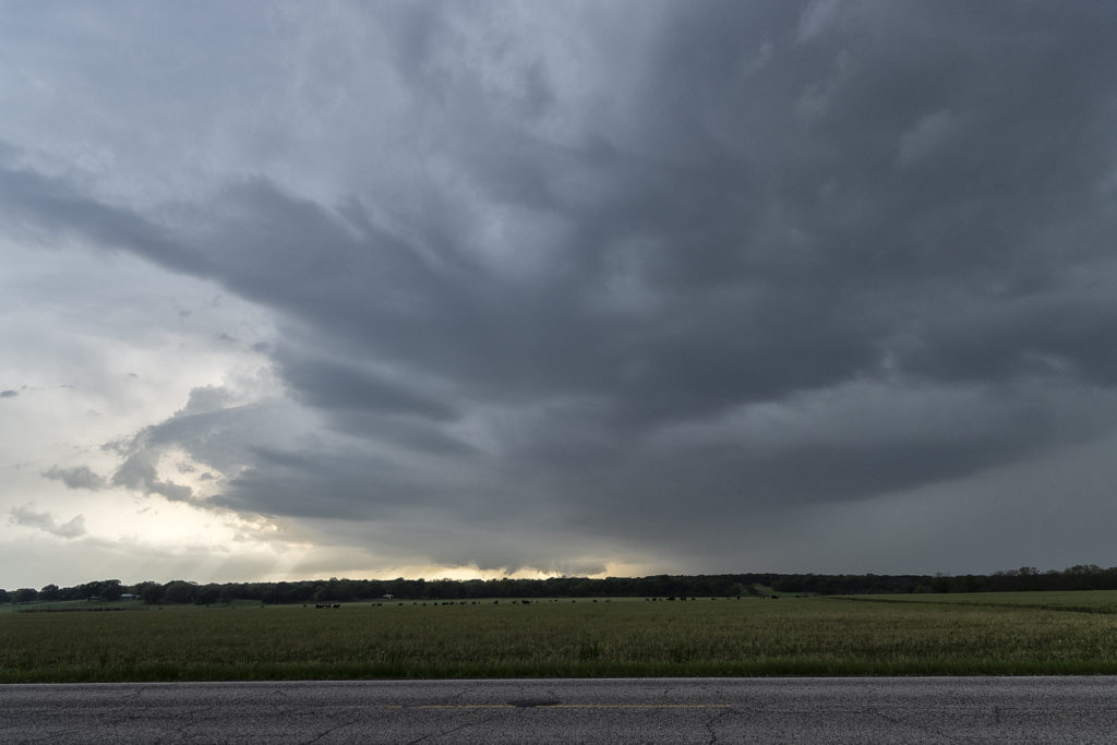
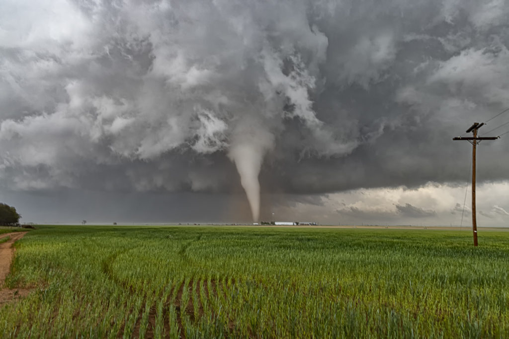
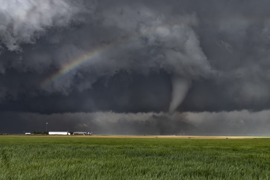
April 27th North Texas Tornadic Supercells
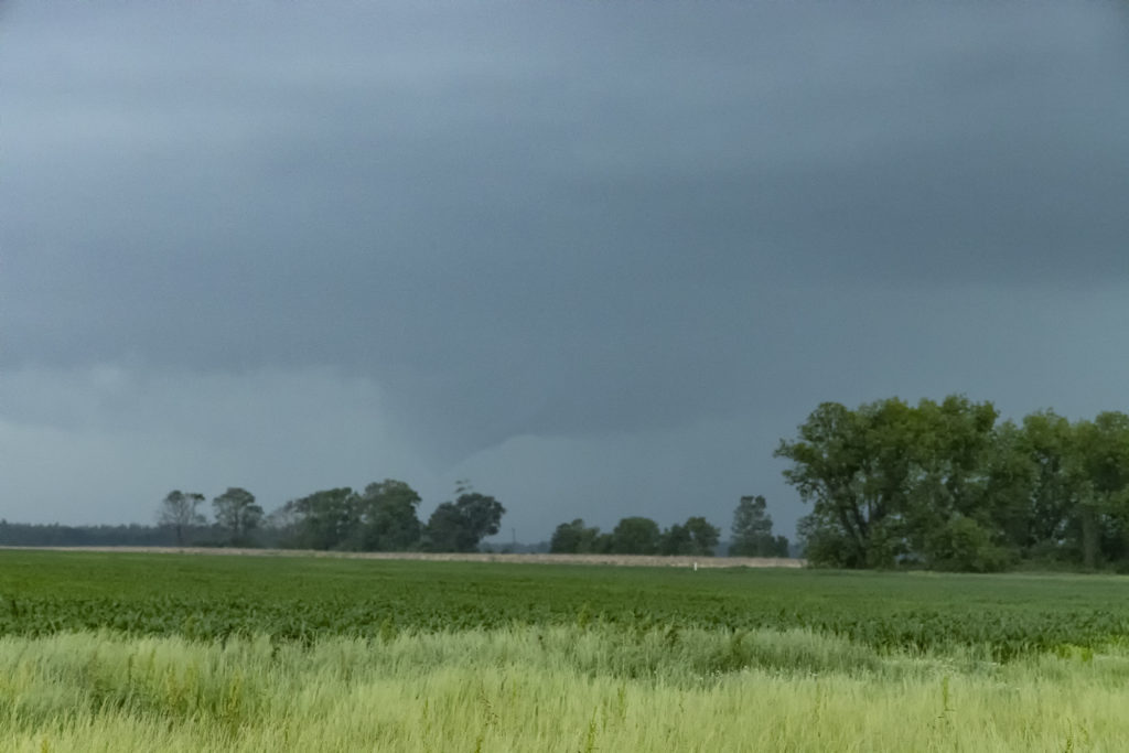
April 27th looked like a day with potential. Decent moisture, instability and shear would exist across northern Texas, with a mixing dryline situated from east of Lubbock to west of Oklahoma City. We headed to Childress to evaluate. We weren’t there long when a cluster of storms formed east of Lubbock. We blasted southwest towards Paducah, Texas to intercept these storms. The lead storm became supercellular and right turned towards Guthrie. We dropped south to position ourselves looking down the notch of this beast. As we set up to watch it, cgs starting raining down on us and the storm became tornado warned. We blasted east to just past Benjamin where we turned north to get in front of this supercell. We arrived to strong inflow and a big block shaped wall cloud with a rain wrapped tornado under it.
We stayed in position until the storm was almost on us then we headed back south and east. As the storm approached Electra it weakened so we let it pass. More storms were firing up along the boundary to our southwest and we waited for them to approach. One supercell dropped a brief tornado about 2 miles from our location. We dropped south after it passed to play more supercells along the boundary and were treated to a great lightning show after dark. Fun day, no major damage despite a couple tornadoes and huge hail! Enjoy the pics!
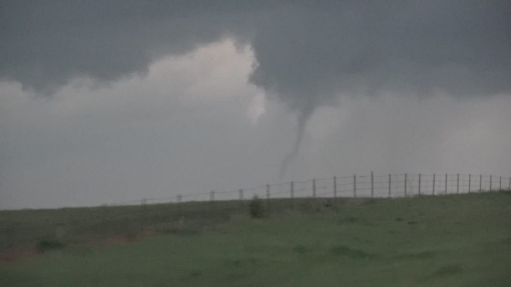
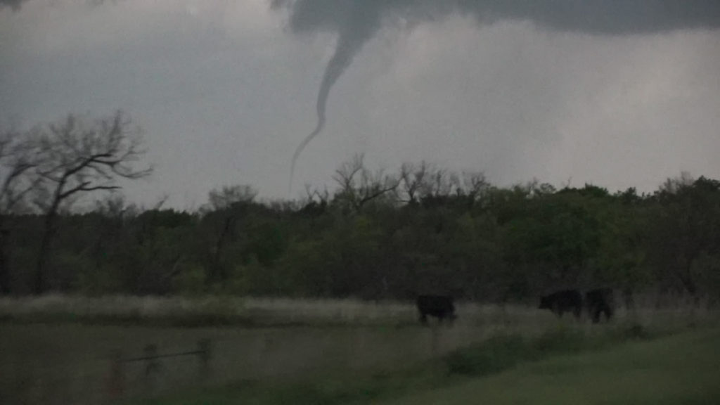
April 23rd Northwest Texas Tornado Outbreak
April 23rd kicked off our storm chasing tour season and what a way to start! After leaving Oklahoma City at noon, my target was the triple point somewhere near Childress, Texas. Mid afternoon, updrafts formed and quickly became severe and tornado warned. It tried on the first tornado warning to produce one, but shear just wasn’t quite right yet. Decent moisture for late April with mid 60s dewpoints, as well as 3000 CAPE was sufficient to get intense supercells to fire. I had a hunch this storm would be special
and we stuck with it the rest of the day.
Between the bluebonnets in full bloom and the developing supercell, it made for an amazing scene. Soon, though, we we treated to an even more spectacular view, as our supercell latched onto the boundary and the low level jet cranked up causing it to produce 6 tornadoes in a little over an hour, while drifting very slowly eastward! A few of these, in the photos below were incredibly photogenic!! An amazing way to start Tour #1 and our season off! Please enjoy the images!!!!
Here are two cool videos form this day too!
March Chases
Due to prior commitments, we did not conduct any on call storm chasing adventures during March. Stay tuned, as we will in April!