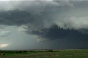
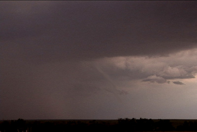
July 20 promised to be a day with decent shear, instability and moisture, with a strong wave moving southeast out of Montana late in the day. Morning cloudiness cast a doubt on anything decent happening, but by noon, the mid level clouds eroded and good surface heating commenced. It didn’t take long for storms to fire up, and this storm became the storm of the day, producing tennisball sized hail, at least two funnels and intense lightning. It developed along I-25 south of Chugwater, WY and dissipated along the WY/NE border. It was one of the prettier storms of 2006!
July 17th, 2006 Eastern Colorado Severe Weather
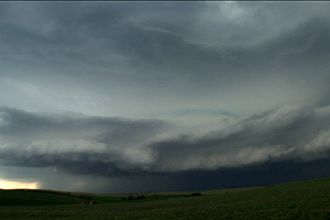
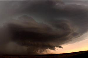
July 17 featured a persistent boundary across eastern Adams, Arapahoe and Elbert counties in Colorado with deepening moisture on easterly flow. Shear was marginal, but with the boundary in place and strong instability, storms developed along the boundary and two of them spun pretty strongly, causing the NWS to issue tornado warnings on them. We caught them as the intensified and produced a couple of funnels, although we never could confirm touchdown. The one pictured above appeared to be anticyclonic as it formed on the south side (looking west) of the clear slot of this rotating storm.
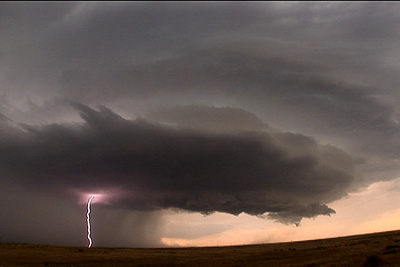
July 13th, 2006 Greeley, Nebraska Supercell
July 13th had a great set up potential for Nebraska. Strong shear, a nice boundary and mid 70s dewpoints would all come together and produce a nice supercell in north central Nebraska. I came from Grand Island north to catch it. SPC mesoanalysis page showed the best of the best conditions feeding into that storm! (I just couldn’t go for the elevated trashy crap heading towards OMA) I sat just south of Greeley to watch it before heading west towards Ord. I was looking west at it, and it had a nice soda can/bell shape to it. Nice structure, tried to produce, but just couldn’t. Typical 2006. The core had solid 1.5″ to 2″ diameter hail from it. I also encountered winds gusting to 82 MPH (measured!) not far from Greeley when it gusted out.