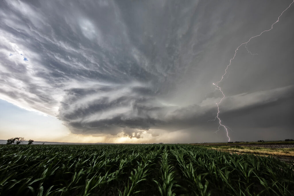
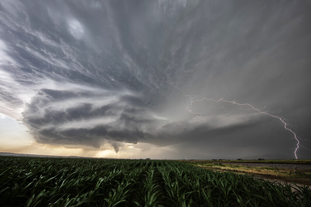
June 27th had 2 different targets. One by the Nebraska/South Dakota border, and a second along the Chugwater low at the Nebraska/Wyoming border. We hoped to chase the northern target, but nature had other plans. We went south and caught an intensifying supercell west of Bridgeport, NE. We had to punch through the core and encountered pingpong ball sized hail as we approached Broadwater, NE. Once on the east side of the storm, intense lightning was occurring. Structure became quite nice as the storm spun hard moving towards the east. After it passed Oshkosh, it started weakening as it encountered a capping inversion. We followed it through the sandhills and had a nice sunset with great color and lightning! Enjoy the pics!!!
June 28th Central North Dakota Stunning Thunderstorm
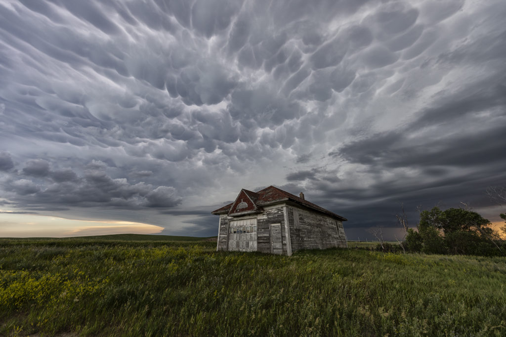
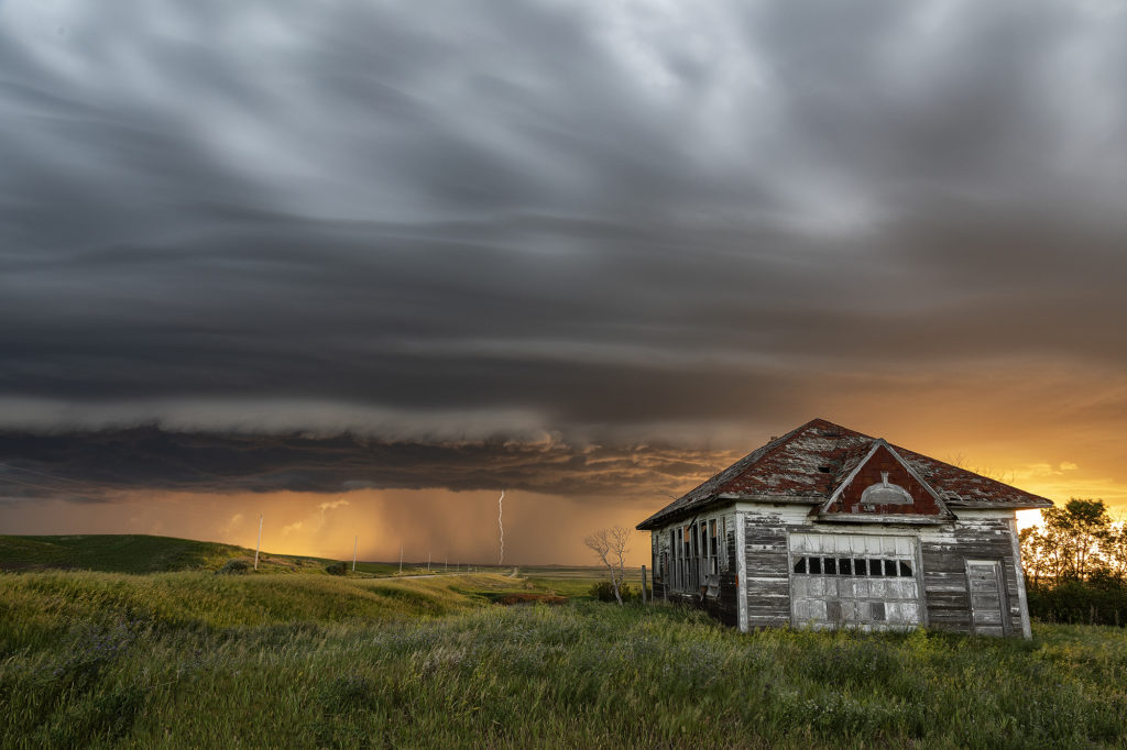
June 28th took Photo Tour 3 to North Dakota. Good moisture and instability, coupled with weaker shear would allow a squall line of severe thunderstorms to form northeast of Bismark, ND. We managed to find an old abandoned farmstead south of Wing, ND where we were able to set up and capture some amazing images! The storms, coupled with the lowering sun in the evening, along with the old farmstead, allowed us to capture some of my favorite images from 2020! We stayed in place for a couple of hours photographing the area, and eventually headed back to I-94 and west to Bismark. A landspout tornado occurred well to our south near the South Dakota border, but everyone didn’t mind based on the images each person captured. Spectacular day with nature painting the Photo Tour one of the best set ups one could want! Please click on an image for a larger photo. Enjoy!
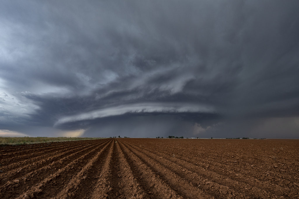
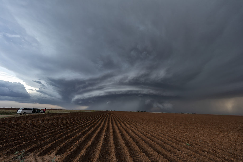
May 11th, Anton, Texas Spectacular Supercell
May 11th brought about a boundary that stretched from northeast New Mexico, southeastward across the Texas panhandle north of Lubbock. Moisture initially wasn’t high quality, although shear and lift were very good. Storms first went up southwest of Lubbock, followed by more storms northwest of Lubbock along the boundary. One storm rode the boundary, and started to get very organized. This supercell eventually merged with another cluster of storms. It later emerged from the line of storms and become a stunning supercell, with very strong rotation on the eastern side of the storm. We watched this entire sequence of developments, amazed at this storm’s ability to push through other weaker cells and emerge as the most intense cell of the day. It also became extremely photogenic as it marched southeast toward the north side of Lubbock. Producing huge hail and very strong winds, it pushed across town and eventually weakened. Enjoy the photos! Please click on an image to see a larger photo.