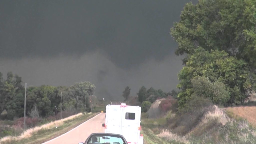
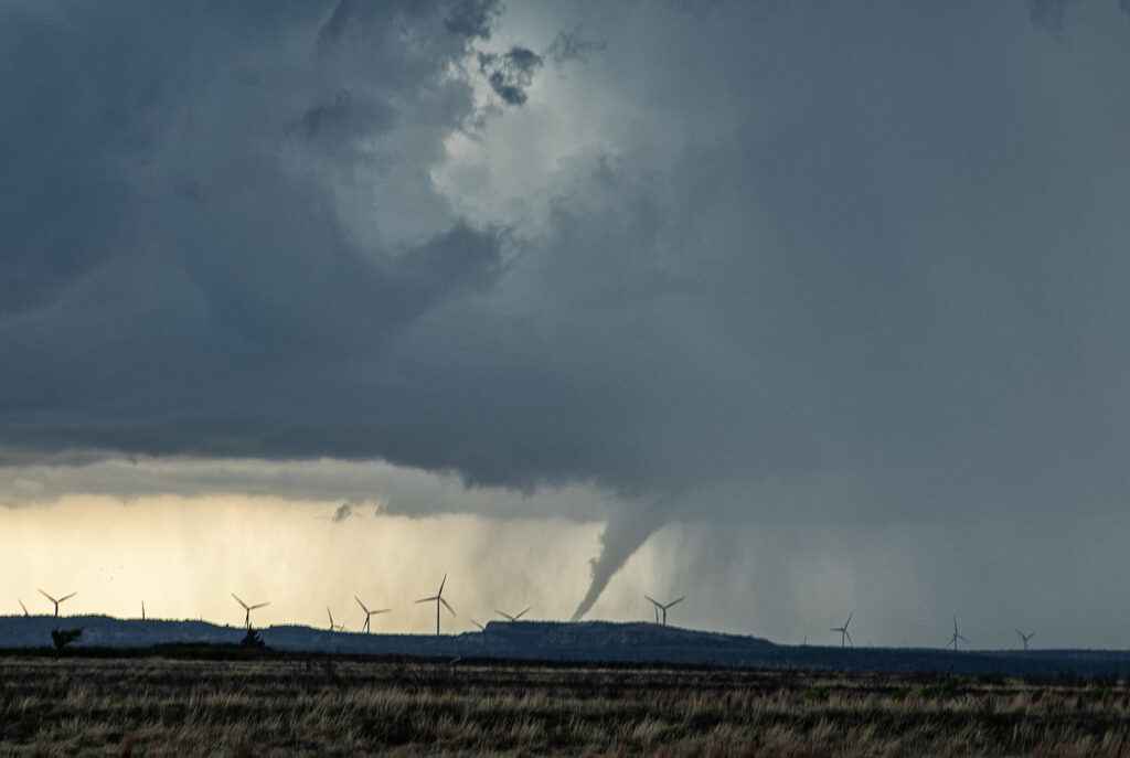
June 5th. What more can be said??? One of the most incredible days in the 2025 storm chasing season! We started off the day in Lubbock, Texas. The target was to find the triple point, which appeared based on satellite and surface obs to be near Dora, New Mexico. We positioned ourselves near Causey, NM where 2 large updrafts were forming. We decided to play the southern most developing storm. The storm sat anchored for a couple of hours before it finally started its trek southeast along an outflow boundary from previous days storms. Just before it reached the Texas border it spun hard and became tornado warned. The merry go round ensued and quickly dropped a tapered cone tornado that was on the ground for a couple of minutes. It lifted as the storm moved east, but the low level mesocyclone stayed in tack. Soon several different tornadoes formed, and eventually stout stovepipe tornado descended. After this another elephant trunk shaped tornado formed as well. You could see the occlusion happened with the old meso dying and a new one forming east of us. We blasted east to get on the other side of it and quickly an extremely large, very dusty tornado formed. It grew to a mile wide and just missed the town of Morton, Texas. We got ahead of the tornado as it became completely obscured with dust and rain. Several miles east of town it disippated, and yet another tornado formed just to our north. Within a few minutes very strong RFD winds and atomized rain smacked into us, so we blasted east to try to get ahead of it. As we did, another ghostly white tornado came out of the rain just to our north. Realizing the mesocyclone was hopelessly buried in dirt and rain, we blasted east towards Lubbock. Another very large tornado occurred right to our north that we could not see, so we decided it was time to call off the chase. Later that evening, after we ended the chase, one last tornado formed near Reece Center. Since we were already done and settled into our hotel, we did not go back out because it would have been too late to make it there. An absolutely CRAZY day and I am so thankful there were no fatalities with this supercell. Enjoy the photos and this Youtube video of the Morton tornado. Another video will be made soon showing the rest of the tornadoes!
April 24th, 2025 Matador, Texas Tornadic Supercell
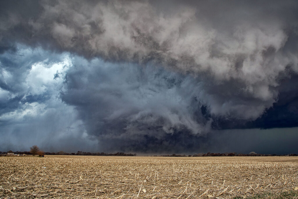
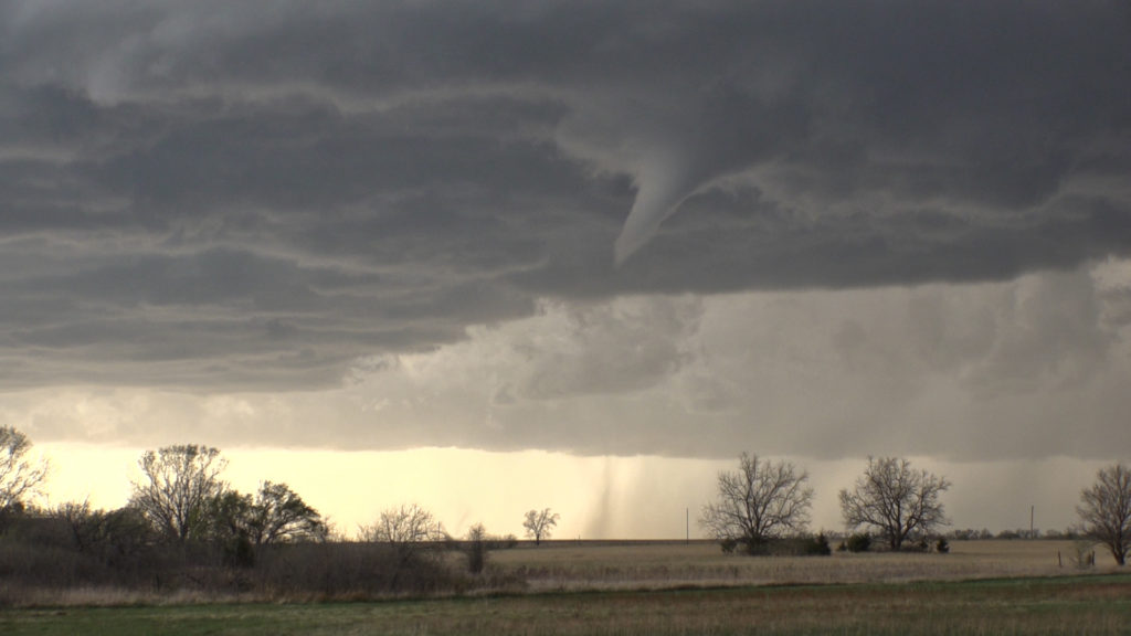
What a day April 24th was!! There was a high threat for supercells and if one could latch on to a boundary in place it had the potential to produce tornadoes. Strong shear, great moisture for late April standards, and good instability were all present. I headed down from Woodward to the Texas Rolling Plains. When I arrived, a supercell had formed and started spinning hard not far from Silverton. As I approached it from the east at Turkey, I encountered baseball sized hail and dropped south to get out of it. I set up my camera and soon an elephant trunk shaped tornado formed. It planted firmly for about 10 minutes before dissipating. Soon the storm started reorganizing and I dropped south to just north of Matador. It cycled and developed a wall cloud, then a bowl and then a multivortex tornado. That turned into a huge cone, then close to a wedge before becoming rain wrapped. It was on the ground for probably 25-30 minutes!! After that the storm became quite HP and, having to be back in Oklahoma City that night, I left it and proceeded back to our base city. An amazing day, structure, 2 tornadoes, huge hail and lightning. Enjoy the pics!

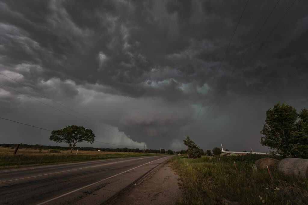
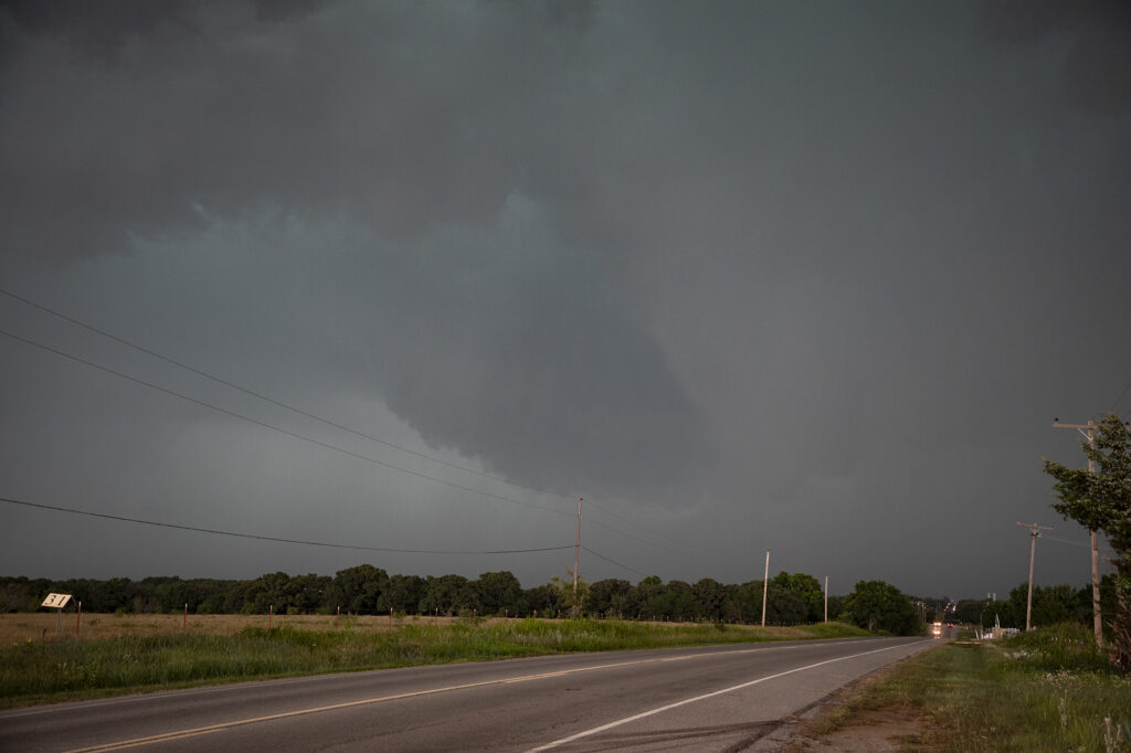
May 23rd Eldorado, Oklahoma Large Violent Tornado
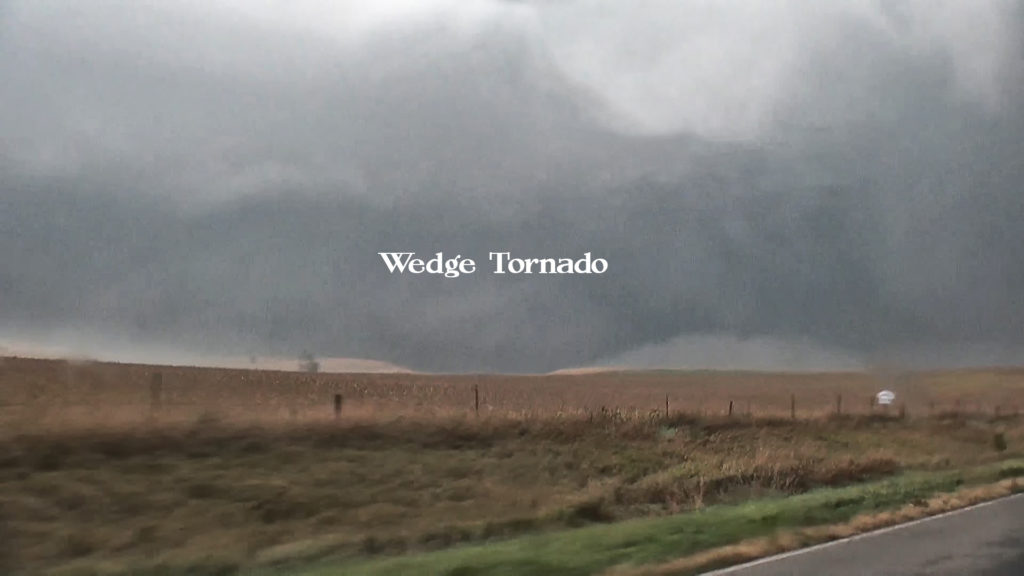
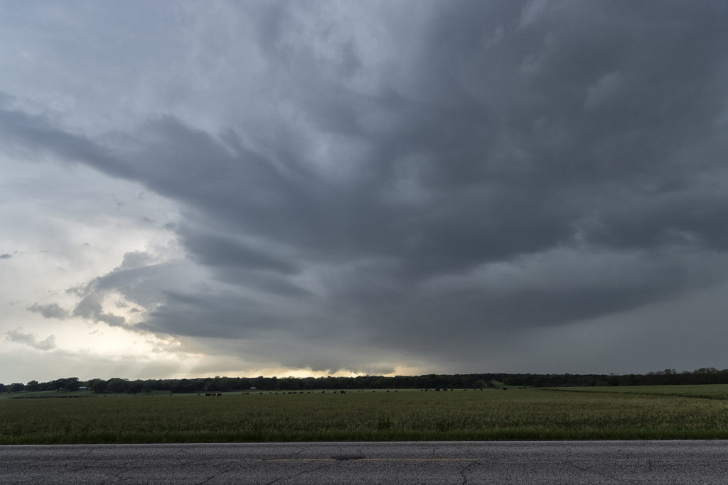
May 23rd was the final day of Tour #4, the Prime Time tour. As often occurs, the final day of the tour would be quite eventful!!! A triple point boundary was present north of Childress, Texas. Good moisture and instability were present as well as increasingly favorable wind shear. Mid afternoon storms formed at the triple point. They quickly became severe for large hail. As they moved the boundary, they weakened and died. Soon other storms formed at the same spot and also became severe. One also became tornado warned, but did not produce. Another cell formed to its southwest and eventually merged with the lead cell and also became severe and tornado warned. We stayed with it as it tracked southeast along the boundary. Just northeast of Eldorado, Oklahoma, a lowering formed in the 70 dewpoint air and started spinning. Soon a tornado formed. This tornado morphed several times from nearly a wedge, to a cone, to a multivortex and another cone before dissipating. Quickly a spectacular barrel tornado developed and tracked slowly east. Our position was perfect with the sun lightning up the barrel and collar cloud making for a spectacular sight! Just an amazing day and thankfully the tornadoes hit no towns! Enjoy the pics!


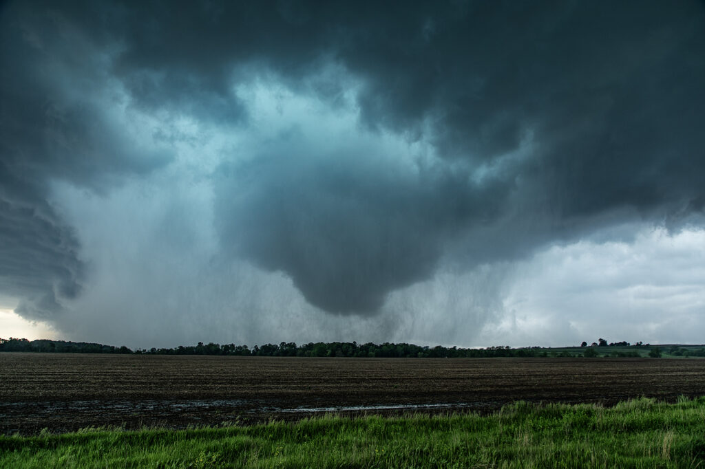
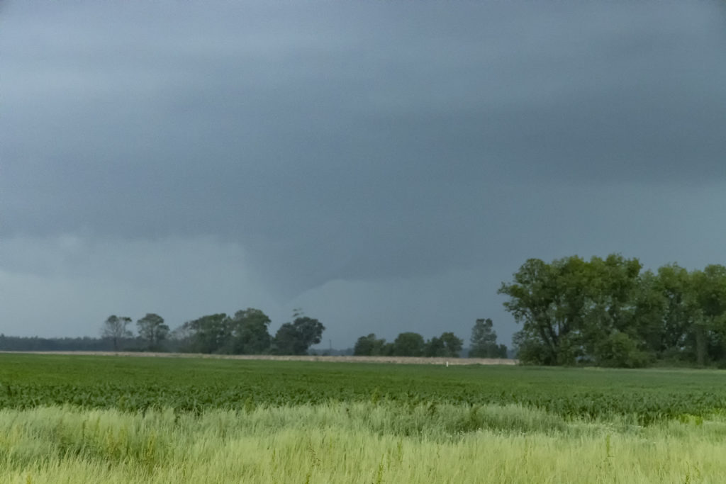
May 21st Southwest Iowa Tornado Outbreak
May 21st was a high potential set up in Iowa. A strong dry line, with fantastic shear, high CAPE and deep moisture would create a very dangerous environment in Iowa. By early afternoon storms exploded along the dry line and intensified as they moved east. Initial storms were not tornadic, but as the afternoon progressed, low level shear increased and tornadoes occurred with many storms! Our first tornado intercept was near Red Oak, Iowa as a supercell started spinning hard. The tornado went from a slender elephant trunk to a stovepipe and persisted for several minutes. The second tornado formed southwest of Carbon. It started as a big bowl, then vortices spun up and wrapping rain curtains were rotating violently around it. With motions of 60 mph we had to get out of its way as it approached us within a mile. The next tornado is now probably the most well-known. A strong multivortex tornado formed to our south near Corning and intensified as it moved northeast. It eventually turned into a raging F3 tornado that caused significant loss of property and life in the town of Greenfield. Our heartfelt sympathies go out to those who suffered losses there. Always the downside of significant tornadoes. Another tornado occurred to our southeast as a cell raced north towards Creston but we lost it due to storm motion and another core with huge hail causing us to have to slow down. Crazy, wild day that most will never forget.
April 26th Iowa Violent Tornado Outbreak
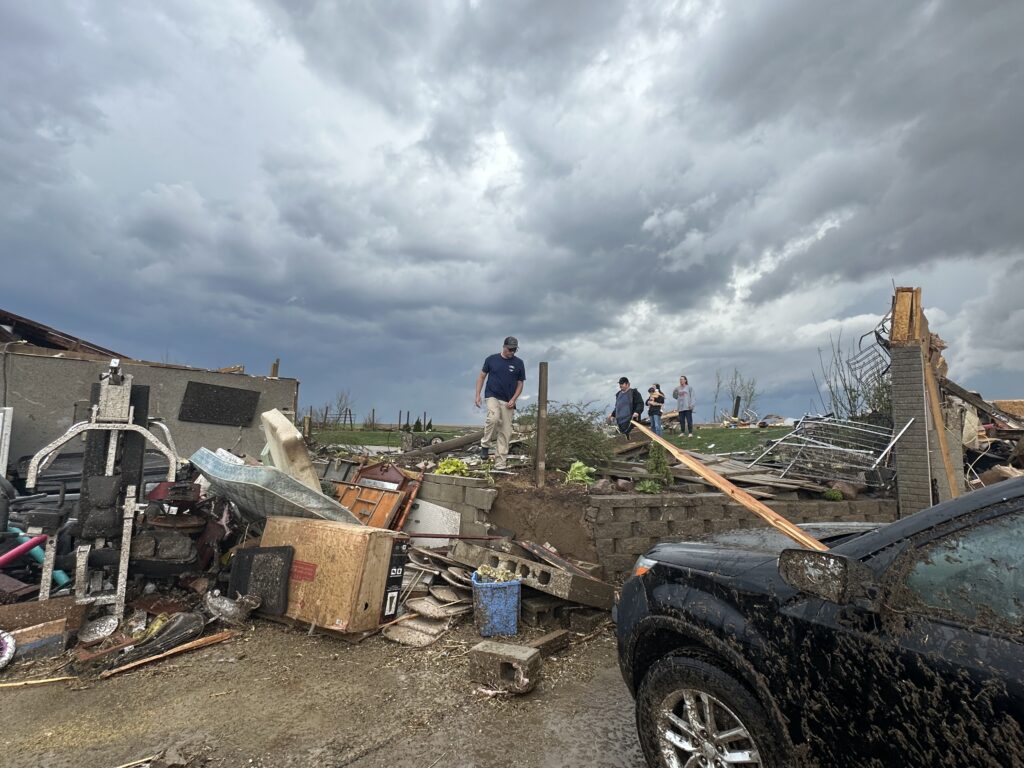
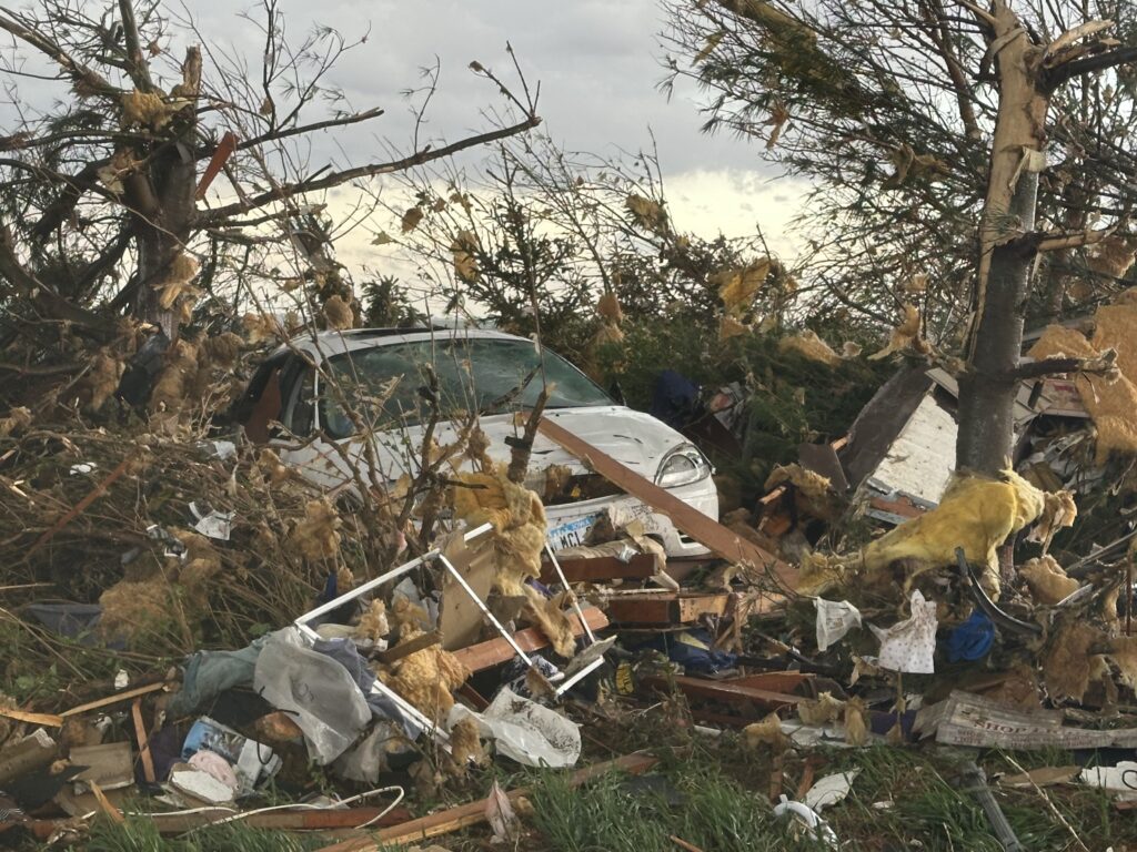
April 26th had the appearance of a major tornado outbreak. It certainly lived up to the hype! We had spent the night in Salina, Kansas and targeted Nebraska City, NE to Creston, Iowa for tornadic supercells. Strong wind shear, with dew points in the lower 60s and surface based instability of 2500 CAPE would set the stage for the event. We arrived in the Nebraska City area mid afternoon, as a supercell produced a couple of tornadoes between Lincoln and Omaha, Nebraska. Due to storm motion and speed, we could not catch up to it, so we decided to stay put. An hour later storms erupted along a confluence line near the Missouri river and quickly gained rotation. Near Council Bluffs we decided to go east and get in front of a tornado warned storm. When we saw it, it was ready to produce a tornado. As it approached a cone shaped tornado formed, turning into an 800 yard wide EF3 wedge tornado as it crossed the road within a half mile of us. It completely destroyed 2 farmsteads along highway 92 and as we approached them, nobody was there to help the residents. We immediately stopped and went into search and rescue mode. We found a family trapped in their storm shelter as their home collapsed on them. After removing a lot of debris as a few other chasers stopped to help, we were able to get them freed. Shook up, but healthy, attention turned to the other farm. An elderly woman and her dog were buried in debris as her house was demolished except for the walls. They also were able to be rescued. Soon paramedics and the local fire department arrived as we directed them to the residents and told them about propane tank leaks. At that point, it was time for us to leave and let the authorities do their jobs they did so well!
By the time we were able to depart the scene, it was too late to keep chasing as the tornadic supercell was 15 miles north moving away. It went on and produced more strong tornadoes near Minden and Harlen as we turned south to make the journey back to Oklahoma City. I do NOT regret missing the other tornadoes to stop and render help to those in need. Given the opportunity to do it again, there would be no hesitation!!! People are far more important than weather. Thanks to all who stopped that day to help families in desperate need of assistance.
June 15th Southern Oklahoma Tornadic Supercell
June 15th featured very high dewpoints and instability, as well as good shear and several boundaries for storms to form on. A cluster of storms formed in southwest Oklahoma later in the afternoon and became severe. We followed them towards Lawton as another storm developed on it eastern flank. As we approached Commanche it became tornado warned. Just north of town, it developed a rather large wedge tornado that persisted for over a half hour although it became rain wrapped. If was briefly visible near Loco, OK and caused EF2 damage along the way. After the storm weakened we dropped south on a tail end supercell that was just gorgeous and also tornado warned. Our thoughts and prayers for the town of Perryton, TX that was also hit by an EF3 tornado that day causing much damage and a few fatalities. The down side of storm chasing.
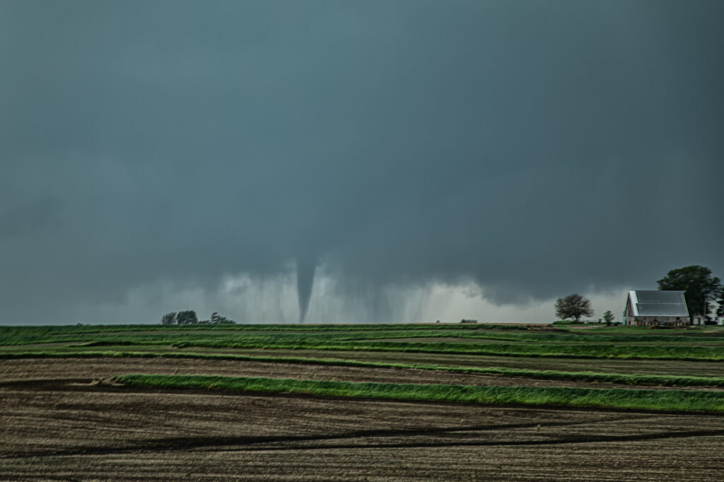
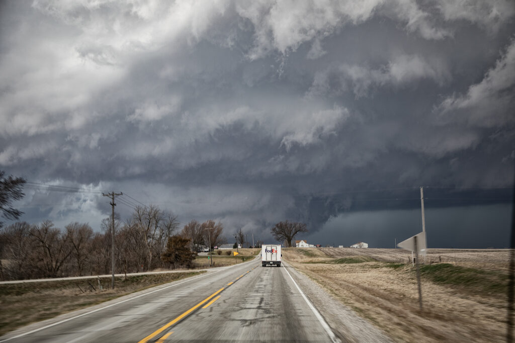
March 31st Ollie, Iowa Violent Tornado
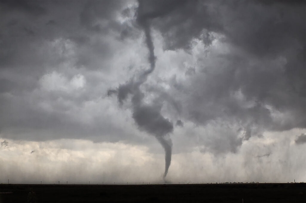
An extremely volatile day was in store on March 31st. A powerful trough was moving out of the Rockies onto the plains as a surface low intensified north of Omaha. We took our on call tour towards the Des Moines area in anticipation of rapid supercell formation early afternoon. The dryline lit up like a Christmas tree shortly after noon as storms raced northeast at 60-70 mph! Strong shear, good moisture and instability and a strong jet would fuel these storms. By 2pm a large thunderstorm formed in northwest Missouri and rapidly moved northeast, becoming tornado warned as it approached Ottumwa, Iowa. We moved to position ourselves in front of it to see what it could produce. We approached the small town of Packwood as a cone tornado stabbed down to the ground west of us and grew to massive proportions.
As we drove west on highway 78 towards Hedrick, the tornado wedged out becoming a massive twister less than a mile from us! The roar of the tornado and rear flank downdrafts winds filled the senses with the sound of a rushing waterfall. Due to fast storm motions and the unfortunate road closures in the area, we were only able to stay with it for about 15 miles before we lost it. This tornado caused a lot of damage, but fortunately no fatalities. It has been officially rated EF-4 by the National Weather Service.
Our thoughts and prayers go out to anyone affected throughout the central and southern plains this day as 60 tornadoes raked the region causing many casualties and much damage.
April 29th Central and Southern Kansas Tornadoes
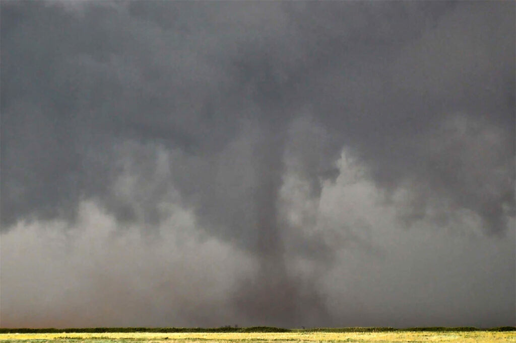
A big day was in store for Kansas. Supercells with tornadoes were possible as a combination of wind shear, moisture and instability were present with an approaching trough. By mid afternoon the dryline sharpened and soon cumulus towers formed. A cluster of storms had formed northeast of McPherson and the tail end storm started spinning. One small tornado formed as the cell moved north towards the warm front. As it approached it, other storms started forming on an advancing cold front and also became severe. We decided to leave the first storm as storm mergers made things too messy. As we blasted south towards Wichita, a landspout tornado formed underneath an updraft in the line and stayed on the ground for 12 minutes. When is dissipated, when then turned our attention to a supercell near Wichita. It had just spawned the Andover tornado and continued to cycle and become tornadic again near El Dorado. We blasted down to town, now in the dark and headed east towards the supercell’s updraft base. Quickly a tapered cone tornado formed and became visible through power flashes and lighting. It crossed the road in front of us and dissipated. Another one formed within a couple minutes and stabbed down to the ground and lifted. We continued to drift east with the storm and turned north at Rosalia. As we did a massive bowl formed and dropped to the ground! A wedge type tornado formed with multiple vortices. We got blasted with RFD winds wrapping around the tornado and had to vacate the area. As we continued east the tornado lifted as a line of storms merged with it ending the tornado threat. A crazy day with 5 tornadoes! Enjoy the pics!
May 4th Jackson, MS Area Tornadic Supercells
May 4th took us deep into the southeastern US. Very strong shear, 70 dewpoints, 2500 CAPE and an advancing cold front would set the stage for intense storm development. We chased a cluster of supercells over west central Mississippi and merged into a raging bow echo as it ripped through the Jackson, MS area. Extreme lightning, high winds and a couple of tornadoes occurred as storm approached Jackson. Sometimes it is hard to see in the southeast due to trees, hills and hazy conditions due to close proximity to the gulf. We managed to find farmland and breaks in the tree cover to watch these intense storms roll through. Enjoy the pics!
October 4th, 2013 – Northeast Nebraska/Northwest Iowa Tornadoes
October 4th looked crazy on paper. Great shear, super lift, great instability and moisture for Oct spelled big trouble for the folks in eastern Nebraska and western Iowa. We left early morning in heavy snow and fog from our home in Colorado, and headed towards Lincoln, NE where we’d decide to head north or east. A supercell formed north of Columbus and was moving away from us so we decided to play the patience game for something further east. Soon a wedge tornado formed from the first supercell and we were feeling pretty bummed. Finally our storm got going as it crossed into western Iowa, dropping a large tornado west of Sloan. After an occlusion, a second, third and fourth tornado formed and the latter becoming a large 1.5 mile wide wedge heading near Climbing Hill northeast towards Cherokee. We had to stop the trip as we encountered a destroyed farmstead north of Climbing Hill, where our search resulted in no injuries, except farm animals. Fortunately, no fatalaties occurred that day, but a lot of destruction of property. Here’s a 10 minute video from this day: