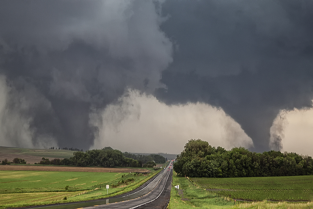
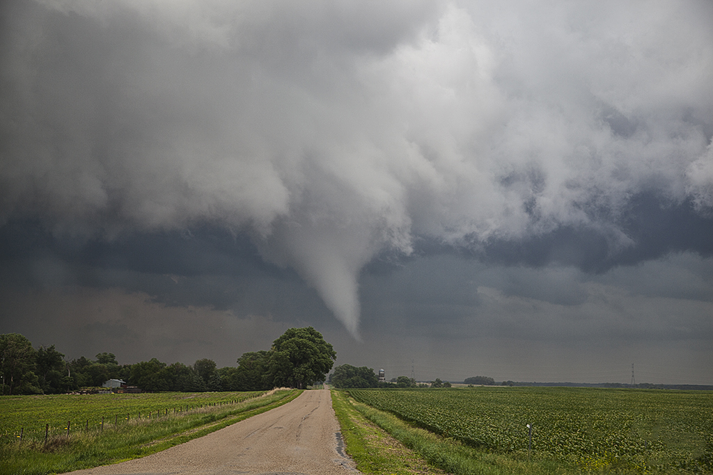
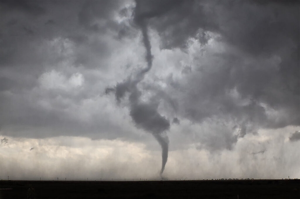
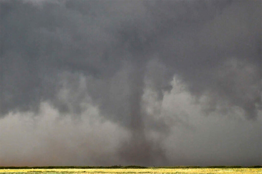
June 5th. What more can be said??? One of the most incredible days in the 2025 storm chasing season! We started off the day in Lubbock, Texas. The target was to find the triple point, which appeared based on satellite and surface obs to be near Dora, New Mexico. We positioned ourselves near Causey, NM where 2 large updrafts were forming. We decided to play the southern most developing storm. The storm sat anchored for a couple of hours before it finally started its trek southeast along an outflow boundary from previous days storms. Just before it reached the Texas border it spun hard and became tornado warned. The merry go round ensued and quickly dropped a tapered cone tornado that was on the ground for a couple of minutes. It lifted as the storm moved east, but the low level mesocyclone stayed in tack. Soon several different tornadoes formed, and eventually stout stovepipe tornado descended. After this another elephant trunk shaped tornado formed as well. You could see the occlusion happened with the old meso dying and a new one forming east of us. We blasted east to get on the other side of it and quickly an extremely large, very dusty tornado formed. It grew to a mile wide and just missed the town of Morton, Texas. We got ahead of the tornado as it became completely obscured with dust and rain. Several miles east of town it disippated, and yet another tornado formed just to our north. Within a few minutes very strong RFD winds and atomized rain smacked into us, so we blasted east to try to get ahead of it. As we did, another ghostly white tornado came out of the rain just to our north. Realizing the mesocyclone was hopelessly buried in dirt and rain, we blasted east towards Lubbock. Another very large tornado occurred right to our north that we could not see, so we decided it was time to call off the chase. Later that evening, after we ended the chase, one last tornado formed near Reece Center. Since we were already done and settled into our hotel, we did not go back out because it would have been too late to make it there. An absolutely CRAZY day and I am so thankful there were no fatalities with this supercell. Enjoy the photos and this Youtube video of the Morton tornado. Another video will be made soon showing the rest of the tornadoes!
April 26th Iowa Violent Tornado Outbreak
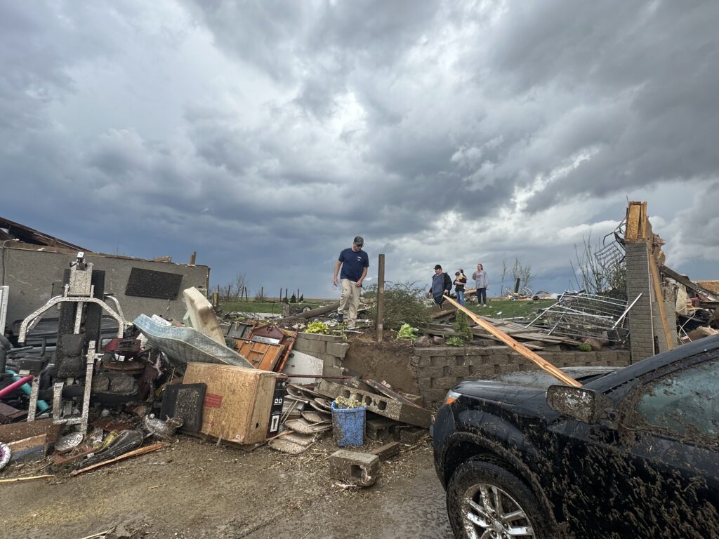
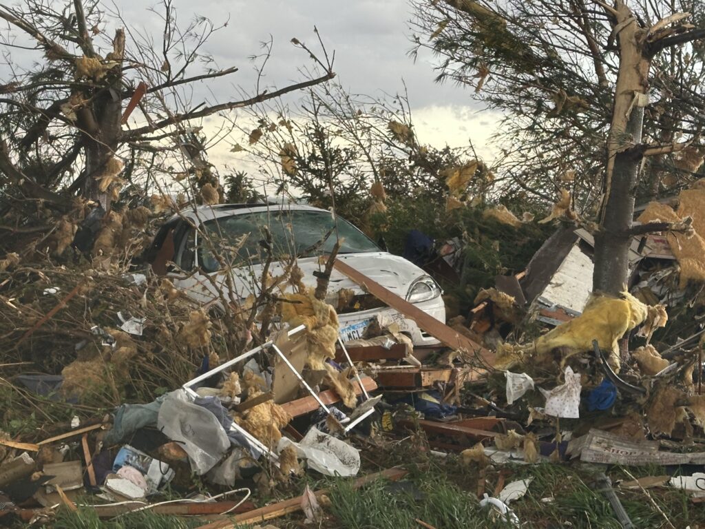
April 26th had the appearance of a major tornado outbreak. It certainly lived up to the hype! We had spent the night in Salina, Kansas and targeted Nebraska City, NE to Creston, Iowa for tornadic supercells. Strong wind shear, with dew points in the lower 60s and surface based instability of 2500 CAPE would set the stage for the event. We arrived in the Nebraska City area mid afternoon, as a supercell produced a couple of tornadoes between Lincoln and Omaha, Nebraska. Due to storm motion and speed, we could not catch up to it, so we decided to stay put. An hour later storms erupted along a confluence line near the Missouri river and quickly gained rotation. Near Council Bluffs we decided to go east and get in front of a tornado warned storm. When we saw it, it was ready to produce a tornado. As it approached a cone shaped tornado formed, turning into an 800 yard wide EF3 wedge tornado as it crossed the road within a half mile of us. It completely destroyed 2 farmsteads along highway 92 and as we approached them, nobody was there to help the residents. We immediately stopped and went into search and rescue mode. We found a family trapped in their storm shelter as their home collapsed on them. After removing a lot of debris as a few other chasers stopped to help, we were able to get them freed. Shook up, but healthy, attention turned to the other farm. An elderly woman and her dog were buried in debris as her house was demolished except for the walls. They also were able to be rescued. Soon paramedics and the local fire department arrived as we directed them to the residents and told them about propane tank leaks. At that point, it was time for us to leave and let the authorities do their jobs they did so well!
By the time we were able to depart the scene, it was too late to keep chasing as the tornadic supercell was 15 miles north moving away. It went on and produced more strong tornadoes near Minden and Harlen as we turned south to make the journey back to Oklahoma City. I do NOT regret missing the other tornadoes to stop and render help to those in need. Given the opportunity to do it again, there would be no hesitation!!! People are far more important than weather. Thanks to all who stopped that day to help families in desperate need of assistance.
June 18, 2014 Central South Dakota Tornado Outbreak
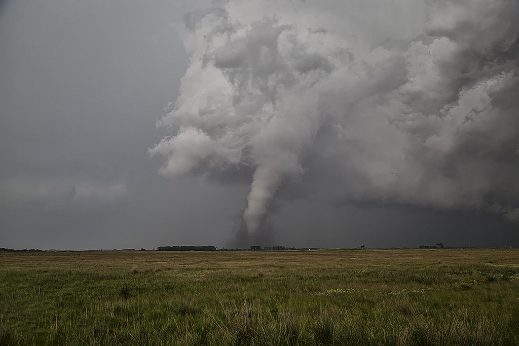
June 18th was an incredible day in South Dakota! Superb moisture, instability and shear was moving northwest from Nebraska and pooled along a cold front. By mid afternoon numerous storms formed along the boundary and merged into a squall line. This was a bit disheartening to see, but we stayed with the tail end and eventually, as the better shear arrived, supercells formed and produced at least 8 tornadoes we witnessed including a couple of strong tornadoes near Wessington Springs, SD. These storms were amazingly electrified and had great structure as well. We had two different times when we had 2 tornadoes on the ground together. The final set of twins were the last two tornadoes of the event and very photogenic. What an amazing 3 day period we had, were we witnessed nearly 15 tornadoes!
June 16, 2014 Northeast Nebraska Tornado Outbreak
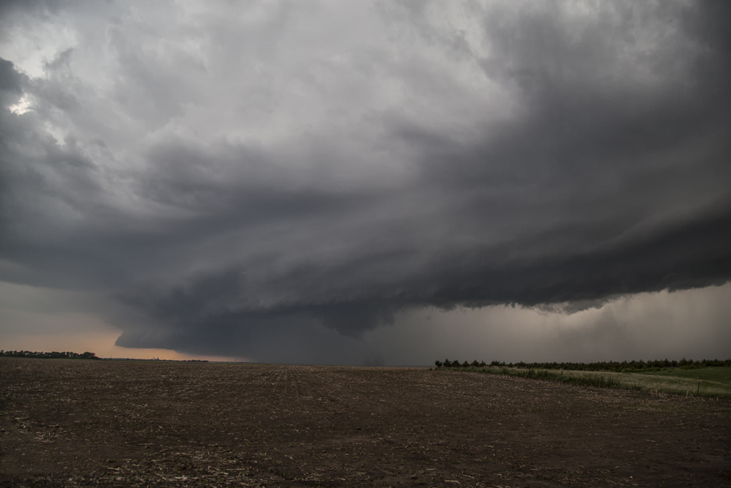
First, our heart felt sympathy goes out to those who suffered losses on this day. When we awoke on the morning of June 16th, I had butterflies in my stomach. I knew there would be potential for strong to violent tornadoes in Nebraska. Unfortunately those fears were realized as at least a half dozen strong or violent tornadoes would ravage the area east of Norfolk. The town of Pilger would be particularly hardest hit. We spent a good chunk of the day around Columbus analyzing data and watching things unfold. With a temp of 83 and a dewpoint of 78, stiff east winds buffeted the area along a warm front. Conditions were ripe for powerful supercells and tornadoes. Mid afternoon storms formed along and north of the warm front. They moved into colder air and weakened. We knew it wouldn’t be long before storms would form along the warm front and ride it eastward with extreme shear. Southeast of Norfolk the first tornado formed and tracked near Stanton. Another tail end cell developed and produced the rest of the tornados this day with twin EF4 tornadoes destroying Pilger and other locations northeast of there. We watched from the back side of the tornadoes, about 1-2 miles east of us as the event unfolded. An event we’ll never forget! Tornadoes of every shape, size and strength occurred. The last time twin violent tornadoes occurred so close together was nearly 50 years ago! Amazing, and devastating to say the least!