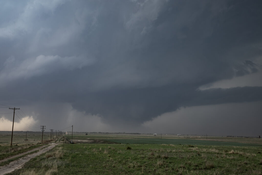
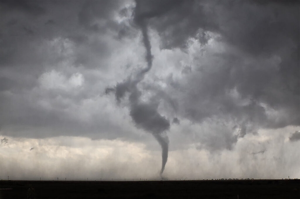
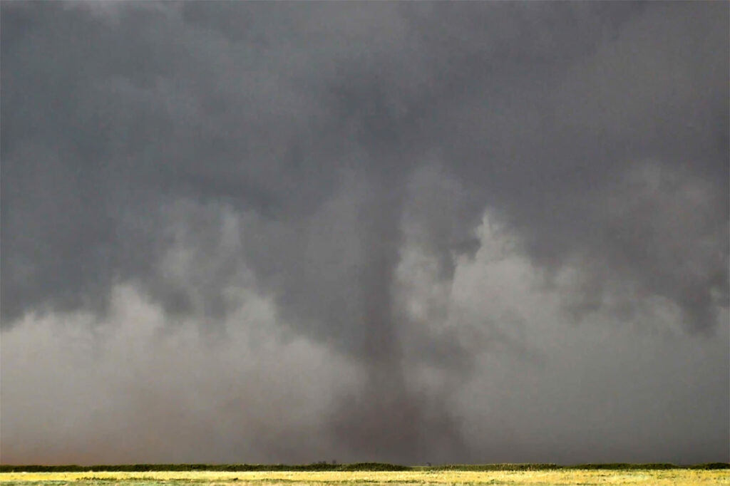
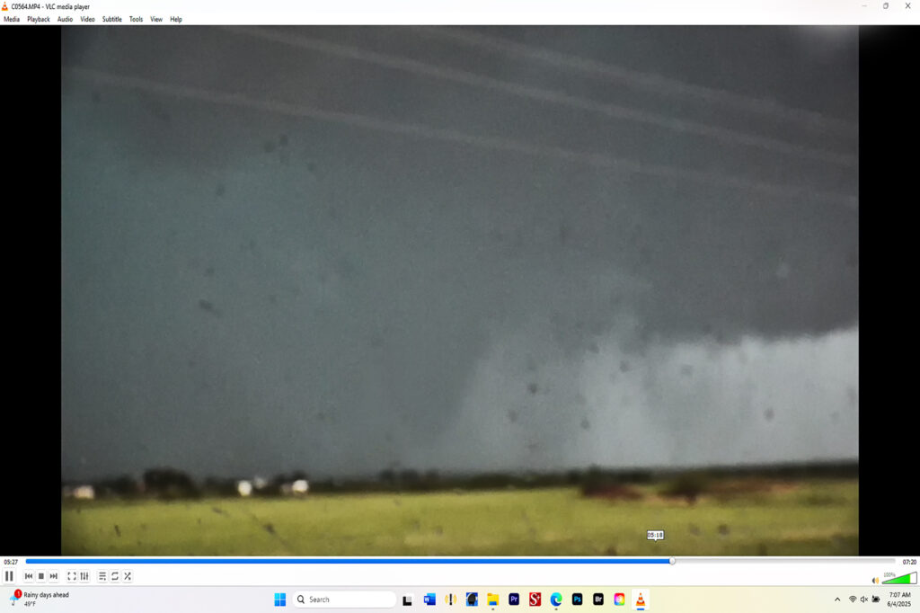
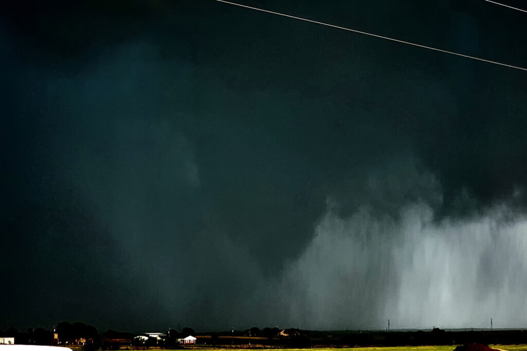
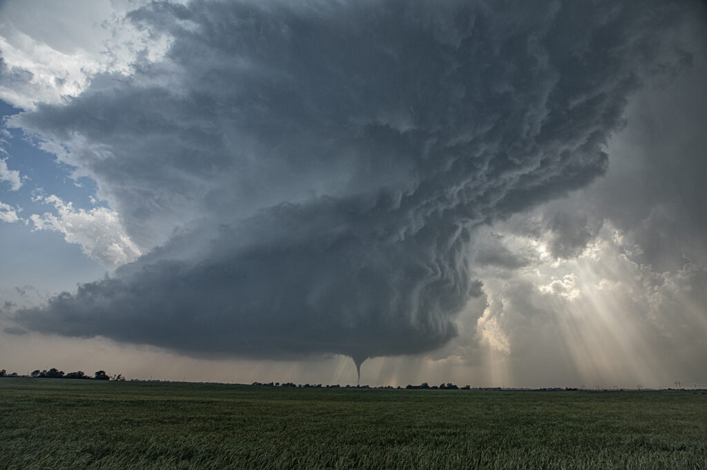
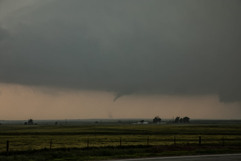
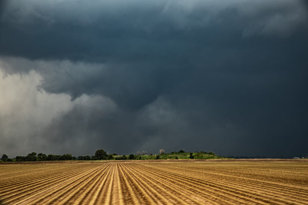
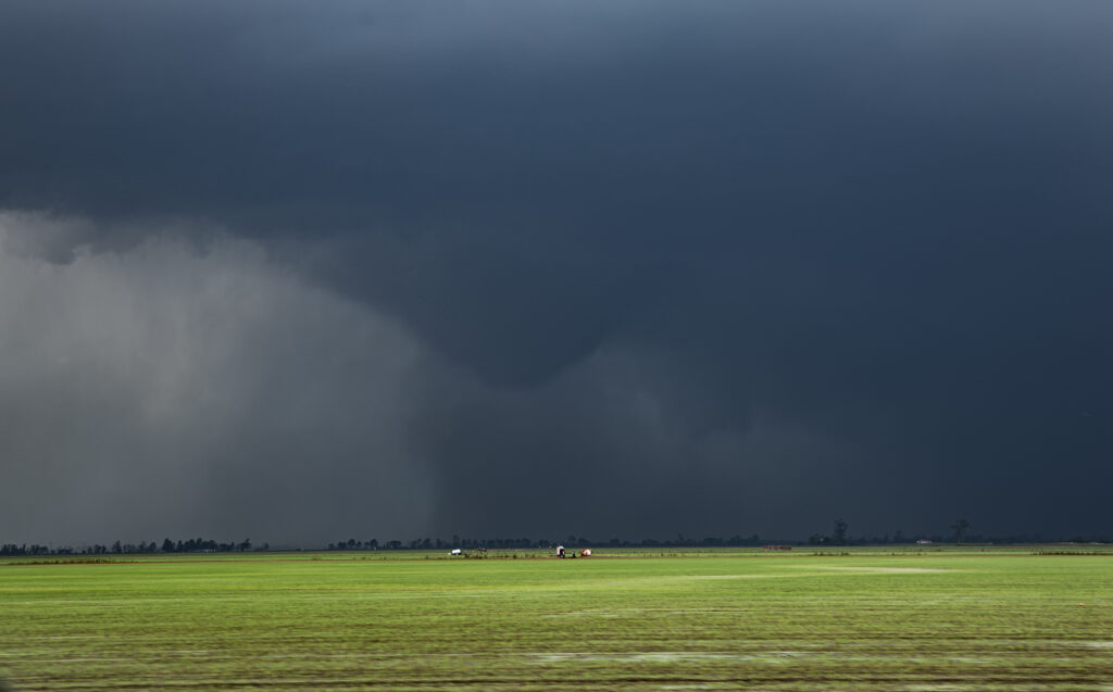
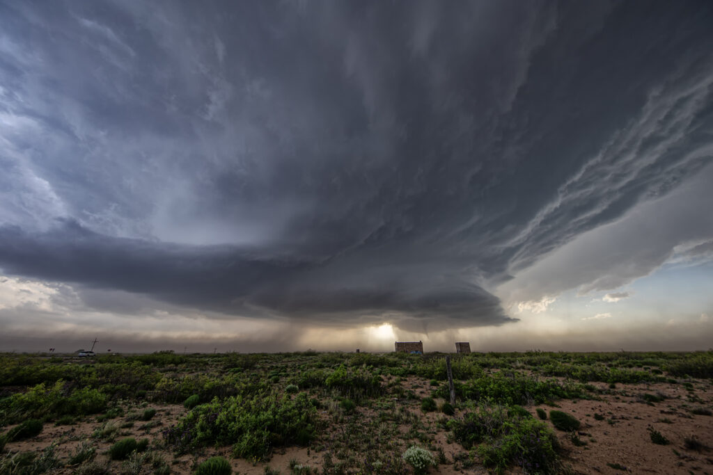
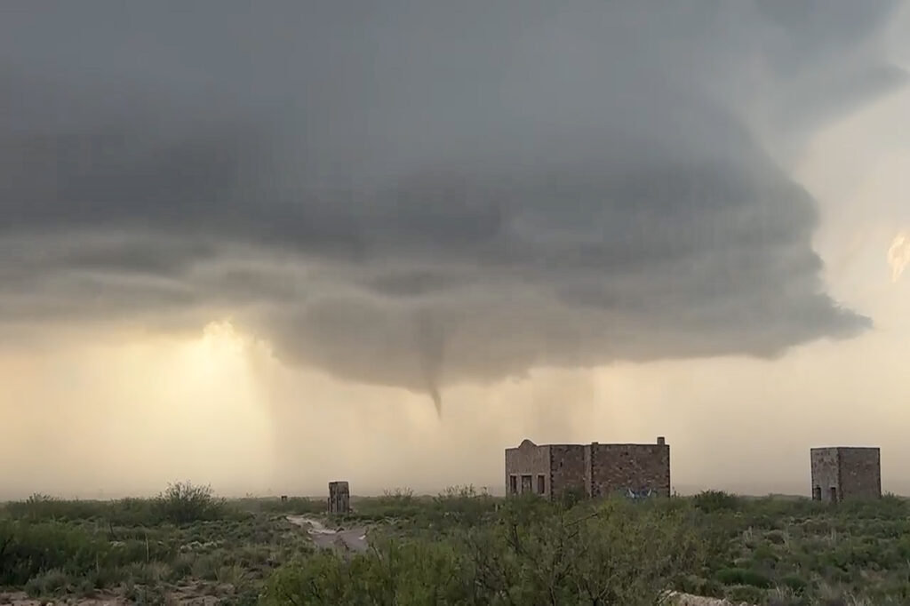
June 5th. What more can be said??? One of the most incredible days in the 2025 storm chasing season! We started off the day in Lubbock, Texas. The target was to find the triple point, which appeared based on satellite and surface obs to be near Dora, New Mexico. We positioned ourselves near Causey, NM where 2 large updrafts were forming. We decided to play the southern most developing storm. The storm sat anchored for a couple of hours before it finally started its trek southeast along an outflow boundary from previous days storms. Just before it reached the Texas border it spun hard and became tornado warned. The merry go round ensued and quickly dropped a tapered cone tornado that was on the ground for a couple of minutes. It lifted as the storm moved east, but the low level mesocyclone stayed in tack. Soon several different tornadoes formed, and eventually stout stovepipe tornado descended. After this another elephant trunk shaped tornado formed as well. You could see the occlusion happened with the old meso dying and a new one forming east of us. We blasted east to get on the other side of it and quickly an extremely large, very dusty tornado formed. It grew to a mile wide and just missed the town of Morton, Texas. We got ahead of the tornado as it became completely obscured with dust and rain. Several miles east of town it disippated, and yet another tornado formed just to our north. Within a few minutes very strong RFD winds and atomized rain smacked into us, so we blasted east to try to get ahead of it. As we did, another ghostly white tornado came out of the rain just to our north. Realizing the mesocyclone was hopelessly buried in dirt and rain, we blasted east towards Lubbock. Another very large tornado occurred right to our north that we could not see, so we decided it was time to call off the chase. Later that evening, after we ended the chase, one last tornado formed near Reece Center. Since we were already done and settled into our hotel, we did not go back out because it would have been too late to make it there. An absolutely CRAZY day and I am so thankful there were no fatalities with this supercell. Enjoy the photos and this Youtube video of the Morton tornado. Another video will be made soon showing the rest of the tornadoes!
June 3rd, Windthorst, Texas Tornado Warned Supercell
June 3rd looked like a day with abundant moisture and CAPE, but fairly weak shear. We knew we’d need a boundary interaction to produce some rotating storms to get a tornado to form. We dropped south from OKC to Wichita Falls, TX to play a developing supercell. The cell quickly took on an outflow dominant look, so we decided to drop south of it and see if anything else would form. As we did near Archer City, a new updraft formed and merged with the old storm. An outflow boundary surged south from Oklahoma convection and smashed into our newly intensifying cell. Just what we needed! Soon, the low levels started spinning wildly! A couple of small funnels would form and dissipate. Then as rain and huge hail wrapped around the mesocyclone, a large cone funnel formed back in the rain. We could never confirm if it touched down or not, but usually when it is 3/4 of the way down, you would assume there would be a circulation. The darkened pic to highlight the funnel is courtesy of SLT guide James Breitenbach. It is certainly compelling that it could have touched down! Excuse the blurry image as I accidentally hit the focus ring as I sat the camcorder on the dash! Ugh….
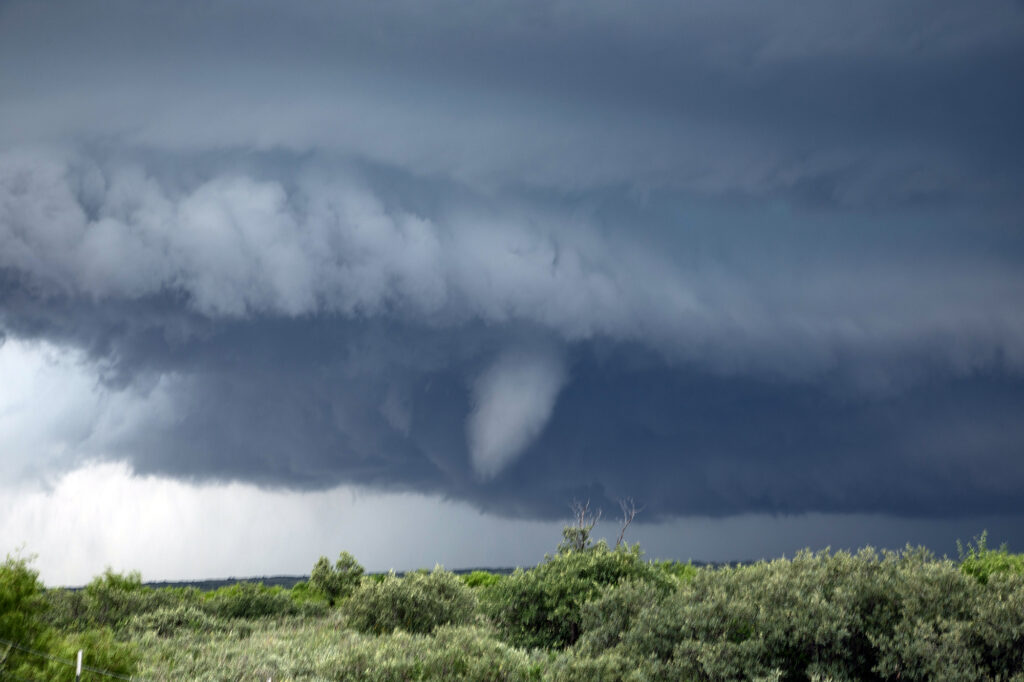
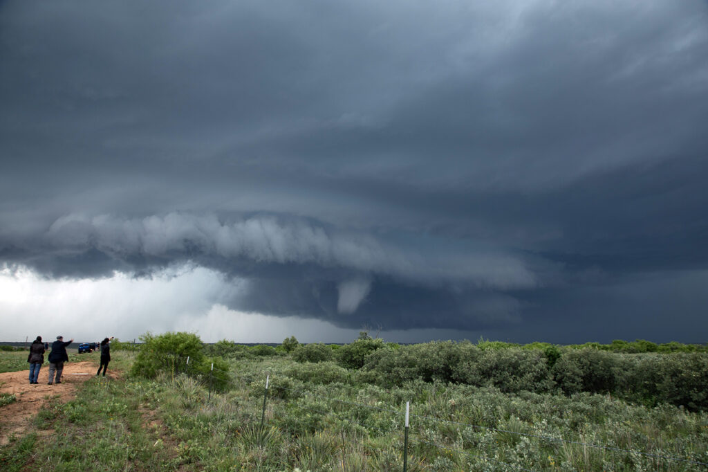
May 25th Afton, Texas Tornadic Supercell
May 25th looked like a high CAPE, lower shear day. A supercell formed west of Matador early in the afternoon, and drifted south along a boundary. It just never had the look like it wanted to produce. Flow around 850-700mb was lacking and it showed. Further south from town, we ended up near Afton on an FM road. Chaser traffic was pretty bad, but we managed to get out from under the hook and watched as the storm’s RFD really cranked up. A truncated cone funnel formed and reportedly touched down. Within a few minutes it dissipated and the storm became outflow dominant. Still in chase mode, we targeted a new supercell southwest of Haskell. By the time we got there, the tail end storm rapidly intensified. Reports of a brief tornado came in, but from our location northeast of the updraft, looking down the notch, we could not confirm or deny. A couple of suspicious lowerings were observed, but that was about it. The electrification of this storm was other worldly! Eventually it weakened as a cluster formed, so we blew it off and headed back to Oklahoma City for other chase day. An exciting day that we all enjoyed some edge of your seats chasing! We hope you like the photos!
May 23rd Kit Carson, CO Tornadic Supercell
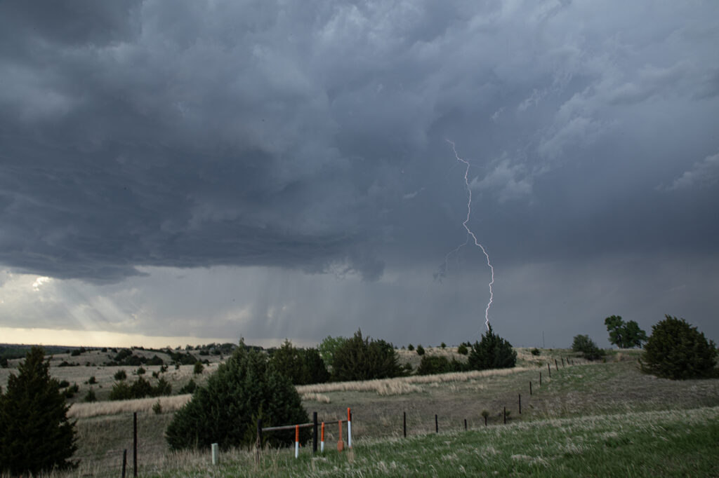
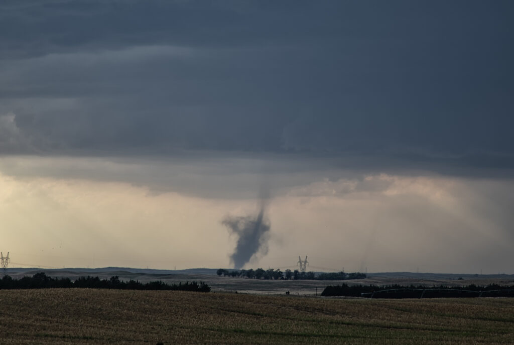
Tough day! Two clear choices were in play. Chase the Cheyenne Ridge, which can (and did!) produce magical results. Or chase the eastern side of the Palmer Divide where dewpoints 5-7 degrees higher were forecast to pool along a boundary. I had a feeling the Cheyenne Ridge would get interesting, but also the latter target would also produce. Higher dews/instability usually result in better results. We caught a stunning structured supercell near Kit Carson. However the Cheyenne Ridge produced one supercell that dropped a few tornadoes. Our storm also produced a tornado, but had far superior storm structure. We chased it down towards Eads where it slowly started to weaken. Having the appearance of a spiraling barber pole, the structure was the best of 2025! We were a bit too far east (after chasing another storm) to get a good shot of the tornado, but a highly contrasted image clearly shows it. No regrets with a storm this pretty! Enjoy the pics!

May 18th Arnett, OK Tornadic Supercell
May 18th looked like a big day on paper. And it certainly fulfilled those expectations! There were a couple potential plays. Western Kansas to the north of the low, and western Oklahoma along the dryline where the subtropical jet punched in to it. After much deliberation, we chose western Oklahoma. Both targets produced and produced big! By mid afternoon multiple updrafts formed along the dryline, where a bit of a bulge was present. The southern most updraft ended up becoming the dominant one and quickly developed into a major supercell. We positioned ourselves down wind of it so we could look at the structure and well as any potential tornado development. Soon, a slender elephant trunk shaped tornado developed and danced across the ground for a few minutes. After it roped out, another funnel formed, but we couldn’t tell if it touched down or not. Moving back east into Arnett, we watched as a merry go round formed under the updraft base and eventually a stout tornado developed. This tornado unfortunately did cause damage and was given an EF3 rating. It came very close to town before it roped out. Another tornado developed from a new mesocyclone as often occurs in cyclic storms and dropped a tapered cone tornado that was on the ground for several minutes. As the storm continued moving northeast, it encountered cooler more stable air and eventually died off. A fantastic day for the tours and an amazing storm to watch! Enjoy the pics!
May 18th Bennett, CO Tornadoes Event
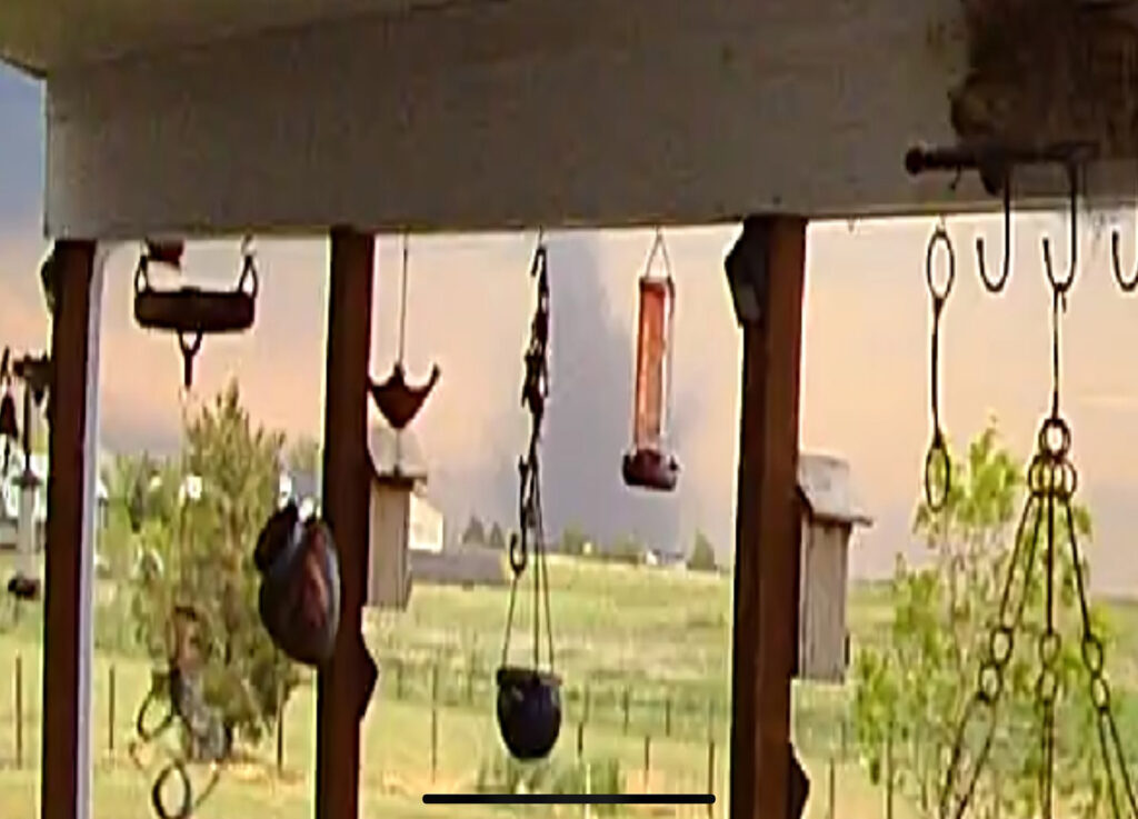
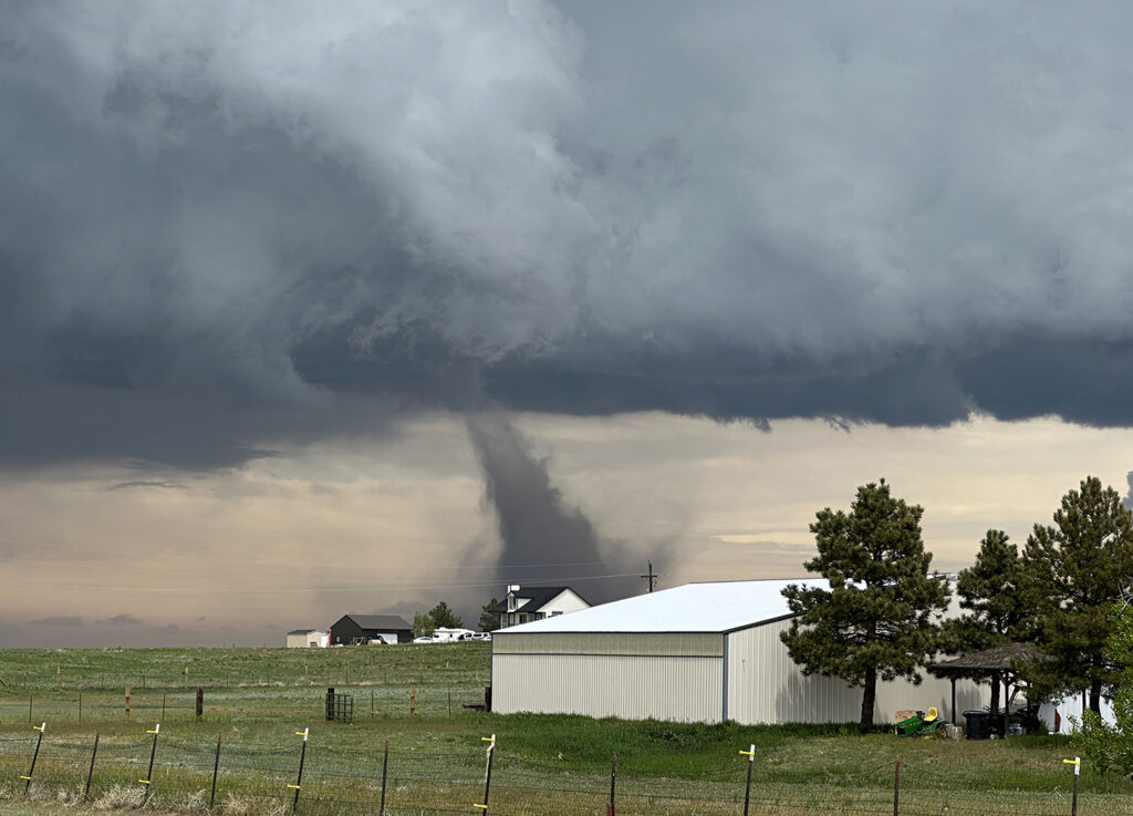
It is not often that the hunter becomes the hunted. However, of May 18th, that is exactly what happened at our home near Bennett, CO. A supercell thunderstorm developed southwest of our house. It produced it’s first of 4 tornadoes near Southlands (Aurora). The second tornado formed southwest of Box Elder Creek Ranches where we live. As it traveled northeast, Caryn Hill saw it and took action. She alerted locals in our miniranch neighborhood and then took off to chase it. It entered our residential area causing EF1 damage. It destroyed barns, garages, other structures and unfortunately killed farm animals. The second tornado dissipated northeast of our house as a third and then fourth tornado formed. These caused extensive damage near Bennett and were both rated EF2. Caryn stayed with the supercell and tornadoes as they moved north of Bennett and eventually roped out. After returning to Box Elder Creek Ranches, she and other neighbors jumped in to help those with damage. Our place was mostly spared, with just some downed trees, and a roof leak which we aren’t sure exactly how it happened. I guess with 80-100 mph winds hitting around the tornado anything is possible! Here’s some pics and also a Youtube video of the event.
May 16th, Southeast Missouri Tornadofest
May 16th was advertised by SPC with a MODERATE RISK across the MS/OH river areas. It did not disappoint! Strong shear, high moisture and instability, and a slowly advancing front set the stage for what would be the most significant severe weather outbreak of the year so far. We started in Springfield, IL and blasted towards Sikeston, MO, which was my target. Storms formed west along the front and moved east and intensified. We decided to push west a bit and meet them as they came out of the Ozarks (a nearly impossible area to chase in!). As is often the case, we targeted the tail end storm, which typically gets the best feed of moisture, as it moved just north of Poplar Bluff. It had a great hook echo on radar and showed a strong velocity couplet. As it emerged onto the flat terrain, a truncated cone tornado formed and went on to be on the ground over 15 miles. It caused significant damage and was rated EF3. Another tornado formed just east of the first, a long slender elephant trunk shaped tornado, and ended up getting rated EF1. The supercell moved east across the Mississippi and Ohio rivers west of Paducah, and due to terrain and poor road networks, we couldn’t stay up with it.
More storms formed back west into southeast Missouri, so we pursued them. We caught up to them just west of Morley. An elephant trunk shaped funnel descended and touched down just west of town causing EF1 damage. Soon another EF1 tornado formed just to out northeast and eventually dissipated as it crossed the river. Numerous tornadoes occurred across this area during this event, causing extensive damage and unfortunately even loss of life. Our heartfelt sympathy goes out to those who suffered, including a tornado that directly hit St Louis. Please take the time to donate to local charities to help those impacted by these tornadoes and supercell thunderstorms.
May 14th Hershey, Nebraska Tornadoes
Wasn’t expecting a lot on May 14th. Moisture was lacking, but shear and lift were good. We chased a high based supercell north of McCook, NE and stayed with it as it moved north. It eventually dissipated as a wind shift boundary west of North Platte generated numerous severe thunderstorms. We approached North Platte as a landspout tornado formed south of Hershey. It persisted for several minutes before roping out. Soon a second tornado formed and became quite pretty! It lasted over 10 minutes before diminishing. Not long after that another tornado formed. It morphed into a slender elephant trunk shaped tornado and also lasted over 10 minutes. Finally we decided to head west on I-80 to the storm, now a formidable supercell. Decent structure and huge hail greeted us north of Hershey, and we decided to head back east as it rapidly weakened when it came off the boundary. A lot of fun today. Great lightning, nice tornadoes and good storm structure! Enjoy the photos!
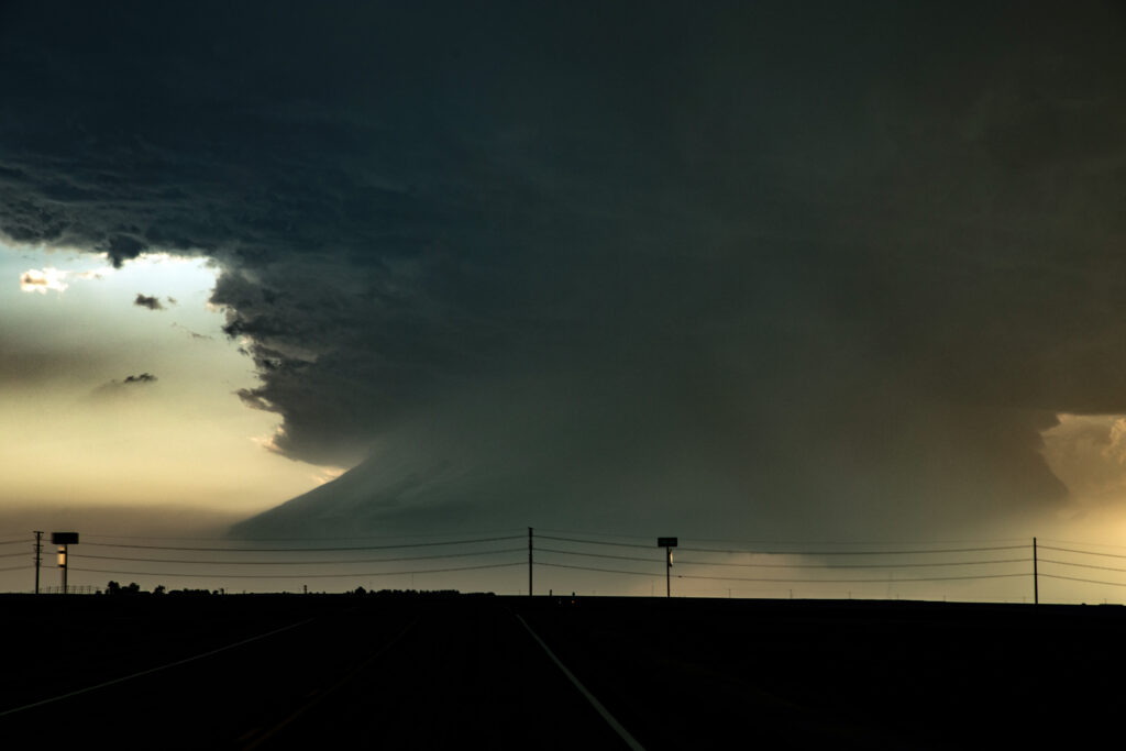
April 26th Roswell, New Mexico Tornadic Supercell
April 26th featured an upslope/dryline play in eastern New Mexico. Storms formed along and north of an outflow boundary. We intercepted the triple point storm that developed just northeast of town and kept back building at the triple point until it got so strong it moved southeast along the boundary. It didn’t take long in the highly sheared environment for it to start rotating strongly. Inflow winds of 50 mph fed the storm. There was so much dirt being sucked into the updraft at times, you could see the dirt cloud rise into the updraft base. Eventually the low levels started rotating as a very obvious mesocyclone formed. A clear slot wrapped around the meso and a long snaking elephant trunk shaped funnel, then tornado descended from cloud base. Dirt partially obscured it from time to time and it dissipated after about 5 minutes. The storm was a prolific hailer as ell we 3-4 inch stones reported. We stay with it until dark when it weakened. A fun day and a major powerful supercell was incredible to experience from birth to death. Enjoy the pics!
April 25th Muleshoe, Texas Tornadic Supercell
The arrival day for Tour #1 took us on an impromptu chase to west Texas. I knew it was a long way out and the we may or may not make it in time. We blasted west of Plainview just as the one decent (but short lived) tornado formed and dissipated. We arrived near Muleshoe to insane inflow winds into the supercell. Multiple wall clouds formed over the next 3 hours, but it just didn’t have that look. Areas of rotation formed, but never could tighten up enough to produce another tornado. The supercell persisted for many hours and was a prolific hail storm with stones up to 5 inches in diameter!!! Typically on arrival day, we restrict the chase within the state of Oklahoma, but this one was an exception, In the end, everyone enjoyed it, but a long way to go for what ended up transpiring, however it was tornado warned for several hours. Enjoy the pics!