June 28th took us to central North Dakota on a set up that didn’t look great. Sometimes nature loves to surprise and it certainly did this day! An updraft developed south of Bismarck and slowly drifted north. It was severe for golfball sized hail, but the best part was the low precipitation supercell structure. Sculpted structure eventually drifted over a nice ripening canola field east of town and was just gorgeous. The storm weakened at sunset, but not before giving us a parting beautiful view! Surprise day, but oh so pretty! Enjoy the pics!
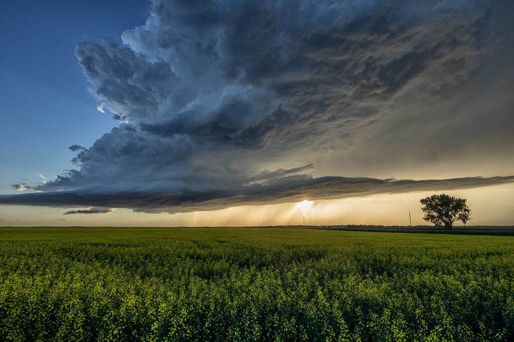
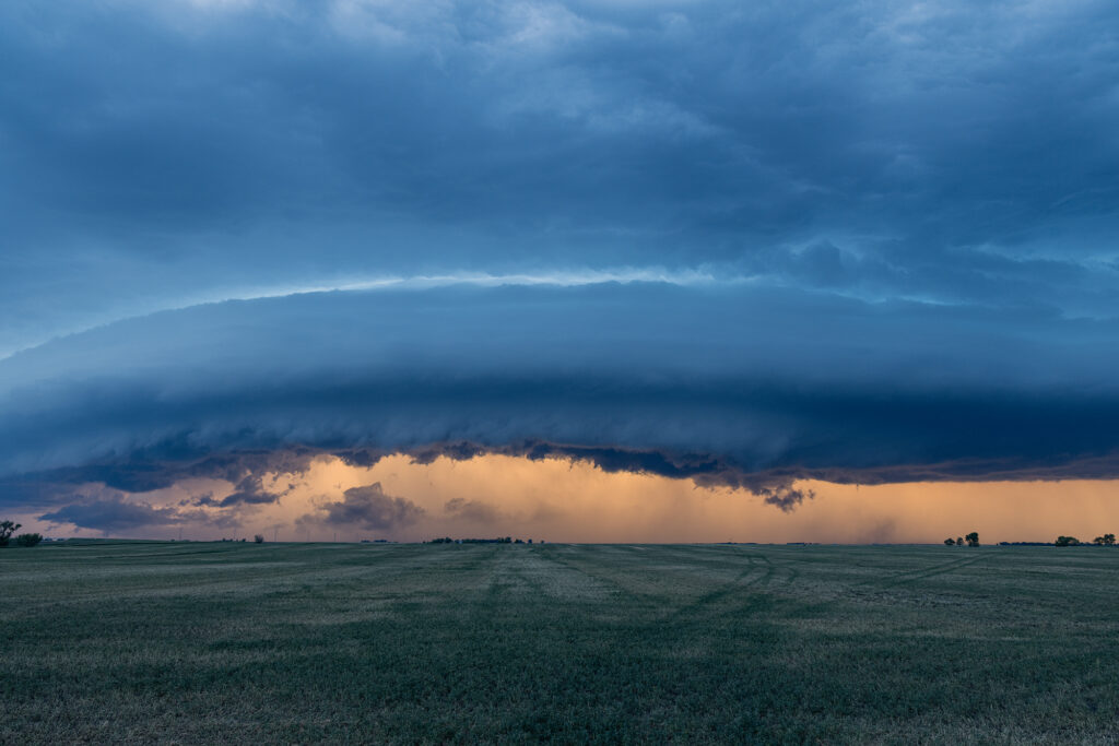
June 3, 2026 Plankinton, South Dakota Tornado Warned Supercell
June 3rd didn’t quite live up to it’s potential. A tornado watch was issued mid afternoon and a few supercells formed. They just didn’t have the look. Lower level winds we not optimal, but still sufficient to get them to spin. We caught one storm near Miller, SD and stayed with it a couple hours as it was tornado warned. It eventually moved into a hostile environment and we let it go. Blasting back towards the I-90 area near Plankinton at sunset we encountered a gorgeous shelf cloud with a couple embedded supercell structures. It was just a gorgeous sight!! The line produced winds over 80 mph and hail golfball sized. A nice way to end the day!
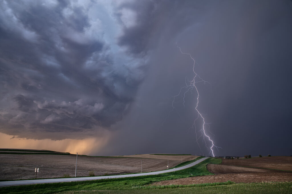
May 15, 2026 Western Iowa Tornadic Supercell
May 15th took us into Iowa. An old outflow boundary/cold front intersection would be our target in northwest Iowa. Plenty of shear, modest moisture and instability would support severe storms, with some tornado threat. We caught several storms, but one, west of Ida Grove, would produce a short-lived tornado. This storm was also an electrified beauty! Several CG strikes occurred per minute, and everyone’s cameras were clicking away! I managed to get a few decent ones as well. A fun day, tons of storms and a brief tornado to boot! Enjoy the pics!
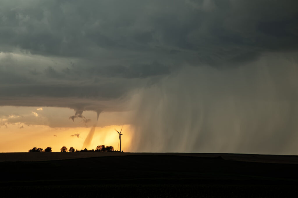
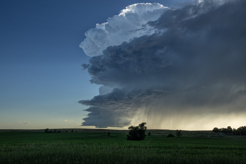
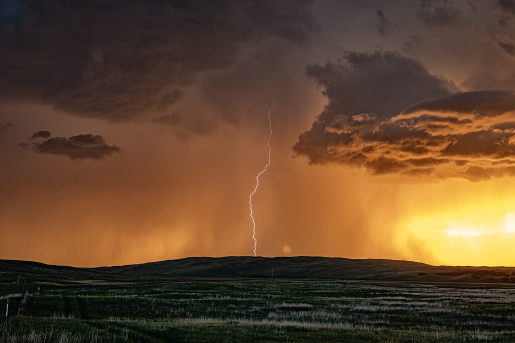
July 1st Hyannis, Nebraska Supercell and Sunset Beauty
I wasn’t expecting much on July 1st and what we got was a lot better than I was hoping! A north/south dryline was over western Nebraska, however limited moisture and instability were present which would limit the severity of storms. We encountered a nearly stationary high based supercell near Lakeview that had decent structure, nice lightning and hail the size of golfballs. We eventually got cut off from the storm due to poor road options, so we moved east and south of Hyannis to watch a new cluster of severe storms at sunset. What a show they put on! It’s been a few years since we’ve encountered such an amazing display of color at sunset. Intense lightning, sun setting through the core and luscious green rolling hills made this a winner to me!! Please enjoy the pics, some beauties!

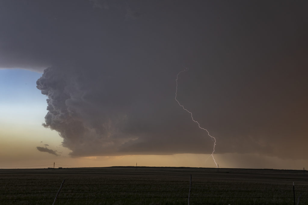
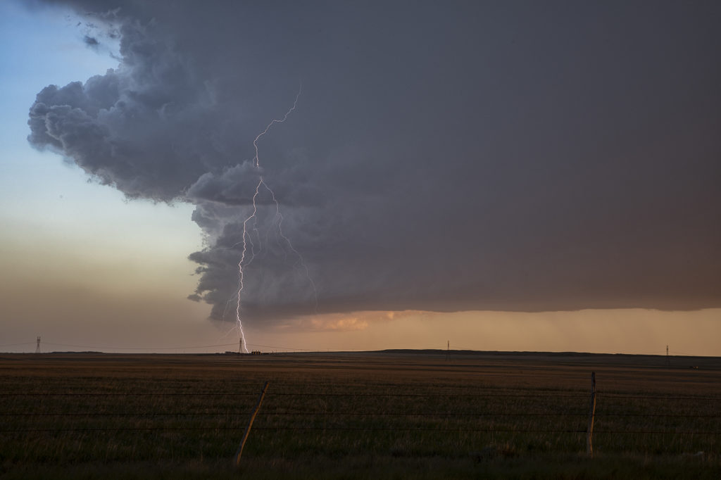
June 27th Broadwater, Nebraska Supercell
June 27th had 2 different targets. One by the Nebraska/South Dakota border, and a second along the Chugwater low at the Nebraska/Wyoming border. We hoped to chase the northern target, but nature had other plans. We went south and caught an intensifying supercell west of Bridgeport, NE. We had to punch through the core and encountered pingpong ball sized hail as we approached Broadwater, NE. Once on the east side of the storm, intense lightning was occurring. Structure became quite nice as the storm spun hard moving towards the east. After it passed Oshkosh, it started weakening as it encountered a capping inversion. We followed it through the sandhills and had a nice sunset with great color and lightning! Enjoy the pics!!!
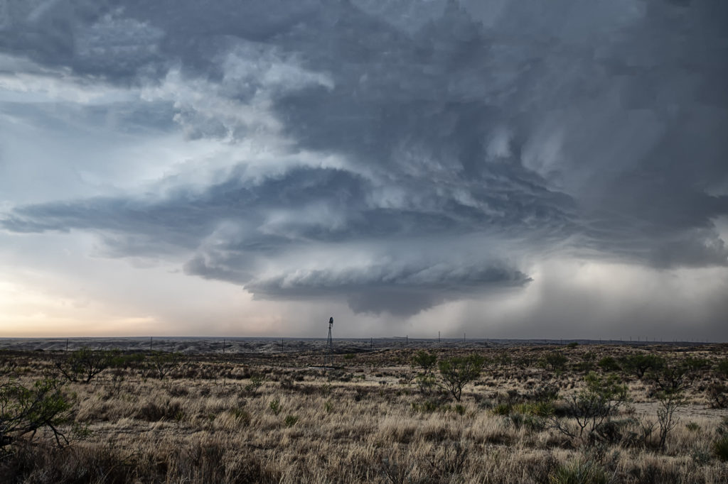
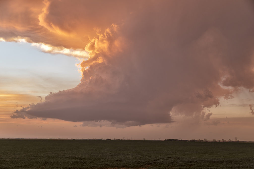
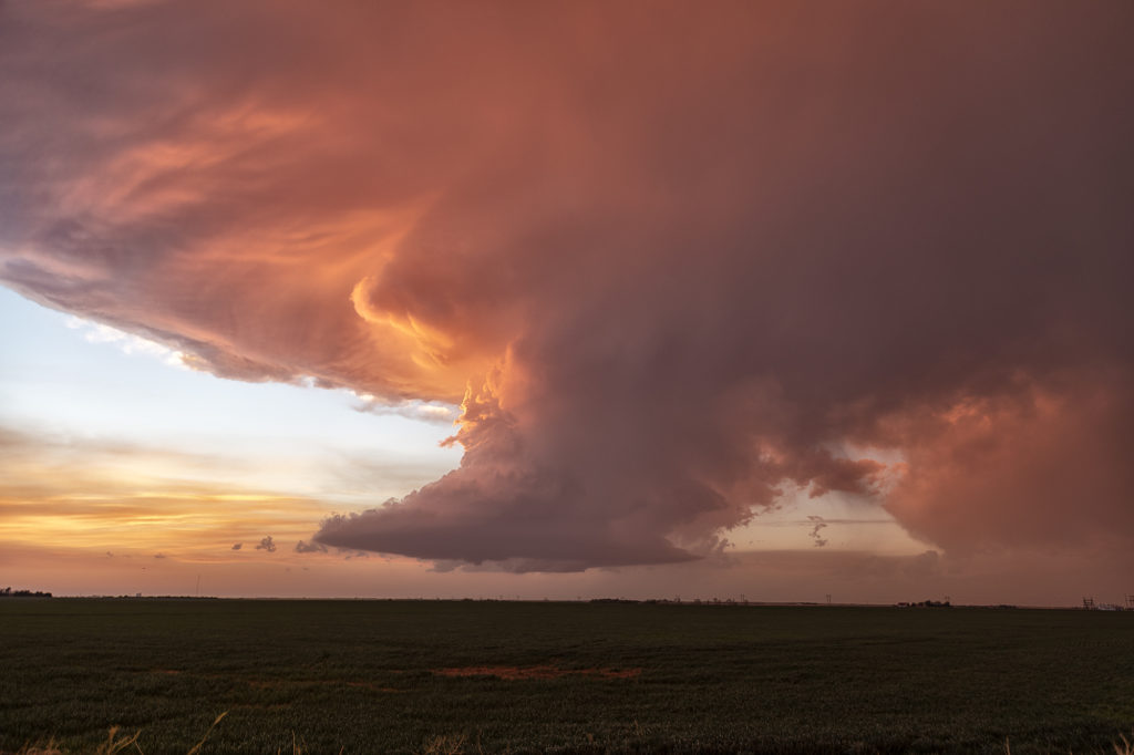
May 1st Texas Panhandle Supercell
May 1st had some potential in the Texas panhandle west of Amarillo. Moderate quality moisture was streaming north as a cold front drifted southeast. Great shear was also present. A cluster of storms developed west of Lubbock and raced northeast spewing outflow. I was certain it would ruin the rest of the day, however a supercell survived the blowing dirt and cold air from the now decaying storm cluster west of Channing. The cell slowly moved east and started getting a great classic supercell appearance. As the sun set, it just added to the beauty of the storm. We ended up losing it in the hills northwest of Amarilla due to a poor road network and other storms forming. But in the end it treated us to a nice show that we weren’t expecting. Enjoy the pics.
April 21st Southwest Kansas Tornado Warned Supercell
Tour 1, Close Encounters started off the tour season with a bang! On arrival day, we blasted to southwest Kansas near Coldwater and caught a pretty LP supercell spinning like crazy! It became tornado warned early evening and tried to produce a funnel. It did not produce any tornadoes. The prettiest thing about this storm were the sunset colors lightning up the underside of the anvil and mammatus clouds. A great start to the official 2022 tour season! Enjoy the pics!
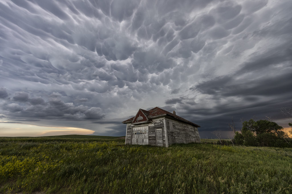
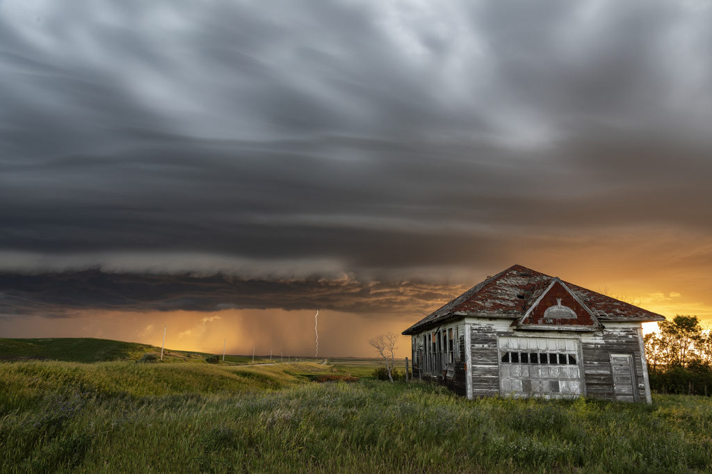
June 28th Central North Dakota Stunning Thunderstorm
June 28th took Photo Tour 3 to North Dakota. Good moisture and instability, coupled with weaker shear would allow a squall line of severe thunderstorms to form northeast of Bismark, ND. We managed to find an old abandoned farmstead south of Wing, ND where we were able to set up and capture some amazing images! The storms, coupled with the lowering sun in the evening, along with the old farmstead, allowed us to capture some of my favorite images from 2020! We stayed in place for a couple of hours photographing the area, and eventually headed back to I-94 and west to Bismark. A landspout tornado occurred well to our south near the South Dakota border, but everyone didn’t mind based on the images each person captured. Spectacular day with nature painting the Photo Tour one of the best set ups one could want! Please click on an image for a larger photo. Enjoy!
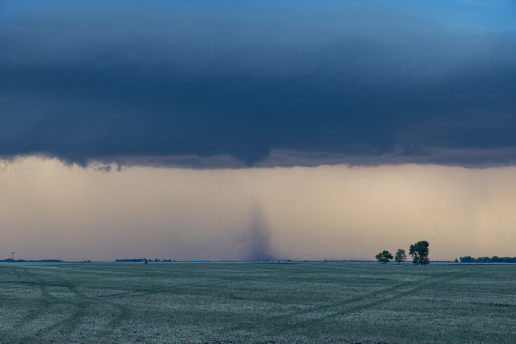
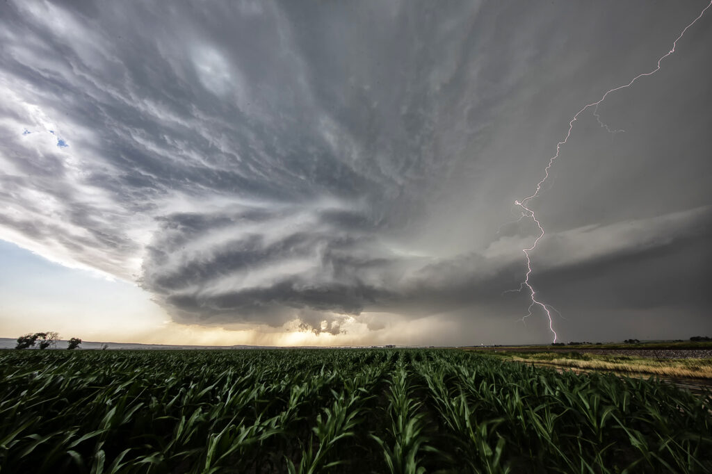
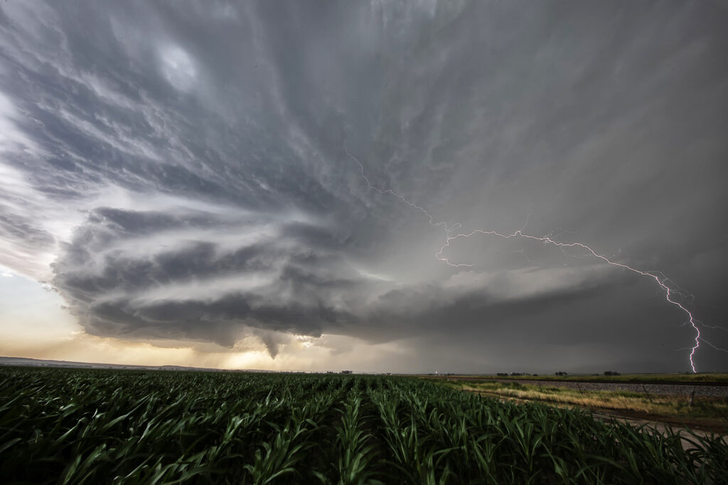
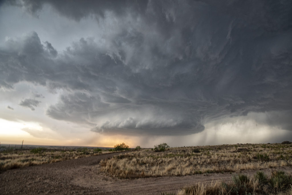
May 20th Northeast Colorado Tornadic Supercell
May 20th looked decent on paper. Strong shear, decent moisture, and moderate CAPE set the stage for intense storms. An outflow boundary/cold front pushed slowly southeast across Wyoming and northeast Colorado. We dropped from Cheyenne into Weld county, Colorado as numerous towers formed. We noticed a column of dirt in the distance (some 20 miles away!) and it turned out to be a landspout tornado that occurred near Greeley. We couldn’t get close enough for a good photo, but a few guests got a shot or video or two of it from our vantage point. The storms congealed into a tail end supercell and were very electrified! As the sun set, the forward flank downdraft lit up with the most incredible orange I have ever witnessed in a storm! After sunset, the sky was illuminated with numerous continuous lightning strikes that were a treat to watch. Click on an image for a larger pic. Enjoy!
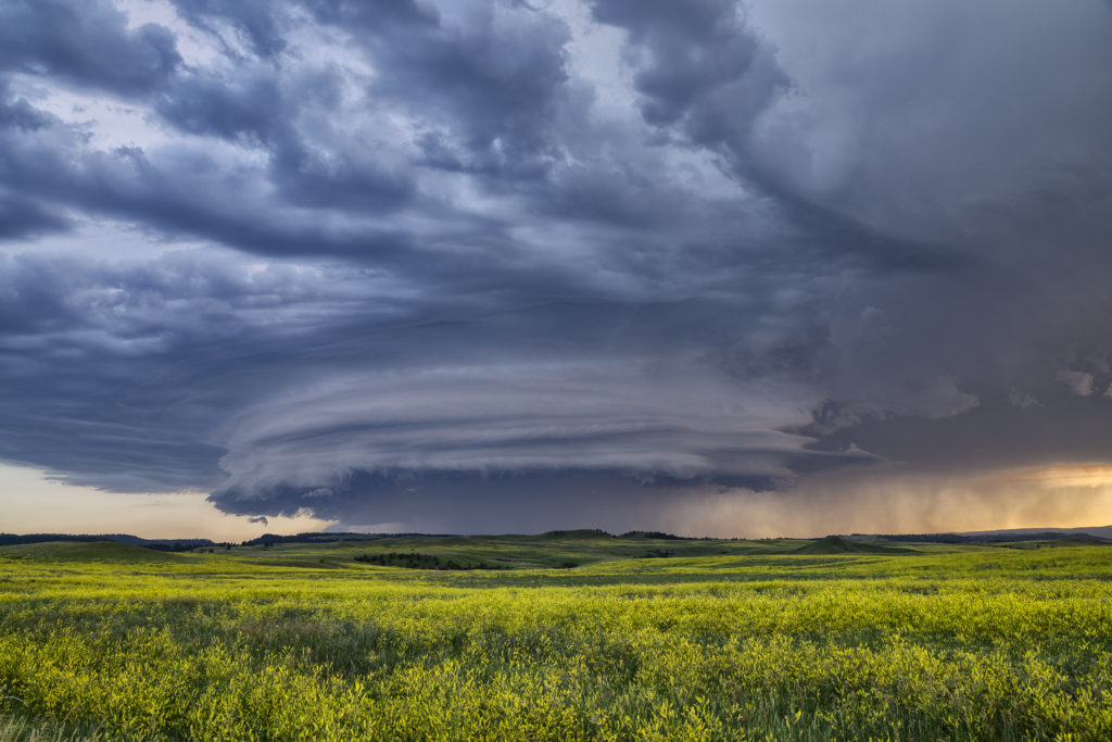
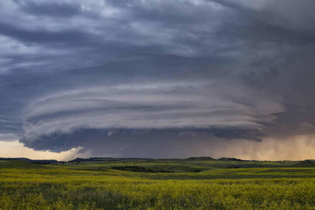
July 11th Black Hills of South Dakota Severe Storm
We weren’t expecting much on July 11th. Nature decided to give us a pretty storm southwest of Spearfish, SD late day. The cell was very photogenic, and throw in the fields of sweet clover and you had a winner! The cell traveled for a few hours across northeast Wyoming into western South Dakota, where it dissipated over the Black Hills. Very pretty to watch and photograph! Enjoy the pics!