Tag Archives | storm

May 20, 2014 – Eastern Colorado Tornado Warned Supercell

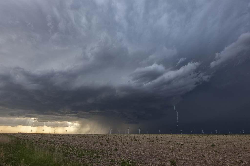
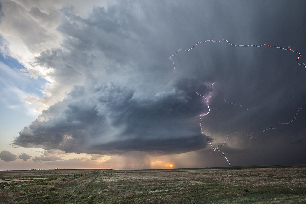
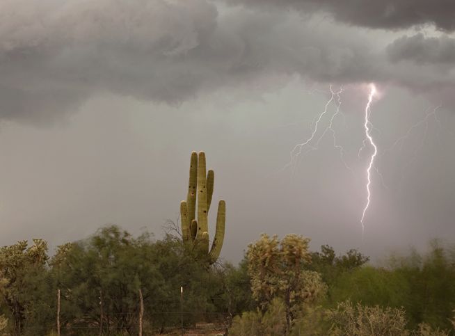
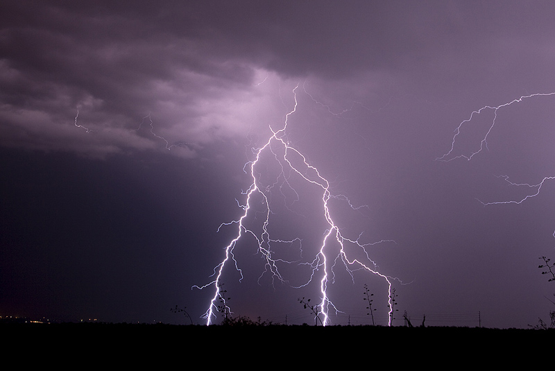
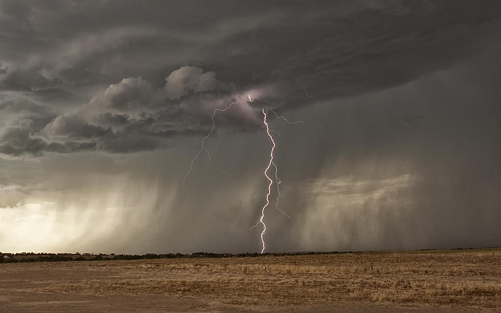
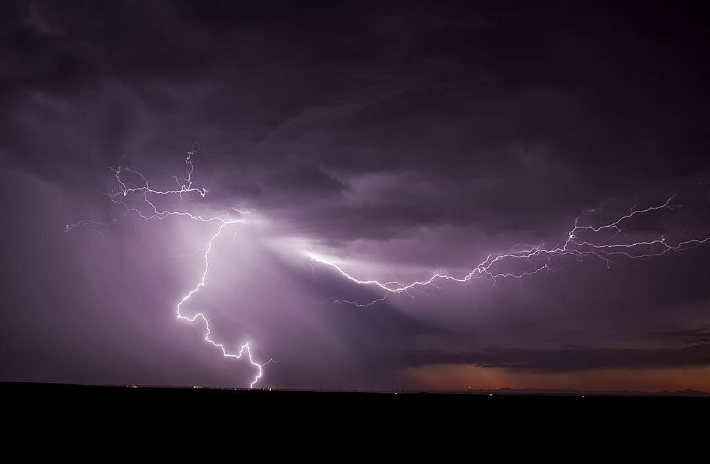
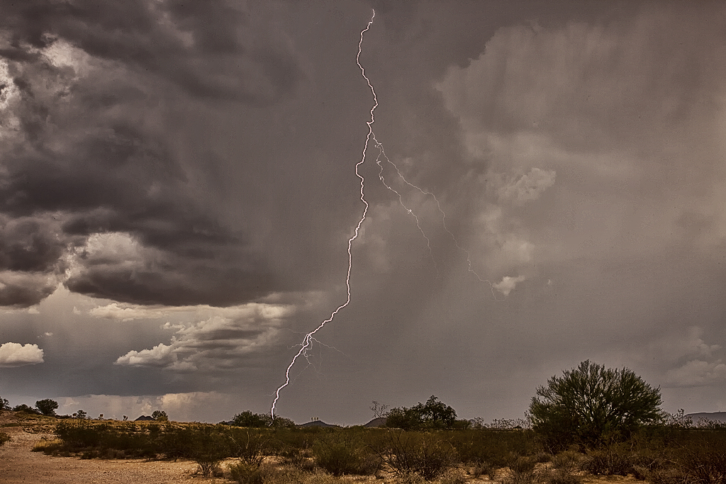
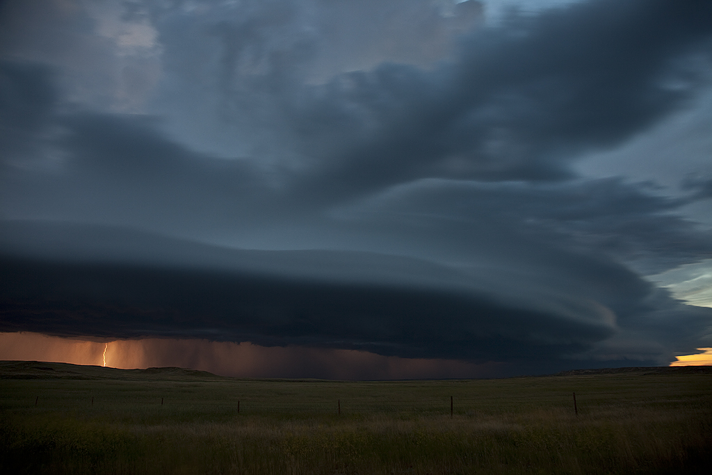
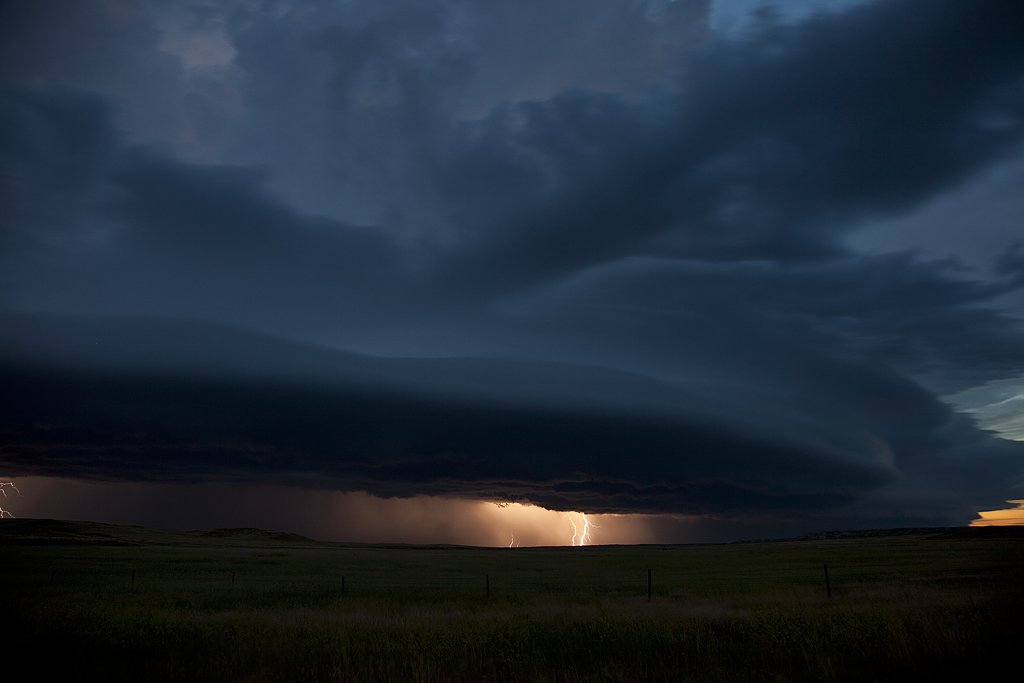
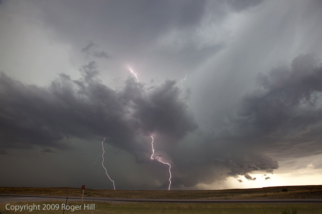
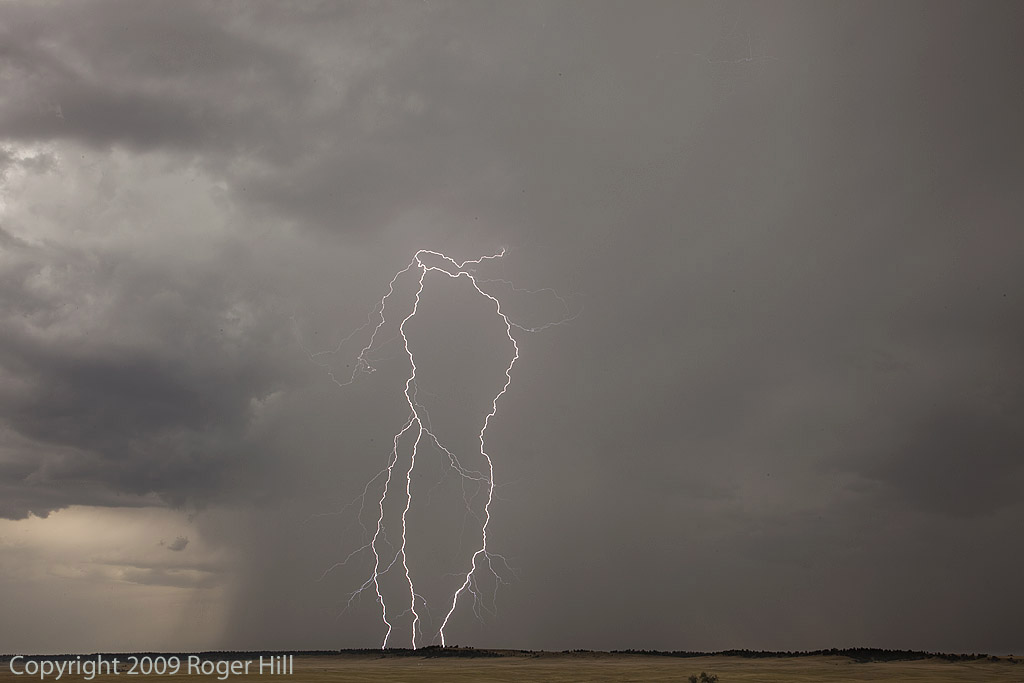
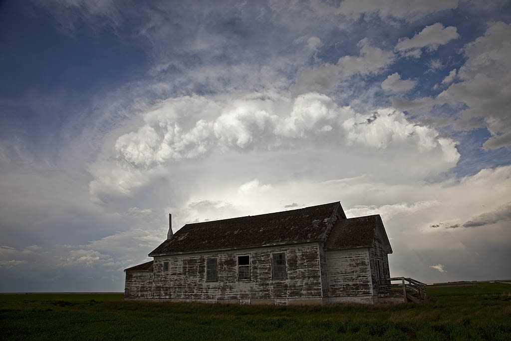
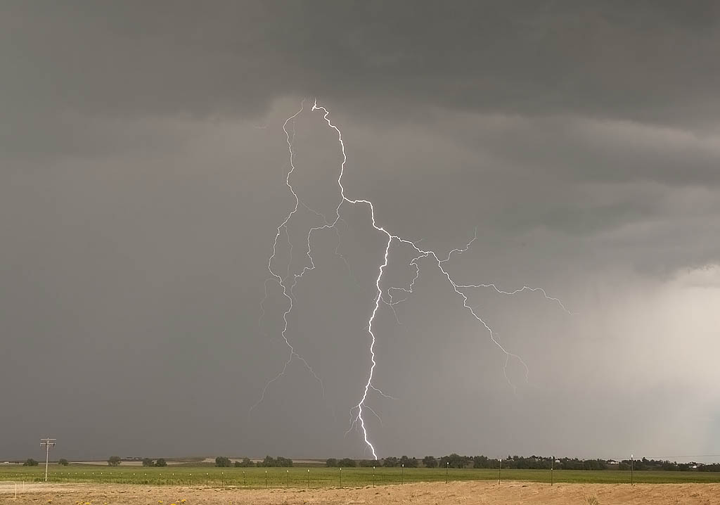
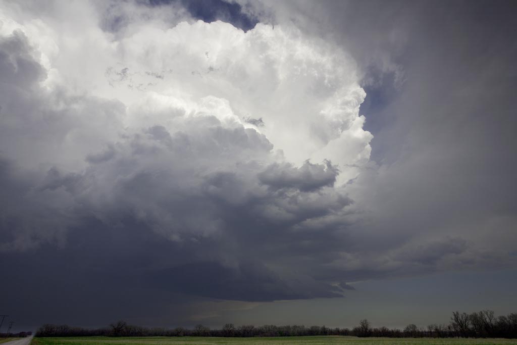
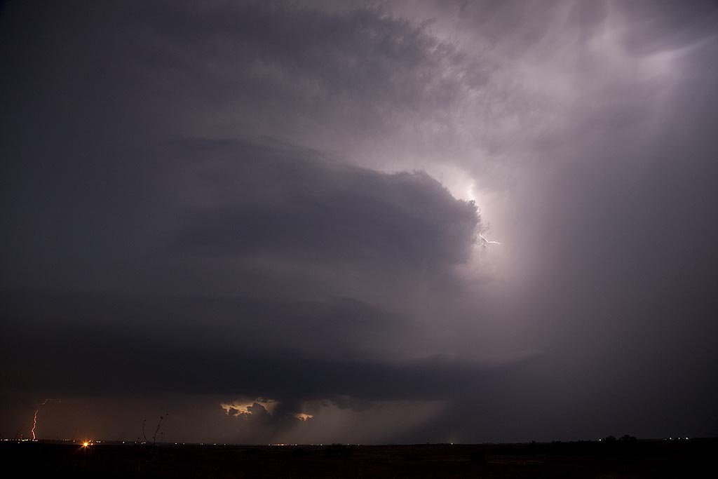
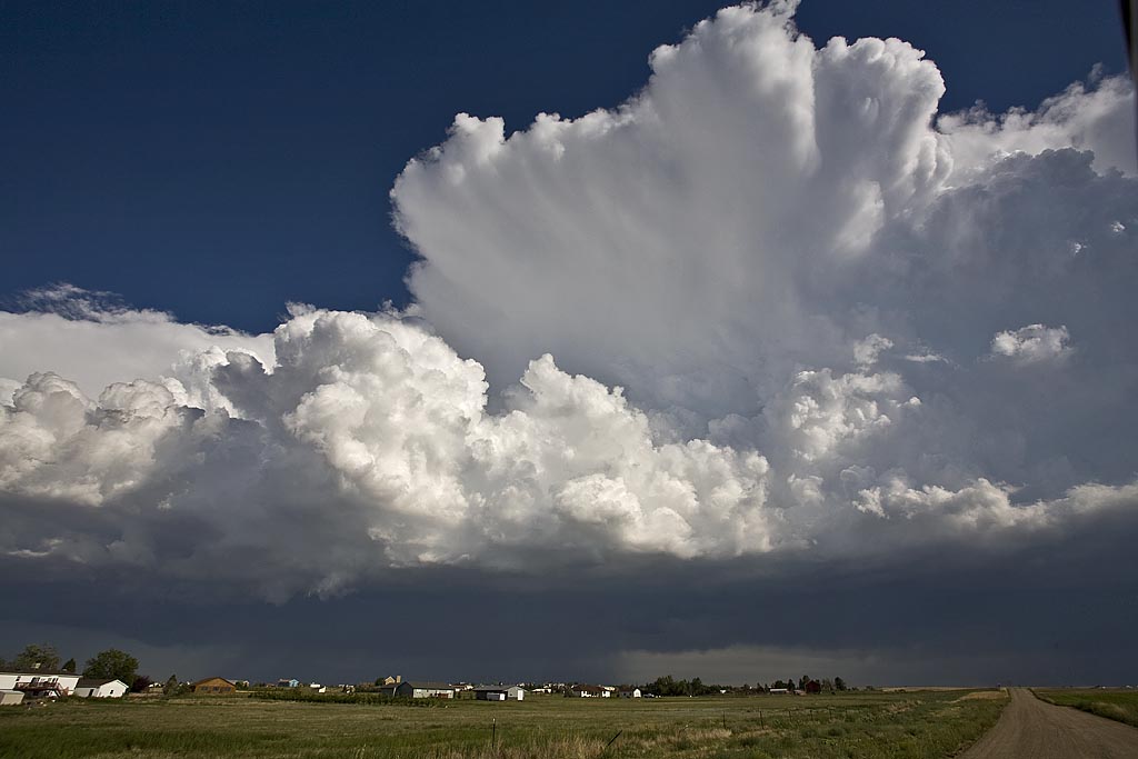
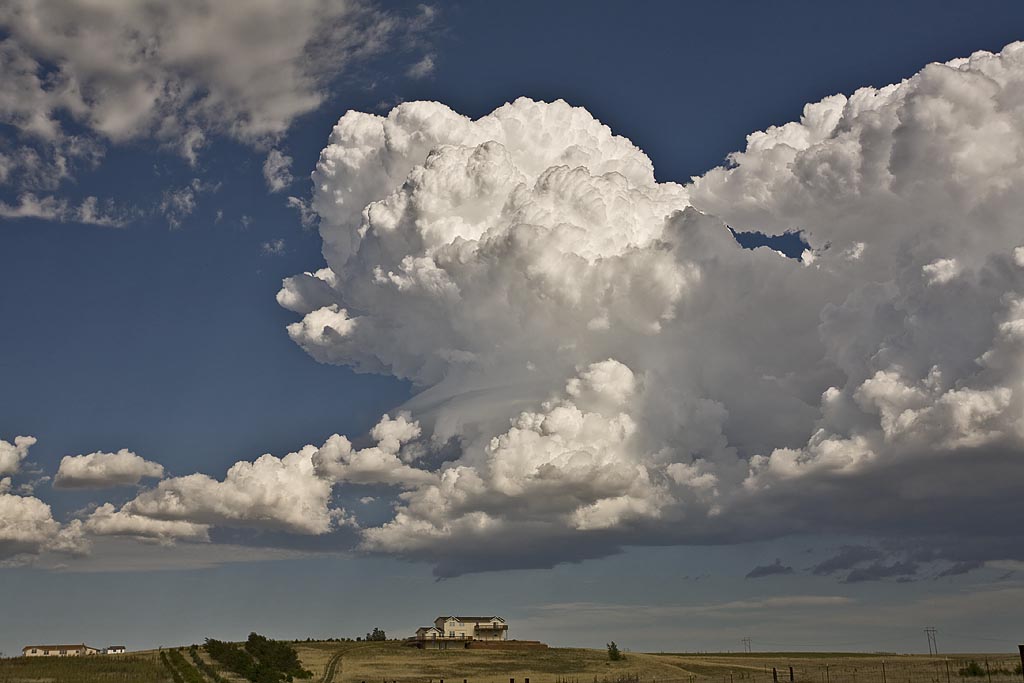
May 20th was the first of two good Colorado severe weather days. This day featured returning moisture, albeit not optimal, strong shear and good upslope flow to generate storms. A few high based storms formed off the Palmer Divide by mid afternoon and the southern most storm intensified later, becoming the storm of the day! This supercell tracked all the way into western Kansas giving us quite a show with fantastic structure, a couple funnels, huge hail to tennisball size and a lot of lightning.  At dusk one of the prettiest structured storms, lit up by lightning, became tornado warned near the town of Burlington, CO. It truly was a sight to behold!


The Desert Monsoons of August

Caryn and I were fortunate to spend a few days in Arizona to film the monsoon storms. Well, I filmed, she shopped, but did film the beautiful cactus in bloom. Check out some of these photos for what the deserts have to offer in late summer. Magnificent place! A photographer’s delight! This will be a VERY LONG page, so be prepared!

September 2, 2011 Colorado Lightning

This day didn’t look like much chance of severe storms, but it did offer the chance for local storms with decent lightning. Nature did not disappoint! Caryn and I went out east of town and had a blast! Several storms were prolific lightning makers and offered great lightning captures.

August 13-20, 2011 Arizona Monsoon Storms

Our annual trip to Tucson resulted in some great lightning from numerous storms, almost everyday. This year we tied in some slot canyon exploration with the monsoon adventure, before and afterwards. A couple select shots are shown below. Enjoy!!!

July 13th, 2011 Montana Severe Storm

Although nothing spectacular happened July 13th, a late show developed with a pretty shelf cloud/undercut supercell, that was fun to photograph. This storm was severe, and produced hail to golf ball size northwest of Miles City, MT. Later, after dark numerous CGs occurred that were also fairly photogenic.

One other photo included in the writeup (first image!) occured the day before, July 12th, east of Lewistown, MT overlooking a valley below. One of the prettiest pure scenes for me to photograph in ages. A young 11 year old farm girl named Jordan came out on a Gator 4×4 and chatted with everyone. She enjoyed meeting us all and couldn’t believe storm chasers were up where she lived. Everyone loved it!

August 7, 2009 Sturgis, South Dakota Hailstorm

August 7th looked like a decent setup for western South Dakota. Good shear and moisture, moderate instability and strong lift would help fire off several supercells, including the Sturgis storm. We followed that storm from the time it passed Sturgis until it died near Murdo well into the night. It left behind a path of massive hail damage. It also injured numerous bikers and caused millions of dollars in damage at the Sturgis Bike Week Rally.

Late May 2009 Images

From mid through late May, nature did not cooperate with an active severe weather pattern. A large ridge of high pressure, along with a persistent gulf coastal frontal boundary would prevent decent moisture from returning to the plains states. When you operate a tour, you still have to find the little nuggets nature gives you. The pictures below are those nuggets from May 19 through 31st.

First 25 days of April, 2009

This is a collection of photos from storms I chased during the first 25 days of April. They are at various locations as shown with each photo’s caption.

September 12th and 13th, 2008 Hurricane Ike Landfall

On Sept 11, I flew from Denver to San Antonio, Texas for the intercept of Hurricane Ike. My plan was to get a rental car, provisions and fuel, and then make my way to Galveston for landfall. Because I had a group of people with me, and the promise I made to their families of not staying out where the surge could cut us off, I took us back across I-45 to the mainland at dark on the 12th. Even the drive across the high bridge from Galveston Island to Bayou Vista was intense as we were raked with 70 MPH winds, a shaking bridge and waves galore. We rode Ike out at the Mall of the Mainland in Texas City and then did not go back towards Galveston due to blocked roads and the local authorities coming in to help the victims. Check out the two videos below, one from daytime hours on the 12th and then the other from the landfall in the dark. The images of the damage in Galveston were from Stuart Robinson (www.stormtrack.co.uk).

August 24th and 25th, 2008 DCVZ Storms and Landspout

August 24th and 25th featured a classic high CAPE/low shear with the Denver Convergence Vorticity Zone (DCVZ) boundary quite active. Both days events would cause the NWS Denver/Boulder to issue tornado warnings along the boundary with a half dozen landspouts reports. My wife Caryn and I would capture one landspout southwest of our house thanks to her keen eyes. Second day, no tornadoes were reported, but severe storms still occurred.