
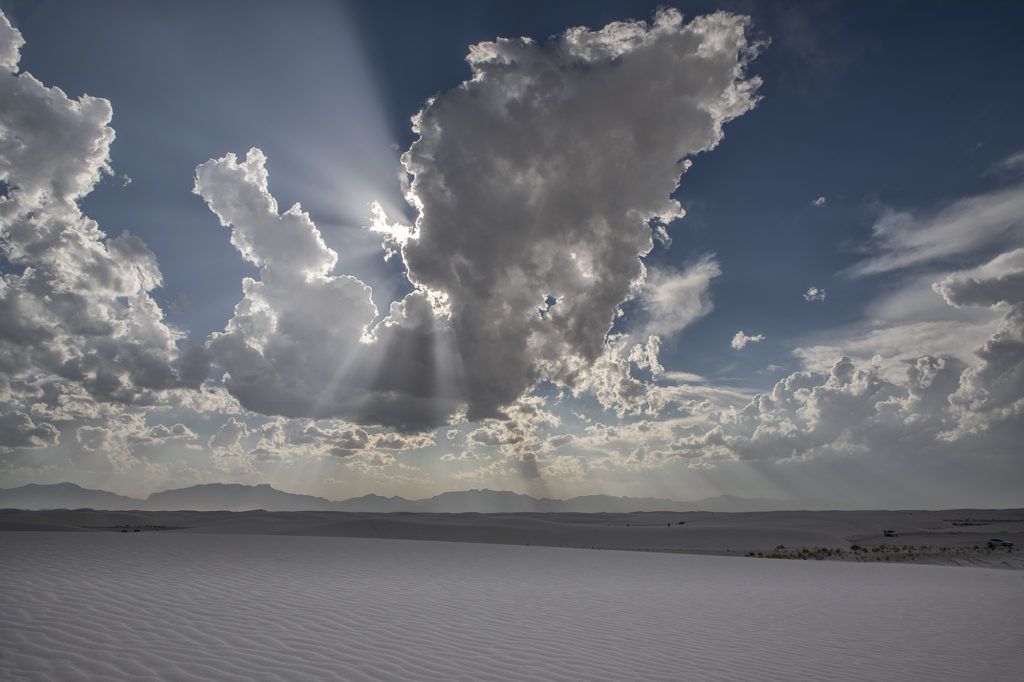
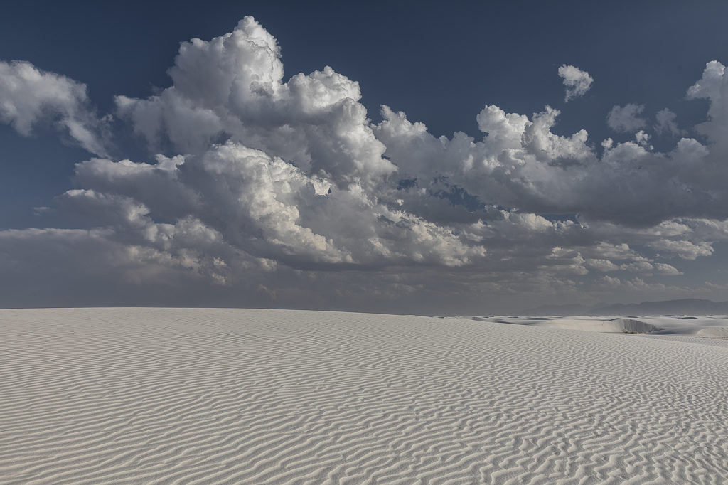
What do you do when storms are not forecast across the plains? We head to scenic areas for some sight seeing and photography. June 2nd took us to White Sands National Park, New Mexico. Storms were forecast over the central New Mexico mountain chains and we hoped they would move towards us over White Sands. The did exactly that, but weren’t producing much lightning. Still a very scenic spot with developing storms around. Made for some stunning photography!
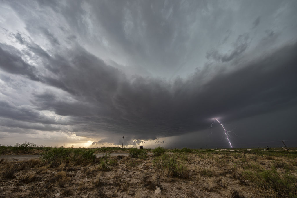
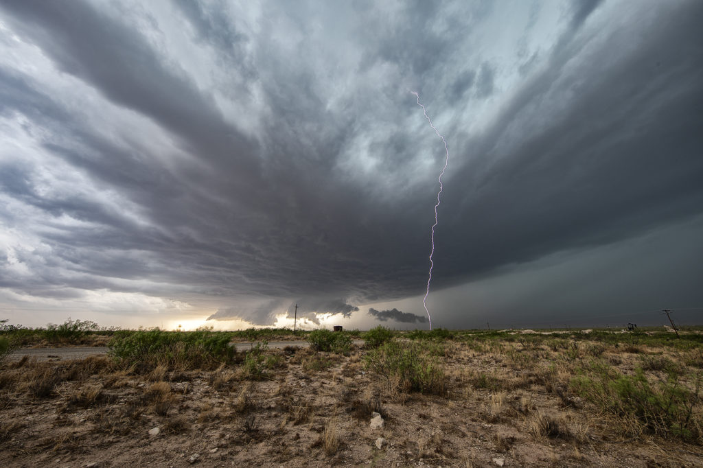
June 1st Southeast New Mexico Powerful Supercell
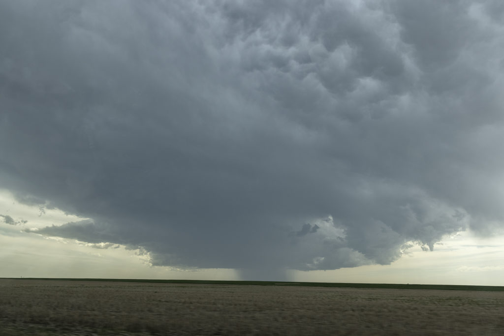
The first day of June took us towards far southeast New Mexico. A couple supercells developed along the dryline west of Jal and drifted eastward, becoming quite prolific hailstorms. The storm’s structure was very nice and it had a wall cloud throughout it’s life cycle. However, low level rotation was lacking. The cell was an amazing lightning machine producing numerous cgs every minute. As it moved southeast, other storms for and soon a cluster of high based severe storms rolled into southwest Texas. We went to our hotel in Midland and watched as the storm approached from the northwest, with tons of blowing dirt, lightning and hail.
May 29th Central Nebraska Tornado Warned Supercell
May 29th was the classic “day before the big day” type set up. Moisture and instability were rapidly increasing along a lifting warm front in Nebraska, and shear was quite strong. Models showed late afternoon and early evening supercells forming north of Broken Bow and that is exactly what occurred. It took awhile from the main supercell to root along the boundary and get organized, but once it did, it became a formidable storm! Eventually it became tornado warned as it moved to the northeast and stayed warned for a few hours. Due to storm motion and poor roads, it became virtually impossible to stay with it. Near O’Neill we had to let it go and head to Sioux Falls, SD for the night. The storm had good structure, and it had a well defined rotating wall cloud. It just couldn’t tighten enough to get a tornado to form. Enjoy the pics!
May 1st Texas Panhandle Supercell
May 1st had some potential in the Texas panhandle west of Amarillo. Moderate quality moisture was streaming north as a cold front drifted southeast. Great shear was also present. A cluster of storms developed west of Lubbock and raced northeast spewing outflow. I was certain it would ruin the rest of the day, however a supercell survived the blowing dirt and cold air from the now decaying storm cluster west of Channing. The cell slowly moved east and started getting a great classic supercell appearance. As the sun set, it just added to the beauty of the storm. We ended up losing it in the hills northwest of Amarilla due to a poor road network and other storms forming. But in the end it treated us to a nice show that we weren’t expecting. Enjoy the pics.
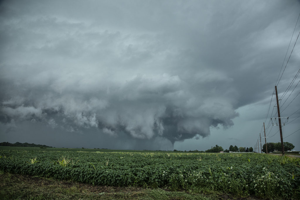
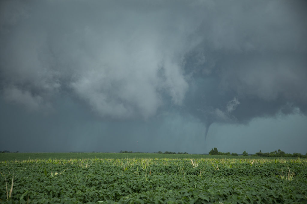
July 14th Central Iowa Tornadoes
July 14th had it all. Boundary, great moisture, instability and good low level shear. We blasted from Pierre, SD to central Iowa as storms formed and became severe and tornado warned. Several tornadoes did occur in central and eastern Iowa with one particular tornado we just missed by 15 minutes being the most intense near Lake City. Frustrating day to say the least, but we still managed some great supercells and a tornado late in the day. Moral of the story is to NEVER give up until storms are weakening and loss of heating reduce instability.
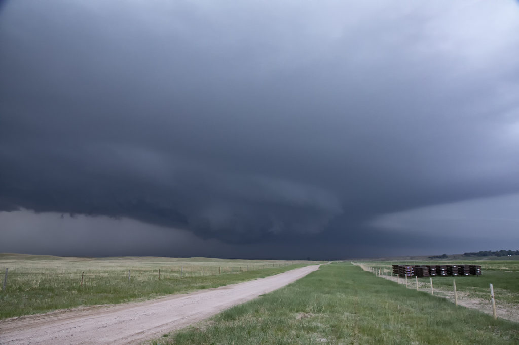
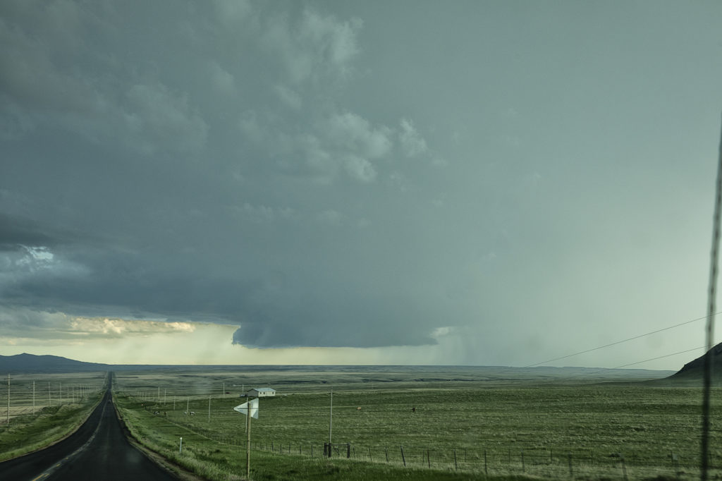
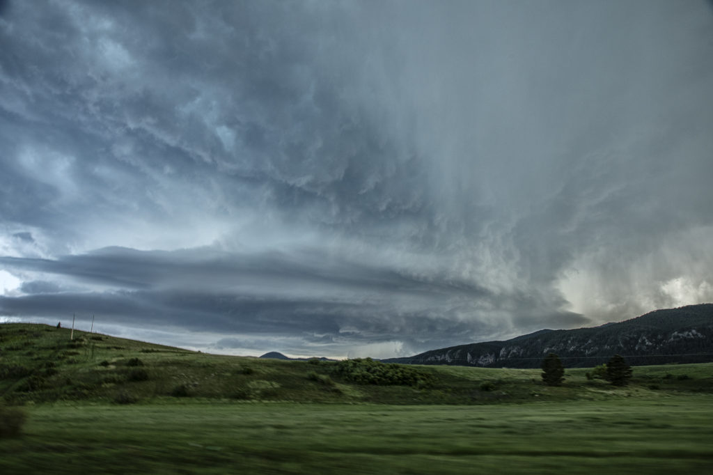
June 9th Lodgepole, Montana Jaw Dropping Supercell!!!
Wow, all I can say is WOW! What an amazing supercell this day produced! Great shear, good moisture and instability, and lift along a boundary and mountains would provide all that was needed to get the best structured supercell of 2021 to form. After hanging out in Havre, MT waiting for a storm to get going, we finally got our wish. Due to the late setting sun in Montana in June, we had several hours to watch this storm ramp up and become a jaw dropper! The one unfortunate thing that occurred were the poor road networks in Montana. We were able to stay with this mothership supercell for a few hours east of Lodgepole and enjoy the treat! Incredible structure and the beautiful countryside in Montana made this day one of my favorite for 2021! Please take time and enjoy the photos of this stunning storm!
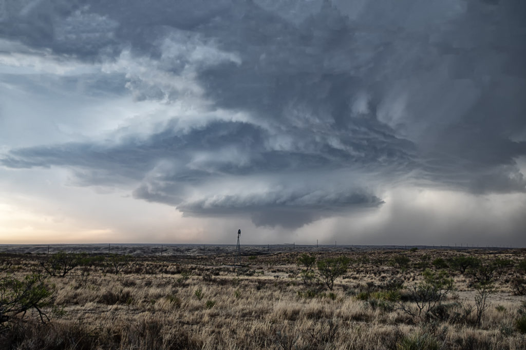
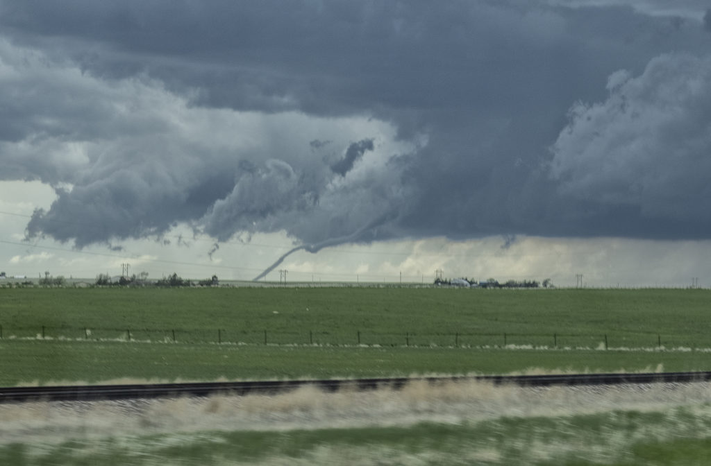
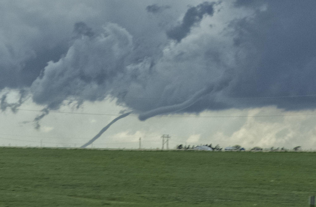
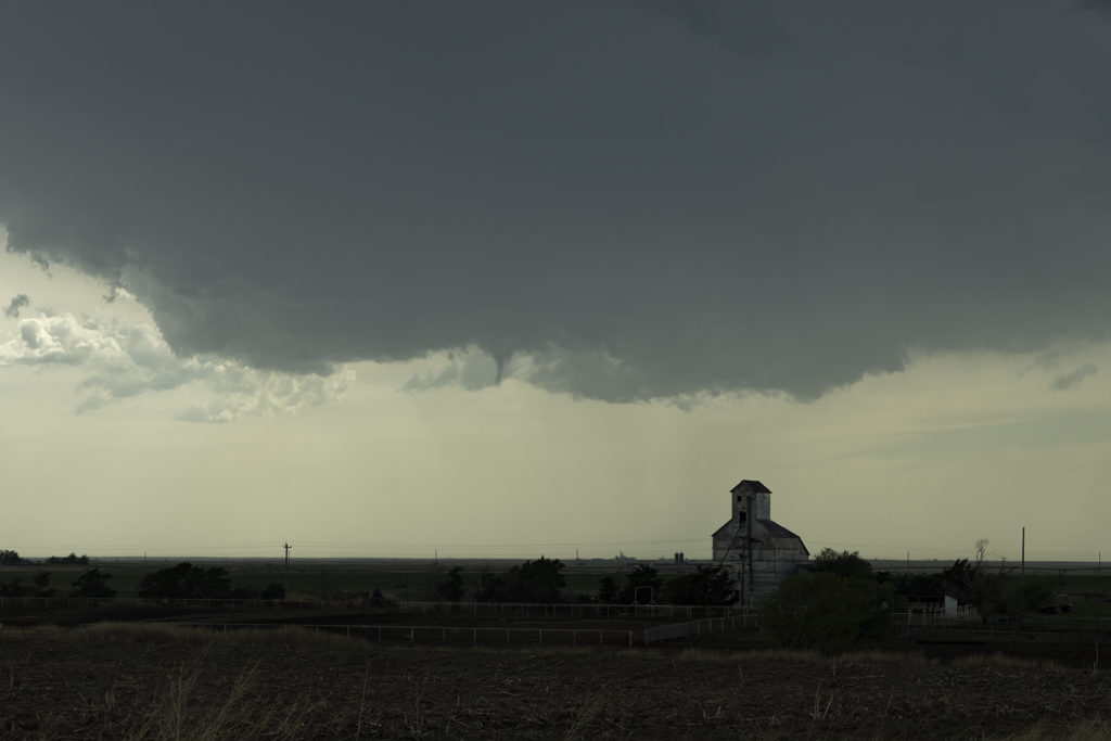
May 30th Roswell, New Mexico Tornadic Supercell
May 30th was the first day of Tour 5 leaving from Denver. It was a long drive to our target of Roswell, NM, but we made it just in time. A tornadic supercell formed west of town and tracked east/southeast. A couple of tornado reports were made and I can’t argue with them. A few spin ups under the updraft occurred as rotation was strong above them. Good CAPE, moisture, and a boundary set the stage for this supercell to form. Nice structure and huge hail also fell from this cell. As it moved east later in the day, it weakened and another supercell formed on it’s outflow. This storm was jaw dropping gorgeous and rolled eastward towards the Texas border in the evening hours. A fantastic day after an extremely long drive, but well worth it! Enjoy the pics!
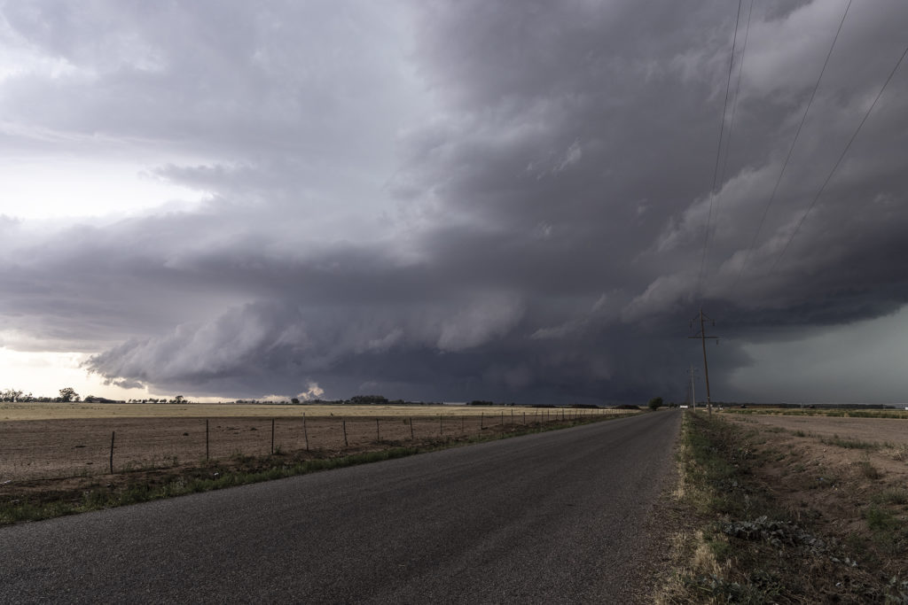
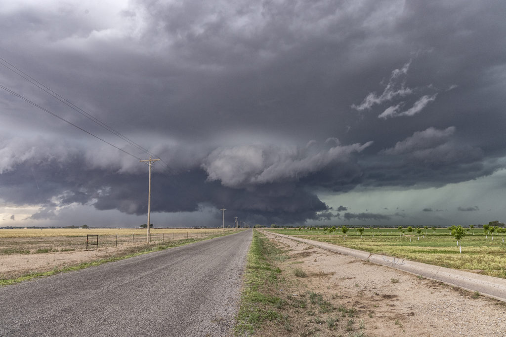
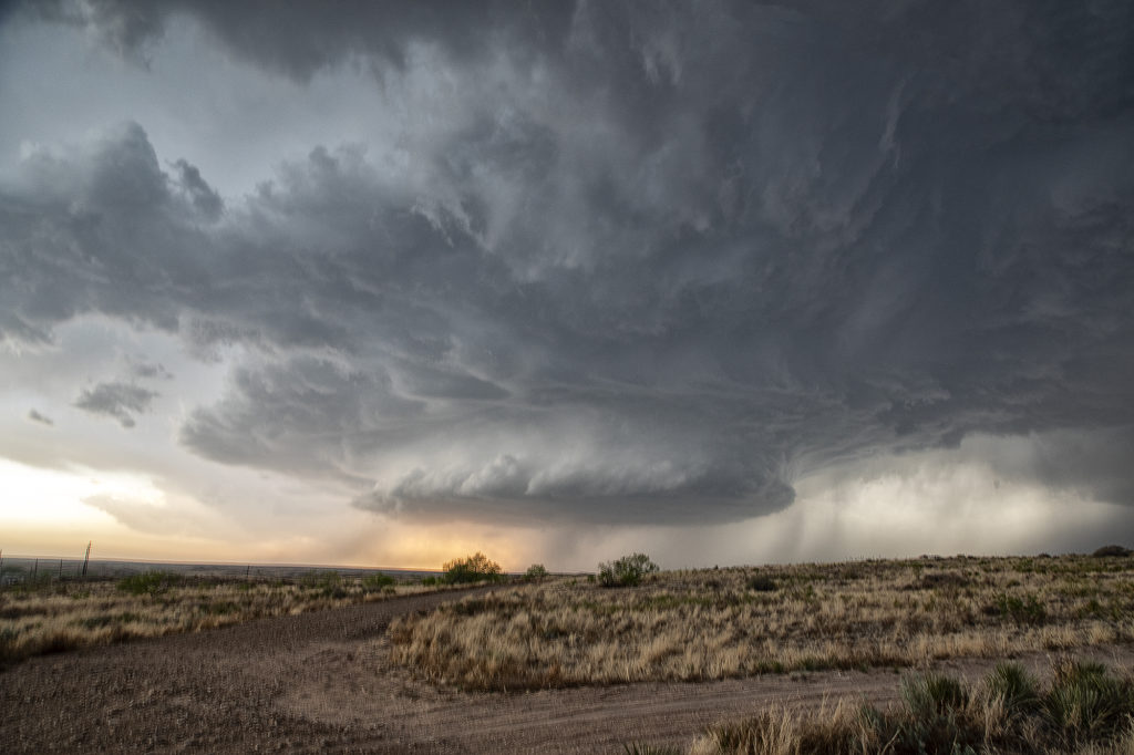
May 22nd Colorado Tornadic Supercells
May 22nd had great potential in Colorado. Good upslope flow and moisture, as well as great instability and wind shear would set the stage for intense tornadic storms! One storm formed early in the afternoon and produced a fast tornado west of Akron. A second supercell formed south of Limon and produced several tornadoes. We were able to intercept the first supercell and tornado west of Akron, but tried to blast down towards Limon later and couldn’t get there in time for the second storm. Still we caught a pretty tornado and then the end of the second tornadic supercell. A fun day, very hectic and exciting!! Enjoy the pics!!!!
May 8th Central Kansas Tornado Warned Supercells
May 8th took us to central Kansas along I-70. Good shear and convergence along a boundary would provide the focus for severe storms. However limited moisture and instability would eventually temper the overall threat. A supercell formed at the triple point southwest of LaCrosse, KS. It looked like THE storm to be on, however, it ingested dry air and died a couple hours later. Outflow from a decaying cluster of storms over northern Kansas would fire off several supercells in the daylight and darkness, of which a couple became tornado warned. There was little threat of a tornado due to the high bases of these supercells. They did produce baseball sized hail and a lot of lightning. Fun day for Tour 3! Enjoy the pics!
April 1, No Chases, SEE BELOW
No chases occurred in the month of April due to the covid 19 pandemic.