
May 30th brought an interesting chase. A sharp dryline and an outflow boundary would intersect over west Texas and provide the focal point for severe weather. Storms formed at the triple point but could not sustain themselves for very long as they moved out into more stable air. We ended up dropping south from Morton, Texas to Denver City, Texas as one storm formed, hooked hard and tried to produce. In the end the only storm that produced was near Midland, Texas as it dropped two substantial tornadoes. Our storms looked good, but due to a bit higher cloud bases, they could not get a circulation down to the ground. Overall a fun day but a bit frustrating as we were so close but not close enough with our storms.
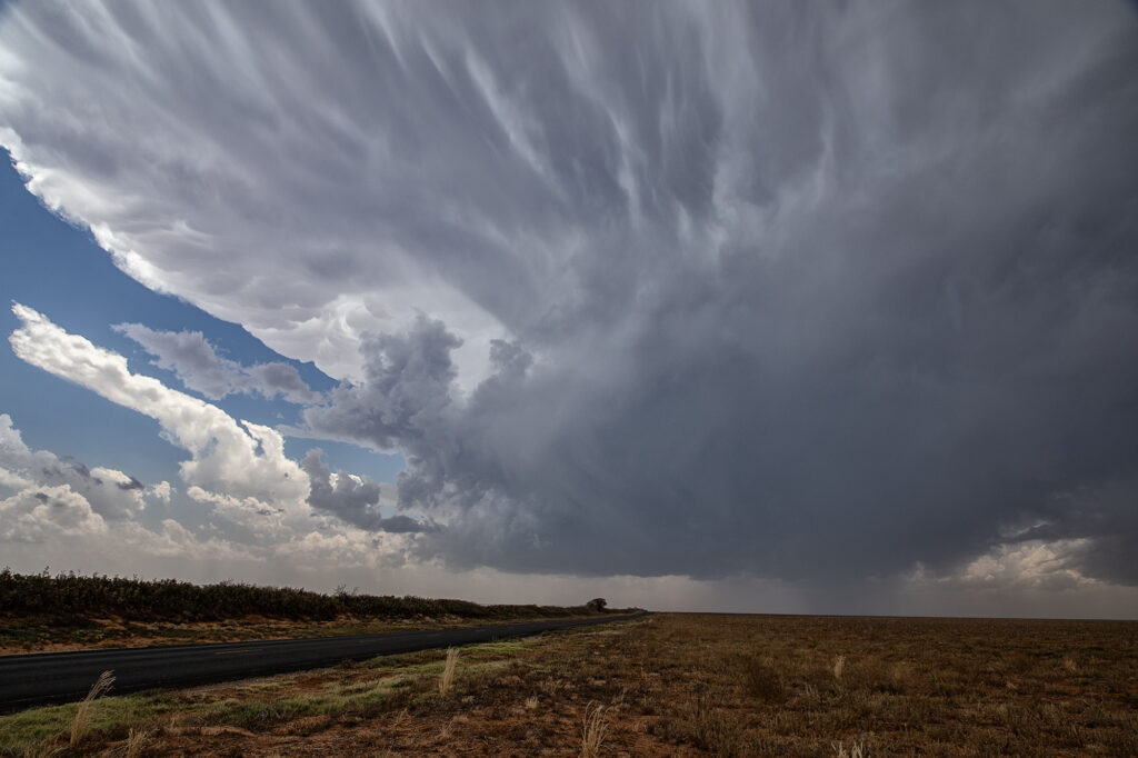
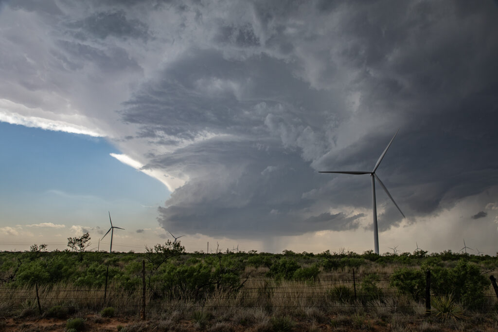
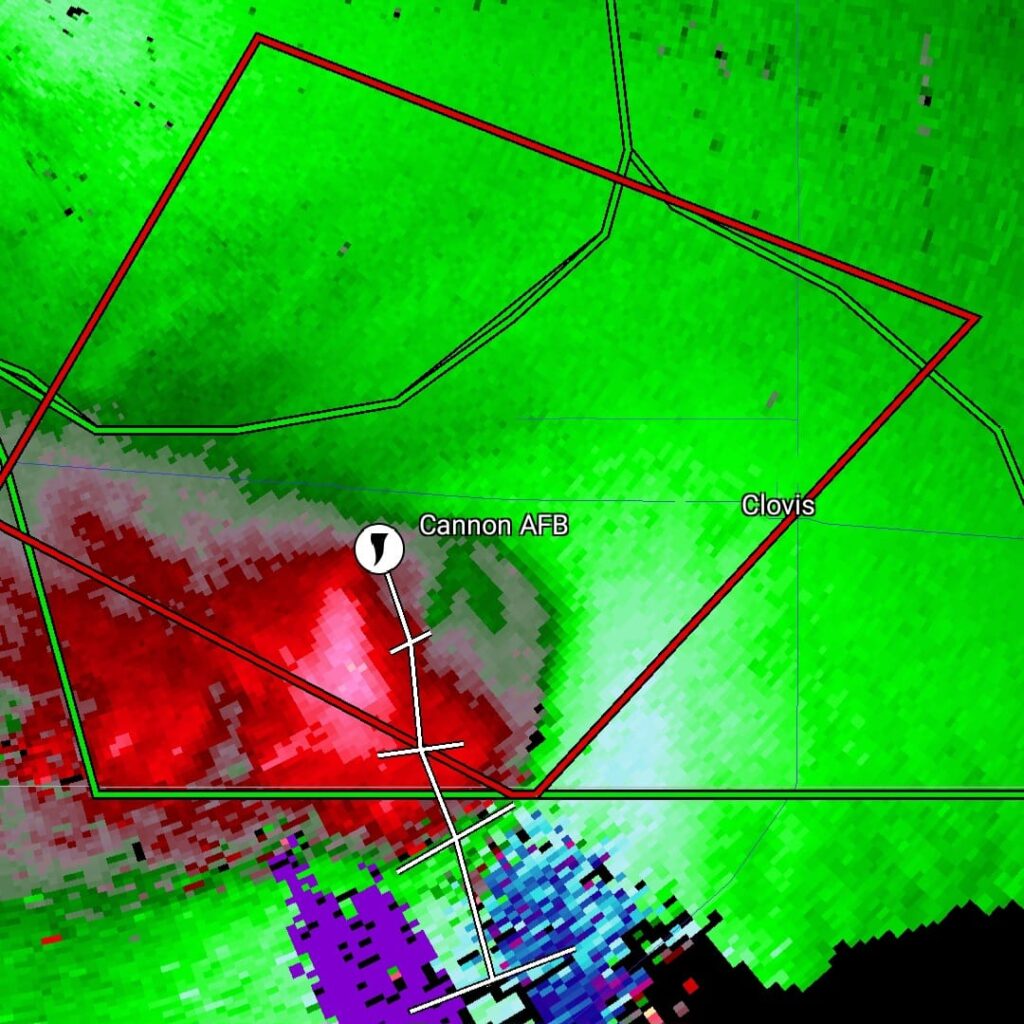
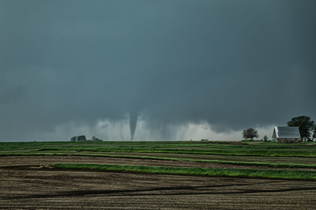
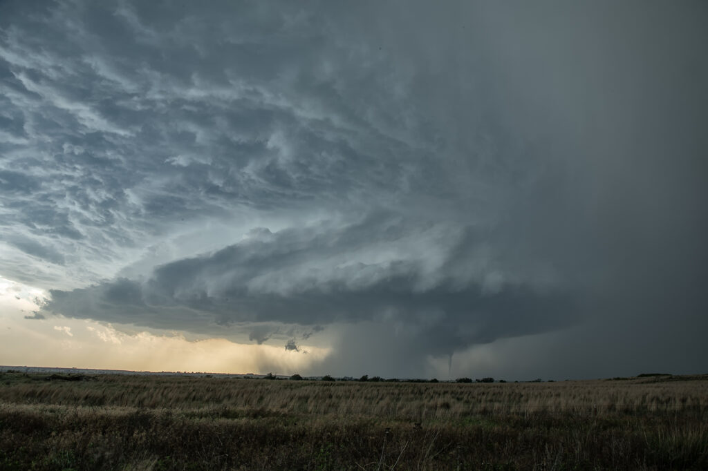
May 29th Clovis New Mexico Tornadic Supercell
May 29th was a marginal day at best. Southeast Colorado looked like the place to be. However, with moisture pooling along a boundary in east central New Mexico, I had a hunch that would produce decent supercells late in the day and evening. The Colorado target got interesting and produced a couple tornado warned storms ( See the previous chase account for the Prime Time Minitour!!!), but I chose to wait and see what would happen in New Mexico. I was not disappointed!!!! By early evening as a short wave trough approached, storms developed northwest of Clovis. It didn’t take long to see they were anchored and would start spinning quickly. As we approached the northeast side of Clovis, a tornado warning was issued. Numerous images from various locals and also my defunked video camera showed what appeared to be a cone tornado northwest of town. The NWS in ABQ is currently validating the tornado based on images, video and local chasers in the area. We nearly had the storm to ourselves, which is quite rare in this day and age!!!! We dropped through Clovis and ended up north of Portales, NM and sat and watched the storm spin like crazy. It was constantly tornado warned. The structure was absolutely top notch, even in the dark and hook after hook formed on this anchored supercell! Finally, by late evening, things started winding down, so we drove to Amarillo to our hotel for the night. One of the BEST structured supercells of 2024, even in the dark! Please enjoy the pics and NO they are not photoshopped!!!!

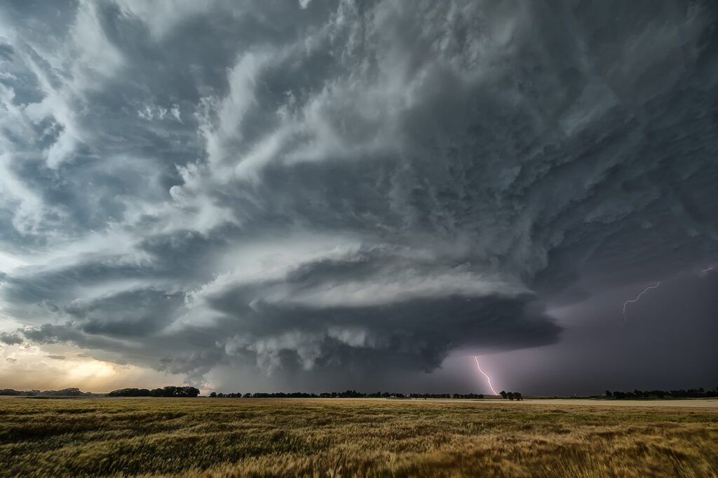
May 23rd Eldorado, Oklahoma Large Violent Tornado
May 23rd was the final day of Tour #4, the Prime Time tour. As often occurs, the final day of the tour would be quite eventful!!! A triple point boundary was present north of Childress, Texas. Good moisture and instability were present as well as increasingly favorable wind shear. Mid afternoon storms formed at the triple point. They quickly became severe for large hail. As they moved the boundary, they weakened and died. Soon other storms formed at the same spot and also became severe. One also became tornado warned, but did not produce. Another cell formed to its southwest and eventually merged with the lead cell and also became severe and tornado warned. We stayed with it as it tracked southeast along the boundary. Just northeast of Eldorado, Oklahoma, a lowering formed in the 70 dewpoint air and started spinning. Soon a tornado formed. This tornado morphed several times from nearly a wedge, to a cone, to a multivortex and another cone before dissipating. Quickly a spectacular barrel tornado developed and tracked slowly east. Our position was perfect with the sun lightning up the barrel and collar cloud making for a spectacular sight! Just an amazing day and thankfully the tornadoes hit no towns! Enjoy the pics!


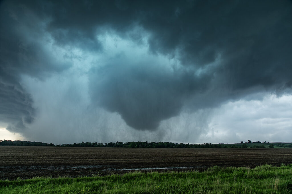
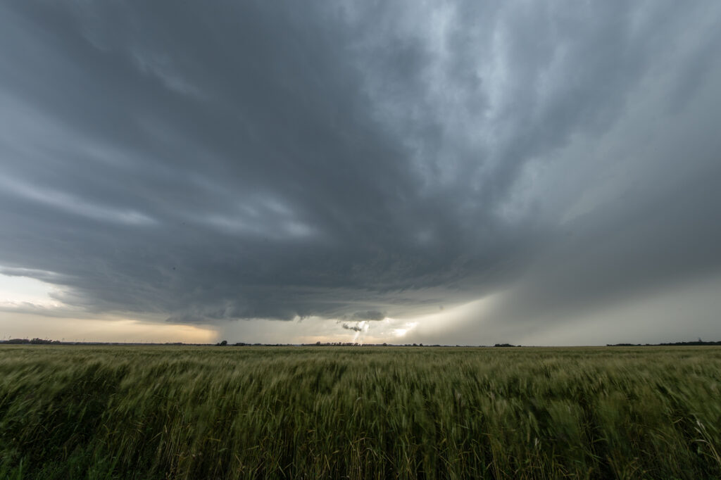
May 21st Southwest Iowa Tornado Outbreak
May 21st was a high potential set up in Iowa. A strong dry line, with fantastic shear, high CAPE and deep moisture would create a very dangerous environment in Iowa. By early afternoon storms exploded along the dry line and intensified as they moved east. Initial storms were not tornadic, but as the afternoon progressed, low level shear increased and tornadoes occurred with many storms! Our first tornado intercept was near Red Oak, Iowa as a supercell started spinning hard. The tornado went from a slender elephant trunk to a stovepipe and persisted for several minutes. The second tornado formed southwest of Carbon. It started as a big bowl, then vortices spun up and wrapping rain curtains were rotating violently around it. With motions of 60 mph we had to get out of its way as it approached us within a mile. The next tornado is now probably the most well-known. A strong multivortex tornado formed to our south near Corning and intensified as it moved northeast. It eventually turned into a raging F3 tornado that caused significant loss of property and life in the town of Greenfield. Our heartfelt sympathies go out to those who suffered losses there. Always the downside of significant tornadoes. Another tornado occurred to our southeast as a cell raced north towards Creston but we lost it due to storm motion and another core with huge hail causing us to have to slow down. Crazy, wild day that most will never forget.
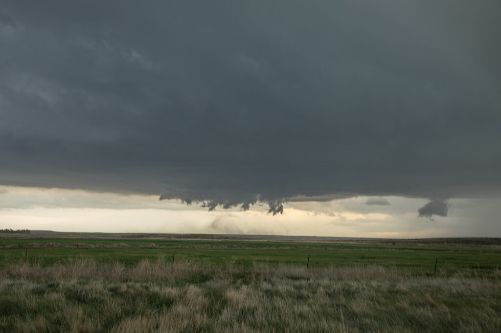
May 20th Akron, Colorado Tornado Warned Supercell
May 20th took us to eastern Colorado for what appeared to be a decent set up on paper. High based storms formed before moisture could work its way west, however they did not last. By later in the afternoon a storm developed rapidly southwest of Akron as a cluster of cumulus deepened. The storm hit the better air and became severe. Structure improved, and soon a lowering developed with RFD dirt wrapping around it. A merry go round ensued. The developing rotation could not tighten enough to produce a tornado, but it was fun watching it try. Lightning became intense so we had to vacate our position and move east and south. Eventually the storm became quite messy and we chose to leave it since we had to be in Iowa the next day on a far better set up (see the next chase account!!!). Enjoy the pics!

May 19th Butler, Oklahoma Tornadic Supercell
May 19th had a lot going for it. Good shear, instability and moisture, as well as a dryline in the eastern Texas panhandle set the stage for intense storms to form. By mid afternoon numerous storms formed and it wasn’t long before one updraft became dominant. Structure became quite good, and quickly a very slim tornado formed and disappeared in less than a minute. This just attested to the shear that was present. As the storm moved into Oklahoma, structure became amazing! A big soda can updraft with striations and a wall cloud were visible. As the storm approached Butler, it became tornadic and produced a cone tornado, near Custer City followed by w wedge north of Hydro. We got in intense RFD and had trees coming down around us, so we had to get out and move them ourselves so we could continue the chase. As we later past ElReno, we stopped at an exit and filmed the storm coming at us, complete with rapid rising and twisting scud, which soon a debris cloud appeared. We were trying to get through OKC and head north for the night and didn’t want to chase in the city as a substantial tornado touch down south of ElReno. Chasing at night is a challenge, but around a larger city, it is dangerous. We drove north to spend the night in Salina and get ready for the next day which would be a chase day. Enjoy the pics!
May 15th Ponca City, Oklahoma Supercell
May 15th featured a boundary across far southern Kansas into northern Oklahoma. Strong convergence, decent moisture and good shear would set the stage for supercells to form along it. By mid afternoon, storms did just that. One main supercell developed and right turned into northern Oklahoma. Structure was very nice and at one point it even produced a funnel halfway to the ground. The supercell was a prolific hail producer with stones falling as large as softballs. As it moved east, it eventually out ran the instability and weakened near dark. One of the prettier supercell of this year so far, and even though it didn’t produce a tornado, the guests loved it! Enjoy the pics!

May 6th High Risk Oklahoma Chase
May 6th looked amazing on paper. All ingredients were well balanced and it appeared that a major tornado outbreak would occur. As the chase set up, models kept hinting at a rapid evolution to a line of severe storms instead of individual supercells. In the end the afternoon models are absolutely correct. The Storm Prediction Center issued a HIGH RISK for Oklahoma and the highest tornado probabilities that I’ve ever seen! As the old saying goes, sometimes too much of a good thing isn’t a good thing. Strong forcing would cause rapid line of storms to form. Most storms were tornado warned, but did not produce. We chased a half dozen tornado warned storms, but only one came close to producing near Canton, OK. We kept dropping to the tail end storm with no luck. Each cell would mature, with a fast developing storm on its flank causing the forward storm to become a cell embedded within a line. Storms need space to rotate and nature didn’t provide that this day. In the end, it was a total bust for almost all chasers, the SPC and local NWS offices. It just goes to show you that no matter what you think you know about the environment, nature knows more!
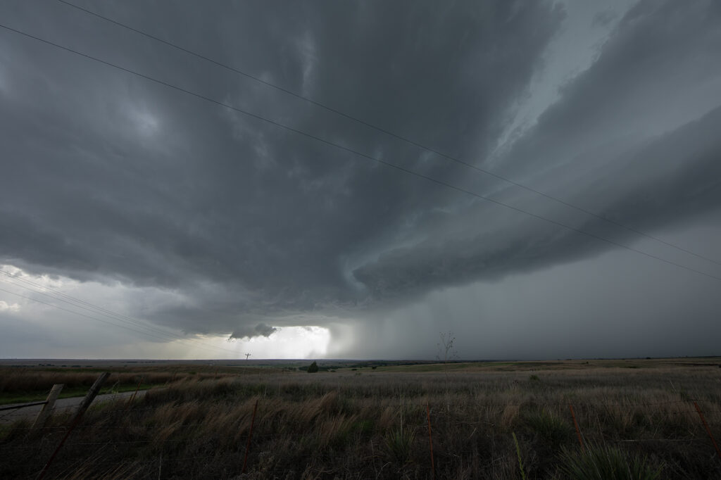

May 4th Davis Mountains Tornadic Supercell
Even though May 4th was the last day of the tour, we could not pass up the chance to chase the set up this day. Upslope flow, good moisture and instability, along with good shear provided the needed ingredients for supercells and potential tornadoes this day. We knew storms would start out high based, but their bases would lower as they moved east off the mountains into the lower lands where better moisture resided. That is exactly what happened. A cluster of storms formed, of which the tail end cell took over and became dominant. A quick spinup occurred as low level rotation cranked up under the updraft We had to vacate our position due to huge hail falling and drove east of Ft Stockton to a south bound road that would be give a view. The only issue is there just aren’t many roads in this part of Texas. As we drove south, rotation increased as the supercell dropped a rather large cone. It became rain wrapped after a few minutes so we continued southward to where the road put us directly in front of the supercell. Soon cgs started raining down from the updraft and rotation became focused. Several tornadoes formed and rotated around the wall cloud. It was quite the sight!!! After becoming strongly HP, we blew it off since we had a 600 mile drive back to Oklahoma City that night. 3 am arrival, but everyone was stoked due to the excellent day we had! Enjoy the pics!
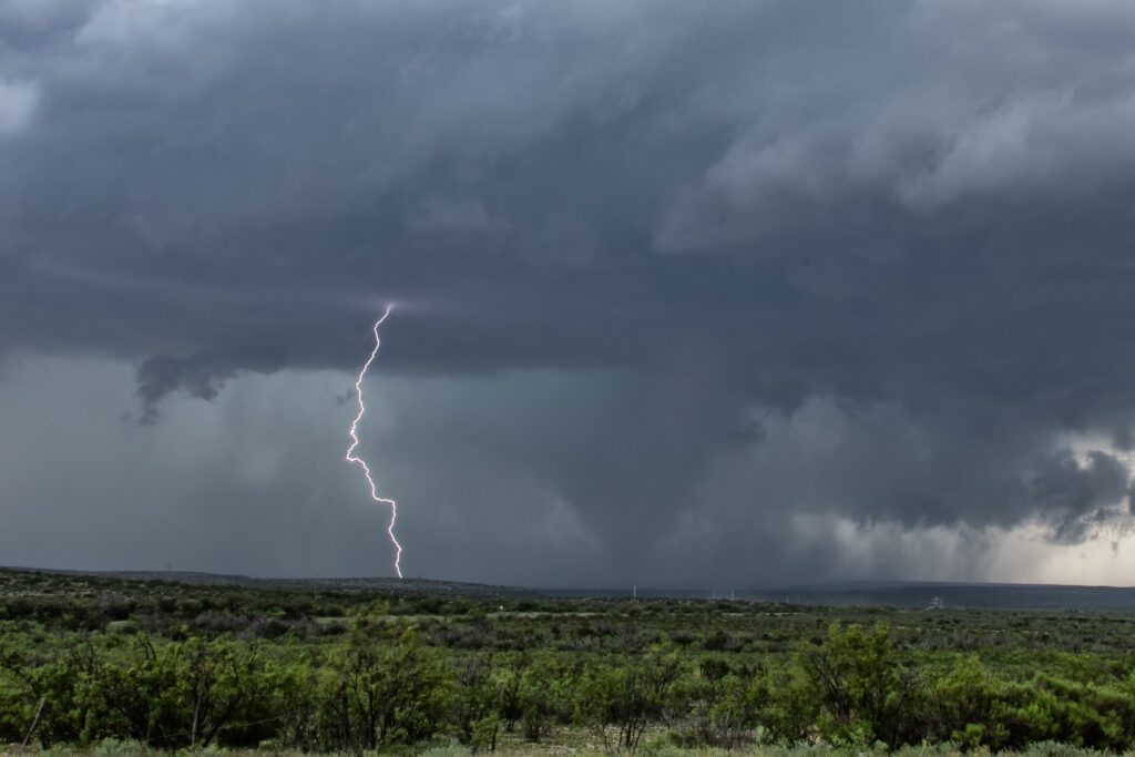
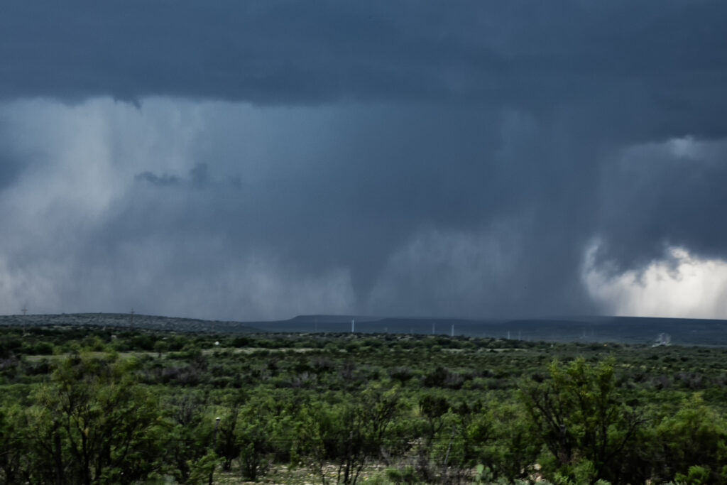
May 3rd Southwest Texas Tornadic Supercells
May 3rd kept us in southwest Texas near San Angelo and vicinity. Strong instability, good moisture, high CAPE ad decent shear would set the stage for several supercells. A tornado occurred near Silver, Texas early on as we tried to get over to the supercell. Due to one lane roads and closed roads, we could not make it in time, so we dropped south towards San Angelo and played another supercell that had formed and anchored on a boundary east of Town. It had a very pronounced clears slot with rapid rotation in the mesocyclone, and dropped a quick brief dusty tornado. As we pushed east near Eola and watched couple brief landspout tornadoes. RFD was wrapping hard to our north and we decided to explore it. A big bowl formed with tons of blowing dirt, and eventually a brief tornado occurred. Soon numerous storms exploded and things became messy and outflow dominant. At this time, we decided to get away from the mess and call it a day. Fun day, a bit frustrating due to closed roads, etc, but another day with supercells and tornadoes is always a good day! Enjoy the pics!

