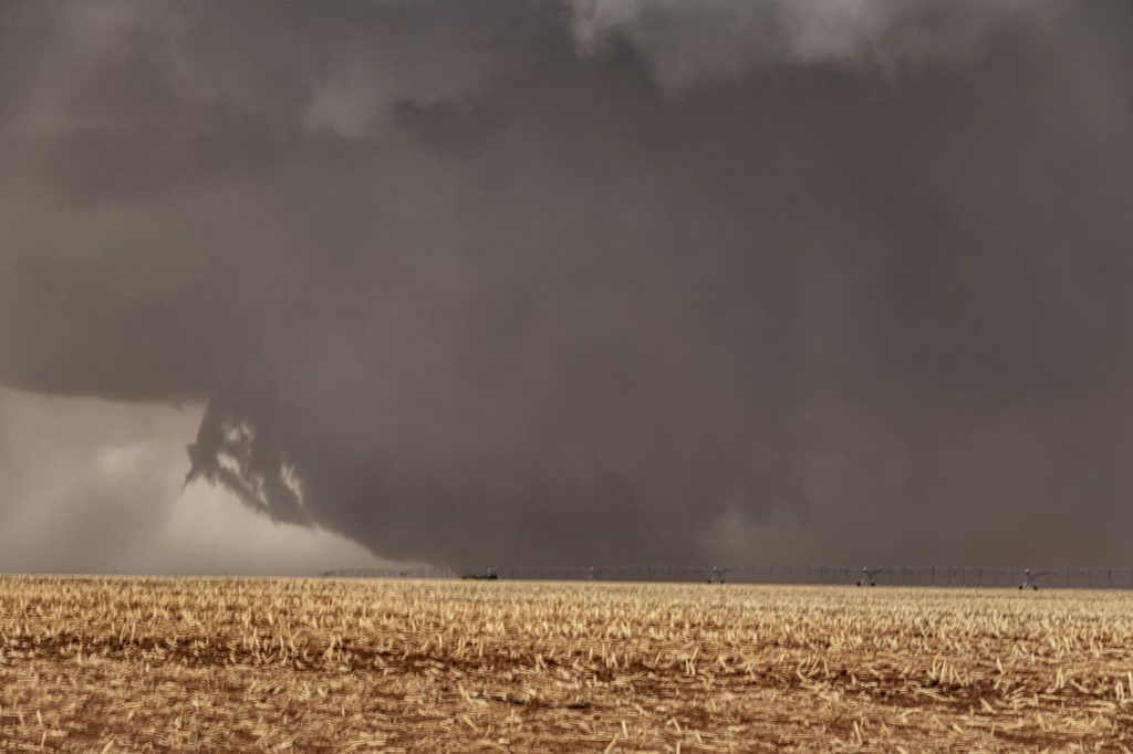
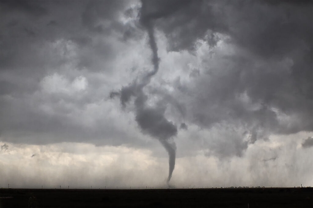
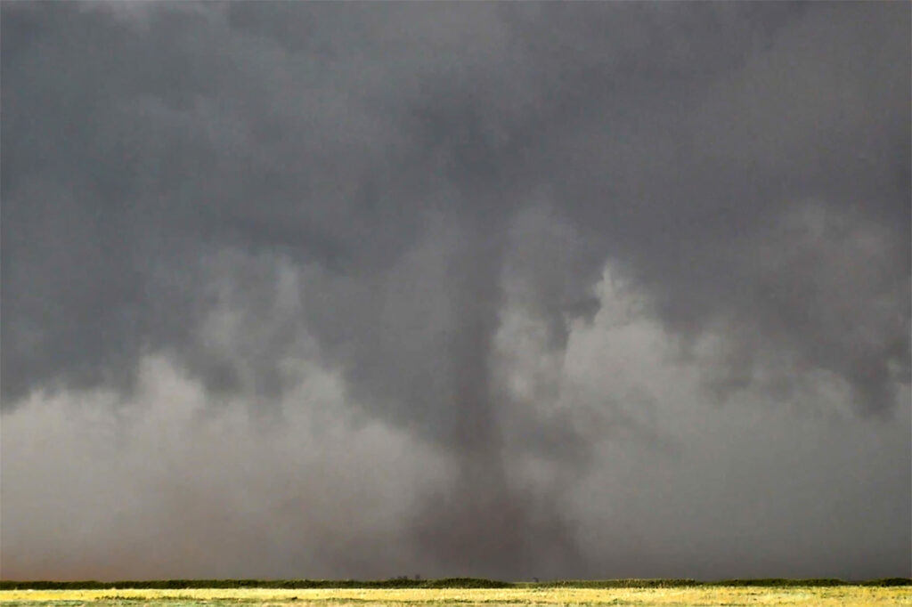
June 5th. What more can be said??? One of the most incredible days in the 2025 storm chasing season! We started off the day in Lubbock, Texas. The target was to find the triple point, which appeared based on satellite and surface obs to be near Dora, New Mexico. We positioned ourselves near Causey, NM where 2 large updrafts were forming. We decided to play the southern most developing storm. The storm sat anchored for a couple of hours before it finally started its trek southeast along an outflow boundary from previous days storms. Just before it reached the Texas border it spun hard and became tornado warned. The merry go round ensued and quickly dropped a tapered cone tornado that was on the ground for a couple of minutes. It lifted as the storm moved east, but the low level mesocyclone stayed in tack. Soon several different tornadoes formed, and eventually stout stovepipe tornado descended. After this another elephant trunk shaped tornado formed as well. You could see the occlusion happened with the old meso dying and a new one forming east of us. We blasted east to get on the other side of it and quickly an extremely large, very dusty tornado formed. It grew to a mile wide and just missed the town of Morton, Texas. We got ahead of the tornado as it became completely obscured with dust and rain. Several miles east of town it disippated, and yet another tornado formed just to our north. Within a few minutes very strong RFD winds and atomized rain smacked into us, so we blasted east to try to get ahead of it. As we did, another ghostly white tornado came out of the rain just to our north. Realizing the mesocyclone was hopelessly buried in dirt and rain, we blasted east towards Lubbock. Another very large tornado occurred right to our north that we could not see, so we decided it was time to call off the chase. Later that evening, after we ended the chase, one last tornado formed near Reece Center. Since we were already done and settled into our hotel, we did not go back out because it would have been too late to make it there. An absolutely CRAZY day and I am so thankful there were no fatalities with this supercell. Enjoy the photos and this Youtube video of the Morton tornado. Another video will be made soon showing the rest of the tornadoes!
May 28th Morton, Texas Supercell with HUGE hail
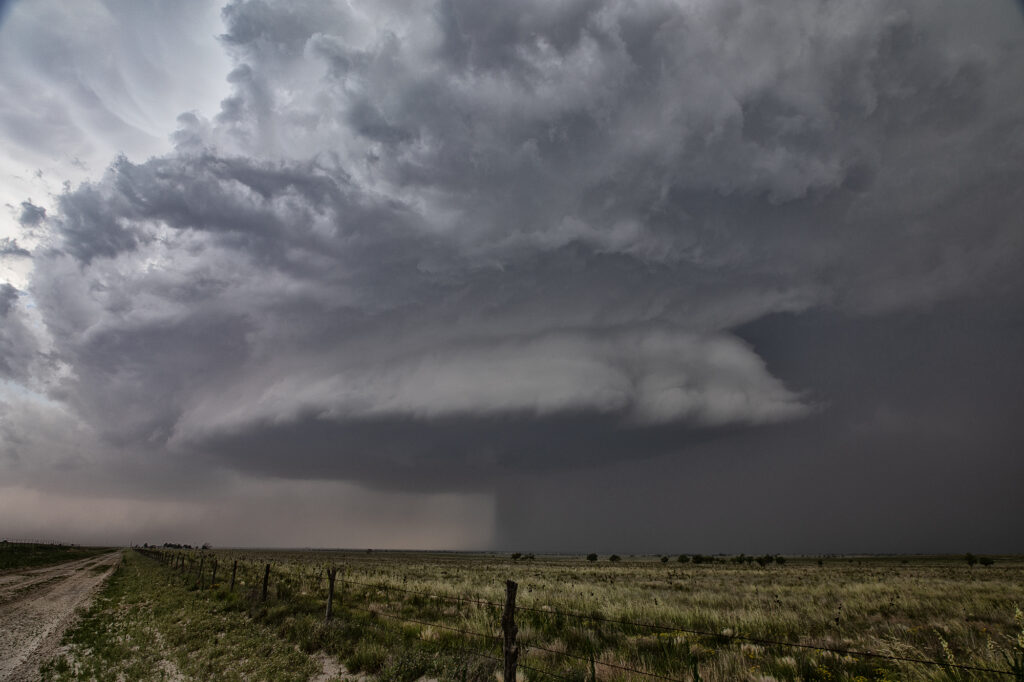
May 28th set up had a dryline in west Texas, with strong southeast winds bringing modest moisture westward. Moderate CAPE developed as well and storms formed mid afternoon along the dryline. Storms pulsed quite a bit, and due to straight hodographs, storms split and many mergers occurred. Eventually a supercell developed, anchored near Morton. Structure became better, but due to modest moisture, the cloud base was too high to produce tornadoes. As it moved east it encountered a boundary and spun nicely. After several cycles, it produced 5 inch diameter hail west of Lubbock! We blew it off as it weakened and played further south with a supercell that had softball sized hail. The tornado threat this day was quite low due to high bases, but with strong shear in place and low freezing levels, storms were prolific hail producers.

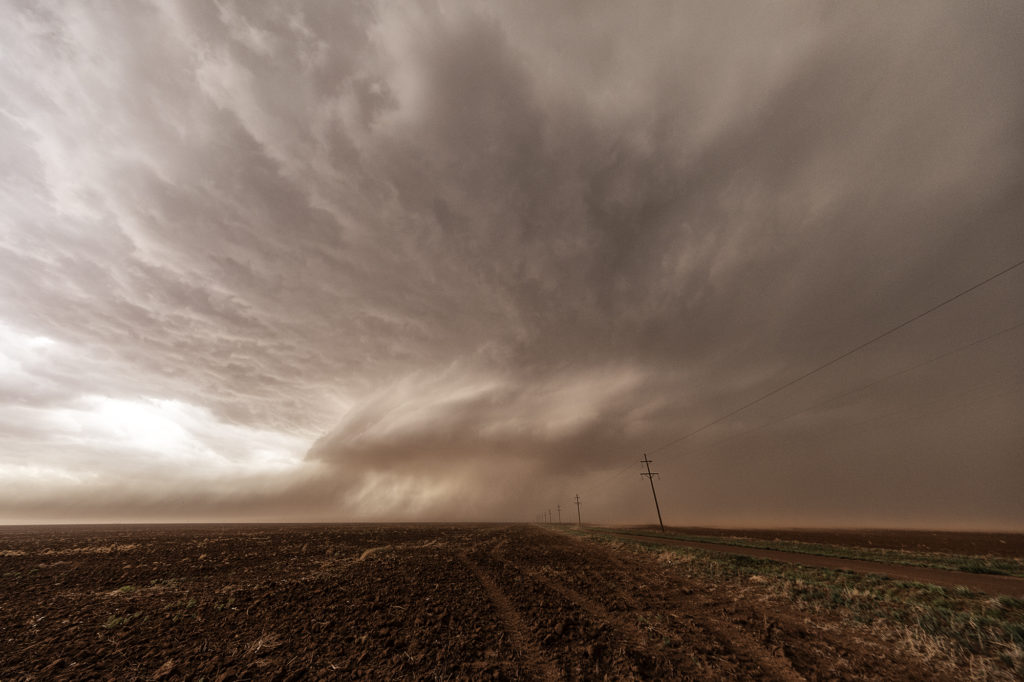
May 23rd Morton, Texas Wedge Tornadoes
What a day! We certainly weren’t expecting what happened this day to occur. Limited moisture, but good shear and a dryline would set the stage for severe thunderstorm development. There is a term chasers use in the Texas panhandle called “panhandle magic” and it certainly was the mode this day! Storms developed in eastern New Mexico and clustered as they moved into west central Texas. It was a very messy storm mode. Eventually the tail end cell in the cluster anchored and started spinning. It became a very intense supercell, even with low dewpoints in the 50s! Soon the cell developed a wall cloud, then a multivortex tornado, and finally a 400 foot wide EF2 wedge tornado! It was nearly stationary! A second wedge occurred about 30 minutes later east of Morton and finally a 2 minute elephant trunk west of Levelland. Inflow was so strong ti was knocking down power lines and toppling trees! The storm was sucking so much dirt due to the drought in west Texas at times the updraft was barely visible. Structure was nice when you could see it and the storm as it approached Lubbock eventually died. It put on a nice lightning show at dusk as well. An incredible day and evening! Certainly by far more than we expected. Even the Storm Prediction Center didn’t have much of a tornado threat in its’ outlooks! Enjyo the pics!