Our Photo Tour #3 had one of the worst weather patterns of 2021! This period usually produces great severe weather, supercells, lightning and tornadoes. Not the case for 2021. Since the pattern was dominated by a massive record breaking ridge of high pressure resulting in sunny hot days, we decided to take the group to Arizona to photograph monsoon storms. Much better than doing the park scene! We DO go the extra mile to at least find a storm, any storm, that is worthy to photograph! We spent most of the tour around the Tucson area as an active monsoon had set in. This is the first time we have ever taken a storm chasing tour to Arizona to chase in June! Some of the lightning we captured was super, and there was also a marginal supercell near Stafford. Upon our return to the Denver area on the last day of the tour, we did intercept a supercell just east of town. Enjoy the pics! We hope the weather pattern will be back to normal for 2022 Photo Tour #3!
June 22nd Central Nebraska Supercells!
June 22nd didn’t have a ton going for it. It was one of those surprise days when the atmosphere over performed. We started the day in York, Nebraska and just drifted north to Norfolk. Shear was pretty decent, but low level moisture had been scoured out by the Pella, IA event two days earlier. However enough moisture was present, as well as instability, to fuel a few supercell thunderstorms along a boundary over northern Nebraska. The first supercell we witnessed was a high based, hail and wind producer. Structure was decent. The second more intense storm occurred north of York (funny how this storm drove us right back to our hotel again that night in York!) and produced baseball sized hail and 70 mph plus winds. Structure on this storm steadily improved as it encountered greater moisture the farther south it traveled. Just before sunset it was an absolute beauty just southeast of town! We had the fun of driving through the front edge of the core and encountered tennisball sized hail as we headed back to our hotel for the night. Enjoy the pics! It was a beauty!
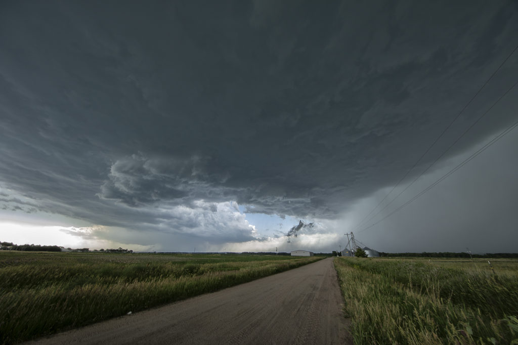
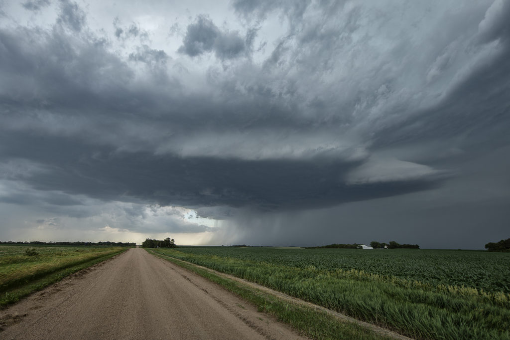
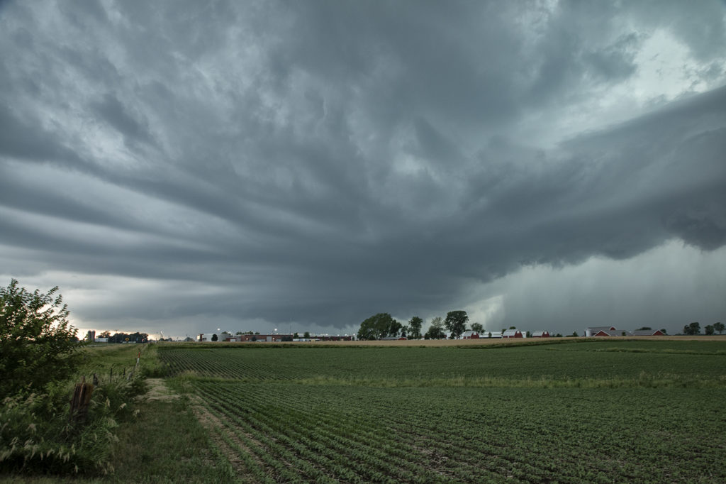
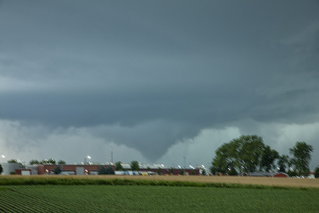
June 20th Pella, Iowa Tornado
June 20th featured extreme instability, moderate wind shear and good lift along an advancing boundary over Iowa. We started the day from Denver, CO as it was the first day of the tour. After an early departure, we made it just east/southeast of Des Moines, Iowa (650 miles later!) just in time for storms to explode. The first supercell we intercepted was just east of Des Moines and never had the “look” like it wanted to become tornadic. Nice structure and a rotating wall cloud occurred, but it could never tighten up enough to produce a tornado. We dropped south and headed back west a little bit as a second storm quickly became organized. It developed a strong hook echo on radar to the west of Pella. As we arrived in town near the factory, we stopped to watch. Intense lightning was also occurring, a tell tale sign of storm intensification. Within a few minutes, a large bowl shaped funnel formed. Soon it developed into a full fledged cone shaped tornado that was on the ground for several minutes. In my haste to shoot video, time lapse and digital images, I failed to get a proper focus on my camera and thus most images were slightly blurry. The tornado dissipated and the storm eventually weakened as it moved east, ending our chase. A great first day for Tour 8!! Enjoy the pics, blurriness and all !!!!!
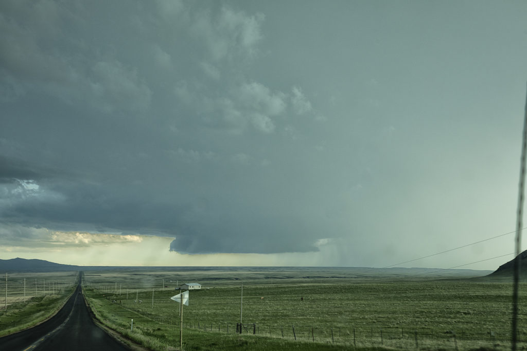
June 19th Eastern Colorado Tornadoes
Arrival day for Tour 8 brought us out to chase! The Denver Convergence Vorticity Zone (DCVZ) was active, with steep lapse rates, moderate CAPE and the wind shift to set the stage for severe thunderstorms and nonsupercell tornadoes. Two such tornadoes occurred with early convection that formed along the boundary. Cells developed and back built on the boundary tapping into the vorticity that was present. One tornado was on the ground for about 10 minutes northwest of Last Chance and the second tornado for only a couple minutes to the south of Last Chance. A fun way for tour guests to spend arrival day! We’ll chase every day we can, even if it isn’t a scheduled day. Enjoy the pics!
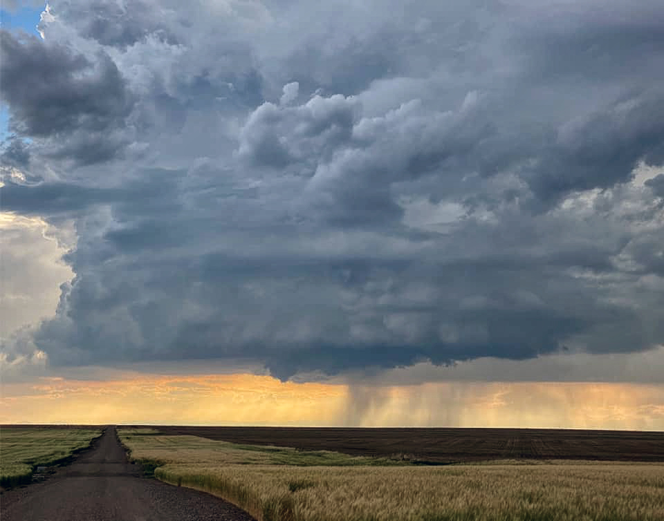
June 13th Western Nebraska Severe Storms
June 13th was the last chase day for the next week as a massive ridge of high pressure dominated the western 2/3 of the US. Fortunately we were able to catch a few severe storms/marginal supercells in western Nebraska north of Alliance. Good CAPE, but marginal shear would let these storms become a cluster of outflow dominant storms late in the day. However they were quite electrified, before gusting out near Hemingford, Nebraska. Fun day, with 80mph winds, golfball sized hail and some pretty scenery to watch these storm do their thing! Enjoy the pics!

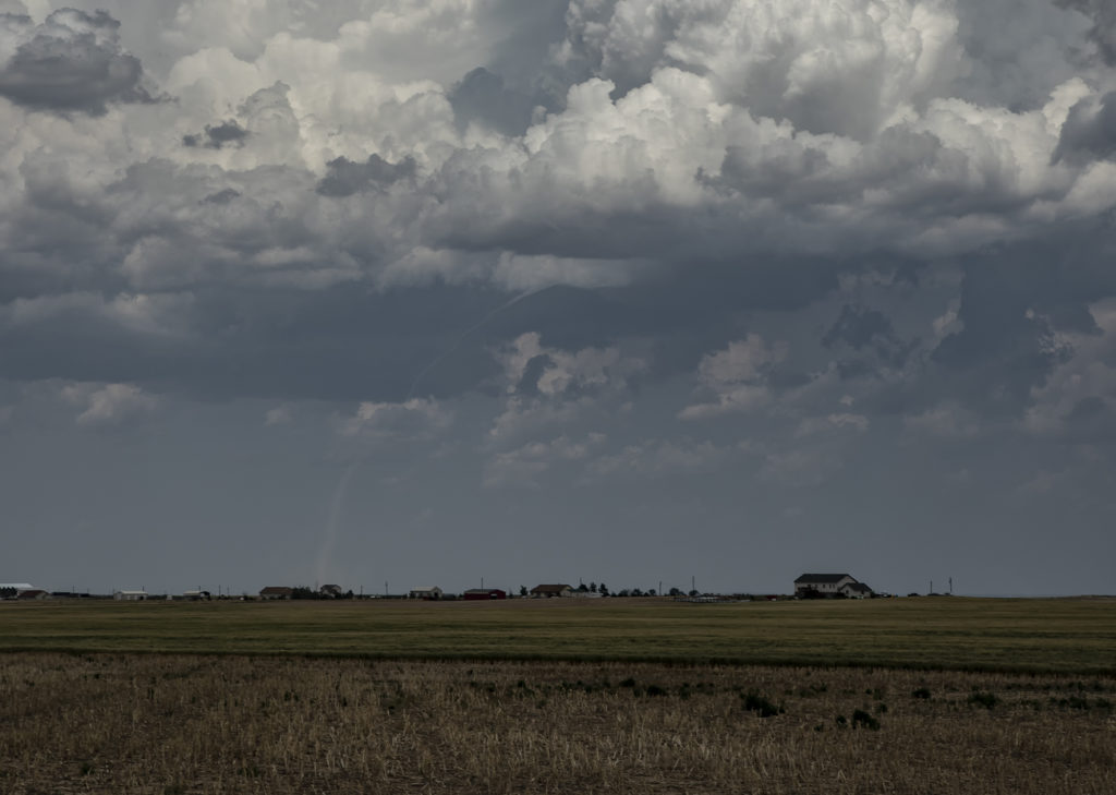
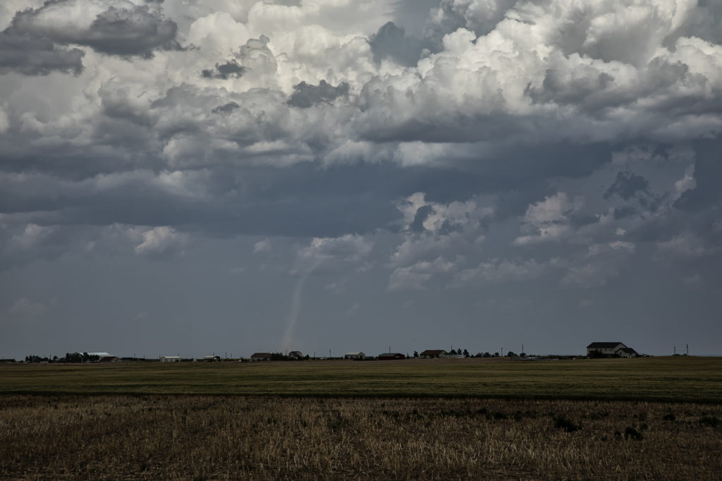
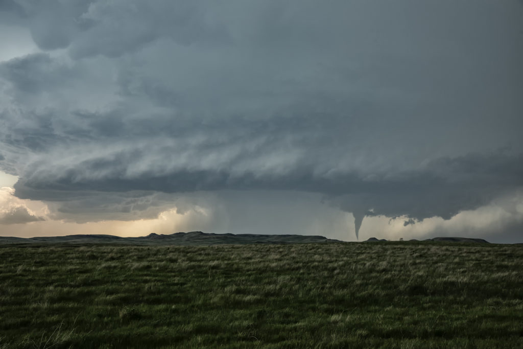
June 10th Alexander, North Dakota Tornadoes
June 10th was a great set up in northeast Montana and western North Dakota. A warm front lay from Glasgow, MT southeast towards Dickenson, ND. Strong instability, good moisture and fantastic shear set the stage this day for multiple supercells and tornadoes along the warm front/dry line intersection north of Wibaux, MT. Cells initially formed all along the boundary, but the northern cells moved into cooler air and weakened. The triple was a storm producing machine firing off one supercell after another as they each matured and some became tornadic. The first tornado was my favorite, coming over the hills near the Roosevelt National Park area and was quite visible. The second tornado was a bit further away and choked with rain and very large hail, making photos hard to see. Nonetheless, it was a spectacular day and great results for Tour 7! Enjoy the photos!
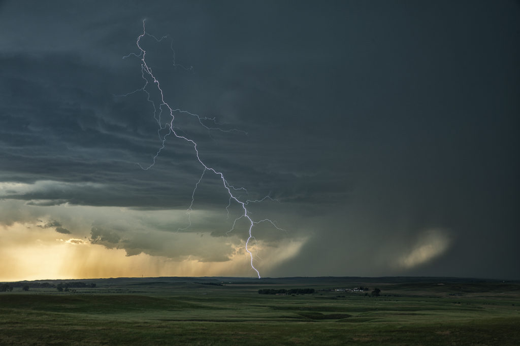
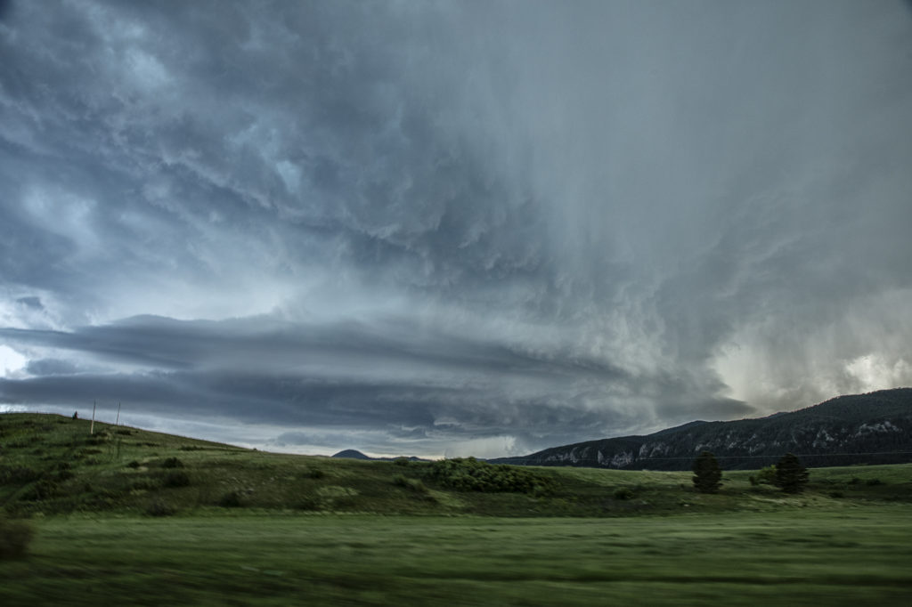
June 9th Lodgepole, Montana Jaw Dropping Supercell!!!
Wow, all I can say is WOW! What an amazing supercell this day produced! Great shear, good moisture and instability, and lift along a boundary and mountains would provide all that was needed to get the best structured supercell of 2021 to form. After hanging out in Havre, MT waiting for a storm to get going, we finally got our wish. Due to the late setting sun in Montana in June, we had several hours to watch this storm ramp up and become a jaw dropper! The one unfortunate thing that occurred were the poor road networks in Montana. We were able to stay with this mothership supercell for a few hours east of Lodgepole and enjoy the treat! Incredible structure and the beautiful countryside in Montana made this day one of my favorite for 2021! Please take time and enjoy the photos of this stunning storm!
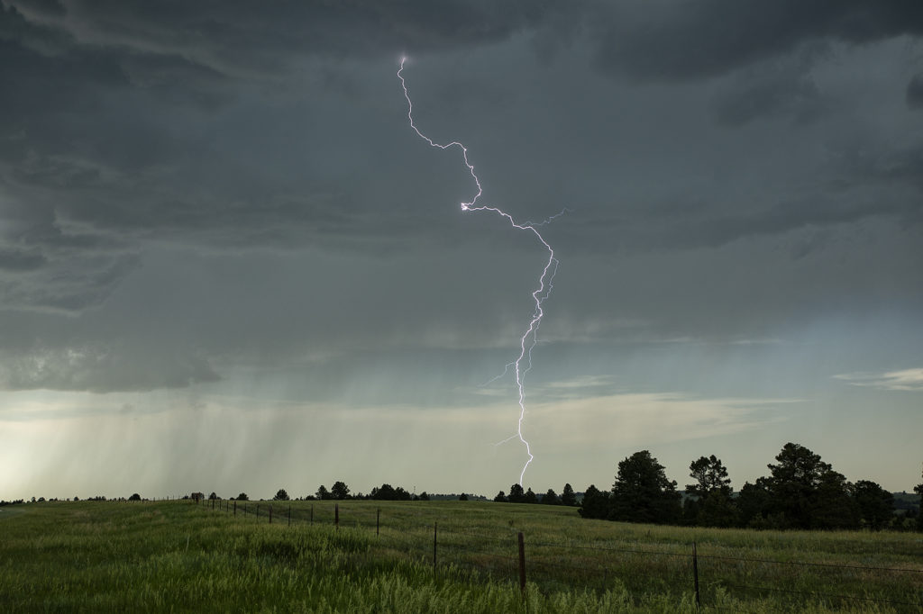
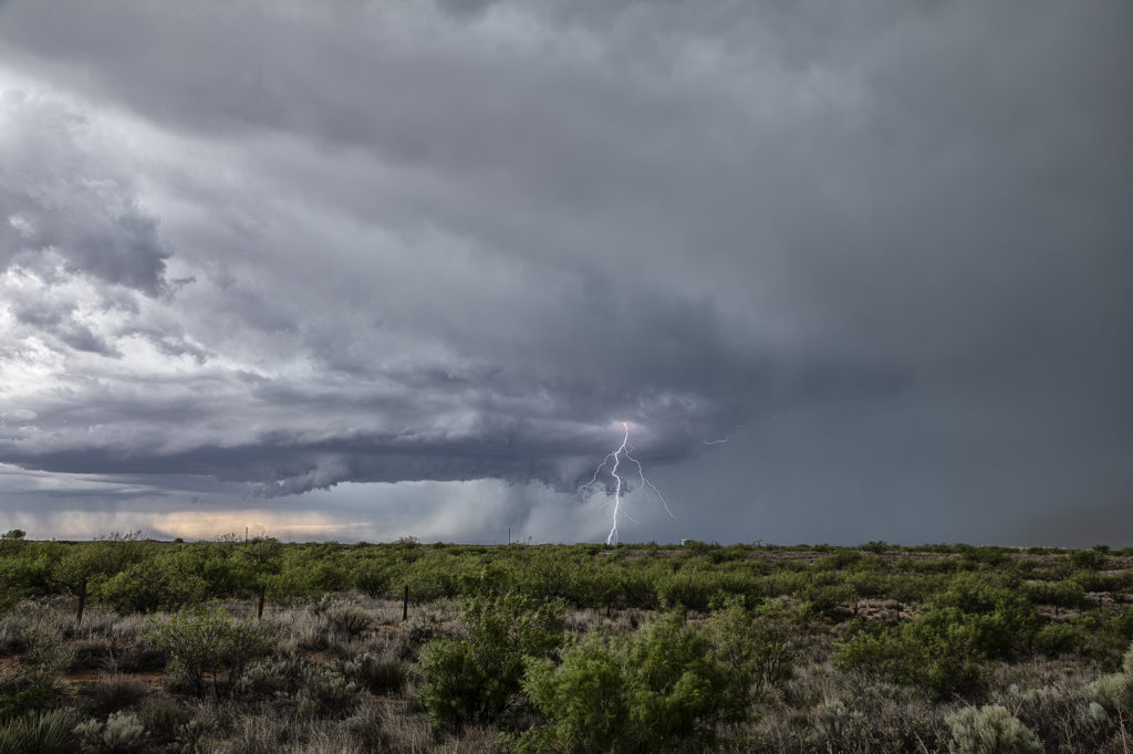
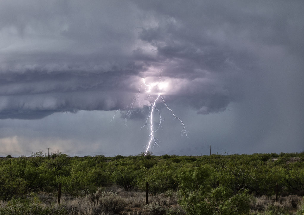
June 2nd Jal, New Mexico Supercell
We weren’t expecting a great show this date as the ingredients just weren’t there. Marginal moisture and weak wind shear would limit the longevity and structure to storms this day, but we did manage to capture a couple of pretty supercells. We started the day in Lubbock, Texas so it wasn’t far to get into position. An old outflow boundary would provide to focus for storms. Due to the steep lapse rates and rapid cooling of the hot boundary layer as air rose aloft, storms became hailers and also were nicely electrified! The cells shown below produced hail the size of golfballs and 80 mph outflow winds, which generated a lot of blowing dirt across west Texas. It was getting late in the season to chase this far south, but you go where you need to. Many days of excessive heat dried up the landscapes which fueled the fire so to speak with intense blowing dirt. Fun day regardless! Enjoy the pics below!
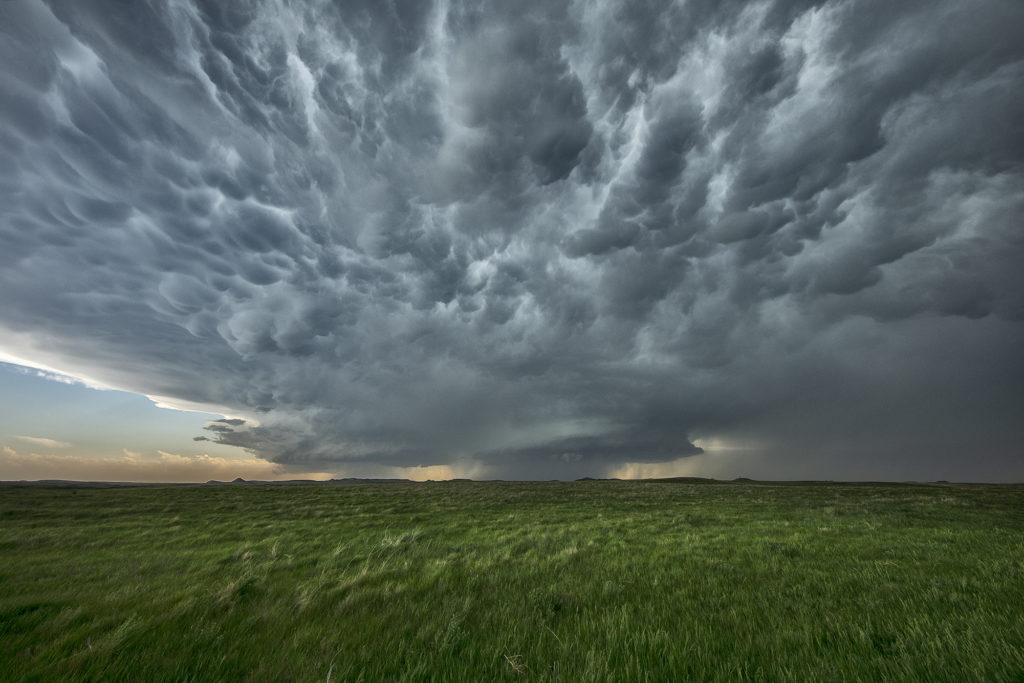
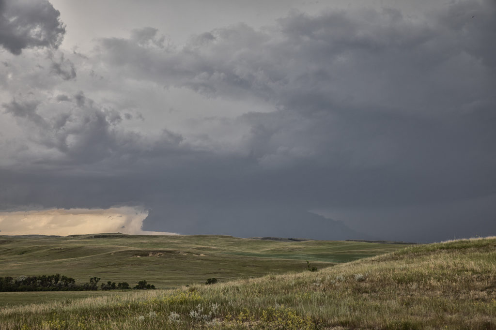
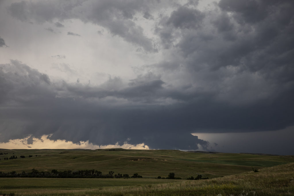
June 29th Theodore Roosevelt NP Tornadic Supercell
June 29th took Photo Tour #3 westward to Theodore Roosevelt National Park area where a triple point would set up and cause supercells to form. Strong shear, high CAPE values, good moisture and lift at the triple point helped to generate one intense supercell northeast of Wibaux, Montana that moved into western North Dakota. We positioned ourselves down wind to allow the storm to mature as it approached. A large wall cloud formed that started rotating with wrapping rain/hail engulfing it. A brief tornado occurred that we could see in the distance. Unfortunately there weren’t many roads to allow us to get closer or even stay with it. Numerous other storms formed and became quite a messy MCS. We stayed with them all the way to New Town, ND where another tornado warning was issued. A messy murky system approached as we decided to retreat and get out of it’s way. We headed on northwest to Williston for the night. Yours truly lost his cell phone as huge hail started falling and ended up driving back to the park in the middle of the night to find it. Success, it was found! (Destroyed and cracked, but it was found!!!) Please click on a pic for a larger image. Enjoy!
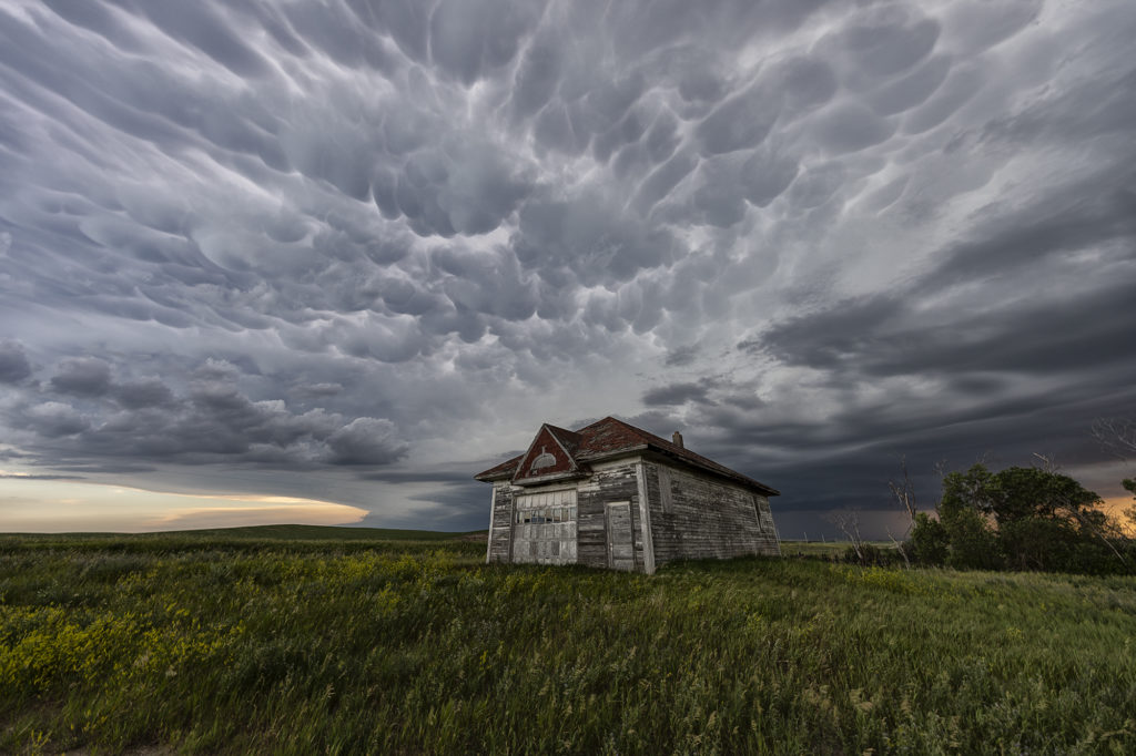
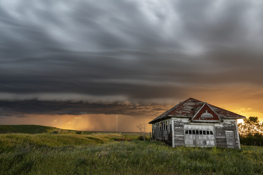
June 28th Central North Dakota Stunning Thunderstorm
June 28th took Photo Tour 3 to North Dakota. Good moisture and instability, coupled with weaker shear would allow a squall line of severe thunderstorms to form northeast of Bismark, ND. We managed to find an old abandoned farmstead south of Wing, ND where we were able to set up and capture some amazing images! The storms, coupled with the lowering sun in the evening, along with the old farmstead, allowed us to capture some of my favorite images from 2020! We stayed in place for a couple of hours photographing the area, and eventually headed back to I-94 and west to Bismark. A landspout tornado occurred well to our south near the South Dakota border, but everyone didn’t mind based on the images each person captured. Spectacular day with nature painting the Photo Tour one of the best set ups one could want! Please click on an image for a larger photo. Enjoy!