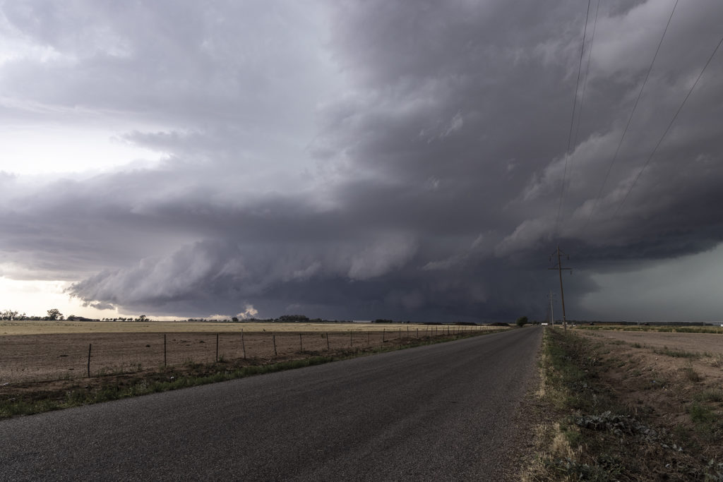
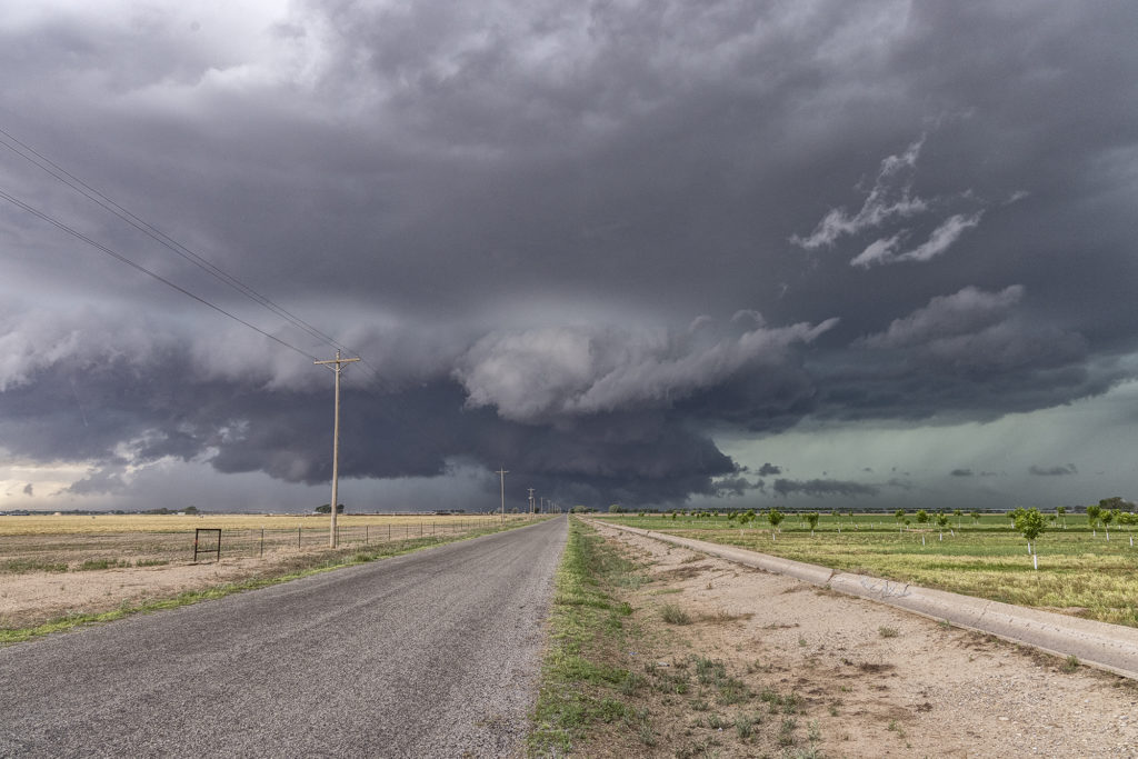
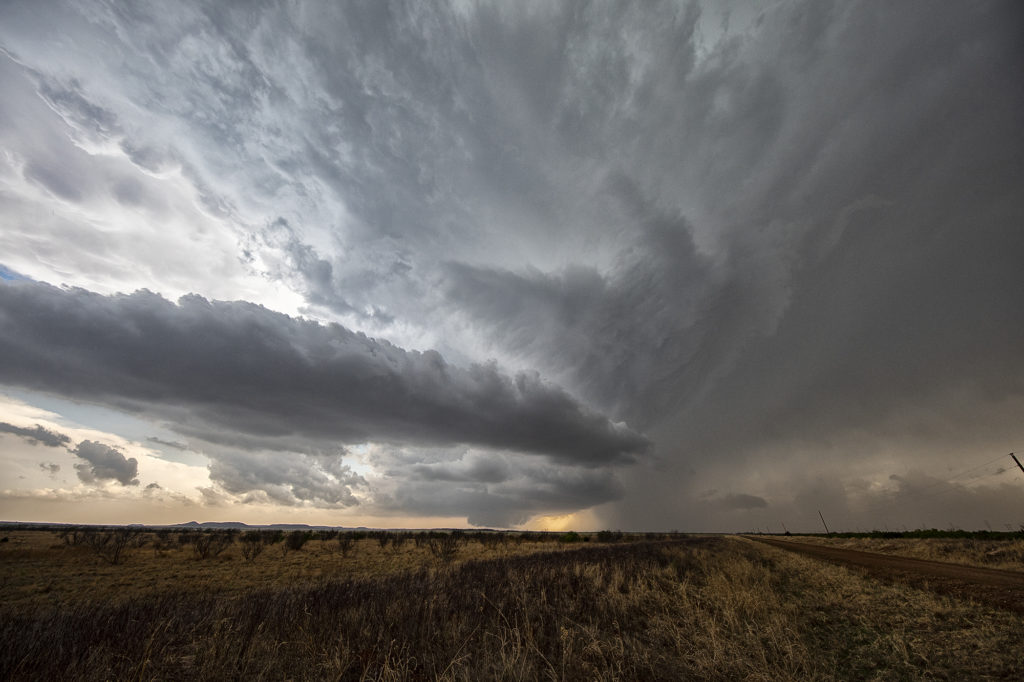
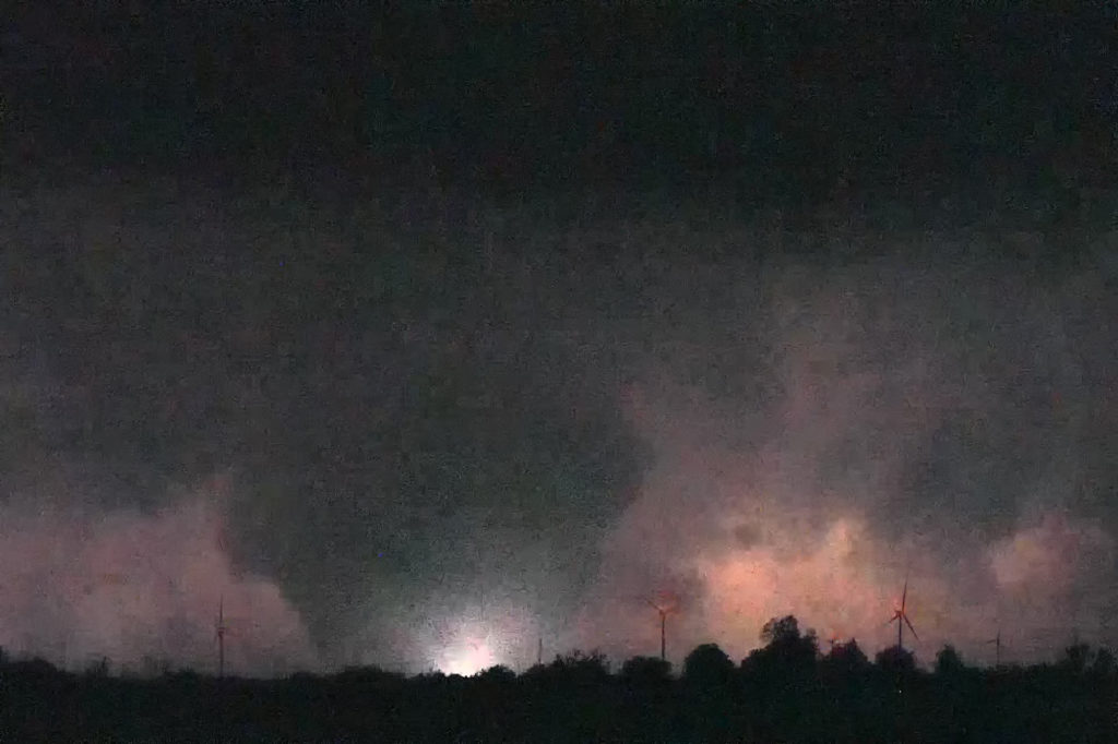
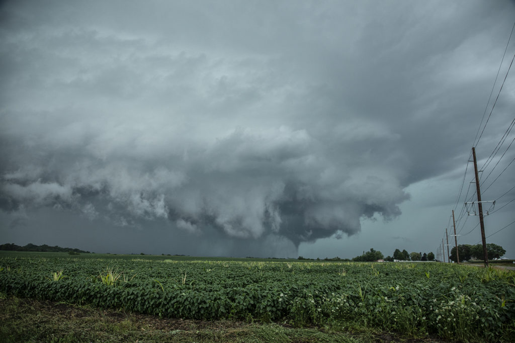
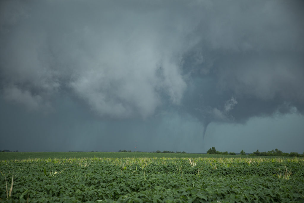
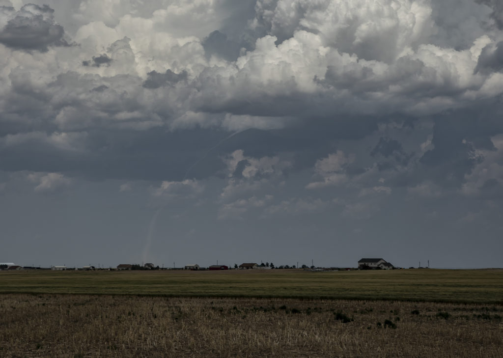
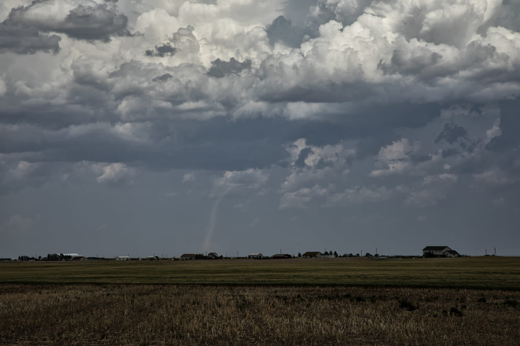
One of the most exciting days of 2022 so far occurred on May 4th. A dryline/triple point was located west of Paducah, Texas as moisture streamed northward. Great shear was also present. By mid afternoon a supercell formed and quickly became severe. It would be the storm of the day and produce several tornadoes. We tried to stay in front of it, but an error in the road map wreaked havoc for us. Maps showed a paved road that would have taken us right in front of the supercell towards Crowell and eventually Lockett, however it became dirt and was blocked off by a rancher with no trespassing signs, which of course we obeyed. This made us have to back track 20 miles on muddy and wet roads through huge hail and then blast east towards Crowell where we would have gone south to get right in front of the tornadic supercell. Due to losing 40 minutes on the map error, we could not go south as the storm was already crossing the road. Instead we went east then south but by that time the 5 minute tornado was gone. We continued east and then back north at Seymour to get in front of the supercell. It was now becoming dark as lightning constantly lit up the updraft. South of Vernon we stopped to watch the storm as a truncated cone tornado formed and crossed the road in the night directly in front of us. Then numerous power flashes were observed just northwest of us and lightning lit up a wedge tornado that hit the town of Lockett. We watched as this monster EF3 tornado roared across in the darkness, only lit by lightning and power flashes. It eventually dissipated as the storm weakened. Crazy day, and one stroke of bad luck due to a error in mapping software kept us from a pretty tornado. However, we still witnessed 4 others! Enjoy the pics!
May 2nd Central Oklahoma Tornadic Supercells
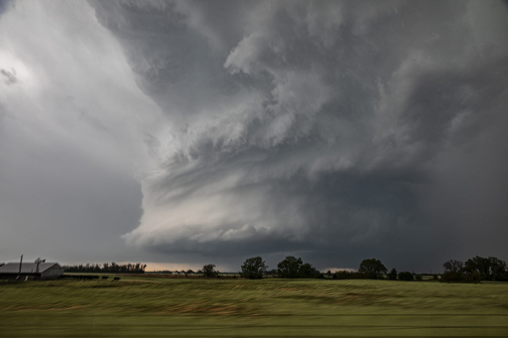
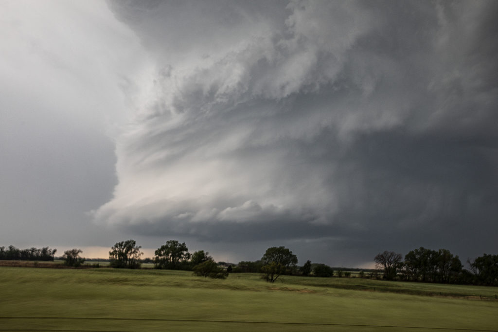
May 2nd offered a significant severe weather threat. An advancing cold front would be the focal point for severe storms, including supercells. Good moisture and instability would be present to fuel these storms. The question was what mode would storm take? As the front moved southeast, storms became linear. However a couple of storms formed along the dryline and would be the best storms to chase. A significant supercell formed near Dover, OK and produced a weak tornado. The structure on this storm was just gorgeous. Big spiraling soda can shape that spun like crazy. As the cold front overtook it, we blasted east and south towards Pauls Valley and caught another supercell that cycled several times before eventually producing a tornado near Seminole. The structure was spectacular with a mothership base to it and a very cumuliform updraft. Above it was a spectacular mammatus field that went on for many miles. A great chase day, very photogenic storms, and one of the best mammatus of the year!
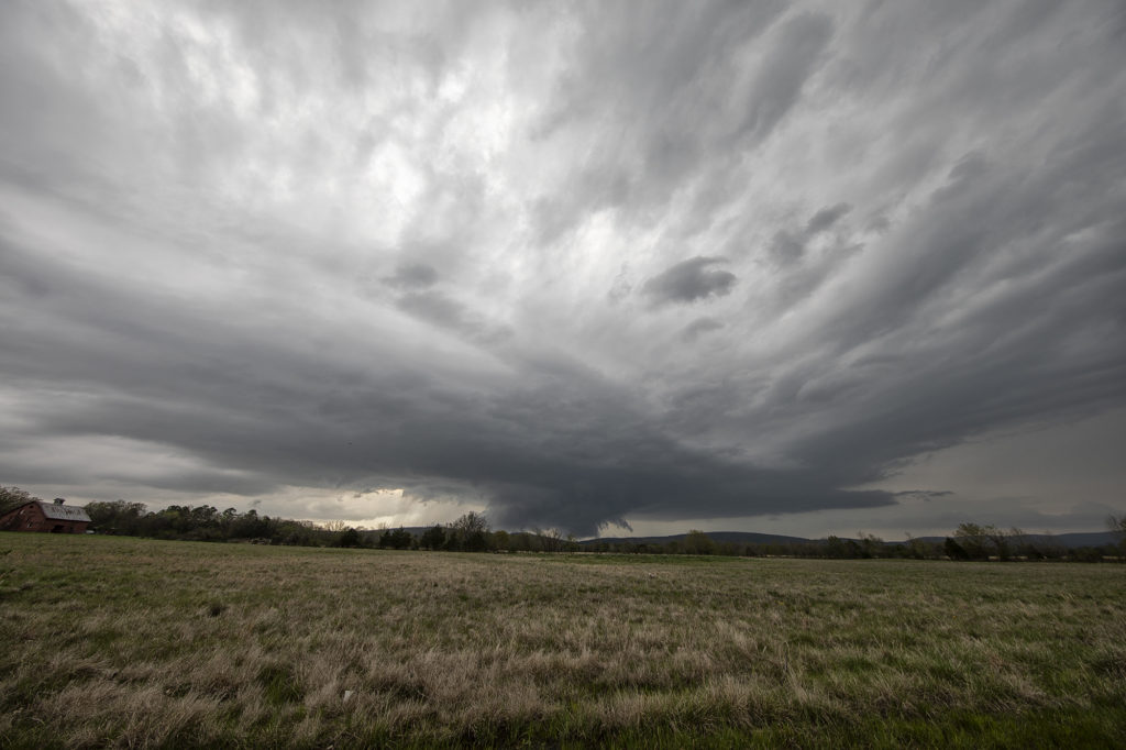
April 12th, 2022 Gilmore City, Iowa Strong Tornado
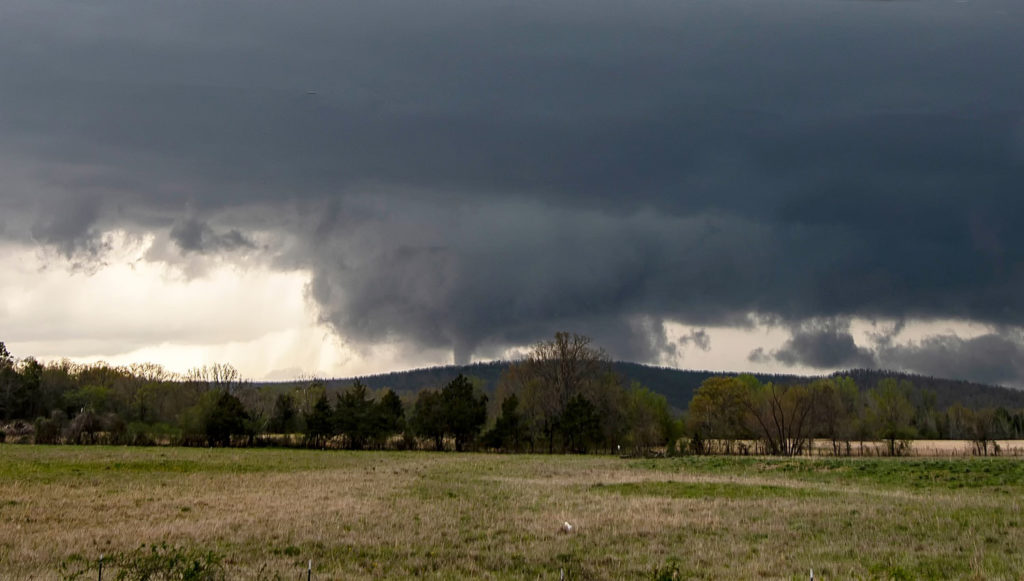
April 12th had a lot going for it. The problem was there were two clear targets. Play the better moisture, but less shear in central Texas, or play the warm front with a bit less moisture but better shear in Iowa. We started the morning in Oklahoma City and made the decision at 6am to head to Iowa, while looking over our shoulder at Texas. At the end of the day, both targets produced strong tornadoes! As we headed north it became pretty clear that the warm front was going to be our target with a strong theta-e axis slamming into it, instead of playing the triple point back northwest of Omaha. That decision was a good one as by mid afternoon, the warm front lit up with intense storms, some of which were supercells.
We had over a 500 mile trip to get into position and we made it by minutes! We stopped in Dakota City for fuel quickly and then headed west, to just east of Gilmore City. The supercell became tornado warned as we left Dakota City. So, with storm motion showing 50 mph plus, we positioned ourselves about 6-10 miles down wind of the storm, figuring it would take a few minutes for it to become tornadic. It sure didn’t wait long! I wish we would have gone a couple more miles south to get closer, but as the tornado formed, we decided to stay put so as not to miss any of it and thought it would come very close to us. The models showed the potential of long tracked tornadoes, however this one dissipated as it came about a mile to our west. We stayed with the supercell for awhile as it became very messy and hp in nature. Eventually we blew it off, as we knew we had to be in Arkansas the next day, and stopped to watch an electrified storm on the way to our hotel.
Great day, beautiful storms and fortunately there were no injuries or fatalities from the tornadoes! Enjoy the pics!
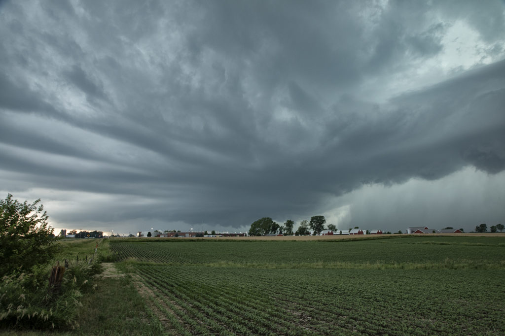
April 11th, 2022 Talihina, Oklahoma Tornado
We couldn’t resist running an on call tour during the week of April 11th. We gathered the guests early in the morning and departed Denver, headed for southeastern Oklahoma. Tough countryside to chase in with the Ouachita and Kiamichi mountains providing plenty of obstacles. However the set up would too good on paper to resist making the 850 miles trek there! High dewpoints, high CAPE, strong shear and a lingering boundary would provide all the ingredients needed for supercells. As we blasted there, about 120 miles out a supercell formed, earlier than models showed, and moved slowly eastward through Ft Smith, Arkansas. Knowing there was no way to catch it, we set our sights on another storm southwest of there. As we approached , it became better organized and soon became severe. We dropped south at Sallisaw, OK toward Poteau and it was evident we needed to get even further southwest to cut in front of this now tornado warned supercell. Coming over the mountains near Talimena State Park, we got a glimpse of a huge block shaped wall cloud. As we approached Talihina, we stopped to watch it wrap up. Within a few minutes it dropped a tapered cone tornado.
Not wanting to let is go through the mountains, we followed it eastward as radar continued to show a massive hook echo, often indicative of a potential tornado. We ended up the Talimena Scenic Drive, which is a stunning high road with views of the mountains at many places. We were on top at 2000 ft with a view of a massive wall cloud to our north and several cg lightning strikes. We stayed with the storm for another hour as sunset came and darkness ensued. We let the storm go as it was steadily weakening and heading into Arkansas. A fantastic chase, caught our first tornado of the year, and was reminded just how difficult it is chasing in the mountains of eastern OK/western AR! Enjoy the pics!
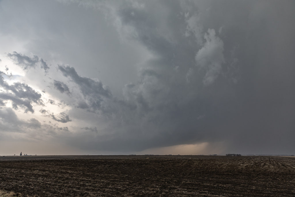
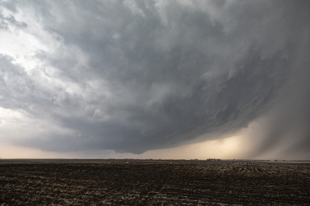
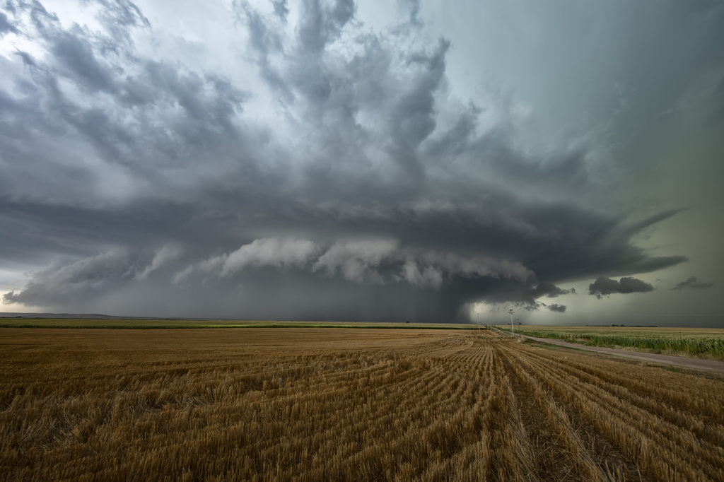
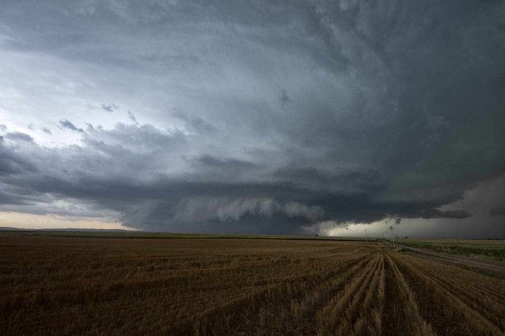
August 19th Lamar, NE area Tornadic Supercell
August 19th looked too good not to chase. Good moisture, high CAPE values, strong lift with an approaching wave and good low level shear along a boundary would set the stage for a good day! Mid afternoon storms exploded over northeast Colorado and slowly intensified. One particular storm, south of Holyoke, CO became a supercell. As it drifted east/northeast along the boundary it took off and became tornado warned. Very very strong low level rotation was occurring and the low level mesocyclone eventually became rain wrapped where you couldn’t see it anymore. Extremely heavy rains (4-9 inches!) prevented me from taking dirt, now mud, roads to get into the notch for a better look. However, the storm did produce a tornado, possibly two, one of which was a fast funnel in the hook area before it wrapped up in rain. A fun chase day, and good results, just wished for a better view in the notch! Enjoy the pics!
July 14th Central Iowa Tornadoes
July 14th had it all. Boundary, great moisture, instability and good low level shear. We blasted from Pierre, SD to central Iowa as storms formed and became severe and tornado warned. Several tornadoes did occur in central and eastern Iowa with one particular tornado we just missed by 15 minutes being the most intense near Lake City. Frustrating day to say the least, but we still managed some great supercells and a tornado late in the day. Moral of the story is to NEVER give up until storms are weakening and loss of heating reduce instability.
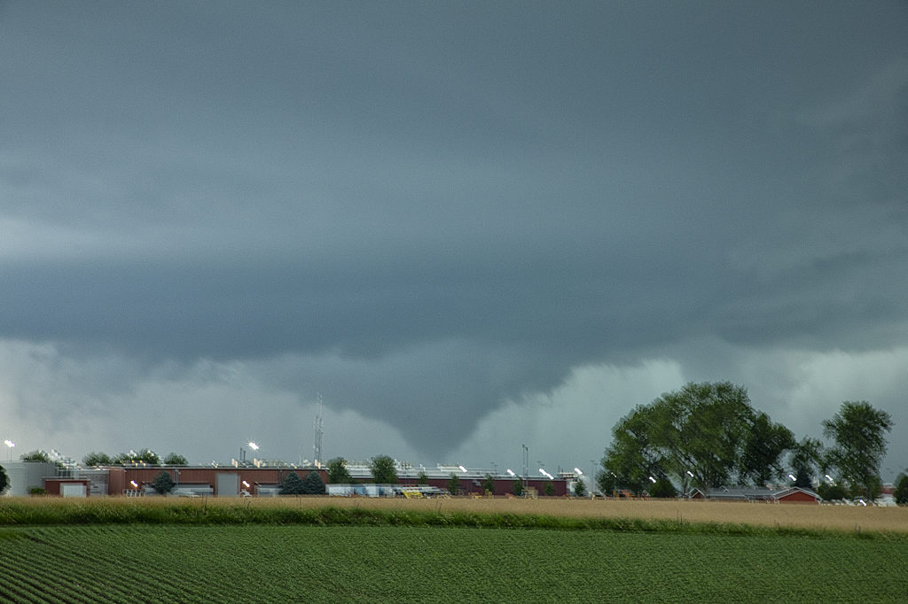
June 20th Pella, Iowa Tornado
June 20th featured extreme instability, moderate wind shear and good lift along an advancing boundary over Iowa. We started the day from Denver, CO as it was the first day of the tour. After an early departure, we made it just east/southeast of Des Moines, Iowa (650 miles later!) just in time for storms to explode. The first supercell we intercepted was just east of Des Moines and never had the “look” like it wanted to become tornadic. Nice structure and a rotating wall cloud occurred, but it could never tighten up enough to produce a tornado. We dropped south and headed back west a little bit as a second storm quickly became organized. It developed a strong hook echo on radar to the west of Pella. As we arrived in town near the factory, we stopped to watch. Intense lightning was also occurring, a tell tale sign of storm intensification. Within a few minutes, a large bowl shaped funnel formed. Soon it developed into a full fledged cone shaped tornado that was on the ground for several minutes. In my haste to shoot video, time lapse and digital images, I failed to get a proper focus on my camera and thus most images were slightly blurry. The tornado dissipated and the storm eventually weakened as it moved east, ending our chase. A great first day for Tour 8!! Enjoy the pics, blurriness and all !!!!!
June 19th Eastern Colorado Tornadoes
Arrival day for Tour 8 brought us out to chase! The Denver Convergence Vorticity Zone (DCVZ) was active, with steep lapse rates, moderate CAPE and the wind shift to set the stage for severe thunderstorms and nonsupercell tornadoes. Two such tornadoes occurred with early convection that formed along the boundary. Cells developed and back built on the boundary tapping into the vorticity that was present. One tornado was on the ground for about 10 minutes northwest of Last Chance and the second tornado for only a couple minutes to the south of Last Chance. A fun way for tour guests to spend arrival day! We’ll chase every day we can, even if it isn’t a scheduled day. Enjoy the pics!
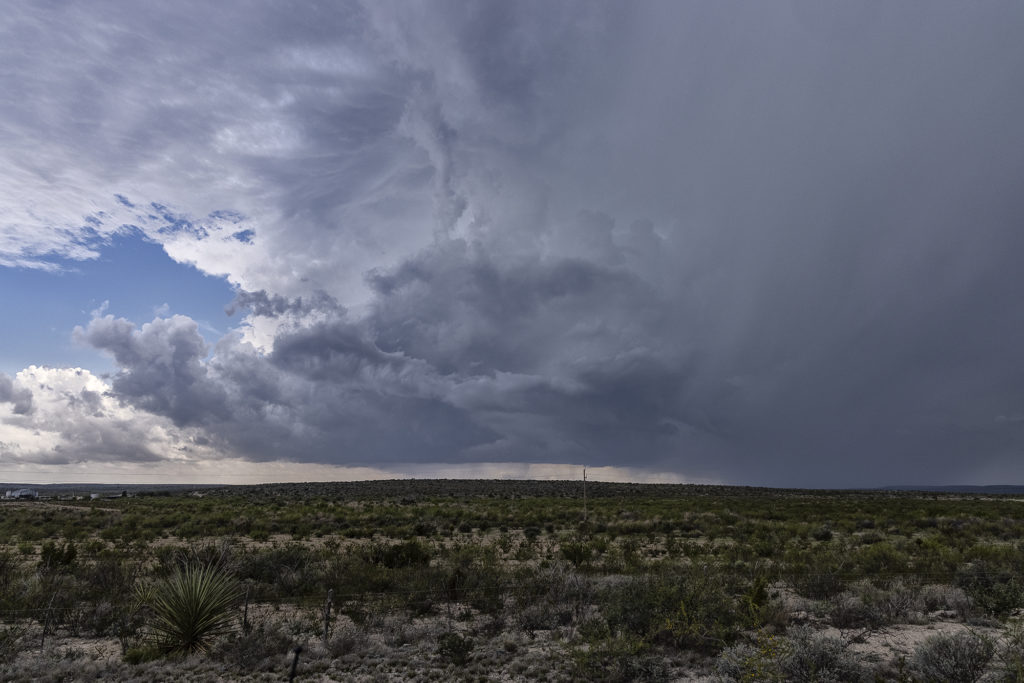
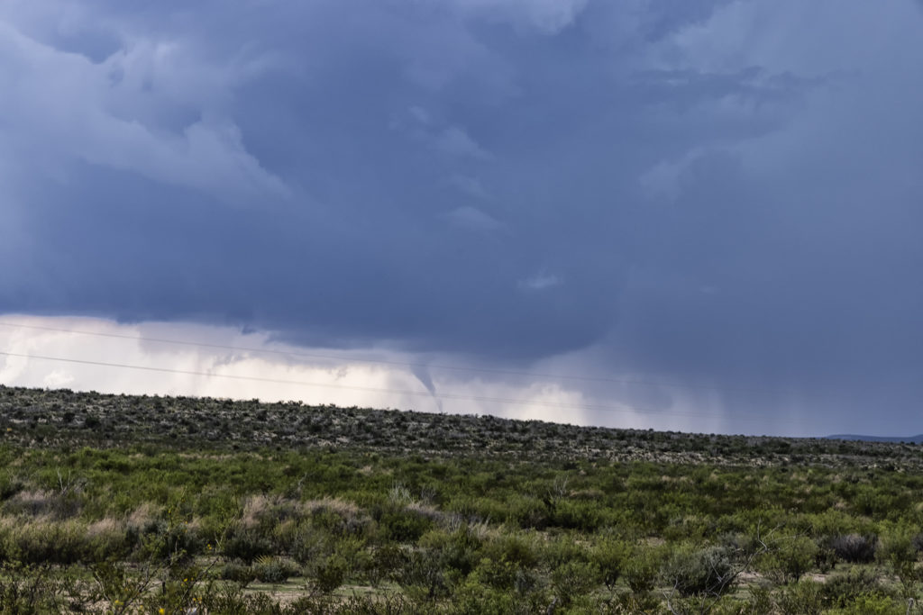
May 31st Ft Stockton, Texas Tornadoes
May 31st took us to the Davis Mountains of southwest Texas. Good upslope flow, along with ample moisture and instability, would provide the needed ingredients to get tornadic storms to form. Good low level wind shear caused this supercell to spin like a top, and as it moved off the mountains into the nearby terrain, it produced 3 tornadoes that we could see. The road network is very poor in this part of Texas, so you had to position yourself where you could see what was happening. Most of the time we were at least 10 miles away from the tornadoes because of this. Nonetheless, it was a spectacular sight to watch this storm roll across southwest Texas. Enjoy the pics!
May 30th Roswell, New Mexico Tornadic Supercell
May 30th was the first day of Tour 5 leaving from Denver. It was a long drive to our target of Roswell, NM, but we made it just in time. A tornadic supercell formed west of town and tracked east/southeast. A couple of tornado reports were made and I can’t argue with them. A few spin ups under the updraft occurred as rotation was strong above them. Good CAPE, moisture, and a boundary set the stage for this supercell to form. Nice structure and huge hail also fell from this cell. As it moved east later in the day, it weakened and another supercell formed on it’s outflow. This storm was jaw dropping gorgeous and rolled eastward towards the Texas border in the evening hours. A fantastic day after an extremely long drive, but well worth it! Enjoy the pics!