First of all, my heart goes out to everyone who suffered a loss on this horrific day. One of the worst tornado outbreaks and highest number of fatalities in US history. A very sad day indeed.
It was evident for a couple of days before this event that this would be the final day in a 3 day tornado outbreak for the US, and that this would be the most violent and wide spread. We started this day in Jackson, MS positioned to move in any direction. The plan was to intercept storms in MS, then continue moving east into Alabama, and eventually end up somewhere around Tuscaloosa by mid afternoon. However, fate would have it that this would never materialize for us. We jumped on the first storm that developed southwest of Jackson as it quickly moved towards Philadelphia, MS (and would create destruction and death during its entire life cycle through Tuscaloosa, Birmingham and into Georgia). One event changed what we would do the rest of the day. As we were 10 miles from Philadelphia, MS, well ahead of the storm, a vehicle with a young man and two girls ran off the road, slid down an embankment and hit a tree going 50 mph. The car spun around in a circle as we watched in horror. We immediately stopped to render assistance and called the state patrol. Fortunately nobody was seriously injured, but now the supercell was overhead and racing away from us at 60 mph, while there was no possible way through the trees, hills and winding roads to stay with it. The rest is history. We tried in vain to catch up to it again, and quickly learned of the strong tornado it was now producing, less than 5 miles in front of us, but we were never to see it. I believe all things happen for a reason, and I will never know why we were never to chase this storm.
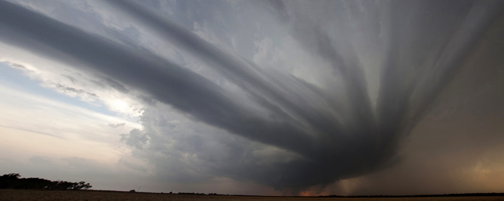
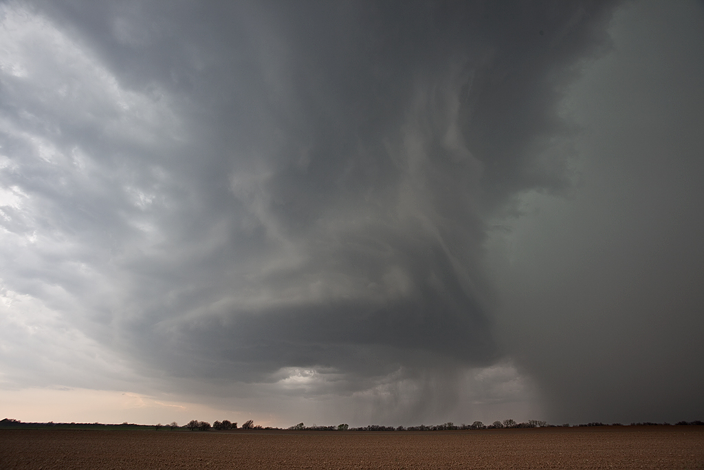
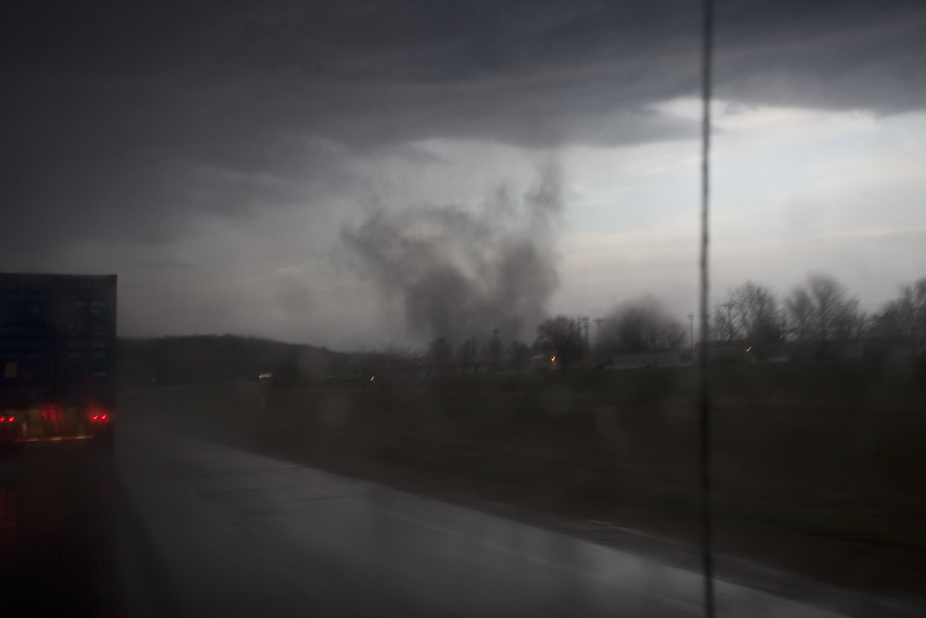
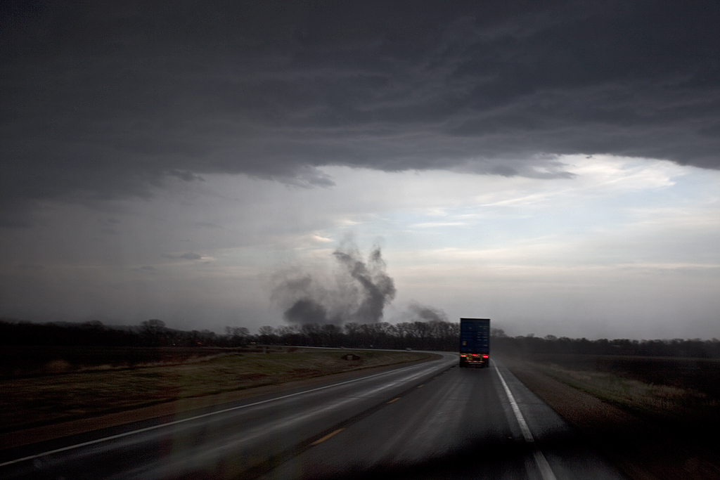
We dropped south towards Meridian, MS to get back on the interstate as another supercell formed and raced past us (no road options to chase it) and also became tornadic. It was already becoming a frustrating day and it had just begun!Storm motion of 60 mph, poor terrain for chasing, lack of roads and low visibility led me to rethink the entire rest of the day. I felt the only way to have any reasonable chance of intercepting tornadoes would be to get 30-45 minutes ahead of the supercell, find one of the few clearing to view it, watch it approach and fly past us, then drop south on the next storm and do it again. This approach finally paid off, however we were never able to get into Alabama, and instead stayed in the rough terrain in eastern Mississippi.
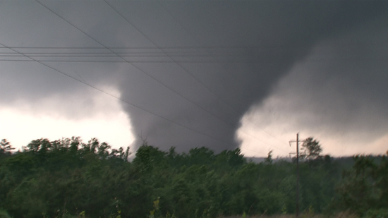
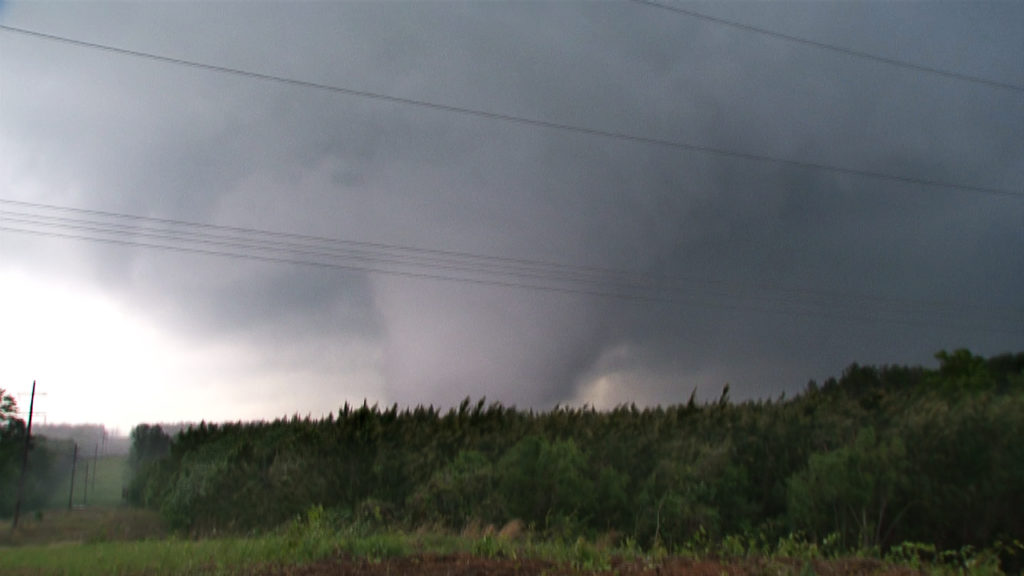
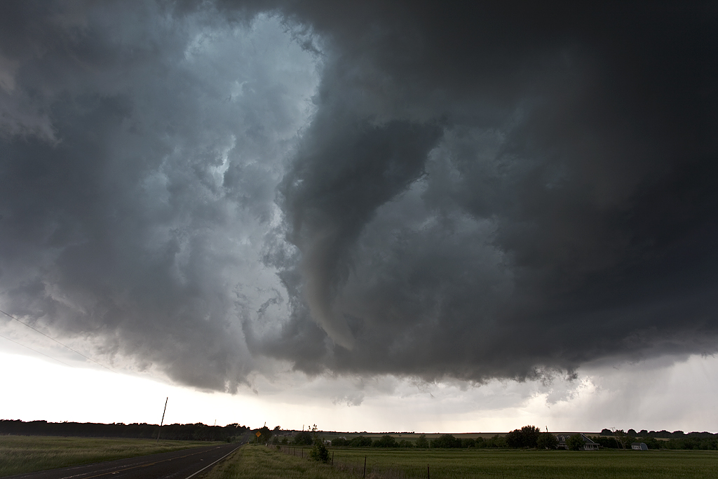
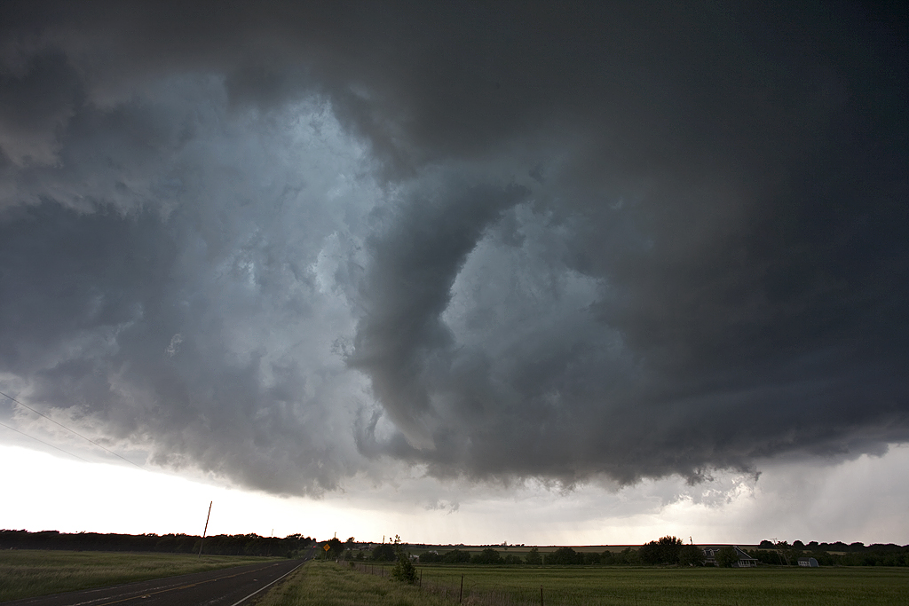
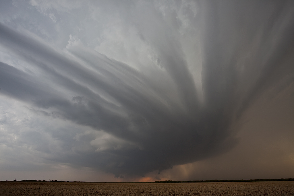
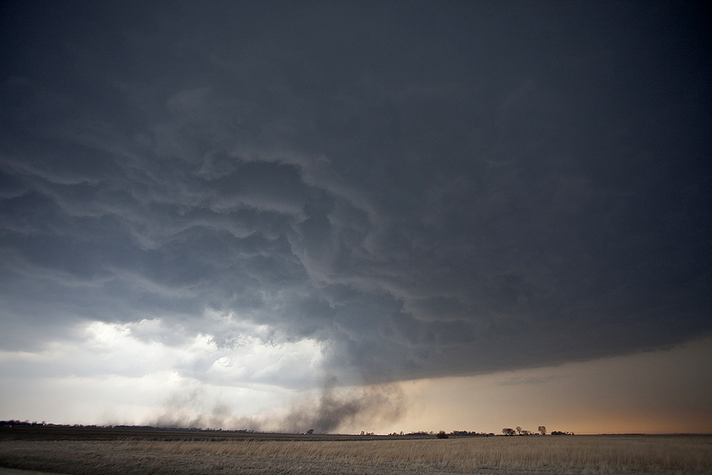
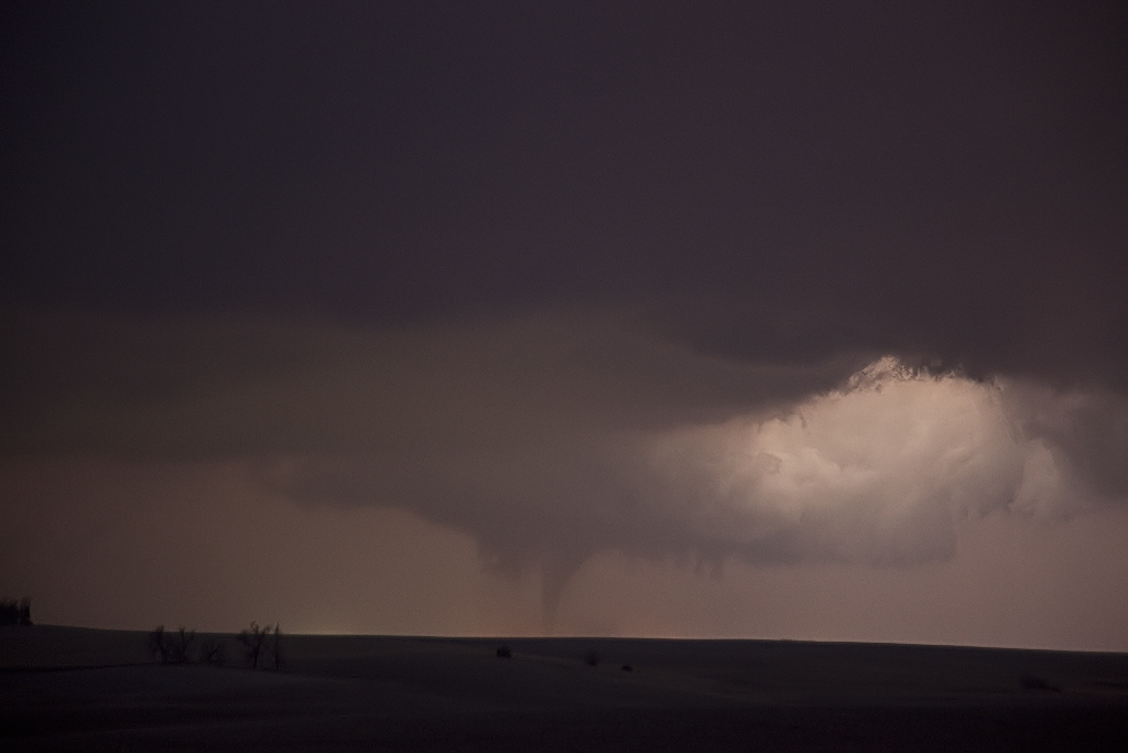
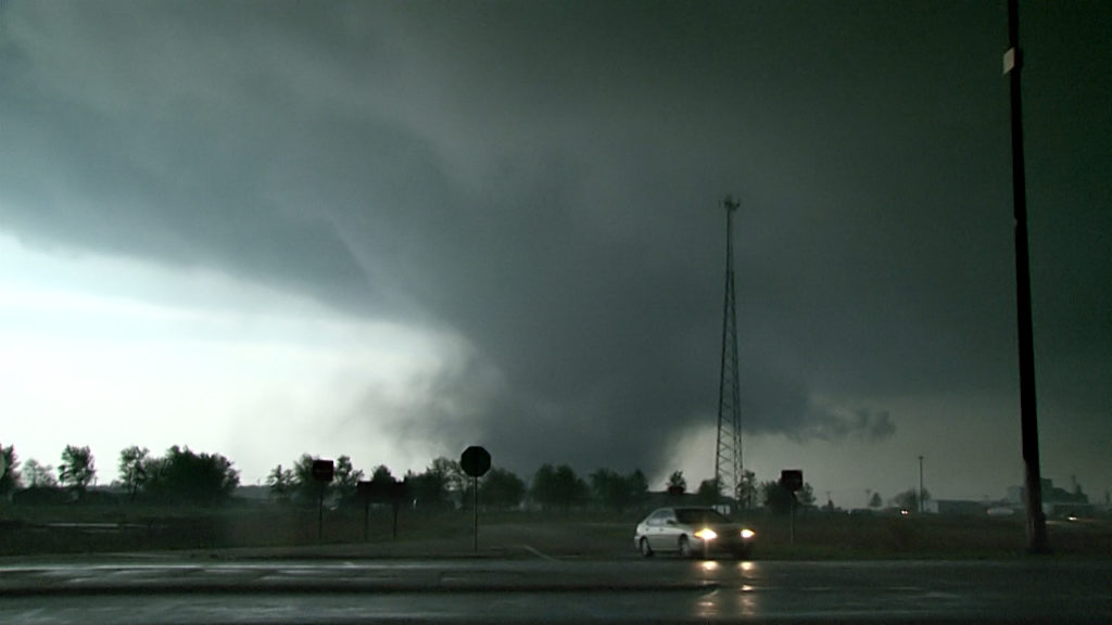
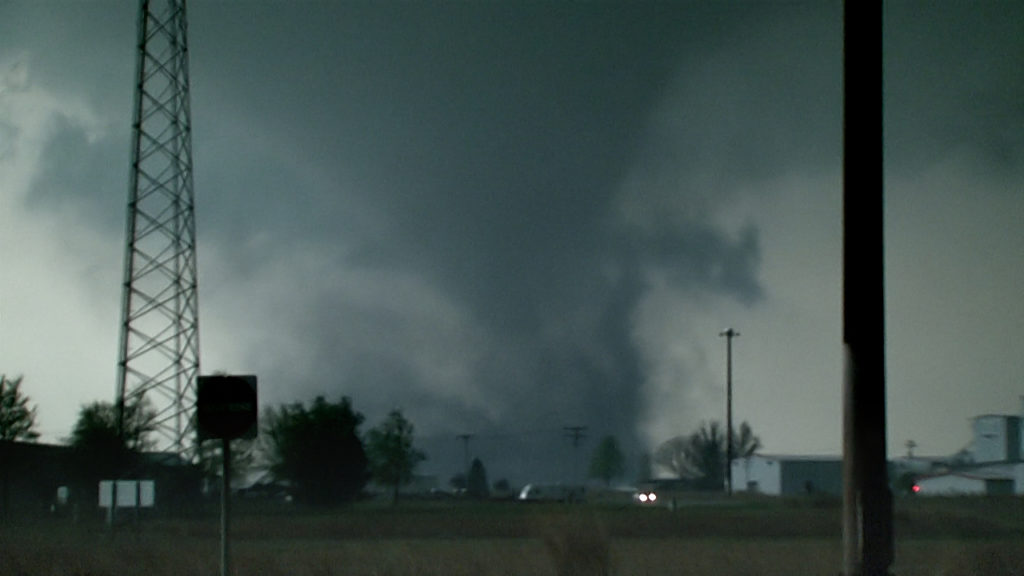
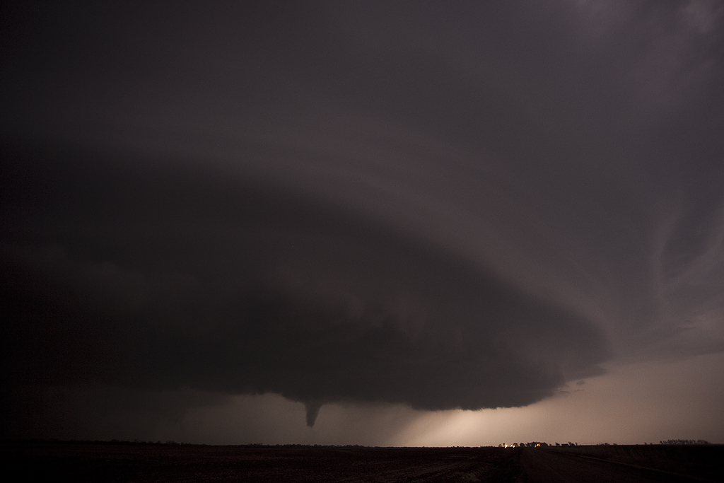
A tornadic supercell formed southwest of Jackson and right turned, heading east/slightly northeast toward Newton/Hickory, MS. we dropped south of town about 3 miles and found a great clearing to view it. The storm, already tornadic and a killer, quickly approached. As it did, a wedge tornado was quite evident over the hills and trees to our southwest. About 2 miles west/southwest of us another tornado materialized in an instant and approached us at lightning speed. As this grey cone moved dangerously close to us we blasted south out of its way and watched as cars were driving directly into the path! We honked, stopped and waived people off as the tornado, now another wedge crossed the road at the exact spot we were parked and viewing it from, uprooting trees and flattening power lines in its wake. We drove back north as the strong tornado raced away from us and crossed I-20. I was fearful for vehicles on the interstate and the town of Hickory they were directly in its path. We drove to the interstate and went east to see if we could still view the tornado (an EF3), but now it was rain wrapped and long gone. As we dropped south through Hickory we encountered a couple destroyed homes with rescue vehicles already on the scene. We decided it best to continue south (since help had arrived) and intercept the next supercell also tornadic now just northeast of Turnerville.
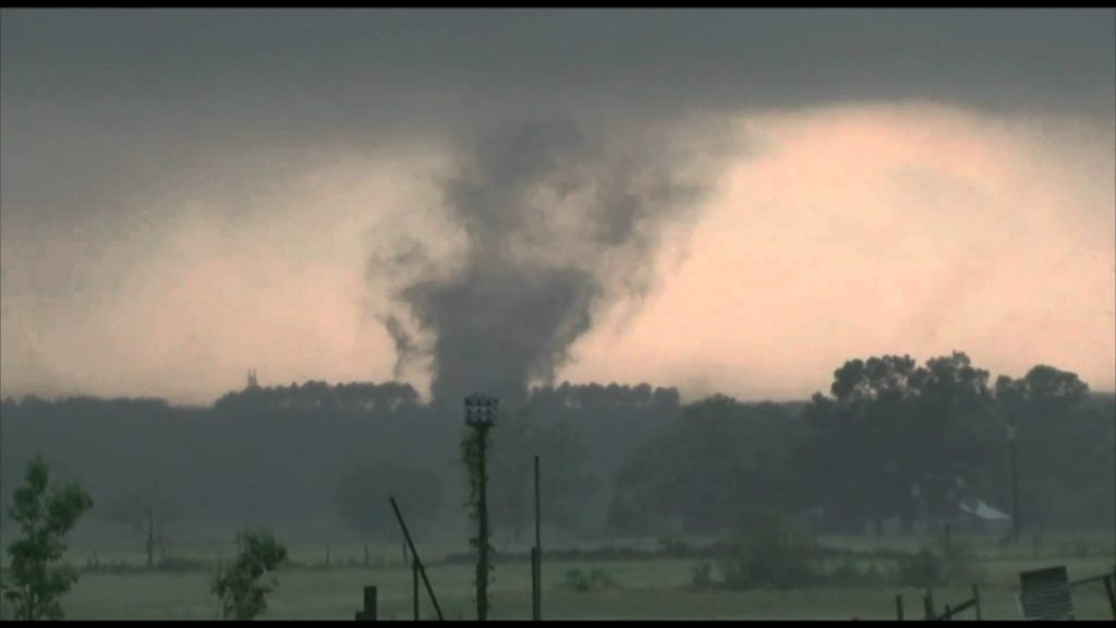
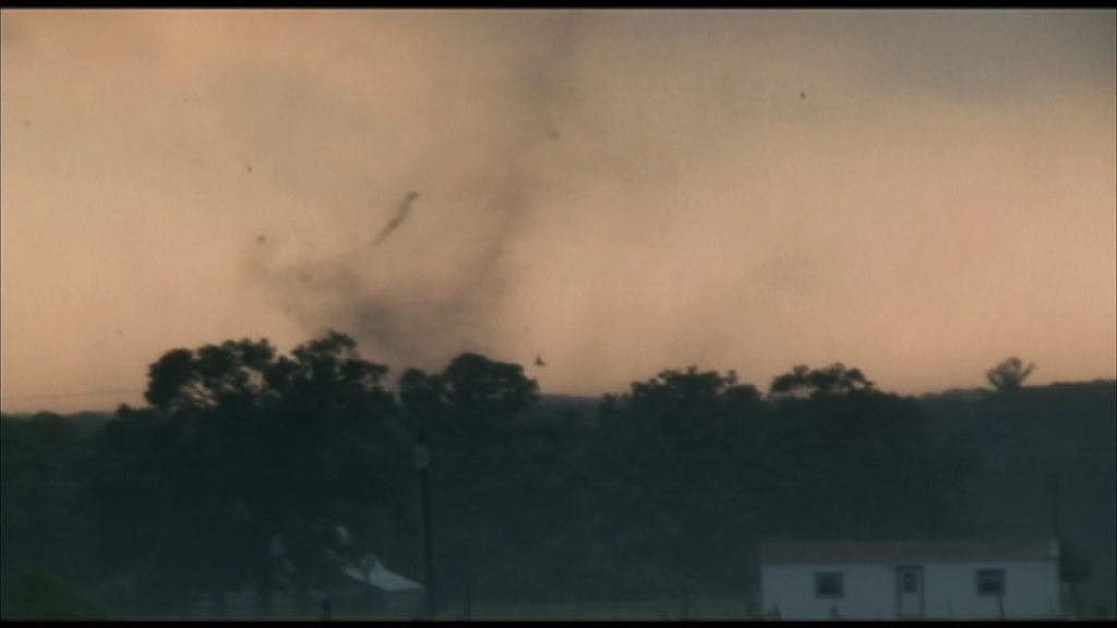
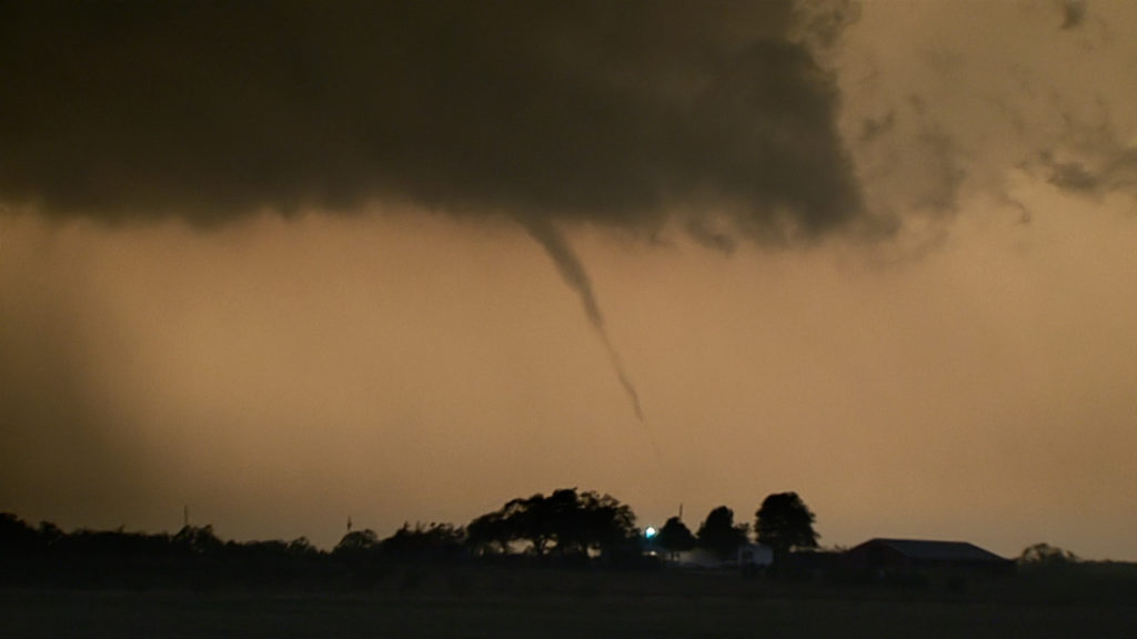
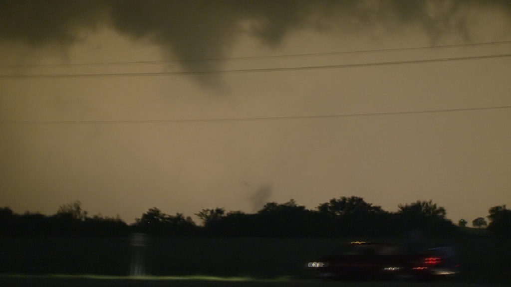
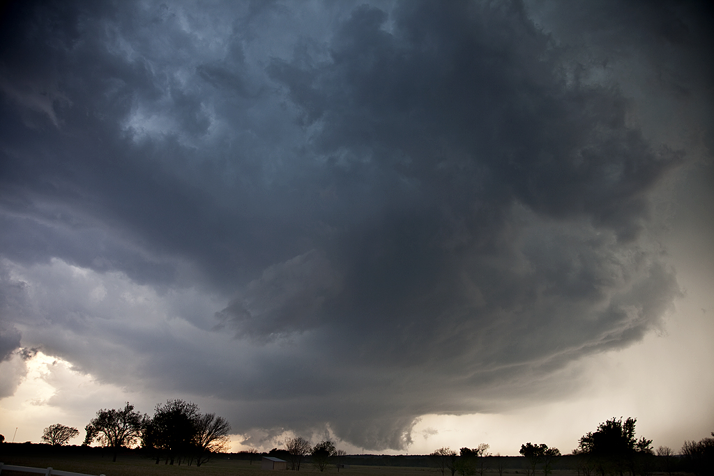
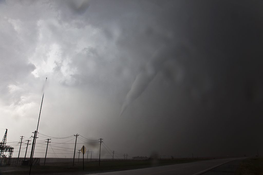
We dropped south on highway 503 and headed southwest on 18 towards Turnerville. At that point we stopped, although the view was partially obstructed by woods and hills. I could see a very large multivortex tornado directly southwest, rapidly approaching. It wasn’t until later that we learned of the fatalities just north of Turnerville as numerous homes were destroyed by this EF4 tornado. At the junction of 18 and 503 a barbeque place had a couple of people in it. We warned them of the approaching danger and they left. Amazing how oblivious people are to a dangerous situation. We told them to get south and far away from this large, violent monster. The tornado turned into a fat cone, then wedge as it blasted past our location less than a quarter mile south of it at 60 mph. The noise was horrendous, louder than any tornado I have ever witnessed. Everything in its path was demolished. Trees, houses, power poles, everything. We saw the tornado was heading directly into the small town of Rose Hill, and headed up 18 towards town. Trees and power lines were down and after some local help and moving debris out of the way, we proceeded into town. Rose Hill was directly hit by the violent tornado about 3-5 minutes before we got there. We found much damage, homes destroyed, animals killed, and people in need of assistance. At this point we abandoned the tour and rendered assistance. One family we immediately found lost everything. Their house was totally leveled, their barn destroyed, vehicles and horse trailer thrown and demolished. They were trying to round up their horses who of course were totally spooked and uncontrollable. Dead chickens lay around. The father, mother and daughter survived due to a freakish event. About 5 minutes before the tornado hit, their neighbor had called them and asked them to come over for a minute. The whole family walked over to the neighbors only a few minutes before the tornado hit. They surely would not have survived had they stayed in their house (without a basement or shelter!).
With our day now done, and authorities on the scene, we left our search and rescue efforts and headed back towards Jackson for the night. We knew the supercell still had this violent tornado in it. We let authorities know this. Later we discovered the tornado had continued nearly 65 miles and leveled a big part of the town of Snell, where 7 fatalities had also occurred. A horrible discovery.
I am still amazed in this day and age of the lack of concern by a vast majority of people when faced with a dangerous situation. The NWS, SPC, local authorities, etc all approached this day and through the day with great reaction to this historic situation. Still, hundreds have perished, and maybe the toll would have be considerably larger, had not the agencies made sure the word was spread and warnings issued with as much lead time as possible. People seemed to have the idea that nothing would happen the them, it would always be someone else. This event proved otherwise.
I am pleading to every person who reads this account to get involved and donate your resources to help those in need. It will be a long time before things return to any sense of normalcy in the southeast. Please get involved!
Here is a video I put up of the tornadic events from this day.