Tag Archives | 2022

June 7th Northeast Colorado Tornado Warned Supercells

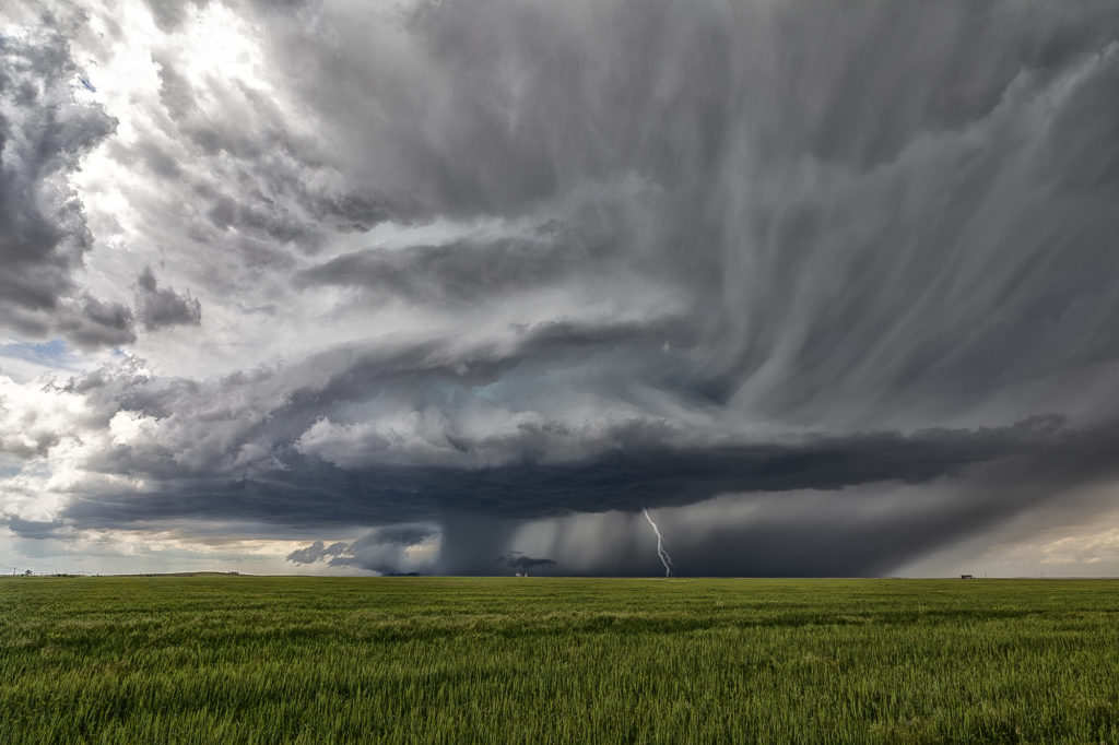
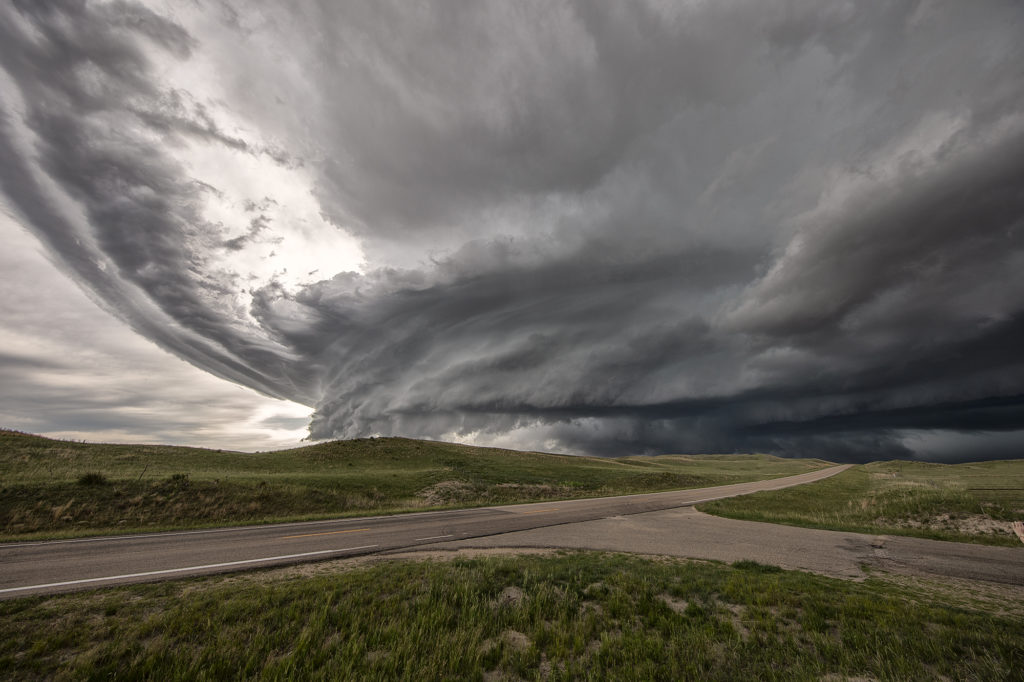
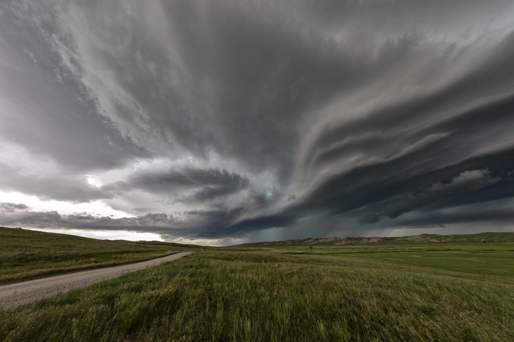
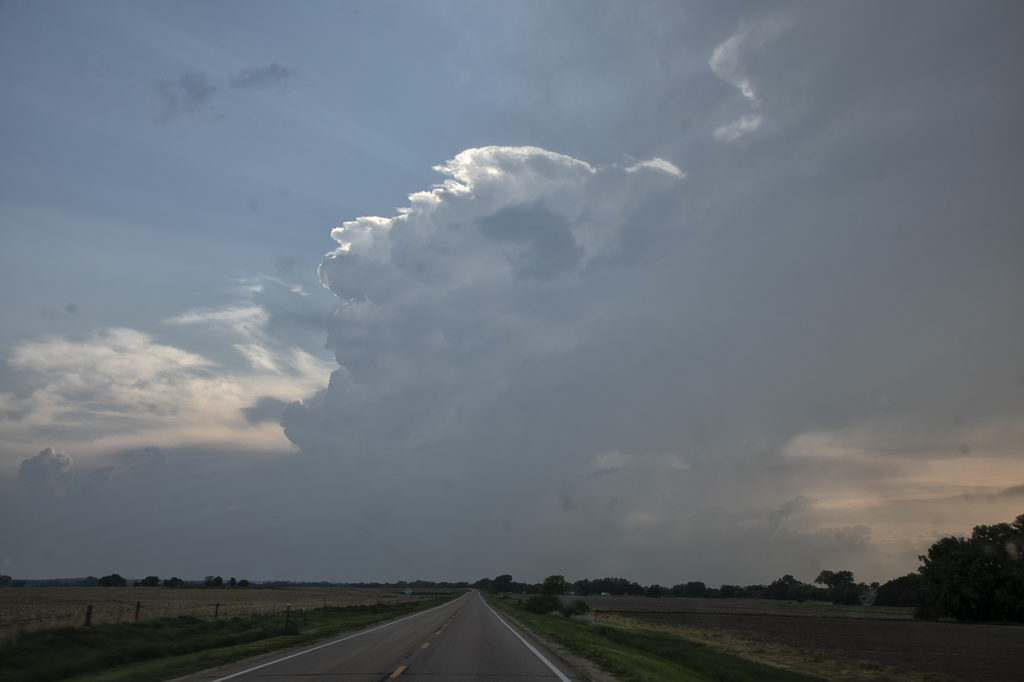
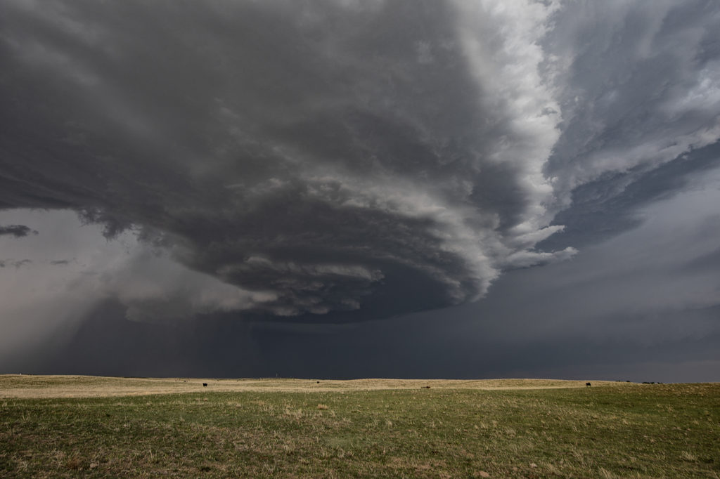
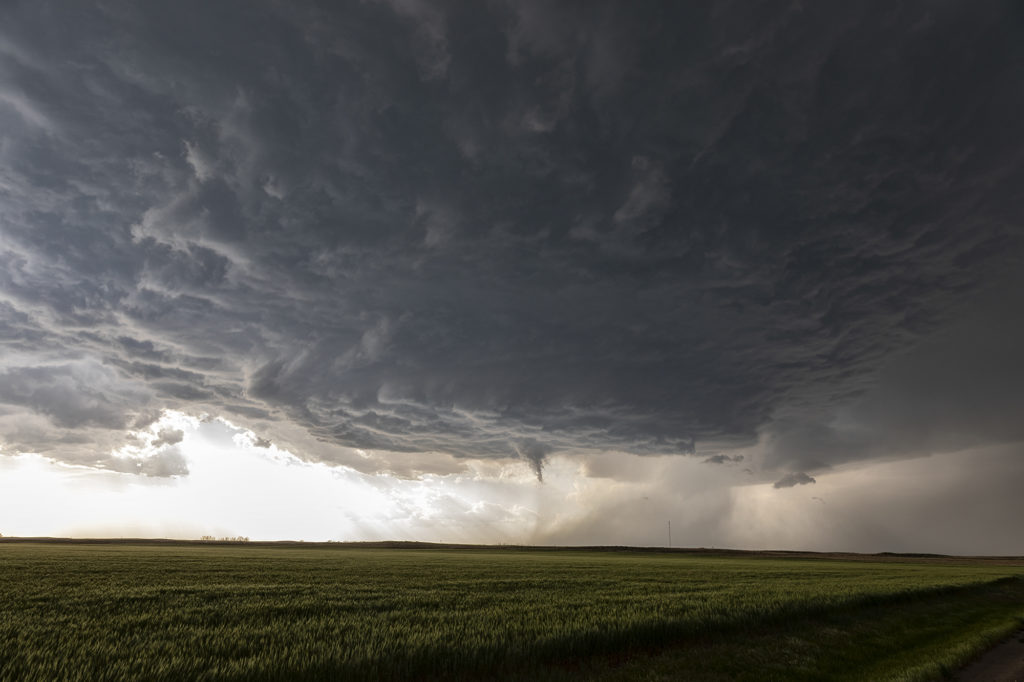
June 7th took us to the north side of the Cheyenne Ridge, playing the upslope there with moderate shear, decent moisture and instability. Several storms formed, with a couple becoming supercells and even tornado warned. It is amazing what some chasers call a tornado (landspout) when it occurred in a part of a thunderstorm that landspouts wouldn’t even form in! Stay tuned to a narrative we will publish explaining how and where a landspout would form.

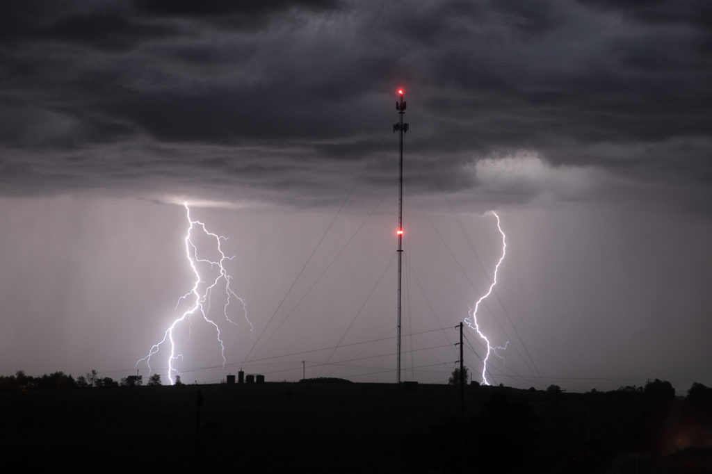
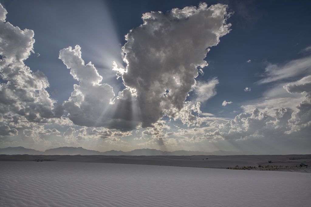
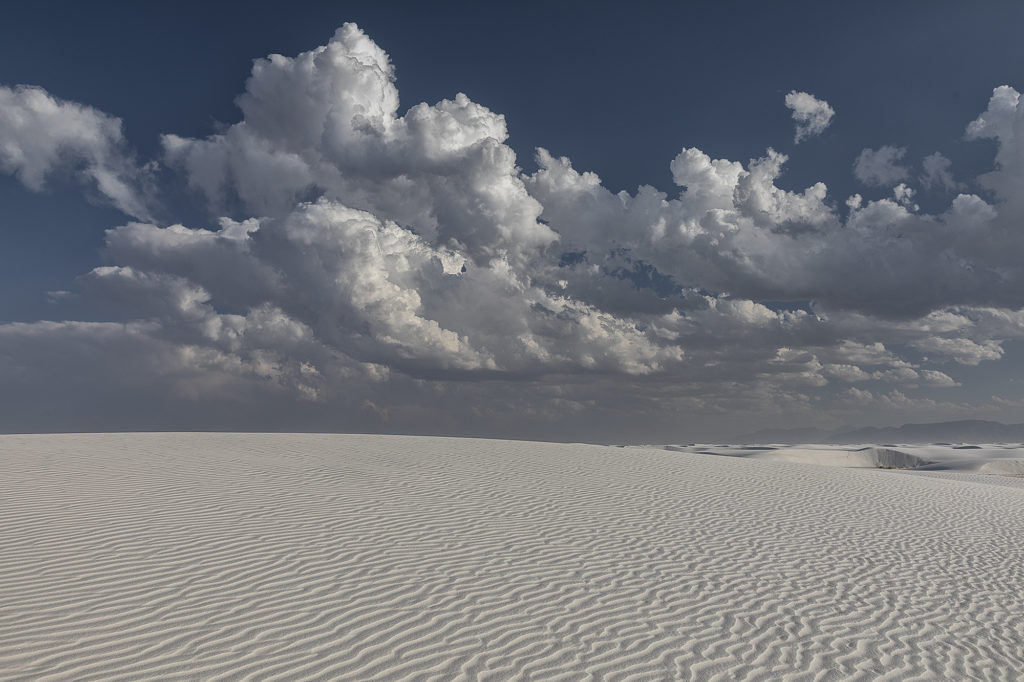
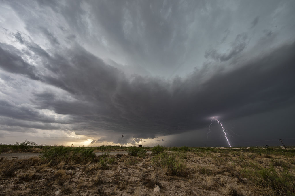
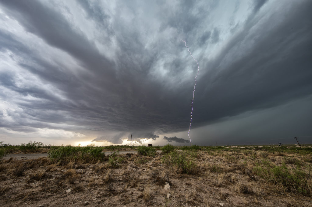
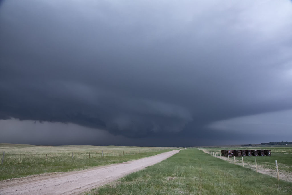
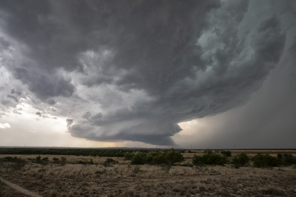
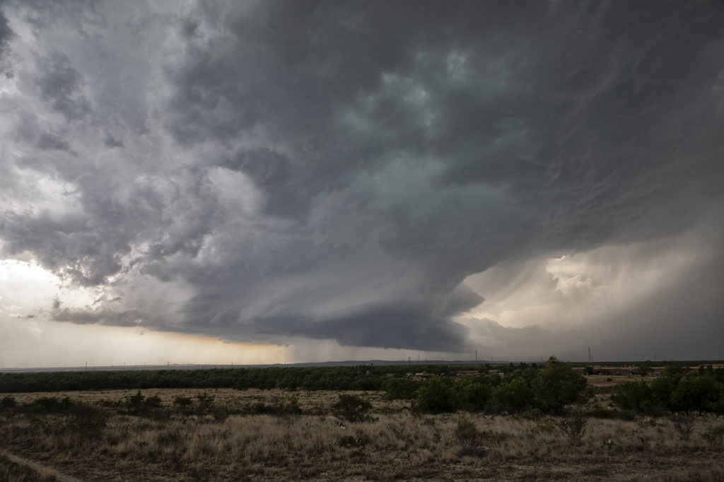
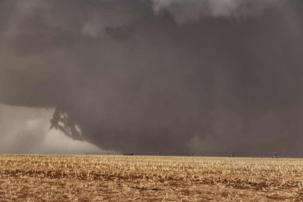
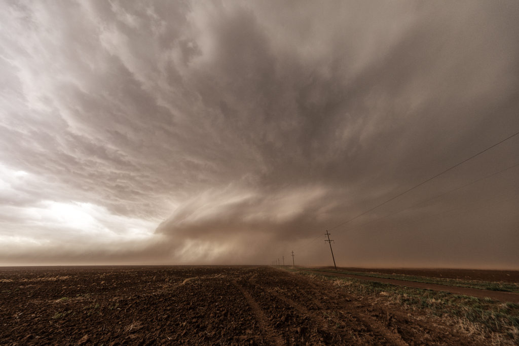
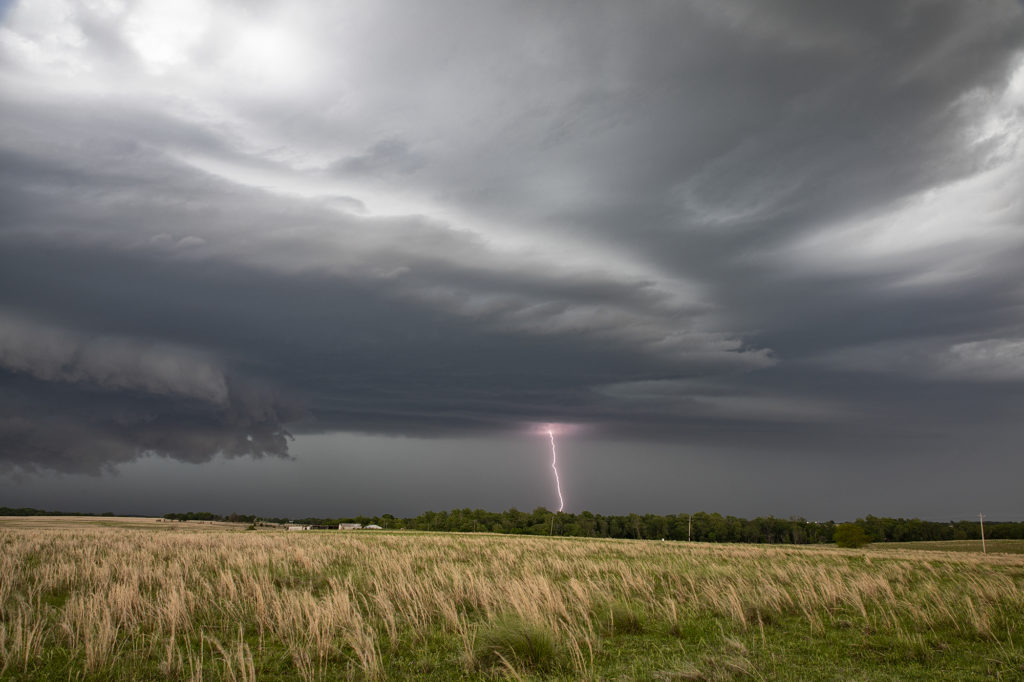
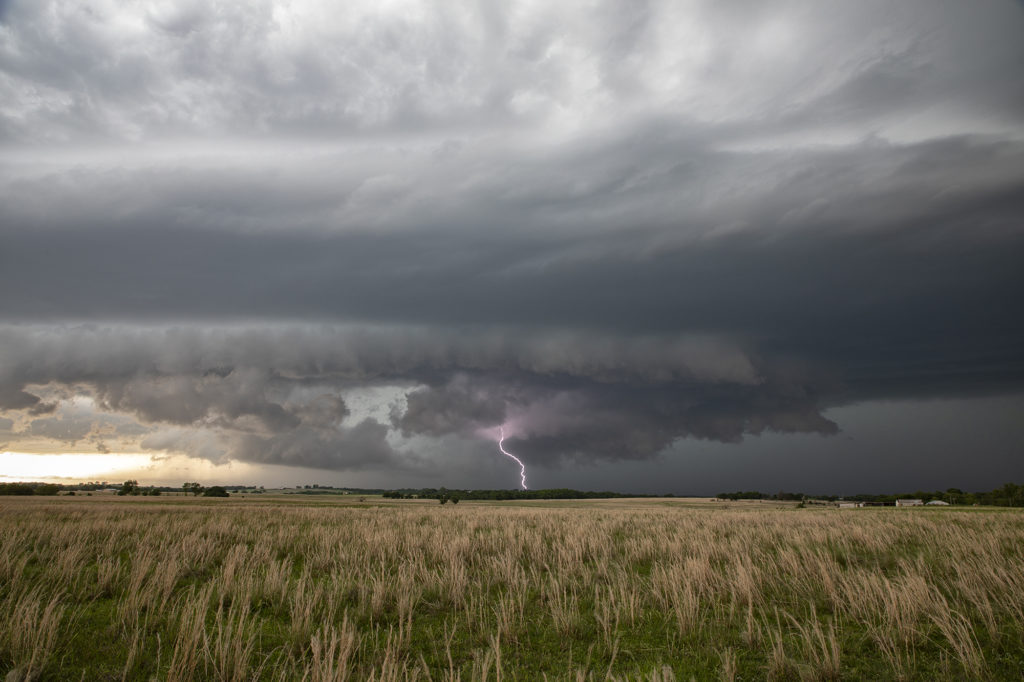
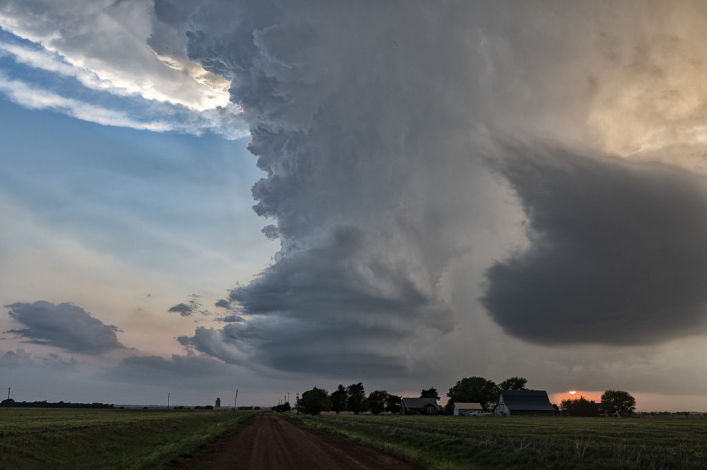
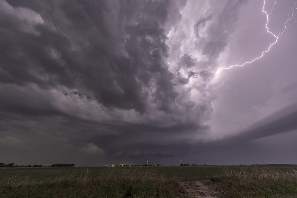
These storms moved southeast into northeast Colorado and became quite intense, producing very high winds and baseball sized hail. The continued moving southeast eventually into northwest Kansas and were continuously tornado warned or severe warned. Structure was very nice as they marched into central Kansas overnight. A fun day for the tours with plenty of excitement with the storms as we moved in very close to where rotation was, but no tornadoes were confirmed. Check out the images below!

June 6th Western Nebraska Supercells

Sometimes you get a set up where shear is really strong, but moisture is a bit lacking. June 6th was one of those days where if only the moisture and resulting instability were a bit stronger that a significant severe weather event would occur. It looked like storms would form off the Black Hills and ride a frontal boundary to the southeast. By mid afternoon, a supercell formed northwest of Thedford, Nebraska and became severe. As it moved east it weakened while others formed further northwest. A storm did form off the hills and trek southeast into northwest Nebraska and became a formidable supercell. The structure was nice and the colors of the storm were superb! Having it in the sand hills is always a challenge to chase due to lack of roads. We were able to stay with it all the way past Stapleton before it eventually weakened to the southeast. A fun chase, pretty structure and beautiful landscapes! Enjoy the pics!

June 2nd White Sands, New Mexico Fun!

What do you do when storms are not forecast across the plains? We head to scenic areas for some sight seeing and photography. June 2nd took us to White Sands National Park, New Mexico. Storms were forecast over the central New Mexico mountain chains and we hoped they would move towards us over White Sands. The did exactly that, but weren’t producing much lightning. Still a very scenic spot with developing storms around. Made for some stunning photography!

June 1st Southeast New Mexico Powerful Supercell

The first day of June took us towards far southeast New Mexico. A couple supercells developed along the dryline west of Jal and drifted eastward, becoming quite prolific hailstorms. The storm’s structure was very nice and it had a wall cloud throughout it’s life cycle. However, low level rotation was lacking. The cell was an amazing lightning machine producing numerous cgs every minute. As it moved southeast, other storms for and soon a cluster of high based severe storms rolled into southwest Texas. We went to our hotel in Midland and watched as the storm approached from the northwest, with tons of blowing dirt, lightning and hail.

May 29th Central Nebraska Tornado Warned Supercell

May 29th was the classic “day before the big day” type set up. Moisture and instability were rapidly increasing along a lifting warm front in Nebraska, and shear was quite strong. Models showed late afternoon and early evening supercells forming north of Broken Bow and that is exactly what occurred. It took awhile from the main supercell to root along the boundary and get organized, but once it did, it became a formidable storm! Eventually it became tornado warned as it moved to the northeast and stayed warned for a few hours. Due to storm motion and poor roads, it became virtually impossible to stay with it. Near O’Neill we had to let it go and head to Sioux Falls, SD for the night. The storm had good structure, and it had a well defined rotating wall cloud. It just couldn’t tighten enough to get a tornado to form. Enjoy the pics!

May 24th San Angelo, Texas Supercell

We weren’t expecting big things this day. An advancing cold front was pushing south across the area near San Angelo and the fear was it would undercut storms that would develop. As we arrived, one storm rode the boundary for a couple hours before being undercut and became for formidable supercell. It dropped hail the size of softballs and had some really pretty structure. However, as feared, the cold front continued to push south and undercut the storm. From then on it was a battle to stay ahead of anything that wouldn’t be undercut as the front continued its steady push southward. A quick end to the day, but still a fun day w

ith a great supercell!

May 23rd Morton, Texas Wedge Tornadoes

What a day! We certainly weren’t expecting what happened this day to occur. Limited moisture, but good shear and a dryline would set the stage for severe thunderstorm development.  There is a term chasers use in the Texas panhandle called “panhandle magic” and it certainly was the mode this day! Storms developed in eastern New Mexico and clustered as they moved into west central Texas. It was a very messy storm mode. Eventually the tail end cell in the cluster anchored and started spinning. It became a very intense supercell, even with low dewpoints in the 50s! Soon the cell developed a wall cloud, then a multivortex tornado, and finally a 400 foot wide EF2 wedge tornado! It was nearly stationary! A second wedge occurred about 30 minutes later east of Morton and finally a 2 minute elephant trunk west of Levelland.  Inflow was so strong ti was knocking down power lines and toppling trees! The storm was sucking so much dirt due to the drought in west Texas at times the updraft was barely visible. Structure was nice when you could see it and the storm as it approached Lubbock eventually died. It put on a nice lightning show at dusk as well.  An incredible day and evening! Certainly by far more than we expected. Even the Storm Prediction Center didn’t have much of a tornado threat in its’ outlooks! Enjyo the pics!

May 15th Eastern Oklahoma Supercells

Eastern Oklahoma was the target on May 15th. Extreme instability and moisture as well as a cold front would provide the ingredients for severe storms this day. A supercell developed along I-40 near Henrietta, OK and drifted south. More storms formed south of there and continued through the evening. Very high wind, huge hail and heavy rain would accompany them as the built south. We were on several different cells that gave us some good structure and great lightning. No tornadoes occurred, but the storms were quite pretty nonetheless! Enjoy the pics!

May 14th Southern Kansas/Northern Oklahoma Supercells

Lack of low level moisture was the theme this day. Good shear was present, however due to limited moisture, cloud bases were too high to produce tornadoes. Storms formed over south central Kansas and right turned into northwest Oklahoma as they became supercells. One storm even developed a clear slot and tried to produce a funnel. The intense lightning caused several grassland fires as well. Hail to the size of tennisballs also fell. They persisted through early evening before weakening due to loss of daytime heating. Very photogenic to say the least!

May 13th Northern Oklahoma Supercells

May 13th was a fairly marginal day as forecast. Some models tried to break out storms in southern Kansas and northern Oklahoma. We decided to chase down by the OK/KS border area and see if anything would form. Indeed it did! A couple of slow moving LP supercells developed and had decent structure and golfball hail. During the early evening hours, another supercell formed just southwest of the now decaying storms and became a formidable storm! Structure was of the classic supercell type and is spun like crazy in the dark. At one point we though it could even produce a tornado due to strong low level rotation. However it was not to be. A fun day, some good storms and great lightning in the night!