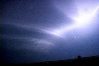
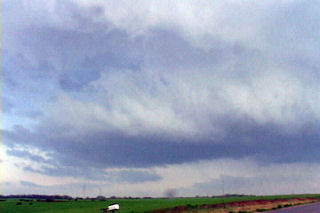
April 19 was an interesting set up. A large closed low over the inter-mountain west would meander without moving much eastward this day. A surface low would develop over northeast Colorado with a boundary extending into Nebraska. This boundary would be to focus for severe thunderstorm development. Several storm first formed north into Nebraska and went severe. I decided to play the tail end storm which ended up being the prettiest storm of the day. Explosive convection developed north of Sterling mid afternoon as a substantial LP supercell formed. This storm produced at least one brief tornado, if not two!
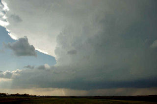
April 10th, 2005 St. John, Kansas Supercell & Funnels
April 10 was a day I wouldn’t soon forget. We had to leave Denver early to escape a raging blizzard. We were able to get out in front of it and into the warm sector under sunny skies. This was a tough day forecast wise for me as it looked like the dryline bulge would be the place to play. We later discovered too much dry air and a perpendicular orientation of the mid level winds to the dryline would cause the storms to form in a line instead of discreet supercells. Too much dry air never let the storm updrafts get organized for long periods. Later we also found out about the tornadoes in Trego county, to our north. We had actually taken off from the Pratt area to head back north and play that spot, but changed our minds. Live and learn. Thank goodness it is early season!
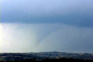
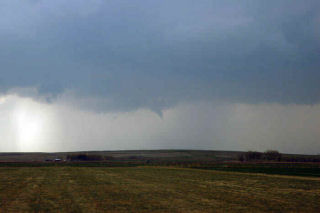
March 20-21st, 2005 Kansas & Oklahoma Supercells & Tornadoes
The weekend of March 20 and 21 shaped up to be an active period as a deep negative tilted trough developed and pushed south across the southern plains. I couldn’t resist the first chase of the year and I am glad I didn’t! Caryn, Colton and I left Sunday afternoon for what hoped to be elevated supercells in Kansas, then into Oklahoma for tornadic supercells the following day. The atmosphere did not disappoint. An elevated supercell produced copious amounts of CG and hail near Rush Center, Kansas during the evening of the 20th. On the 21st we targeted the area just east of Oklahoma City. By mid afternoon an awesome supercell developed and produced 4 confirmed tornadoes, 3 of which we captured on video. The first tornadic circulation developed almost overhead and developed a nice funnel followed by a debris cloud less than 200 yards from the van. The second tornado was a nice multivortex tornado that lasted about 5 minutes. The 3rd was a small rope tornado that we weren’t able to capture on video. The last tornado, was a LARGE cone, that we tried desperately to catch but just couldn’t due to road options.