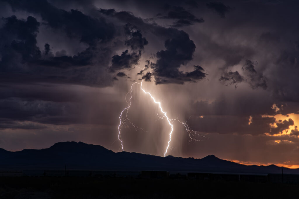
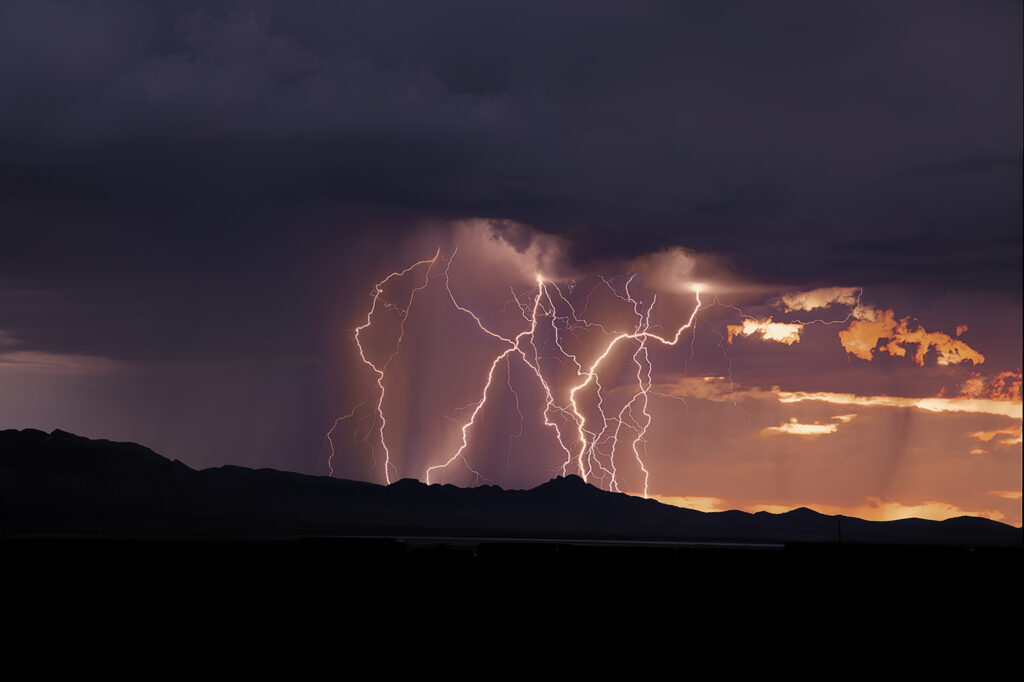
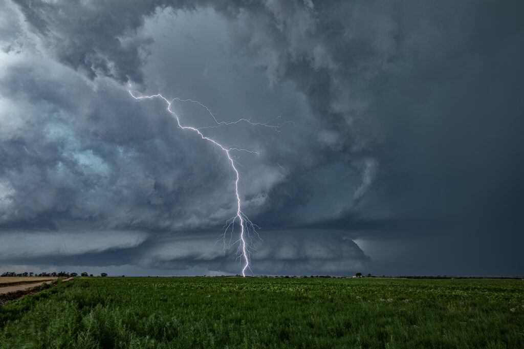
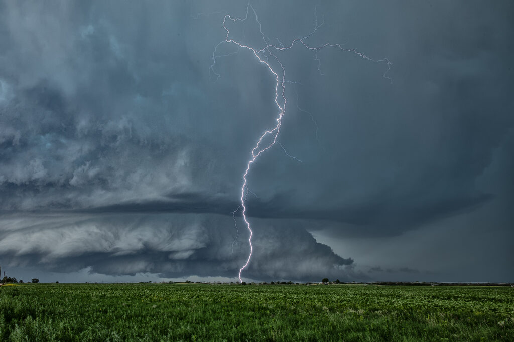
Each year we conduct lightning tours in Arizona during monsoons. This year we were there the first week of August. Despite a far from favorable weather pattern nature provided some pretty storms with excellent lightning! We traveled over southeastern Arizona and occasionally into southwestern New Mexico on various days. However the majority of the time we spent in Cochise and Santa Cruz counties this year. Temperatures were extremely hot with daytime highs from 105-115. Moisture was on the marginal side with dewpoints in the upper 40s to mid 50s. However enough was available to generate some instability to produce these storms. Enjoy the pics!
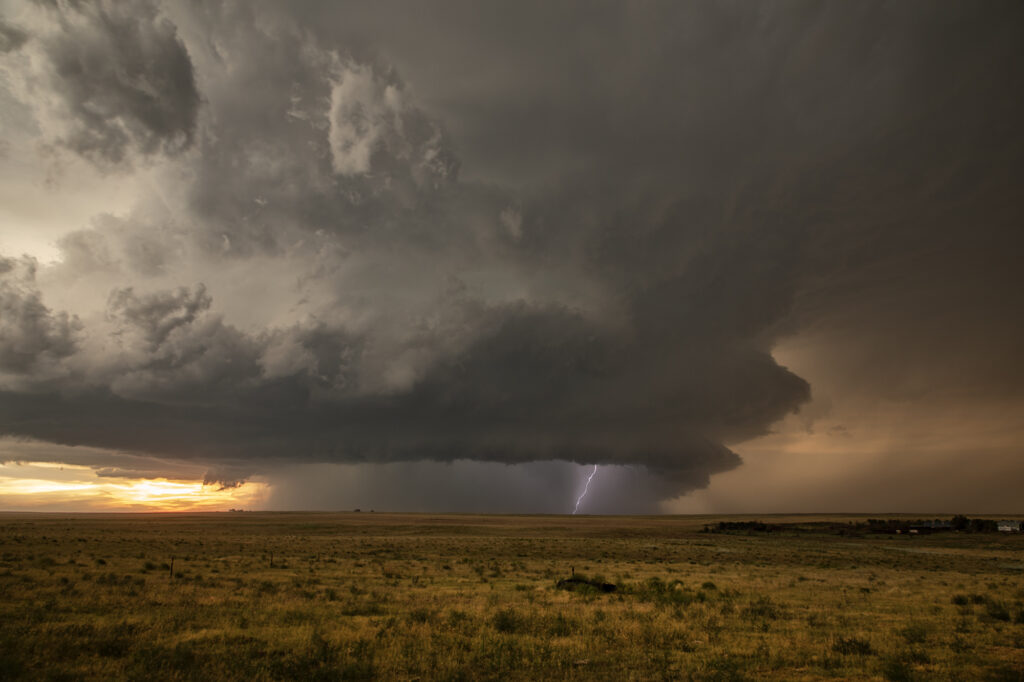
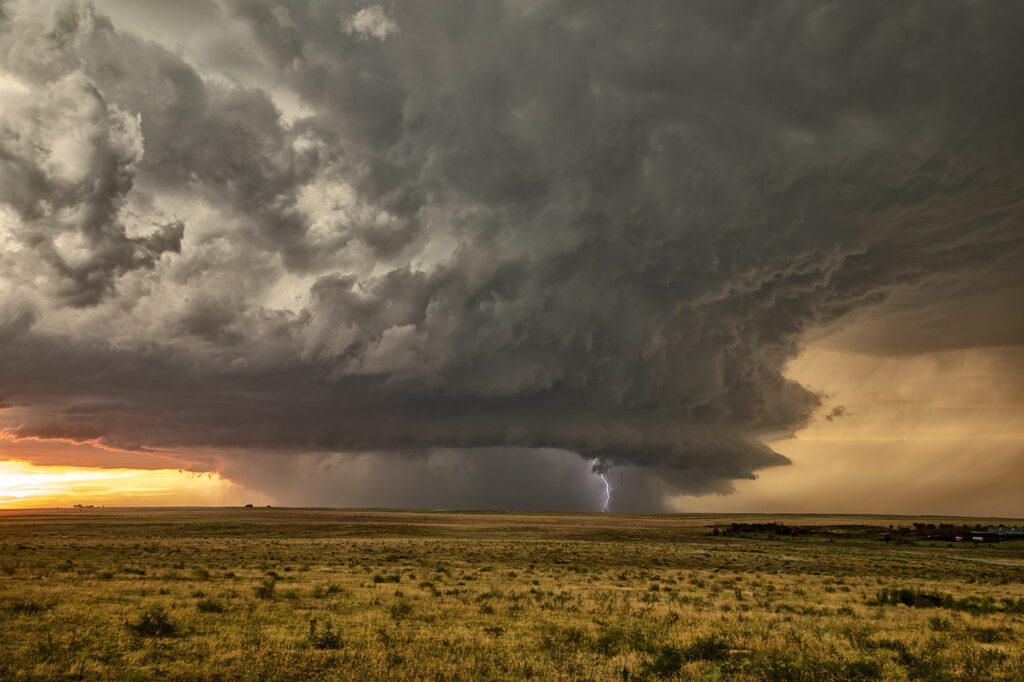
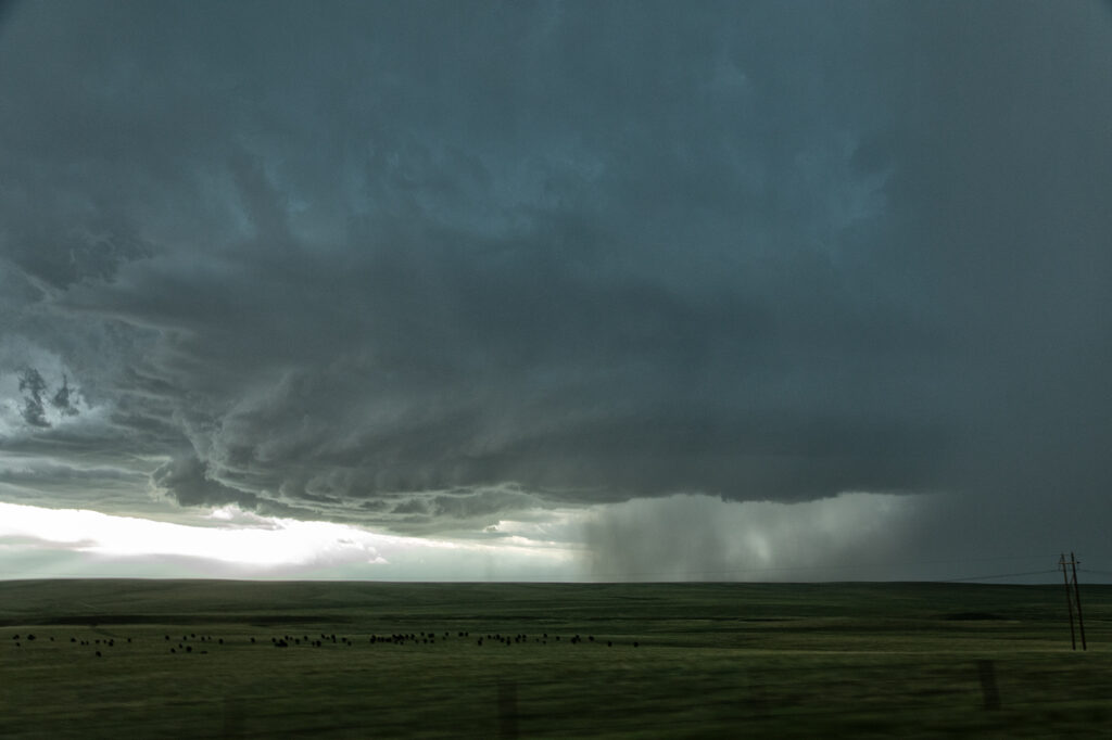
August 4th Kim, Colorado Tornado Warned Supercell
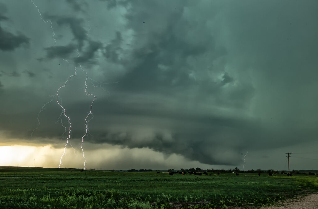
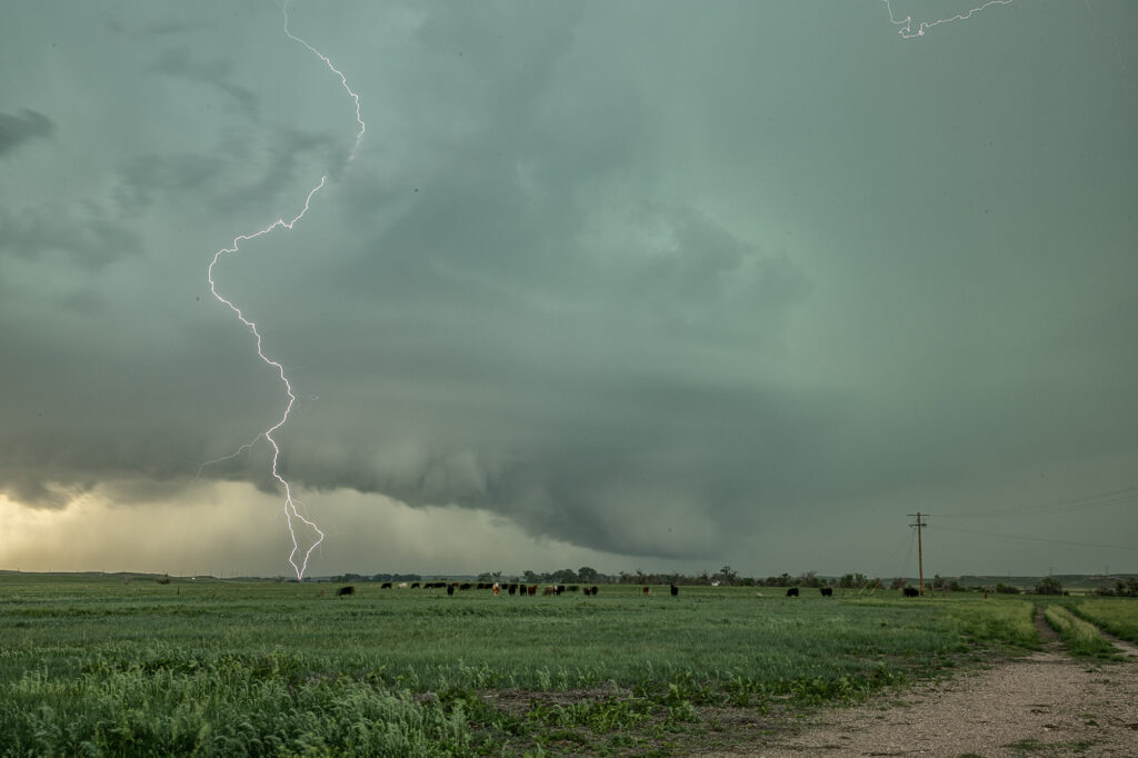
When you have nothing to photograph during our Desert Thunder tour, you go where there are storms, even if not in Arizona. Models were consistent on the set up in southeast Colorado on August 4th. We headed out and drove from Tucson, AZ to Springfield, CO. One lone supercell formed on the “LaJunta Low” just southwest of Lamar and right turned all the way to the New Mexico border. Structure was great and the lightning was amazing! We even watched a semi truck’s trailer get a direct hit, glowing it a bright orange in color! As the supercell turned into better moisture and instabillity, it steadily strengthened until it became tornado warned for 2 hours. It slowly took on HP features as the RFD cut around the updraft with a lot of precip and hail, blocking our view of what was happening under the base. A couple of times there appeared to be a cone shaped funnel that persisted for several minutes. Eventually though, the precip became too dense to see under it anymore and we had to admire the beautiful structure! A long way to come for a storm, but it was well worth it! Enjoy the pics!
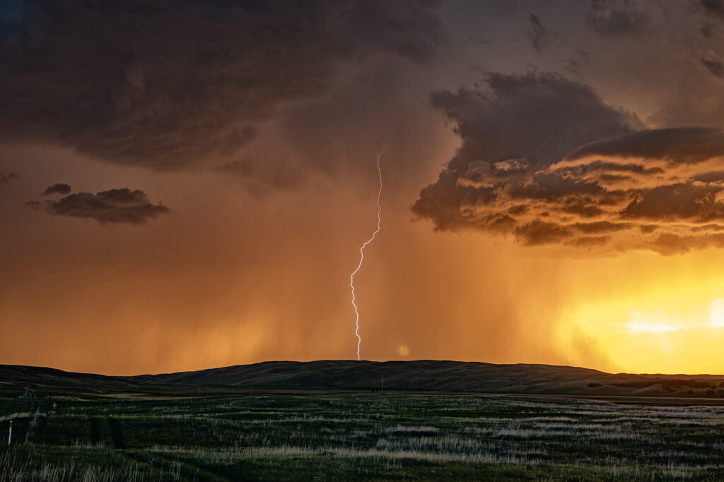
July 1st Hyannis, Nebraska Supercell and Sunset Beauty
I wasn’t expecting much on July 1st and what we got was a lot better than I was hoping! A north/south dryline was over western Nebraska, however limited moisture and instability were present which would limit the severity of storms. We encountered a nearly stationary high based supercell near Lakeview that had decent structure, nice lightning and hail the size of golfballs. We eventually got cut off from the storm due to poor road options, so we moved east and south of Hyannis to watch a new cluster of severe storms at sunset. What a show they put on! It’s been a few years since we’ve encountered such an amazing display of color at sunset. Intense lightning, sun setting through the core and luscious green rolling hills made this a winner to me!! Please enjoy the pics, some beauties!

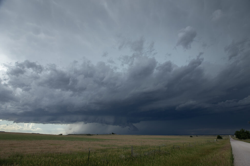
June 29th Edgemont, South Dakota Supercell
Modest amounts of moisture, wind shear and CAPE would lead to storms forming along the Black Hills. One storm latched onto an outflow boundary and spun southeast along the southern side of the hills into northwest Nebraska. We encountered some intense hail up to tennisball size! The structure was nice and the cell had that classic “hail core green” look to it. It made for some nice photos ops with the structure, colors and pretty scenery of the Black Hills. We pushed around the supercell towards Chadron, NE where numerous storms formed and weakened the supercell due to too many cell interactions. A fun day, nice supercell, broken windshield from the hail and pretty colors!! Since this was the photo tour’s first day, they thoroughly enjoyed it! Enjoy the pics!
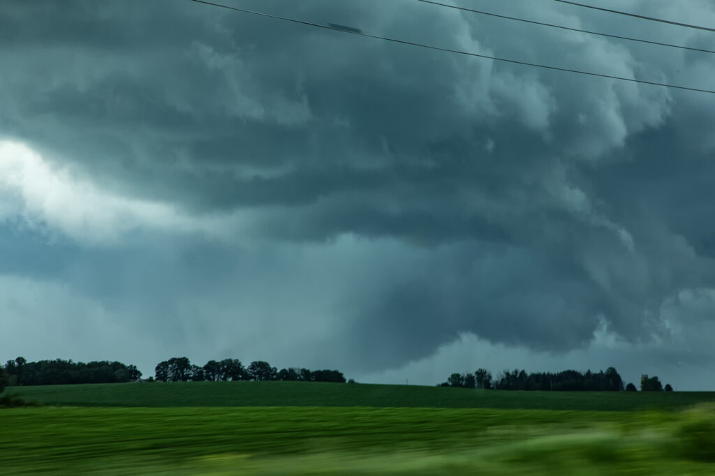
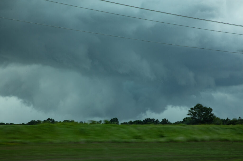
June 25th Southeast Minnesota Tornadic Supercells
June 25th was an unusual day to say the least. Very high dewpoints in the mid to upper 70s were present along a boundary in southern MN. This boundary slowly moved north through the day. As it did, storms formed along and just north of it from around Alber Lea north and northeast. We intercepted one such storm that was tornado warned. As it rode the boundary, it spun hard. It had a good velocity couplet on radar and developed low level rotation quite obvious! Soon a broad rotating lowering formed with condensation fingers rising into it. Then a funnel formed that we could not confirm touched down. There were tornado reports from other locals that were right near it. These types of set ups are extremely difficult to chase, let along witness a tornado with numerous storms along and north of the boundary. But it was a pretty fun day, with decent results!
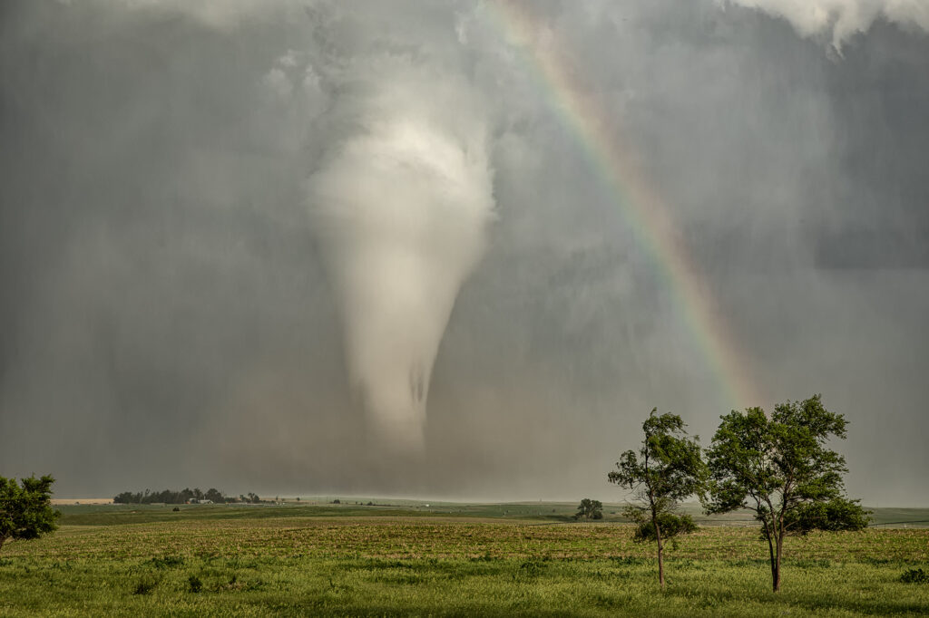
June 16th Dickens, Nebraska Once a Decade Tornado!!!!!!
June 16th, a day that is now etched our my mind forever. Two targets were evident in the morning, the warm front in Minnesota and the front/theta e axis in Nebraska. Minnesota produced a few tornadoes, but nothing compared to the long lived photogenic beauty in Nebraska. After chasing in Montana the day before, we had a long drive to make Nebraska in time for storm initiation. Over 4000 CAPE, moderate shear and near 70 dewpoints present, we knew we had no time to waste! We blasted towards the target south of I-80 between Ogallala and North Platte, as we approached Lake McConaughy, strong updrafts started forming south of North Platte. We jumped on I-80 headed east as one updraft took over the show! It looked like a nuclear bomb had gone off! Within 20 minutes a tornado warning was issued and almost immediately a tornado was reported on the ground. This was a landspout that last 8 minutes. Soon after that a supercellular tornado formed, and firmly planted itself just east of Dickens. We were finally in a position to blast south on the back side of the supercell and could see this tornado 25 miles away! About 20 minutes later we arrived near Dickens as the tornado became a huge cone/stovepipe shaped tornado, barely moving! We sat up our cameras and camcorders and captured this 45 minute long EF2 tornado as is barely moved, only traveling 3 miles in it’s lifetime. Sitting up on a hill gave us a great view of the tornado and the sun lighting it almost white with a rainbow was a sight to behold! One of the prettiest tornadoes this decade! It eventually roped out, moving slowly southwest and tried a couple more times to produce. It was amazingly electrified during this phase as well, with a classic liberty bell shaped structure! A day we’ll never forget! Enjoy the pics!

June 13th Potter, Nebraska Surprise Tornadic Supercell
June 13th looked poor on paper. Modest shear, moisture and CAPE along the Cheyenne Ridge between Colorado and Nebraska. We started west towards Cheyenne where moisture was really quite meager. Much better and deeper moisture and instability existed further east, from near Sidney, Nebraska eastward. Strong easterly winds were pushing that moisture westward, but it didn’t look like it would make it in time before storms collapsed. Outflow surge from Cheyenne storms blew east and when it interacted with that deeper moisture, a line of storms, some supercells, exploded. Near Potter, NE on I-80 an updraft anchored and spun hard. It became incredibly electrified! It also produced a 5 minute multivortex tornado before it produced a tapered truncated cone tornado right near the interstate. Staying down wind a few miles allowed us to get out of the intense lightning threat, but also limited the view we had. But we were able to see the tornado and structure of the supercell together. It was very nice! Quite the surprise ending to a marginal day. Once in awhile nature gives you those surprises! Enjoy the pics!
June 10th Marfa, Texas Supercell and Weak Tornado
June 10th took us deep into southwest Texas in the Davis Mountains. One of the prettiest places in the state. Northwest flow aloft and southeast surface winds provided decent shear, and dewpoints in the low to mid 60s, fueled 3000 CAPE. The ingredients were there for severe storms and supercells. What we didn’t expect was to see a tornado, albeit a weak one! Mid afternoon we were near Alpine watching storms come off Mt Livermore and move southeast. The struggled mightily, so we left there and headed west to the surface triple point just west of Marfa. A supercell had formed and was anchored so we knew it would be spinning. As we arrived, a big blocky wall cloud was present with intense cgs raining down to our west. Soon a clear slot formed and you coudl see the RFD wrapping around the mesocyclone. Within another 15 minutes a dirt column formed and a small funnel was visible at cloud base. This persisted for about 8 minutes. What a surprise! The storm became outflow dominant due to weak flow at anvil level, and soon a tornado warning was issued (for the one we saw, but reported by another storm chaser!). We stayed with it for a bit longer until the outflow surged out from the supercell and it collapsed. A nice end to a day that we though would produce a decent storm. Enjoy the pics!
June 8th Lakeview, Texas Tornado Warned Supercell
June 8th featured a couple of different plays. First one could play the cold front dropping south across the high plains into the OK/TX panhandles. This ultimately produced one tornadic storm that was high based ingesting only dewpoints in the 50s, but still managed to drop a couple of tornadoes. The second play was to chase the area just off the caprock southeast of Amarillo along an outflow boundary with extreme instability and very high dewpoints in the 70s. We chose the southern play based on the great parameters. We arrived in Amarillo as cumulus towers formed southeast of town and developed into severe thunderstorms. One storm latched on to the boundary and spun like crazy, getting tornado warned. We stayed with it south of Claude all the way down to Lakeview and beyond. It was an electrified machine. It also produced huge hail and tried numerous times to produce a tornado. But it did not unfortunately. It was one of those days where the least likely area produced the only decent tornado of the day. Only a couple of chasers played the northern play and were coming from Denver headed to the southern target when the northern storm went up and produced. Luck of the draw lol!!! Anyway, our supercell was a beauty! It eventually gusted out so we moved southwest along the dryline to play more supercells. We encountered one near Jayton that came very close to producing a tornado. It was also tornado warned. Soon, everything merged into a line and the show was over. Fun day for all! Enjoy the pics!
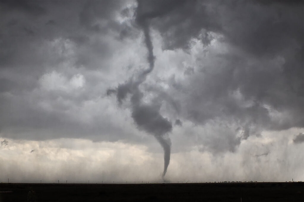
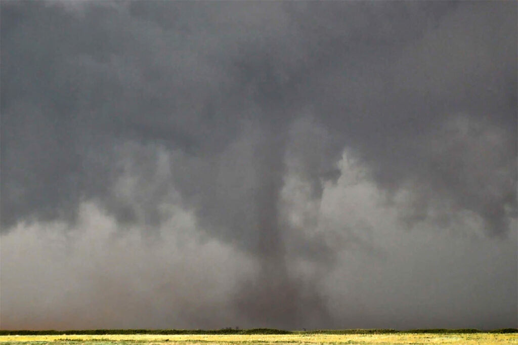
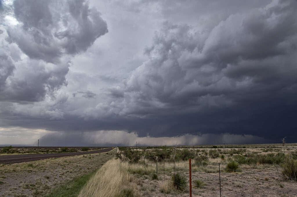
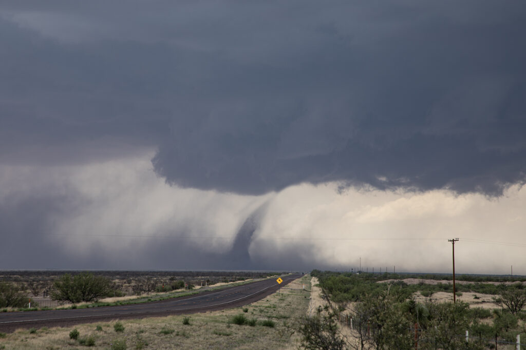
June 5th Morton, Texas Wedge Tornado and Many More!!!!!
June 5th. What more can be said??? One of the most incredible days in the 2025 storm chasing season! We started off the day in Lubbock, Texas. The target was to find the triple point, which appeared based on satellite and surface obs to be near Dora, New Mexico. We positioned ourselves near Causey, NM where 2 large updrafts were forming. We decided to play the southern most developing storm. The storm sat anchored for a couple of hours before it finally started its trek southeast along an outflow boundary from previous days storms. Just before it reached the Texas border it spun hard and became tornado warned. The merry go round ensued and quickly dropped a tapered cone tornado that was on the ground for a couple of minutes. It lifted as the storm moved east, but the low level mesocyclone stayed in tack. Soon several different tornadoes formed, and eventually stout stovepipe tornado descended. After this another elephant trunk shaped tornado formed as well. You could see the occlusion happened with the old meso dying and a new one forming east of us. We blasted east to get on the other side of it and quickly an extremely large, very dusty tornado formed. It grew to a mile wide and just missed the town of Morton, Texas. We got ahead of the tornado as it became completely obscured with dust and rain. Several miles east of town it disippated, and yet another tornado formed just to our north. Within a few minutes very strong RFD winds and atomized rain smacked into us, so we blasted east to try to get ahead of it. As we did, another ghostly white tornado came out of the rain just to our north. Realizing the mesocyclone was hopelessly buried in dirt and rain, we blasted east towards Lubbock. Another very large tornado occurred right to our north that we could not see, so we decided it was time to call off the chase. Later that evening, after we ended the chase, one last tornado formed near Reece Center. Since we were already done and settled into our hotel, we did not go back out because it would have been too late to make it there. An absolutely CRAZY day and I am so thankful there were no fatalities with this supercell. Enjoy the photos and this Youtube video of the Morton tornado. Another video will be made soon showing the rest of the tornadoes!