Blog

April 25th Sweetwater, Texas Stunning Supercell!!

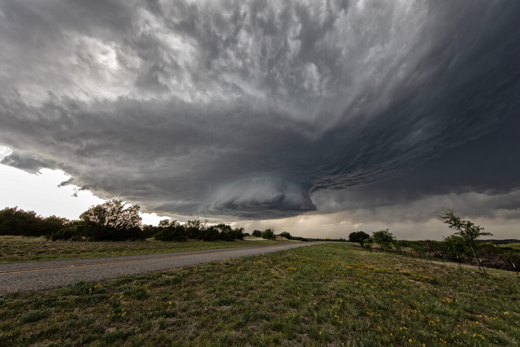
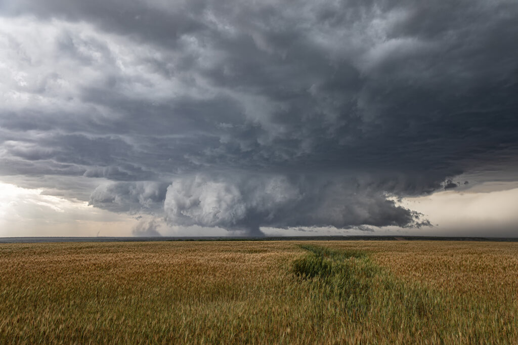
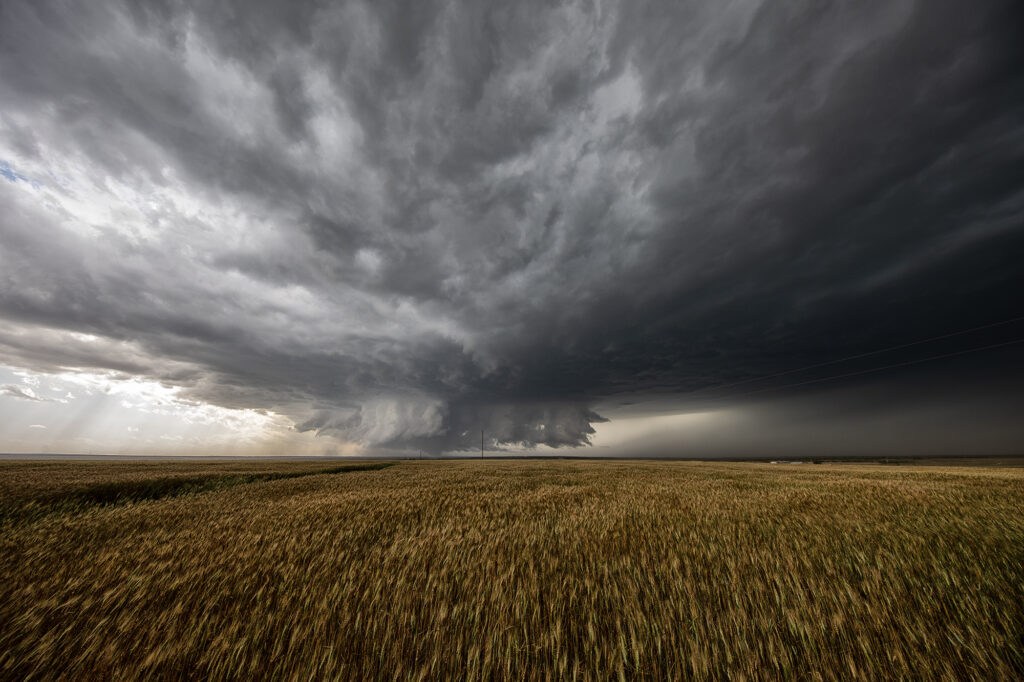
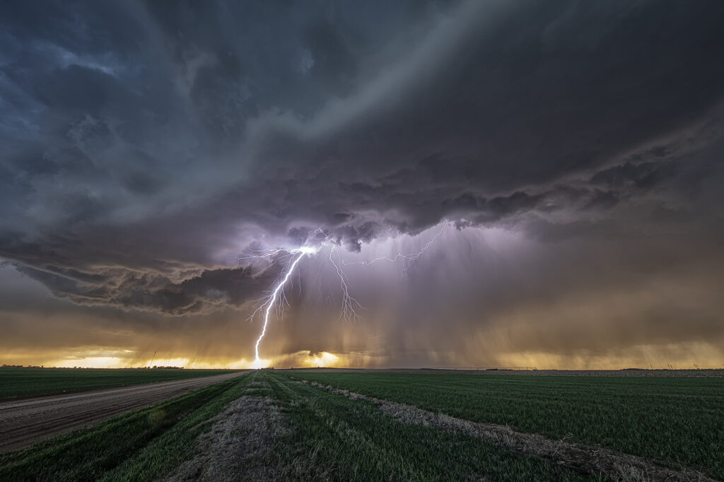
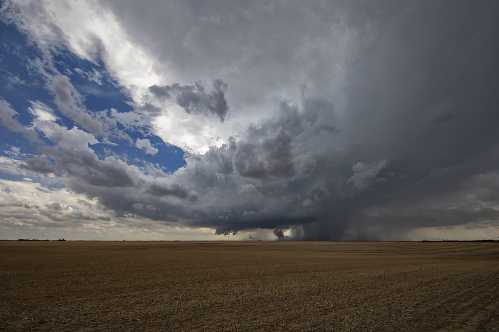
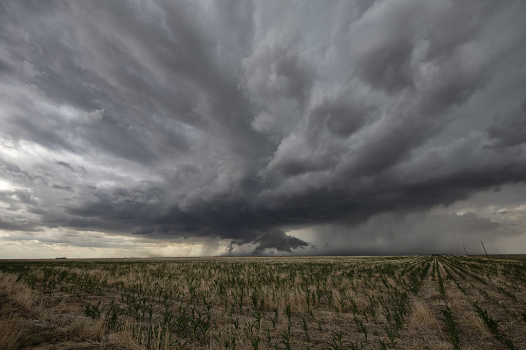
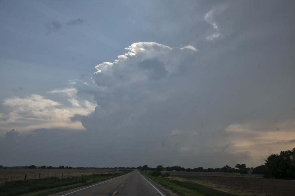
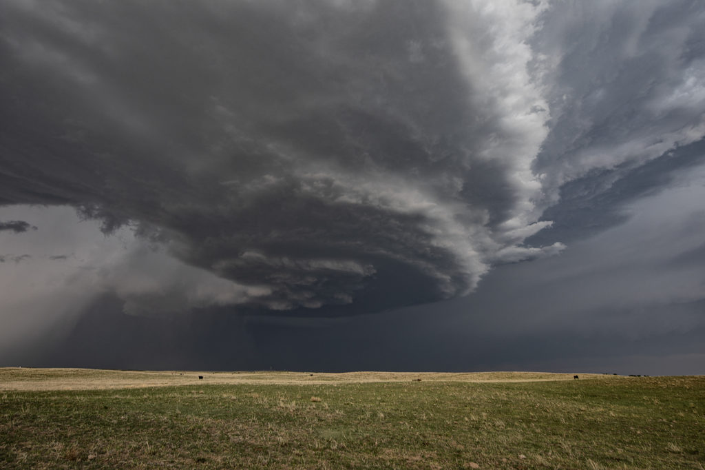
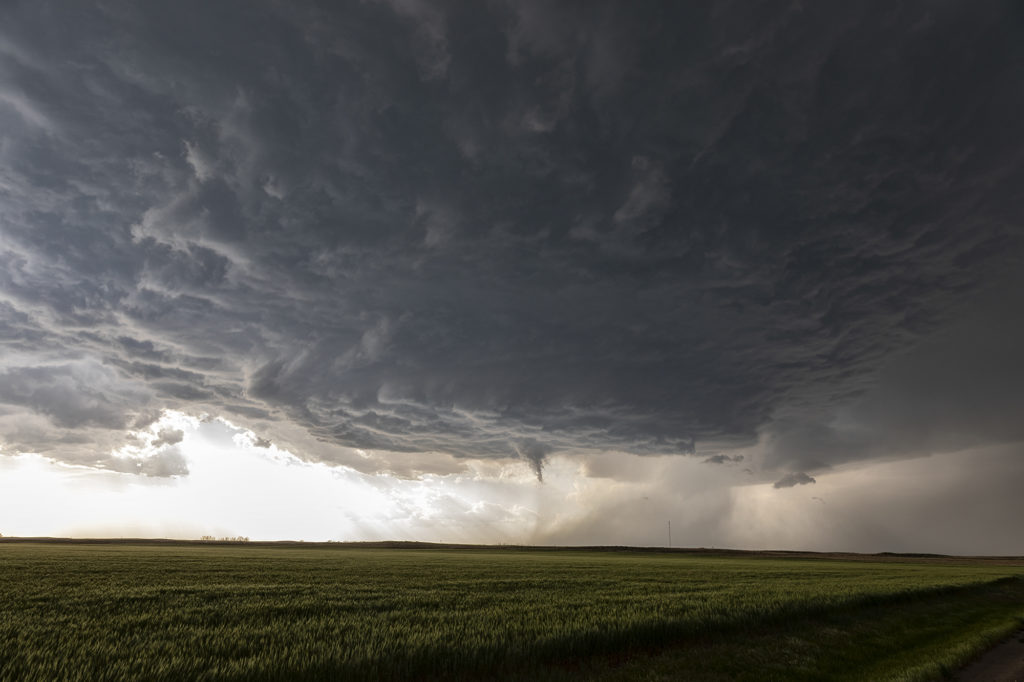
April 25th featured a short wave trough approaching Texas. This lead to a surface trough in eastern New Mexico that helped bring moisture northward from the gulf of Mexico. Southeasterly surface winds raced northwest towards a dryline in west Texas where a weak low had developed. Models were fairly consistent developing storms, some supercells, near the Snyder/Sweetwater area and they nailed it. We approached Sweetwater later in the afternoon as cumulus towers were seen. A high based severe thunderstorm produced a couple shear funnels due to strong motion at cloud base. This storm became a prolific hailer as it moved towards town and eventually to the southeast.

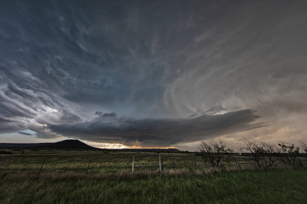
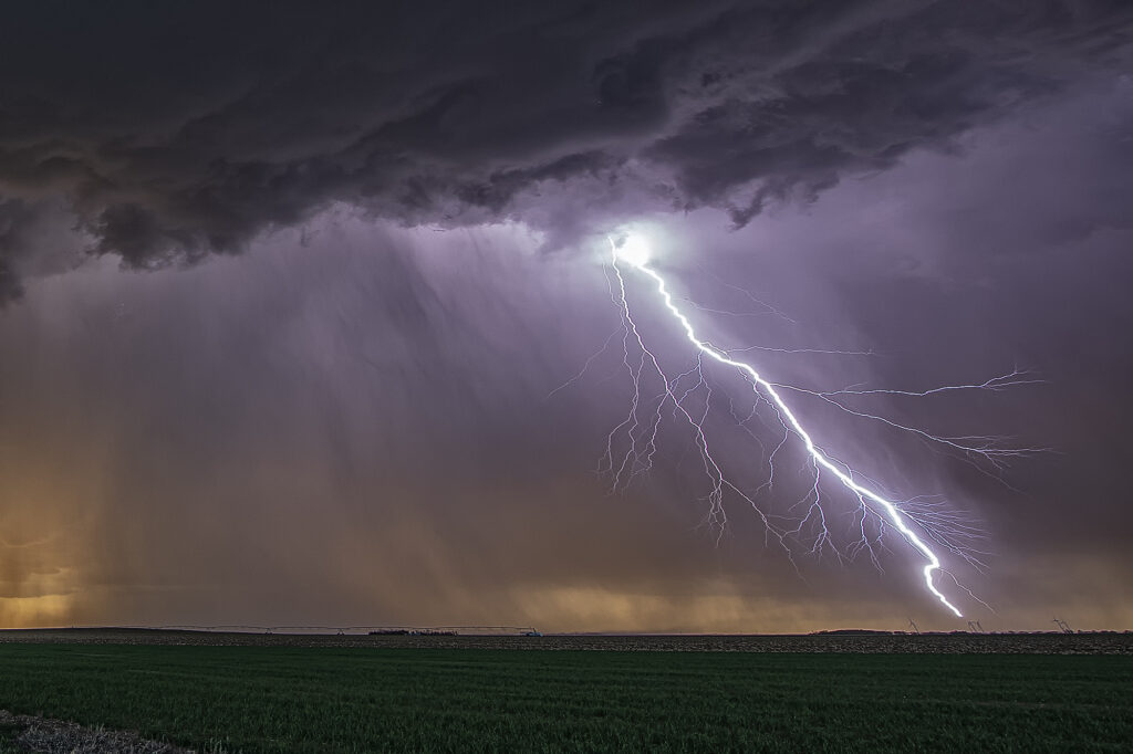
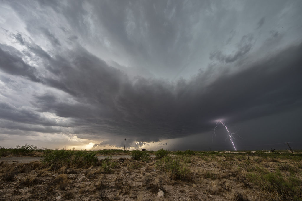
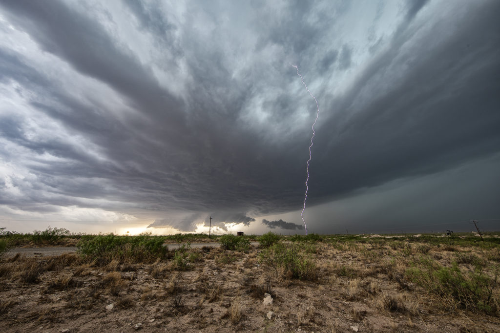
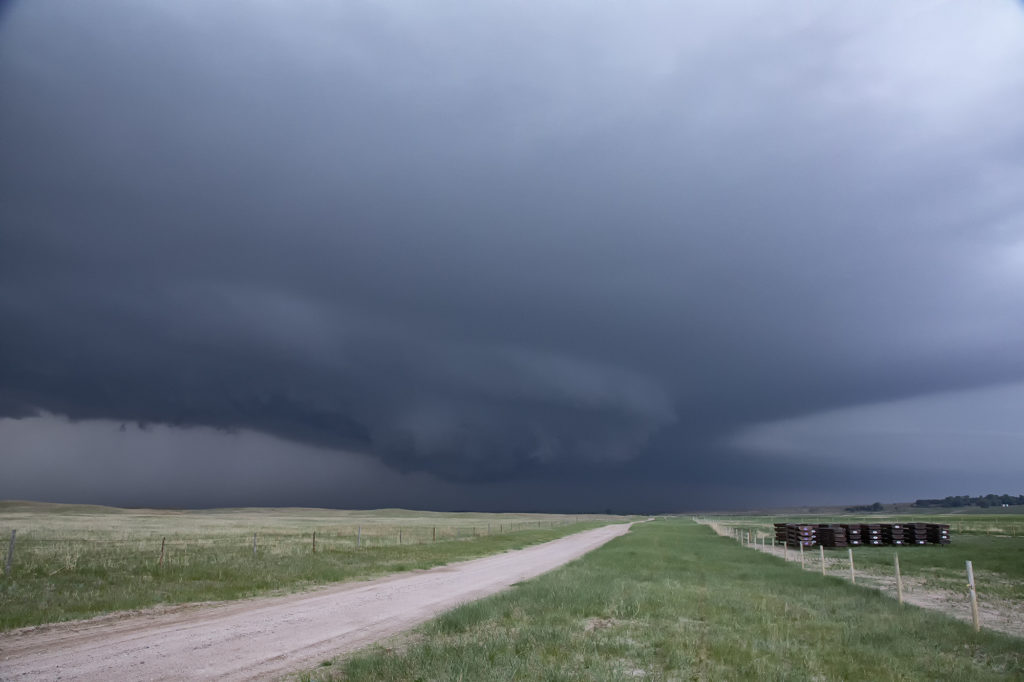
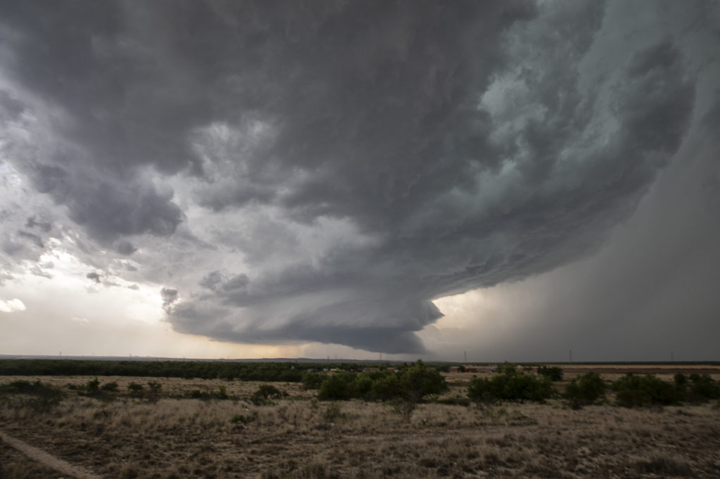
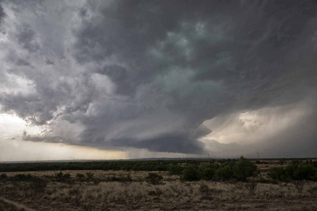
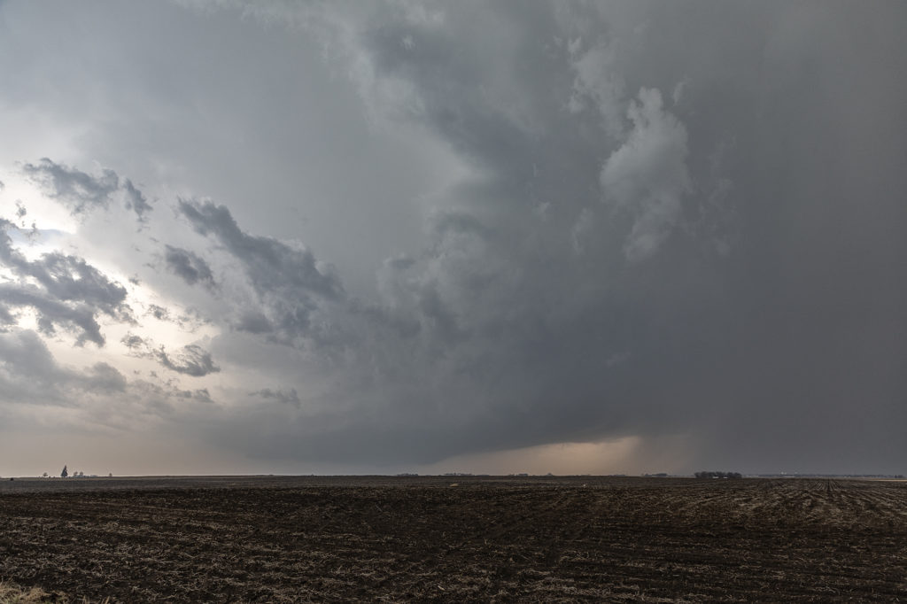
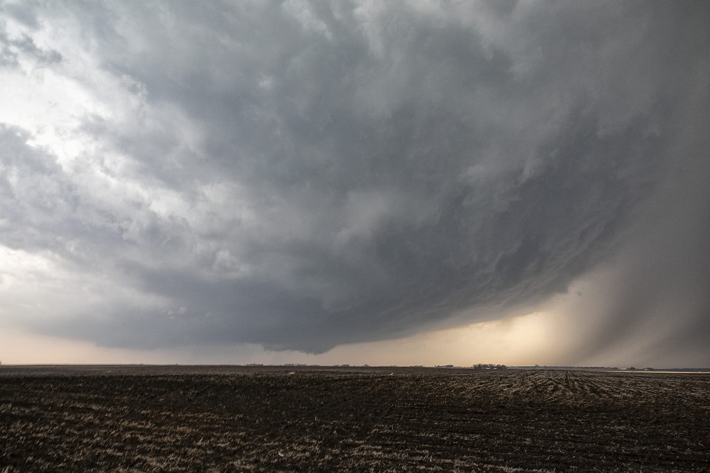
South of town, the structure was magnificent! A sculpted updraft with striations showed just how well organized this supercell was. As darkness fell, the storm maintained its intensity as it moved southeast. Lightning illuminated the structure in the dark and made for quite the scene. Finally, about 10pm we let it go as it weakened and we drove towards Abilene where we spent the night. We came across copious amounts of hail, some close to tennisball sized.  A fun day and it’s always amazing to see nature’s artistic side in a gorgeous sculpted supercell! Enjoy the pics!

April 22nd Doole, Texas Potentially Tornadic Supercell

An interesting set up with northwest flow aloft on April 22nd. A weak low along with a sharpening dryline and warm front, set up a triple point northwest of San Angelo, Texas. Moisture would be the issue as dewpoints were in the 50s. Shear was good and convergence at the triple point would fire off a storm that became a long lived supercell. As the storm turned along the boundary, it started spinning strongly. After an interaction with another weak cell which it destroyed, it developed intense rotation, and on radar a classic scorpion tail hook echo formed with a good velocity couplet. RFD dirt was seen wrapping around the southern periphery of the storm and soon a large dirt bowl formed and persisted for about 5 minutes. Tornado? Possibly. But the storm also had hail the size of softballs. It soon moved east into less unstable air with lower dewpoints and it slowly decayed over the next couple of hours. A GREAT way to start the 2023 official tour season with Tour #1, the Close Encounters tour, witnessing this supercell. Enjoy the pics!!!

April 14th Medicine Lodge, Kansas Severe Thunderstorm

April 14th had plenty of shear, decent instability and a dryline in place. However, moisture was lacking, but enough of present to fire severe storms along the dryline late afternoon into the evening. I took the group the furthest south we could to get closer to better moisture, but still have enough forcing to help maintain storms as they moved off the dryline. Several storms formed and most went severe warned. However the tail end storm, as is often the case, became the strongest. Near sunset it started producing numerous lightning strikes, some starting fires. The structure was pretty good with the shear in place and it gave us a nice show as it rolled east towards Wichita. A fun day, we got about what we thought we would and had some very pretty scenes in the gypsum hills south of Pratt. Enjoy the pics!

April 4th Pleasantville, IA Tornadic Supercell

April 4th was a complicated day. A powerful upper level low would pivot out onto the plains late in the period. Low level moisture was fairly shallow for a big event, with pockets of dry air mixing out the better moisture. It seemed like two areas would be the best targets: 1) southwest Iowa as the forcing came out, however moisture was forecast to mix (and did!), 2) southeast Iowa and western Illinois in the free warm sector. We sat in Ottumwa for a couple hours waiting for one target to become clear. It never really did. A cluster of storms formed in eastern Missouri and consolidated into a few supercells as they moved into western IL. We started to head that way to chase, but it would have been a long way back to Kansas City that night as several guests had to be back in Denver by late afternoon the next day. Shortly after we headed out to go to IL, the Iowa play started forming. A line of storms, now severe, formed along the dryline west of Osceola and moved east. The tail end storm really started getting it’s act together so we quickly turned around and headed toward Pella (where we saw a tornado 2 years ago!).  As we approached Pella, a tornado warning came out with a confirmed tornado towards Pleasantville, which was another 15 miles west. We did all we could to get there, but were only able to get a glimpse of the pretty tornado before it dissipated. We stayed with the supercell as it approached the warm front and became tornado warned again. A brief spin up happened south of Malcom. The storm continued its path across the warm front, weakening in the colder air.  Here’s a few pics of what we saw with the supercell, distant tornado and the second spin up. Enjoy!!!!

July 6th Eastern Colorado Tornado Warned Supercell

July 6th took us to eastern Colorado. Good moisture and instability, along with modest shear and upslope flow into the Palmer Divide would set the stage for supercells and multicells. One such storm formed just west of Limon and right turned southeast towards Hugo. As it did, the structure improved as severe thunderstorm warnings were issued for golfball sized hail. As it moved further east, it became better organized and was tornado warned. It didn’t produce one, but you could clearly see the rotation in the storms updraft. As it moved furth east towards Eads, it encountered drier are and eventually weakened. Pretty storm, and the eastern plains of Colorado certainly needed all the moisture it can get! Enjoy the photos!

June 1st Southeast New Mexico Powerful Supercell

The first day of June took us towards far southeast New Mexico. A couple supercells developed along the dryline west of Jal and drifted eastward, becoming quite prolific hailstorms. The storm’s structure was very nice and it had a wall cloud throughout it’s life cycle. However, low level rotation was lacking. The cell was an amazing lightning machine producing numerous cgs every minute. As it moved southeast, other storms for and soon a cluster of high based severe storms rolled into southwest Texas. We went to our hotel in Midland and watched as the storm approached from the northwest, with tons of blowing dirt, lightning and hail.

May 29th Central Nebraska Tornado Warned Supercell

May 29th was the classic “day before the big day” type set up. Moisture and instability were rapidly increasing along a lifting warm front in Nebraska, and shear was quite strong. Models showed late afternoon and early evening supercells forming north of Broken Bow and that is exactly what occurred. It took awhile from the main supercell to root along the boundary and get organized, but once it did, it became a formidable storm! Eventually it became tornado warned as it moved to the northeast and stayed warned for a few hours. Due to storm motion and poor roads, it became virtually impossible to stay with it. Near O’Neill we had to let it go and head to Sioux Falls, SD for the night. The storm had good structure, and it had a well defined rotating wall cloud. It just couldn’t tighten enough to get a tornado to form. Enjoy the pics!

May 24th San Angelo, Texas Supercell

We weren’t expecting big things this day. An advancing cold front was pushing south across the area near San Angelo and the fear was it would undercut storms that would develop. As we arrived, one storm rode the boundary for a couple hours before being undercut and became for formidable supercell. It dropped hail the size of softballs and had some really pretty structure. However, as feared, the cold front continued to push south and undercut the storm. From then on it was a battle to stay ahead of anything that wouldn’t be undercut as the front continued its steady push southward. A quick end to the day, but still a fun day w

ith a great supercell!

May 14th Southern Kansas/Northern Oklahoma Supercells

Lack of low level moisture was the theme this day. Good shear was present, however due to limited moisture, cloud bases were too high to produce tornadoes. Storms formed over south central Kansas and right turned into northwest Oklahoma as they became supercells. One storm even developed a clear slot and tried to produce a funnel. The intense lightning caused several grassland fires as well. Hail to the size of tennisballs also fell. They persisted through early evening before weakening due to loss of daytime heating. Very photogenic to say the least!

April 12th, 2022 Gilmore City, Iowa Strong Tornado

April 12th had a lot going for it. The problem was there were two clear targets. Play the better moisture, but less shear in central Texas, or play the warm front with a bit less moisture but better shear in Iowa. We started the morning in Oklahoma City and made the decision at 6am to head to Iowa, while looking over our shoulder at Texas. At the end of the day, both targets produced strong tornadoes! As we headed north it became pretty clear that the warm front was going to be our target with a strong theta-e axis slamming into it, instead of playing the triple point back northwest of Omaha. That decision was a good one as by mid afternoon, the warm front lit up with intense storms, some of which were supercells.

We had over a 500 mile trip to get into position and we made it by minutes! We stopped in Dakota City for fuel quickly and then headed west, to just east of Gilmore City. The supercell became tornado warned as we left Dakota City. So, with storm motion showing 50 mph plus, we positioned ourselves about 6-10 miles down wind of the storm, figuring it would take a few minutes for it to become tornadic. It sure didn’t wait long! I wish we would have gone a couple more miles south to get closer, but as the tornado formed, we decided to stay put so as not to miss any of it and thought it would come very close to us. The models showed the potential of long tracked tornadoes, however this one dissipated as it came about a mile to our west. We stayed with the supercell for awhile as it became very messy and hp in nature. Eventually we blew it off, as we knew we had to be in Arkansas the next day, and stopped to watch an electrified storm on the way to our hotel.

Great day, beautiful storms and fortunately there were no injuries or fatalities from the tornadoes! Enjoy the pics!