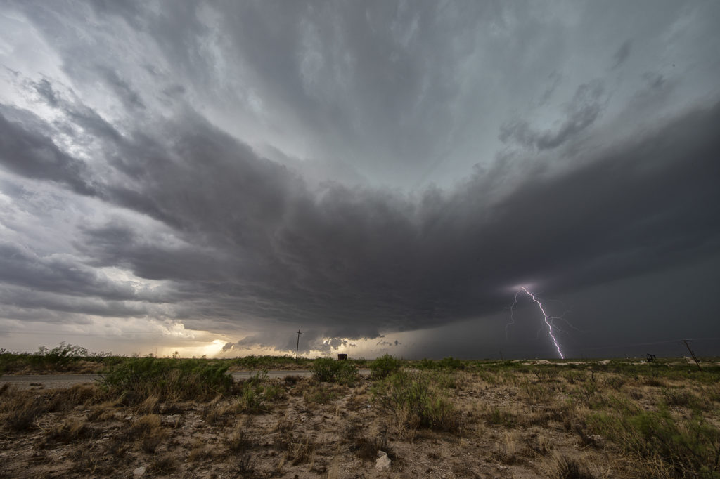
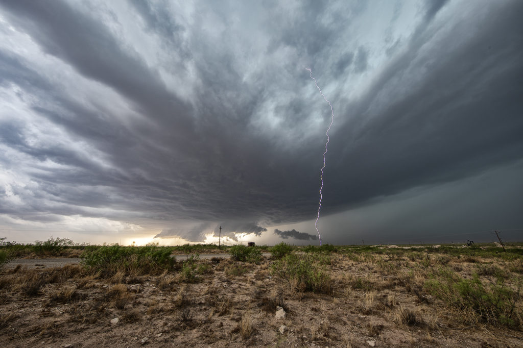
The first day of June took us towards far southeast New Mexico. A couple supercells developed along the dryline west of Jal and drifted eastward, becoming quite prolific hailstorms. The storm’s structure was very nice and it had a wall cloud throughout it’s life cycle. However, low level rotation was lacking. The cell was an amazing lightning machine producing numerous cgs every minute. As it moved southeast, other storms for and soon a cluster of high based severe storms rolled into southwest Texas. We went to our hotel in Midland and watched as the storm approached from the northwest, with tons of blowing dirt, lightning and hail.
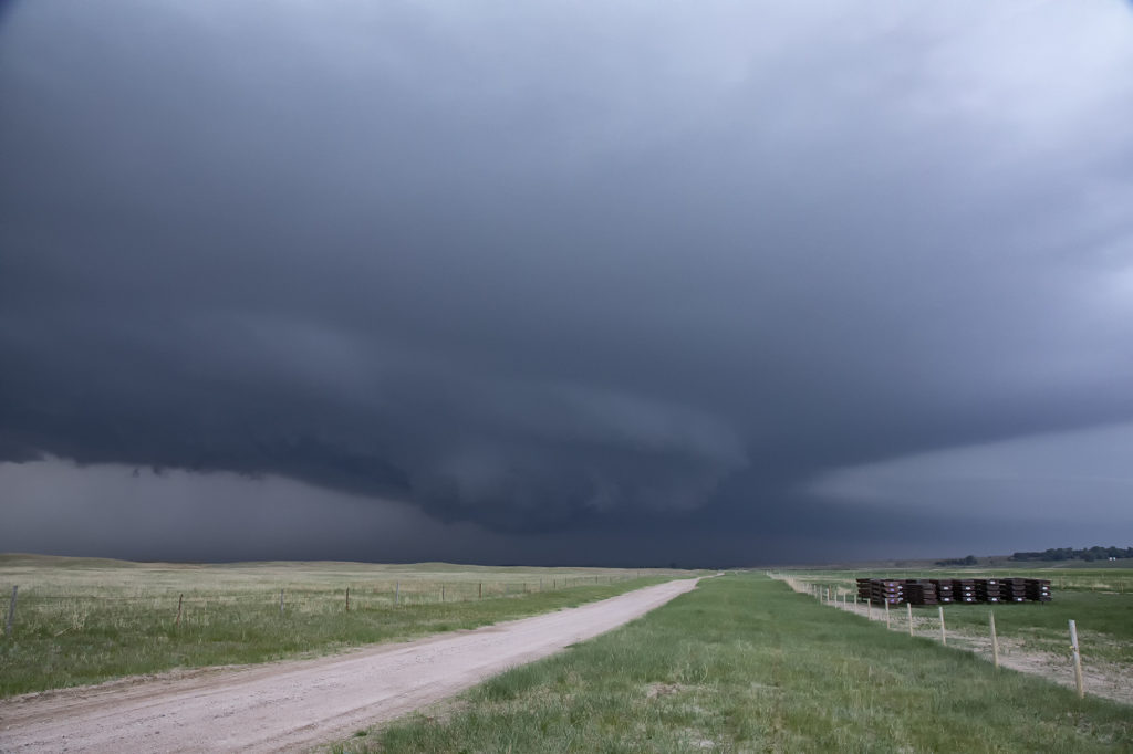
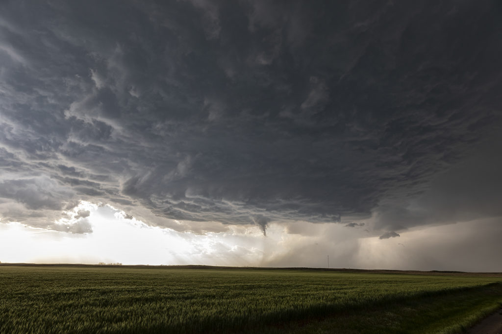
May 29th Central Nebraska Tornado Warned Supercell
May 29th was the classic “day before the big day” type set up. Moisture and instability were rapidly increasing along a lifting warm front in Nebraska, and shear was quite strong. Models showed late afternoon and early evening supercells forming north of Broken Bow and that is exactly what occurred. It took awhile from the main supercell to root along the boundary and get organized, but once it did, it became a formidable storm! Eventually it became tornado warned as it moved to the northeast and stayed warned for a few hours. Due to storm motion and poor roads, it became virtually impossible to stay with it. Near O’Neill we had to let it go and head to Sioux Falls, SD for the night. The storm had good structure, and it had a well defined rotating wall cloud. It just couldn’t tighten enough to get a tornado to form. Enjoy the pics!
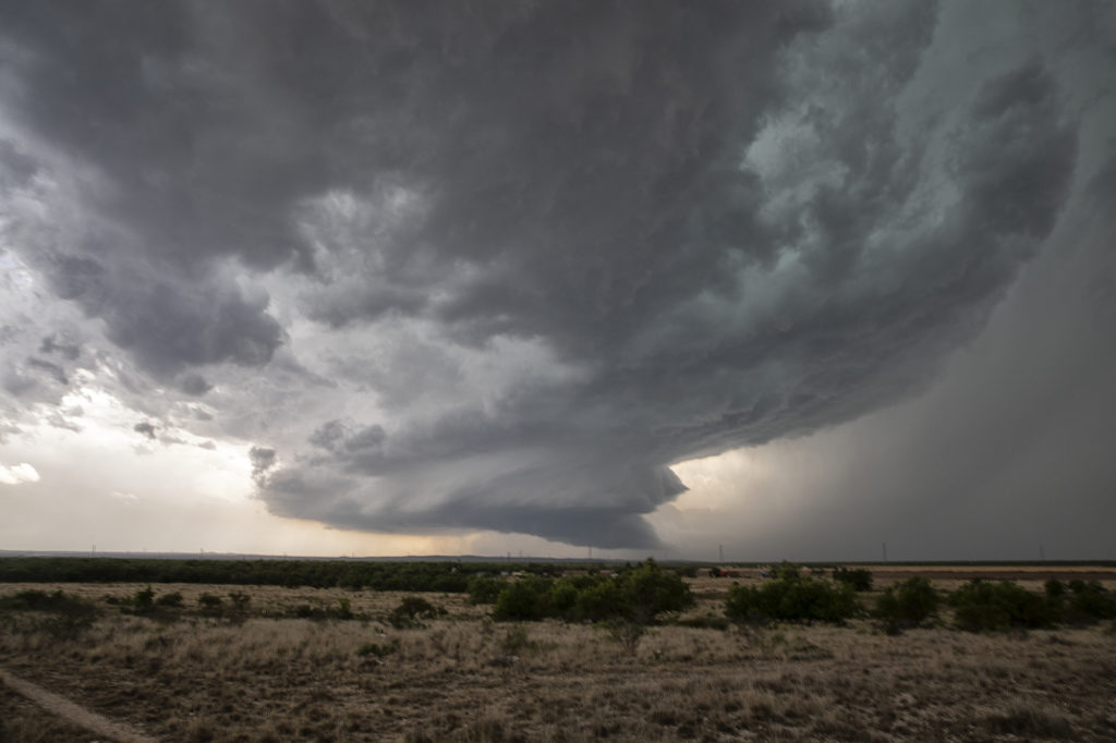
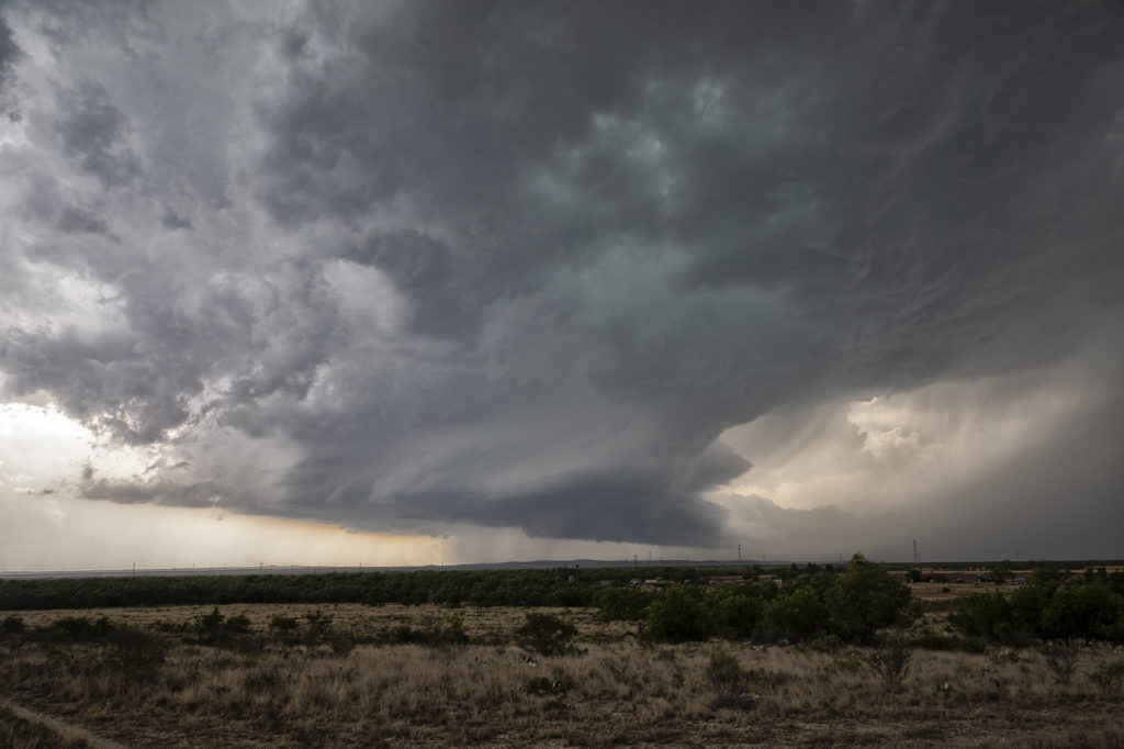
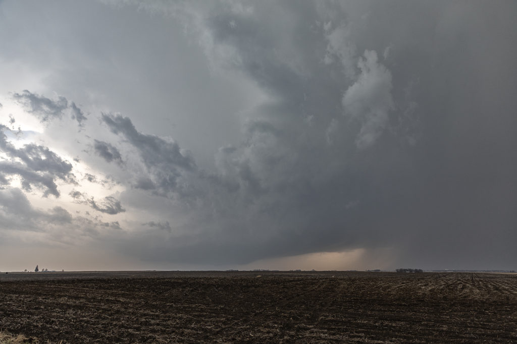
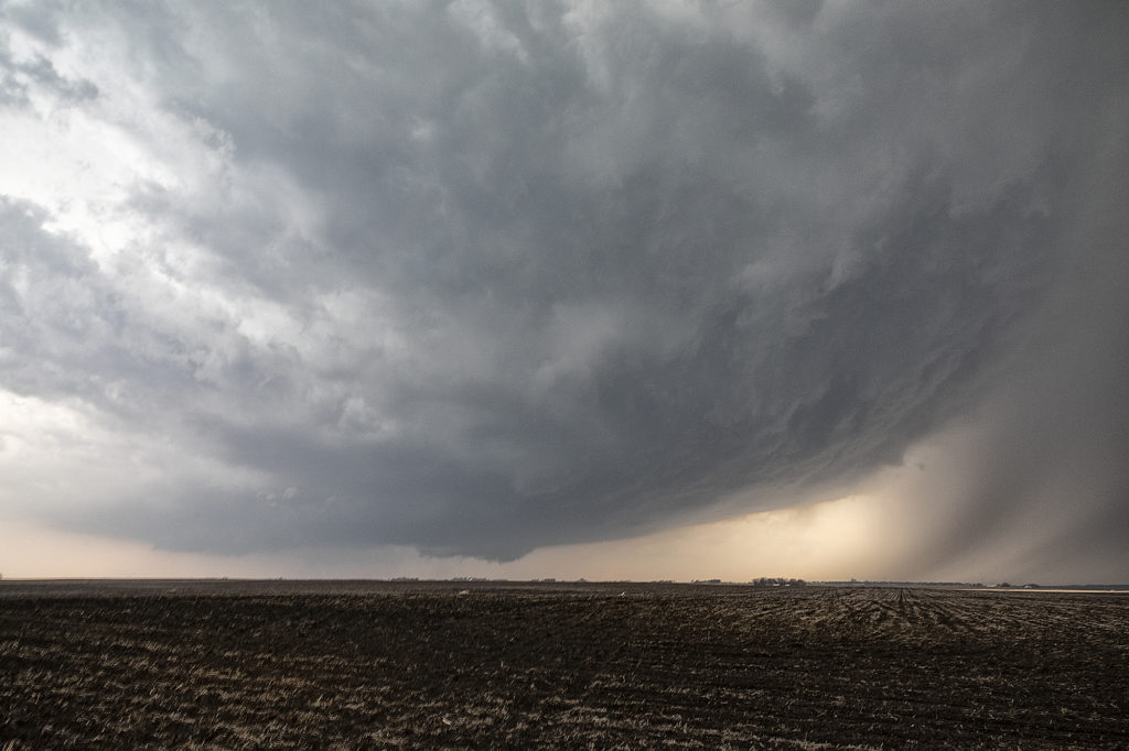
May 24th San Angelo, Texas Supercell
We weren’t expecting big things this day. An advancing cold front was pushing south across the area near San Angelo and the fear was it would undercut storms that would develop. As we arrived, one storm rode the boundary for a couple hours before being undercut and became for formidable supercell. It dropped hail the size of softballs and had some really pretty structure. However, as feared, the cold front continued to push south and undercut the storm. From then on it was a battle to stay ahead of anything that wouldn’t be undercut as the front continued its steady push southward. A quick end to the day, but still a fun day w
ith a great supercell!
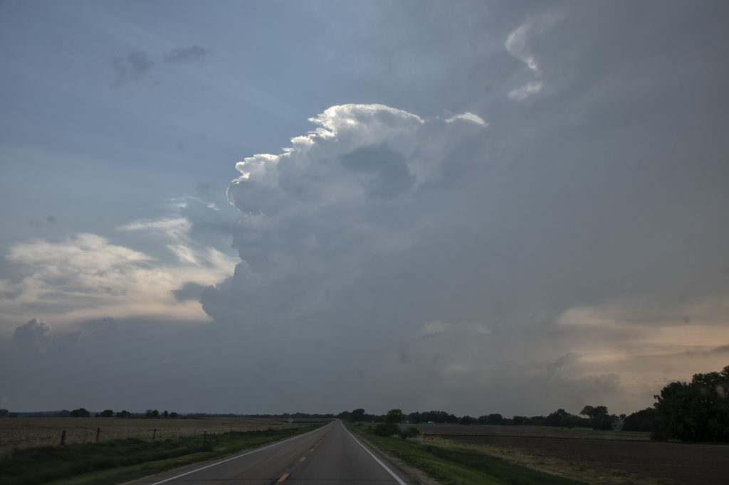
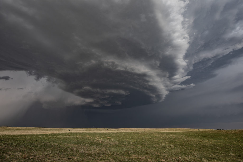
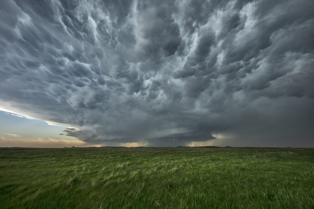
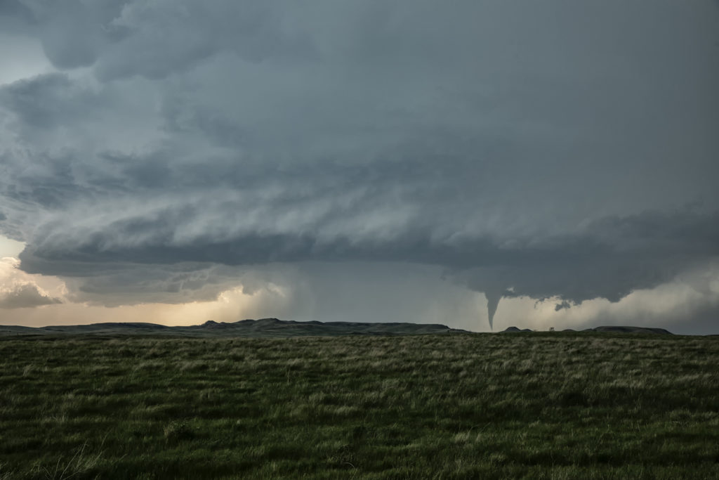
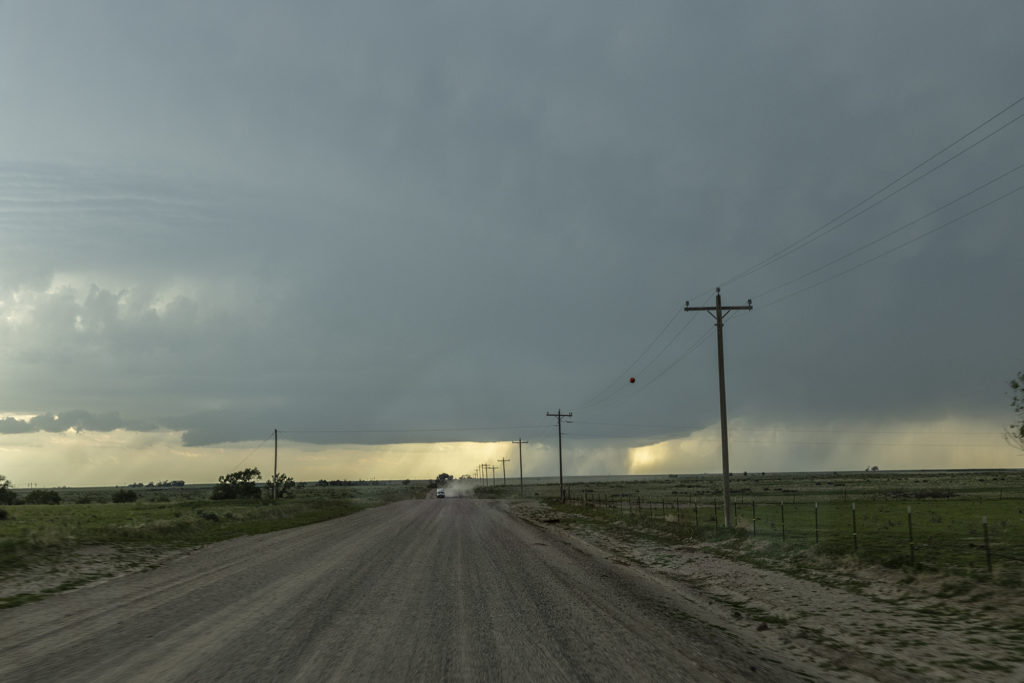
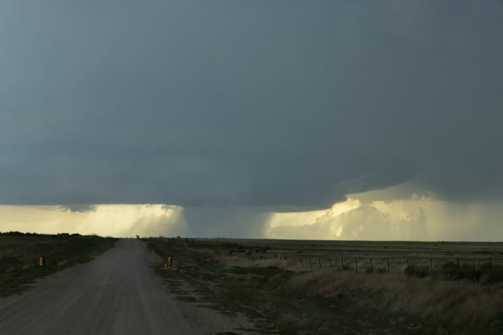
May 14th Southern Kansas/Northern Oklahoma Supercells
Lack of low level moisture was the theme this day. Good shear was present, however due to limited moisture, cloud bases were too high to produce tornadoes. Storms formed over south central Kansas and right turned into northwest Oklahoma as they became supercells. One storm even developed a clear slot and tried to produce a funnel. The intense lightning caused several grassland fires as well. Hail to the size of tennisballs also fell. They persisted through early evening before weakening due to loss of daytime heating. Very photogenic to say the least!
April 12th, 2022 Gilmore City, Iowa Strong Tornado
April 12th had a lot going for it. The problem was there were two clear targets. Play the better moisture, but less shear in central Texas, or play the warm front with a bit less moisture but better shear in Iowa. We started the morning in Oklahoma City and made the decision at 6am to head to Iowa, while looking over our shoulder at Texas. At the end of the day, both targets produced strong tornadoes! As we headed north it became pretty clear that the warm front was going to be our target with a strong theta-e axis slamming into it, instead of playing the triple point back northwest of Omaha. That decision was a good one as by mid afternoon, the warm front lit up with intense storms, some of which were supercells.
We had over a 500 mile trip to get into position and we made it by minutes! We stopped in Dakota City for fuel quickly and then headed west, to just east of Gilmore City. The supercell became tornado warned as we left Dakota City. So, with storm motion showing 50 mph plus, we positioned ourselves about 6-10 miles down wind of the storm, figuring it would take a few minutes for it to become tornadic. It sure didn’t wait long! I wish we would have gone a couple more miles south to get closer, but as the tornado formed, we decided to stay put so as not to miss any of it and thought it would come very close to us. The models showed the potential of long tracked tornadoes, however this one dissipated as it came about a mile to our west. We stayed with the supercell for awhile as it became very messy and hp in nature. Eventually we blew it off, as we knew we had to be in Arkansas the next day, and stopped to watch an electrified storm on the way to our hotel.
Great day, beautiful storms and fortunately there were no injuries or fatalities from the tornadoes! Enjoy the pics!
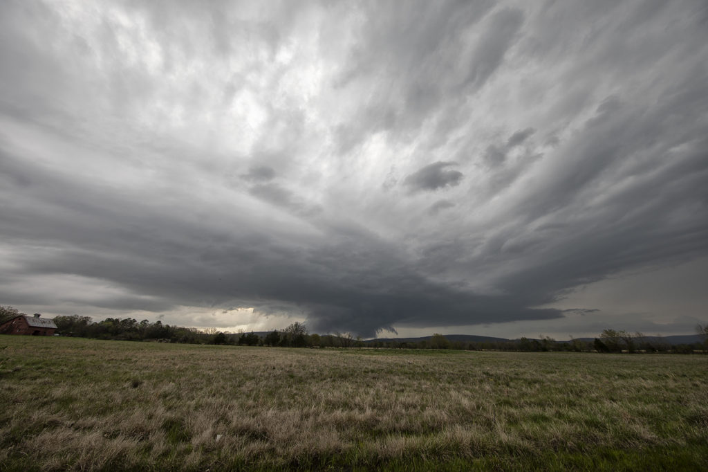
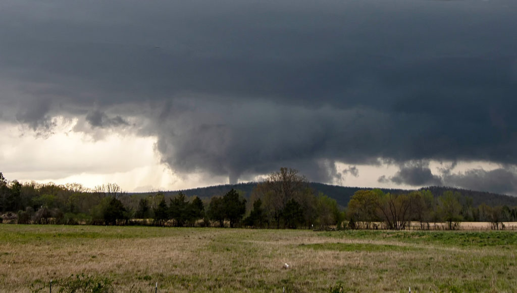
April 11th, 2022 Talihina, Oklahoma Tornado
We couldn’t resist running an on call tour during the week of April 11th. We gathered the guests early in the morning and departed Denver, headed for southeastern Oklahoma. Tough countryside to chase in with the Ouachita and Kiamichi mountains providing plenty of obstacles. However the set up would too good on paper to resist making the 850 miles trek there! High dewpoints, high CAPE, strong shear and a lingering boundary would provide all the ingredients needed for supercells. As we blasted there, about 120 miles out a supercell formed, earlier than models showed, and moved slowly eastward through Ft Smith, Arkansas. Knowing there was no way to catch it, we set our sights on another storm southwest of there. As we approached , it became better organized and soon became severe. We dropped south at Sallisaw, OK toward Poteau and it was evident we needed to get even further southwest to cut in front of this now tornado warned supercell. Coming over the mountains near Talimena State Park, we got a glimpse of a huge block shaped wall cloud. As we approached Talihina, we stopped to watch it wrap up. Within a few minutes it dropped a tapered cone tornado.
Not wanting to let is go through the mountains, we followed it eastward as radar continued to show a massive hook echo, often indicative of a potential tornado. We ended up the Talimena Scenic Drive, which is a stunning high road with views of the mountains at many places. We were on top at 2000 ft with a view of a massive wall cloud to our north and several cg lightning strikes. We stayed with the storm for another hour as sunset came and darkness ensued. We let the storm go as it was steadily weakening and heading into Arkansas. A fantastic chase, caught our first tornado of the year, and was reminded just how difficult it is chasing in the mountains of eastern OK/western AR! Enjoy the pics!
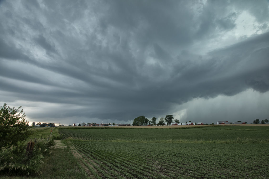
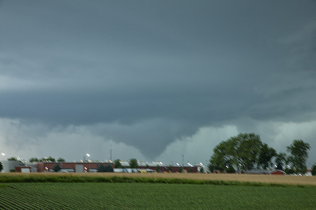
June 20th Pella, Iowa Tornado
June 20th featured extreme instability, moderate wind shear and good lift along an advancing boundary over Iowa. We started the day from Denver, CO as it was the first day of the tour. After an early departure, we made it just east/southeast of Des Moines, Iowa (650 miles later!) just in time for storms to explode. The first supercell we intercepted was just east of Des Moines and never had the “look” like it wanted to become tornadic. Nice structure and a rotating wall cloud occurred, but it could never tighten up enough to produce a tornado. We dropped south and headed back west a little bit as a second storm quickly became organized. It developed a strong hook echo on radar to the west of Pella. As we arrived in town near the factory, we stopped to watch. Intense lightning was also occurring, a tell tale sign of storm intensification. Within a few minutes, a large bowl shaped funnel formed. Soon it developed into a full fledged cone shaped tornado that was on the ground for several minutes. In my haste to shoot video, time lapse and digital images, I failed to get a proper focus on my camera and thus most images were slightly blurry. The tornado dissipated and the storm eventually weakened as it moved east, ending our chase. A great first day for Tour 8!! Enjoy the pics, blurriness and all !!!!!
June 10th Alexander, North Dakota Tornadoes
June 10th was a great set up in northeast Montana and western North Dakota. A warm front lay from Glasgow, MT southeast towards Dickenson, ND. Strong instability, good moisture and fantastic shear set the stage this day for multiple supercells and tornadoes along the warm front/dry line intersection north of Wibaux, MT. Cells initially formed all along the boundary, but the northern cells moved into cooler air and weakened. The triple was a storm producing machine firing off one supercell after another as they each matured and some became tornadic. The first tornado was my favorite, coming over the hills near the Roosevelt National Park area and was quite visible. The second tornado was a bit further away and choked with rain and very large hail, making photos hard to see. Nonetheless, it was a spectacular day and great results for Tour 7! Enjoy the photos!
May 29th Campo, Colorado Large Tornado
May 29th was a surprise day! It was our inbetween tours day with tour 5 guests arriving in Denver. With the potential set up in southeast Colorado, we decided to gather those who had arrived in Denver and blast south to the southeast corner of the state. Models showed a supercell developing on the Raton Mesa and slowly tracking towards the southeast through the evening hours. We were on the road and in our target late afternoon as a cluster of high based marginal severe storms formed as models showed. Great shear was in place but the only issue was a lack of moisture. Late afternoon as we arrived in the Campo area a tongue of higher dewpoints surged into the storms and the southern most storm became quite intense. The base lowered and soon a wall cloud formed. As rain and hail started descending and wrapping around the lowering a rather large cone shaped tornado formed and was on the ground for several minutes. Fortunately it was in open country and hit no towns and ranches! The storm drifted southeast as we went down a gravel road over the mesa. Unfortunately as we came around a corner a stone in the road penetrated one of our tires and blew it out. After we got the tire changed as fast as a NASCAR pit crew, we were back in business. We needed a quick exodus as hail the size of baseballs was falling from the supercell. We made it just east of Kenton, Oklahoma and watched this storm continue to crank away! Since we had to be back in Denver, we ended up leaving the storm mid evening to make our 4 hour journey back home. A great day and superb results! Enjoy the pics!
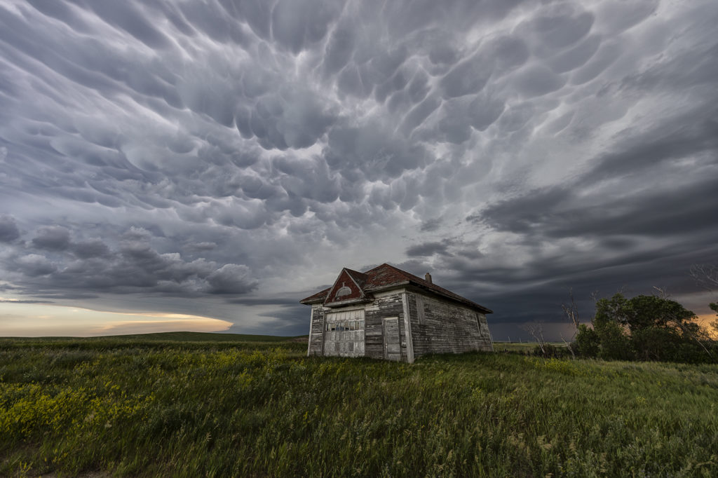
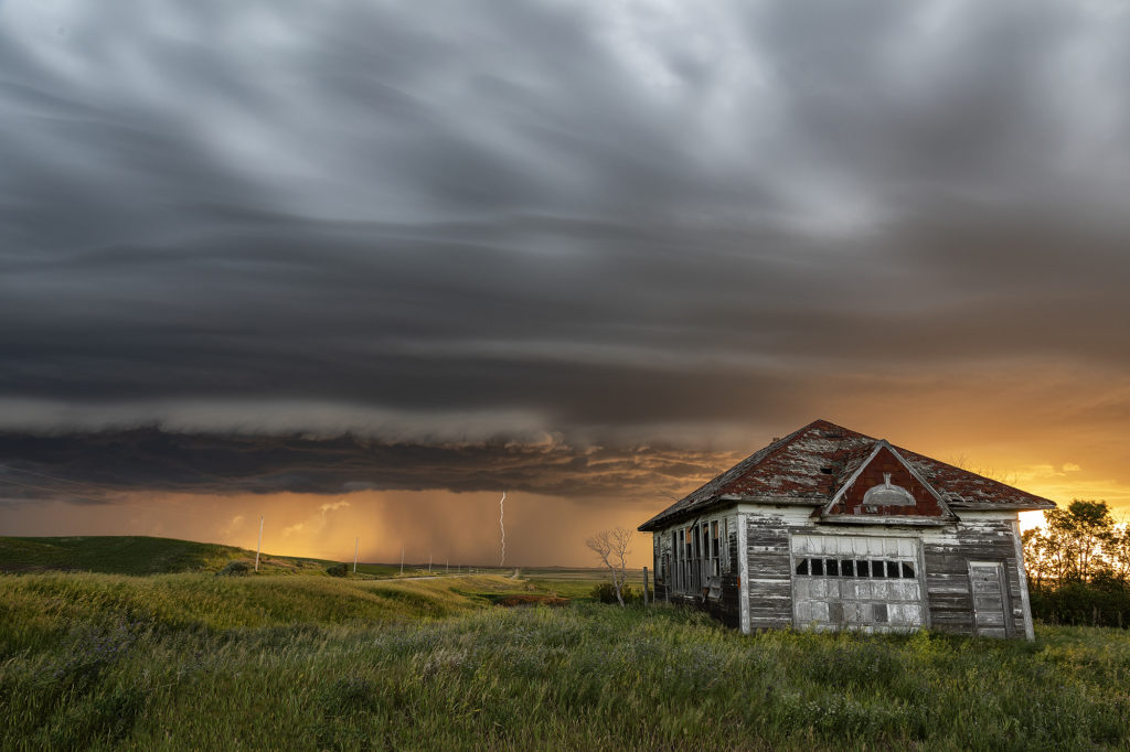
June 28th Central North Dakota Stunning Thunderstorm
June 28th took Photo Tour 3 to North Dakota. Good moisture and instability, coupled with weaker shear would allow a squall line of severe thunderstorms to form northeast of Bismark, ND. We managed to find an old abandoned farmstead south of Wing, ND where we were able to set up and capture some amazing images! The storms, coupled with the lowering sun in the evening, along with the old farmstead, allowed us to capture some of my favorite images from 2020! We stayed in place for a couple of hours photographing the area, and eventually headed back to I-94 and west to Bismark. A landspout tornado occurred well to our south near the South Dakota border, but everyone didn’t mind based on the images each person captured. Spectacular day with nature painting the Photo Tour one of the best set ups one could want! Please click on an image for a larger photo. Enjoy!