It isn’t often that a setup warrants a long trip to Oklahoma in November. However, the setup for November 5th was more than conducive to rotating supercells. Strong shear, good lift, decent moisture, but a narrow instability axis would support supercells this day. I arrived on scene by mid afternoon just as storms exploded. These supercells were very nice, producing large hail, high winds, wall clouds and several attempts at tornadogenesis, but in the end, no tornadoes would form. After dark the lightning was spectacular. Some of the best I have ever witnessed in November.
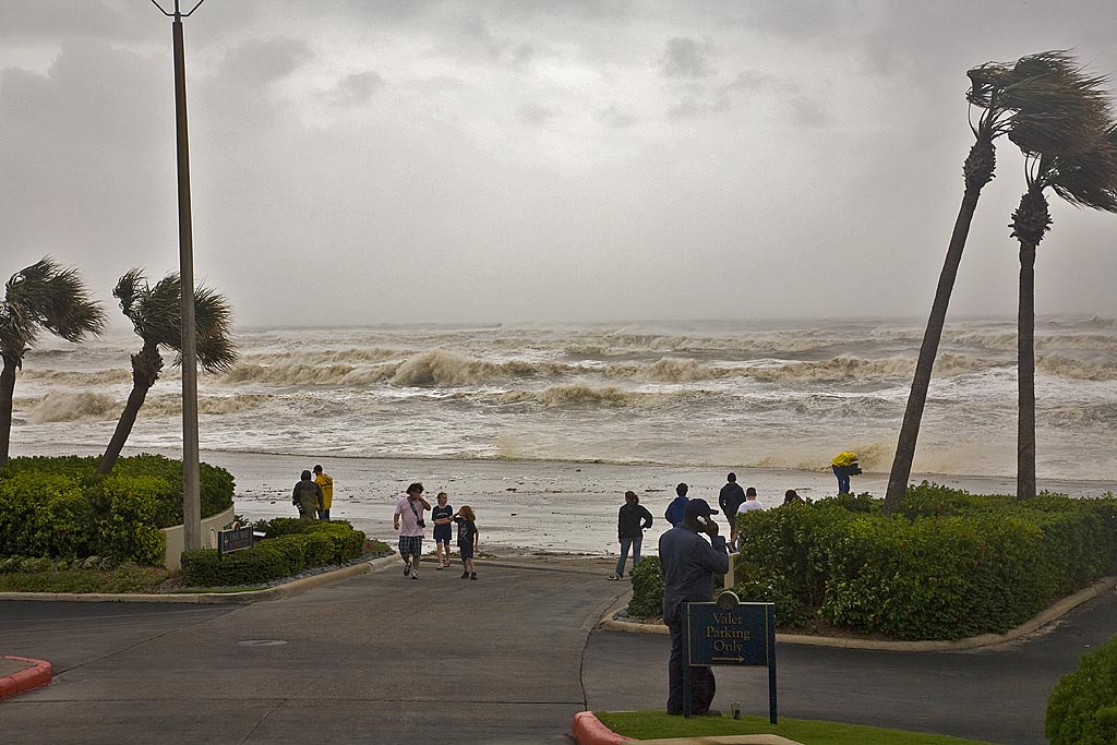
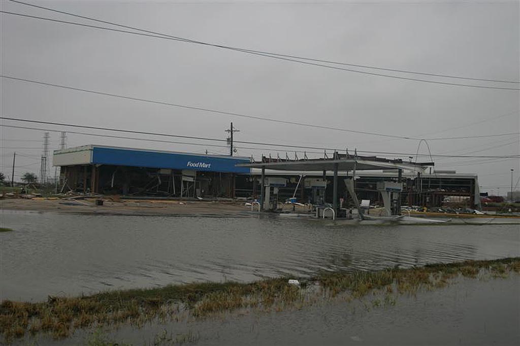
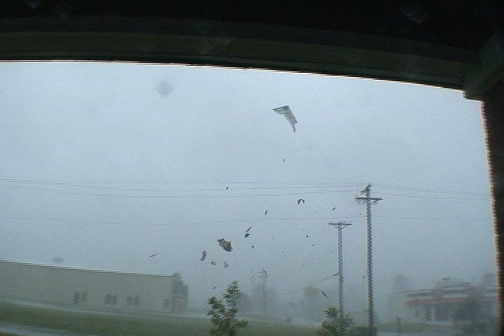
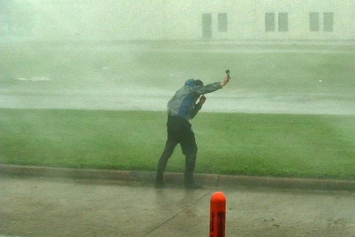
September 12th and 13th, 2008 Hurricane Ike Landfall
On Sept 11, I flew from Denver to San Antonio, Texas for the intercept of Hurricane Ike. My plan was to get a rental car, provisions and fuel, and then make my way to Galveston for landfall. Because I had a group of people with me, and the promise I made to their families of not staying out where the surge could cut us off, I took us back across I-45 to the mainland at dark on the 12th. Even the drive across the high bridge from Galveston Island to Bayou Vista was intense as we were raked with 70 MPH winds, a shaking bridge and waves galore. We rode Ike out at the Mall of the Mainland in Texas City and then did not go back towards Galveston due to blocked roads and the local authorities coming in to help the victims. Check out the two videos below, one from daytime hours on the 12th and then the other from the landfall in the dark. The images of the damage in Galveston were from Stuart Robinson (www.stormtrack.co.uk).
September 1st, 2008 Hurricane Gustav Intercept
August 31st and September 1st I traveled to Louisiana to intercept Hurricane Gustav. It was an intense Category 4 storm when it crossed Cuba, weakening to a Category 3 storm as hit approached Louisiana. I wanted the eye and thus Stuart Robinson and I, along with a cameraman from North One, positioned ourselves first in Houma, then near Morgan City. The eye approached by the noon hour and the eyewall blasted us with nearly 100 MPH wind gusts, causing damage to trees, roofs, power poles and lines, along with damage to weak structures.
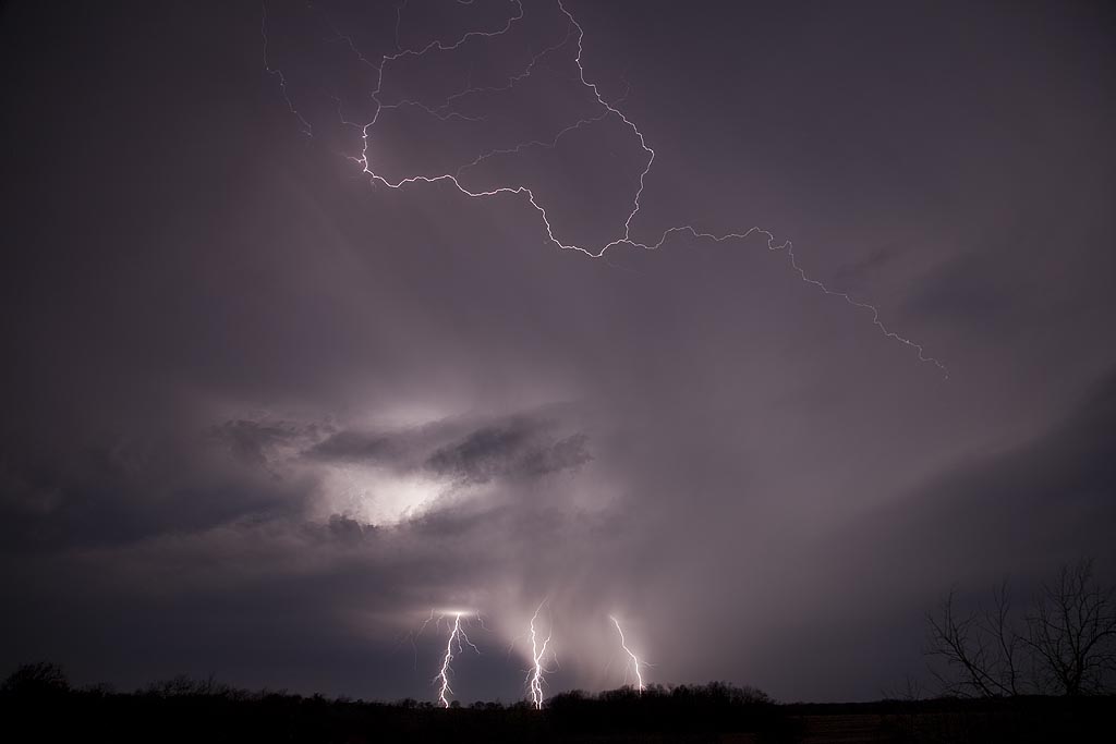
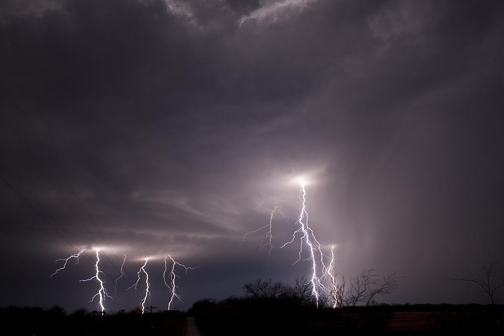
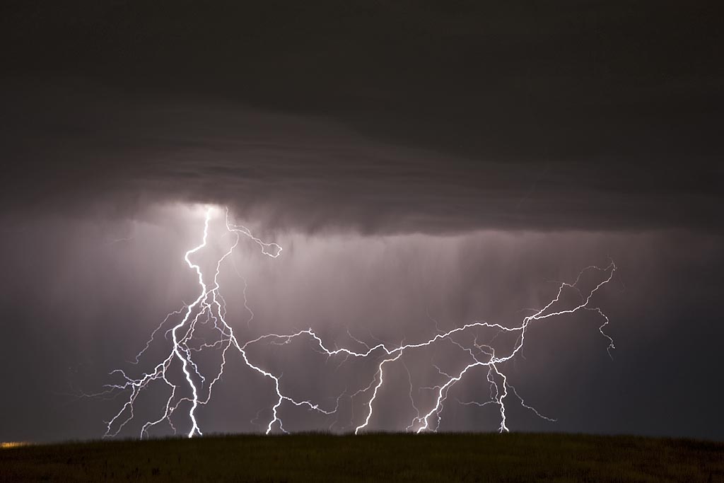
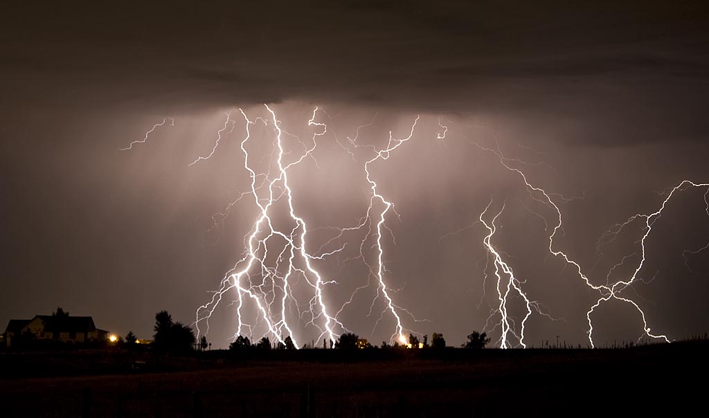
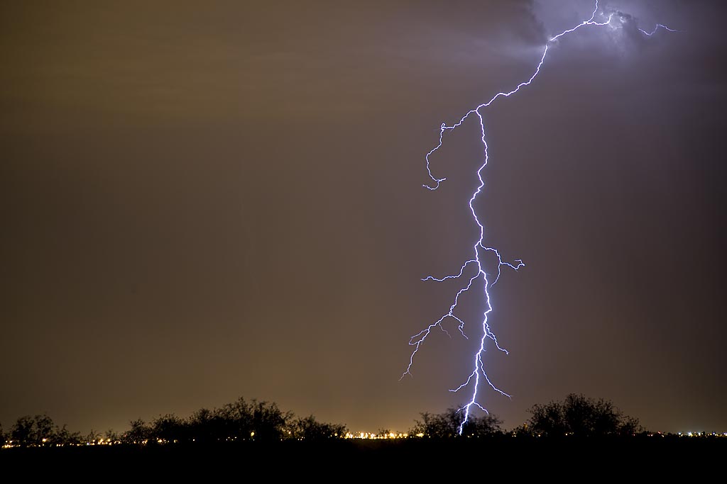
August 26th, 2008 Colorado Incredible Lightning Display
It isn’t often I get the pleasure of sitting on my back porch and filming a electrical display such as occurred on August 26th. Caryn enjoyed the hot tub, while I was shooting picture after picture. A very fun and enjoyable evening!!
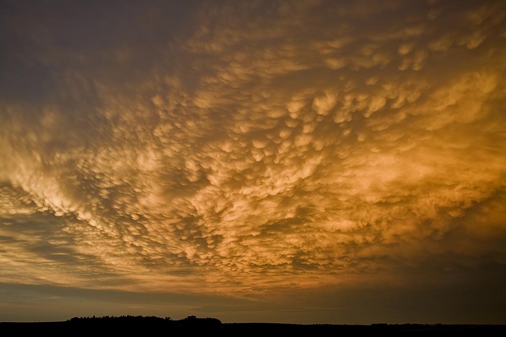
August 24th and 25th, 2008 DCVZ Storms and Landspout
August 24th and 25th featured a classic high CAPE/low shear with the Denver Convergence Vorticity Zone (DCVZ) boundary quite active. Both days events would cause the NWS Denver/Boulder to issue tornado warnings along the boundary with a half dozen landspouts reports. My wife Caryn and I would capture one landspout southwest of our house thanks to her keen eyes. Second day, no tornadoes were reported, but severe storms still occurred.
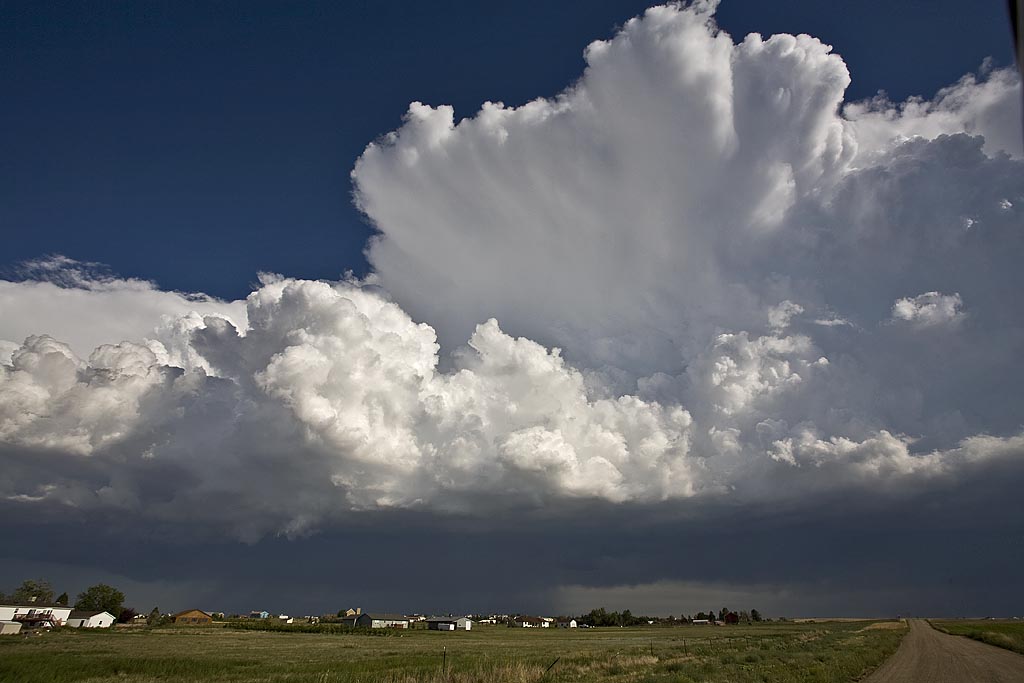
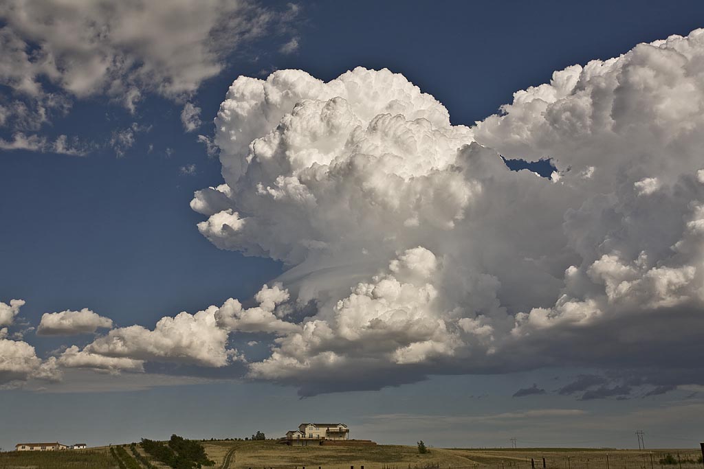
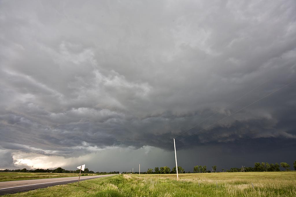
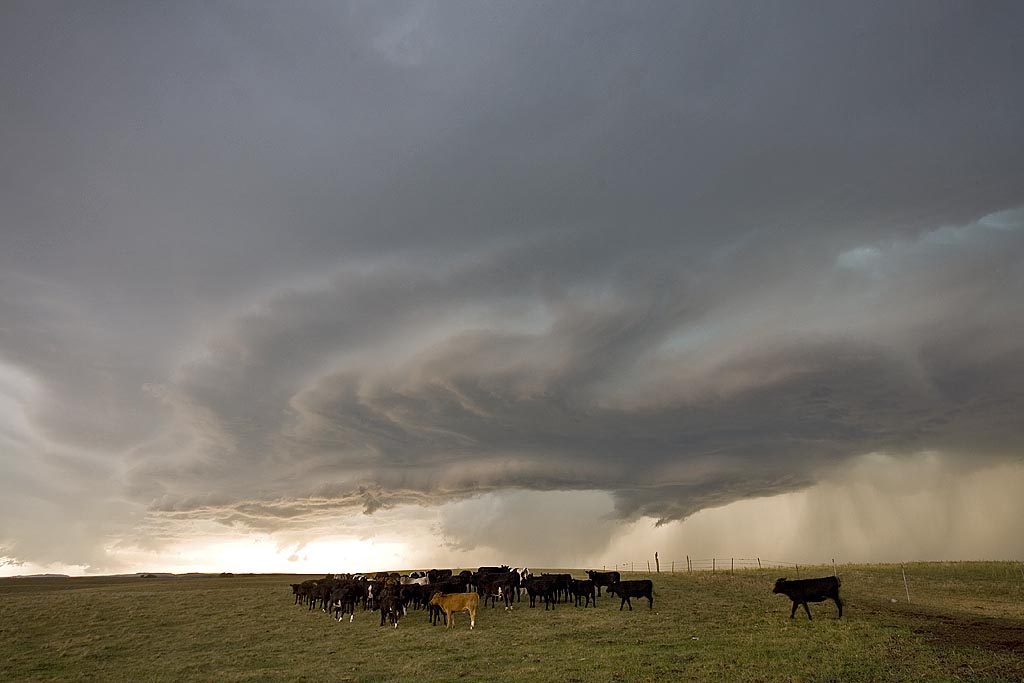
August 11th through 17th, 2008 Colorado Storms
Over a several day period, severe storms developed over eastern Colorado and western Nebraska. I was able to chase several days. Decent upslope flow, along with fair moisture, instability and shear would allow for organized storms, including supercells to develop. The results of my chases during this time are shown below. Everyday, I was on a storm that had a tornado warning.
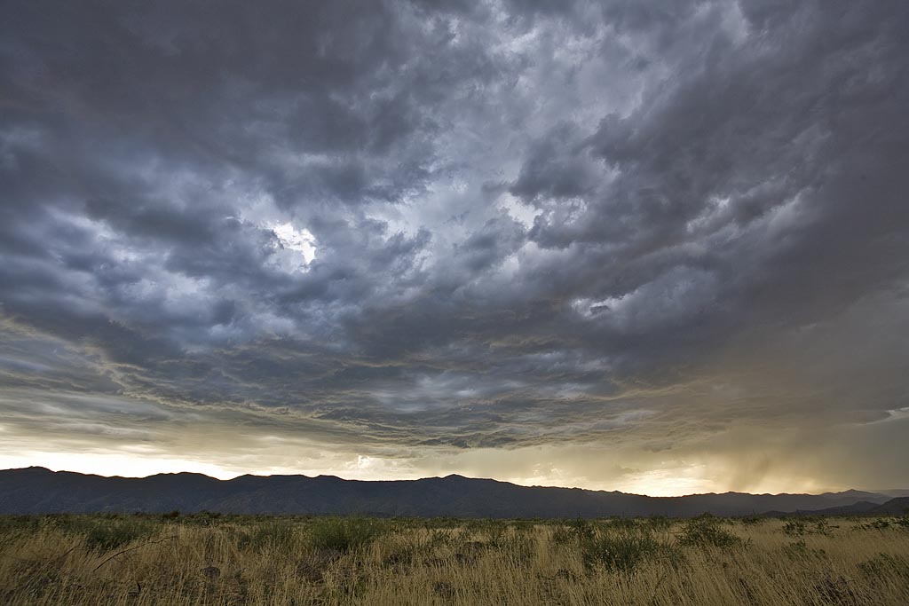
July 25 through August 3rd, 2008 Arizona Monsoons
This was our annual Desert Thunder tour for Silver Lining Tours, and it did not disappoint. Several days, we had intense storms developing off the mountains and moving over the lower deserts, providing wonderful electrical displays.
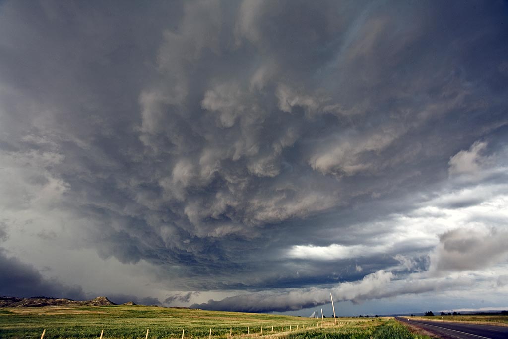
July 19th, 2008 North Dakota Incredible Supercell!
July 19th was a day I thought we would be in Canada. A strong trough, with good moisture and instability tracked along the US and Canada border. A boundary had formed from northwest North Dakota into western Iowa and would be the focal point for severe storms. We intercepted a supercell near Williston, North Dakota and tracked it well south of Bismark, North Dakota, over a 10 hour chase! It was either severe or tornado warned the entire time. What a beautiful storm. It arguably was the prettiest supercell of the year. It produced dozens of severe hail reports including hail baseball sized.
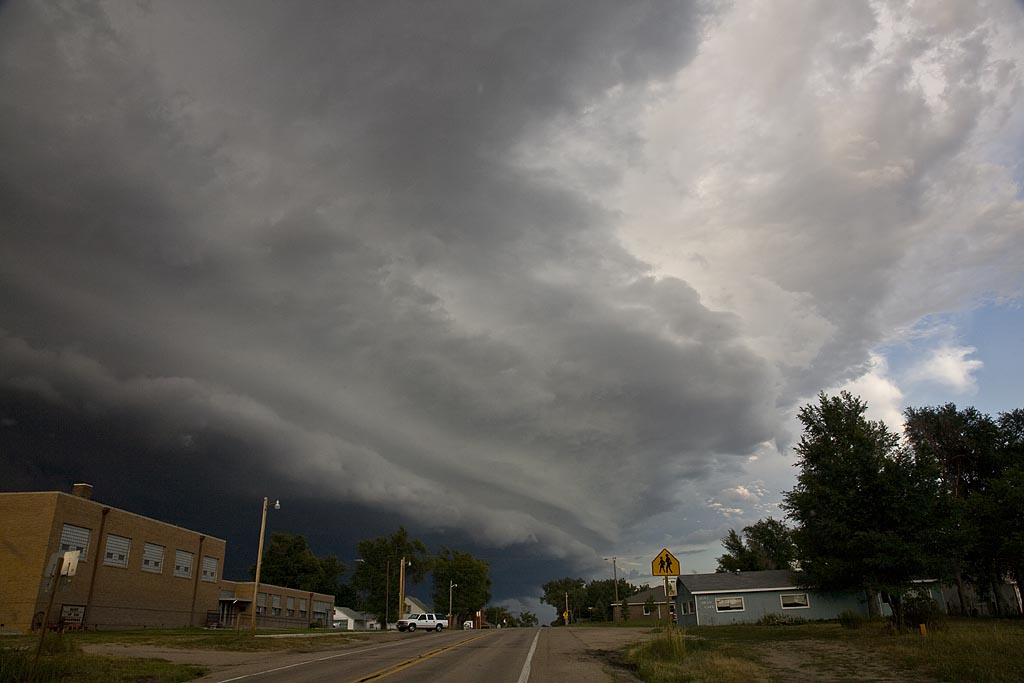
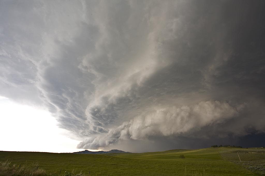
July 18th, 2008 Wyoming Supercell
July 18th had good hope for supercells, but less chance for tornadoes. Good shear, along with moderate instability and weak low level moisture would be sufficient for storms to form. By mid afternoon, supercells exploded along the Big Horn mountains and moved eastward across northeast Wyoming. I intercepted this storm north of Gillette. The supercell contained 2″ diameter hail, very strong winds and it tried very hard to produce as it blasted across the Black Hills.
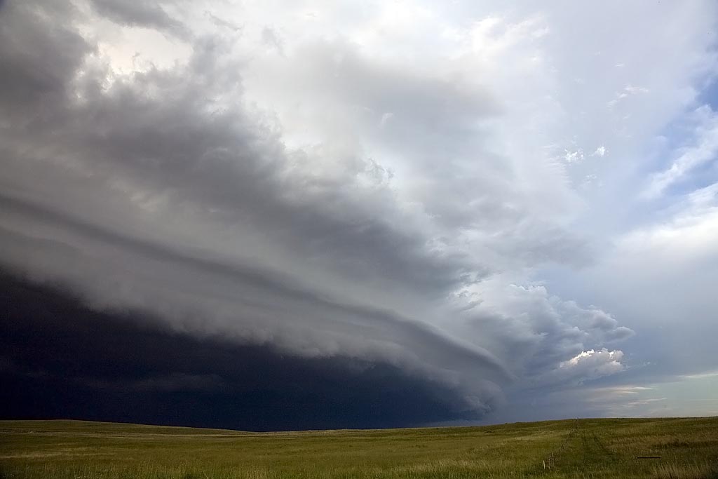
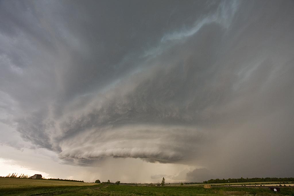
July 15th/16th Nebraska and South Dakota Tornado Warned Storms
July 15 and 16 took me to northern Nebraska and South Dakota to play storms along the dryline. Shear wasn’t expected to be very strong, but enough to help generate supercells, and to my surprise tornado warned supercells. July 15th took us to Nebraska where a large supercell developed west of O’Neill. This storm was fairly high based, but rotating nonetheless. It produced golfball sized hail and had very high winds once it lined out. July 16th took me to central South Dakota along the Missouri River where numerous severe storms formed near dark. Lightning was decent and the hail was large, also to golfball sized.