May 8th had a lot going for it. Strong instability, good shear, high CAPE and several boundaries played into the end result. We caught several tornado warned supercell, including one near Springfield, TN that produced a cone tornado. Between slow, curving, winding roads, low speed limits and slow traffic, it made it difficult to get in front of storms. The Springfield supercell spun like crazy and produced a cone, causing damage. It took us what seemed like forever to get in front of it. As we broke through the core, we could see the cone tornado behind us in the distance. It had been on the ground over 10 minutes. As we got into a better position to see it (due to hills and trees!), it dissipated. We then blasted south to catch a supercell near Columbia, TN that showed signs of strong rotation and was tornado warned. As we approached Nashville, insane traffic slowed us down by 30 minutes. And of course the supercell produced a violent wedge tornado that became rain wrapped by the time we could get to it due to traffic. Frustrating day, but we DID see a tornado! Tennessee and Kentucky are extremely difficult to chase in!!!! Enjoy what pics we could get!
May 24th Eastern New Mexico Tornadic Supercell
What a day! May 24th looked great in the models, and in real time, it was amazing!! Violent supercell thunderstorms congealed into one monster that dropped from Tucumcari, New Mexico southward to Clovis over a several hour period. Insane lightning and incredible storm structure persisted its entire life cycle. It also produced a few tornadoes, of which we caught a couple of them. During the early evening hours, as the storm approached Clovis, the inflow into this supercell was over 60 mph! Just showed the power of this HP storm! As it moved into far west Texas at dusk, the structure was constantly illuminated by incredible lightning. One of the most powerful supercells of 2023 to date, and it was a sight to behold! Enjoy the pics!
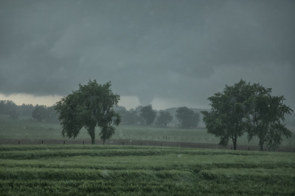
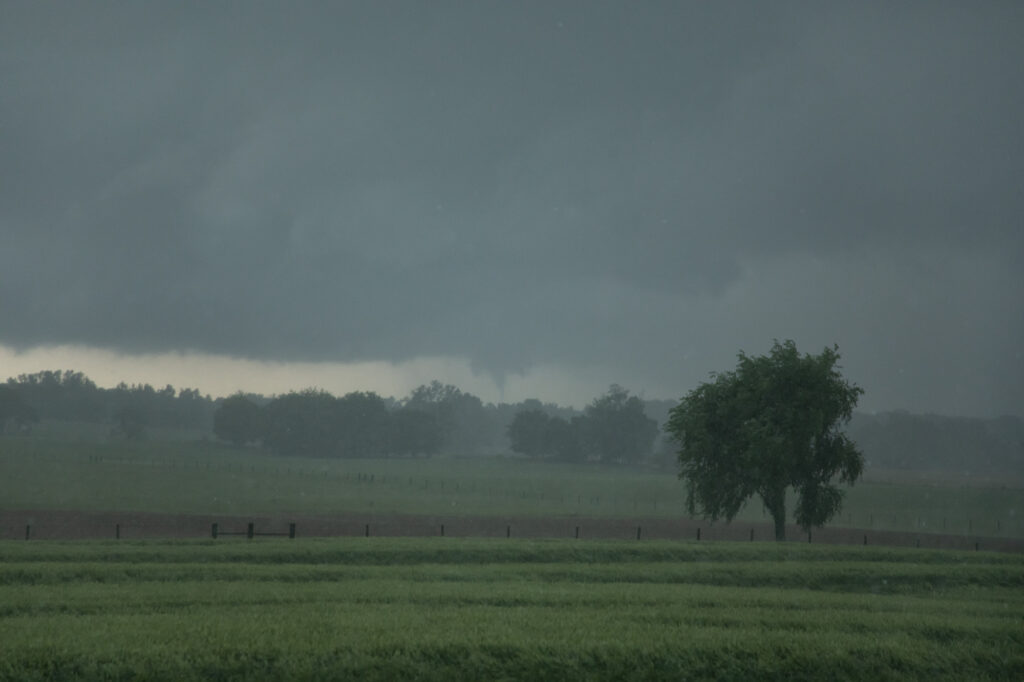
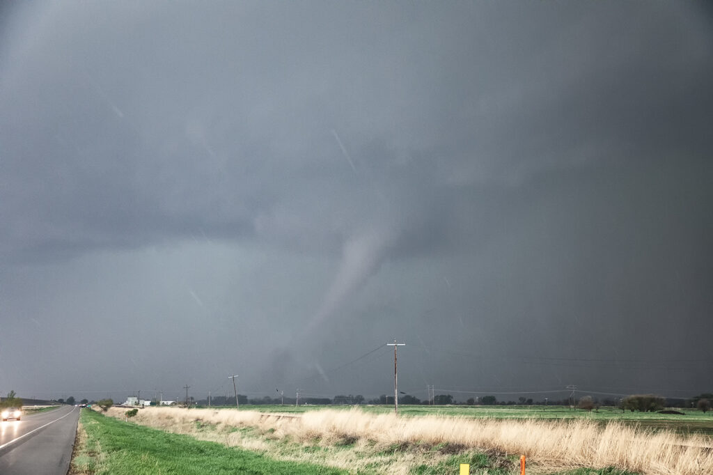
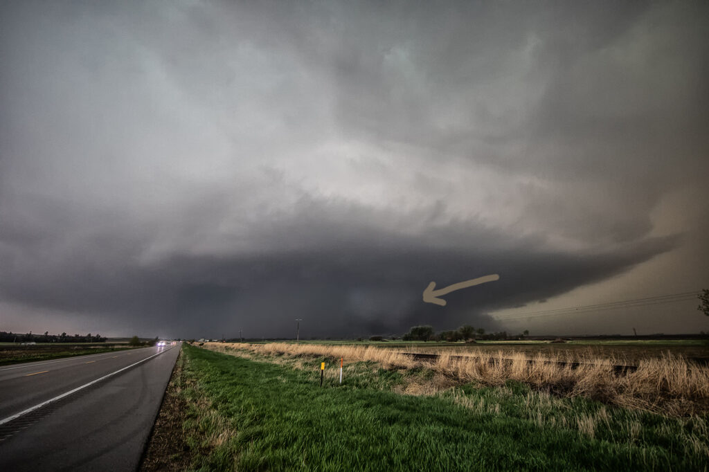
May 12th Nebraska Tornadoes
A great set up on May 12th took us to an arching boundary across central and eastern Nebraska. Early day storms produced weak tornadoes over north central Nebraska, but since our target was further east, we decided to wait it out for what we hoped were more violent storms. The wait paid off and numerous storms formed, almost all tornado warned, from northwest of York to north of Lincoln. One particular storm became violently tornado near Scribner, NE as we watched it produced a large partially rain wrapped wedge, then another elephant trunk shaped tornado in front of it. The wedge was rated EF-2 and the elephant trunk EF-1 as they hit a few structures, but fortunately nobody was killed. It was a murky day with a lot of low level moisture in place so apologies for the murky looking photos! Enjoy!
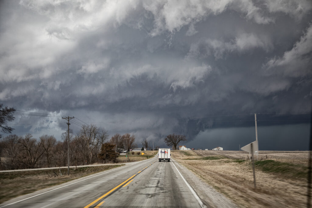
March 31st Ollie, Iowa Violent Tornado
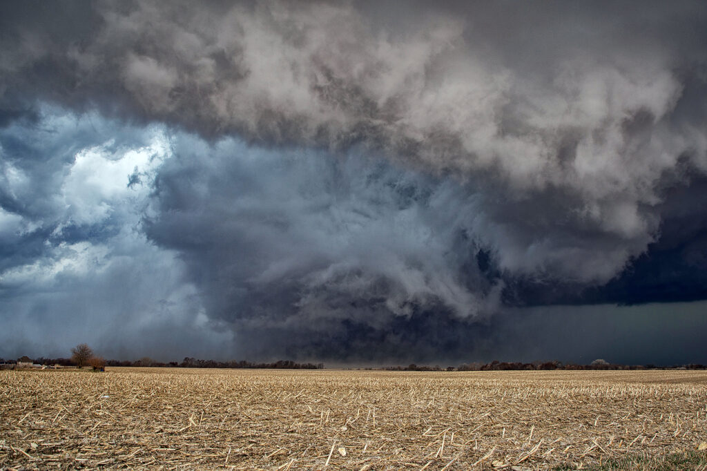
An extremely volatile day was in store on March 31st. A powerful trough was moving out of the Rockies onto the plains as a surface low intensified north of Omaha. We took our on call tour towards the Des Moines area in anticipation of rapid supercell formation early afternoon. The dryline lit up like a Christmas tree shortly after noon as storms raced northeast at 60-70 mph! Strong shear, good moisture and instability and a strong jet would fuel these storms. By 2pm a large thunderstorm formed in northwest Missouri and rapidly moved northeast, becoming tornado warned as it approached Ottumwa, Iowa. We moved to position ourselves in front of it to see what it could produce. We approached the small town of Packwood as a cone tornado stabbed down to the ground west of us and grew to massive proportions.
As we drove west on highway 78 towards Hedrick, the tornado wedged out becoming a massive twister less than a mile from us! The roar of the tornado and rear flank downdrafts winds filled the senses with the sound of a rushing waterfall. Due to fast storm motions and the unfortunate road closures in the area, we were only able to stay with it for about 15 miles before we lost it. This tornado caused a lot of damage, but fortunately no fatalities. It has been officially rated EF-4 by the National Weather Service.
Our thoughts and prayers go out to anyone affected throughout the central and southern plains this day as 60 tornadoes raked the region causing many casualties and much damage.
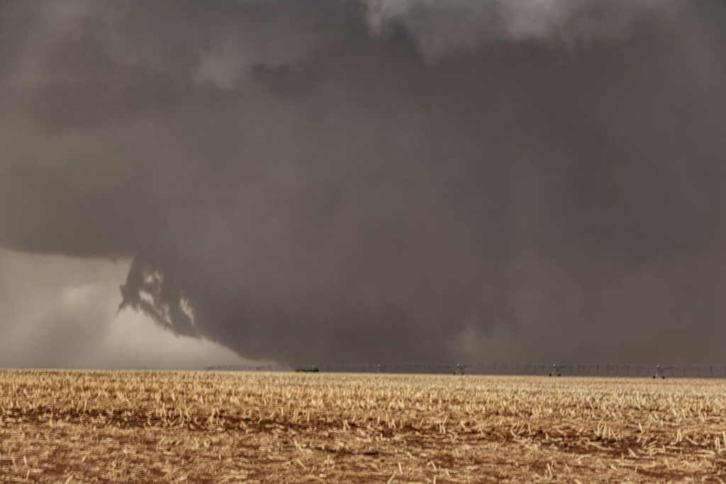
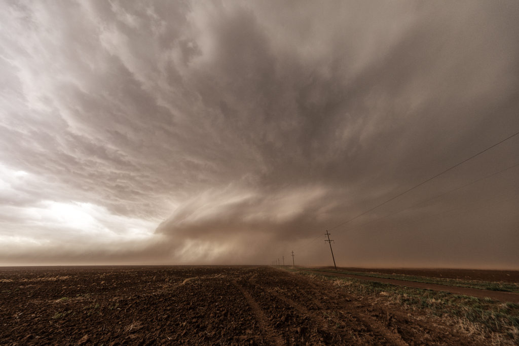
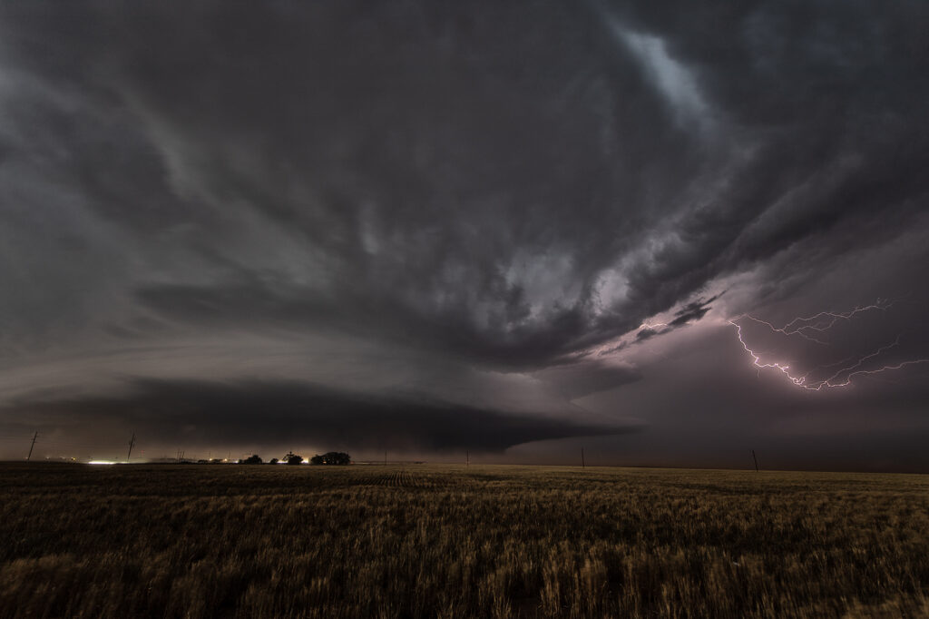
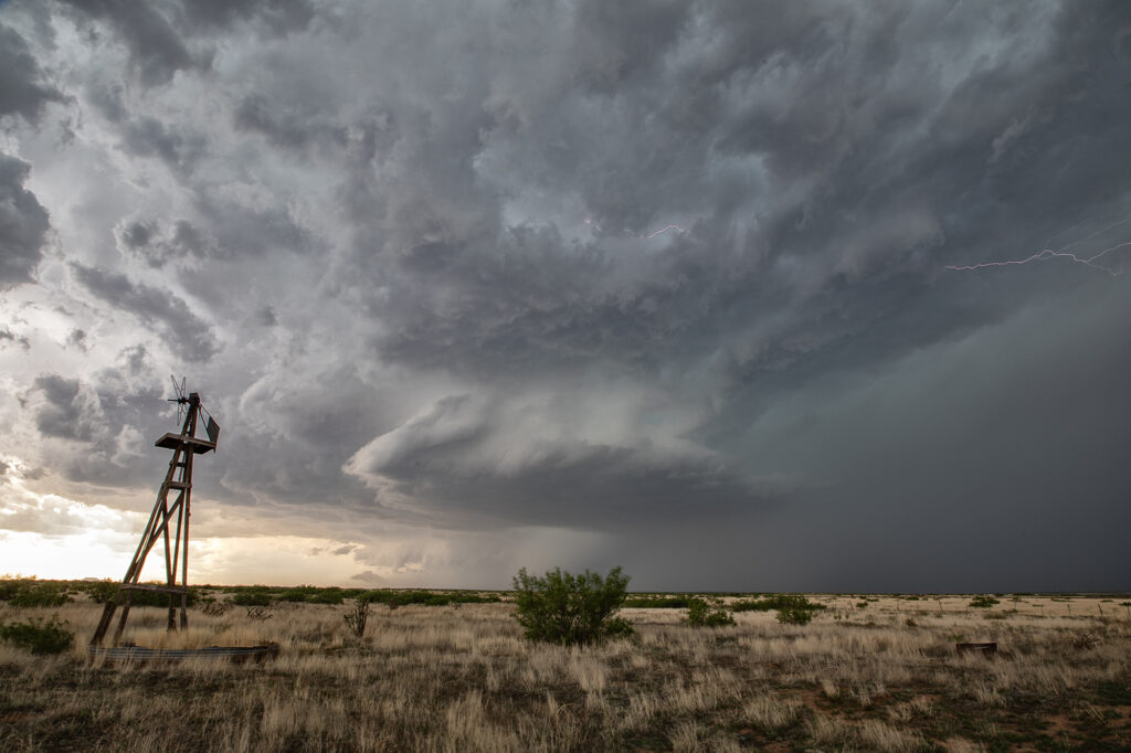
May 23rd Morton, Texas Wedge Tornadoes
What a day! We certainly weren’t expecting what happened this day to occur. Limited moisture, but good shear and a dryline would set the stage for severe thunderstorm development. There is a term chasers use in the Texas panhandle called “panhandle magic” and it certainly was the mode this day! Storms developed in eastern New Mexico and clustered as they moved into west central Texas. It was a very messy storm mode. Eventually the tail end cell in the cluster anchored and started spinning. It became a very intense supercell, even with low dewpoints in the 50s! Soon the cell developed a wall cloud, then a multivortex tornado, and finally a 400 foot wide EF2 wedge tornado! It was nearly stationary! A second wedge occurred about 30 minutes later east of Morton and finally a 2 minute elephant trunk west of Levelland. Inflow was so strong ti was knocking down power lines and toppling trees! The storm was sucking so much dirt due to the drought in west Texas at times the updraft was barely visible. Structure was nice when you could see it and the storm as it approached Lubbock eventually died. It put on a nice lightning show at dusk as well. An incredible day and evening! Certainly by far more than we expected. Even the Storm Prediction Center didn’t have much of a tornado threat in its’ outlooks! Enjyo the pics!