Tag Archives | Texas

May 7th, Northwest Texas Supercell

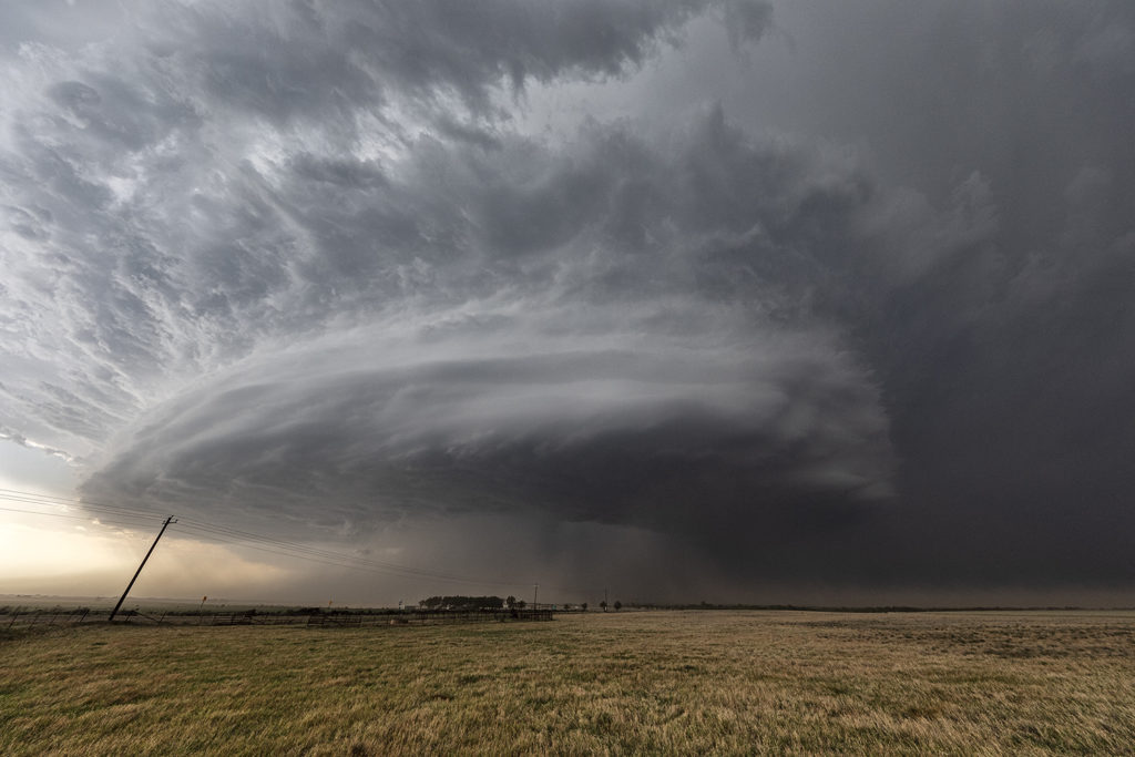
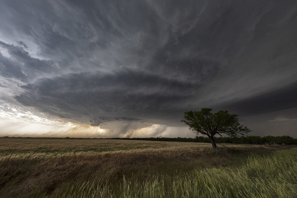
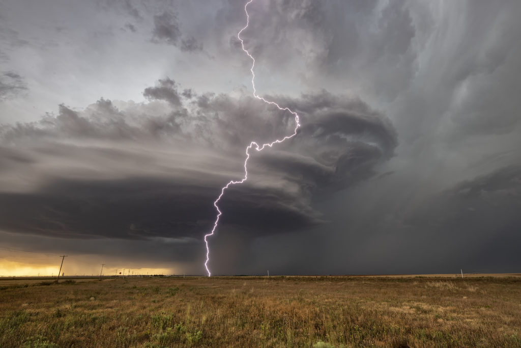
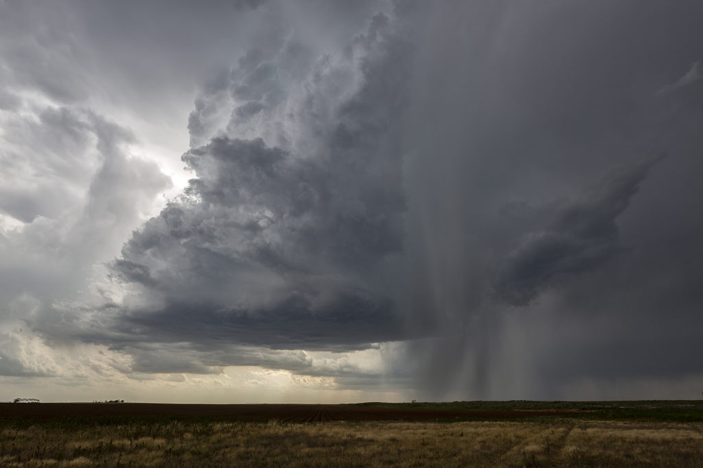
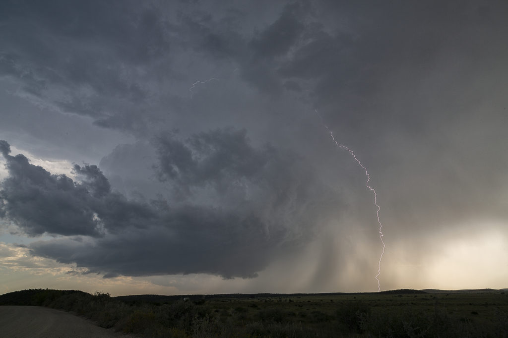
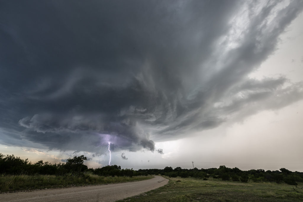
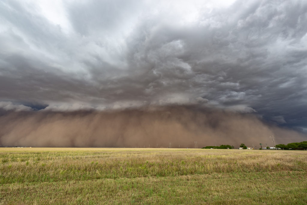
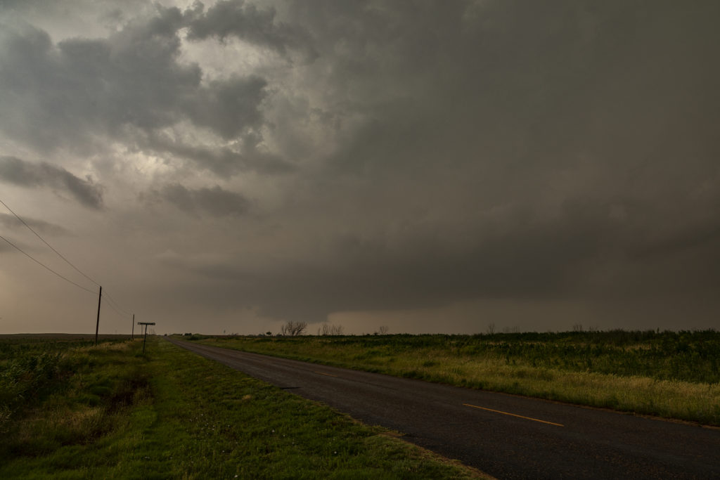
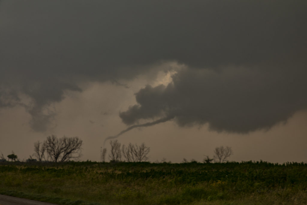
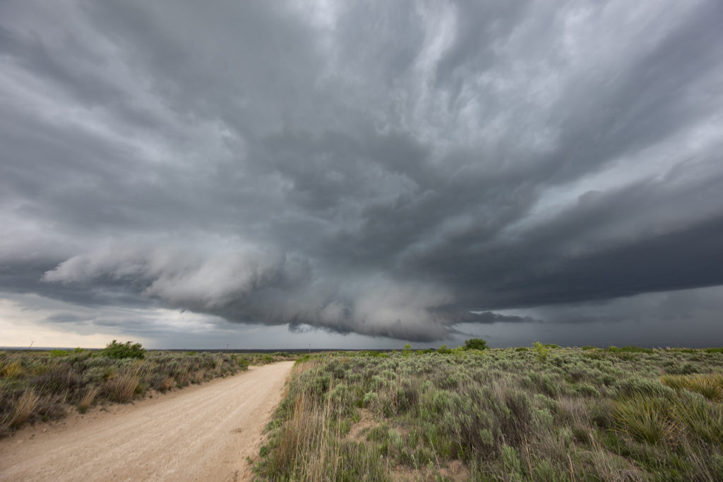
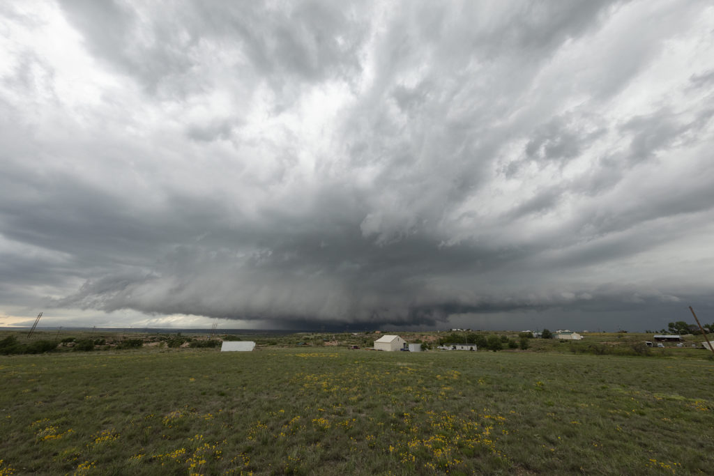
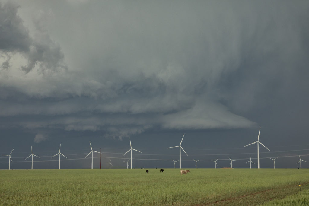
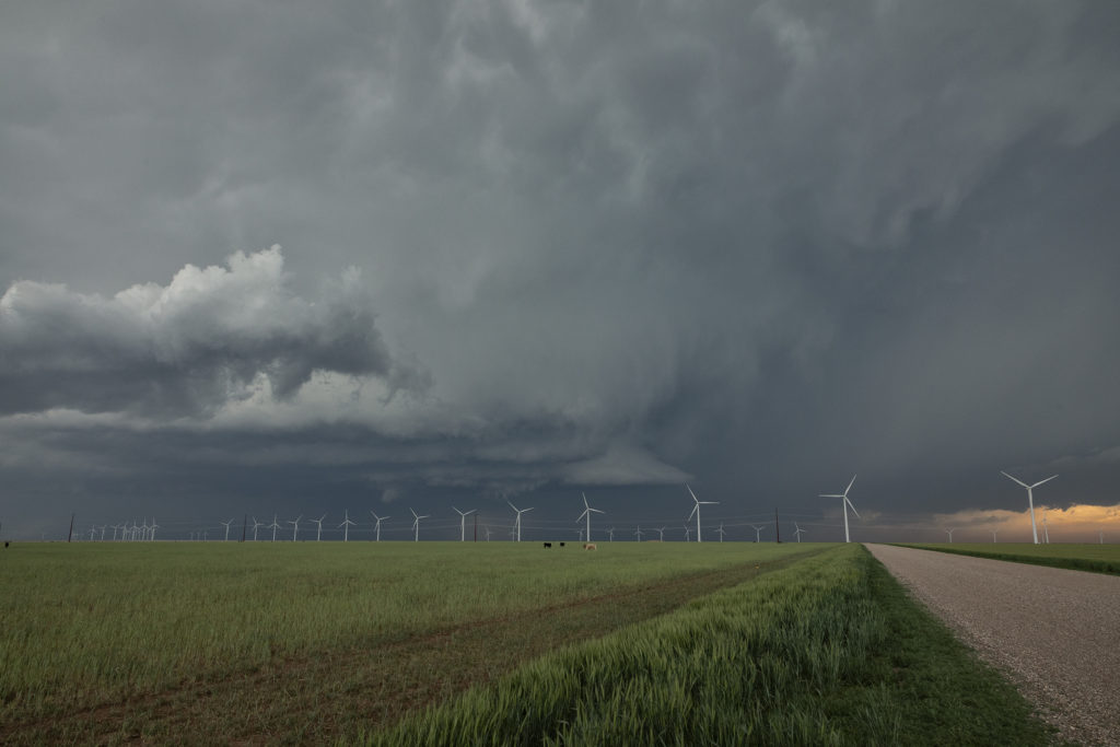
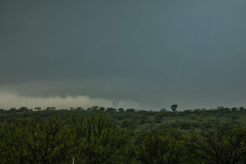
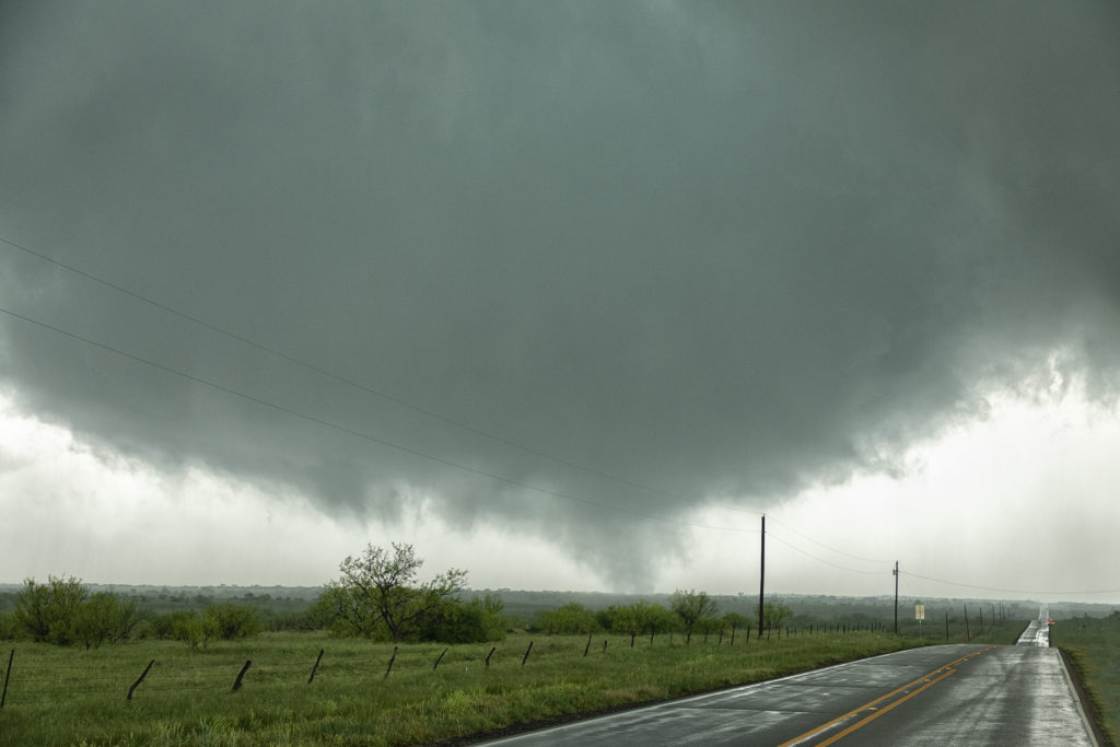
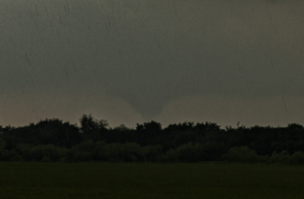
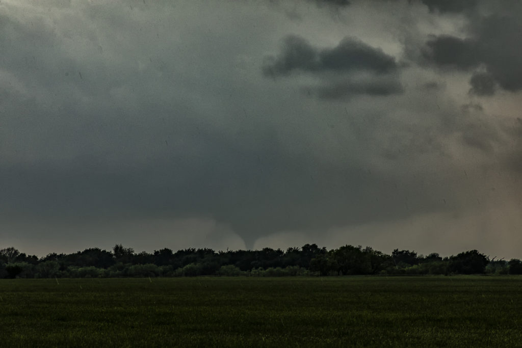
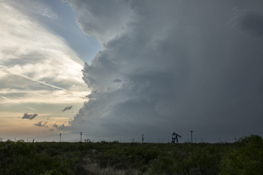
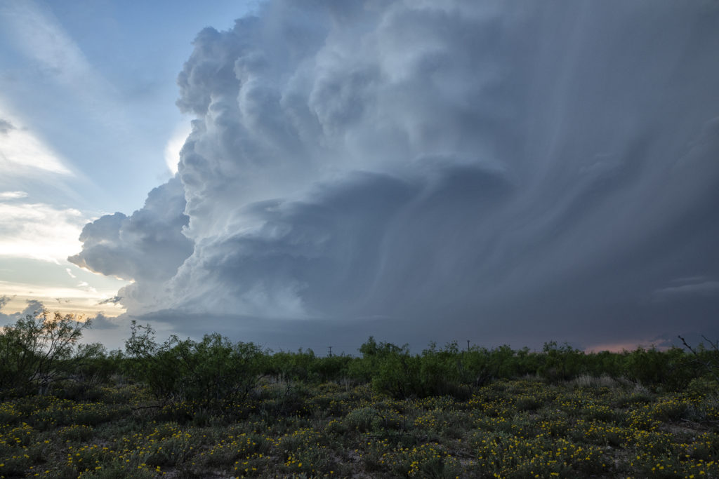
May 7th brought our first chase of the season. Tours began and we hit the road for the triple point near Childress, Texas. By late afternoon, a storm formed on the boundary and moved southeast while intensifying. As it moved east of Childress, it produced very large hail over baseball sized and had incredible structure. It was never a threat to become tornadic, as the base was a tad too high. We stayed with this supercell to the northwest side of the DFW metroplex when we let it go as to not take a chance chasing in a huge city. Please click on an image below to see a larger photo. Enjoy!


June 17th West Texas Tornado Warned Supercell

Sometimes, you just don’t care if a storm produces a tornado. It can be that pretty. Dryline supercell thunderstorms can be quite pretty, although they are often higher based. This day would give us just that. We had a high based supercell that formed along the Texas/New Mexico border and drifted slowly southeast towards Muleshoe, Texas. It spun like crazy. There was plenty of shear and instability this day and with the active dryline closeby we were hoping for a pretty storm. Active for several hours, this supercell produced incredible lightning, some of the best of 2019 to date and had nice structure.

Other storms would form later in the day and especially during the early evening as the cap was breached. Many of these storms were very electrified and intense, often being warned for large hail and damaging winds. A couple storms would become tornado warned, however no tornadoes occurred this day in our area. All in all, a fun day with a great storm and superb lightning!

June 16th Mertzon, Texas Tornado Warned Supercell

June 16th featured strong instability, good moisture and moderate deep layer shear. An old outflow boundary across the I-20 area west of Abilene would be the focal point for severe and tornado warned storms this day. We started the day in Denver and left very early to reach our target by initiation time. We made it with little time to spare! Storms rapidly developed and intensified along the southward sagging boundary. We headed south from Sterling City and got in front of a beautifully structured and tornado warned supercell! This storm was quite pretty, had a rotating wall cloud and incredible lightning. It spun southward for hours giving us a treat to watch.

Eventually near dark, the storm weakened, but not before giving us one last great lightning show! Over an 800 mile day, but worth it! Just goes to show we’ll go anywhere we need to so we can get our guests the best storms around!

June 5th West Texas Haboob

A crazy day ensued as a cluster of high based storms formed in New Mexico and tracked east into west Texas. As the storms approached the Lubbock area a very well formed haboob occurred, with a wall of dust/dirt scouring the landscapes. Haboobs can be very photogenic and this one was one of the best I’ve ever witnessed in 35 years of chasing in the Texas panhandle! High winds, large hail and that wall of dirt occurred within this line of cells as they raced across Texas.  An exciting day on a day when we weren’t expecting anything significant!  Enjoy the cool pics!

May 20th Texas/Oklahoma High Risk Day

My 20th looked downright scary on all models. SPC issued a HIGH RISK for long tracked violent tornadoes and had a greater than 95% probably of numerous/violent tornadoes on their tornado watch box they issued. Schools closed, Air Force bases evacuated aircraft, lots of safety precautions were made. It ended up being a major, major bust. Very few tornadoes occurred and there were no violent tornadoes. Fortunately we played the dryline in northwest Texas where strong heating and good convergence would result in a couple of supercells forming by mid afternoon. We blasted down to Paducah, Texas from Childress and watched one storm produced two tornadoes. One was on the ground for about 5 minutes and the other about 10 minutes. They were fun to watch skipping across the countryside!  Chaser convergence was horrendous this day, as expected being close to Oklahoma. We opted for another target later in the evening instead of fighting with the mobs in Oklahoma, but neither target panned out. Fortunately we got tornadoes this day as many, many chasers did not! Fun day, frustrating day and a disappointing day in the end. No lives were lost, very little injuries occurred. Good news for the plains!

May 7th Texas Tornado Warned Supercells

May 7th was advertised to be a strong tornado threat. In the end of the day, there really weren’t many tornadoes and none that were strong/violent. Too many storms would form and create a competition where none were able to be long lived tornado producing machines. We were able to chase 3 significant supercells, one near Stinnett, Texas, one near Amarillo and another near Tulia, Texas. The Tulia storm was the only one that produced, and even that was not significant. We arrived near Tulia a few minutes too late to see a weak bowl with a couple condensation fingers and also another small tornado. As we arrived, video caught a tornado in the distance about 10 miles away. The storm was high precipitation and very messy. We stayed with it as long as we could, however the caprock escarpment has few roads off of it and it made it impossible to stay with the storm. Later in the evening we chased 2 other tornado warned supercells in southwest Oklahoma near Hobart and Vinson. Fun day, a bit frustrating, but we still had several tornado warned storms to chase!

May 4th Adrian, Texas Tornado

A fantastic day and great way to end the Caprock Magic tour this day! High based LP supercells formed west of Channing and Adrian, Texas this day amidst modest moisture and instability. Great wind shear allowed these cells to spin, enhancing hail production and longevity.  We watched one supercell west of Channing try hard to stay alive, but it just didn’t have the needed instability to survive long. We dropped down to I-40 west of Amarillo and headed towards a cluster of storms near Adrian. When we arrive it was apparent that one cell was anchored, enhancing its ability to rotate. As another cell approached from the west, the downdraft from that cell hit the anchored storm causing the low levels to rotate strongly. A white funnel formed and touched down for about 3 minutes before dissipating. The storm eventually became a very pretty high precipitation storm as it moved south of Amarillo. What a great day and an amazing event that caused our supercell to produce a tornado. Enjoy the photos!

May 1st Seymour, Texas Tornadoes

May 1st was a great setup. An outflow boundary lay in northern Texas with 70 degree dewpoints to its south. High CAPE, strong shear and lift along the boundary would cause several tornado warned supercells to form. However, only one would produce any tornadoes. We sat in Seymour for a couple hours waiting for initiation to occur at the triple point just southwest of town. Soon, a storm developed and shot to 55,000 feet in height. We blasted south through intense rain and lightning only to be greeted by the first tornado about 7 miles to our west. Poor road networks prevented us from getting close to this beauty! It lasted about 10 minutes and dissipated. Not long afterwards, a new meso formed to the east and started rotating intensely. A multivortex tornado touched down and lifted several times before a slender cone tornado formed. It bounced around the ground for a few minutes before lifting. We were about 1 mile from it when it occurred! You could hear the waterfall sound of the rear flank downdraft winds as it crossed to highway just north of us. Eventually the storm weakened as we blasted west to another tornado warned supercell. This storm became high precipitation quickly, but it tried hard to drop another tornado to our north. I cannot confirm if it did or not based on our position, but it spun wildly. Enjoy the photos!

April 30th Red River Area Tornadic Supercell

A day of big hopes was April 30th. Great moisture, high CAPE and strong deep layer shear would set the stage for supercell development. We started the day in Wichita Falls, Texas only to move across the Red River into southern Oklahoma. It appeared that storms would form along a cold front and intensify as they crossed the river into Oklahoma. We played with a cell near Randlett, OK initially, which never did much. It was severe, but never looked like a threat to produce tornadoes. Eventually a couple of cells formed in front of the cold front and rapidly became severe. One storm near Byers, Texas dropped a significant tornado just across the Red River from us. We figured since the storm was moving northeast at 35 mph that we would stay on the Oklahoma side of the river (since there are FEW crossings!) and wait for the storm and tornado to approach. To our much surprise the tornado dissipated and the supercell died as it came to us! There was NO reason for the NEW supercell to abruptly diminish! However it did, but not before we were able to get some photos of the structure and of the tornado in the distance. It was only about 8 miles away when it’s demise occurred. Fun day, frustrating day, but we all enjoyed ourselves!

April 29th Kermit, TX Supercell

April 29th was a strange day.  Models initially like the area west of Midland, only to show no storms forming later in the day. A composite outflow boundary was moving steadily south and we were afraid it would push too far south and undercut any chance of a storm sustaining itself. Eventually however, large cumulus towers formed west of Odessa and turned into a pair of very pretty LP supercells. The structure was very nice and the lightning pretty. One thing to remember when you are in the desert is to watch out for reptiles as we encountered a young rattlesnake where we stopped. It was more afraid of us than we were of it. Pretty desert flowers dotted the countryside as this storm continued for several hours. A good result on a day that didn’t look great. We NEVER give up!!!!