July 14th had it all. Boundary, great moisture, instability and good low level shear. We blasted from Pierre, SD to central Iowa as storms formed and became severe and tornado warned. Several tornadoes did occur in central and eastern Iowa with one particular tornado we just missed by 15 minutes being the most intense near Lake City. Frustrating day to say the least, but we still managed some great supercells and a tornado late in the day. Moral of the story is to NEVER give up until storms are weakening and loss of heating reduce instability.
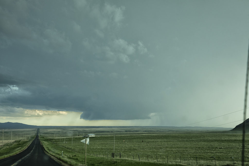
June 22nd Central Nebraska Supercells!
June 22nd didn’t have a ton going for it. It was one of those surprise days when the atmosphere over performed. We started the day in York, Nebraska and just drifted north to Norfolk. Shear was pretty decent, but low level moisture had been scoured out by the Pella, IA event two days earlier. However enough moisture was present, as well as instability, to fuel a few supercell thunderstorms along a boundary over northern Nebraska. The first supercell we witnessed was a high based, hail and wind producer. Structure was decent. The second more intense storm occurred north of York (funny how this storm drove us right back to our hotel again that night in York!) and produced baseball sized hail and 70 mph plus winds. Structure on this storm steadily improved as it encountered greater moisture the farther south it traveled. Just before sunset it was an absolute beauty just southeast of town! We had the fun of driving through the front edge of the core and encountered tennisball sized hail as we headed back to our hotel for the night. Enjoy the pics! It was a beauty!
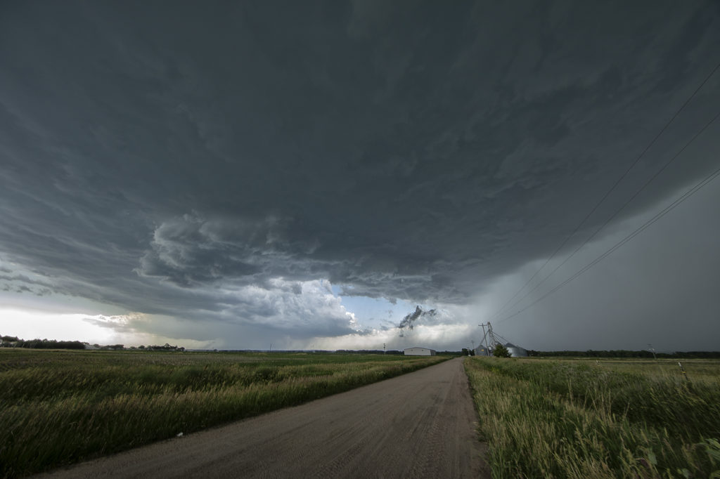
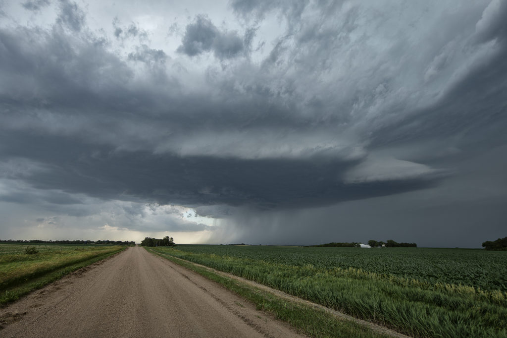
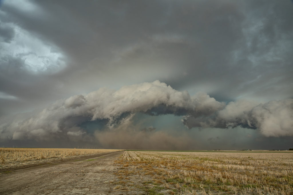
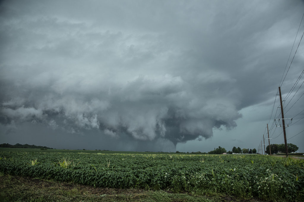
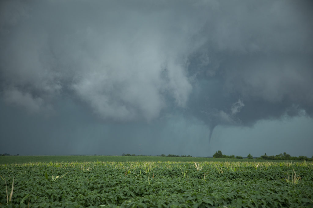
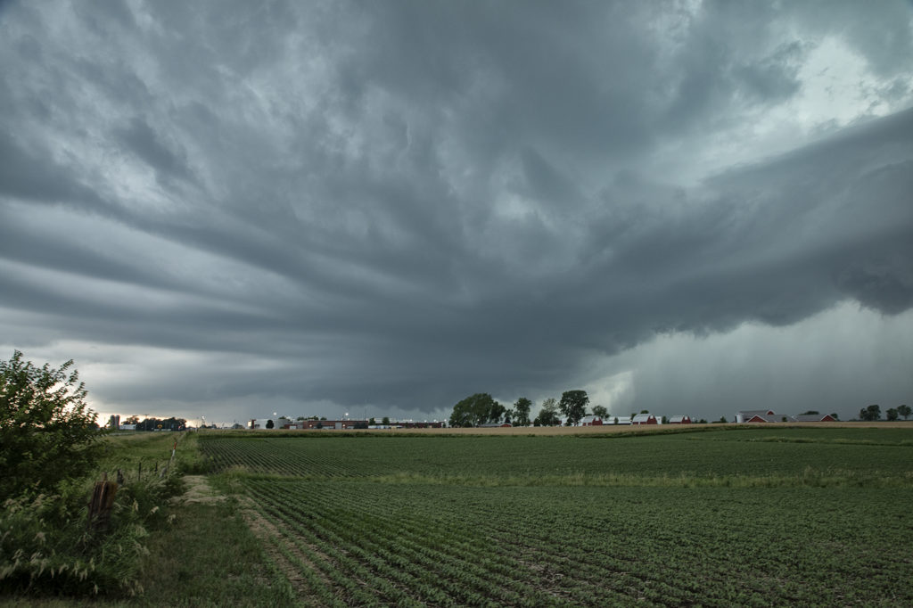
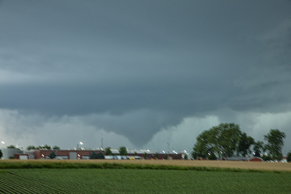
June 20th Pella, Iowa Tornado
June 20th featured extreme instability, moderate wind shear and good lift along an advancing boundary over Iowa. We started the day from Denver, CO as it was the first day of the tour. After an early departure, we made it just east/southeast of Des Moines, Iowa (650 miles later!) just in time for storms to explode. The first supercell we intercepted was just east of Des Moines and never had the “look” like it wanted to become tornadic. Nice structure and a rotating wall cloud occurred, but it could never tighten up enough to produce a tornado. We dropped south and headed back west a little bit as a second storm quickly became organized. It developed a strong hook echo on radar to the west of Pella. As we arrived in town near the factory, we stopped to watch. Intense lightning was also occurring, a tell tale sign of storm intensification. Within a few minutes, a large bowl shaped funnel formed. Soon it developed into a full fledged cone shaped tornado that was on the ground for several minutes. In my haste to shoot video, time lapse and digital images, I failed to get a proper focus on my camera and thus most images were slightly blurry. The tornado dissipated and the storm eventually weakened as it moved east, ending our chase. A great first day for Tour 8!! Enjoy the pics, blurriness and all !!!!!
June 13th Western Nebraska Severe Storms
June 13th was the last chase day for the next week as a massive ridge of high pressure dominated the western 2/3 of the US. Fortunately we were able to catch a few severe storms/marginal supercells in western Nebraska north of Alliance. Good CAPE, but marginal shear would let these storms become a cluster of outflow dominant storms late in the day. However they were quite electrified, before gusting out near Hemingford, Nebraska. Fun day, with 80mph winds, golfball sized hail and some pretty scenery to watch these storm do their thing! Enjoy the pics!
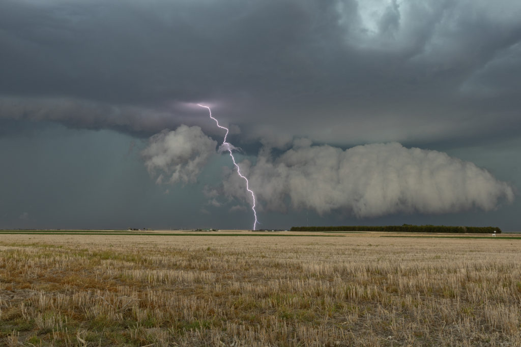
June 10th Alexander, North Dakota Tornadoes
June 10th was a great set up in northeast Montana and western North Dakota. A warm front lay from Glasgow, MT southeast towards Dickenson, ND. Strong instability, good moisture and fantastic shear set the stage this day for multiple supercells and tornadoes along the warm front/dry line intersection north of Wibaux, MT. Cells initially formed all along the boundary, but the northern cells moved into cooler air and weakened. The triple was a storm producing machine firing off one supercell after another as they each matured and some became tornadic. The first tornado was my favorite, coming over the hills near the Roosevelt National Park area and was quite visible. The second tornado was a bit further away and choked with rain and very large hail, making photos hard to see. Nonetheless, it was a spectacular day and great results for Tour 7! Enjoy the photos!
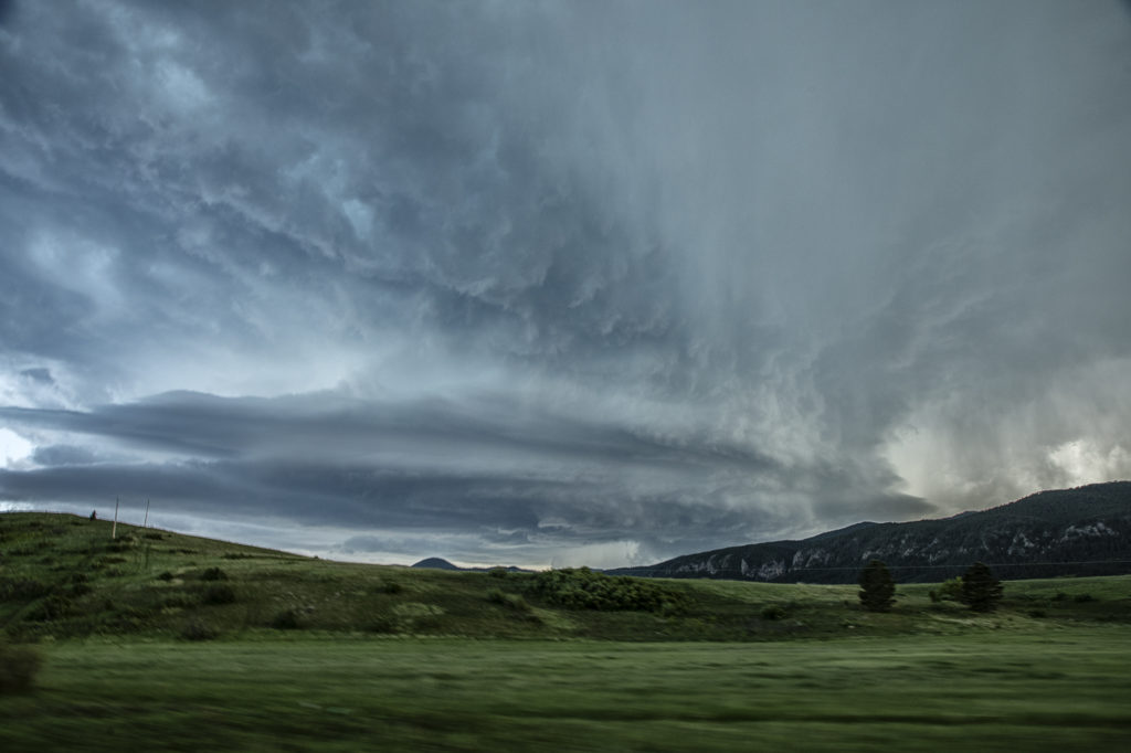
June 9th Lodgepole, Montana Jaw Dropping Supercell!!!
Wow, all I can say is WOW! What an amazing supercell this day produced! Great shear, good moisture and instability, and lift along a boundary and mountains would provide all that was needed to get the best structured supercell of 2021 to form. After hanging out in Havre, MT waiting for a storm to get going, we finally got our wish. Due to the late setting sun in Montana in June, we had several hours to watch this storm ramp up and become a jaw dropper! The one unfortunate thing that occurred were the poor road networks in Montana. We were able to stay with this mothership supercell for a few hours east of Lodgepole and enjoy the treat! Incredible structure and the beautiful countryside in Montana made this day one of my favorite for 2021! Please take time and enjoy the photos of this stunning storm!
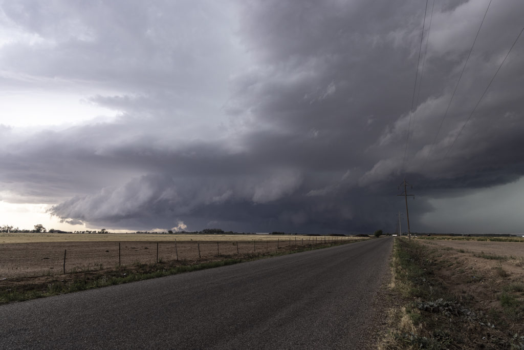
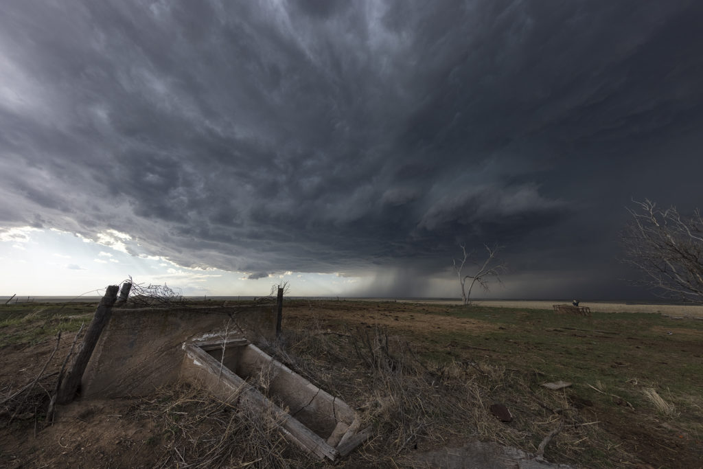
May 30th Roswell, New Mexico Tornadic Supercell
May 30th was the first day of Tour 5 leaving from Denver. It was a long drive to our target of Roswell, NM, but we made it just in time. A tornadic supercell formed west of town and tracked east/southeast. A couple of tornado reports were made and I can’t argue with them. A few spin ups under the updraft occurred as rotation was strong above them. Good CAPE, moisture, and a boundary set the stage for this supercell to form. Nice structure and huge hail also fell from this cell. As it moved east later in the day, it weakened and another supercell formed on it’s outflow. This storm was jaw dropping gorgeous and rolled eastward towards the Texas border in the evening hours. A fantastic day after an extremely long drive, but well worth it! Enjoy the pics!
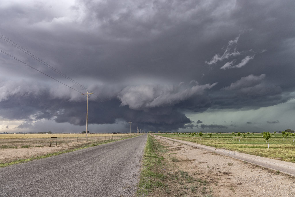
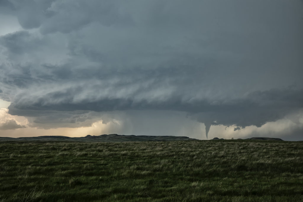
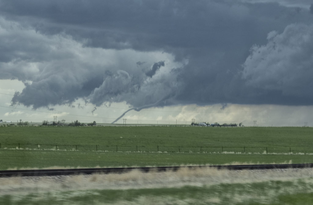
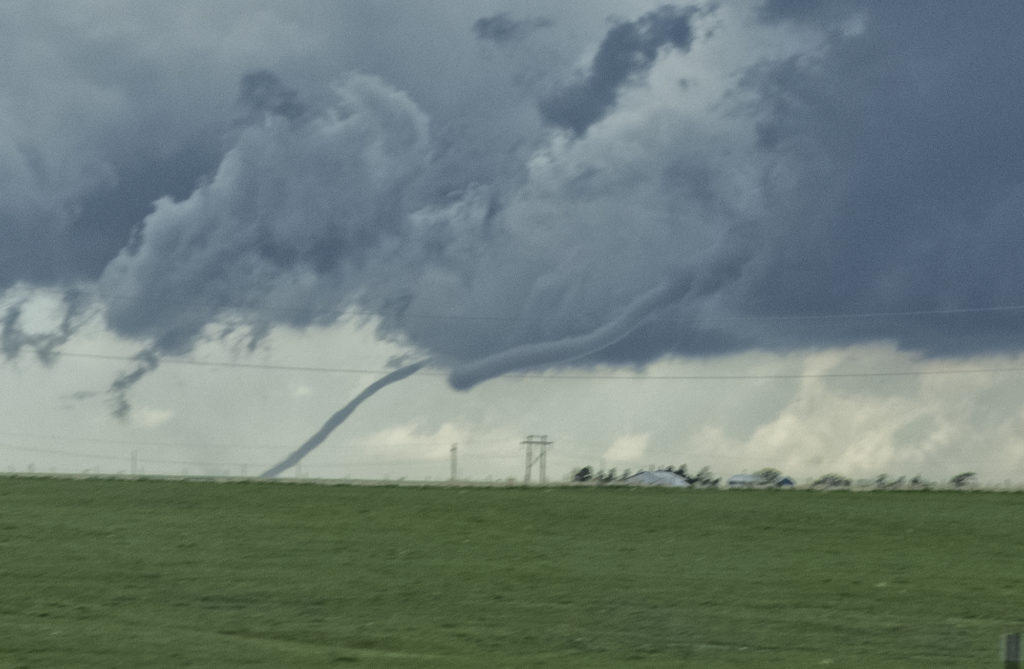
May 22nd Colorado Tornadic Supercells
May 22nd had great potential in Colorado. Good upslope flow and moisture, as well as great instability and wind shear would set the stage for intense tornadic storms! One storm formed early in the afternoon and produced a fast tornado west of Akron. A second supercell formed south of Limon and produced several tornadoes. We were able to intercept the first supercell and tornado west of Akron, but tried to blast down towards Limon later and couldn’t get there in time for the second storm. Still we caught a pretty tornado and then the end of the second tornadic supercell. A fun day, very hectic and exciting!! Enjoy the pics!!!!
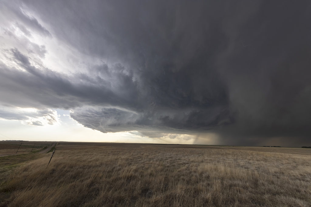
May 13th Western Kansas Gorgeous Supercell
May 13th took us to the triborder area between CO/NE/KS. Strong shear, but marginal moisture would be the story this day. A supercell formed mid afternoon and tracked south along the dryline. Structure, lightning and big hail would be the results from this pretty supercell. A couple of shear funnels occurred as well. The storm rolled south until about 9pm when it dissipated. A fun chase day and we got more than we thought we would. Sometimes good shear can overcome a limited moisture set up and still produce a beautiful storm! Enjoy the pics!
May 2nd Northwest Kansas Severe Thunderstorms
Day 1 of Tour 2 took us north from Oklahoma City to western Kansas. Shear was good this day, however moisture was lacking. This resulted in higher based severe thunderstorms with hail and high winds. Some of the areas of northwest Kansas near the Smoky Hill River bottoms are full of badlands type formations and make for a great photo! Lots of lightning also occurred with these storms as the built southward along an advancing cold front. Fun first day for Tour 2!! Enjoy the pics!