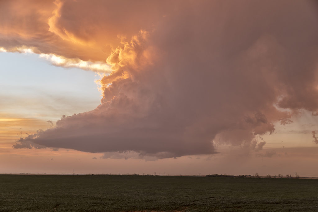
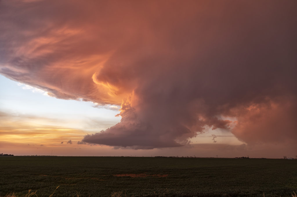
June 19th took us to the upslope area of the Big Horn mountains in southeast Montana. These mountains are notorious for producing beautiful supercells when upslope conditions occur with decent westerly flow aloft. This day would be no different. Mid afternoon, a cluster of high based storms formed near Sheridan, WY and slowly tracked northeast. One storm on the southeastern side of the cluster tapped into better moisture and instability and eventually became the storm of the day. There wasn’t a tornado threat due to limited moisture, but between wind shear and instability, it developed into a jaw dropping gorgeous storm! As the storm passed into the southeast corner of the state near Baker, it had beautiful structure and also hail the size of golfballs. In the evening, it slowly weakened as it moved into southwest North Dakota. Just a stunning storm on a day when all the ingredients weren’t there! Montana is one of our favorite states to chase in during late spring. Enjoy the pics!!
April 4th Pleasantville, IA Tornadic Supercell
April 4th was a complicated day. A powerful upper level low would pivot out onto the plains late in the period. Low level moisture was fairly shallow for a big event, with pockets of dry air mixing out the better moisture. It seemed like two areas would be the best targets: 1) southwest Iowa as the forcing came out, however moisture was forecast to mix (and did!), 2) southeast Iowa and western Illinois in the free warm sector. We sat in Ottumwa for a couple hours waiting for one target to become clear. It never really did. A cluster of storms formed in eastern Missouri and consolidated into a few supercells as they moved into western IL. We started to head that way to chase, but it would have been a long way back to Kansas City that night as several guests had to be back in Denver by late afternoon the next day. Shortly after we headed out to go to IL, the Iowa play started forming. A line of storms, now severe, formed along the dryline west of Osceola and moved east. The tail end storm really started getting it’s act together so we quickly turned around and headed toward Pella (where we saw a tornado 2 years ago!). As we approached Pella, a tornado warning came out with a confirmed tornado towards Pleasantville, which was another 15 miles west. We did all we could to get there, but were only able to get a glimpse of the pretty tornado before it dissipated. We stayed with the supercell as it approached the warm front and became tornado warned again. A brief spin up happened south of Malcom. The storm continued its path across the warm front, weakening in the colder air. Here’s a few pics of what we saw with the supercell, distant tornado and the second spin up. Enjoy!!!!
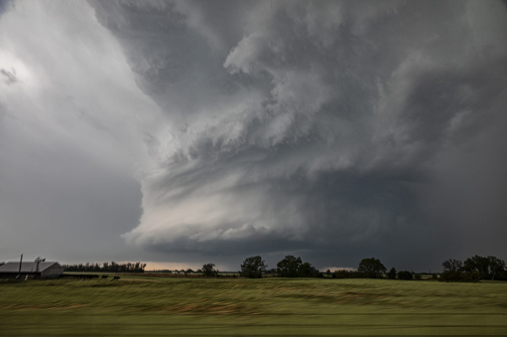
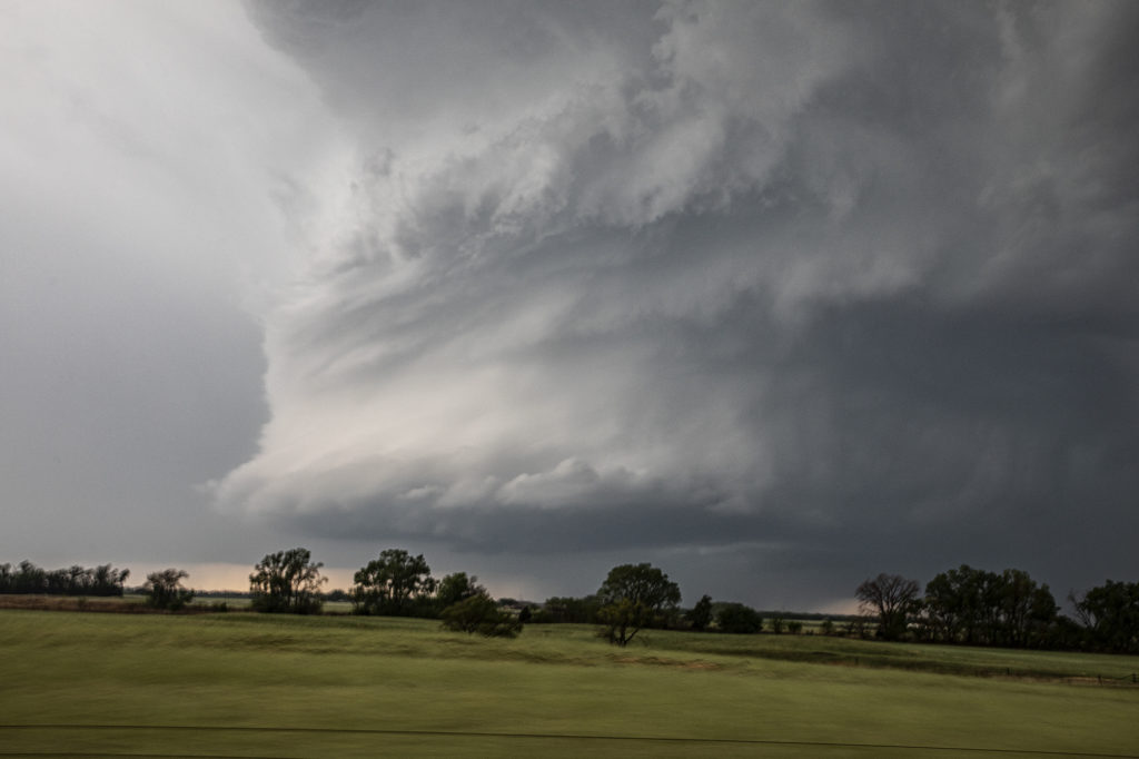
May 2nd Central Oklahoma Tornadic Supercells
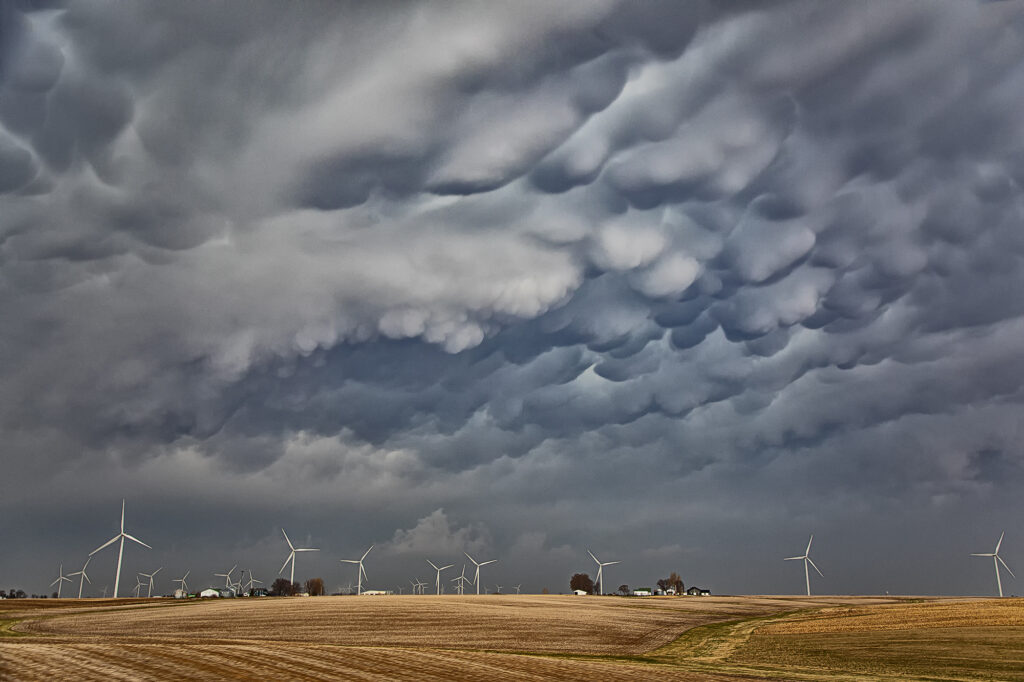
May 2nd offered a significant severe weather threat. An advancing cold front would be the focal point for severe storms, including supercells. Good moisture and instability would be present to fuel these storms. The question was what mode would storm take? As the front moved southeast, storms became linear. However a couple of storms formed along the dryline and would be the best storms to chase. A significant supercell formed near Dover, OK and produced a weak tornado. The structure on this storm was just gorgeous. Big spiraling soda can shape that spun like crazy. As the cold front overtook it, we blasted east and south towards Pauls Valley and caught another supercell that cycled several times before eventually producing a tornado near Seminole. The structure was spectacular with a mothership base to it and a very cumuliform updraft. Above it was a spectacular mammatus field that went on for many miles. A great chase day, very photogenic storms, and one of the best mammatus of the year!
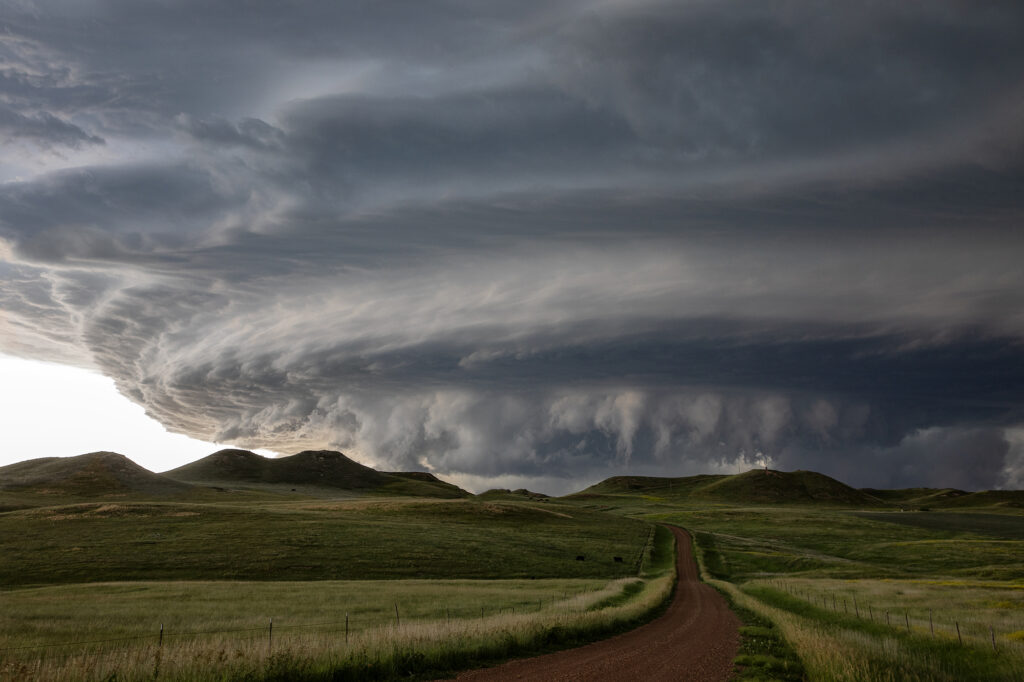
April 21st Southwest Kansas Tornado Warned Supercell
Tour 1, Close Encounters started off the tour season with a bang! On arrival day, we blasted to southwest Kansas near Coldwater and caught a pretty LP supercell spinning like crazy! It became tornado warned early evening and tried to produce a funnel. It did not produce any tornadoes. The prettiest thing about this storm were the sunset colors lightning up the underside of the anvil and mammatus clouds. A great start to the official 2022 tour season! Enjoy the pics!
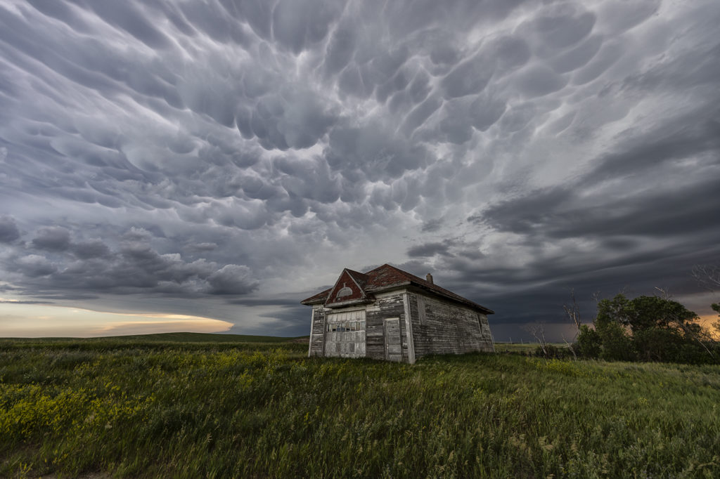
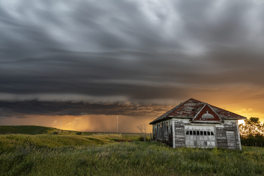
June 28th Central North Dakota Stunning Thunderstorm
June 28th took Photo Tour 3 to North Dakota. Good moisture and instability, coupled with weaker shear would allow a squall line of severe thunderstorms to form northeast of Bismark, ND. We managed to find an old abandoned farmstead south of Wing, ND where we were able to set up and capture some amazing images! The storms, coupled with the lowering sun in the evening, along with the old farmstead, allowed us to capture some of my favorite images from 2020! We stayed in place for a couple of hours photographing the area, and eventually headed back to I-94 and west to Bismark. A landspout tornado occurred well to our south near the South Dakota border, but everyone didn’t mind based on the images each person captured. Spectacular day with nature painting the Photo Tour one of the best set ups one could want! Please click on an image for a larger photo. Enjoy!
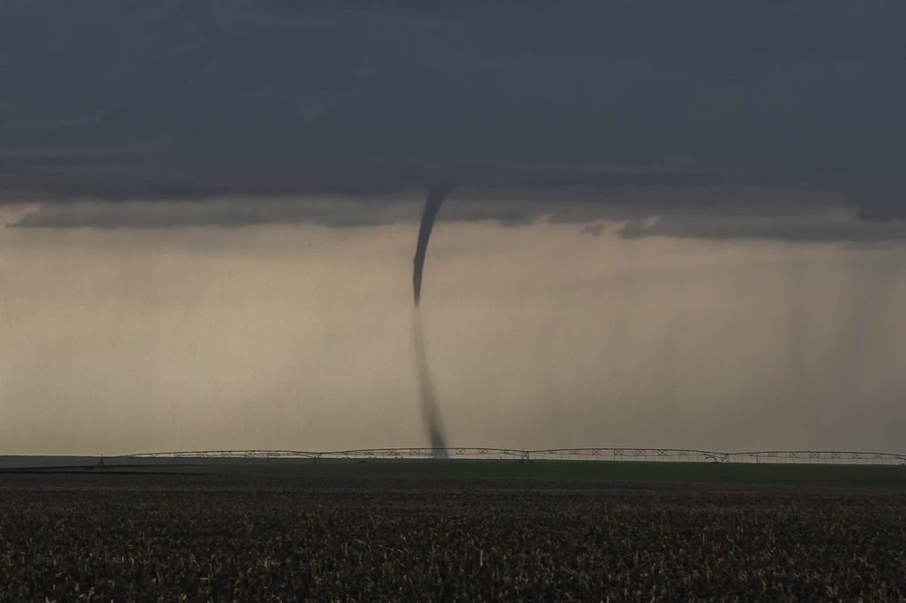
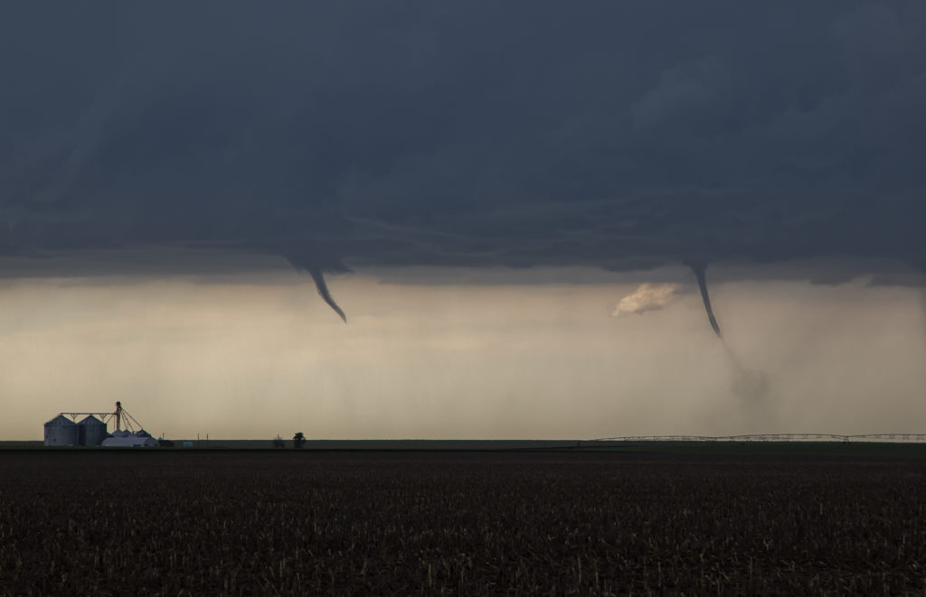
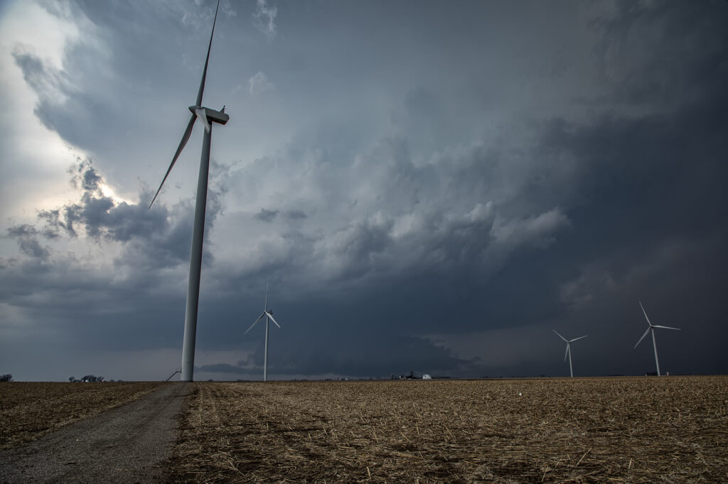
June 8th Northwest Kansas Tornadoes
June 8th continued our streak of tornadoes for each tour! Two twisters formed north of Goodland along a boundary. Decent instability and moisture, as well as a wind shift boundary, would provide all that was needed to get supercells to form. One tornado formed late afternoon, and soon a second would also form as the first was dissipating. They both were on the ground for over 5 minutes as they slowly drifted eastward along the boundary. They were quite photogenic as well!
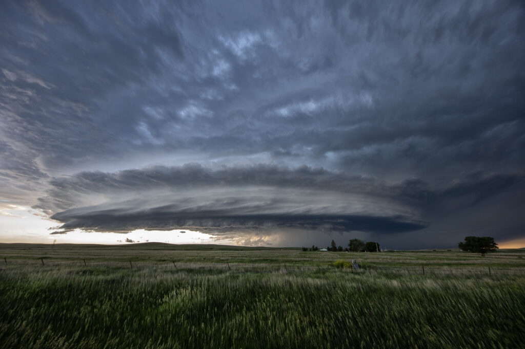
Later in the evening, a supercell came off the higher terrain of eastern Colorado and was very photogenic. Near Flagler, CO the storm had beautiful structure and quite nice colors too! Even a funnel formed briefly under the inflow side of the updraft! After a couple hours the storm eventually weakened as it moved into more stable air, leaving behind an amazing mammatus display! A great way to start the tour!