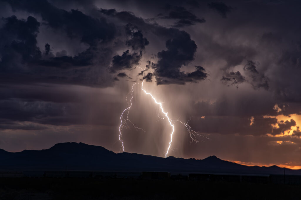
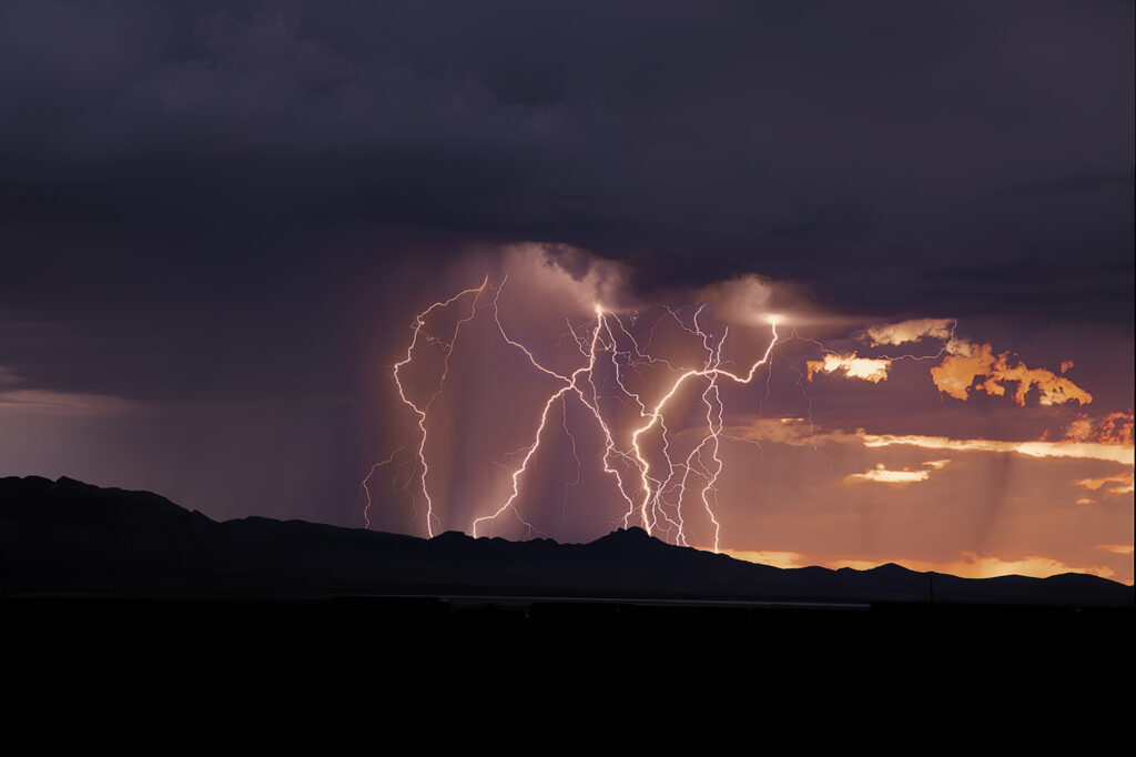
Each year we conduct lightning tours in Arizona during monsoons. This year we were there the first week of August. Despite a far from favorable weather pattern nature provided some pretty storms with excellent lightning! We traveled over southeastern Arizona and occasionally into southwestern New Mexico on various days. However the majority of the time we spent in Cochise and Santa Cruz counties this year. Temperatures were extremely hot with daytime highs from 105-115. Moisture was on the marginal side with dewpoints in the upper 40s to mid 50s. However enough was available to generate some instability to produce these storms. Enjoy the pics!
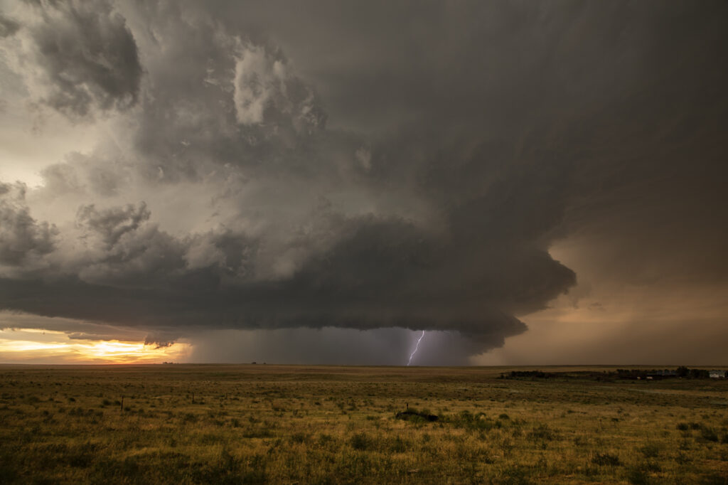
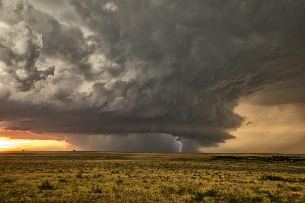
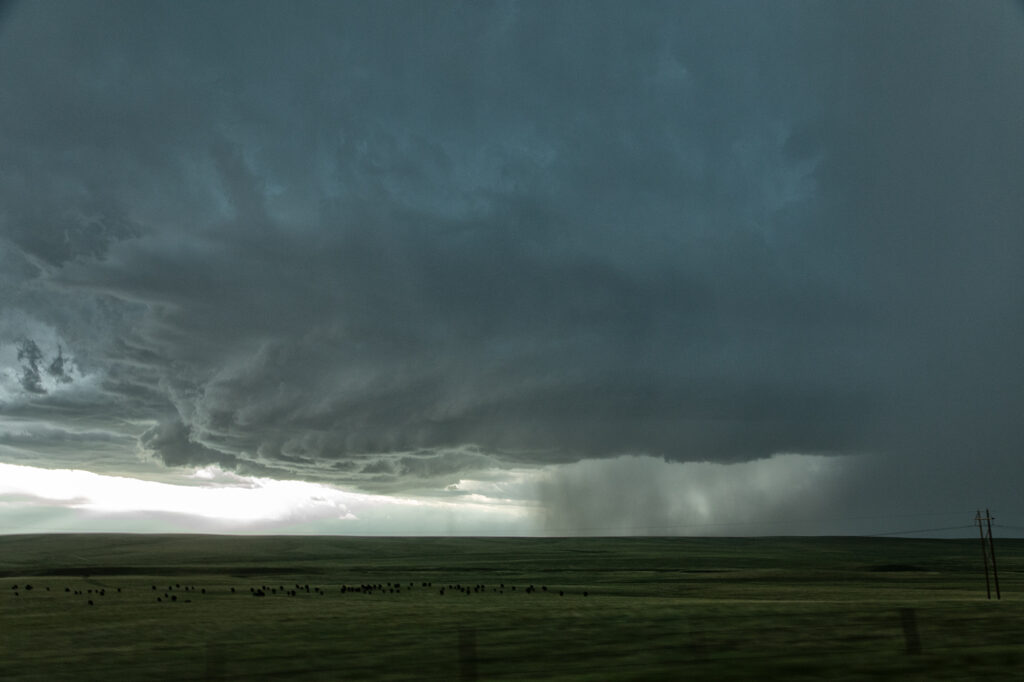
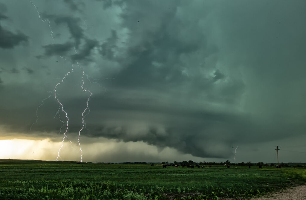
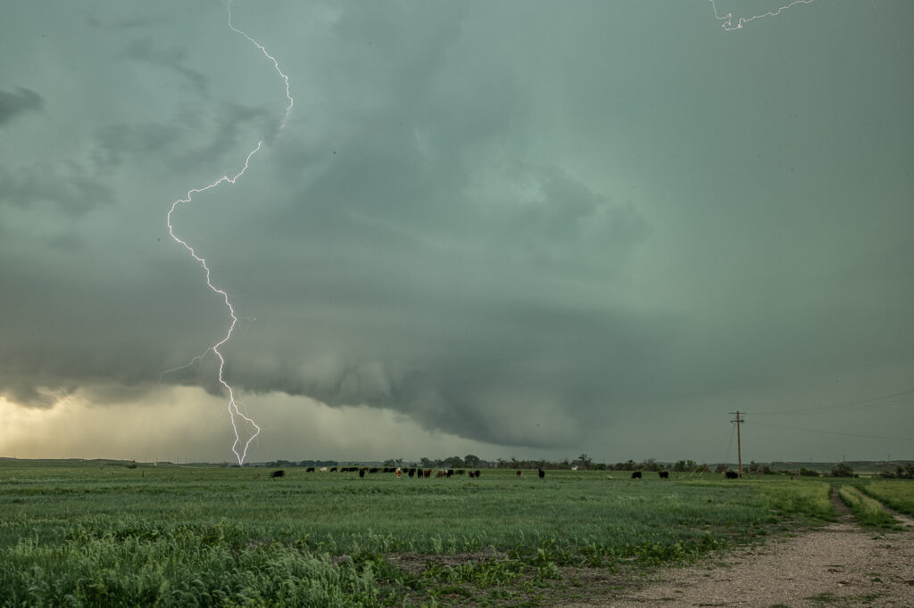
August 4th Kim, Colorado Tornado Warned Supercell
When you have nothing to photograph during our Desert Thunder tour, you go where there are storms, even if not in Arizona. Models were consistent on the set up in southeast Colorado on August 4th. We headed out and drove from Tucson, AZ to Springfield, CO. One lone supercell formed on the “LaJunta Low” just southwest of Lamar and right turned all the way to the New Mexico border. Structure was great and the lightning was amazing! We even watched a semi truck’s trailer get a direct hit, glowing it a bright orange in color! As the supercell turned into better moisture and instabillity, it steadily strengthened until it became tornado warned for 2 hours. It slowly took on HP features as the RFD cut around the updraft with a lot of precip and hail, blocking our view of what was happening under the base. A couple of times there appeared to be a cone shaped funnel that persisted for several minutes. Eventually though, the precip became too dense to see under it anymore and we had to admire the beautiful structure! A long way to come for a storm, but it was well worth it! Enjoy the pics!
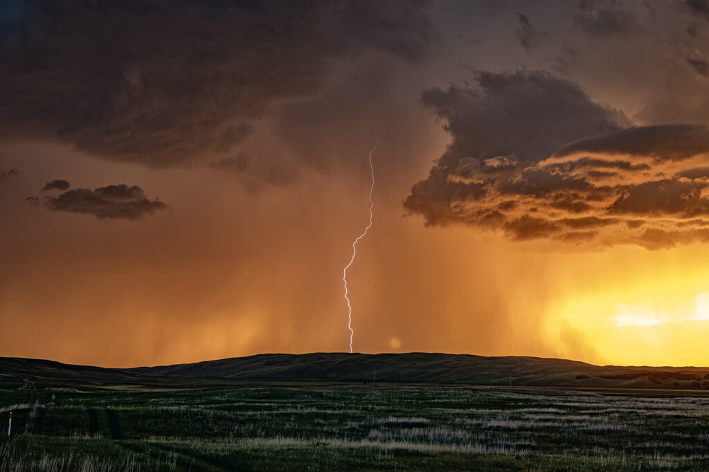
July 1st Hyannis, Nebraska Supercell and Sunset Beauty
I wasn’t expecting much on July 1st and what we got was a lot better than I was hoping! A north/south dryline was over western Nebraska, however limited moisture and instability were present which would limit the severity of storms. We encountered a nearly stationary high based supercell near Lakeview that had decent structure, nice lightning and hail the size of golfballs. We eventually got cut off from the storm due to poor road options, so we moved east and south of Hyannis to watch a new cluster of severe storms at sunset. What a show they put on! It’s been a few years since we’ve encountered such an amazing display of color at sunset. Intense lightning, sun setting through the core and luscious green rolling hills made this a winner to me!! Please enjoy the pics, some beauties!

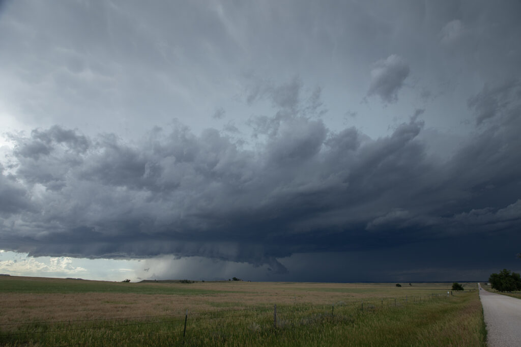
June 29th Edgemont, South Dakota Supercell
Modest amounts of moisture, wind shear and CAPE would lead to storms forming along the Black Hills. One storm latched onto an outflow boundary and spun southeast along the southern side of the hills into northwest Nebraska. We encountered some intense hail up to tennisball size! The structure was nice and the cell had that classic “hail core green” look to it. It made for some nice photos ops with the structure, colors and pretty scenery of the Black Hills. We pushed around the supercell towards Chadron, NE where numerous storms formed and weakened the supercell due to too many cell interactions. A fun day, nice supercell, broken windshield from the hail and pretty colors!! Since this was the photo tour’s first day, they thoroughly enjoyed it! Enjoy the pics!
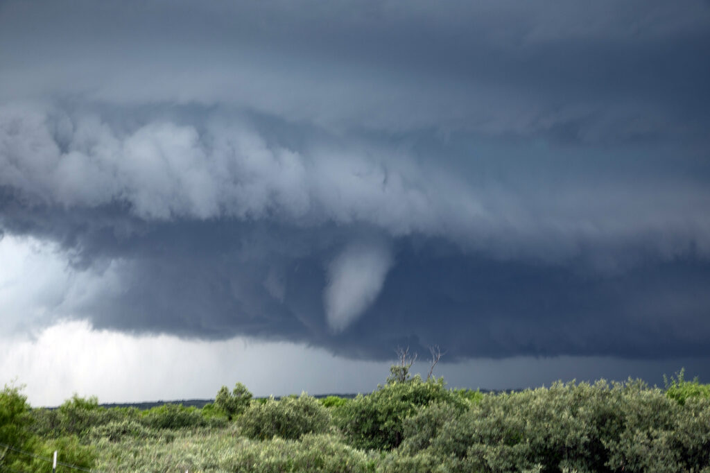
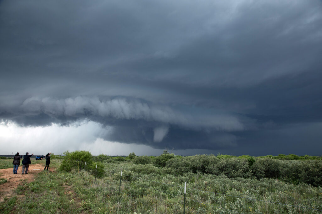
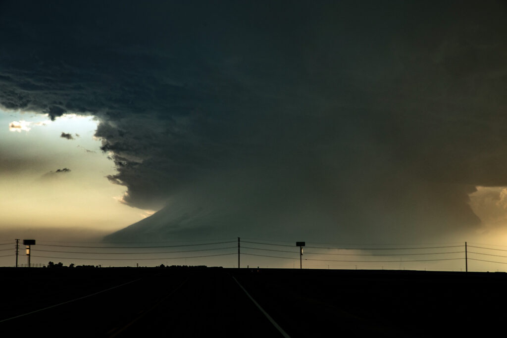
June 13th Potter, Nebraska Surprise Tornadic Supercell
June 13th looked poor on paper. Modest shear, moisture and CAPE along the Cheyenne Ridge between Colorado and Nebraska. We started west towards Cheyenne where moisture was really quite meager. Much better and deeper moisture and instability existed further east, from near Sidney, Nebraska eastward. Strong easterly winds were pushing that moisture westward, but it didn’t look like it would make it in time before storms collapsed. Outflow surge from Cheyenne storms blew east and when it interacted with that deeper moisture, a line of storms, some supercells, exploded. Near Potter, NE on I-80 an updraft anchored and spun hard. It became incredibly electrified! It also produced a 5 minute multivortex tornado before it produced a tapered truncated cone tornado right near the interstate. Staying down wind a few miles allowed us to get out of the intense lightning threat, but also limited the view we had. But we were able to see the tornado and structure of the supercell together. It was very nice! Quite the surprise ending to a marginal day. Once in awhile nature gives you those surprises! Enjoy the pics!
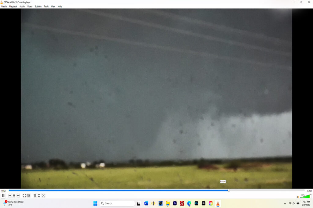
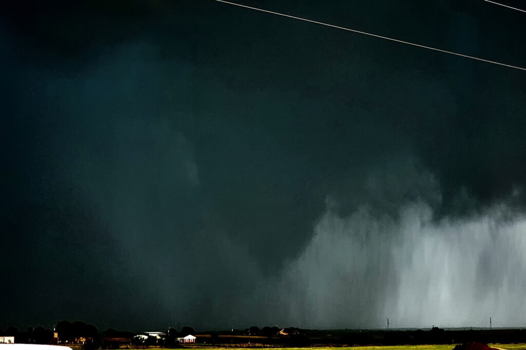
June 3rd, Windthorst, Texas Tornado Warned Supercell
June 3rd looked like a day with abundant moisture and CAPE, but fairly weak shear. We knew we’d need a boundary interaction to produce some rotating storms to get a tornado to form. We dropped south from OKC to Wichita Falls, TX to play a developing supercell. The cell quickly took on an outflow dominant look, so we decided to drop south of it and see if anything else would form. As we did near Archer City, a new updraft formed and merged with the old storm. An outflow boundary surged south from Oklahoma convection and smashed into our newly intensifying cell. Just what we needed! Soon, the low levels started spinning wildly! A couple of small funnels would form and dissipate. Then as rain and huge hail wrapped around the mesocyclone, a large cone funnel formed back in the rain. We could never confirm if it touched down or not, but usually when it is 3/4 of the way down, you would assume there would be a circulation. The darkened pic to highlight the funnel is courtesy of SLT guide James Breitenbach. It is certainly compelling that it could have touched down! Excuse the blurry image as I accidentally hit the focus ring as I sat the camcorder on the dash! Ugh….
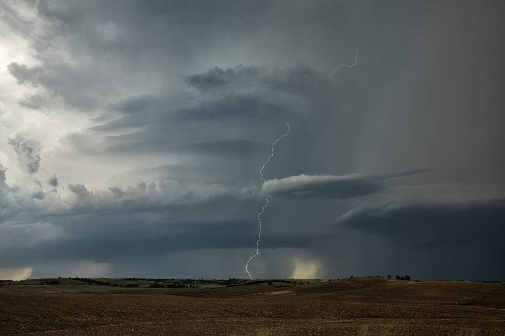
June 2nd Sargent, Nebraska Intense Supercell
Although June 2nd didn’t look like a tornado day (and it wasn’t), we were hoping for some pretty storm structure. Limited moisture, but steep lapse rates and high CAPE would provide the ingredients to get storms to form. Moderate deep layer shear would cause storms to spin and look nice. They also produced copious amounts of lightning and very large hail to baseball sized. We intercepted a very nice supercell near Sargent, Nebraska that sat anchored along a stationary front for hours. Structure was quite nice with the striated “stack of plates” look to the updraft, and it even produced a couple of shear funnels at cloud base. Since they were very slow moving, we were able to sit and watch for long periods of time. Eventually, they gusted out as we left to head to our hotel for the night. A fun day and a bit better than I was planning on. Enjoy the pics!

May 25th Afton, Texas Tornadic Supercell
May 25th looked like a high CAPE, lower shear day. A supercell formed west of Matador early in the afternoon, and drifted south along a boundary. It just never had the look like it wanted to produce. Flow around 850-700mb was lacking and it showed. Further south from town, we ended up near Afton on an FM road. Chaser traffic was pretty bad, but we managed to get out from under the hook and watched as the storm’s RFD really cranked up. A truncated cone funnel formed and reportedly touched down. Within a few minutes it dissipated and the storm became outflow dominant. Still in chase mode, we targeted a new supercell southwest of Haskell. By the time we got there, the tail end storm rapidly intensified. Reports of a brief tornado came in, but from our location northeast of the updraft, looking down the notch, we could not confirm or deny. A couple of suspicious lowerings were observed, but that was about it. The electrification of this storm was other worldly! Eventually it weakened as a cluster formed, so we blew it off and headed back to Oklahoma City for other chase day. An exciting day that we all enjoyed some edge of your seats chasing! We hope you like the photos!
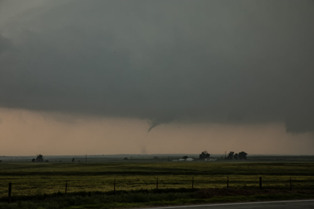
May 23rd Kit Carson, CO Tornadic Supercell
Tough day! Two clear choices were in play. Chase the Cheyenne Ridge, which can (and did!) produce magical results. Or chase the eastern side of the Palmer Divide where dewpoints 5-7 degrees higher were forecast to pool along a boundary. I had a feeling the Cheyenne Ridge would get interesting, but also the latter target would also produce. Higher dews/instability usually result in better results. We caught a stunning structured supercell near Kit Carson. However the Cheyenne Ridge produced one supercell that dropped a few tornadoes. Our storm also produced a tornado, but had far superior storm structure. We chased it down towards Eads where it slowly started to weaken. Having the appearance of a spiraling barber pole, the structure was the best of 2025! We were a bit too far east (after chasing another storm) to get a good shot of the tornado, but a highly contrasted image clearly shows it. No regrets with a storm this pretty! Enjoy the pics!

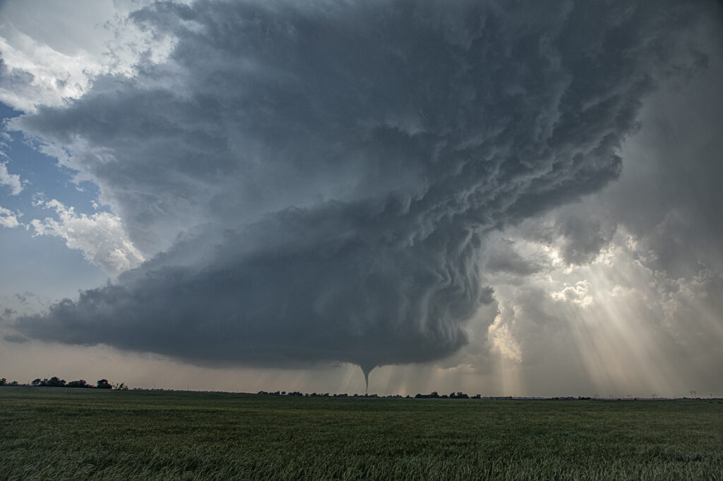
May 18th Arnett, OK Tornadic Supercell
May 18th looked like a big day on paper. And it certainly fulfilled those expectations! There were a couple potential plays. Western Kansas to the north of the low, and western Oklahoma along the dryline where the subtropical jet punched in to it. After much deliberation, we chose western Oklahoma. Both targets produced and produced big! By mid afternoon multiple updrafts formed along the dryline, where a bit of a bulge was present. The southern most updraft ended up becoming the dominant one and quickly developed into a major supercell. We positioned ourselves down wind of it so we could look at the structure and well as any potential tornado development. Soon, a slender elephant trunk shaped tornado developed and danced across the ground for a few minutes. After it roped out, another funnel formed, but we couldn’t tell if it touched down or not. Moving back east into Arnett, we watched as a merry go round formed under the updraft base and eventually a stout tornado developed. This tornado unfortunately did cause damage and was given an EF3 rating. It came very close to town before it roped out. Another tornado developed from a new mesocyclone as often occurs in cyclic storms and dropped a tapered cone tornado that was on the ground for several minutes. As the storm continued moving northeast, it encountered cooler more stable air and eventually died off. A fantastic day for the tours and an amazing storm to watch! Enjoy the pics!