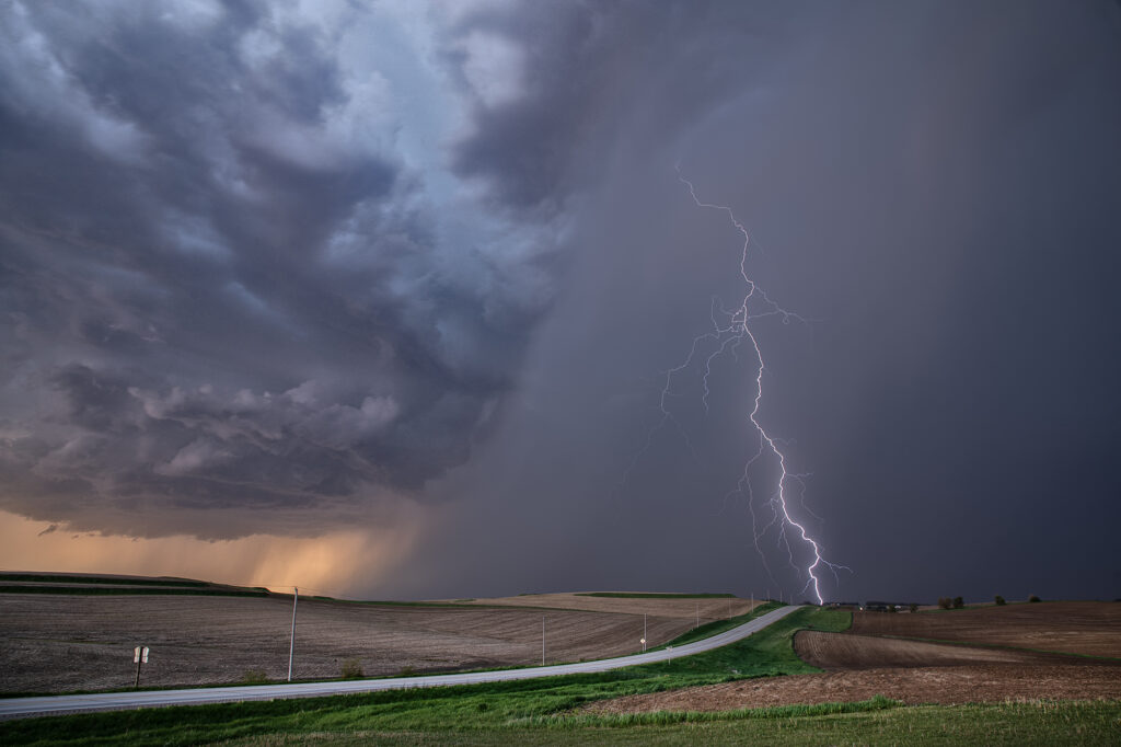
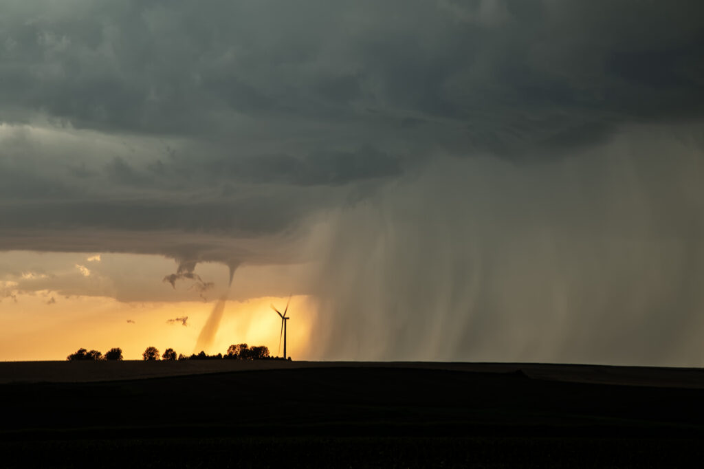
May 15th took us into Iowa. An old outflow boundary/cold front intersection would be our target in northwest Iowa. Plenty of shear, modest moisture and instability would support severe storms, with some tornado threat. We caught several storms, but one, west of Ida Grove, would produce a short-lived tornado. This storm was also an electrified beauty! Several CG strikes occurred per minute, and everyone’s cameras were clicking away! I managed to get a few decent ones as well. A fun day, tons of storms and a brief tornado to boot! Enjoy the pics!
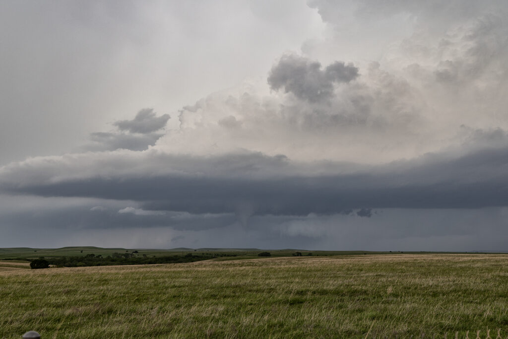
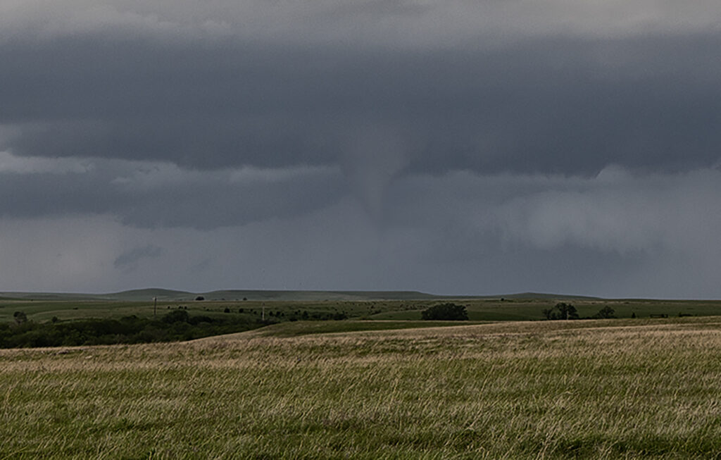
April 23, 2026 Central Kansas Tornadoes
As we headed from Denver to Oklahoma City to prepare for our first tour of the season, we caught a few severe storms producing a couple of tornadoes in Kansas near Cottonwood Falls. A boundary was pushing slowly east and fired off supercells along it, so we stayed with them as they moved into better shear. One lone supercell east of the boundary had nice structure and produced a truncated cone tornado west of town. In the distance you could see the line of storms on the front and they started producing landspouts. Later in the evening, 2 supercells south of the KS/OK border became violently tornadic with one strong tornado directly impacting Enid. Our thoughts and prayers go out to those affected it this tornado!