Tag Archives | June 2014

June 18, 2014 Central South Dakota Tornado Outbreak

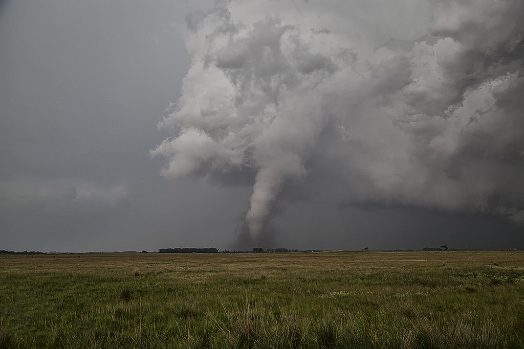
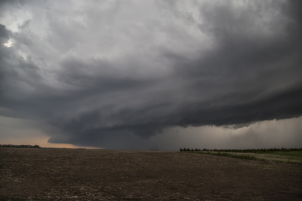
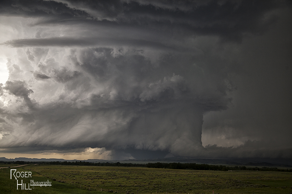
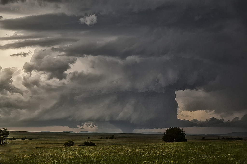
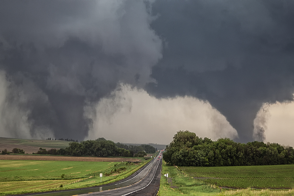
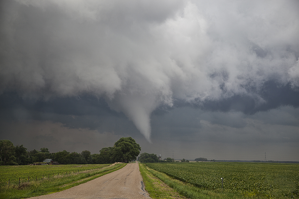
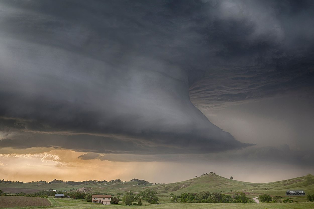
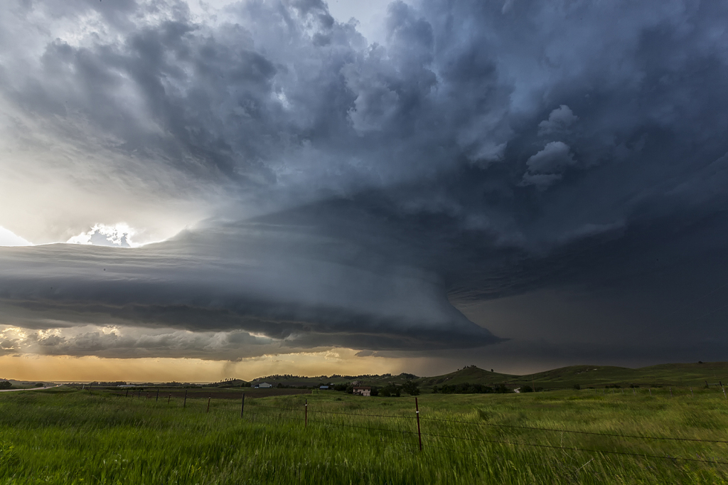
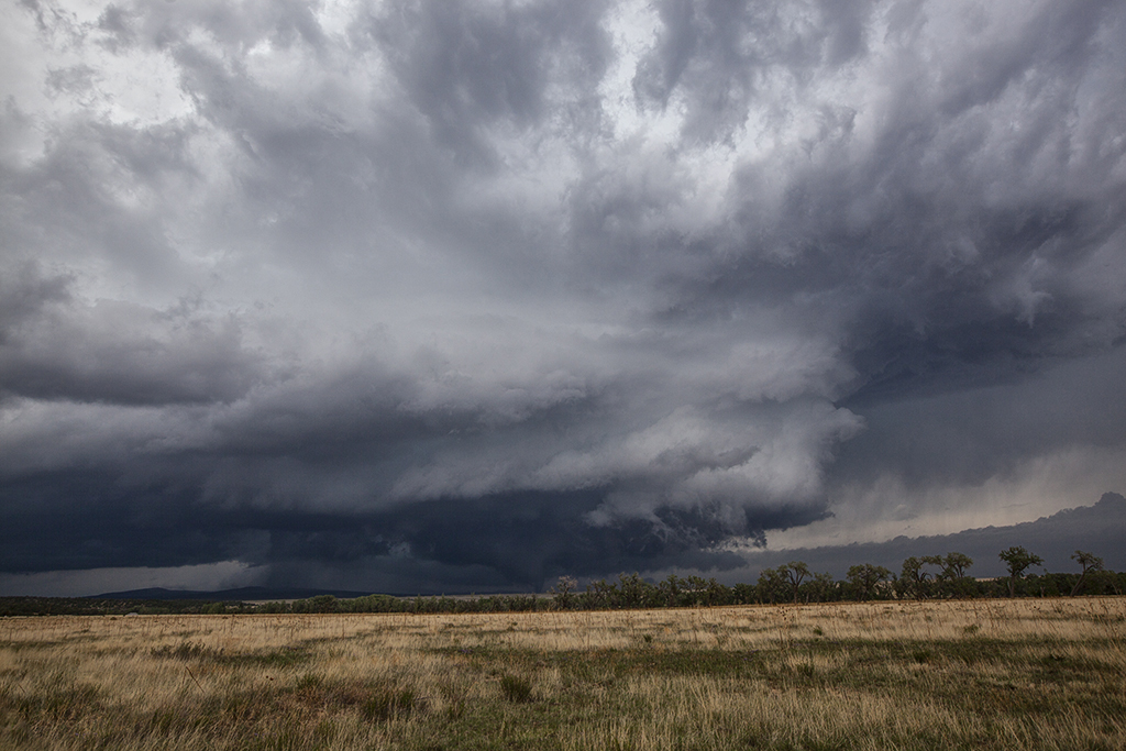
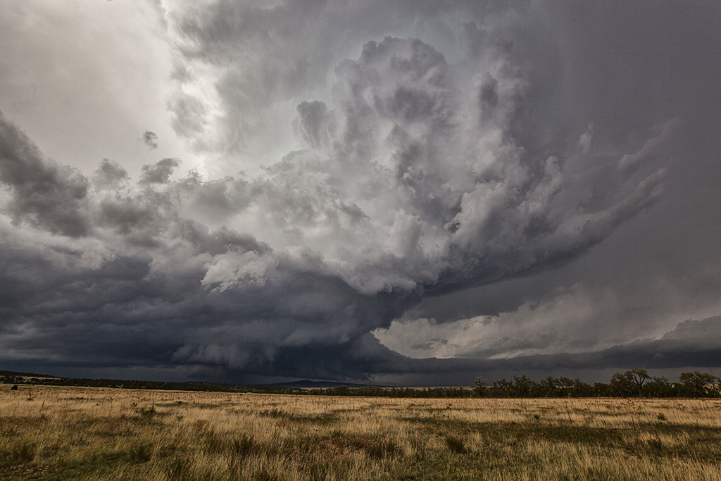
June 18th was an incredible day in South Dakota! Superb moisture, instability and shear was moving northwest from Nebraska and pooled along a cold front.  By mid afternoon numerous storms formed along the boundary and merged into a squall line.  This was a bit disheartening to see, but we stayed with the tail end and eventually, as the better shear arrived, supercells formed and produced at least 8 tornadoes we witnessed including a couple of strong tornadoes near Wessington Springs, SD. These storms were amazingly electrified and had great structure as well. We had two different times when we had 2 tornadoes on the ground together. The final set of twins were the last two tornadoes of the event and very photogenic. What an amazing 3 day period we had, were we witnessed nearly 15 tornadoes!


June 17, 2014 – Eastern Montana Record Tornado

June 17th was a tough day to forecast. It was clear there were two targets, northeast Nebraska again, or far western South Dakota/eastern Montana. After analyzing both, we decided to head to western South Dakota. In the end both areas produced several tornadoes, however the largest and most powerful tornado ever recorded occurred in southeast Montana and we were privy to watch the event from a safe and spectacular distance! Very strong shear, dewpoints near 70 (unheard of for Montana!), high instability and convergence along the dryline set the stage there for violent supercells and strong tornadoes. By early afternoon the storm of the day formed near Capital, Montana as it sat and steadily intensified. We were racing trying to get there in time (VERY early initiation!!!!) , and managed to catch the tornado and supercell at its strongest and prettiest stages! The result was a nearly mile wide wedge tornado that was rated EF3 (Very high for a remote region!)  and was on the ground for nearly an hours time. Fortunately it dissipated just before reaching Camp Crook, SD or the destruction would have been severe.


June 16, 2014 Northeast Nebraska Tornado Outbreak

First, our heart felt sympathy goes out to those who suffered losses on this day. When we awoke on the morning of June 16th, I had butterflies in my stomach. I knew there would be potential for strong to violent tornadoes in Nebraska. Unfortunately those fears were realized as at least a half dozen strong or violent tornadoes would ravage the area east of Norfolk. The town of Pilger would be particularly hardest hit. We spent a good chunk of the day around Columbus analyzing data and watching things unfold.  With a temp of 83 and a dewpoint of 78, stiff east winds buffeted the area along a warm front. Conditions were ripe for powerful supercells and tornadoes. Mid afternoon storms formed along and north of the warm front. They moved into colder air and weakened. We knew it wouldn’t be long before storms would form along the warm front and ride it eastward with extreme shear. Southeast of Norfolk the first tornado formed and tracked near Stanton. Another tail end cell developed and produced the rest of the tornados this day with twin EF4 tornadoes destroying Pilger and other locations northeast of there. We watched from the back side of the tornadoes, about 1-2 miles east of us as the event unfolded. An event we’ll never forget! Tornadoes of every shape, size and strength occurred. The last time twin violent tornadoes occurred so close together was nearly 50 years ago! Amazing, and devastating to say the least!


June 13, 2014 – Nebraska Beautiful Supercell

June 13th appeared to be a decent chase day. An approaching shortwave would induce a lee cyclone that would in turn draw moisture northward into western Nebraska. A developing dryline would be the focus for several storms that would form. We played the tail end storm as it developed eastward and spun very hard. Due to fairly high cloud bases, this storm became a tad outflow dominant and never could produce a tornado. It was tornado warned twice in it’s life cycle. It did have very pretty structure and also produced very large hail and high winds. The sandhills of northwest Nebraska provide an amazing foreground for storm photography!


June 8, 2014 – New Mexico Tornadic Supercell

What a surprise it was this day!! A magnificent tornadic supercell formed over the higher mountain in northeast New Mexico west of the town of Watrous. This storm anchored for nearly 2 hours along the mountains and an old outflow boundary. Finally as the storm became a monster, it moved east of the mountains and tracked along the boundary producing at least one tornado we could confirm. A couple other chasers also confirmed the tornado near I-25 north of town. The structure on this storm was top notch as well! It also produced copious amounts of hail up to baseball sized.  As the storm moved well east of the mountains, it eventually merged in with a line of severe storms, still spinning wildly all the way to the Texas border.