Tag Archives | funnell

July 6th/7th Northeast Wyoming/Southwest South Dakota Tornadic Supercell and Severe Storms

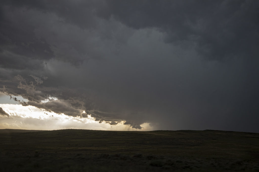
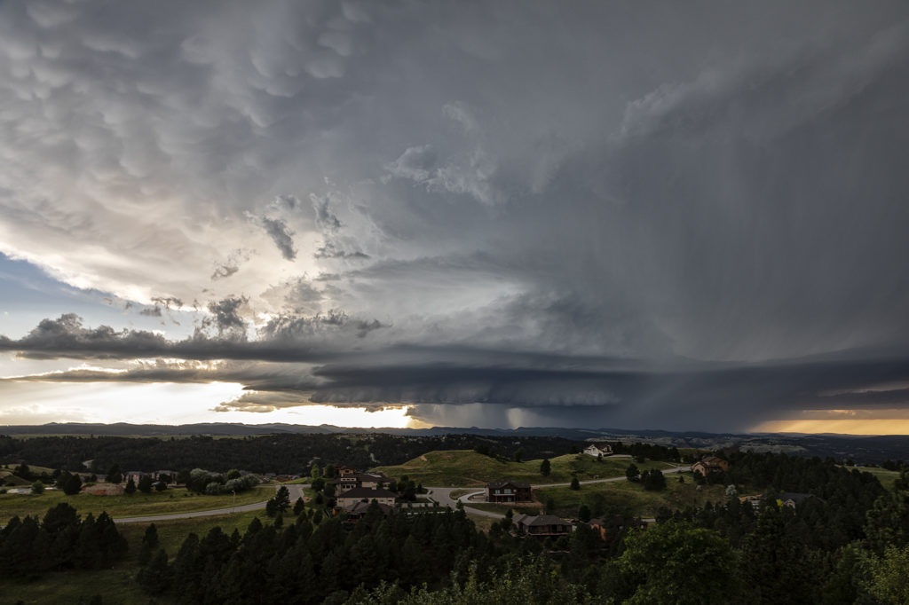
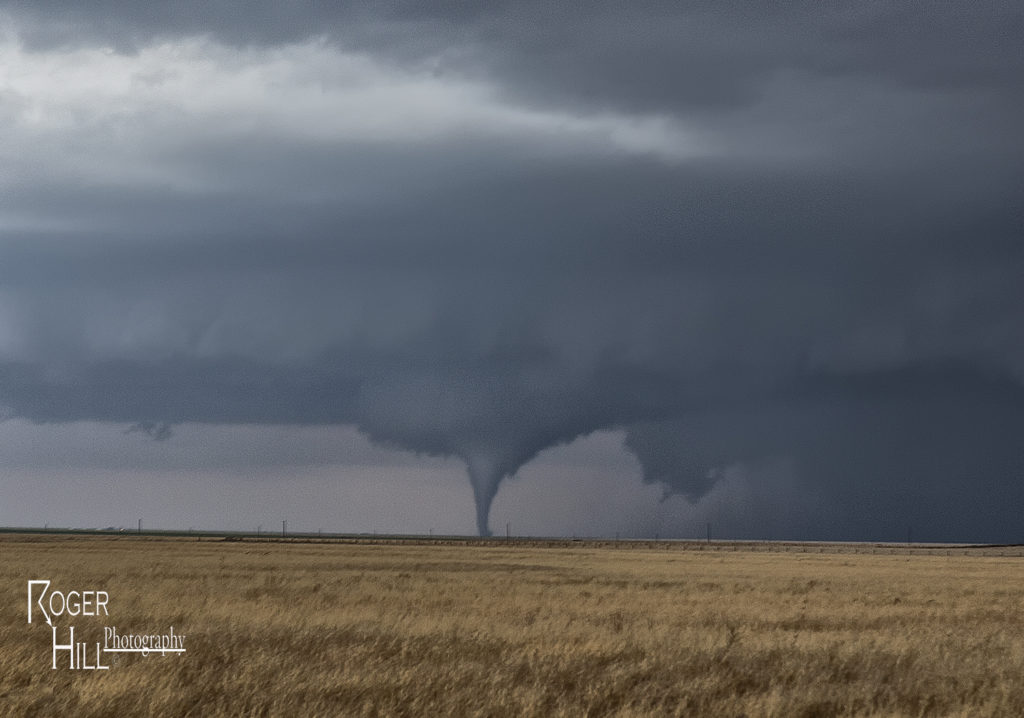
July 6th was an inbetween day for our tours. However, as we often do, if there is a decent set up, we’ll run one of our on call tours. That’s exactly what we did the 6th and 7th! On July 6th we started in Denver and blasted to southeast Montana where storms were forecast to form along a boundary with good instability and shear. We’ve seen numerous tornadoes in this region over the years and some outstanding supercells! Today would be no different! We made it south of Broadus, MT and turned east on a dirt road near Biddle. We had a great view of the developing supercell. As we continued east, the forward flank core caught up with us so Caryn had to push it a bit to get out of the heavy rain so we wouldn’t get stuck. Low and behold as we were blasting east on muddy roads, trying to get south of Alzada to head south towards Hulett, WY, our wonderful storm tornadoed. Couldn’t see it from our location, thanks to horrid road network. However, if you were north of Hulett, you had a decent, albeit distant view. We stayed with the storm as it crossed the Black Hills near MT Rushmore and onto the nearly plains. It became a stunningly beautiful supercell as it tracked towards the Badlands. Gorgeous!

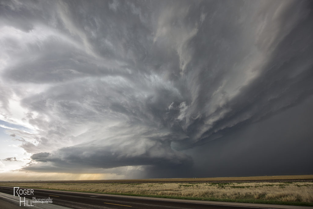
On the 7th we played southeast Montana again. However moisture quality was much poorer than the day before. Storms formed along a boundary and became a squall line as they moved east. They were still pretty and offered some very photogenic moments! We stayed in front of them back to Rapid City, SD where we spent the night before returning to Denver the next day.

Please click on a photo for a larger image. Enjoy!

April 15th Eva, Oklahoma Tornadoes

April 15th had potential. We weren’t sure how storm modes would end up, and the bigger question was how good of quality would low level moisture be this day. The various models were at odds with each other. We decided to target the northern Texas panhandle dryline and hope storms could form, mature and then move off the dryline into better air. We sat around the Dalhart, Texas area waiting for initiation to occur. By mid afternoon storms started to form, but due to many splits, storms never maintained for very long without having merging issues. A couple storms did intensify and one particular supercell even became tornado warned southwest of Stratford. It actually tried hard as a wall cloud formed and was steadily rotating. However, its rear flank downdraft became too strong and undercut the storm’s updraft causing it to weaken. It cycled up and down a couple times, and then near Stratford, something happened. The storm was ingesting very unstable air as inflow dramatically increased. You could see a huge dirt plume skyrocketing upward as rapid lift was occurring in the storm’s forward portion of the updraft.

A tornado warning was reissued as the storm crossed into the Oklahoma panhandle. Soon a cone shaped funnel formed and was visible for about 5 minutes before it dissipated. The structure of the supercell was top notch as a sculpted liberty bell formed and spun wildly. We raced up the highway towards Eva and sat on US 64 east of town about 5 miles. An elephant trunk shaped tornado soon formed and stabbed the ground a few times and dissipated. Quickly another larger truncated cone shaped tornado formed and stirred up dirt and debris for a minute or two and also dissipated. As the supercell crossed 64 heading towards Eva the supercell had a very strong RFD surge as a new wall cloud quickly lowered to our northwest. Soon a pretty white elephant trunk shaped tornado formed, followed by a second one just to the east of the first. These two danced around for 10 minutes, often creating multiple vortices under them and then dissipated soon afterwards. By this time darkness was approaching and the storm was weakening, so we broke off our chase and headed for home.  Great day and fortunately all tornadoes occurred in open country!