Day 1 of Tour 2 took us north from Oklahoma City to western Kansas. Shear was good this day, however moisture was lacking. This resulted in higher based severe thunderstorms with hail and high winds. Some of the areas of northwest Kansas near the Smoky Hill River bottoms are full of badlands type formations and make for a great photo! Lots of lightning also occurred with these storms as the built southward along an advancing cold front. Fun first day for Tour 2!! Enjoy the pics!
July 6th/7th Northeast Wyoming/Southwest South Dakota Tornadic Supercell and Severe Storms
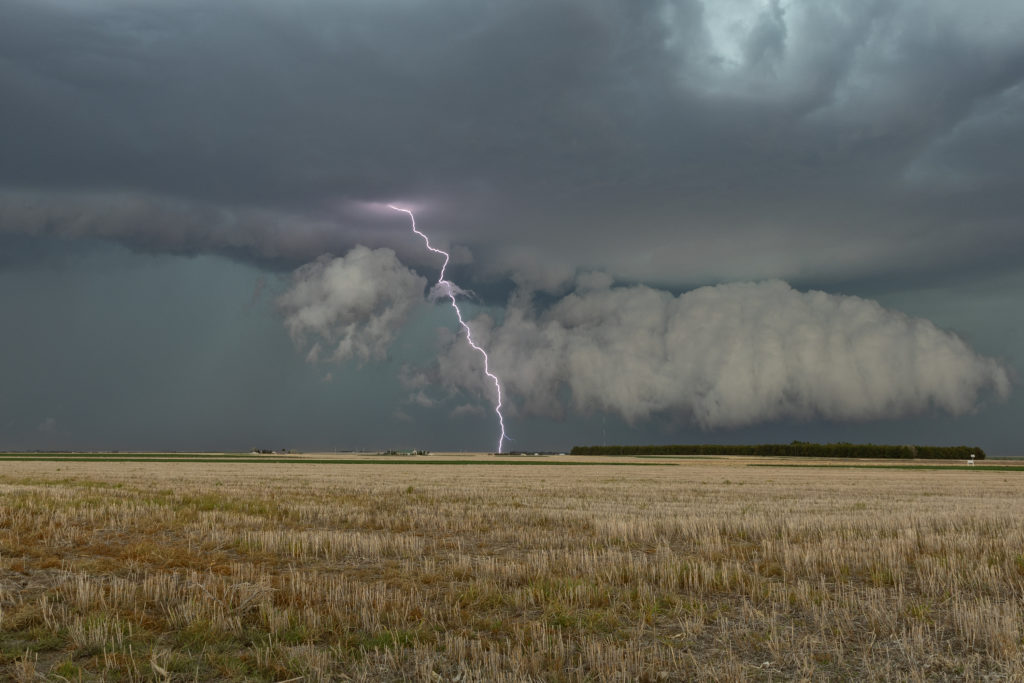
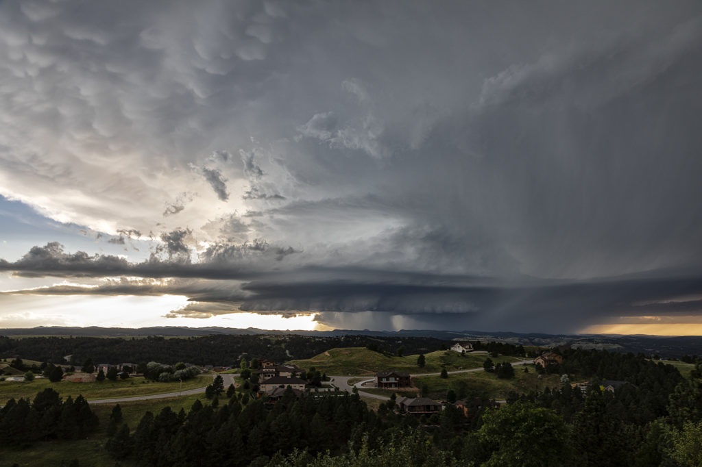
July 6th was an inbetween day for our tours. However, as we often do, if there is a decent set up, we’ll run one of our on call tours. That’s exactly what we did the 6th and 7th! On July 6th we started in Denver and blasted to southeast Montana where storms were forecast to form along a boundary with good instability and shear. We’ve seen numerous tornadoes in this region over the years and some outstanding supercells! Today would be no different! We made it south of Broadus, MT and turned east on a dirt road near Biddle. We had a great view of the developing supercell. As we continued east, the forward flank core caught up with us so Caryn had to push it a bit to get out of the heavy rain so we wouldn’t get stuck. Low and behold as we were blasting east on muddy roads, trying to get south of Alzada to head south towards Hulett, WY, our wonderful storm tornadoed. Couldn’t see it from our location, thanks to horrid road network. However, if you were north of Hulett, you had a decent, albeit distant view. We stayed with the storm as it crossed the Black Hills near MT Rushmore and onto the nearly plains. It became a stunningly beautiful supercell as it tracked towards the Badlands. Gorgeous!
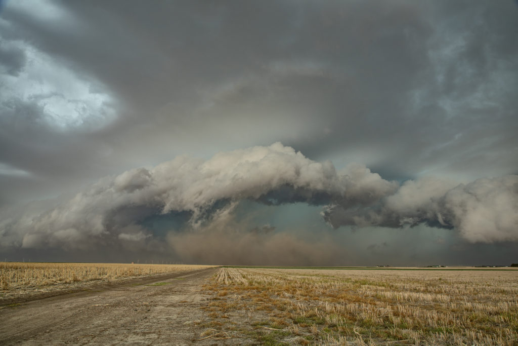
On the 7th we played southeast Montana again. However moisture quality was much poorer than the day before. Storms formed along a boundary and became a squall line as they moved east. They were still pretty and offered some very photogenic moments! We stayed in front of them back to Rapid City, SD where we spent the night before returning to Denver the next day.
Please click on a photo for a larger image. Enjoy!
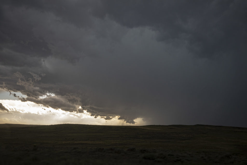
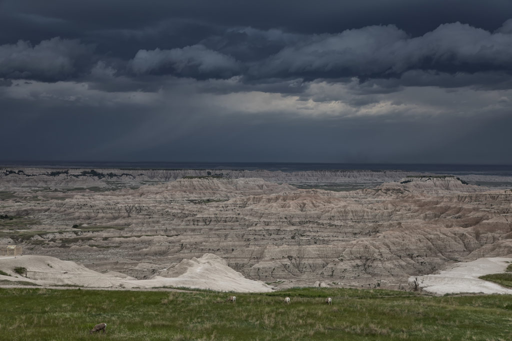
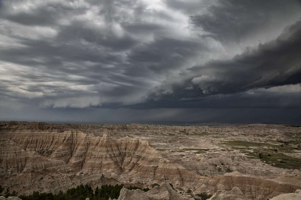
June 6th South Dakota Badlands Severe Storm
June 6th appeared to be a day of fast moving squall lines, and it panned out to be just that. Storms formed early afternoon over Colorado and Wyoming and raced north, at times over 100 mph, to the northeast! These storms produced extreme wind damage as the pushed through the Dakotas by evening. As they approached Badlands National Park, they were severe with hail and winds, while the badlands themselves, provided a very photogenic foreground. Please enjoy the pics and click on an image for a larger photo.