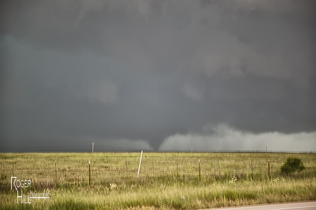
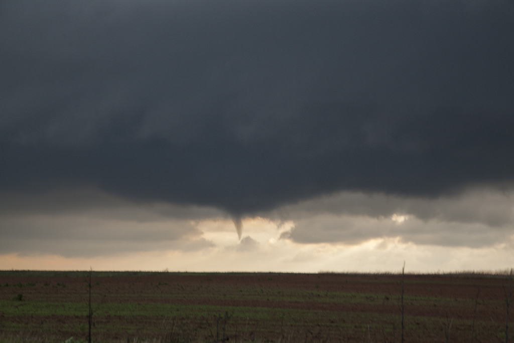
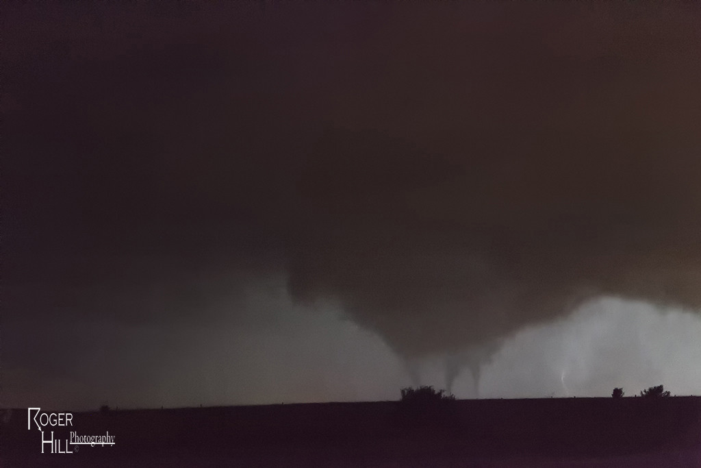
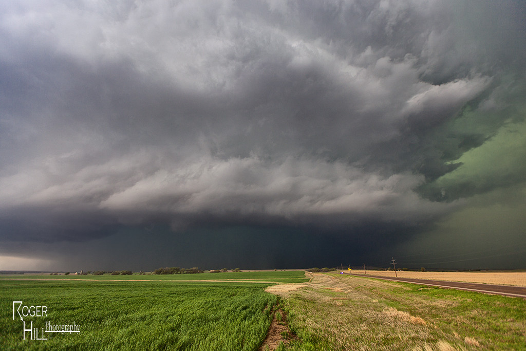
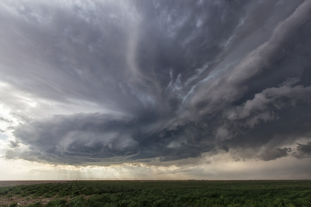
May 8th had significant severe weather potential. Several boundaries would come into play that would focus severe storms and tornado potential. We chose an outflow boundary that extended from near Lubbock eastward to north of Dallas. A supercell storm formed along the boundary and became quite intense. As it moved eastward along the boundary it produced a tornado just north of Throckmorton, Texas. It was on the ground for several minutes and became fairly significant as it eventually wrapped in rain.
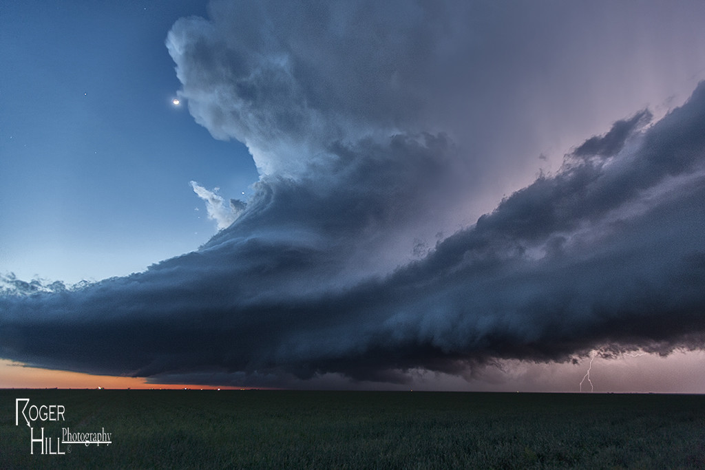
May 6th Southern Kansas/Oklahoma Tornadic Supercells
A complicated scenario was unfolding this day. Chase well north along the warm front or play south on the nose of the dry punch. We chose the latter. By mid afternoon storms exploded freely in the warm sector and produced a few tornadoes. We intercepted one tornadic storm near Goddard, Kansas, followed by a beautiful supercell near Renfrow, Oklahoma. Fun and exciting day for everyone!
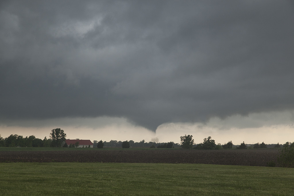
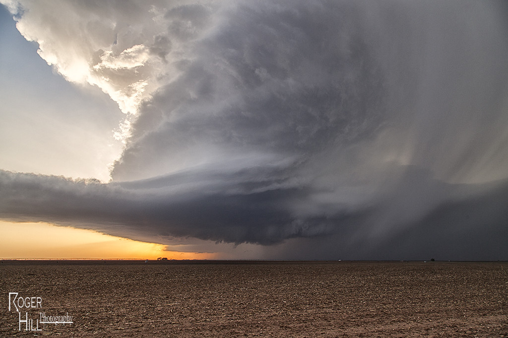
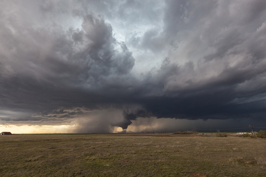
May 5th Luther, Texas Tornado
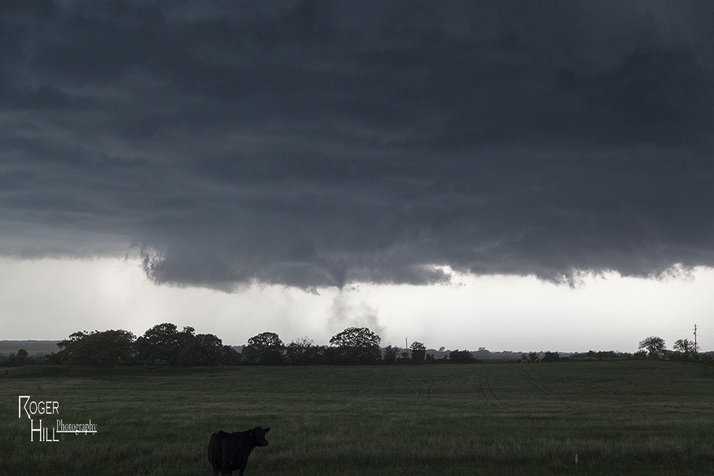
Tour 2 got a special treat this day. We spent the night in Big Spring, Texas and waited for the skies to clear behind a large complex of storms. It did by noon, and the outflow boundary/dryline triple point starting developing cumulus towers by early afternoon and an amazing supercell formed and produced a gorgeous tornado! It was on the ground for nearly 20 minutes while churning across the countryside.
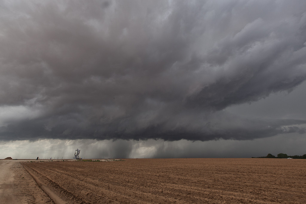
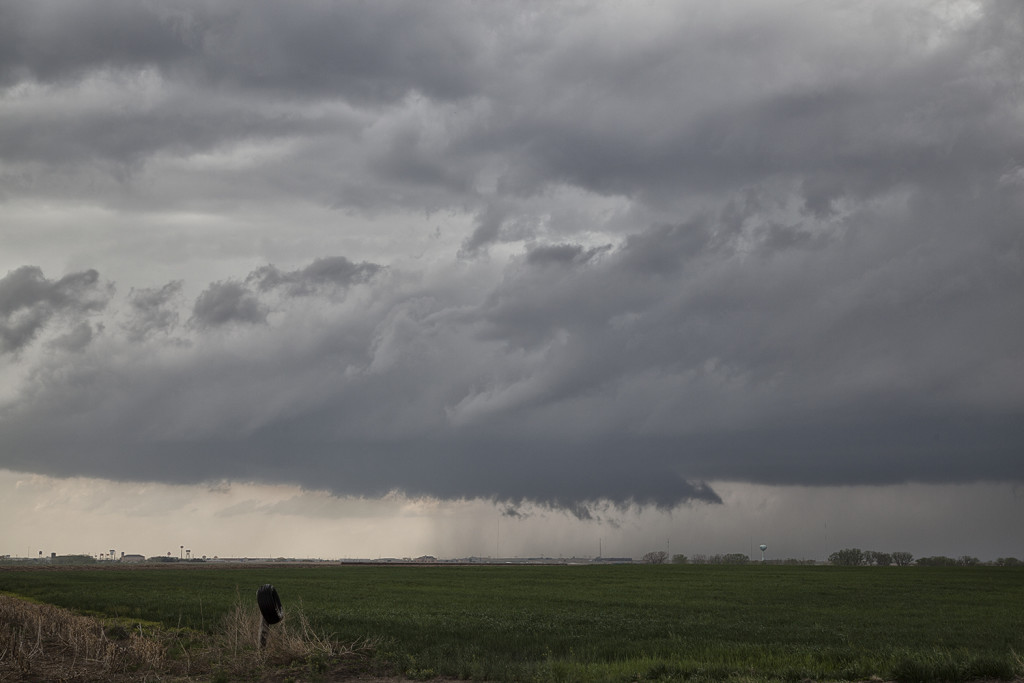
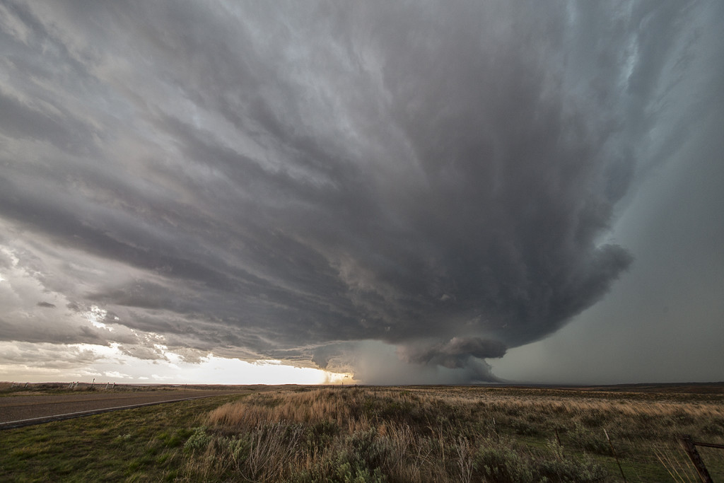
May 4th Southwest Texas Tornado Warned Supercell
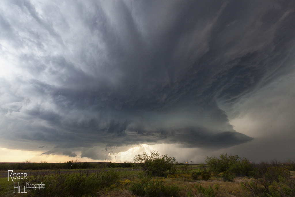
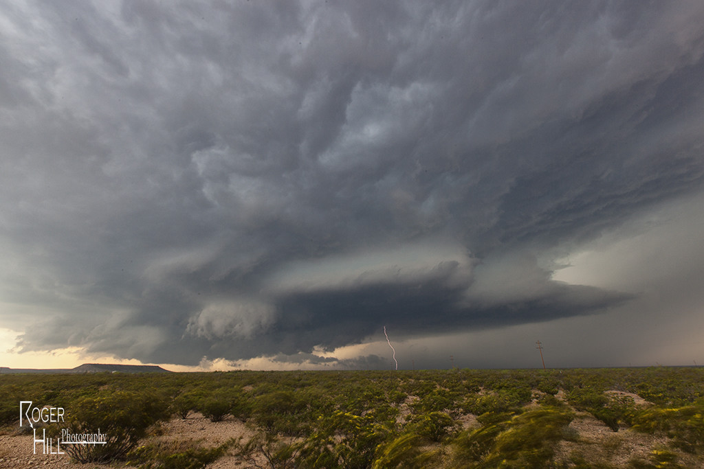
May 4th took Tour 2 down to far southwest Texas. Upslope flow into the Davis mountains would produce several supercells, with one particular storm riding southeast from the mountains and becoming tornado warned for hours. It exhibited good rotation, had decent structure, great lightning and huge hail, but just couldn’t focus long enough for tornado production. Still, it was a great storm for the Caprock Magic tour guests!
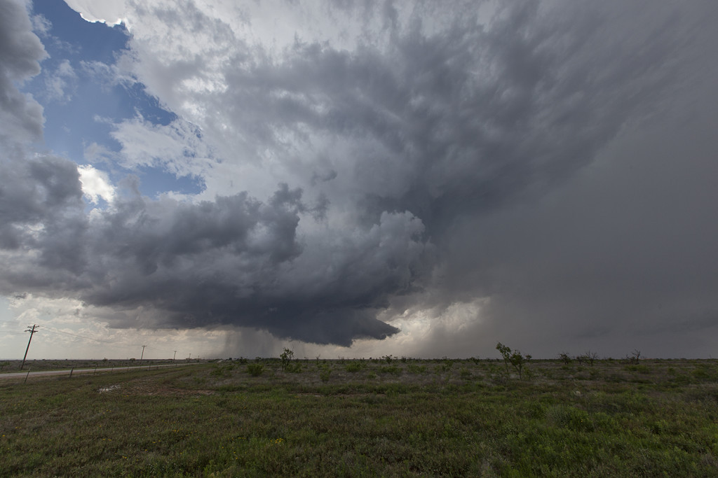
April 26th Central Texas Incredible Supercell and Multiple Tornadoes
Day Five of the Close Encounters Tour produced the best event of this young season so far! A triple point supercell formed southeast of Abilene, Texas, and moved along the warm front producing a couple tornadoes, amazing structure and grapefruit sized hail. A second supercell evolved near Dublin, Texas and became the tornadic beast of the day traveling along the warm front as well, all the way to south of Dallas by midnight. We witnessed several tornadoes from this storm, amazing structure and inflow winds over 60 mph! Crazy, wild night for us!
April 24th Northern Kansas Tornadic Supercell
Day Three of Close Encounters had good potential in Texas and Kansas. We chose to chase the triple point near Hays. The first tornado warned storm formed right near Hays and failed to produce. A second storm formed just northeast and became the storm off the day. We witnessed a couple brief tornadoes (although one we couldn’t get a visual on actually was fairly significant!) and watched the superb structure of this supercell as it traversed the warm front of hours!
April 22nd Texas Panhandle Supercells and Tornado
Day One of the Close Encounters tour didn’t disappoint! A triple point southwest of Amarillo would foster the first significant tornado warned supercell of the day. Fairly limited low level moisture resulting in higher cloud bases, diminished the tornado threat. The first storm rolled across the panhandle all afternoon before weakening. Low and behold, another supercell formed southeast of Lubbock near the town of Lockney and had amazing structure and even produced a weak tornado we were able to witness. Fun day, and a great finish to it!
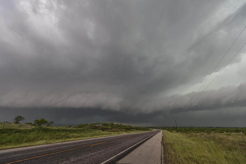
April 16th Texas Panhandle Tornado and Supercell
April 16th had good potential, but a tad limited moisture. Mid 50s dewpoints raced north on a strong low level jet and storms exploded on the dryline by mid afternoon. We interecepted the southernmost cell not far from Groom, Texas. Appearing outflow dominant and linear, we pushed ahead of it and watched as the tail end updraft become a rotating beast and produced a tornado. As the storm continued northeast, the structure was quite pretty as it tried again to produce several times, but just couldn’t stay focused long enough for that to occur. Overall, beautiful supercell and a great chase!
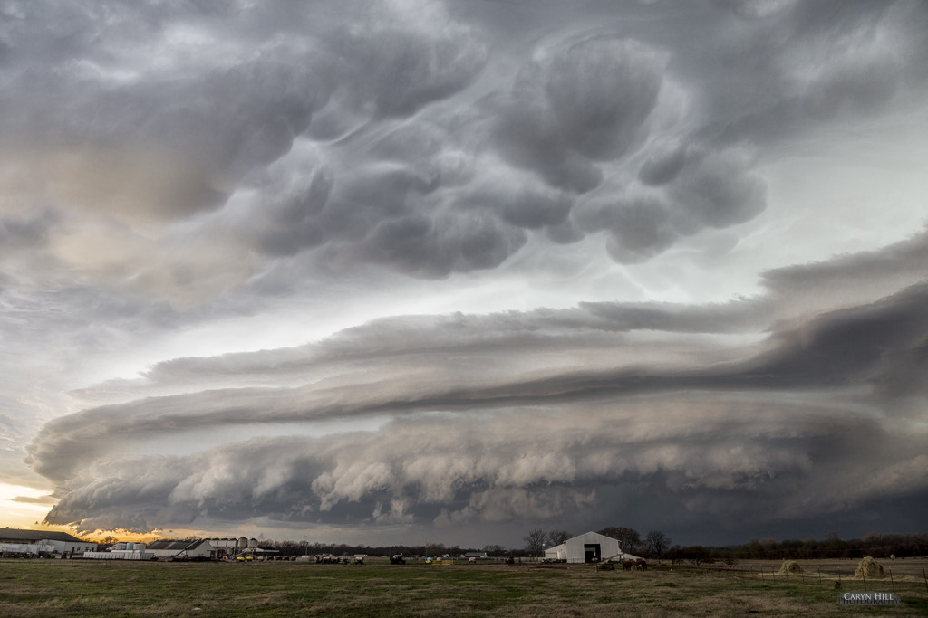
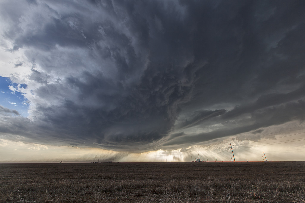
April 11th Southwest Kansas Tornado Warned Supercell
We got to chase close to home on April 11th, with storms developing in southeast Colorado off the Raton Mesa. As they moved east into southwest Kansas, deeper moisture and increasing instability resulted in an intense supercell forming which produced baseball sized hail and had incredible inflow winds. It came close to producing a tornado as well before diminishing after dark.
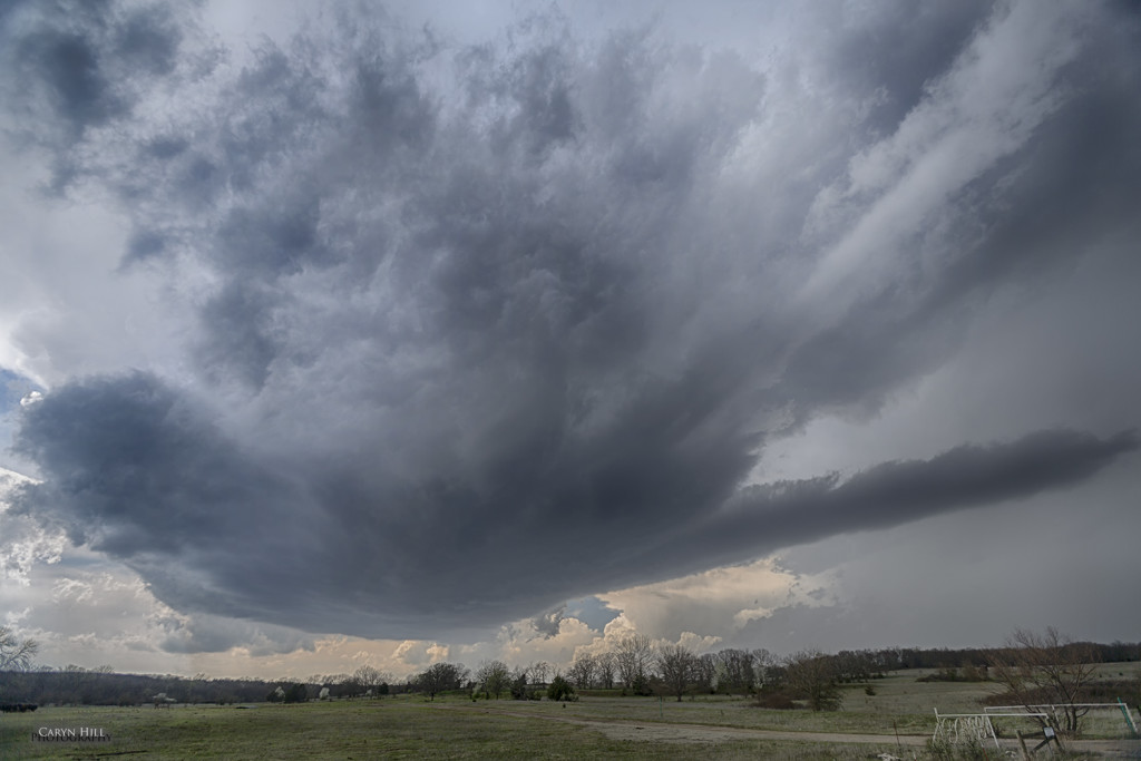
March 25th Central Oklahoma Tornadic Supercells
The first chase day for us for 2015! After a long drive from Denver, Caryn and Roger ended up near Stillwater, Oklahoma where several storms developed. Following the first supercell towards Tulsa, which weakened, we dropped southwest towards Moore, Oklahoma to catch this highly striated supercell at the tail end of a line. This storm produced another damaging tornado in Moore, which had been hit several times by violent tornadoes in the past 15 years.