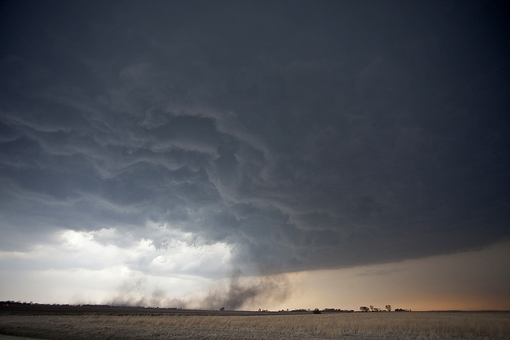
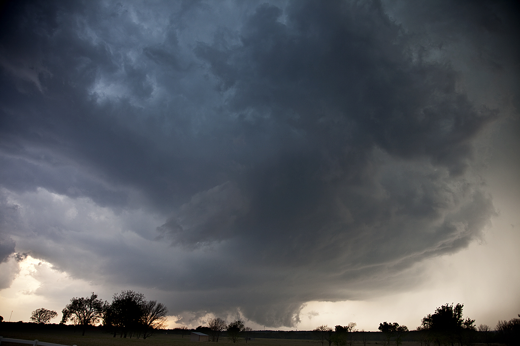
A surprise for me this day as I didn’t expect much. By late afternoon a storm formed at the triple point near Sweetwater, TX. This storm quickly anchored and spun like crazy! Some of the most amazing inflow bands I have ever seen developed and made for spectacular photography! To my surprise, just after dark, the storm produced an 8 minute long elephant trunk tornado just west of Hawley. Pardon the blurriness from the tornado shots, as a high ISO and 15 second plus exposure made the photo blurry due to storm and tornado motion. All in all, an extremely satisfying day and witnessing the only tornado in the US!
April 9, 2011 Mapleton, IA Tornadic Supercell
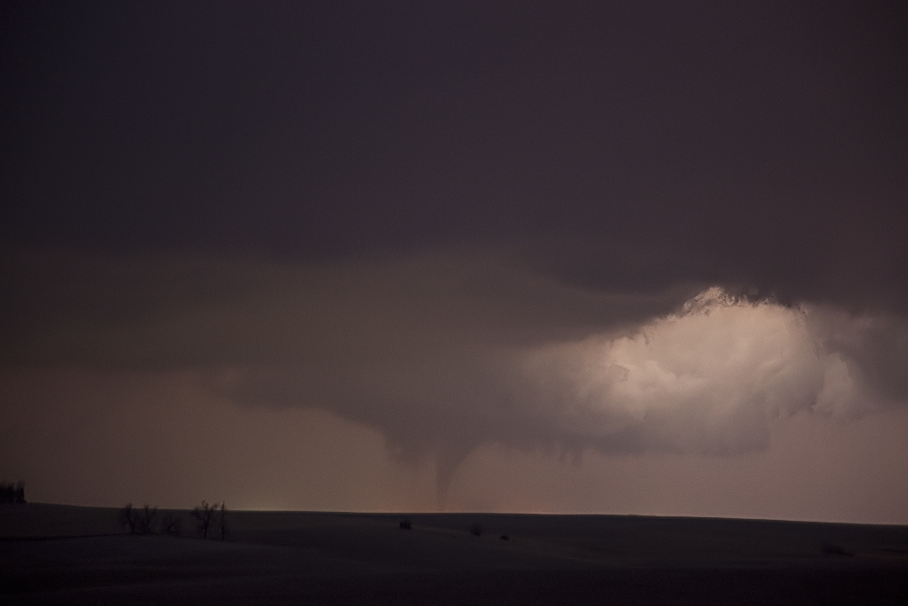
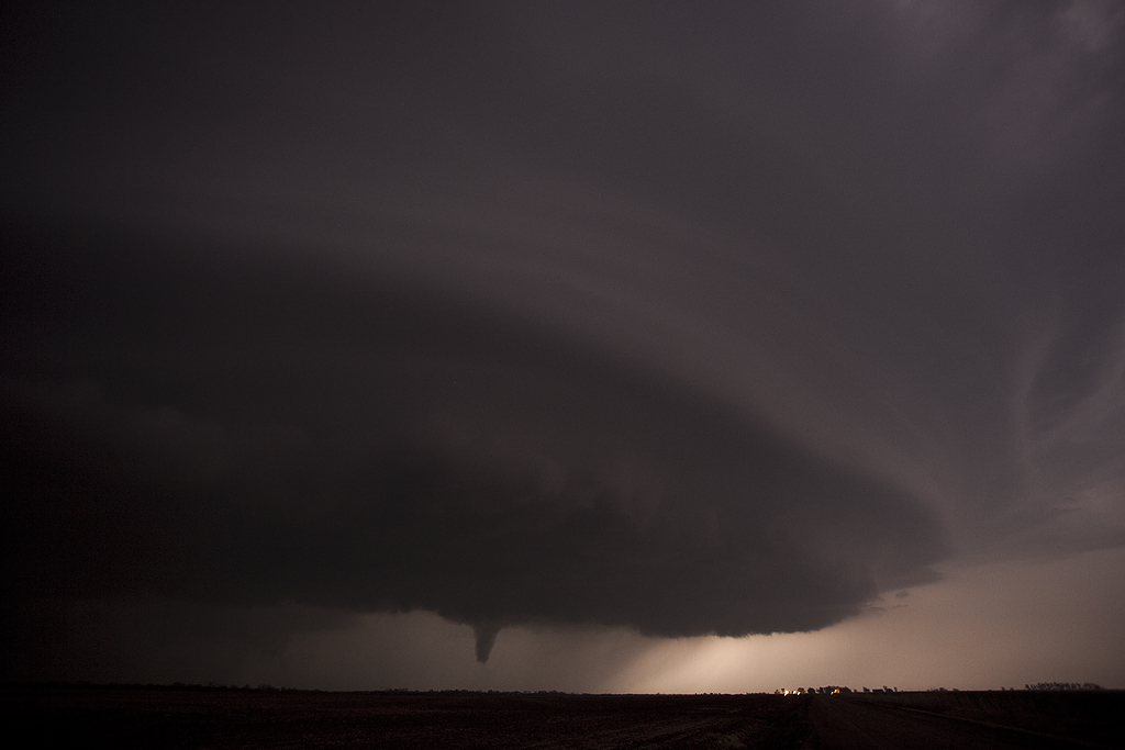
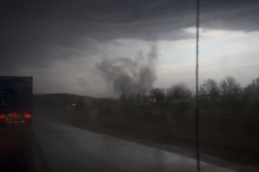
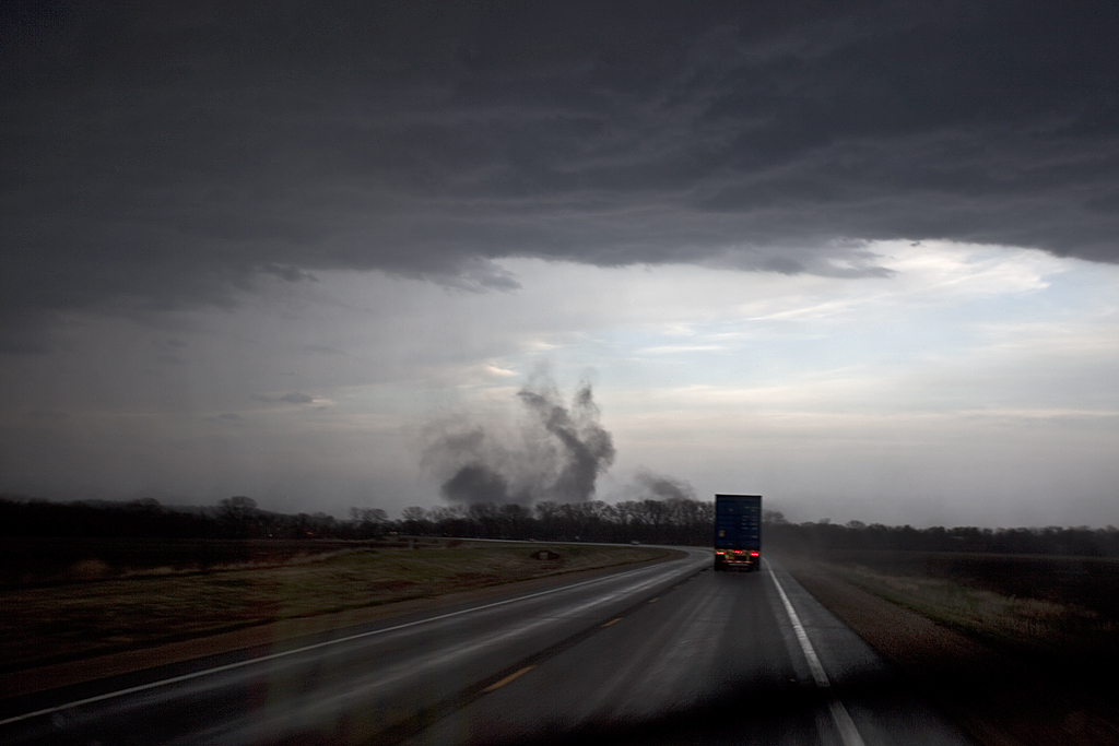
April 9th took us to the warm front in western/northwestern Iowa. A supercell developed on the southern flank of a cluster of storms, and became the storm of the day. Very good shear, moisture and instability would allow this beast to spin for hours! We witnessed 12 tornadoes from this monster, with many strong tornadoes occurring after dark. Photography is tricky when you don’t get a ton of lightning, thus a few of the images are a bit blurring caused by long exposures at high ISO.
April 19, 2011 Carlinville, IL Tornado
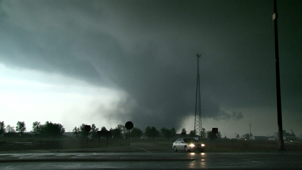
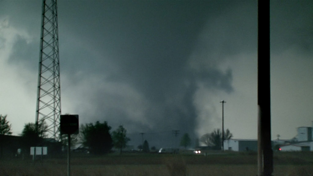
A pre-birthday present for myself brought me to a quick trip into Illinois for what appeared to be a significant tornado event. It did not disappoint! By mid afternoon, I was heading towards the Bowling Green, MO area and ended up too late for the supercell that produced 2 good tornadoes there. Heading east, I decided to get ahead of a cluster of supercells and play the southern storm.
As I was passing through Carlinville, a tornado warning was issued. Not long after heading east of of town, a funnel formed to my south. It dissipated quickly only to be replaced by another one. It also dissipated. As I stopped near the I-55, a strongly rotating mesocyclone formed, and quickly dropped a large tornado. This tornado did damage to homes, power lines, and trees and was rated EF3. Most of the shots here are video stills, as I didn’t have a chance to take still photos.
April 14, 2011 Oklahoma Tornadic Supercells
Caryn and I took a group to Oklahoma for what appeared to be a significant tornado event. Even though we did see a tornado near Burbank, OK, it did not live up to the hype that had been built up this day. A weakness in the low level shear would result in lots of supercells that were rotating, but very few that actually did produce a tornado. We witnessed a tornado during the afternoon near Burbank as a supercell spun wildly and dropped the elephant trunk shaped tornado in the photos below less than a quarter mile from us. A fun day, but not as wild as anticipated. We were saddened to learn of the 2 fatalities in southeast Oklahoma from a strong tornado that did occur near Tushka.
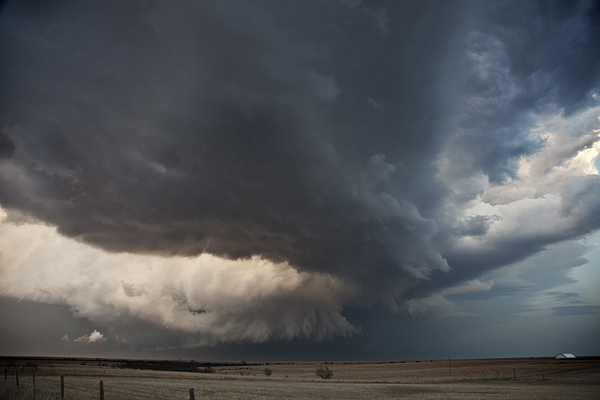
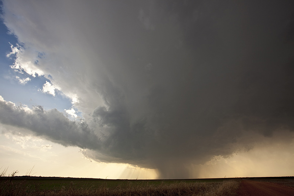
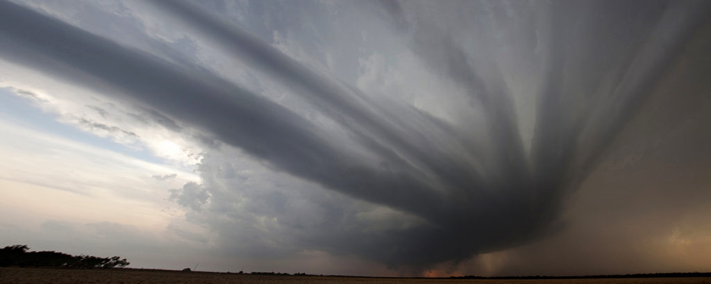
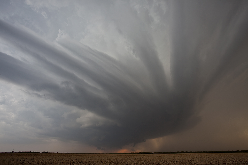
April 8, 2011 Medford, OK Tornadic Supercells
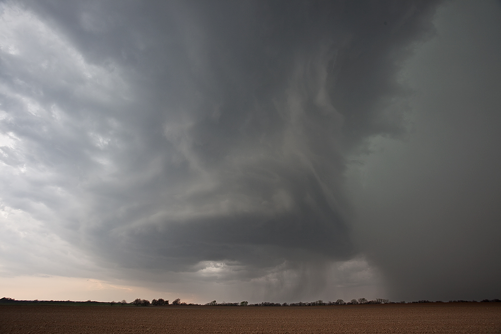
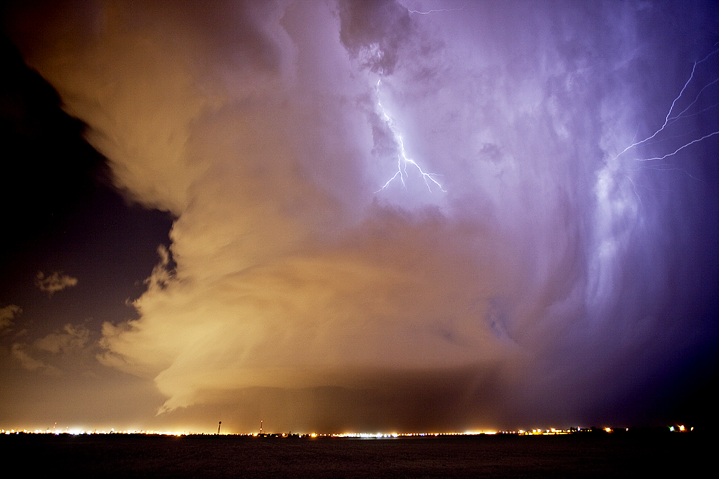
We headed to northern Oklahoma this day for what appeared to be a high risk/high reward setup. By late afternoon a few supercells developed on the dryline and intensified as the evening progressed. The low level jet strengthened as stronger mid and upper level flow overspread the region, creating a nicely sheared environment. One supercell spun like crazy as a wall cloud formed directly overhead, while another became a classic monster after dark.
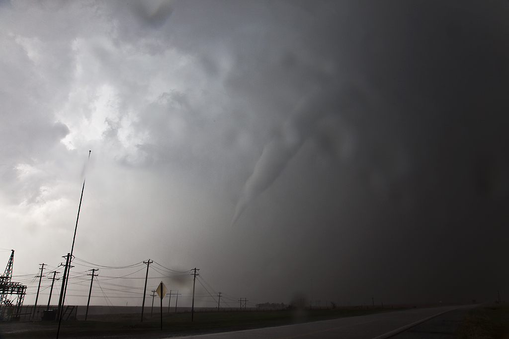
April 3, 2011 Lawrence, KS Gustnado/Tornado
April 3rd brought Caryn and I to eastern Kansas to play the dryline/front intersection. By late afternoon a supercell developed and tracked just north of the boundary, occasionally pulling it into it. The high based nature of the storm limited its ability to produce a significant tornado, however, just north of Lawrence on US24 the storm spun up “something” that has been dubbed a tornado, landspout and a gustnado. It did cause damage to irrigation systems, trees and destroyed a building. Due to the strong RFD associated with this, I would be more inclined to call it a gustnado or a weak tornado. The debate will go on.
March 19, 2011 Texas Panhandle Tornado Warned Supercell
Mid March took me to the Texas panhandle for what looked to be a slightly marginal day. The long drive to Lubbock paid off in the end with a beautiful mothership supercell, that became tornado warned. It produced a brief funnel or two, along with golf ball sized hail. A second supercell at dark passed over north Lubbock and eventually produced a lot of photogenic lightning.
February 27, 2011 Northern Oklahoma Tornado Warned Supercell
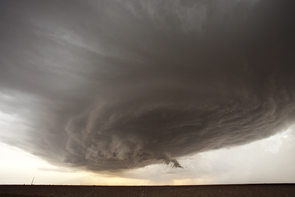
I couldn’t resist the first chase of the year. A strong, but shearing short wave was forecast to emerge into western Texas/Oklahoma, and race east northeast. A lee cyclone was developing in southeast Colorado and was forecast to move eastward along the warm front. A strong dryline was moving east into Oklahoma and would be the culprit in developing the lone warm sector supercell west of Pond Creek by mid afternoon. We intercepted this storm in its formation stages and virtually had the storm to ourselves early in its life. As it moved into a moistening environment along the warm front it eventually became a nice supercell that rode and occasionally went north of the boundary. Finally, just northeast of Newkirk, OK, the storm produced a tornado, albeit fairly short lived. The storm had pretty structure through most of its life cycle.