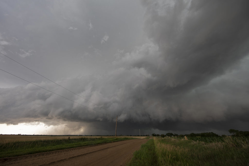
July 16th featured very high dew points in the mid 70s and CAPE values over 3000 j/kg. Shear was modest, so we weren’t certain we would get supercells. An early day supercell over eastern Nebraska laid out an outflow boundary over central Nebraska from Valentine southeast towards Grand Island. Storms formed along this boundary and moved east into the cool stable air and died. Later in the afternoon a cluster of storms formed on the boundary and the tail end storm anchored. It immediately started spinning and became a formidable supercell! As the storm right turned on the boundary and moved towards Burwell, it was rotating strongly and was extremely electrified! I thought it had a decent chance to produce a tornado, but it did not. A couple of weak funnels did form. As the storm continued southeast, it became tornado warned with strong rotation continuing. Another supercell formed west of this and rotated down towards I-80 near Gibbon and also became tornado warned. The structure was incredible with one of the best shelf clouds I’ve seen in years! As the storms pushed south of I-80, they gusted out and became a wind machine. A great day with far better results than we were expecting! Enjoy the pics!
July 11th Northeast New Mexico Severe Storms
We weren’t expecting much this day. Modest moisture, CAPE and shear were present, thus we were hoping for a few pulse storms. Thunderstorms formed over the higher terrain of northeast New Mexico and collapsed. Their outflow pushed east and helped developed additional storms on the south side of the Raton Mesa. These storms congealed into a cluster of high wind producing severe storms in far eastern parts of the state and eventually moved into northwest Texas panhandle. Lightning was decent as well.
July 10th Southeast Montana Supercells
Southeast Montana was the target this day for what appeared to be a decent chance of high based supercells. Great shear was in place, but limited moisture and instability would temper the threat of significant severe weather. Nonetheless, storms formed off the Big Horn mountains and moved east and intensified. Hail the size of half dollars and winds to 70mph occurred from these supercells. Structure was typical for high based storms and one can wonder only what if there would have been better moisture and instability. It was still a fun day and we at least had severe storms.
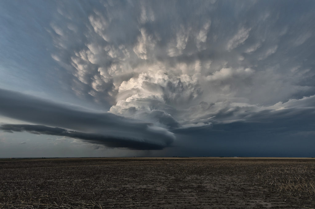
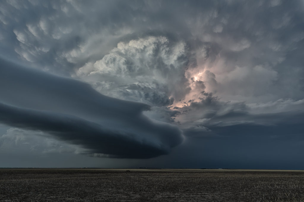
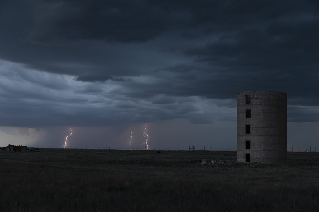
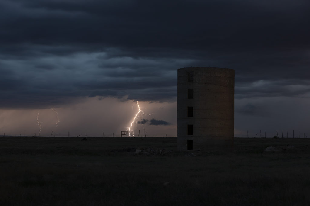
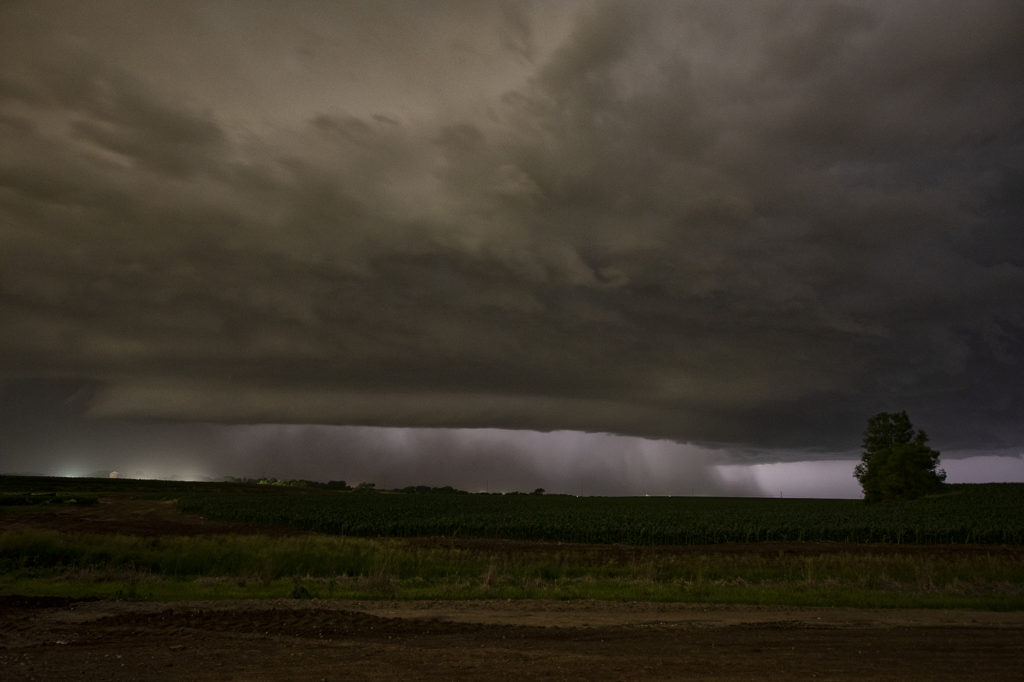
July 6th Eastern Colorado Tornado Warned Supercell
July 6th took us to eastern Colorado. Good moisture and instability, along with modest shear and upslope flow into the Palmer Divide would set the stage for supercells and multicells. One such storm formed just west of Limon and right turned southeast towards Hugo. As it did, the structure improved as severe thunderstorm warnings were issued for golfball sized hail. As it moved further east, it became better organized and was tornado warned. It didn’t produce one, but you could clearly see the rotation in the storms updraft. As it moved furth east towards Eads, it encountered drier are and eventually weakened. Pretty storm, and the eastern plains of Colorado certainly needed all the moisture it can get! Enjoy the photos!
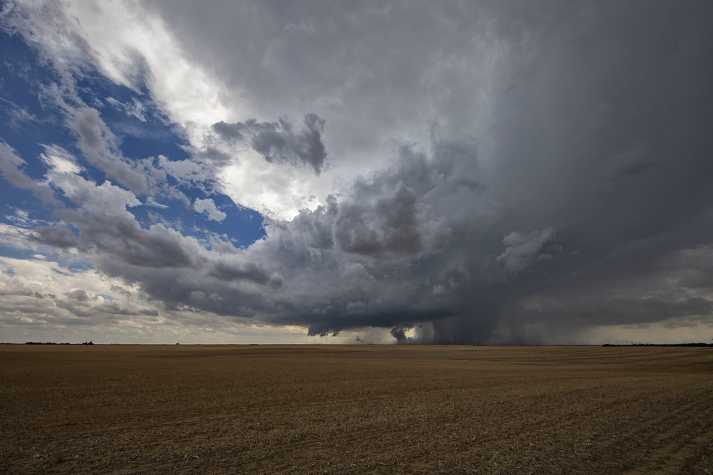
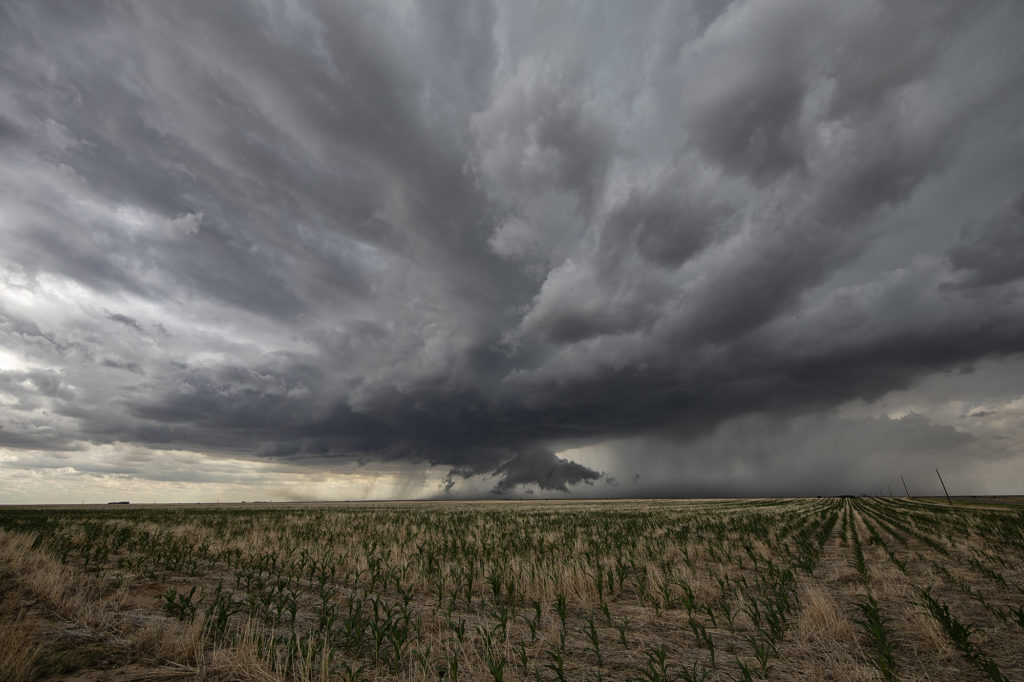
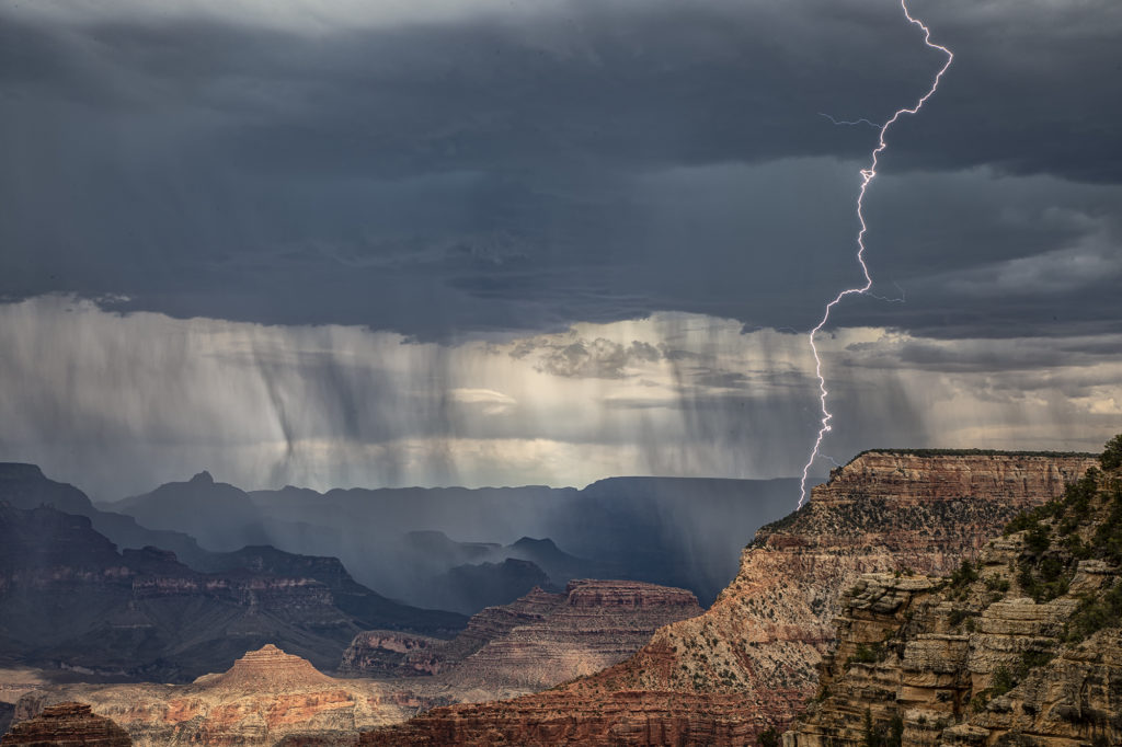
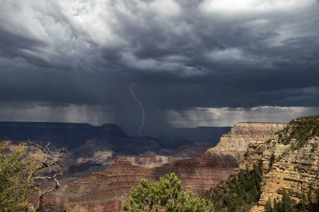
Photo Tour #3 Thunderstorm Images June 26th through July 1st
Due to a very poor weather pattern across the plains of the US, we took our Photo Tour #3 group to Arizona to photograph the monsoon thunderstorms. We had some AMAZING success in northern Arizona, capturing severe storms near Winslow and the Grand Canyon. On the final day of the tour, July 1st, we ended up in southeast Colorado on a supercell that came out of the Sangre de Cristo moutains near Aguilar, Colorado and produced golfball sized hail and high winds. A testament to the fact that Silver Lining Tours will get you ANYWHERE there are severe storms and photogenic storms! Enjoy the pics!
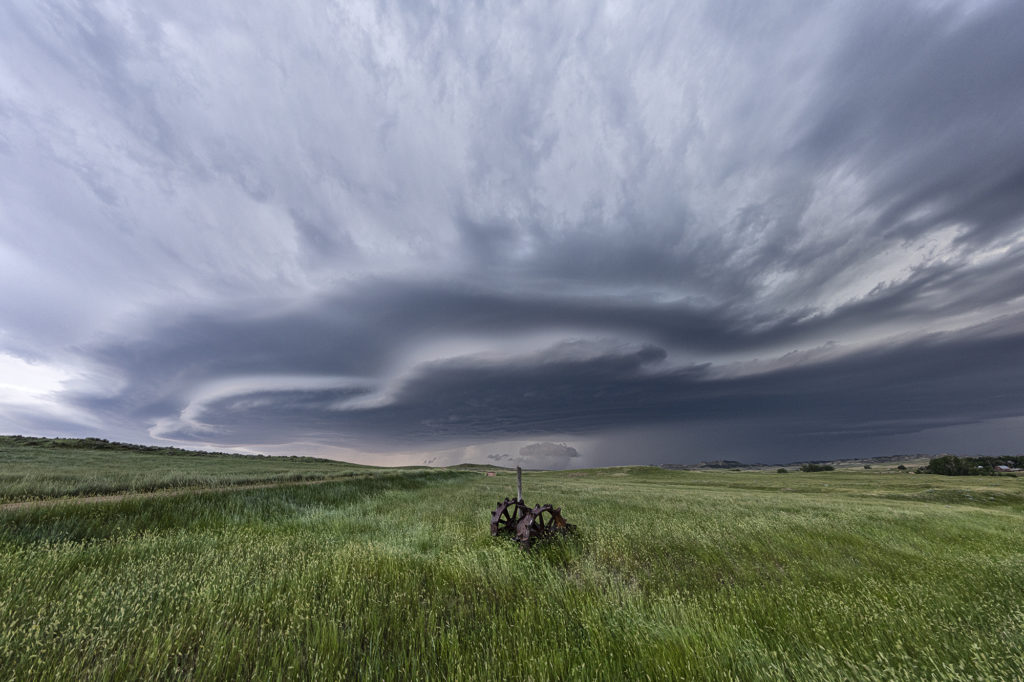
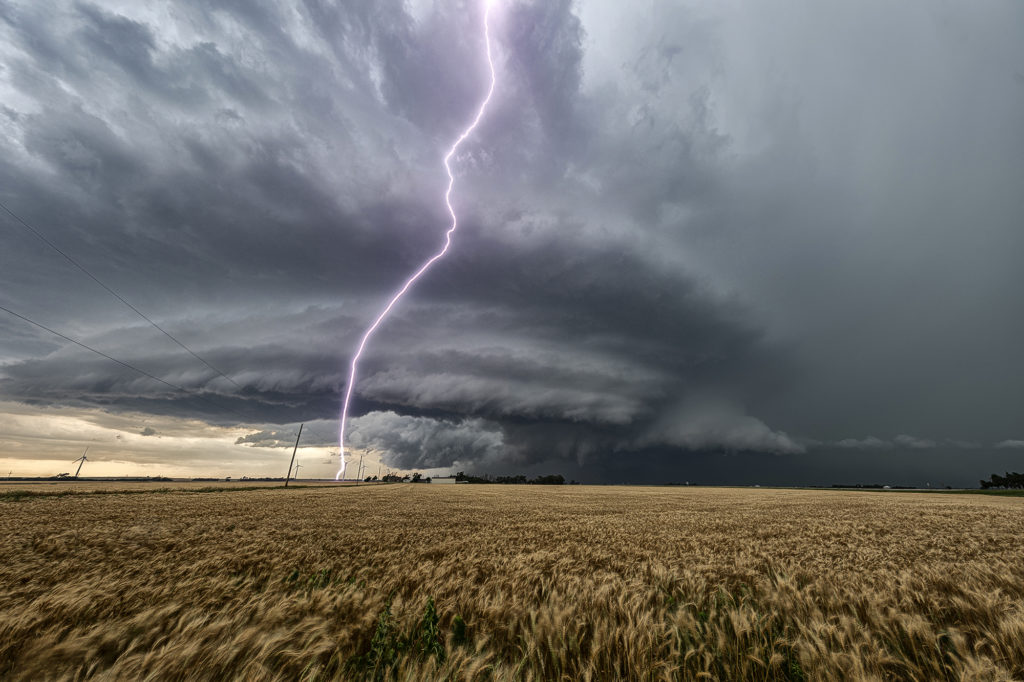
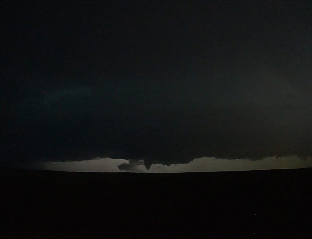
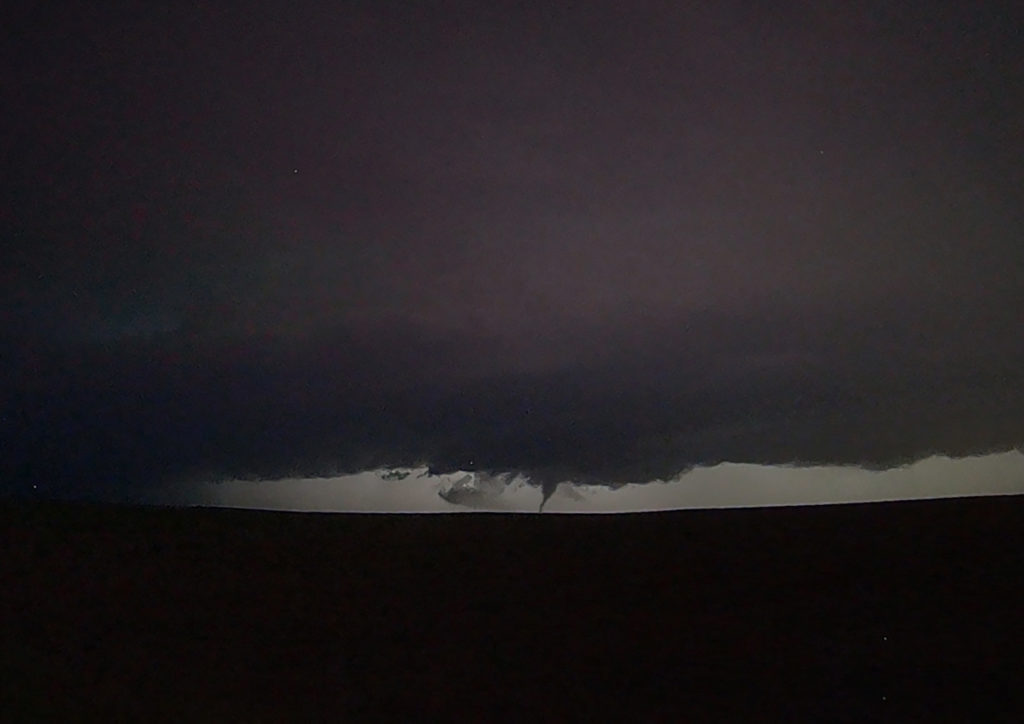
June 23rd Central Kansas Cyclic Tornadic Supercell
The ingredients for severe storms on June 23rd were there. We only needed a focusing mechanism to get a storm to form on and ride along the boundary. It certainly did! An outflow boundary from previous night’s thunderstorms lay across the I-70 corridor in central Kansas. Storms formed along it and continuously crossed northward into the colder, more stable air. As they did, they weakened and moved off to the northeast. Finally, a storm formed along the boundary at the intersection of the dryline and anchored along it. It started spinning wildly as we sat just a mile east of the updraft and watched low stratocumulus race westward into the updraft twisting and turning along the way. At that point it was just a matter of time before a tornado would form. During the next 3 hours at least 6 tornadoes occurred, although most were brief, dissipating within a couple minutes. We first had a slender slanted tornado that touched down near Wilson Lake. It didn’t last more than a minute. Next another tornado, a slender elephant trunk touched down just west of Dorrance. Little did we know, but another larger tornado was not visible from our position, so we moved east to get in front of the supercell updraft. The structure was insane! While we drove that 3 miles east, the larger tornado came out of the rain and near the interstate. One of our long time guests, Cathy Murphy snapped a shot of it out the rear window. (Thanks Cathy for letting us use your image!) We continued to move east as the storm also moved east, spinning like crazy the whole time. Another white tornado from our view formed near a cluster of wind turbines and was confirmed a brief touchdown. Eventually we ended up just west of Salina as the final tornado formed and also briefly touched down just before the storm died. A heck of a day! Great structure and a few tornadoes to boot! Enjoy the pics! A Youtube video will be releases shortly from this day! Check out our channel!
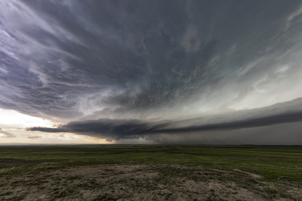
June 19th Long Tracked Tornado Warned Supercell Montana – North Dakota
Fantastic wind shear was available on June 19th, however, due to a frontal passage, only modest moisture was present off the Big Horn mountains of southeast Montana. This allowed only about 1000 CAPE to build in the area. Fortunately sometimes great shear can compensate for a bit of a lack in surface moisture. A storm formed just south of the Wyoming/Montana border and tracked east just north of the boundary. As it approached the Alzada, MT area it started spinning hard and became tornado warned. It pulsed up and down a few times as it moved into northwest South Dakota, eventually crossing into southern North Dakota near Hettinger. East of town we had to core punch it to get back in front of it and were promptly greeted with tons of golfball sized hail. (Video will be on our SLT Youtube channel soon!) Getting back in front of it, and moved east northeast and took us to Bismark where we spent the night being rocked to sleep by constant thunder. A great day, and a supercell that survived over a 250 mile distance! Enjoy the pics!
June 14th Lincoln, Nebraska Nocturnal Tornadic Supercell
We weren’t expecting much on June 14th. Things were mistimed, moisture was iffy and instability lacking. Storms eventually fired early evening towards Grand Island along a front and moved eastward. They started out high based and lowered as the temp/dew point spreads lessened. West of Lincoln by mid evening, a supercell emerged and started really rotating strongly. A tornado warning was issued as the storm moved east and developed a strong couplet. (An EF3 tornado was confirmed later!) As the storm approached the north side of Lincoln, it wrapped in rain and was a very dangerous supercell. You couldn’t see what was going on in the notch and we didn’t dare go north without an escape route to look down the notch. We had to let it go due to timing and lack of roads. It moved east and recycled again becoming tornado warned. Some damage was recorded east of Lincoln, but at the time of this writing it was not confirmed whether it was tornadic or RFD winds. Certainly a surprise event and thankfully no fatalities occurred!

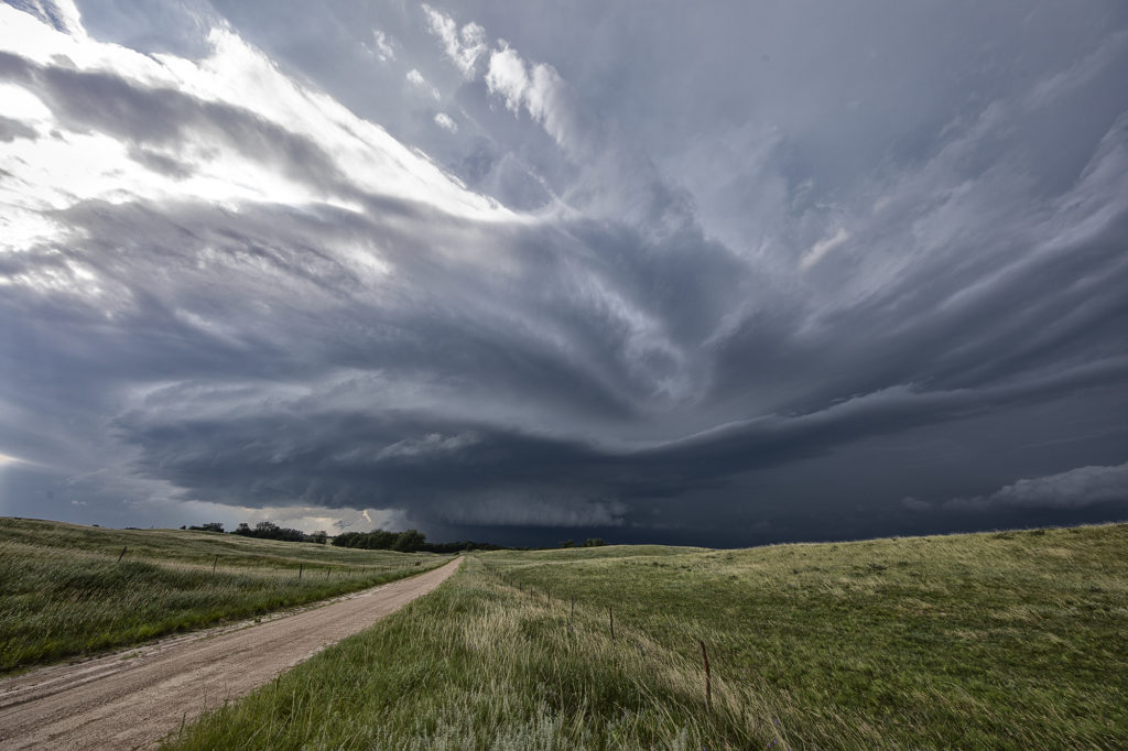
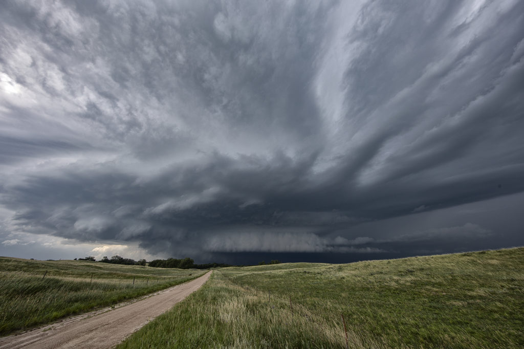
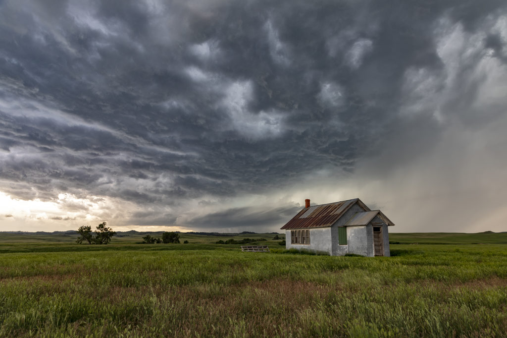
June 12th Central South Dakota Tornadic Supercell
June 12th was a great day for the tours! We intercepted several storms, of which two became strong supercells. Good lift along a boundary, moderate moisture and strong instability as well as shear, would provide the needed ingredients to get these storms firing up. A cluster moved into west central South Dakota and eventually the southern most storm, referred to as “Tail End Charlie” took over the show. The southernmost storm typically gets the best feed of air and usually becomes the most intense. As it moved towards Phillip, South Dakota, it became a strongly rotating supercell. We encountered the south side of the hook as we moved east from town and had winds of 70 mph plus and tennisball hail. Out towards Midland, it took a hard right and become a beast of a storm! Near the I-90 corridor, the storm was an insanely electrified beauty of a mothership! As we watched in the night, you could see a funnel form and touch down. It was later confirmed by the NWS as a tornado. There are a couple video stills in the images below. After a few hours chasing these storms, the lined out so we let them go at midnight and headed to our hotel in Pierre. Enjoy the pics!
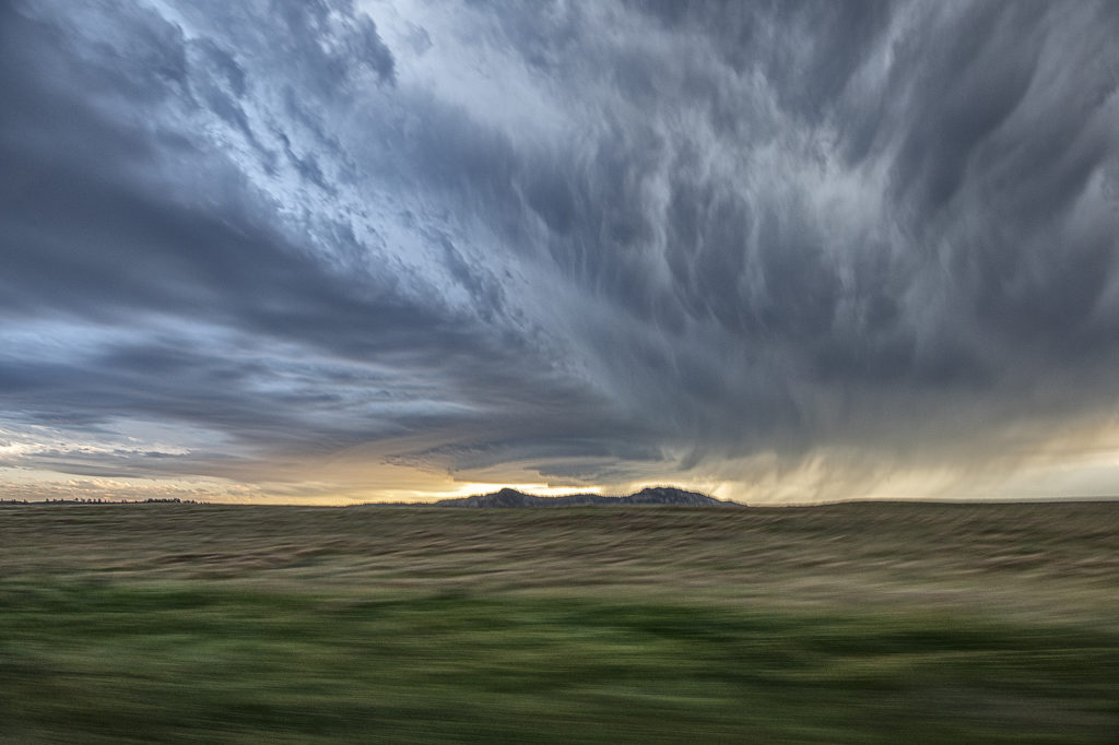
June 9th Southwest Nebraska Gorgeous Supercell!
June 9th had one target for us, southwest Nebraska. An existing boundary would be the focal point for storm development that afternoon. Numerous storms formed, several becoming severe, however only one would survive and be the storm of the day. This supercell formed south of North Platte, NE and turned hard right, spinning like a top all the way to Oberlin, KS. The structure was top notch. When it first got its act together, it did have a slowly rotating wall cloud. We thought for a minute it might try to become tornadic, but the wall cloud eventually disappeared. As the storm moved south, it had the appearance of a mothership, and as it moved into Kansas as a low precipitation supercell, the structure at sunset was just stunning! A great day for the tours and an amazing way to end the evening! Enjoy the pics!