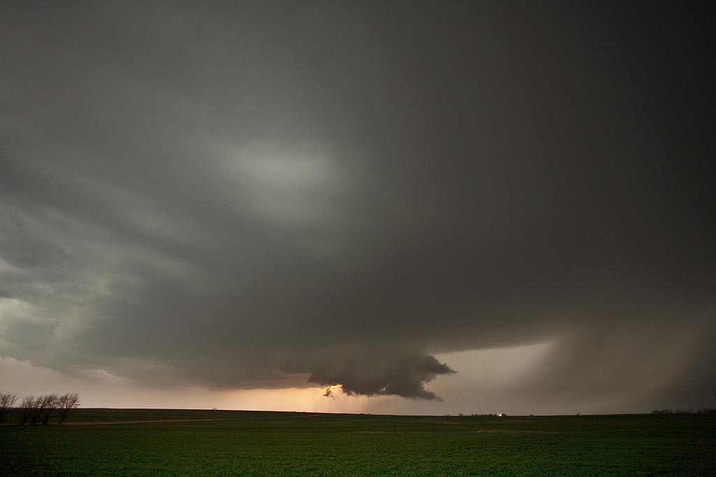
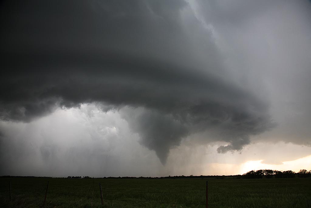
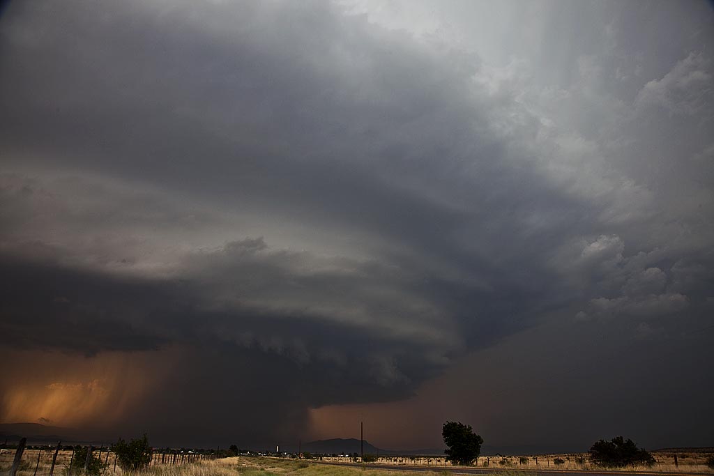
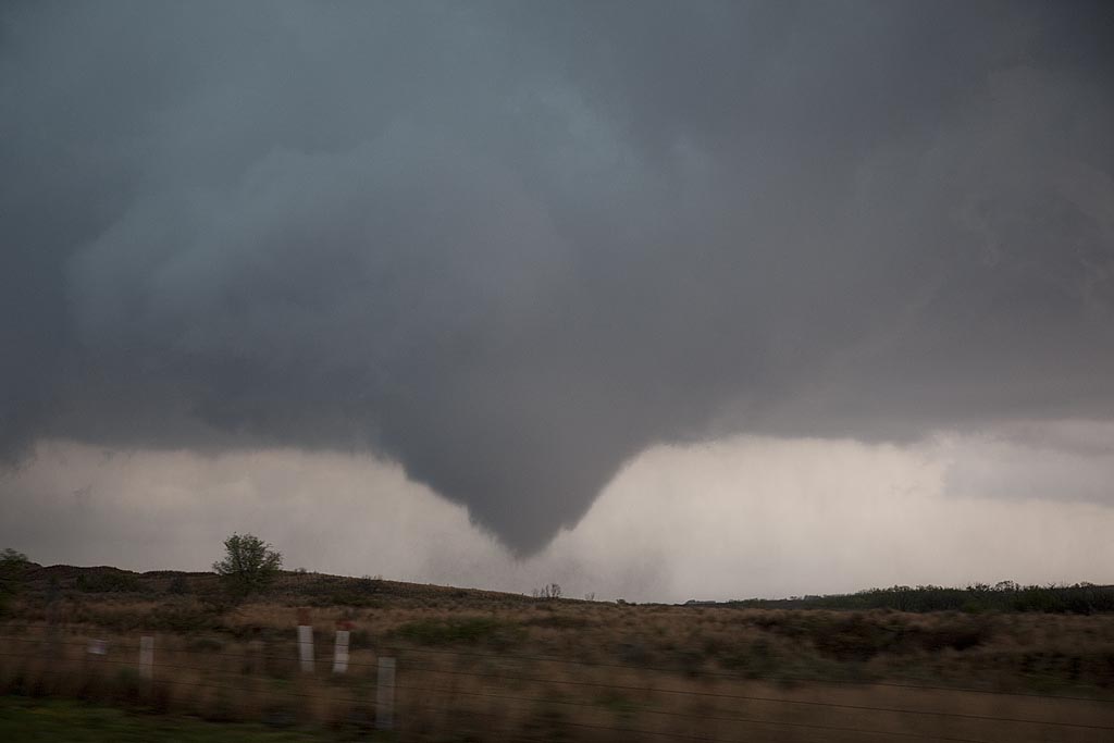
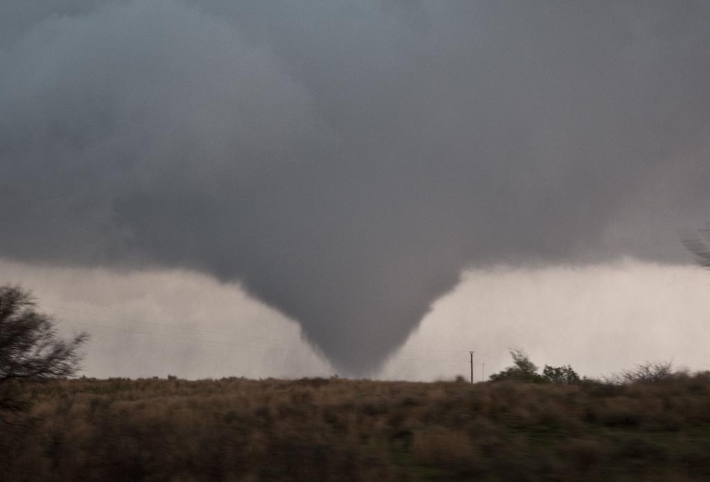
May 13th took us to the Kansas/Oklahoma border. Our initial target was north central Missouri but due to a late night in northwest Texas, it wasn’t going to happen. We positioned ourselves north of near Blackwell and watched as numerous cells developed on the front until finally a decent supercell formed just to our west. It quickly started rotating and produced a very nice tornado that was on the ground for over 15 minutes. Please click on the video link for a neat 2 minute video and click on the photos for a larger image of this very pretty and well structured tornado.
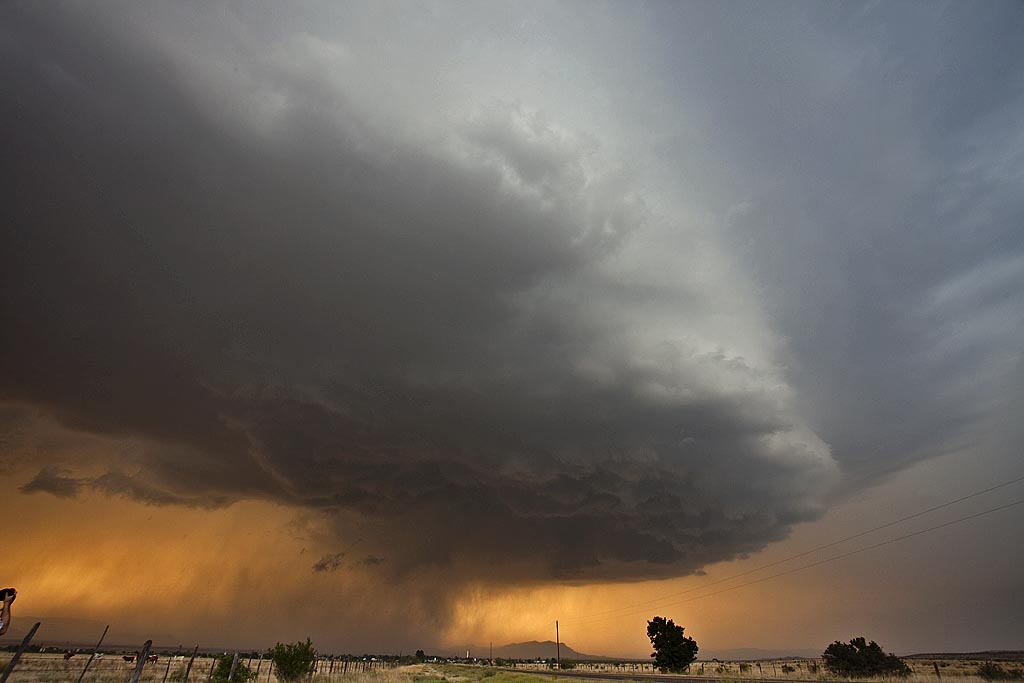
May 10, 2009 Marathon, Texas Beautiful Supercell
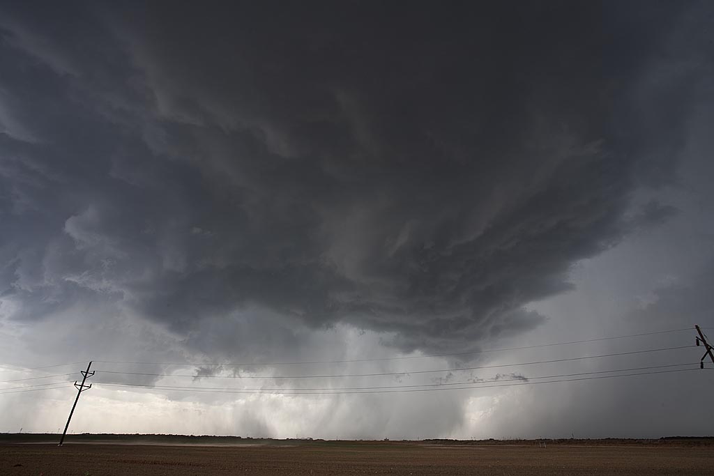
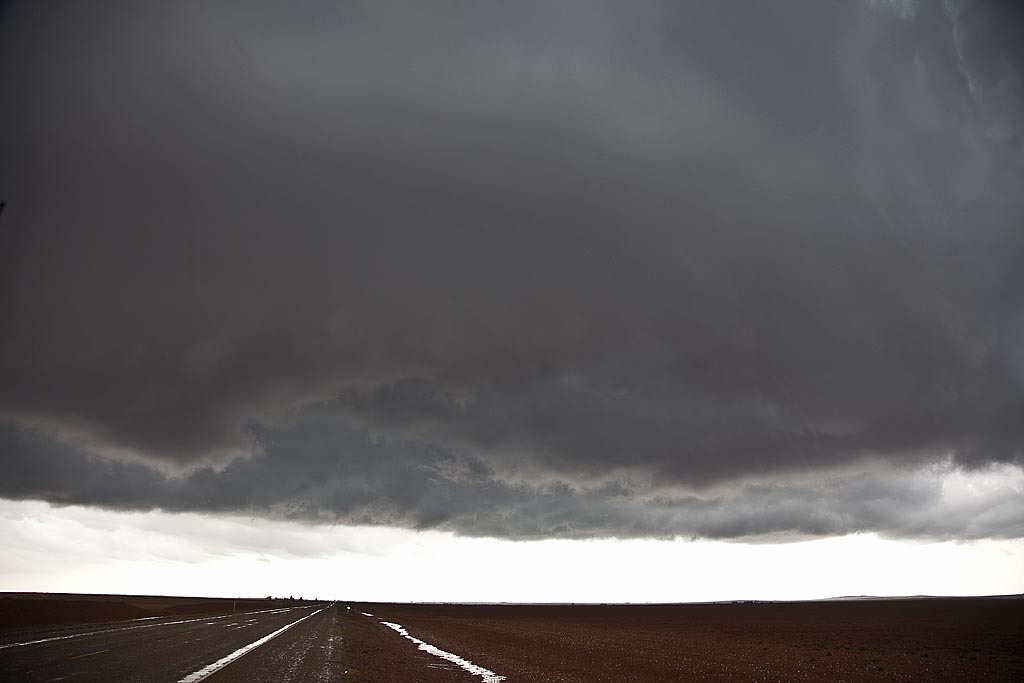
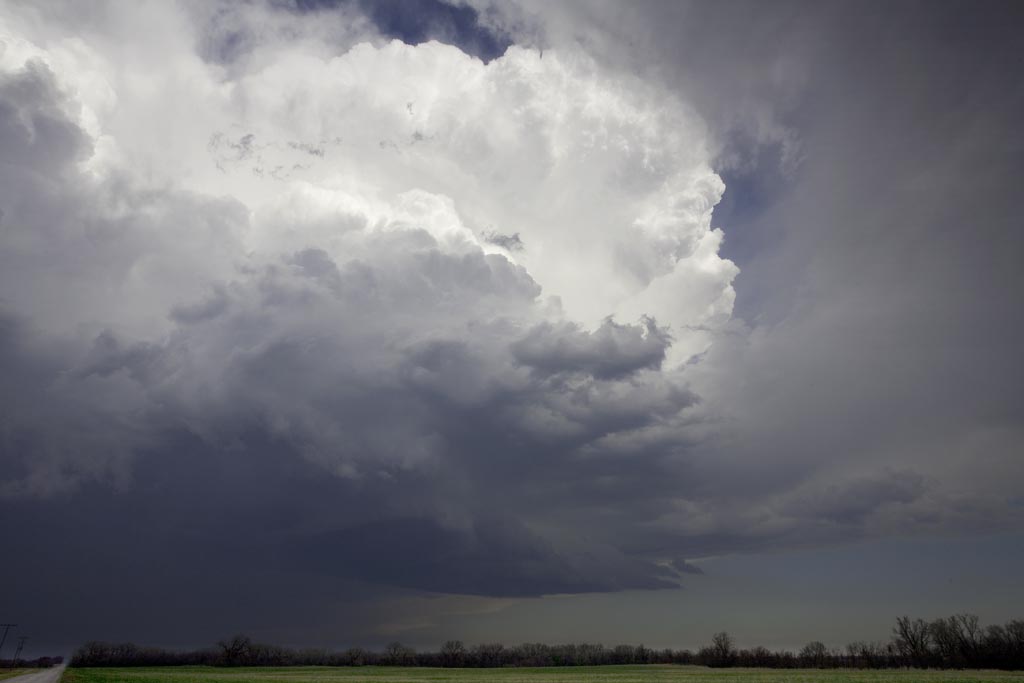
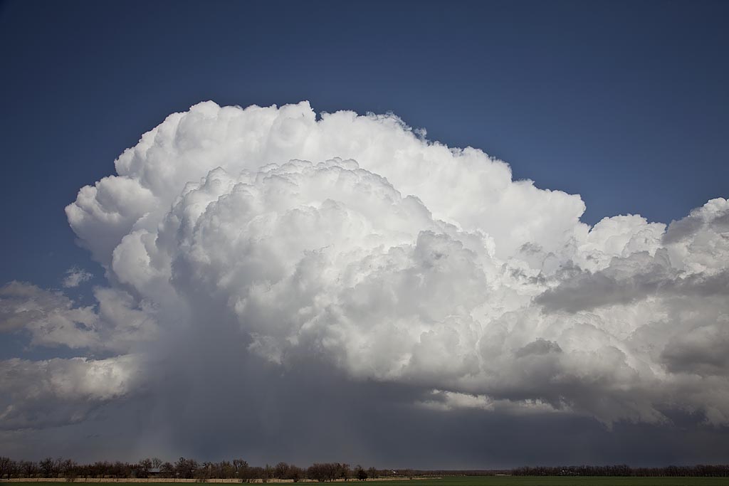
May 10th I wasn’t expecting much at all. High temp/dewpoint spreads, weak surface flow as well as 500 MB flow, and a fairly stout cap, would leave me skeptical about any decent storms. However, nature would have the last laugh as she provided us with a spectacularly structured supercell off the Davis Mountains in southwest Texas. High based storms first formed and became severe along the north and eastern parts of the mountains, with one cell becoming a beastly storm. It tracked east, then south towards Marathon and eventually into the Big Bend region. This storm would also produce copious amounts of hail near Marathon.
May 5, 2009 Strawn, Texas Damaging Hailstorm
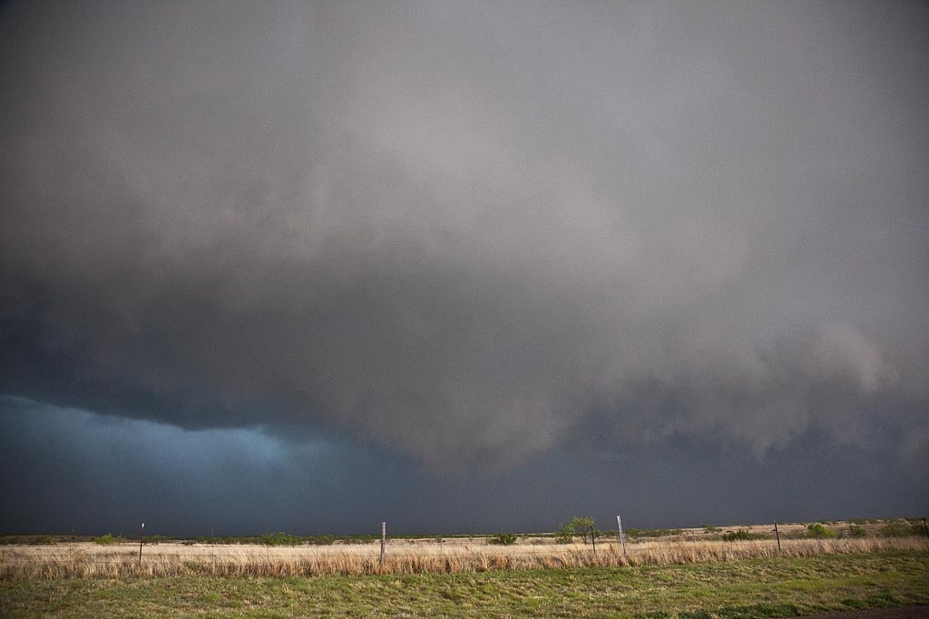
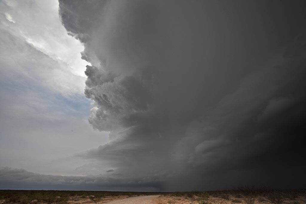
May 5th took us to northwest Texas to play a volatile boundary with high CAPE and moisture, but limited low level shear. A supercell formed along a boundary near Breckenridge, Texas and exploded as it tracked slowly southeast. It spun wildly, tried to produce a tornado a few times, but ended up being a nicely structured supercell with gigantic hail. We destroyed our windshield in the storm near Strawn with softball sized hail being quite common. Click on the video link below for a wild hail video.
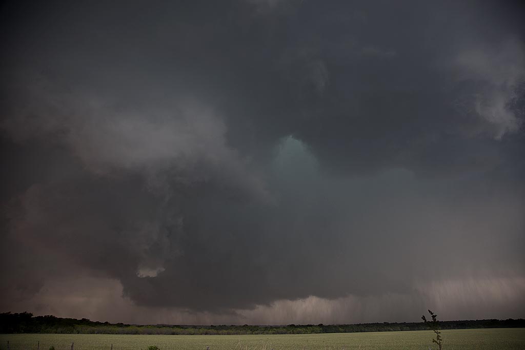

May 1, 2009 Stamford, Texas Supercells
May 1st kept us in northern Texas playing a high CAPE/fairly low shear day. We had strongly deviant moving supercells with pretty structure, tornado warned but never did produce much, other than large hail, a funnel and heavy rain. Still, two very pretty structured supercells were observed.
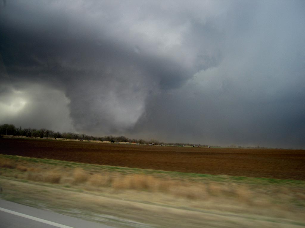
April 29, 2009 Cedar Hill, Texas Tornadoes
April 29th took me to the Texas panhandle. Several severe storms developed along an old outflow boundary and warm front. Many spun strongly and a couple produced tornadoes. We were able to intercept the Cedar Hill storm and tornadoes from a distance of about 10 miles. We actually were chasing a tornado warned supercell just east of the Cedar Hill storm, when I saw the tornado form to our west. Due to poor road options, and muddy dirt roads, we were forced to stay east and watch from a distance.
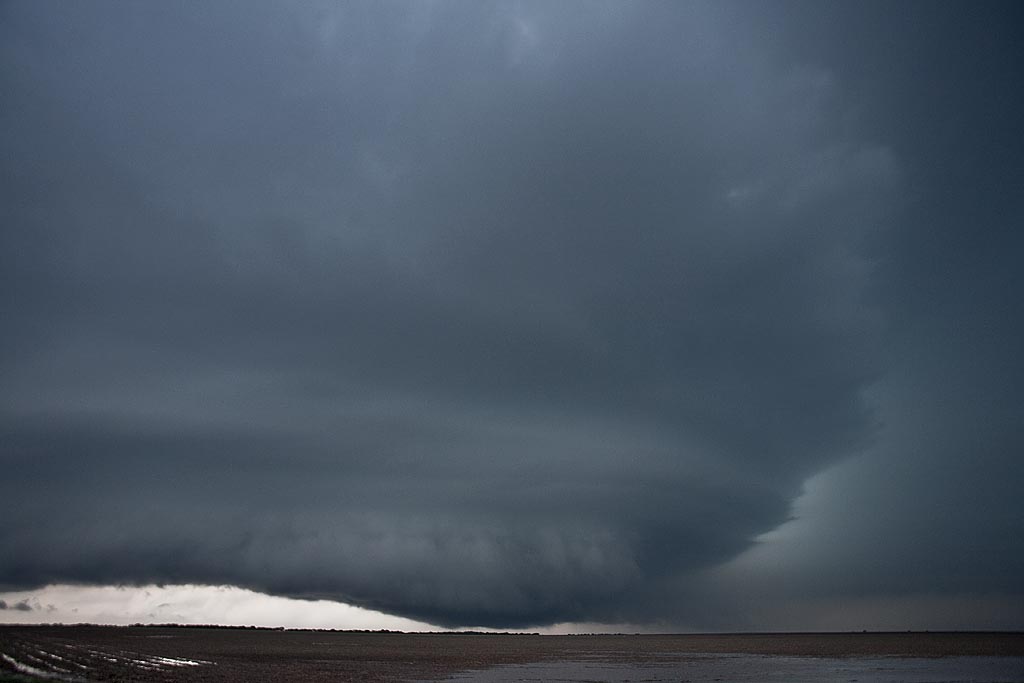
April 28, 2009 Carlsbad, New Mexico Supercell
April 28th took me to southwest Texas and southeast New Mexico to chase upslope storms. By late afternoon such a supercell developed near the Guadalupe mountains and tracked eastward along the Texas/New Mexico border towards Jal. The storm had pretty structure and was tornado warned for a long period of time. There may have been a brief tornado but we were too far away due to poor roads to confirm it. The storm produced large hail and tons of lightning.
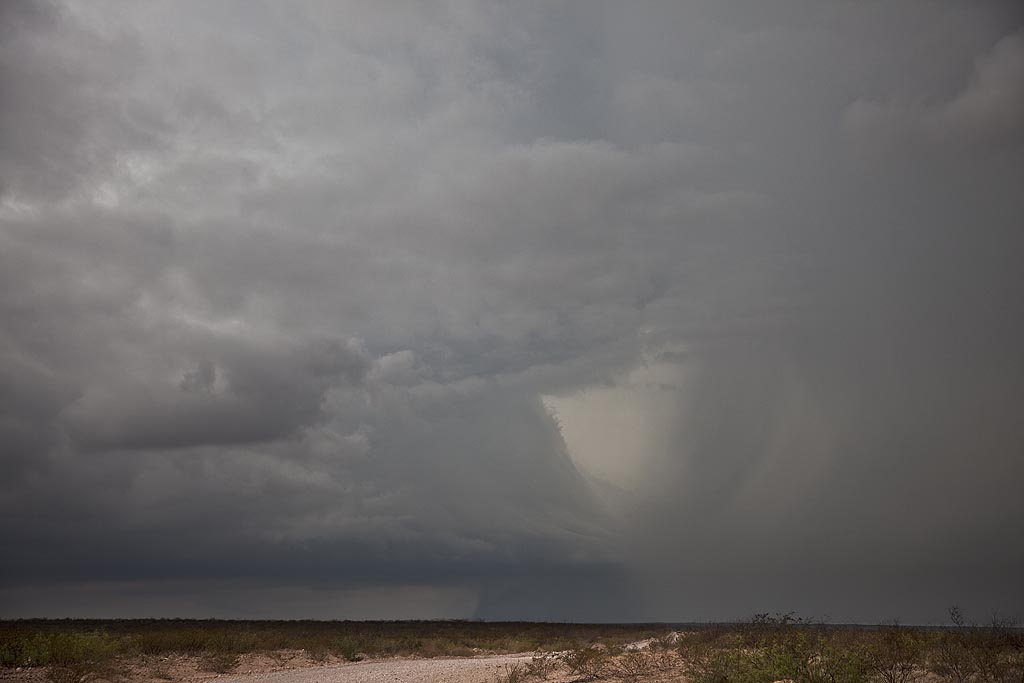
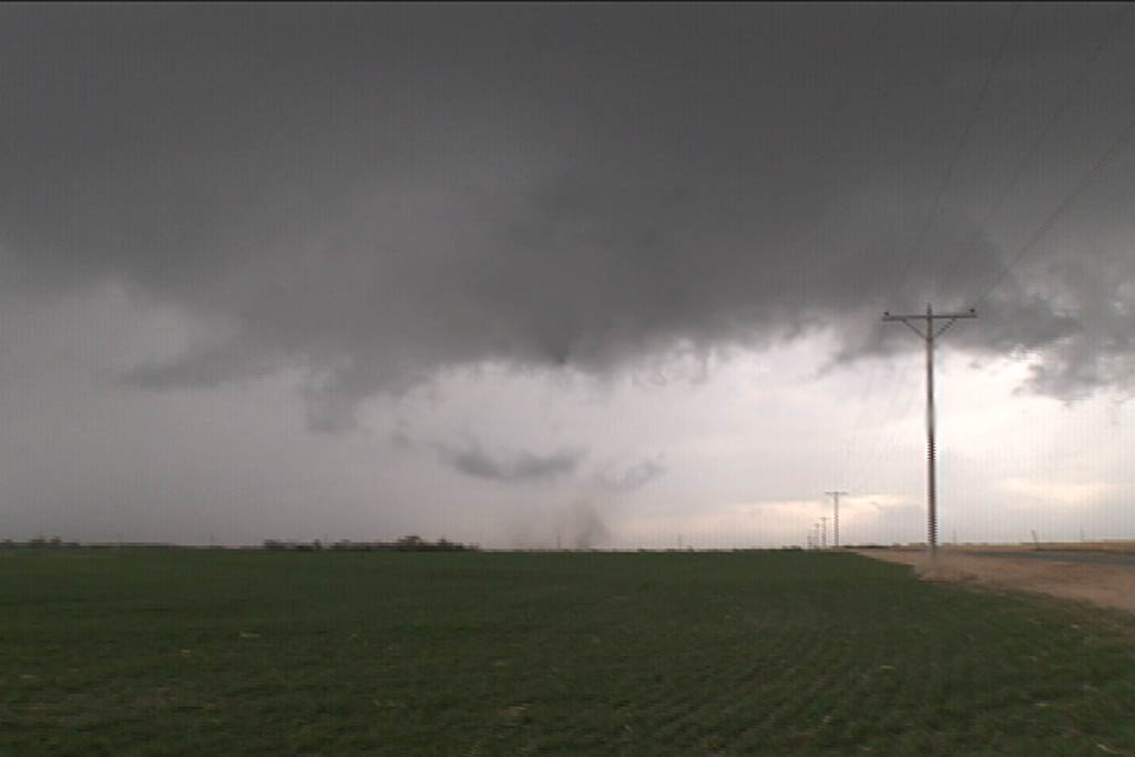
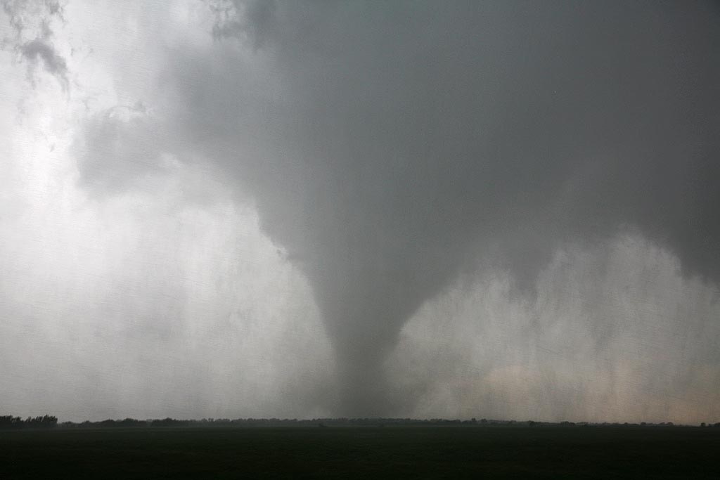
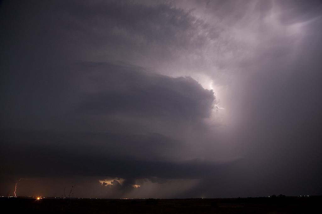
April 26, 2009 Roger Mills County, Oklahoma
April 26th had outbreak written all over it. SPC upgraded to High Risk and issued several PDS tornado watch boxes. Problems seemed to start with storm mode as things would develop and become a bit stretched out and eventually linear. By late afternoon a nice pinch point developed along I-40 over the far eastern Texas panhandle. Storms fired, spun quickly and became tornado warned. We intercepted 2 tornadoes near the town of Crawford and we came very very close to the second larger tornado. Close enough to smell the tornado and feel your ears pop. Click on the link below for a video (beware of LARGE file size!) and the small photos for larger images.
First 25 days of April, 2009
This is a collection of photos from storms I chased during the first 25 days of April. They are at various locations as shown with each photo’s caption.
March 23, 2009 Arkansas City, KS Tornadoes
March 23rd was a day full of strong dynamics but limited moisture/instability. My plan was to head to the I-35 corridor south of Wichita and play where the best moisture/instability intersected the dryline. We caught a nice supercell, albeit high based near Kingman, KS which was severe, produced tons of hail and had a respectable wall cloud. However, the best storm of the day would form south of Enid, Ok and move into the Arkansas City, Kansas area by late afternoon and produce two fairly weak tornadoes. The structure of the storm was by far better than I had anticipated. Later, we dropped into the Oklahoma City area to play the tail end storms for lightning. We weren’t disappointed.
March 7, 2009 Hutchinson, Kansas Tornadic Supercell
March 7th was a day of decent kinematics, but limited moisture. Nonetheless, intense supercell storms formed along the triple point in south central Kansas and intensified as they moved northeast through the instability axis. Most of these storms had decent structure and rotation, with several tornado reports occurring around the Hutchinson area. We intercepted on tornadic storm and several other rotating nicely structured supercells.