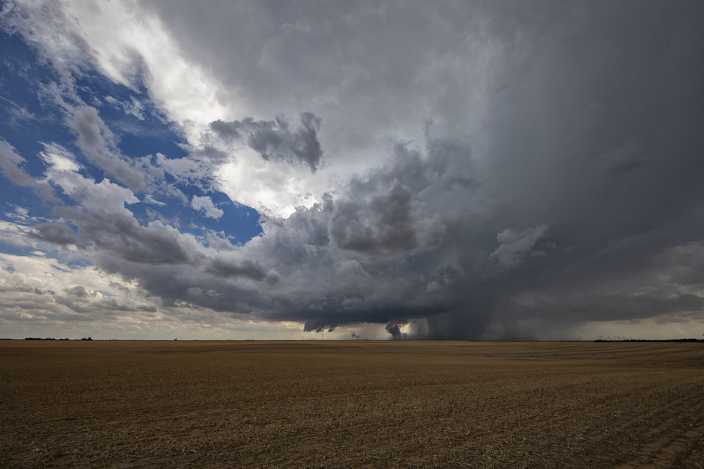
May 4th was a strange day. A decent threat of severe storms and low end tornado potential existed. High based storms formed off the caprock by mid afternoon and moved east. Bases never lowered. Another couple of storms, eventually supercells, formed along a boundary a bit further east southwest of Crowell, TX. Within a few minutes a lowering formed and exhibited some rotation. As the storm moved east, a line of storms formed in front of it, thus limiting the quality of inflow air into the supercell. It caused it to slowly weaken over time. The storm produced baseball sized hail, high winds and was tornado warned for a couple of hours. It showed a fantastic hook echo on radar, but it just couldn’t sustain with cold inflow from storms ahead of it.
May 2nd West Texas Supercell
May 2nd wasn’t expected to be a big severe weather day. Limited moisture would cause storms to be higher based with little tornado threat. That’s exactly what happened. Mid afternoon, storms formed along the New Mexico border ad became severe. They produced hail golfball size and high winds. Lightning was pretty after sunset as well. A fun day on a day we didn’t expect anything substantial to happen.
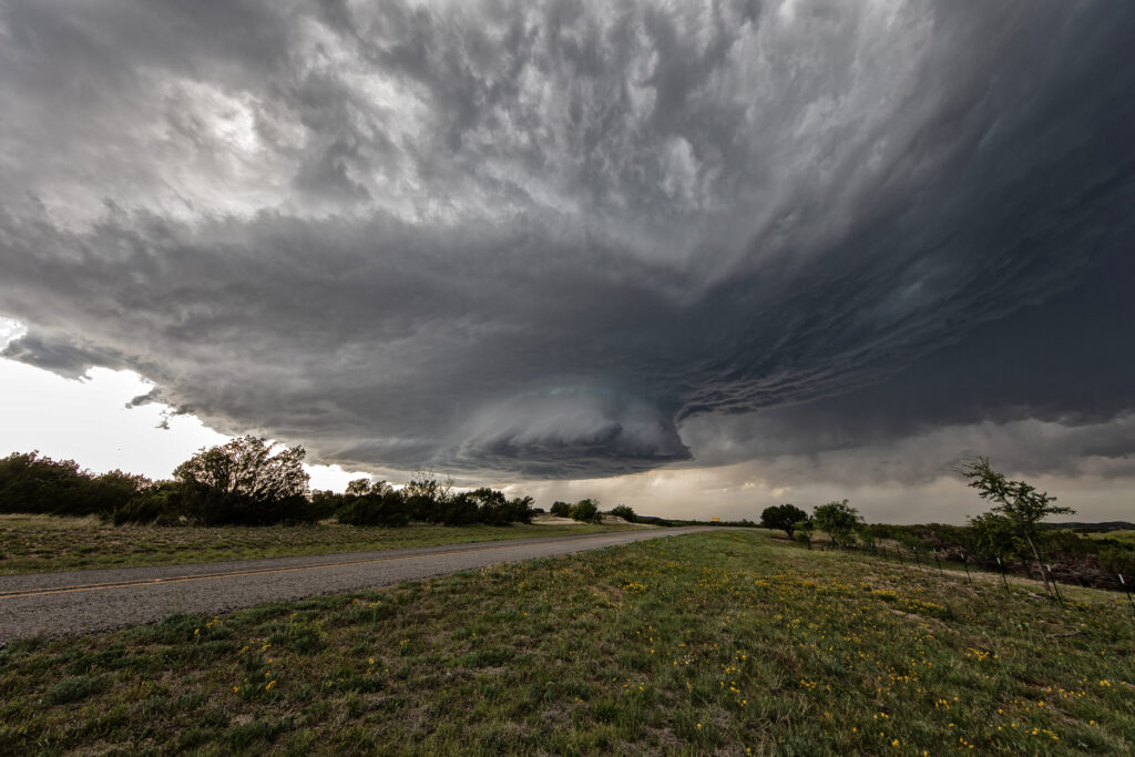
April 25th Sweetwater, Texas Stunning Supercell!!
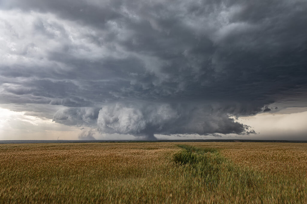
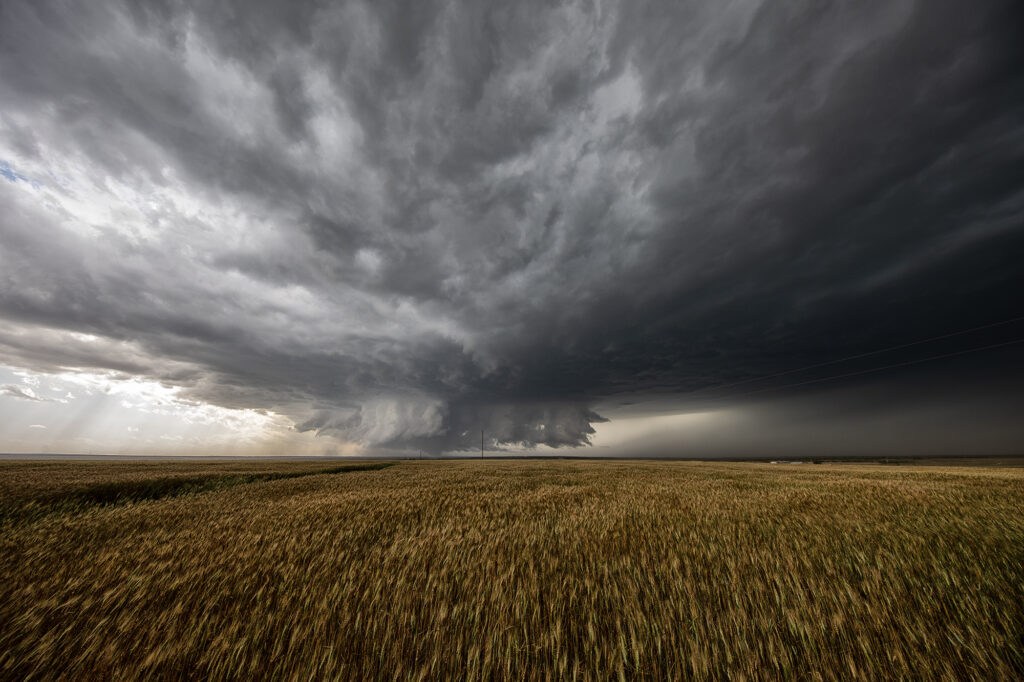
April 25th featured a short wave trough approaching Texas. This lead to a surface trough in eastern New Mexico that helped bring moisture northward from the gulf of Mexico. Southeasterly surface winds raced northwest towards a dryline in west Texas where a weak low had developed. Models were fairly consistent developing storms, some supercells, near the Snyder/Sweetwater area and they nailed it. We approached Sweetwater later in the afternoon as cumulus towers were seen. A high based severe thunderstorm produced a couple shear funnels due to strong motion at cloud base. This storm became a prolific hailer as it moved towards town and eventually to the southeast.
South of town, the structure was magnificent! A sculpted updraft with striations showed just how well organized this supercell was. As darkness fell, the storm maintained its intensity as it moved southeast. Lightning illuminated the structure in the dark and made for quite the scene. Finally, about 10pm we let it go as it weakened and we drove towards Abilene where we spent the night. We came across copious amounts of hail, some close to tennisball sized. A fun day and it’s always amazing to see nature’s artistic side in a gorgeous sculpted supercell! Enjoy the pics!
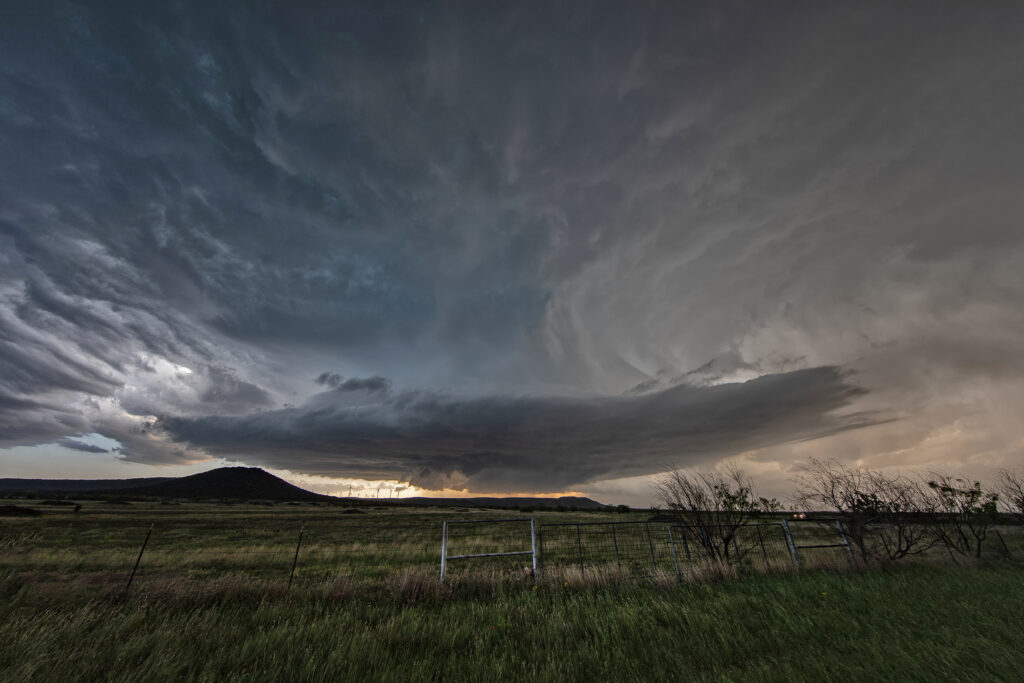
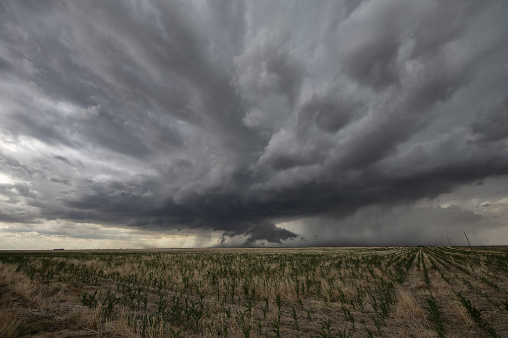
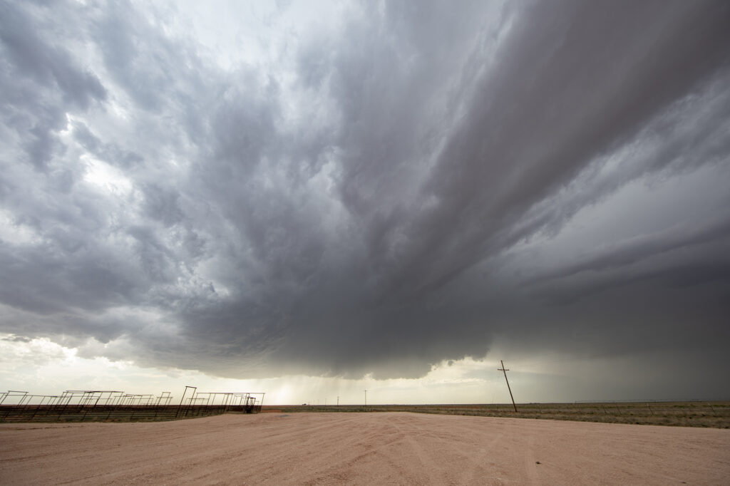
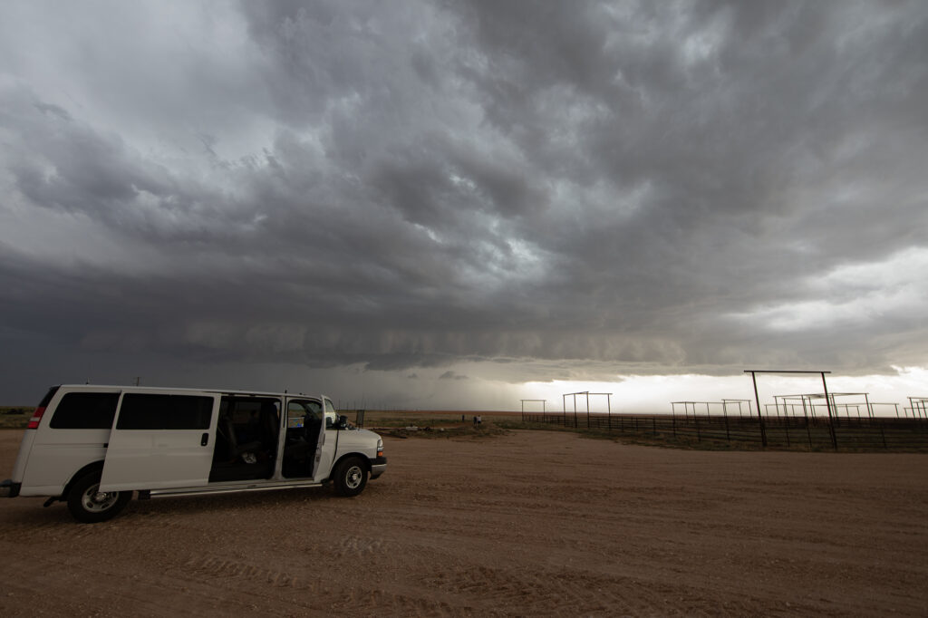
April 22nd Doole, Texas Potentially Tornadic Supercell
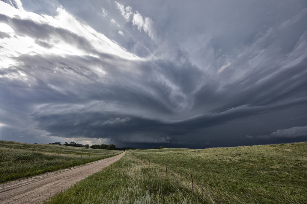
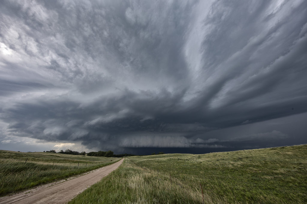
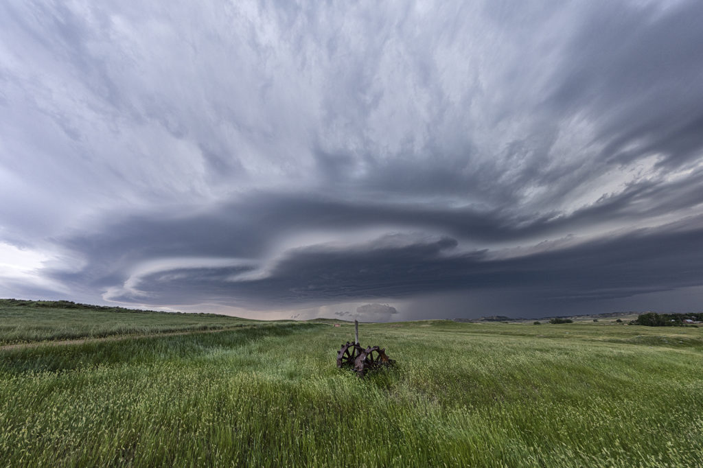
An interesting set up with northwest flow aloft on April 22nd. A weak low along with a sharpening dryline and warm front, set up a triple point northwest of San Angelo, Texas. Moisture would be the issue as dewpoints were in the 50s. Shear was good and convergence at the triple point would fire off a storm that became a long lived supercell. As the storm turned along the boundary, it started spinning strongly. After an interaction with another weak cell which it destroyed, it developed intense rotation, and on radar a classic scorpion tail hook echo formed with a good velocity couplet. RFD dirt was seen wrapping around the southern periphery of the storm and soon a large dirt bowl formed and persisted for about 5 minutes. Tornado? Possibly. But the storm also had hail the size of softballs. It soon moved east into less unstable air with lower dewpoints and it slowly decayed over the next couple of hours. A GREAT way to start the 2023 official tour season with Tour #1, the Close Encounters tour, witnessing this supercell. Enjoy the pics!!!
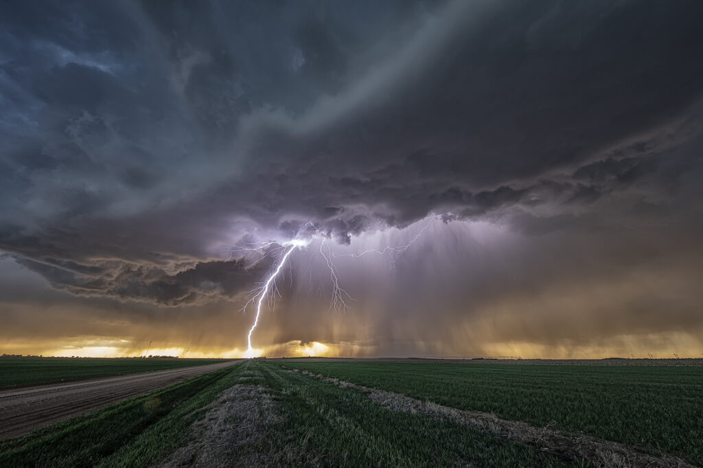
April 14th Medicine Lodge, Kansas Severe Thunderstorm
April 14th had plenty of shear, decent instability and a dryline in place. However, moisture was lacking, but enough of present to fire severe storms along the dryline late afternoon into the evening. I took the group the furthest south we could to get closer to better moisture, but still have enough forcing to help maintain storms as they moved off the dryline. Several storms formed and most went severe warned. However the tail end storm, as is often the case, became the strongest. Near sunset it started producing numerous lightning strikes, some starting fires. The structure was pretty good with the shear in place and it gave us a nice show as it rolled east towards Wichita. A fun day, we got about what we thought we would and had some very pretty scenes in the gypsum hills south of Pratt. Enjoy the pics!
April 4th Pleasantville, IA Tornadic Supercell
April 4th was a complicated day. A powerful upper level low would pivot out onto the plains late in the period. Low level moisture was fairly shallow for a big event, with pockets of dry air mixing out the better moisture. It seemed like two areas would be the best targets: 1) southwest Iowa as the forcing came out, however moisture was forecast to mix (and did!), 2) southeast Iowa and western Illinois in the free warm sector. We sat in Ottumwa for a couple hours waiting for one target to become clear. It never really did. A cluster of storms formed in eastern Missouri and consolidated into a few supercells as they moved into western IL. We started to head that way to chase, but it would have been a long way back to Kansas City that night as several guests had to be back in Denver by late afternoon the next day. Shortly after we headed out to go to IL, the Iowa play started forming. A line of storms, now severe, formed along the dryline west of Osceola and moved east. The tail end storm really started getting it’s act together so we quickly turned around and headed toward Pella (where we saw a tornado 2 years ago!). As we approached Pella, a tornado warning came out with a confirmed tornado towards Pleasantville, which was another 15 miles west. We did all we could to get there, but were only able to get a glimpse of the pretty tornado before it dissipated. We stayed with the supercell as it approached the warm front and became tornado warned again. A brief spin up happened south of Malcom. The storm continued its path across the warm front, weakening in the colder air. Here’s a few pics of what we saw with the supercell, distant tornado and the second spin up. Enjoy!!!!
March 31st Ollie, Iowa Violent Tornado
An extremely volatile day was in store on March 31st. A powerful trough was moving out of the Rockies onto the plains as a surface low intensified north of Omaha. We took our on call tour towards the Des Moines area in anticipation of rapid supercell formation early afternoon. The dryline lit up like a Christmas tree shortly after noon as storms raced northeast at 60-70 mph! Strong shear, good moisture and instability and a strong jet would fuel these storms. By 2pm a large thunderstorm formed in northwest Missouri and rapidly moved northeast, becoming tornado warned as it approached Ottumwa, Iowa. We moved to position ourselves in front of it to see what it could produce. We approached the small town of Packwood as a cone tornado stabbed down to the ground west of us and grew to massive proportions.
As we drove west on highway 78 towards Hedrick, the tornado wedged out becoming a massive twister less than a mile from us! The roar of the tornado and rear flank downdrafts winds filled the senses with the sound of a rushing waterfall. Due to fast storm motions and the unfortunate road closures in the area, we were only able to stay with it for about 15 miles before we lost it. This tornado caused a lot of damage, but fortunately no fatalities. It has been officially rated EF-4 by the National Weather Service.
Our thoughts and prayers go out to anyone affected throughout the central and southern plains this day as 60 tornadoes raked the region causing many casualties and much damage.
July 16th Central Nebraska Tornado Warned Supercell
July 16th featured very high dew points in the mid 70s and CAPE values over 3000 j/kg. Shear was modest, so we weren’t certain we would get supercells. An early day supercell over eastern Nebraska laid out an outflow boundary over central Nebraska from Valentine southeast towards Grand Island. Storms formed along this boundary and moved east into the cool stable air and died. Later in the afternoon a cluster of storms formed on the boundary and the tail end storm anchored. It immediately started spinning and became a formidable supercell! As the storm right turned on the boundary and moved towards Burwell, it was rotating strongly and was extremely electrified! I thought it had a decent chance to produce a tornado, but it did not. A couple of weak funnels did form. As the storm continued southeast, it became tornado warned with strong rotation continuing. Another supercell formed west of this and rotated down towards I-80 near Gibbon and also became tornado warned. The structure was incredible with one of the best shelf clouds I’ve seen in years! As the storms pushed south of I-80, they gusted out and became a wind machine. A great day with far better results than we were expecting! Enjoy the pics!
July 10th Southeast Montana Supercells
Southeast Montana was the target this day for what appeared to be a decent chance of high based supercells. Great shear was in place, but limited moisture and instability would temper the threat of significant severe weather. Nonetheless, storms formed off the Big Horn mountains and moved east and intensified. Hail the size of half dollars and winds to 70mph occurred from these supercells. Structure was typical for high based storms and one can wonder only what if there would have been better moisture and instability. It was still a fun day and we at least had severe storms.
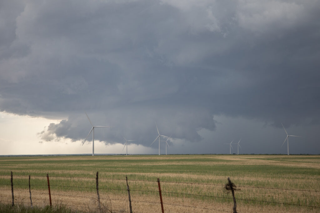
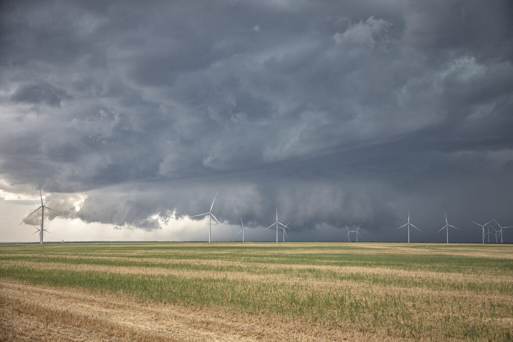
July 6th Eastern Colorado Tornado Warned Supercell
July 6th took us to eastern Colorado. Good moisture and instability, along with modest shear and upslope flow into the Palmer Divide would set the stage for supercells and multicells. One such storm formed just west of Limon and right turned southeast towards Hugo. As it did, the structure improved as severe thunderstorm warnings were issued for golfball sized hail. As it moved further east, it became better organized and was tornado warned. It didn’t produce one, but you could clearly see the rotation in the storms updraft. As it moved furth east towards Eads, it encountered drier are and eventually weakened. Pretty storm, and the eastern plains of Colorado certainly needed all the moisture it can get! Enjoy the photos!