May 29th, what else can be said. I have seen so many tornadoes in the past 20 years on this date. It is like the holy grail for tornadoes. This year would be no different either. We sat near Fairview, Ok watching a cluster of towers go up in a great environment. Good shear, good moisture, great instability and the triple point play. What could go wrong? A storm eventually emerged from the cluster of towers and became an intense supercell. We stayed in front of it from Okeene to Kingfisher and all the way to Yukon. The structure steadily got better and it became tornado warned near Kingfisher. Finally, with help from a left moving cell from the south, our storm produced a weak tornado north of the Yukon/Piedmont area. The best thing about this supercell was definitely its structure!
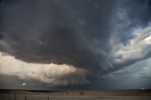
May 4th Oklahoma Supercell
After a long break in the action, May 4th provided a high based supercell with decent structure near Walters, OK. This storm produced hail baseball sized and maintained a nice striated appearance for a couple hours before dissipating. I don’t have a lot of shots from it due to a malfunctioning CF card. Here’s the two I was able to grab.
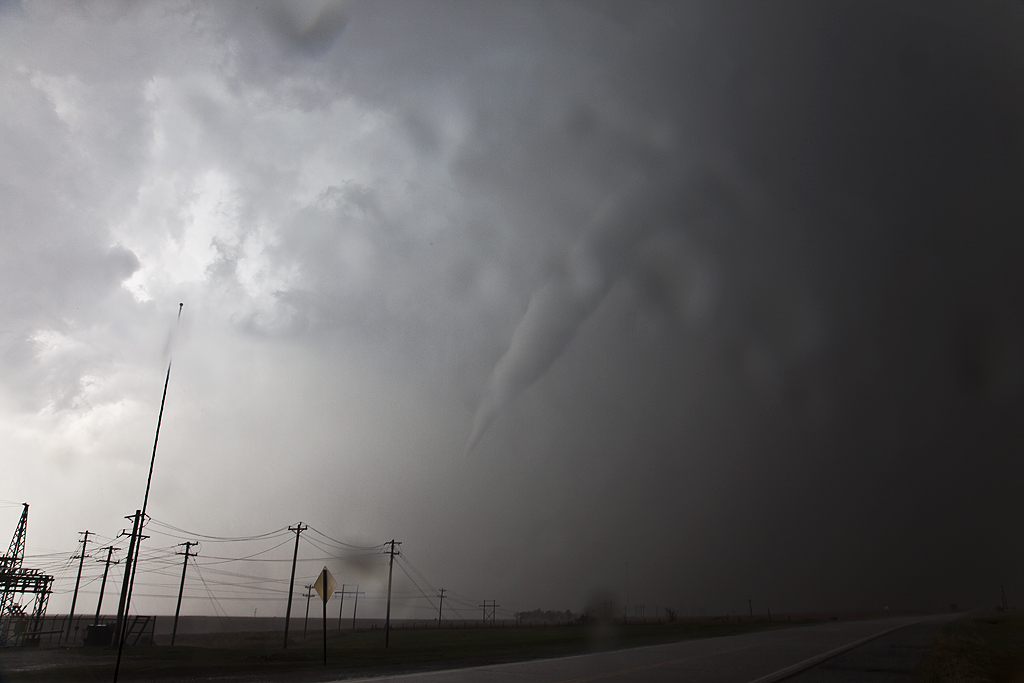
April 14th Kansas/Oklahoma Tornadoes
April 14th was a day that held great promise of long track violent tornadoes. SPC issued a High Risk for the area. We decided that we’d play the dryline down wind to allow storms to intensify as the raced at 50-60 mph towards us. The ultimate goal was to end up in northwest Oklahoma by mid afternoon, by dropping south with each storm until we got to within an hour of initiation point. Only thing is, nature would have the last laugh with us. We captured a tornado warned storm near Macksville that was racing towards Salina. When we saw it, it had weakened considerably, so we let it go. This would be the storm that RE-INTENSIFIED and produced several photogenic strong tornadoes near Salina. So, we dropped further south to a pair of tornado warned supercells heading towards Kingman. First one weakened as well, but briefly intensified and produced a short lived truncated elephant trunk shaped tornado. The second supercell pulsed up and down and produced two brief tornadoes not far from Pretty Prairie. Finally, seeing the storm of the day develop and immediately start producing tornadoes east of Woodward, we blasted south and made Manchester, OK right at dark. A very strong cone, then wedge formed and passed within 400 yards of us and raced into southern Kansas. We stayed with the storm, crossing multiple damage paths and witnessing several more tornadoes before we couldn’t stay up with it as it approached Wichita. This storm would produce anywhere from 15-20 tornadoes along its path from Woodward to northeast of El Dorado. Here’s a few pics from the day, overall a great deal of tornadoes intercepted, but what could have been in daylight for us, just wasn’t meant to be.
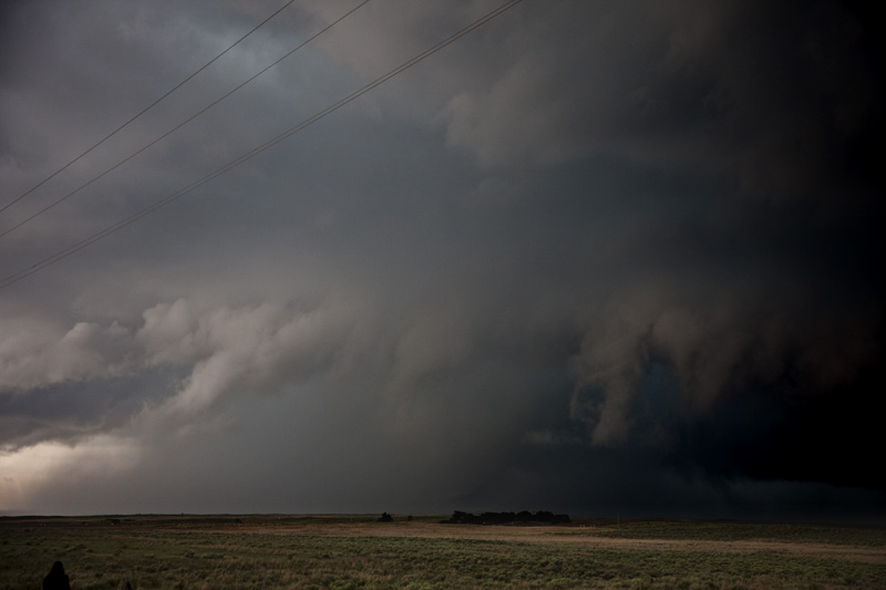
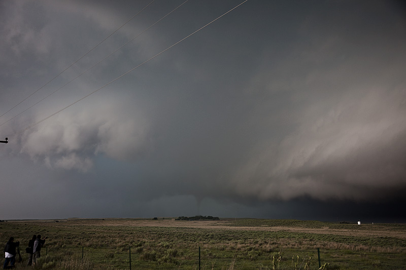
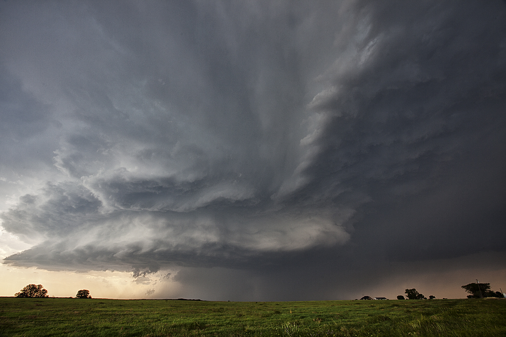
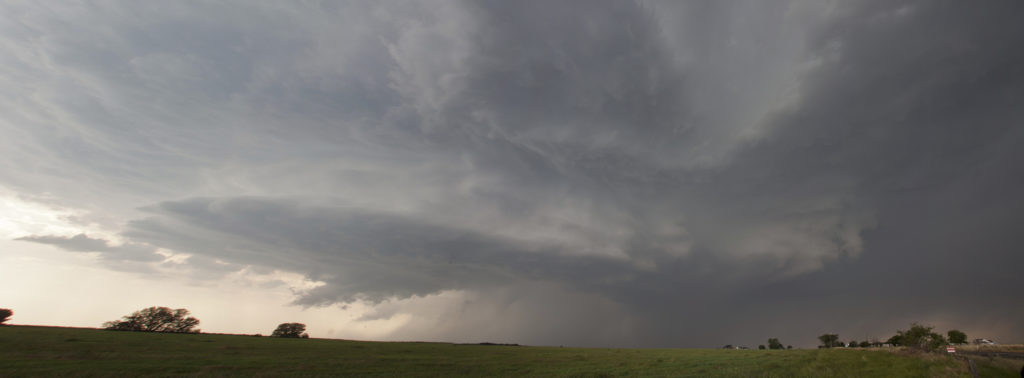
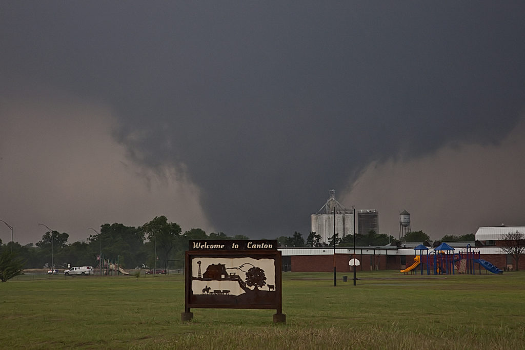
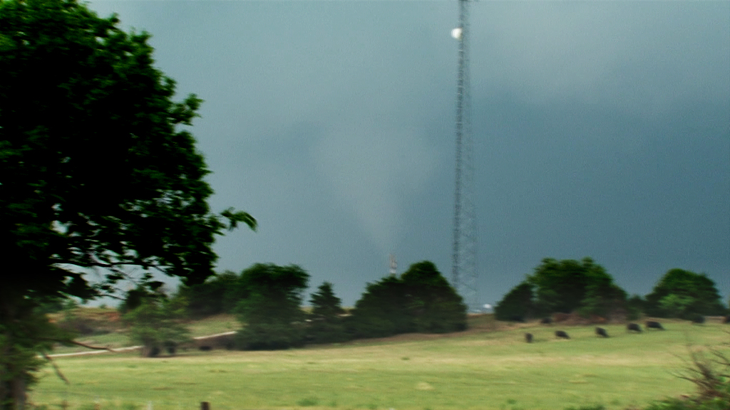
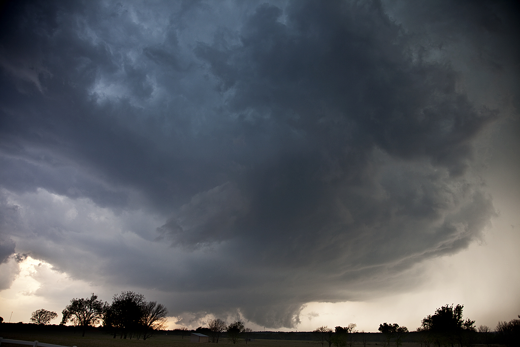
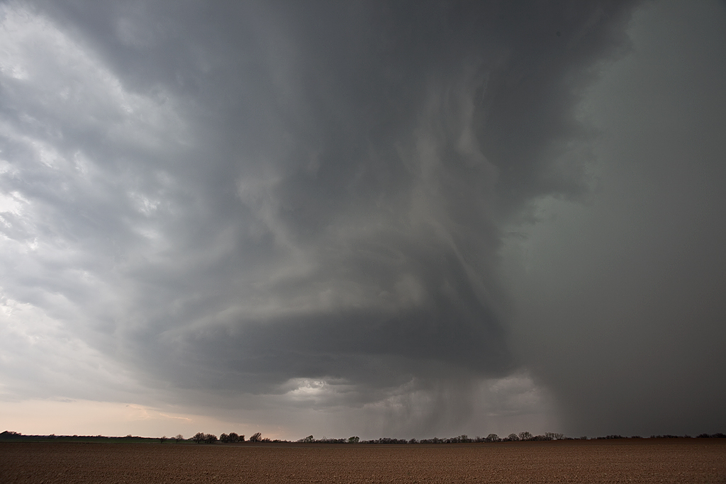
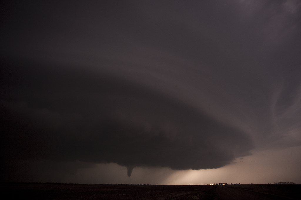
May 24th, 2011 Canton, OK Violent Tornado
May 24th certainly lived up to its High Risk billing. Supercells exploded along the dryline in western Oklahoma and quickly became violent. Numerous EF3 – EF4 tornadoes occurred with various supercells. We intercepted the Canton storm, which produced 3 tornadoes we could verify. Then we dropped south to Oklahoma City and intercepted two more storms that produced tornadoes as well. My heart goes out to all those who suffered personal losses this day. If you haven’t gotten involved or donated to the local Red Cross/or other agencies, please do so!
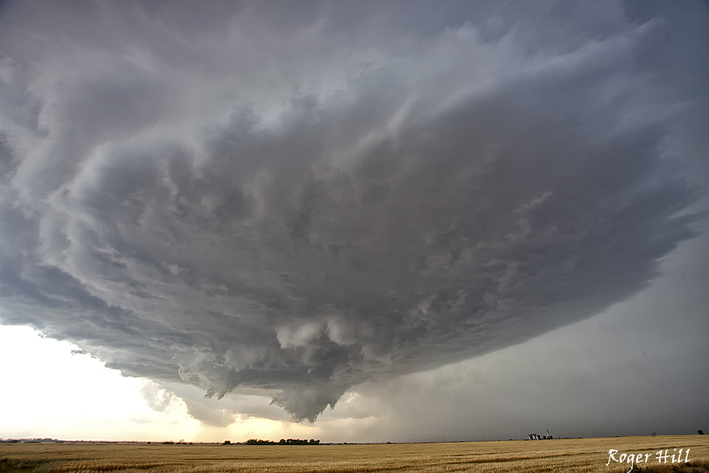
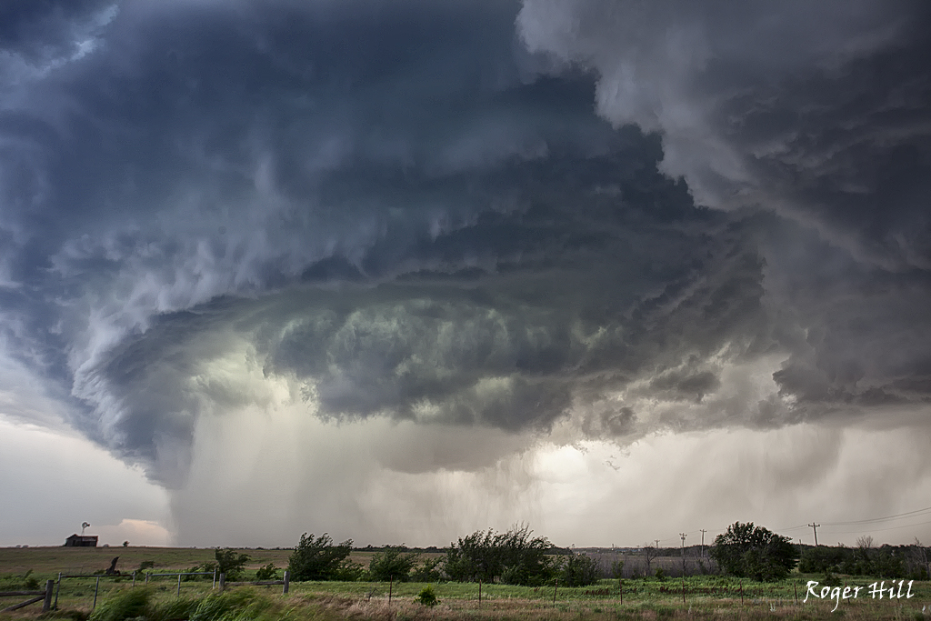
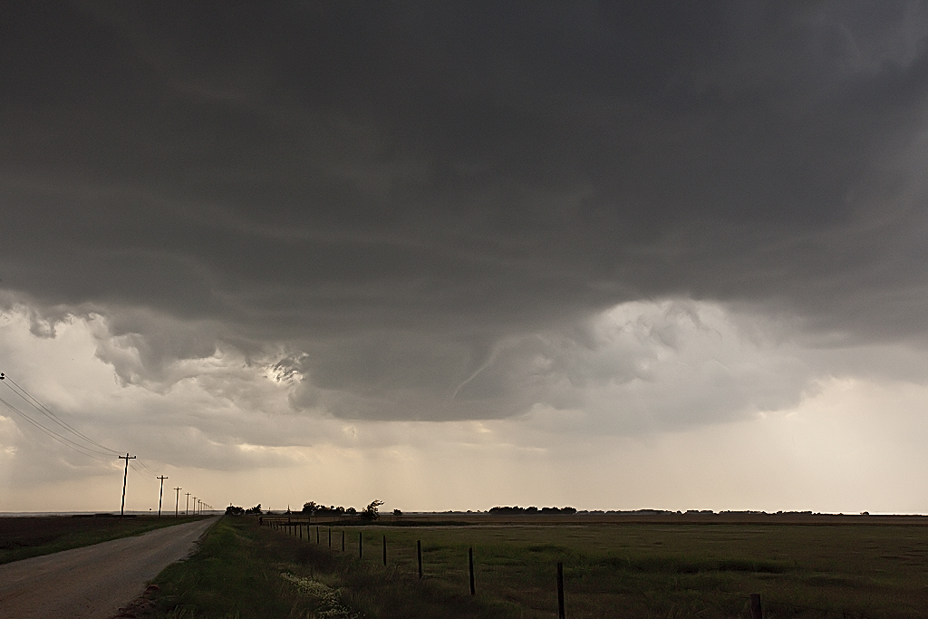
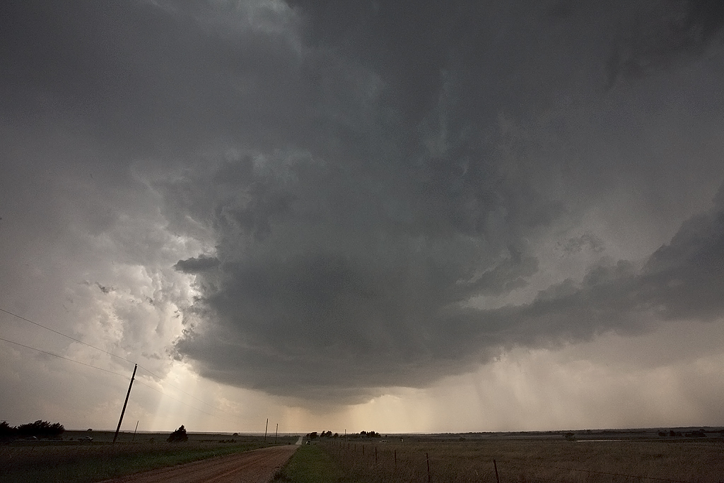
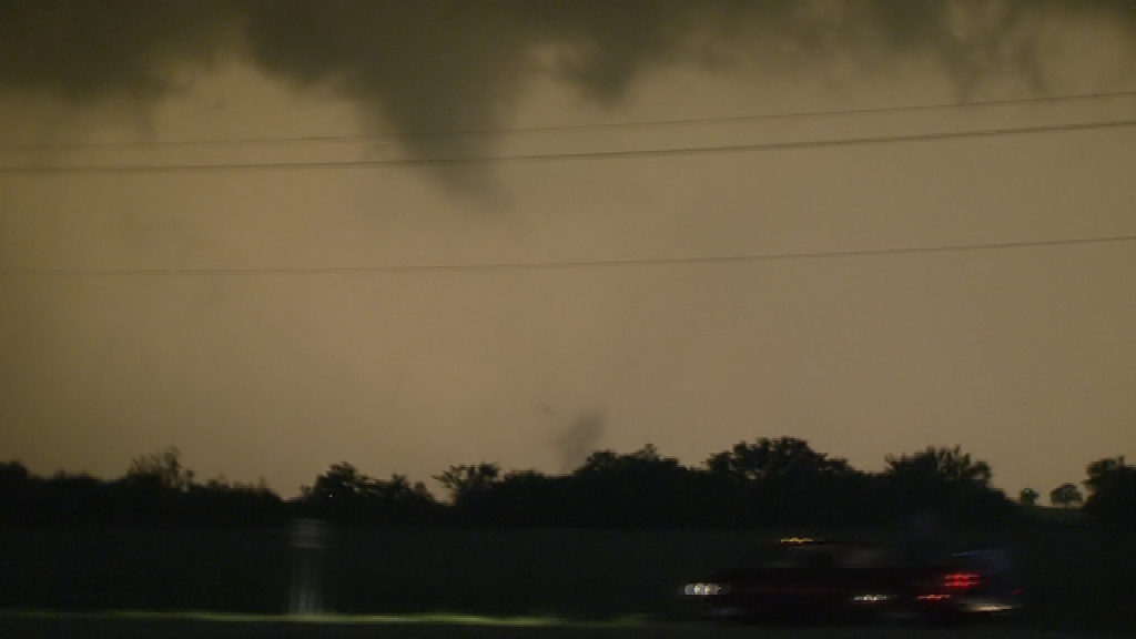
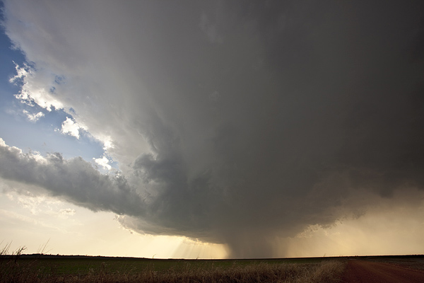
May 23rd, 2011 Homestead, OK Tornado
Things looked decent this day. However, due to high cloud bases, the tornado threat never really materialized. We went west from Enid, OK to play the dryline and encountered a nearly stationary supercell, albeit high based. This cell eventually dropped a slender truncated elephant trunk shaped tornado that was on the ground maybe 3-4 minutes. We later dropped south to another supercell that spun like crazy, and then abruptly died. Very wierd day, but at least we did catch a tornado. Thanks Rich Hamel for your use of your tight shot of the tornado. I had the wrong lens on my camera.
April 22, 2011 Southern Oklahoma Tornadoes
April 22nd took me to south central Oklahoma to play a dryline/triple point setup. Good shear, albeit a bit weak upper flow, excellent instability, dewpoints in the upper 60s and lift along the dryline would spark severe storms this day. Storms became HP fairly fast due to the weaker upper level flow. I intercepted a couple of supercells near Paul’s Valley, that later produced tornadoes near Stratford, OK. HP structure was good and they were extremely electrified. We also viewed 3 tornadoes from these storms.
April 14, 2011 Oklahoma Tornadic Supercells
Caryn and I took a group to Oklahoma for what appeared to be a significant tornado event. Even though we did see a tornado near Burbank, OK, it did not live up to the hype that had been built up this day. A weakness in the low level shear would result in lots of supercells that were rotating, but very few that actually did produce a tornado. We witnessed a tornado during the afternoon near Burbank as a supercell spun wildly and dropped the elephant trunk shaped tornado in the photos below less than a quarter mile from us. A fun day, but not as wild as anticipated. We were saddened to learn of the 2 fatalities in southeast Oklahoma from a strong tornado that did occur near Tushka.
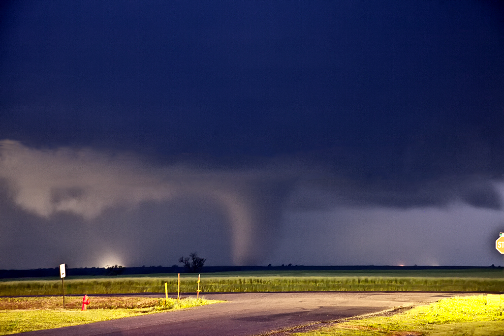
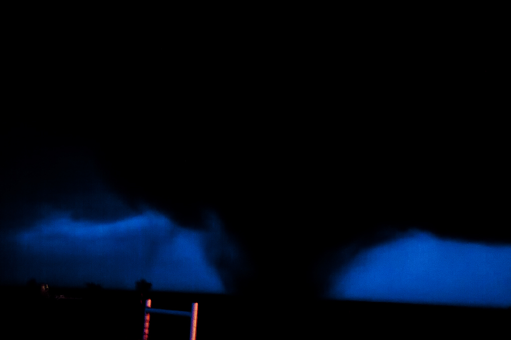
April 8, 2011 Medford, OK Tornadic Supercells
We headed to northern Oklahoma this day for what appeared to be a high risk/high reward setup. By late afternoon a few supercells developed on the dryline and intensified as the evening progressed. The low level jet strengthened as stronger mid and upper level flow overspread the region, creating a nicely sheared environment. One supercell spun like crazy as a wall cloud formed directly overhead, while another became a classic monster after dark.
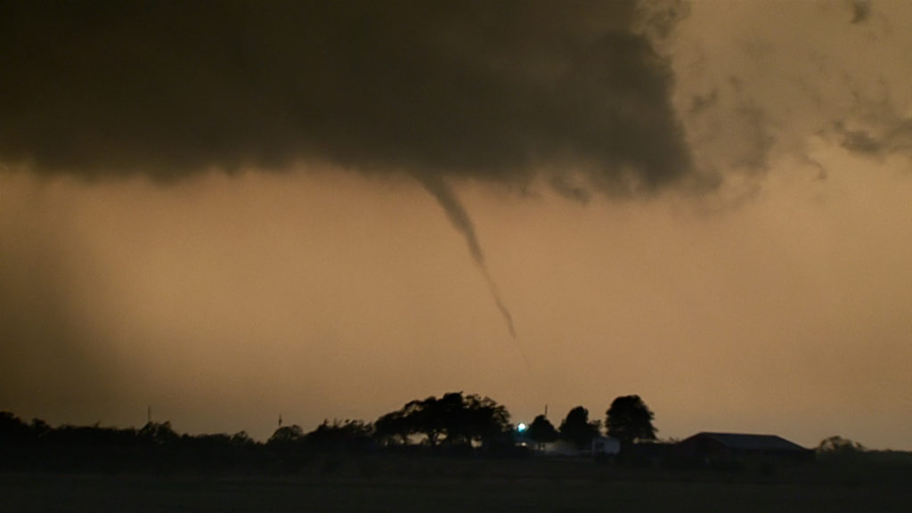
February 27, 2011 Northern Oklahoma Tornado Warned Supercell
I couldn’t resist the first chase of the year. A strong, but shearing short wave was forecast to emerge into western Texas/Oklahoma, and race east northeast. A lee cyclone was developing in southeast Colorado and was forecast to move eastward along the warm front. A strong dryline was moving east into Oklahoma and would be the culprit in developing the lone warm sector supercell west of Pond Creek by mid afternoon. We intercepted this storm in its formation stages and virtually had the storm to ourselves early in its life. As it moved into a moistening environment along the warm front it eventually became a nice supercell that rode and occasionally went north of the boundary. Finally, just northeast of Newkirk, OK, the storm produced a tornado, albeit fairly short lived. The storm had pretty structure through most of its life cycle.
June 13, 2010 Oklahoma Panhandle Tornadoes
June 13th was the first day of our historic Tour 6 (31 tornadoes total on this tour!). We were a bit late to see the first tornado from this HP supercell southwest of Slapout, OK. By the time we arrived, it was cycling, with several occlusions occuring before it finally cycled and produced a fairly stout, low contrast, partially rain wrapped tornado. A second small and brief tornado occurred after the first one wrapped completely in rain. Fun day, even though we were a bit too late for the most photogenic tornado of the day.