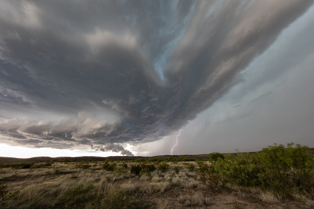
July 12th featured extreme instability and great shear, however a very strong capping inversion would be the main issue to overcome. An outflow boundary from previous nights storms lay east/west near Brady, Texas. Towers kept trying to initiate along the boundary late afternoon with no success. Finally a cluster of updrafts formed along the surface triple point and a supercell was born. This storm spun hard, and had a great hook on radar. Visually you could see the rotation and the storm became incredibly electrified! West of Brady it became tornado warned. It never had a serious tornado threat due to weak low level rotation, but nonetheless it was quite pretty. It slowly drifted east and eventually weakened as a second storm formed and also became supercellular. As the sun set, the colors cast from the supercell updraft were absolutely gorgeous! Enjoy the pics!
June 11th Raton Mesa, CO Tornado Warned Supercell
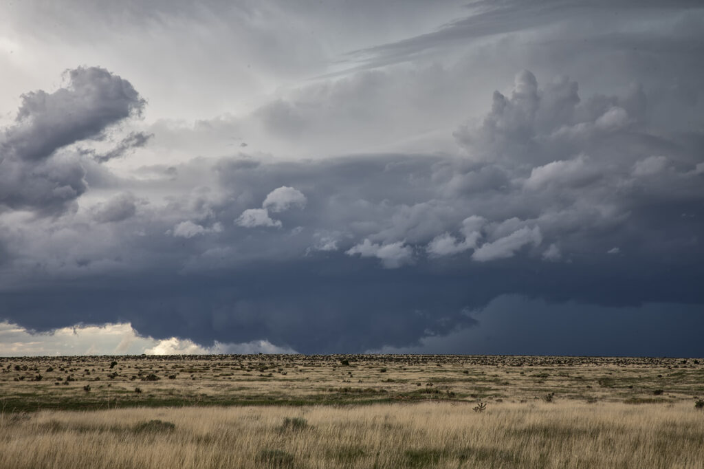
May 11th had a lot going for it. Good upslope flow into the Raton Mesa, decent moisture and instability and great wind shear would set the stage for supercells this day. Storms formed early afternoon and became tornado warned. We blasted west from the Oklahoma panhandle into the mesa in time to watch a supercell get very interesting. Couldn’t confirm any tornadic activity, but it certainly looked like it had potential. This storm also produced baseball sized hail and high winds. It was a treat to photograph and watch spin across the mesa into the Oklahoma/Texas panhandle. Fun day for all the guests who witnessed this beauty! Enjoy the pics!
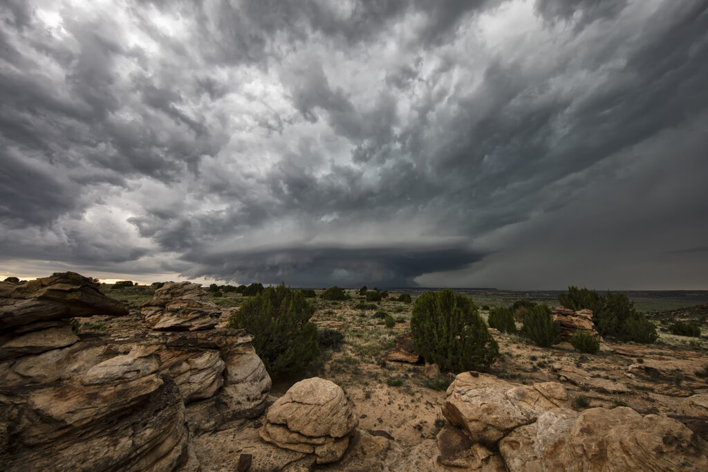
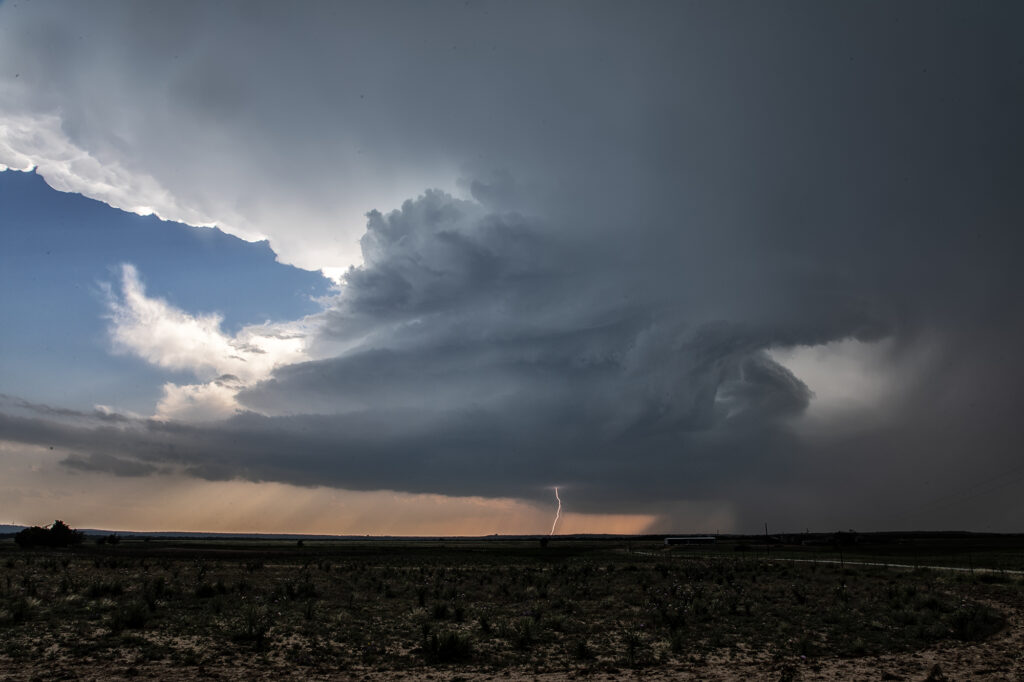
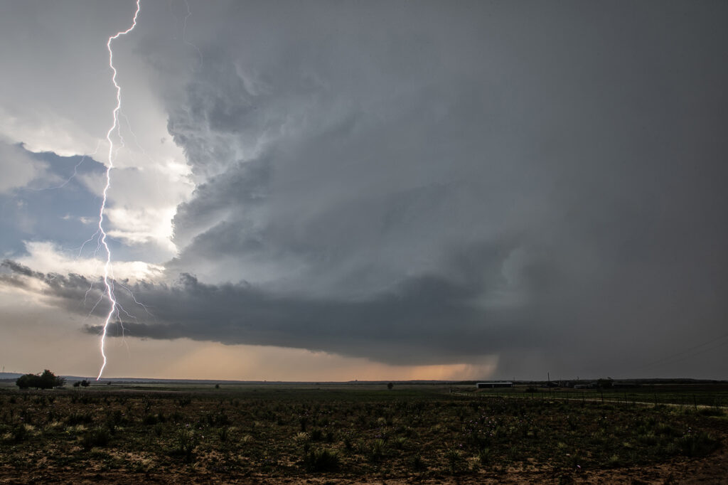
June 7th Marathon, Texas Supercell
With a poor weather pattern forecast, we went to where the best combination of shear, moisture and instability were forecast, near the Davis Mountains of southwest Texas. Storms formed mid afternoon and intensified, with a supercell forming near Marathon, Texas and drifting southeast. It had good structure and was producing numerous cg strikes. As it moved towards Mexico, more storms formed west of town and also produced a lot of lightning. We encountered golfball sized hail and plenty of wind with the initial supercell!
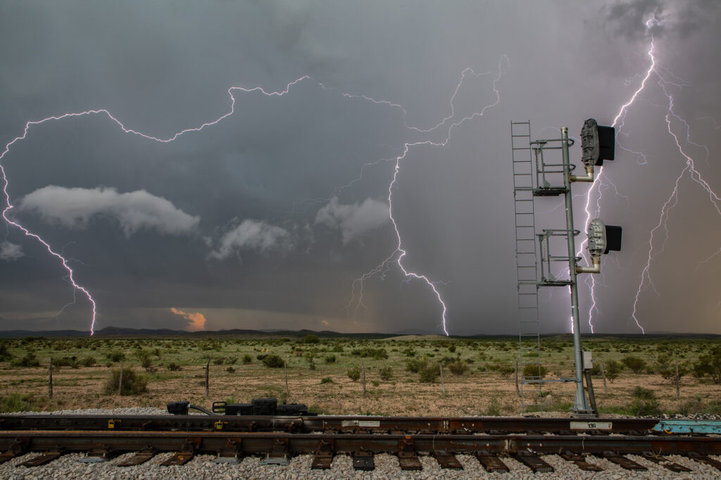
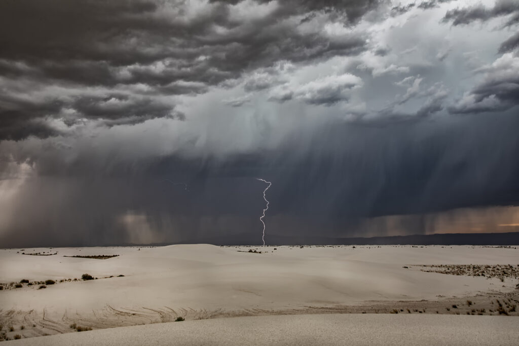
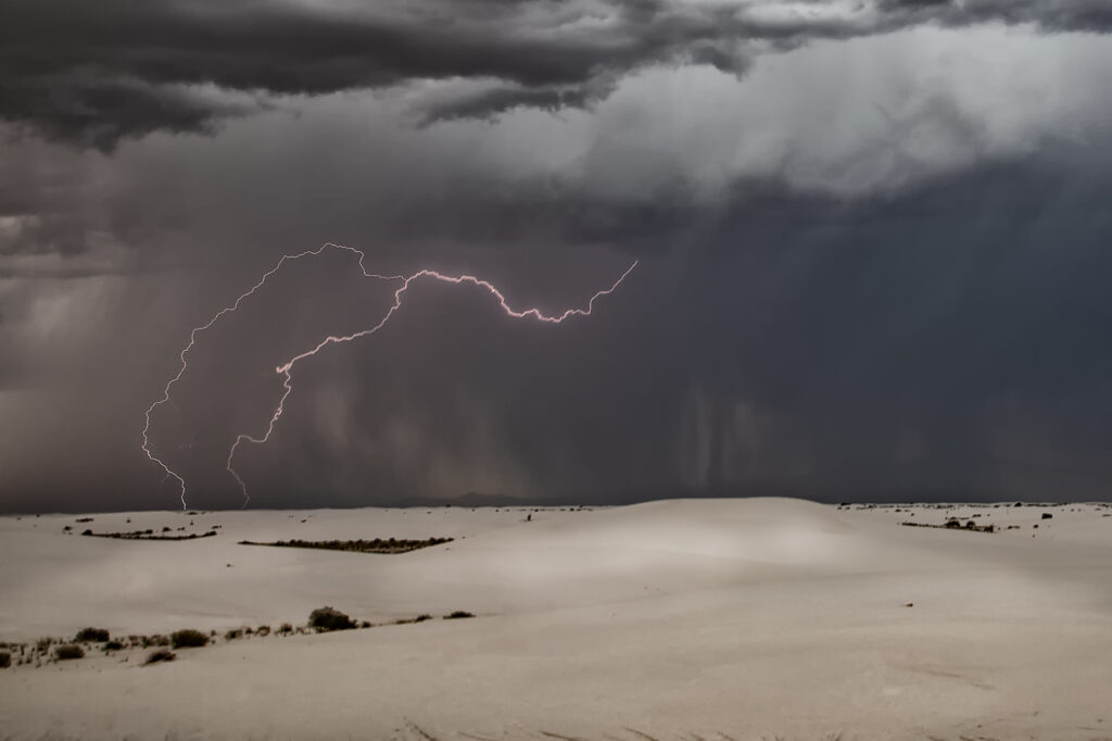
June 6th White Sands, New Mexico Lightning
There wasn’t a lot of hope on June 6th, so we took the group to White Sands National Park in southern New Mexico for some general thunderstorm formation in hopes of catching some lightning over the dunes. Nature did not disappoint! We arrived to developing storms west of the park. A couple hours later, stormed were forming over the park as outflow from the western and southern storms moved into the area, lifting the air and generating storms, some severe! Nature is such an artist as several lightning strikes occurred over and near the park. A fun day and many of the guests had never been to White Sands. Needless to say, I bet they go back again! Enjoy the photos!