Tag Archives | 2002

May 23rd, 2002 Borger, Texas Supercell & Tornado

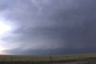
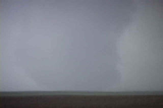
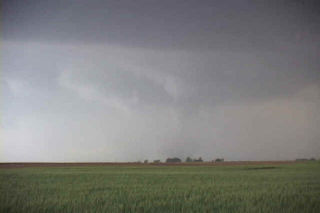
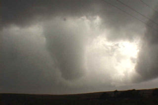
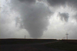
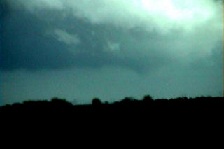
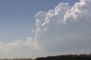
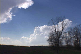
What an incredible storm this was!! After spending almost too much time east of Childress, we drove northeast and were greeted with this beautiful storm. From a distance it did not look that impressive. But as we approached it from the south, the incredible structure of this HP/classic supercell became obvious. This was a special storm!!! One of the top 10 in my book ever! From the highly striated liberty bell updraft, to the FF tornado it produced, this storm was a force to be dealt with carefully. We drove northeast of Skellytown and ended up northwest of Pampa to get the best view we could. And what a view it was!!!!

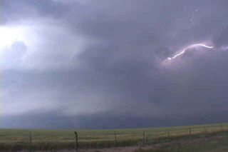
The FF of this storm was very electrified. The striated updraft had clear evidence of major RFD erosion, and I am afraid it produced a rather large rain wrapped tornado that was just out of vision. As the rain cleared the occluded updraft, a rather large block shaped lowering was visible which could have attested to producing a large tornado that we just couldn’t see. Enjoy the photos of this beast.

May 7th, 2002 Southwest Kansas Tornadofest

What an awesome day!!!! We started the day out in Oklahoma City and headed north towards the triple point in southwest Kansas. We intercepted an incredible supercell in eastern Ford county and it moved into Edwards county. This storm had 60 mph inflow winds and awesome structure. It produced several tornadoes, of which we saw 4 of them. The first tube formed in the inflow region in the notch of this beast. The second, third and fourth tornadoes formed in the hook area of supercell. We eventually blew the storm off as it approached Greensberg and took on drastic HP features. We dropped south for the next cell, only to find out later that our first cell later produced the Pratt wedge. Moral of the story: Never blow off your storm!!!!

May 5th, 2002 Texas Panhandle Magic

May 5th was an incredible day. Two very large tornadic supercells developed in the Texas panhandle. Since I was on my way to Oklahoma City to join David Gold and Silver Lining Tours, I took the northern route through the northern Texas panhandle. By mid afternoon a supercell developed near Dumas and tracked east/northeast through the panhandle. This storm produced a very large tornado about 10 miles east of Pringle, Texas, and another beautiful tornado just south of Higgins, Texas.

April 27th, 2002 Crete, Nebraska Tornado

This was an interesting day to chase. The atmosphere over my target area was cloudy and cool, with temps in the low 50s and dewpoints near 50. A moderate risk was issued by SPC, and if skies could just clear enough to destabilize the atmosphere, then there was a good chance of significant tornadoes. I left Denver driving through the rain and snow and arrived near Alma, Nebraska by 1 PM. Skies were clearing as the dry slot had pushed northward. A rope cloud had formed and towers were trying oh so hard to establish themselves with little luck. Finally enough heating had occurred to warm temps into the low 60s with dewpoints near 60. A couple cbs became rooted in the boundary layer and quickly exhibited mini-supercell characteristics. Shortly after 3 PM a rapidly rotating cb developed southwest of Crete, Nebraska. This cell raced northward at 50 mph and produced a tornado that stayed on the ground for 4.5 miles just west of Crete. Unfortunately, I did not get my camcorder up and running and focused in time to catch the mature part of the tornado. Photos are below. A couple of the photos have been enhanced to see the tornado in its latter stages.

April 18th, 2002 McPherson County, KS Monster Supercell & Tornadoes

April 18 was my favorite chase day of the year. A dryline/front intersection (triple point) was the focus for intense convection this day. I arrived north of Wichita in time for the first cb to go up. It died quickly as other towers also tried in vain to break the cap. Finally by late afternoon a storm broke the cap and went on the be the most scenic supercell of the year. It moved slowly across McPherson county, Kansas as it became a gorgeous “upside down wedding cake” with intense cg, hail and a couple of tornadoes.