June 21 was a good set up for late June in the Texas Panhandle. Strong deep layer shear, a sharp dryline and high CAPE would provide a set up for supercells. Mid afternoon an LP supercell developed north of Amarillo and stayed on the triple point for a couple hours. Eventually the storm moved south along the dryline and became an incredible hail producer. It produced hail to cantaloupe size in Amarillo that caused $100m damage. This storm also produced several weak tornadoes.
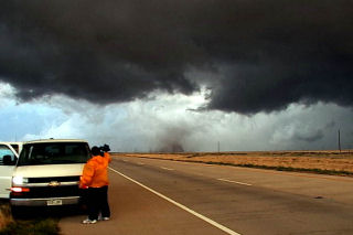
June 16th, 2004 Lamar, Colorado Long Lived Tornadic Supercell
June 16 was to be a day I would not soon forget. Strong upslope flow would provide deep moisture in southeast Colorado. Deep layer shear was more than adequate for tornadoes. By early afternoon, skies cleared and strong heating destabilized the atmosphere. A nearly stationary supercell developed southwest of Lamar and slowly drifted eastward. This storm produced at least 5 tornadoes and possibly more. Due to the poor road network, two tornadoes were not able to be photographed. At one point I had rain and hail falling on a dirt road that quickly turned to Vaseline slick mud!! I though I would NEVER get out!
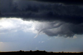
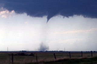
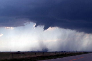
June 10th, 2004 Chappell, Nebraska Tornadic Supercell
June 10 was to be a day nobody would forget. We started in North Platte and analyzed data till early afternoon when a cell blew up west of Julesburg, Colorado on the dry line. I rallied the gang westward and arrived west of Big Spring on US30 just in time to watch the show start. This supercell developed into a beautiful classic with nice wall cloud, clear slot, FF core and an incredible tornado that lasted 28 minutes! This tornado morphed from a small nub funnel with debris cloud, into a full fledged strong cone tornado. The structure of this beast was a sight to behold!!!
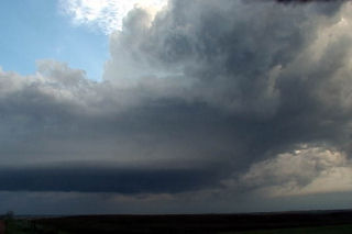
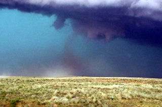
June 9th, 2004 Woodrow, Colorado Tornadic Supercell
The set up for June 9 was good for the high plains of eastern Colorado. Strong upslope flow beneath strong mid level westerlies would provide a good shear profile. Supercells developed near Denver by mid afternoon and moved northeast. One storm produced copious amounts of hail and produced at least two confirmed tornadoes.
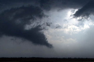
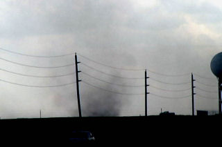
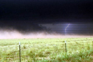
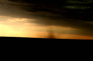
June 6th, 2004 Max, North Dakota Tornadic Supercell
This was a tough one for me. We left Denver early this AM with a target of Dickenson, ND. After almost 800 miles, we arrived to see 3 high based storms get their act together. Strong moisture return ahead of a short wave trough would provide lift to get these storms going. In spite of only upper 50s dewpoints, these 3 storms turned into supercells, with the southern storm, near Max, ND our target. We arrived as the storm was a beautiful saucer base with clear slot. A couple of funnels formed and extended close to the ground. Close enough I would consider this tornadic.