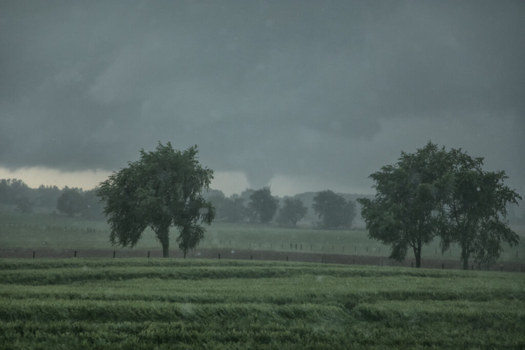
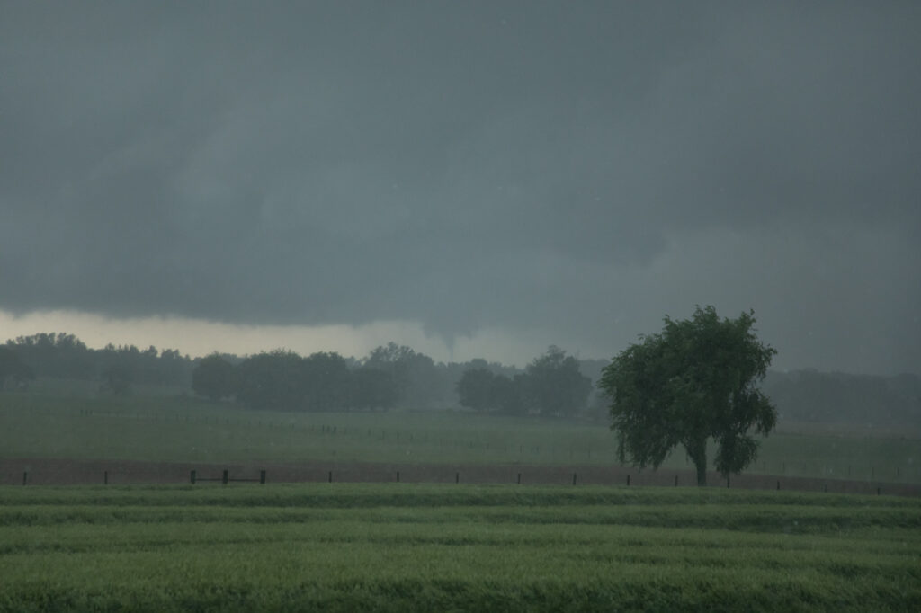
May 8th had a lot going for it. Strong instability, good shear, high CAPE and several boundaries played into the end result. We caught several tornado warned supercell, including one near Springfield, TN that produced a cone tornado. Between slow, curving, winding roads, low speed limits and slow traffic, it made it difficult to get in front of storms. The Springfield supercell spun like crazy and produced a cone, causing damage. It took us what seemed like forever to get in front of it. As we broke through the core, we could see the cone tornado behind us in the distance. It had been on the ground over 10 minutes. As we got into a better position to see it (due to hills and trees!), it dissipated. We then blasted south to catch a supercell near Columbia, TN that showed signs of strong rotation and was tornado warned. As we approached Nashville, insane traffic slowed us down by 30 minutes. And of course the supercell produced a violent wedge tornado that became rain wrapped by the time we could get to it due to traffic. Frustrating day, but we DID see a tornado! Tennessee and Kentucky are extremely difficult to chase in!!!! Enjoy what pics we could get!
May 24th Eastern New Mexico Tornadic Supercell
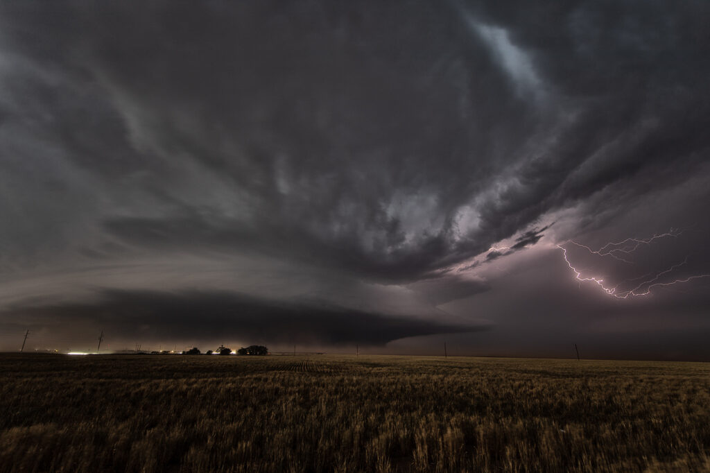
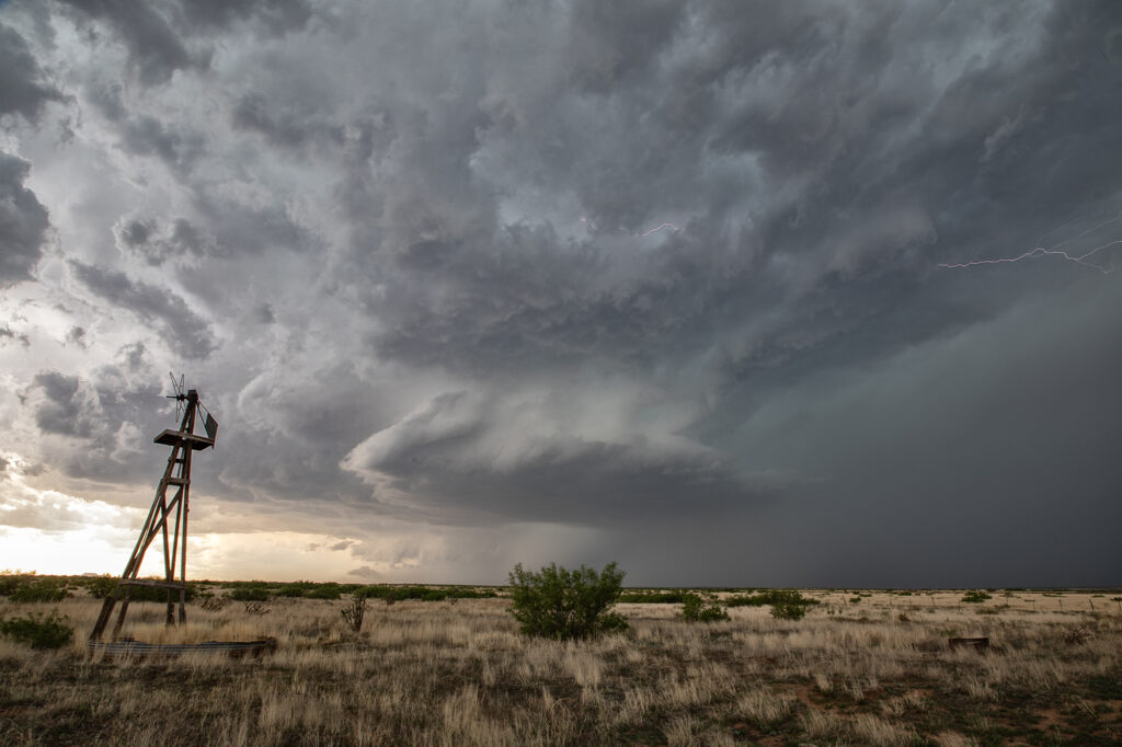
What a day! May 24th looked great in the models, and in real time, it was amazing!! Violent supercell thunderstorms congealed into one monster that dropped from Tucumcari, New Mexico southward to Clovis over a several hour period. Insane lightning and incredible storm structure persisted its entire life cycle. It also produced a few tornadoes, of which we caught a couple of them. During the early evening hours, as the storm approached Clovis, the inflow into this supercell was over 60 mph! Just showed the power of this HP storm! As it moved into far west Texas at dusk, the structure was constantly illuminated by incredible lightning. One of the most powerful supercells of 2023 to date, and it was a sight to behold! Enjoy the pics!