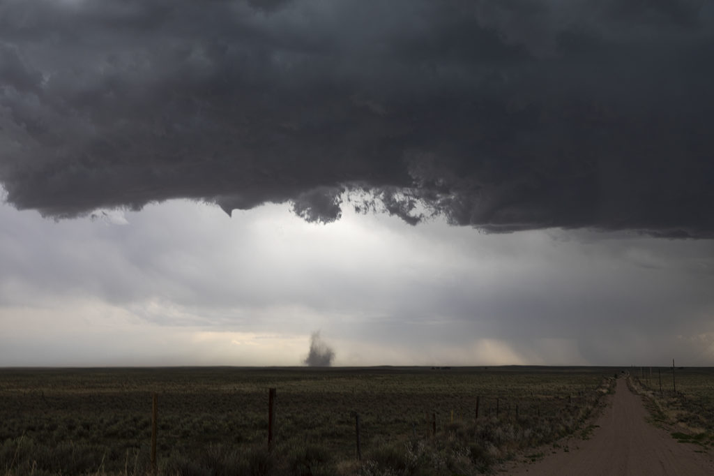
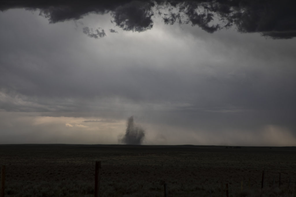
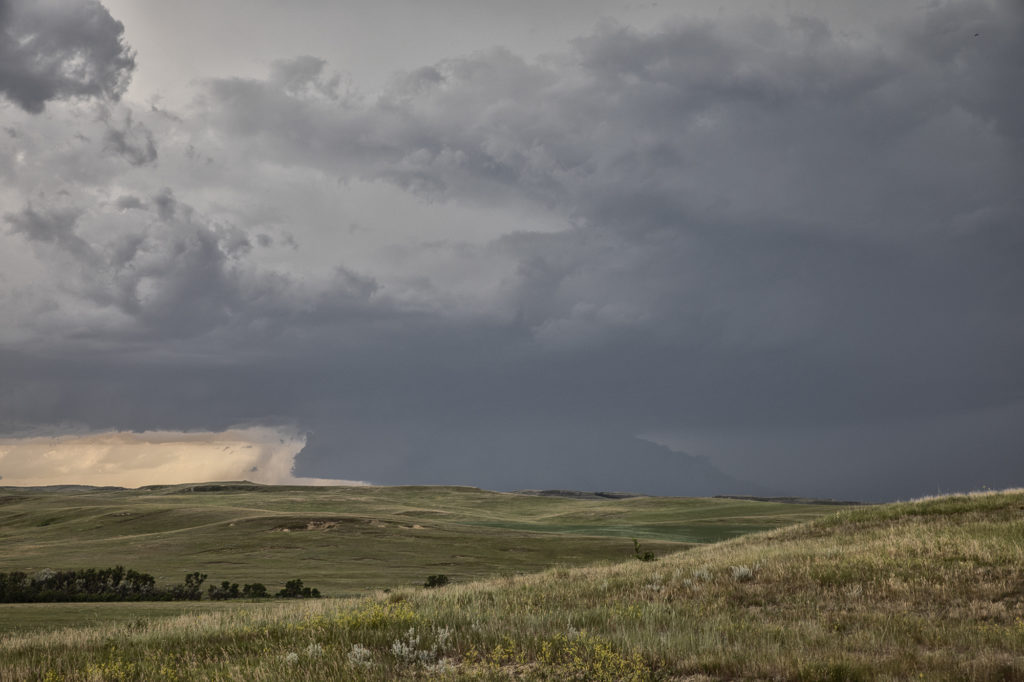
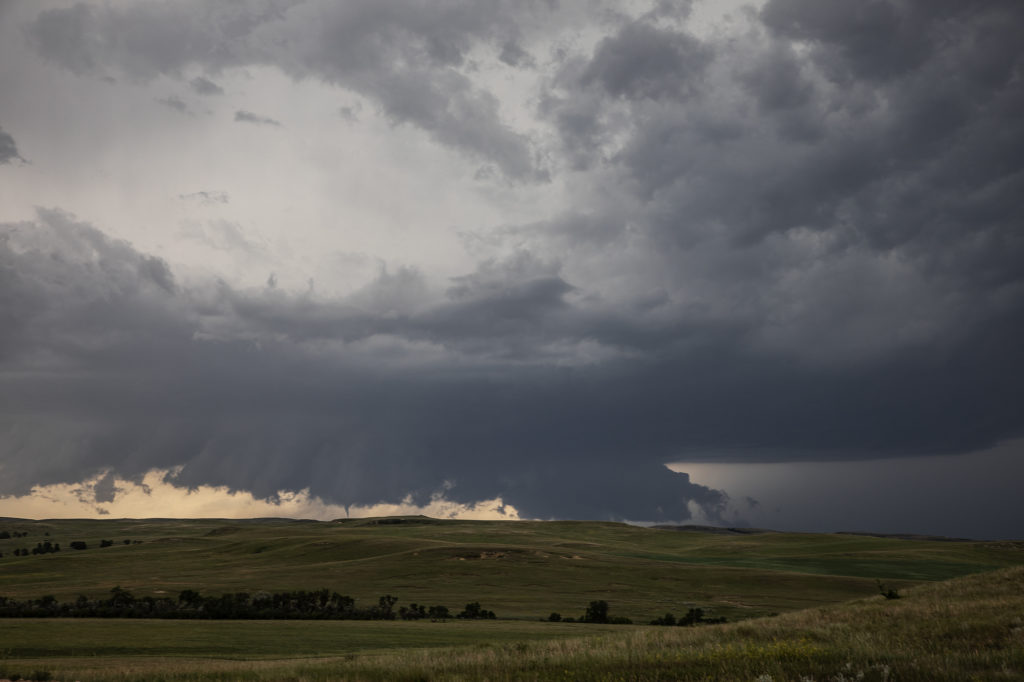
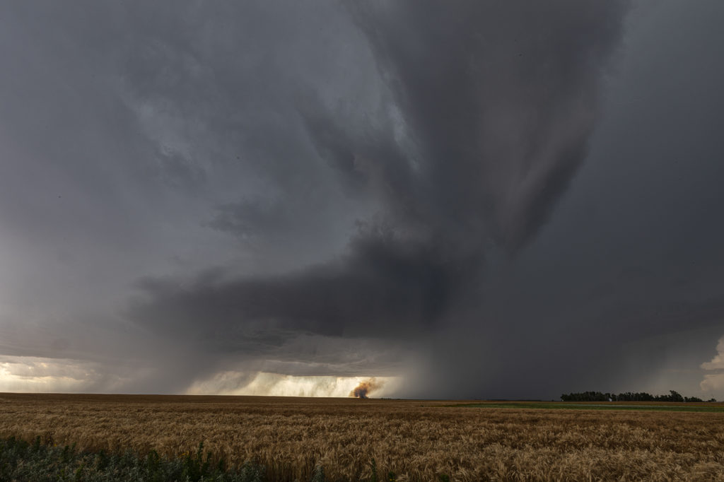
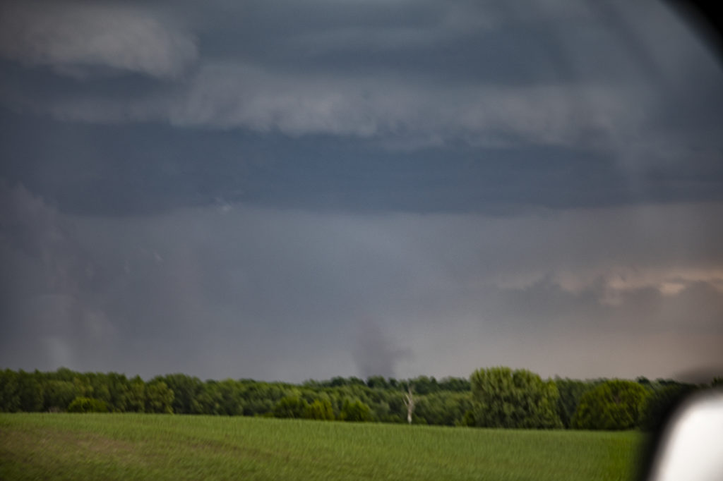
July 3rd brought us back to Colorado for the final day of the Photo Tour. Nature decided to give us some pre4th fireworks! A boundary set up north/south of a line from Ft Morgan to east of Limon. Intense storms formed along it and with a wind shift in place, two landspout tornadoes formed that we were able to witness. They lasted several minutes each before dissipating. Storms were quite sever with hail tennisball sized and lots of lightning as well. We intercepted the first cells on highway 71 south of Brush and followed the southward building line from there. Good shear, moderate CAPE, but limited low level moisture fueled the severe storms till eventually they gusted out and weakened. Fun final day of chasing for the tour before returning to Denver later in the evening. Please click on a pic for a larger image. Enjoy!
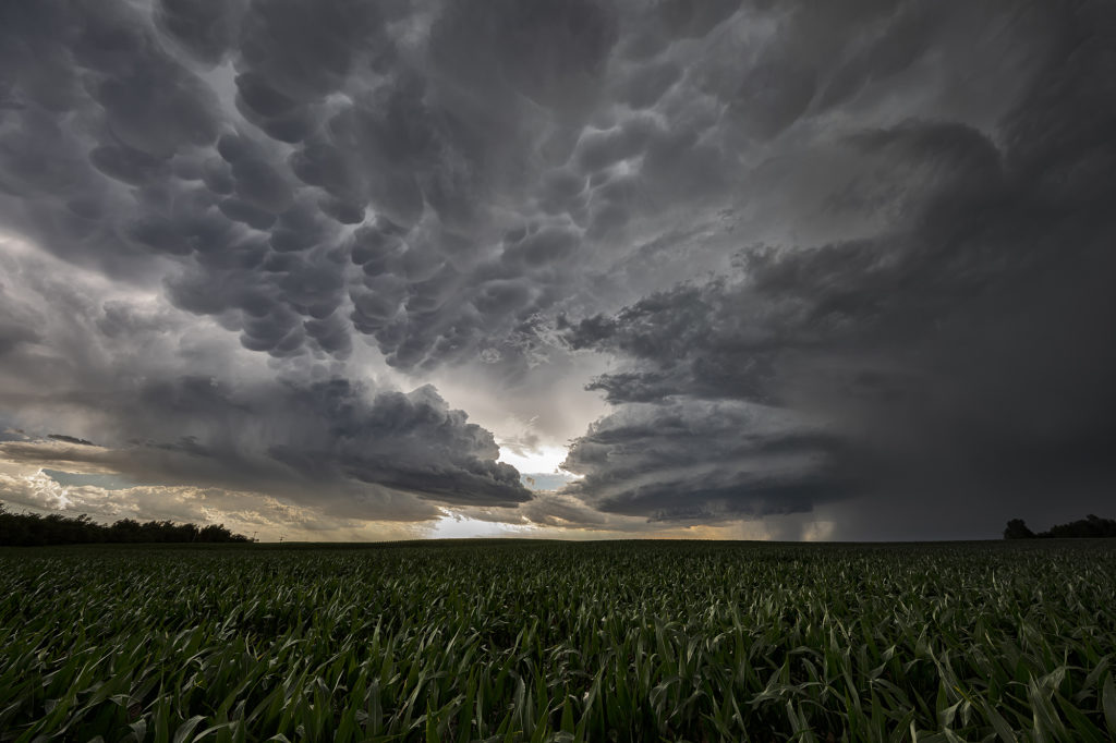
June 29th Theodore Roosevelt NP Tornadic Supercell
June 29th took Photo Tour #3 westward to Theodore Roosevelt National Park area where a triple point would set up and cause supercells to form. Strong shear, high CAPE values, good moisture and lift at the triple point helped to generate one intense supercell northeast of Wibaux, Montana that moved into western North Dakota. We positioned ourselves down wind to allow the storm to mature as it approached. A large wall cloud formed that started rotating with wrapping rain/hail engulfing it. A brief tornado occurred that we could see in the distance. Unfortunately there weren’t many roads to allow us to get closer or even stay with it. Numerous other storms formed and became quite a messy MCS. We stayed with them all the way to New Town, ND where another tornado warning was issued. A messy murky system approached as we decided to retreat and get out of it’s way. We headed on northwest to Williston for the night. Yours truly lost his cell phone as huge hail started falling and ended up driving back to the park in the middle of the night to find it. Success, it was found! (Destroyed and cracked, but it was found!!!) Please click on a pic for a larger image. Enjoy!
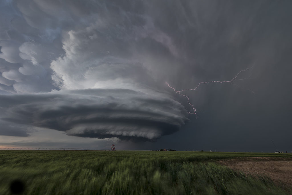
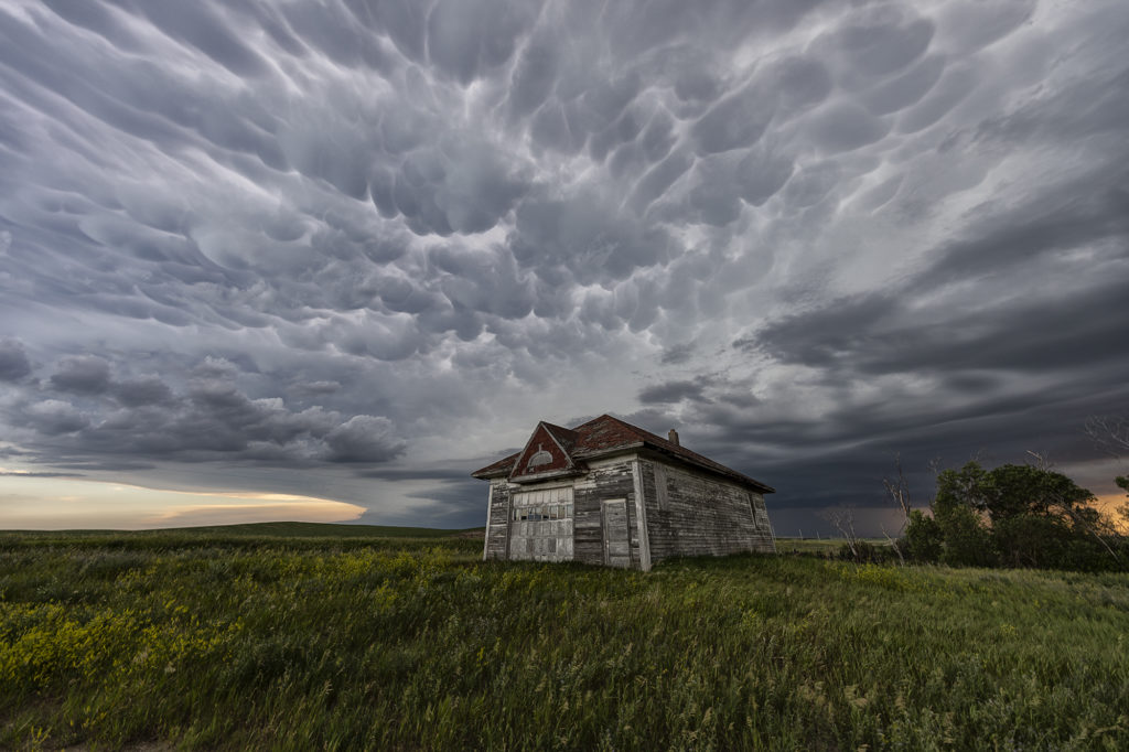
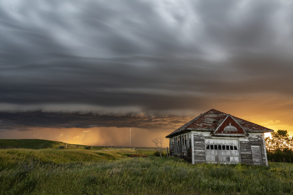
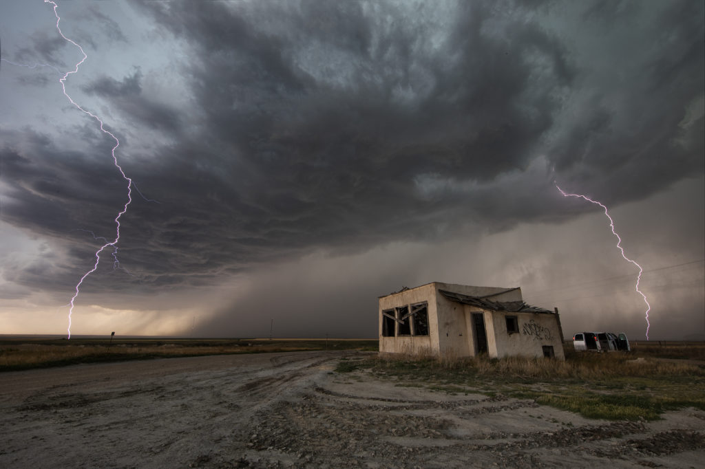
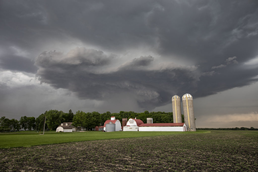
June 28th Central North Dakota Stunning Thunderstorm
June 28th took Photo Tour 3 to North Dakota. Good moisture and instability, coupled with weaker shear would allow a squall line of severe thunderstorms to form northeast of Bismark, ND. We managed to find an old abandoned farmstead south of Wing, ND where we were able to set up and capture some amazing images! The storms, coupled with the lowering sun in the evening, along with the old farmstead, allowed us to capture some of my favorite images from 2020! We stayed in place for a couple of hours photographing the area, and eventually headed back to I-94 and west to Bismark. A landspout tornado occurred well to our south near the South Dakota border, but everyone didn’t mind based on the images each person captured. Spectacular day with nature painting the Photo Tour one of the best set ups one could want! Please click on an image for a larger photo. Enjoy!
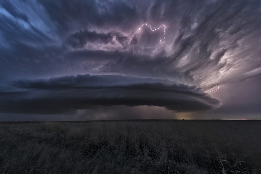
June 24th Southern Kansas Supercells
We had high hopes for some great supercells in southern Kansas on June 24th. The atmosphere didn’t disappoint! High CAPE, strong shear, moderate moisture and decent lift along existing boundaries would set the stage for afternoon severe thunderstorms. An explosive supercell formed in central Kansas mid afternoon and became severe. This storm produced hail to baseball size and high winds. It weakened as it remained nearly stationary and other storms formed south and west of it. A well structured supercell emerged and became very electrified. A grassland fire occurred and fortunately was put out before consuming any farmsteads. As it continued to move south/southwest, it became undercut by outflow and slowly weakened. It continued to produce very large hail and high winds during the remainder of it’s life as it slowly drifted south into far southern Kansas. A fun day of chasing with well structured storms and very large hail. We stopped and examined the hail stones we found up to tennisball sized. Click on a pic for a larger photo. Enjoy!
June 21st Western Kansas Supercell
June 21st looked like a big messy day. Forecast was for thunderstorms, including supercells to form along multiple boundaries in western Kansas. It was thought that storms would congeal into a large MCS and track into northern Oklahoma later. That is in fact exactly what happened. Storms formed first along a weak front in northwest Kansas and tracked south. Other storms formed along old outflow boundaries in southwest Kansas. Eventually they all merged in a large high wind producing MCS. Moisture was marginal, but shear and CAPE were fairly high. As they became outflow dominant, a fast moving convective system produced 80 mph winds and golfball sized hail as it tracked in the Oklahoma panhandle. It was a fun day for lightning, and a well defined shelf cloud formed with the complex. Please click on an image for a larger photo. Enjoy!
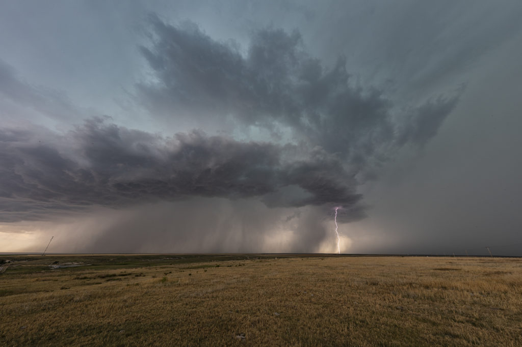
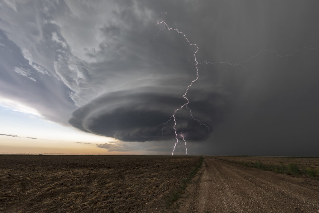
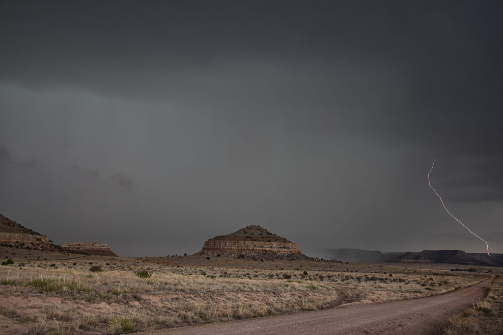
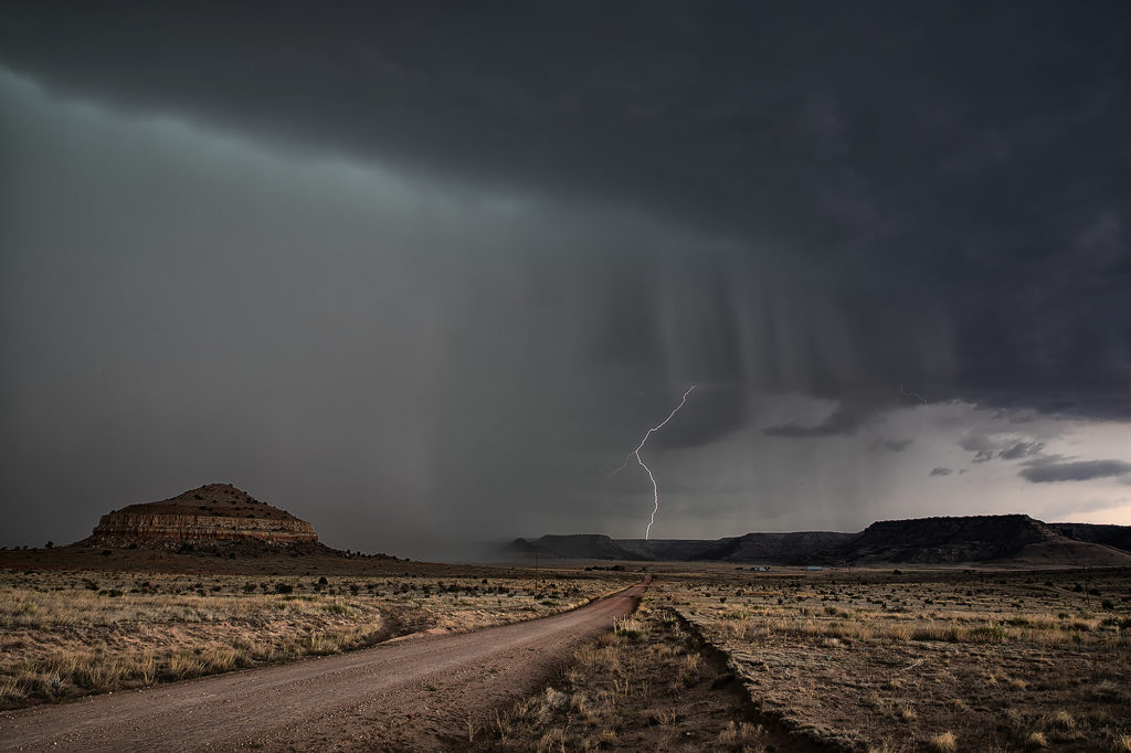
June 19th Raton Mesa, New Mexico Supercell
June 19th was the last day of Tour 7. The weather pattern kept us fairly close to home, with the set up over the Raton Mesa between Colorado and New Mexico. Upslope flow would push decent moisture into the region and thunderstorms would form by mid afternoon. Moderate CAPE and shear were also present as the storm intensified and moved eastward. The region is known for it’s lack of good roads, so we ended up on a few poorer gravel/dirt roads. We arrived as the storm was very intense, producing golfball to tennisball sized hail. Love the “hail core green” color to the clouds when they are suspending millions of hailstones in them. The region is very colorful with many red rock buttes and ridges in the area adding to the already pretty scene. The terrain has been very dry in 2020, so little vegetation was growing. Eventually the storm moved out over the Black Mesa area of the Oklahoma panhandle and weakened as it moved further east. A fun last day was a pretty storm and countryside! Click on a pic for a larger image. Enjoy!
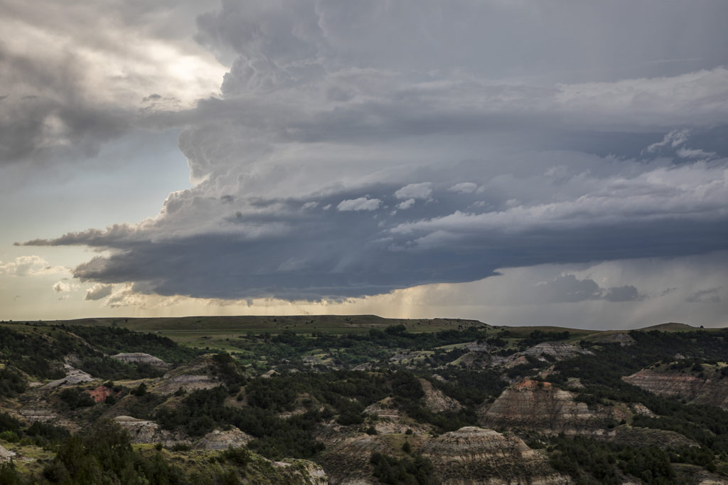
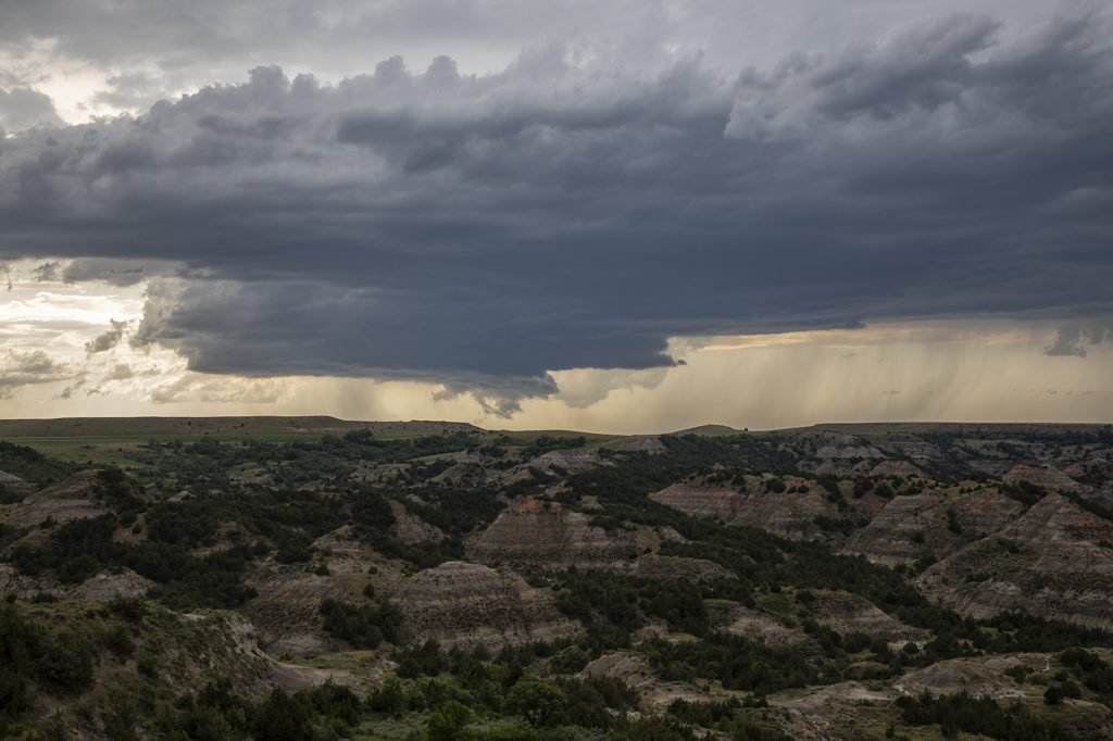
June 14th Theodore Roosevelt National Park Supercell
June 14th was a northern plains/high plains set up. A weak front was draped across eastern Montana and northeastern Wyoming. Moisture was streaming northward as well. Moderate CAPE and good shear developed as storms initiated off the triple point in northwest South Dakota and then a bit later over western North Dakota. We watched the South Dakota cell go up, but it was extremely high based. Better low level moisture existed across western North Dakota, pooling along the front and an old outflow boundary. A storm developed rapidly near Beach and slowly tracked northeastward across Theodore Roosevelt National Park. It had decent structure and produce large hail. At one point northwest of Dickenson, a funnel appeared for a few minutes, but was never a threat to touch down. We stayed with the storm until it weakened early evening, then headed to Bismark for the night. A fun day, very scenic area for chasing and a pretty storm! Click on a pic for a larter image. Enjoy!
June 2nd Southern Minnesota Tornadic Supercell
June 2nd appeared to have some promise for severe storms in southern Minnesota. Very hot and relatively moist air would reside along and south of a stationary front south of the Twin Cities. Large temperature/dewpoint spreads would result in higher based storms. High CAPE and moderate shear also existed. A cluster of cell formed along the boundary, and eventually the eastern most cell would mature into an intense hail/tornado making supercell. I was completely surprised to see a multiple tornado warnings for the storm despite the higher base! It produced a couple of weak tornadoes and very large hail 3 inches in diameter. It persisted for several hours before gusting out, with an eventual line of severe storms forming and moving southeast through southern Minnesota. This area is very photogenic and has many stunningly photographic farmsteads! Check out the photos and please click on an image for a larger pic. Enjoy!
May 24th Southeast Colorado Beautiful Supercell
May 24th appeared to be a more marginal day. But sometimes, those days pleasantly surprise! This would be the case this day as good upslope flow would allow for a couple isolated supercells to develop in southeast Colorado and southwest Kansas. The best moisture was in southwest Kansas along an outflow boundary, but sufficient moisture was pushed into Colorado to support moderate CAPE and long lived supercells. We intercepted our storm east of Springfield, Colorado and stayed with it through the evening hours east of Hugoton, Kansas. This storm was well structured and produced baseball sized hail. The inflow into this storm was severe in strength and was amazing to see this storm process the amount of air it did! A great chase, fun day and everyone thoroughly enjoyed this supercell! Please click on an image for a larger pic. Enjoy!
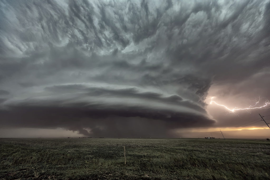
May 21st Southwest Kansas Tornado Warned Supercells
May 21st had a lot of potential. A surface low and triple point was over southwest Kansas. Strong instability, good shear and lift along the various boundaries would set the stage for intense, potentially tornadic supercells this day. We targeted the first intense storm to go up near Lamar, Colorado. It produced tons of hail, great lightning and a couple of weak landspouts. As it pushed east, a second storm formed and quickly became tornado warned. It had great structure and was quite severe. The best storm of the day, however formed near Satanta, Kansas and was an absolute treat to watch. Incredibly electrified and well structured, it persisted for a long time. Just before dark, it produced a couple of funnels, but just couldn’t get the circulations to the ground. One of my favorite chases of 2020 thus far! Please click on an image for a larger pic. Enjoy!!!