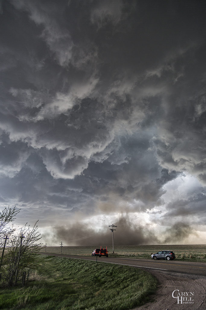
On May 7th we had high hopes for something big to happen. It certainly did not disappoint! Numerous storms formed early afternoon along and south of a warm front draped over eastern Colorado. Upslope flow was deep, while shear, instability and moisture were quite good as well. Too many storm interactions early in the afternoon caused messy modes, with several tail end supercell type storms to form and be the ones that produced the most severe weather. A cluster of cells near Ft Morgan early in the afternoon would produce tornadoes along the warm front, but we decided to target more southern tail end storms that were receiving the best feed of air.
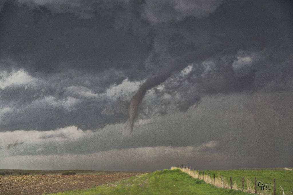
Late afternoon, our on call tour led by Caryn Hill would intercept a supercell south of Wray that would produce a pretty elephant trunk shaped tornado. It would die off fairly quickly before the main show would start. A mixture of supercell and nonsupercell tornadoes would form, nearly a half dozen in all. The final tornado is one that has been well publicized, a beautiful whitish tornado as seen in the pics below, with a reddish debris cloud nearly to cloud base! Remember SLT will get you there!