Tag Archives | wind

June 8th Central Nebraska Tornadic Supercells

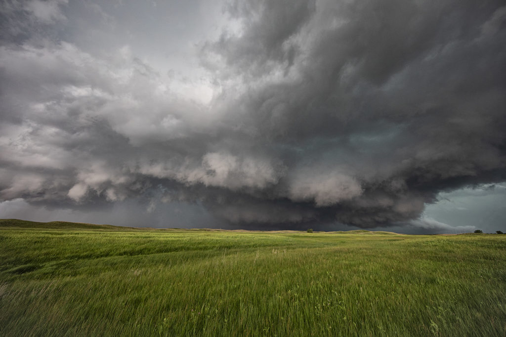
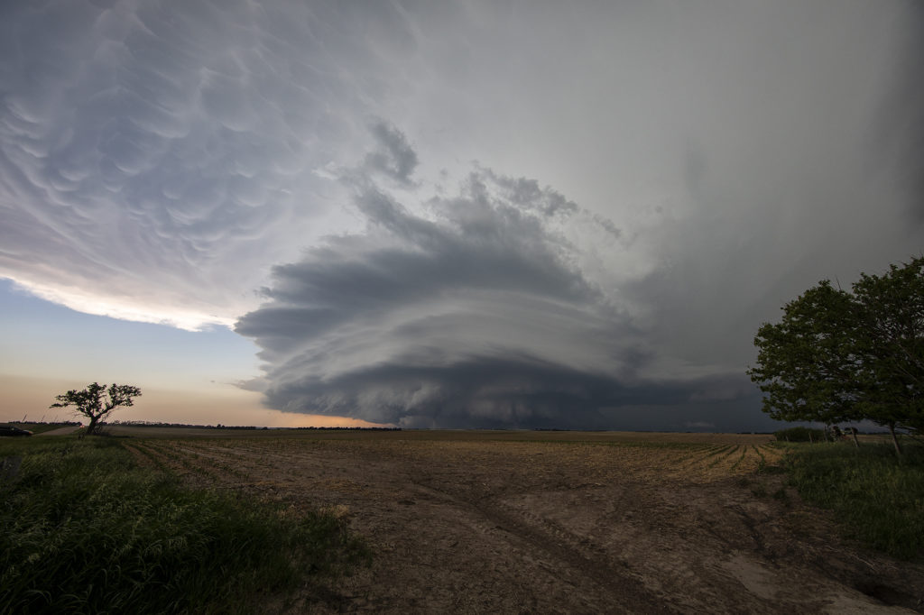
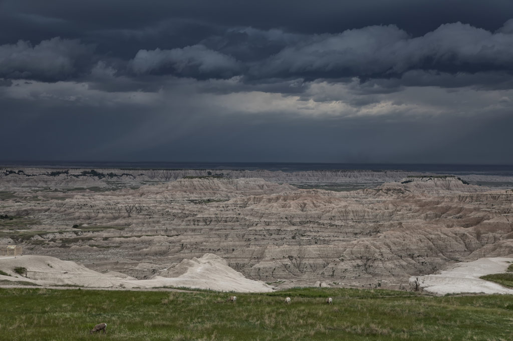
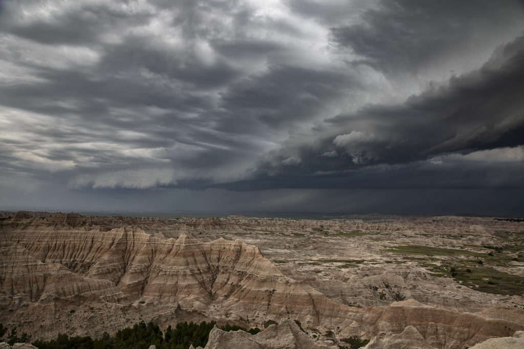
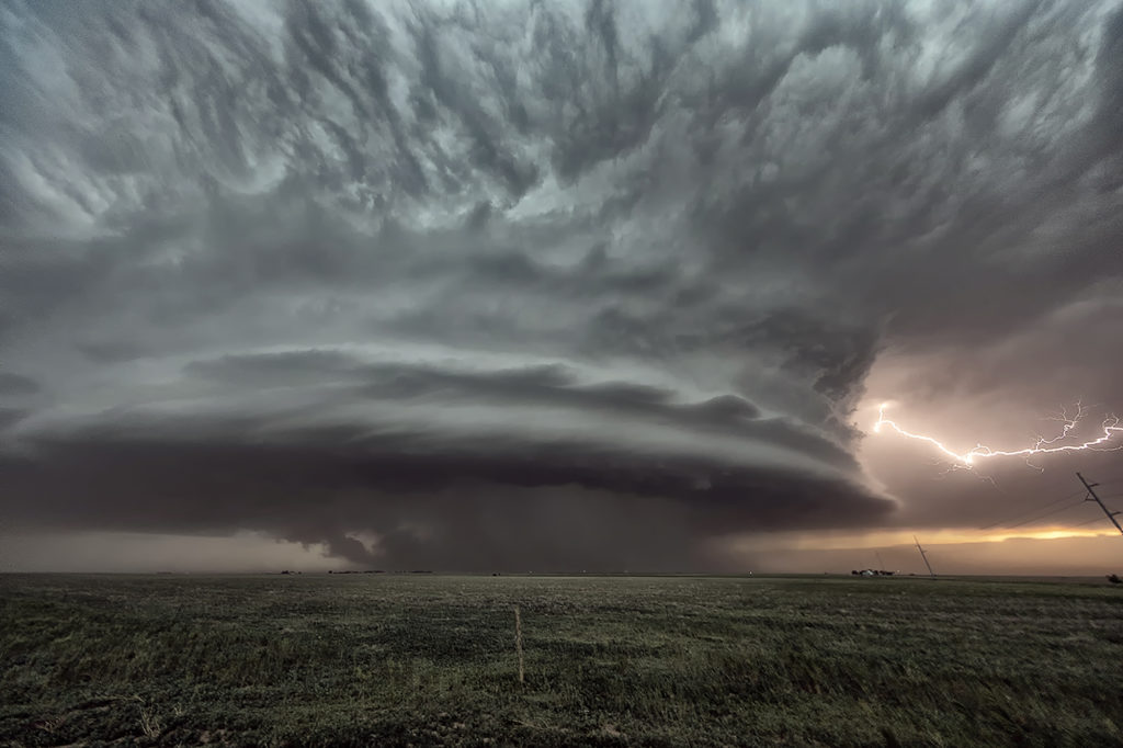
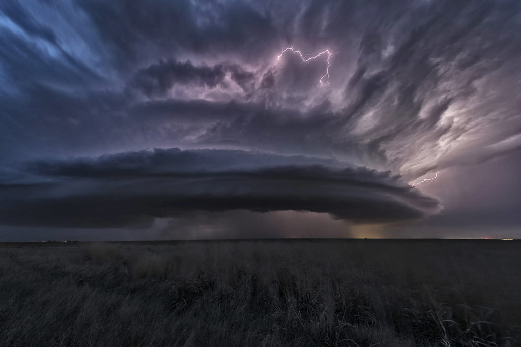
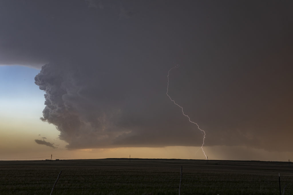
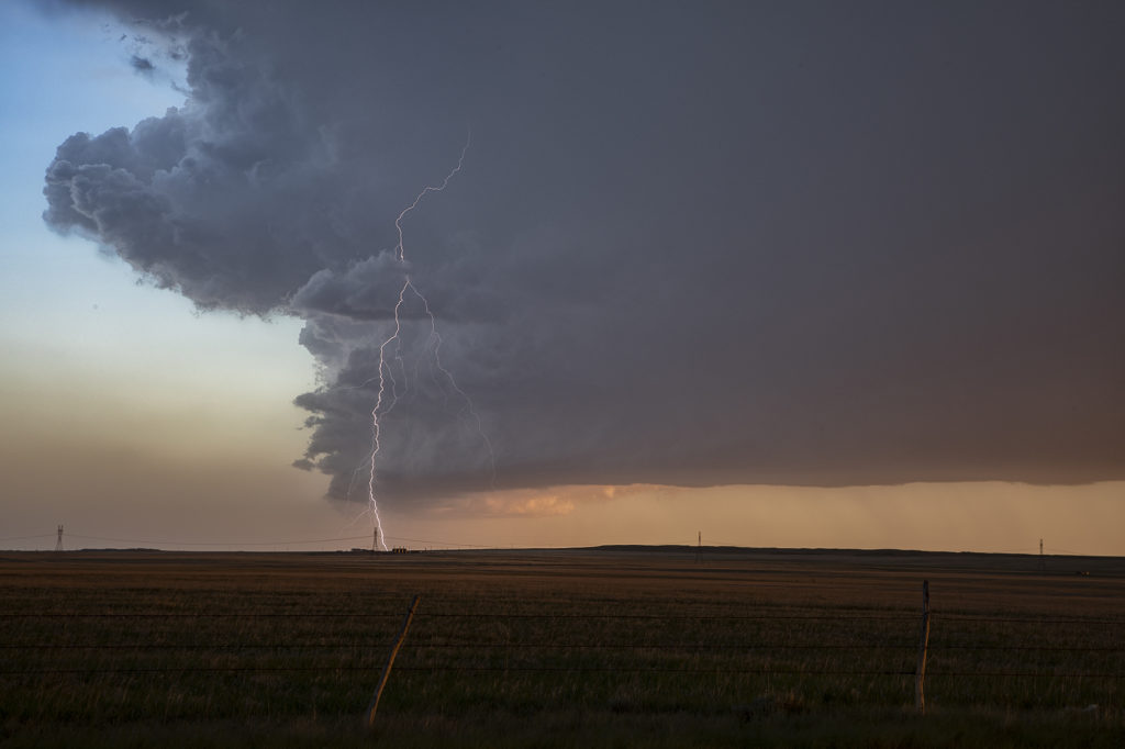
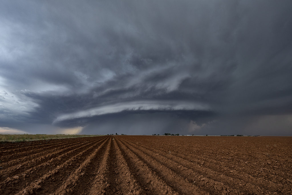
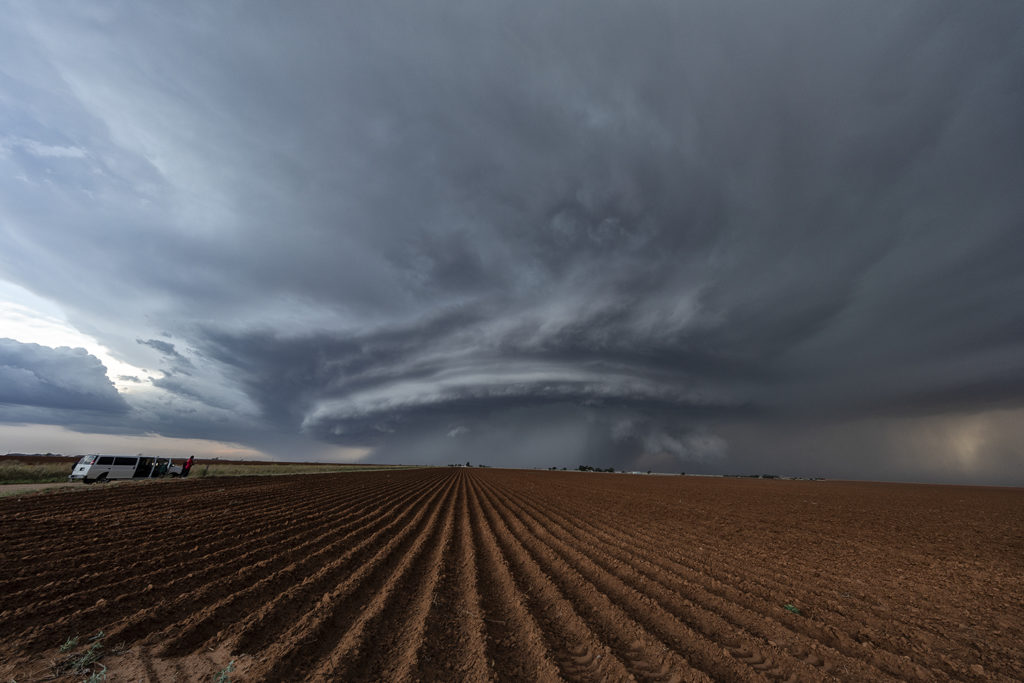
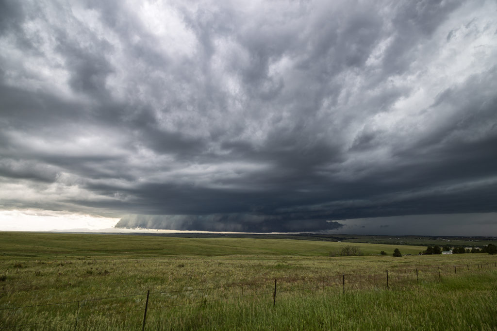
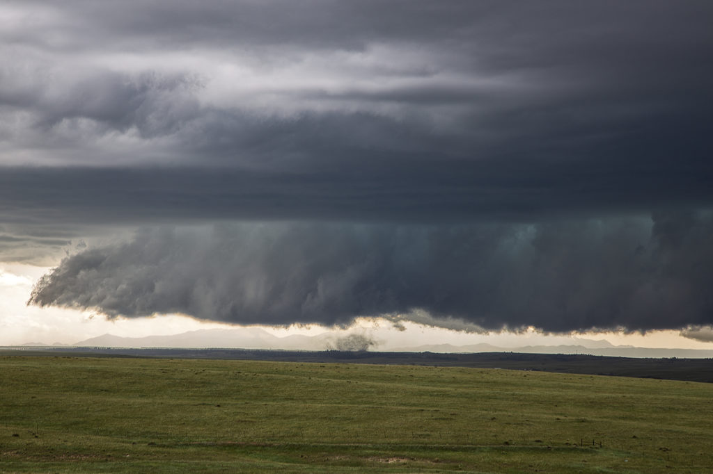
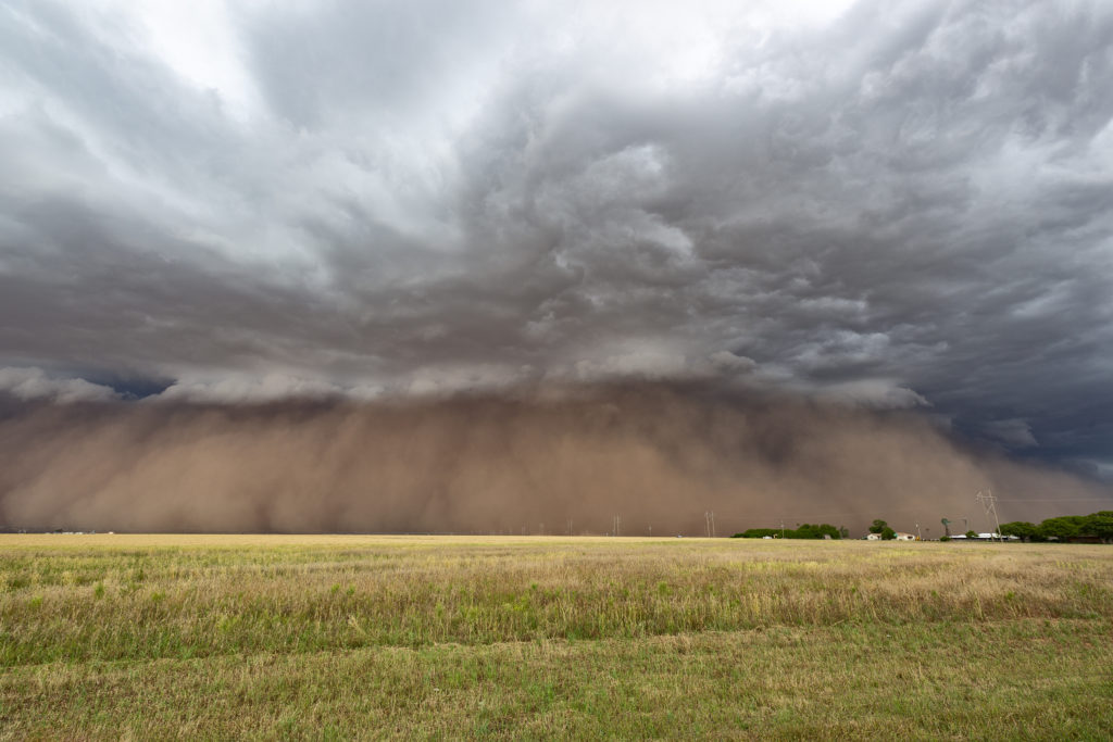
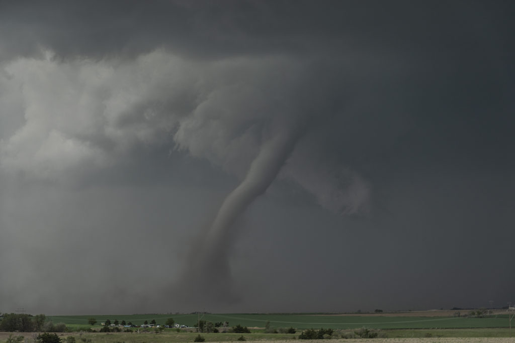
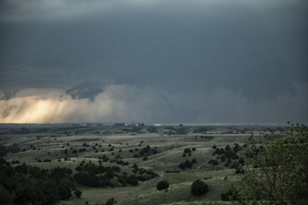
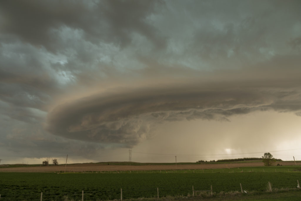
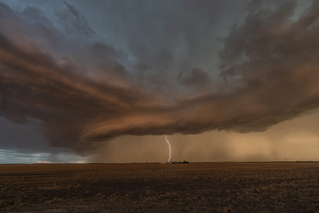
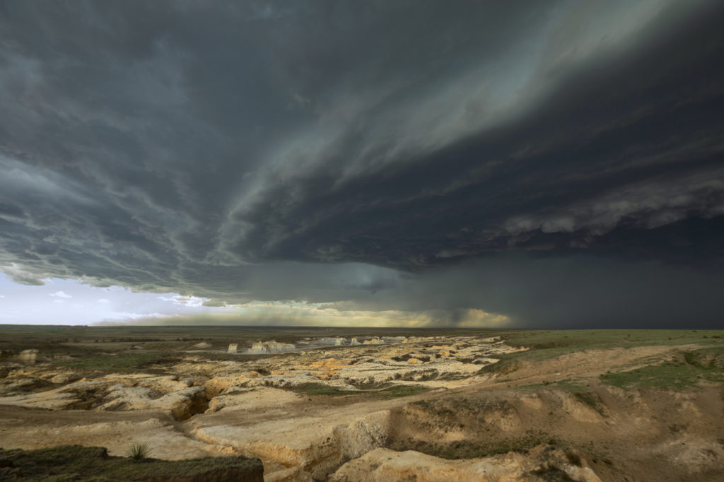
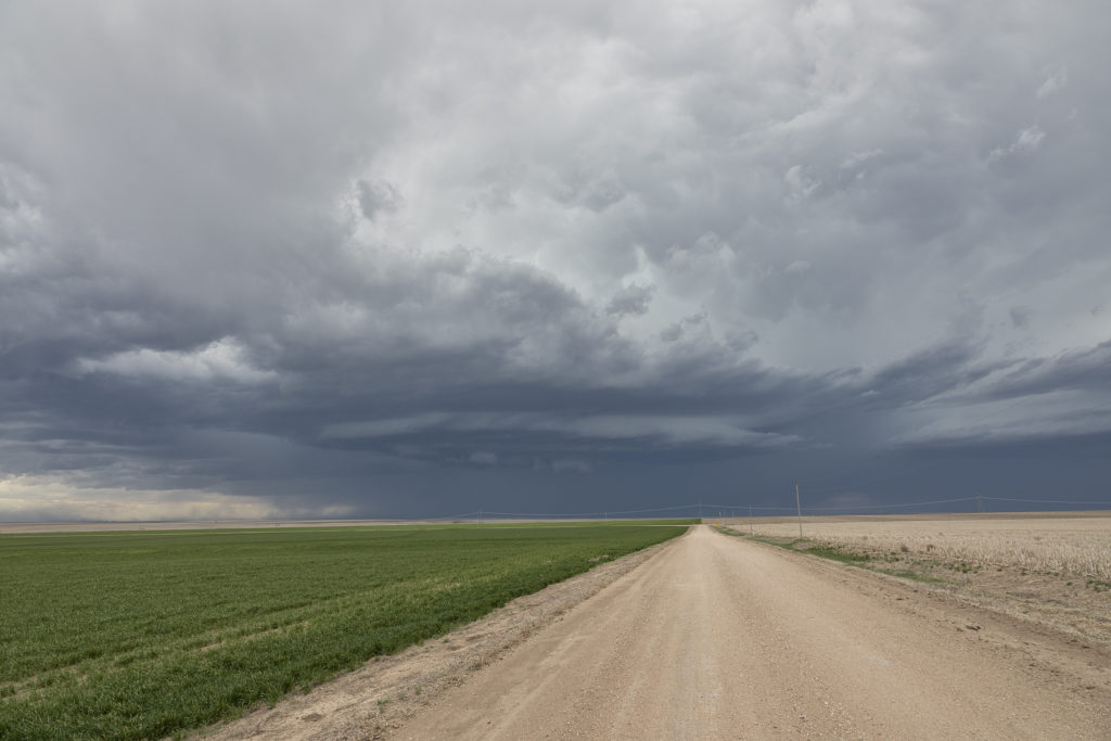
June 8th would provide us with ample opportunities to intercept numerous severe thunderstorms in central Nebraska. By mid afternoon several intense supercells formed along a weak front. Two storms became tornado warned as they spun across the region near Anselmo. Strong shear, decent moisture, high CAPE values and the boundary provided the focus for storms. We caught the first storm as it spun across with a large wall cloud that was rotating steadily but slowly. It tried to produce a tornado but never could. The second cell was by far the prettiest of the day. It had fantastic structure, a very large wall cloud and a couple of weak spin ups. At one point a dusty debris cloud formed underneath a small funnel that touched down for about 1-2 minutes. The storm became a formidable supercell and it moved across the region. Several other storms formed and a couple were also tornado warned, but did not produce. A fun and exciting day with these cells for all tour guests! Enjoy the pics and please click on one for a larger image.

June 6th South Dakota Badlands Severe Storm

June 6th appeared to be a day of fast moving squall lines, and it panned out to be just that. Storms formed early afternoon over Colorado and Wyoming and raced north, at times over 100 mph, to the northeast! These storms produced extreme wind damage as the pushed through the Dakotas by evening. As they approached Badlands National Park, they were severe with hail and winds, while the badlands themselves, provided a very photogenic foreground. Please enjoy the pics and click on an image for a larger photo.

May 24th Southeast Colorado Beautiful Supercell

May 24th appeared to be a more marginal day. But sometimes, those days pleasantly surprise! This would be the case this day as good upslope flow would allow for a couple isolated supercells to develop in southeast Colorado and southwest Kansas. The best moisture was in southwest Kansas along an outflow boundary, but sufficient moisture was pushed into Colorado to support moderate CAPE and long lived supercells. We intercepted our storm east of Springfield, Colorado and stayed with it through the evening hours east of Hugoton, Kansas. This storm was well structured and produced baseball sized hail. The inflow into this storm was severe in strength and was amazing to see this storm process the amount of air it did! A great chase, fun day and everyone thoroughly enjoyed this supercell! Please click on an image for a larger pic. Enjoy!

May 20th Northeast Colorado Tornadic Supercell

May 20th looked decent on paper. Strong shear, decent moisture, and moderate CAPE set the stage for intense storms. An outflow boundary/cold front pushed slowly southeast across Wyoming and northeast Colorado. We dropped from Cheyenne into Weld county, Colorado as numerous towers formed. We noticed a column of dirt in the distance (some 20 miles away!) and it turned out to be a landspout tornado that occurred near Greeley. We couldn’t get close enough for a good photo, but a few guests got a shot or video or two of it from our vantage point. The storms congealed into a tail end supercell and were very electrified! As the sun set, the forward flank downdraft lit up with the most incredible orange I have ever witnessed in a storm!  After sunset, the sky was illuminated with numerous continuous lightning strikes that were a treat to watch. Click on an image for a larger pic. Enjoy!

May 11th, Anton, Texas Spectacular Supercell

May 11th brought about a boundary that stretched from northeast New Mexico, southeastward across the Texas panhandle north of Lubbock. Moisture initially wasn’t high quality, although shear and lift were very good. Storms first went up southwest of Lubbock, followed by more storms northwest of Lubbock along the boundary. One storm rode the boundary, and started to get very organized. This supercell eventually merged with another cluster of storms. It later emerged from the line of storms and become a stunning supercell, with very strong rotation on the eastern side of the storm. We watched this entire sequence of developments, amazed at this storm’s ability to push through other weaker cells and emerge as the most intense cell of the day. It also became extremely photogenic as it marched southeast toward the north side of Lubbock. Producing huge hail and very strong winds, it pushed across town and eventually weakened. Enjoy the photos! Please click on an image to see a larger photo.

June 21st Palmer Divide Briefly Tornadic Supercell

We weren’t expecting anything significant on June 21st. However, as often happens in the upslope regions of Colorado combined with terrain features, a decent supercell formed north of Colorado Springs along the Palmer Divide. Good directional shear due in part to strong easterly winds helped the storm to organize and rotate. As the cell approached the town of Kiowa, the low levels started spinning strongly. You can see a hook forming visually and rotate pretty rapidly. A tornado warning was issued by the NWS and soon an area of rotating debris was seen under the hook area of the storm. This weak tornado only lasted a couple of minutes.

As the cell moved further east, it encountered less surface moisture and instability, which caused it to steadily weaken and eventually dissipate east of Limon. Several other storms initiated in the cold side of the first cell’s outflow and never could really intensify for long periods. A fun chase and right in our backyard.

June 5th West Texas Haboob

A crazy day ensued as a cluster of high based storms formed in New Mexico and tracked east into west Texas. As the storms approached the Lubbock area a very well formed haboob occurred, with a wall of dust/dirt scouring the landscapes. Haboobs can be very photogenic and this one was one of the best I’ve ever witnessed in 35 years of chasing in the Texas panhandle! High winds, large hail and that wall of dirt occurred within this line of cells as they raced across Texas.  An exciting day on a day when we weren’t expecting anything significant!  Enjoy the cool pics!

May 17th Southwest Nebraska Tornadic Supercell

May 17th was an amazing day. Storms formed along a dryline in northwest Kansas and northeast Colorado and pushed into southwest Nebraska. One supercell approached McCook, NE and dropped a few tornadoes along the way. Strong wind shear, great instability and good surface moisture set the stage for this and other storms to form. The first tornado was quite pretty as it tracked just west of town. A couple more formed in the hills where roads were bad and thus not greatly visible from where we had to intercept them. None the less the storm was a very pretty supercell and long lived. It persisted for several hours before weakening north of Kearney, Nebraska.

May 16th North Platte, Nebraska Supercell

May 16th was the day before the big day. Limited moisture would cause storms to be higher based, thus increasing the wind threat as well as hail. However little tornado threat would occur. We intercepted a cluster of storms which would move northeast towards North Platte and become severe. Hail to golfball size, pretty structure and intense lightning would occur from these. The tail end cell broke off from the line and became a pretty supercell right at sunset. The colors, structure and lightning were very pretty! Enjoy the photos below!

April 21st Western Kansas Supercell

April 21st didn’t look great on paper. However, storms erupted along a lee trough in far western Kansas and intensified as they moved eastward. A couple of embedded supercells would produce 70 mph winds and golfball sized hail. With the pretty Smoky Hill River badlands in the foreground, it sure made for a pretty scene! Bases of the supercells were quite high, as much as 8000 feet off the ground. Structure was pretty and lightning became frequent. We stayed with the storms until they weakend mid evening and then headed south for the night. I nice surprise chase for us on a day when it didn’t look very good at all!