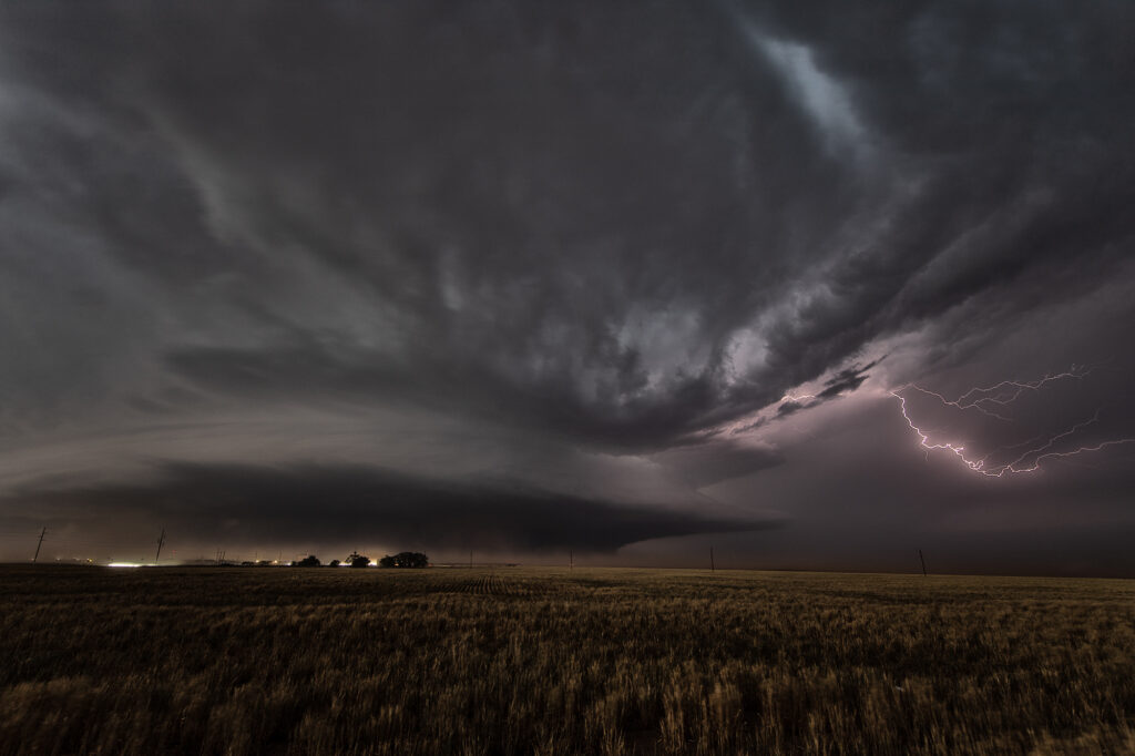
June 27th had 2 different targets. One by the Nebraska/South Dakota border, and a second along the Chugwater low at the Nebraska/Wyoming border. We hoped to chase the northern target, but nature had other plans. We went south and caught an intensifying supercell west of Bridgeport, NE. We had to punch through the core and encountered pingpong ball sized hail as we approached Broadwater, NE. Once on the east side of the storm, intense lightning was occurring. Structure became quite nice as the storm spun hard moving towards the east. After it passed Oshkosh, it started weakening as it encountered a capping inversion. We followed it through the sandhills and had a nice sunset with great color and lightning! Enjoy the pics!!!
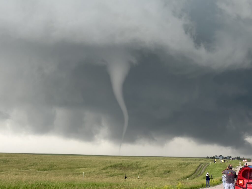
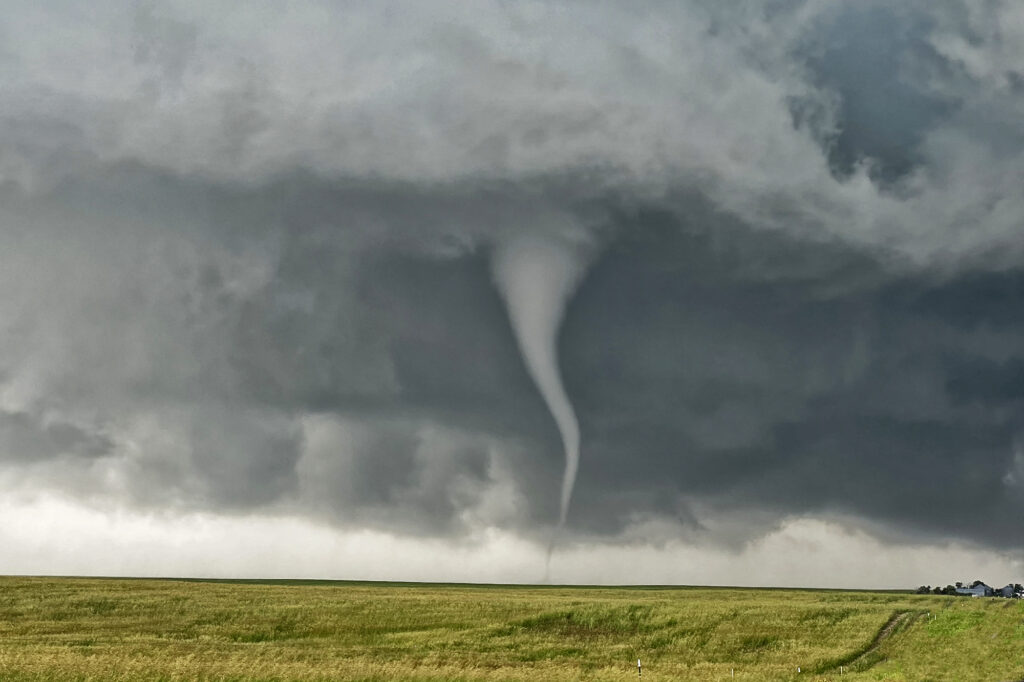
June 26th Big Horn Mountains, Wyoming Supercell and Brief Tornado
The first day of Photo Tour #3 took us to northeast Wyoming to chase the upslope play into the Big Horn mountains. Storms formed early afternoon and struggled to come off the higher terrain for a couple hours. A very low hanging, rotating wall cloud occurred west of Buffalo, WY and produced a 3 minute weak tornado on the top of a mountain! Quite the sight to see! As the storm came off, it became a pretty LP supercell and spun to the southeast, south of Gillette, WY. It eventually dissipated as another supercell formed north of Casper, WY. This cell was rotating nicely and produced a couple of funnels as it moved towards the flat lands east of town. Structure was nice as it persisted well after sunset. A fun day for the tour!
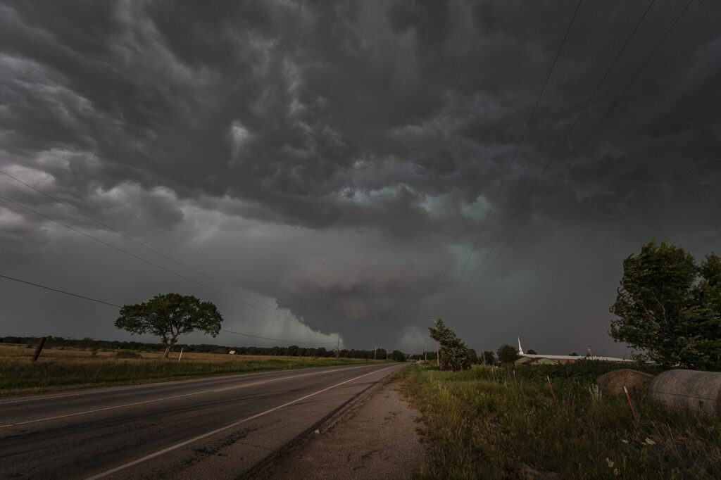
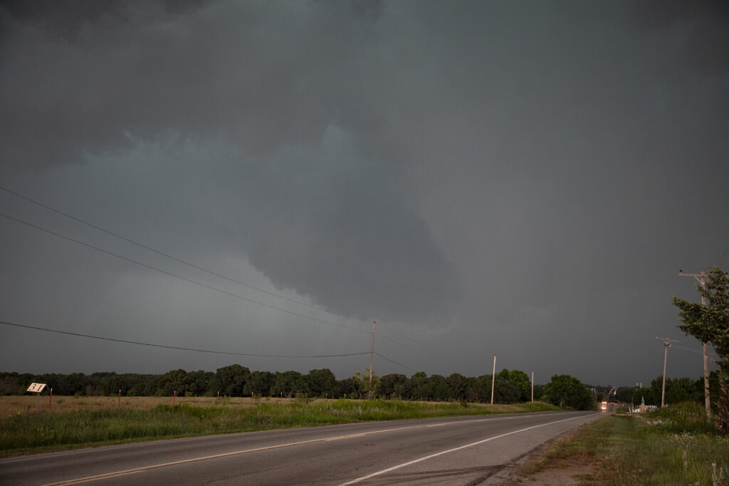
June 23rd Chugwater, WY to Scottsbluff, NE Tornadofest
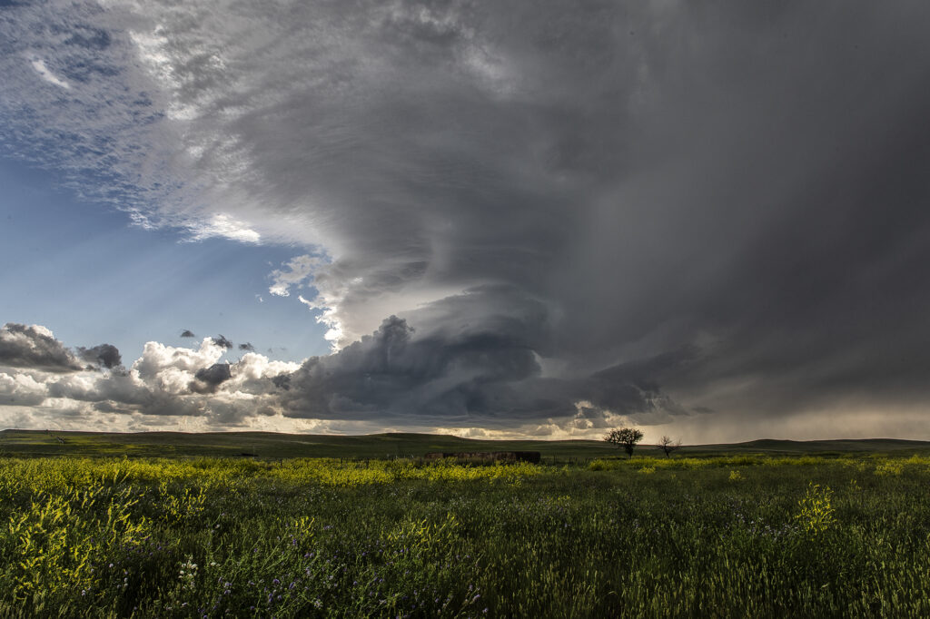
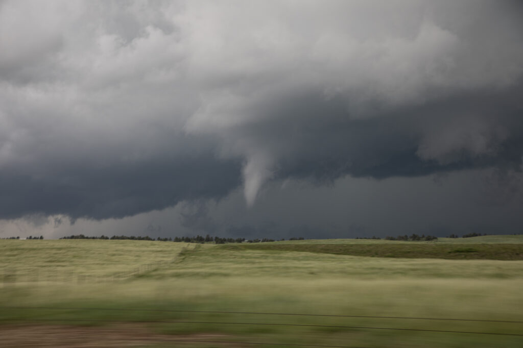
June 23rd had significant potential in southeast Wyoming as well as southeast Colorado. We chose to play the Wyoming target instead of Colorado. And both produced tornadoes!!! When you get upslope flow into the Laramie Range in southeast Wyoming with decent moisture and instability, you chase there, plain and simple. Good shear and lift into the mountains were also present and by midafternoon storms erupted west of Chugwater. It took a bit for storms to become organized, but one such supercell over the town of Chugwater became the primary supercell this day. It spun east all the way past Scottsbluff, NE and produced at least a half dozen tornadoes, a few of which we were close to and became pretty photogenic! A Tornado Emergency was issued for one large tornado near town and fortunately did not cause any serious injuries or fatalities. Storm structure was pretty as well and the supercell also produced softball sized hail at various locations in the lifetime. A great chase day and fortunately the results were good for the local residents. Enjoy the pics!
June 22nd Highlands Ranch, CO Tornado
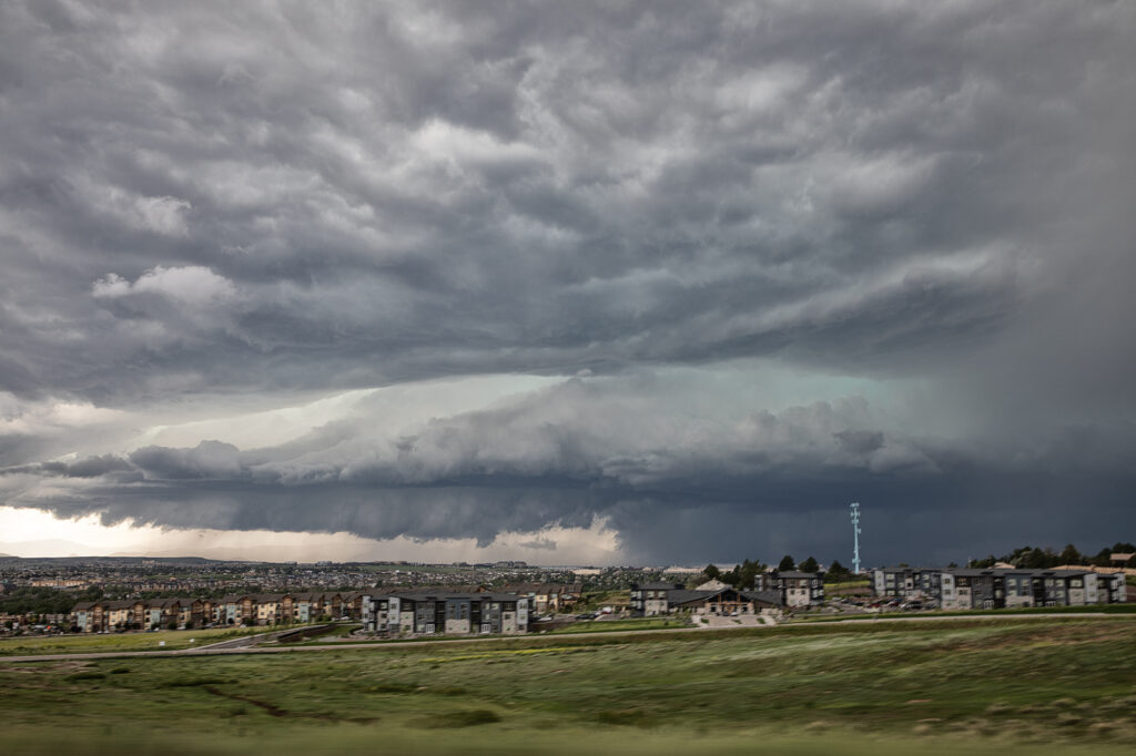
June 22nd took us close to home. We approached Denver after chasing north the previous day. We arrived as a supercell was coming off the foothills and intensifying as it right turned towards the Highlands Ranch area. Soon, a low level mesocyclone formed as a clear slot wrapped around it. Within a few minutes a low hanging wall cloud started spinning. Then a rather large barrel shaped tornado formed in the rich moisture and strong wind shear, and descended on Highlands Ranch. EF1 damage occurred as the tornado was on the ground for about 15 minutes traveling several miles. As the storm moved east, it back built on the southern flank towards the Palmer Divide. As we dropped south, another funnel cloud formed, but did not touch down. As we headed east from Peyton, CO the new southern storm became quite strong and was also tornado warned. However, it did not produce, but certainly was intense. Crazy day, and thankfully nobody was killed in the Denver metro area from this tornado.
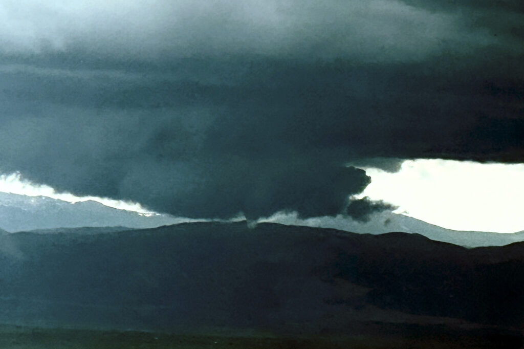
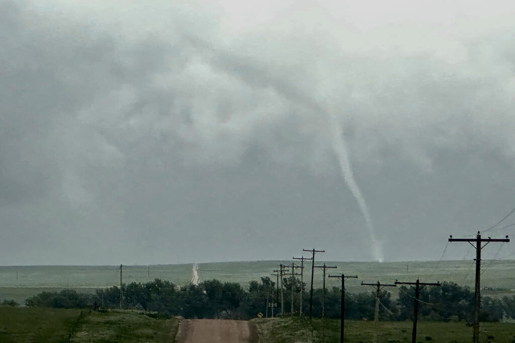
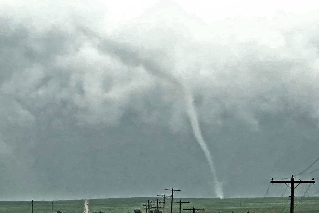
June 21st Sterling, CO Tornadic Supercell
June 21st took SLT co-owner Caryn Hill out to the northeast plains of Colorado. A remnant outflow boundary from overnight storms set the stage for multiple supercells to form during the afternoon. Caryn targeted an anchored storm near Sterling. West of town it wrapped up and likely had a large tornado behind wrapping rain curtains. As the mesocyclone occluded and a new one formed just south of her position, it dropped a long, snaky tornado with a debris cloud. Due to her driving on muddy roads, all the pics of the tornado were cell phone shots, so apologies for the quality. A great day for Caryn and a super result!!!
June 15th Southern Oklahoma Tornadic Supercell
June 15th featured very high dewpoints and instability, as well as good shear and several boundaries for storms to form on. A cluster of storms formed in southwest Oklahoma later in the afternoon and became severe. We followed them towards Lawton as another storm developed on it eastern flank. As we approached Commanche it became tornado warned. Just north of town, it developed a rather large wedge tornado that persisted for over a half hour although it became rain wrapped. If was briefly visible near Loco, OK and caused EF2 damage along the way. After the storm weakened we dropped south on a tail end supercell that was just gorgeous and also tornado warned. Our thoughts and prayers for the town of Perryton, TX that was also hit by an EF3 tornado that day causing much damage and a few fatalities. The down side of storm chasing.
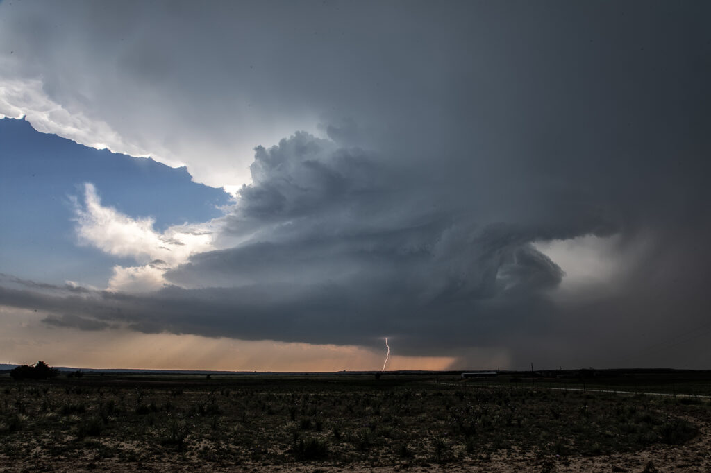
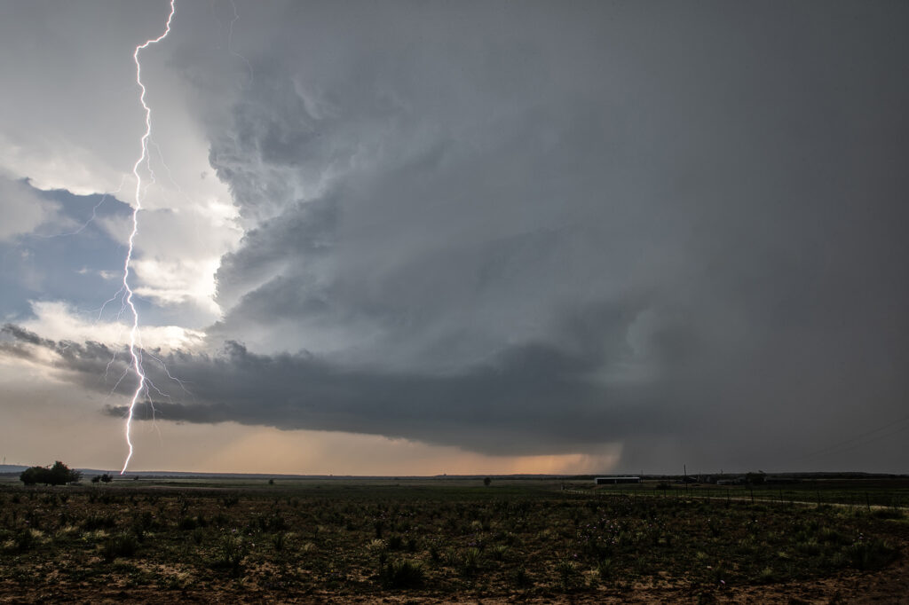
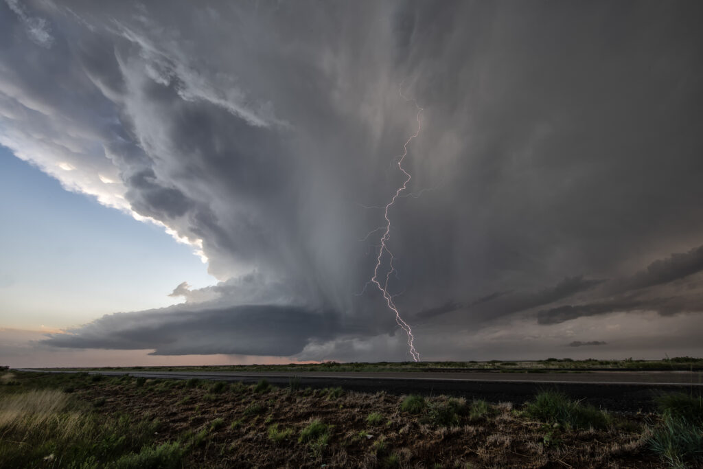
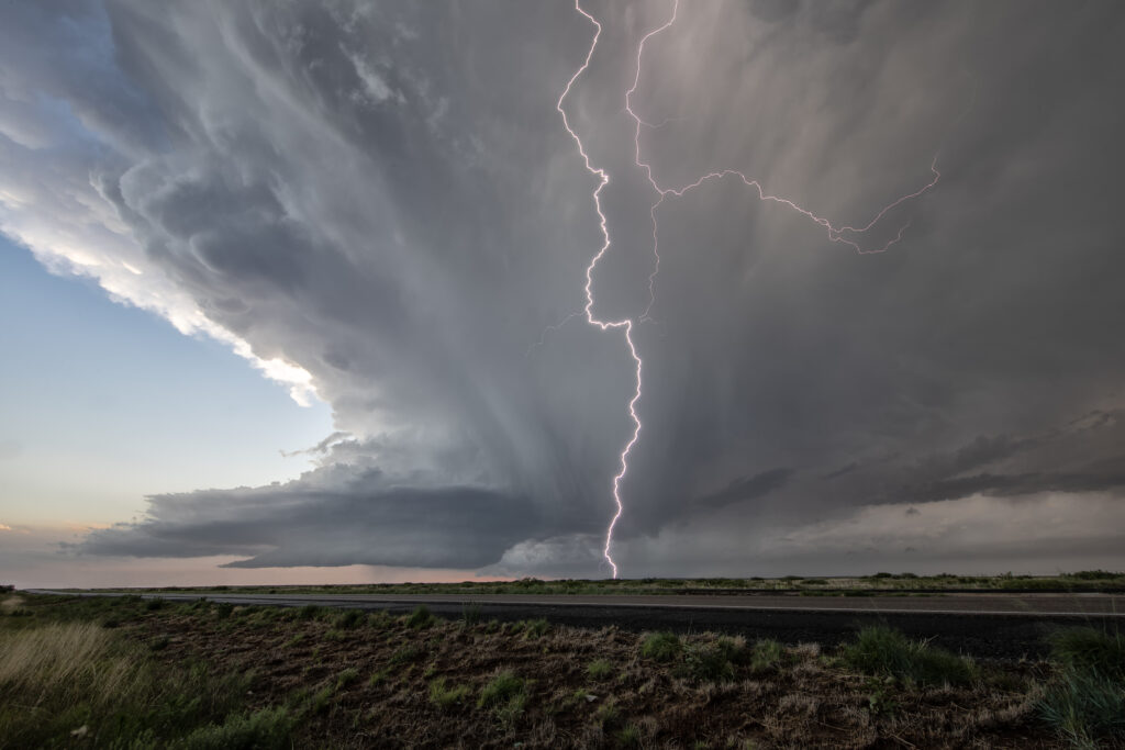
June 12th Brady, Texas Tornado Warned Supercell
July 12th featured extreme instability and great shear, however a very strong capping inversion would be the main issue to overcome. An outflow boundary from previous nights storms lay east/west near Brady, Texas. Towers kept trying to initiate along the boundary late afternoon with no success. Finally a cluster of updrafts formed along the surface triple point and a supercell was born. This storm spun hard, and had a great hook on radar. Visually you could see the rotation and the storm became incredibly electrified! West of Brady it became tornado warned. It never had a serious tornado threat due to weak low level rotation, but nonetheless it was quite pretty. It slowly drifted east and eventually weakened as a second storm formed and also became supercellular. As the sun set, the colors cast from the supercell updraft were absolutely gorgeous! Enjoy the pics!
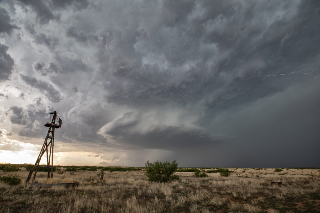
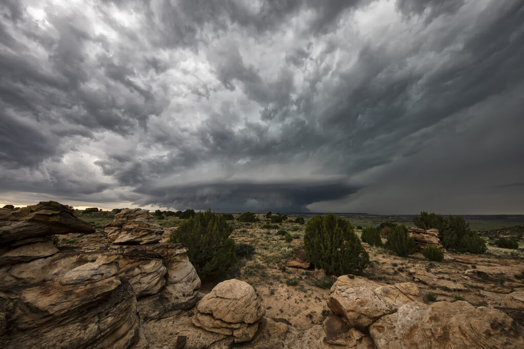
June 11th Raton Mesa, CO Tornado Warned Supercell
May 11th had a lot going for it. Good upslope flow into the Raton Mesa, decent moisture and instability and great wind shear would set the stage for supercells this day. Storms formed early afternoon and became tornado warned. We blasted west from the Oklahoma panhandle into the mesa in time to watch a supercell get very interesting. Couldn’t confirm any tornadic activity, but it certainly looked like it had potential. This storm also produced baseball sized hail and high winds. It was a treat to photograph and watch spin across the mesa into the Oklahoma/Texas panhandle. Fun day for all the guests who witnessed this beauty! Enjoy the pics!
May 31st Roswell, New Mexico Incredible Supercell
May 31st had potential in the western Texas panhandle and southeastern New Mexico. Storms exploded in New Mexico, and a couple became tornado warned. Those clustered and moved into west Texas. A few hours later, more storms formed near Roswell. With good upslope flow, decent moisture and instability, they quickly became severe. One storm, on the southern end of a cluster, became a supercell. The structure was amazing and the electrification was phenomenal! We stayed with it till dark when it weakened and the lightning ceased. One of the prettiest LP supercells of the season to date! Enjoy the pics!
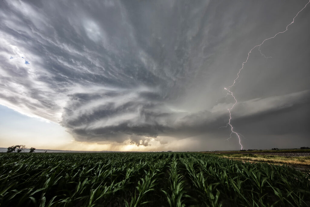
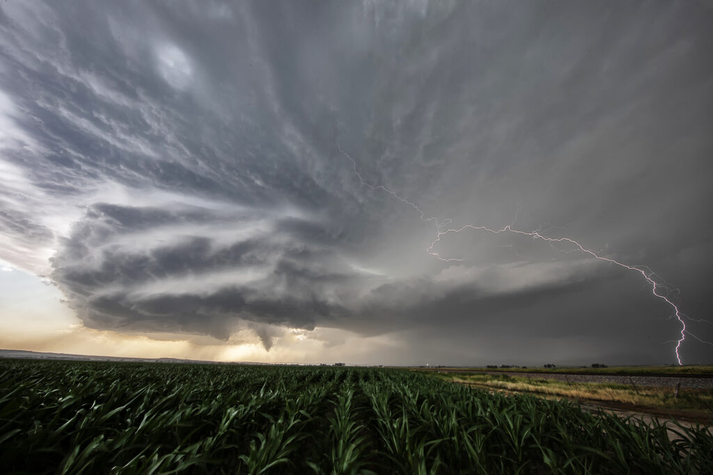
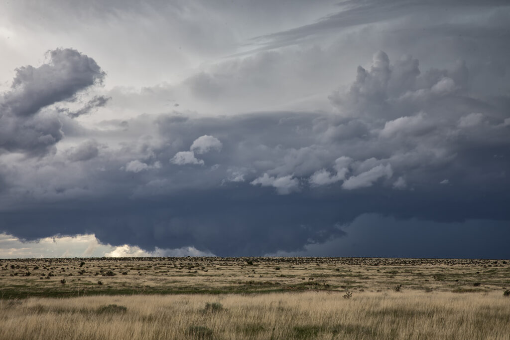
May 24th Eastern New Mexico Tornadic Supercell
What a day! May 24th looked great in the models, and in real time, it was amazing!! Violent supercell thunderstorms congealed into one monster that dropped from Tucumcari, New Mexico southward to Clovis over a several hour period. Insane lightning and incredible storm structure persisted its entire life cycle. It also produced a few tornadoes, of which we caught a couple of them. During the early evening hours, as the storm approached Clovis, the inflow into this supercell was over 60 mph! Just showed the power of this HP storm! As it moved into far west Texas at dusk, the structure was constantly illuminated by incredible lightning. One of the most powerful supercells of 2023 to date, and it was a sight to behold! Enjoy the pics!