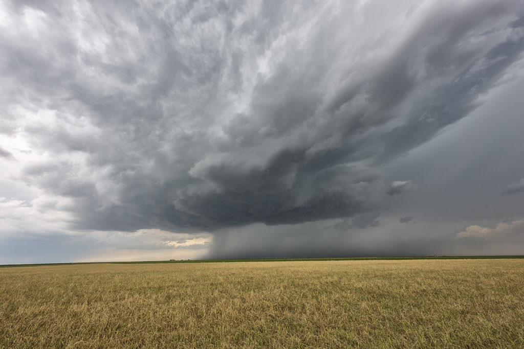
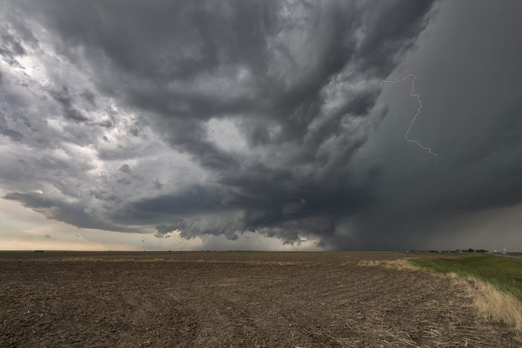
Surging outflow would be the big deal this day. Storms would form on the cold side of a boundary and have very little tornado threat. However their structure was quite pretty. Elevated supercells would produce hail up to softball size and torrential rain. We chased one storm from near Larned, Kansas east towards Hutchinson. A couple other elevated supercells also formed just to the southwest and became hailers as well. With the elevated nature of the storms, the tornado potential was near zero. Hopefully the huge hail didn’t cause too much damage to the farmlands and ranchers in the area!
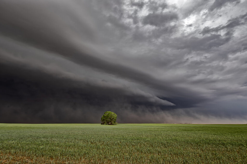
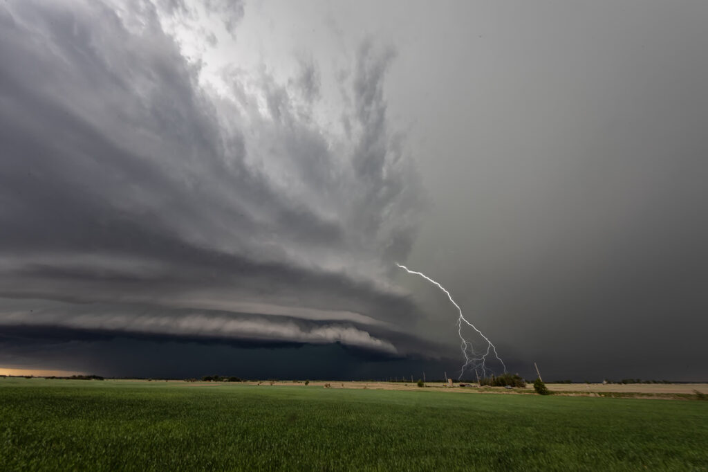
June 26th Kansas Sculpted Tornado Warned Supercell
June 26th on paper didn’t have a lot going for it. We fully expected high based storms to form along a slowly advancing cold front over northern Kansas and southern Nebraska. Early afternoon storms formed in south central Nebraska, but we decided to wait till later and chase in the area where the best parameters were, over northwest and west central Kansas. The wait was well worth it! One storm formed northeast of Colby, Kansas and became severe. Structure was decent and hail large. Soon another 2 storms formed west of it along the same boundary. The lead storm left an outflow boundary that the second storm injested. The air, full of moisture and helicity caused the updraft of the second storm to spin, soon becoming tornado warned near Oakley, Kansas. We intercepted it there and stayed in front of it all the way south of Scott City, Kansas where it moved south of the instability axis and weakened. The storm had top notch structure, was tornado warned its entire life cycle and also produced hail the size of softballs. An amazing and unexpected treat to watch this thing on the first day of the Reunion Tour for hours!