Tag Archives | New Mexico

July 15th Northeast New Mexico Supercell

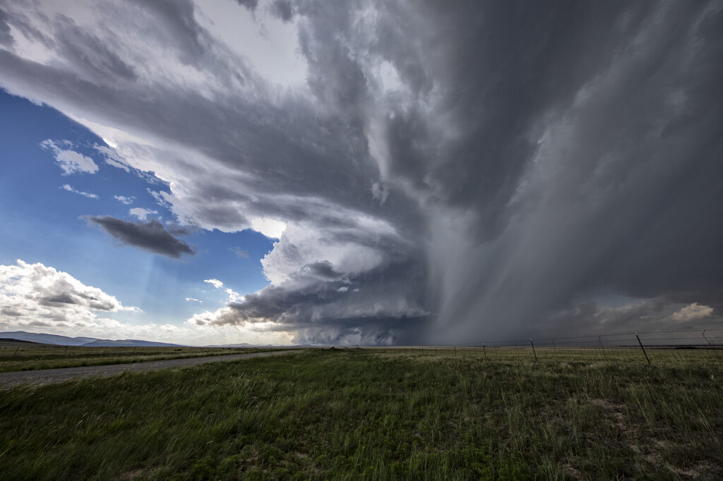
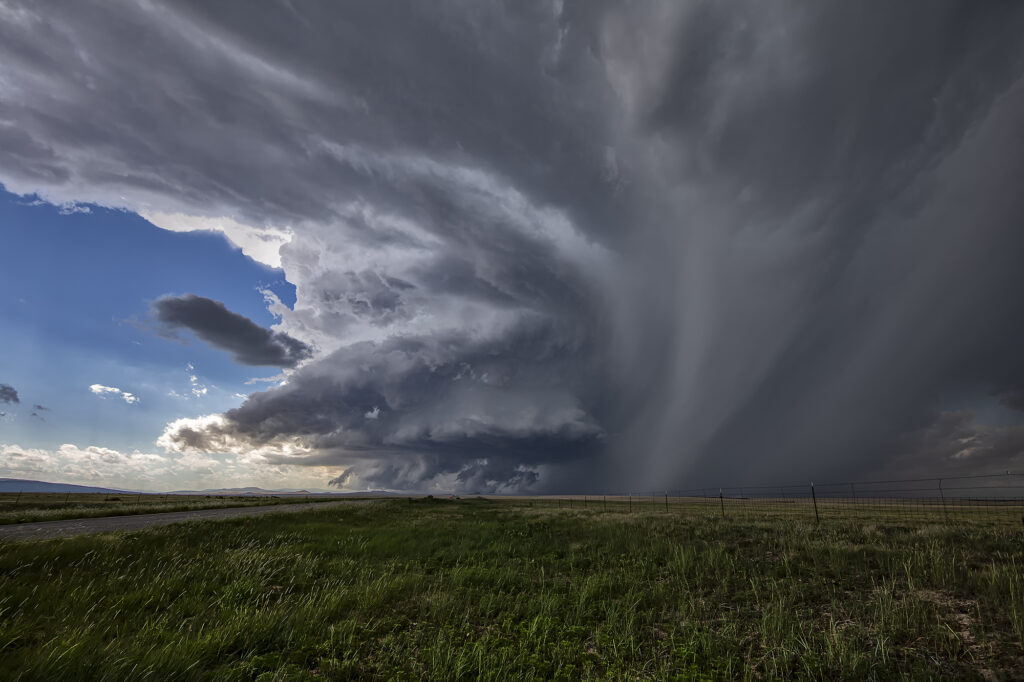
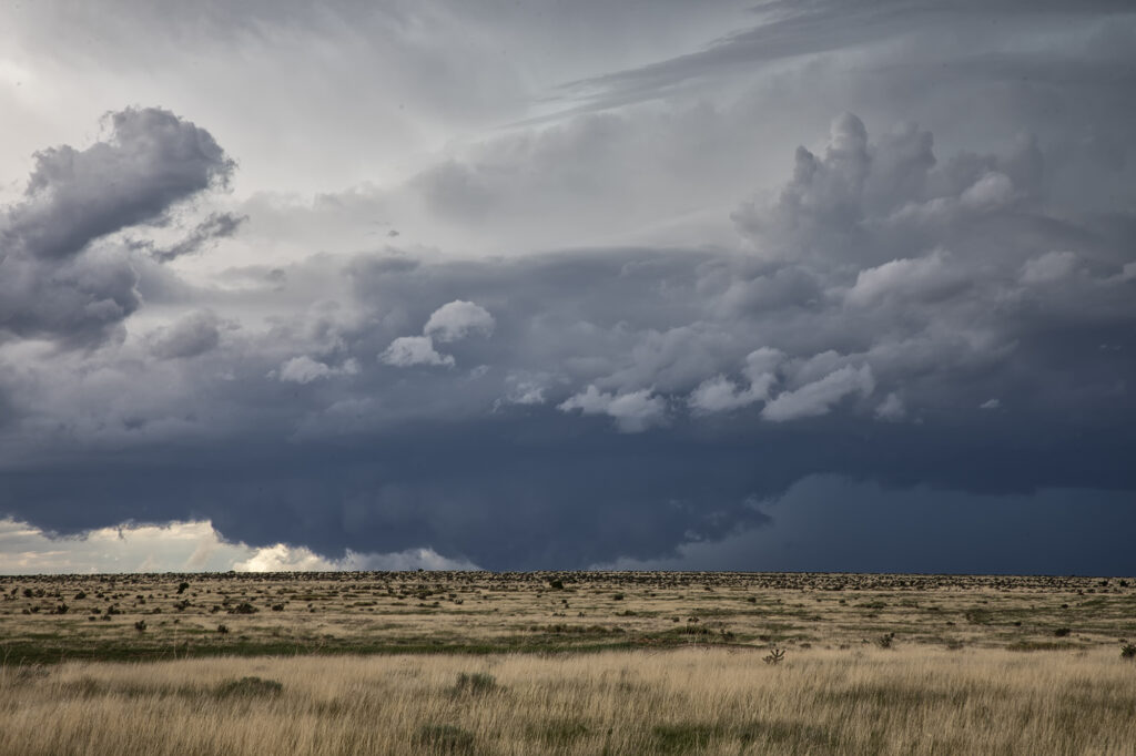
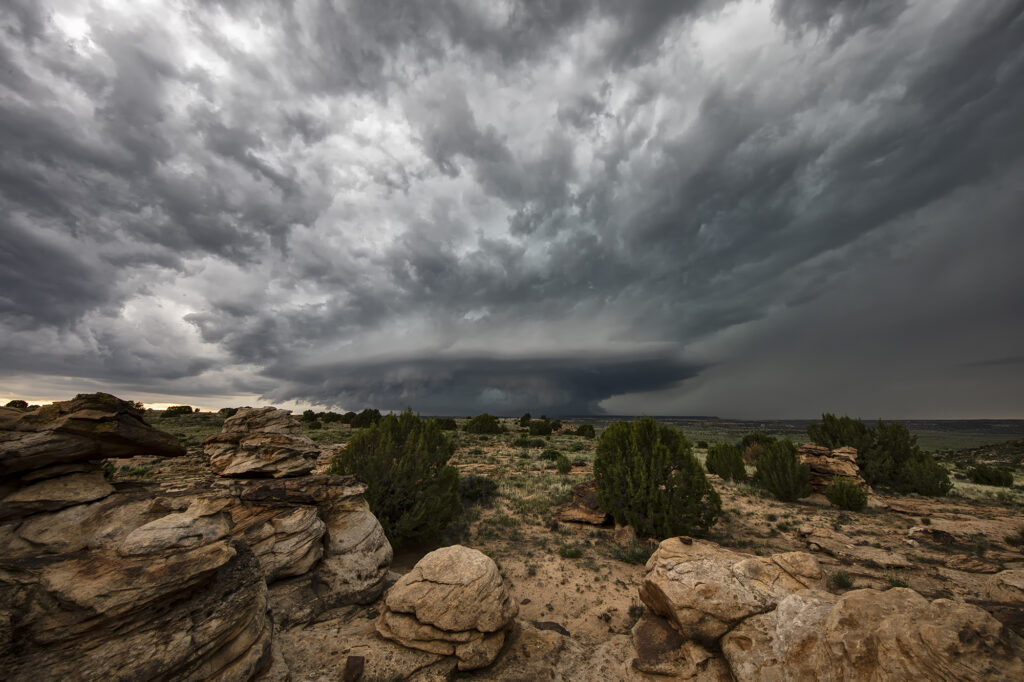
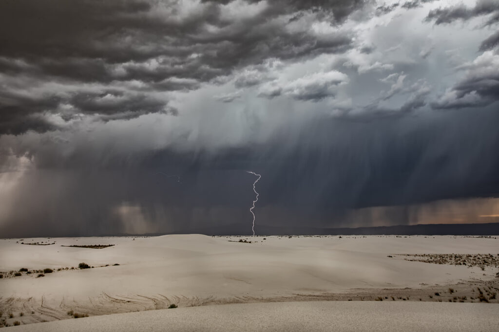
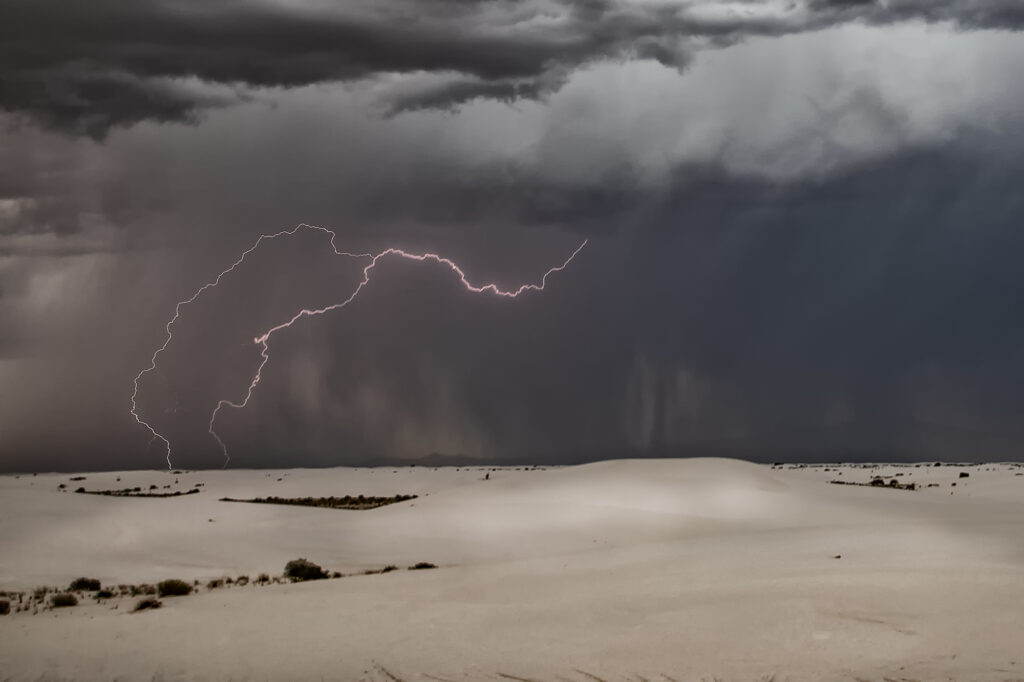
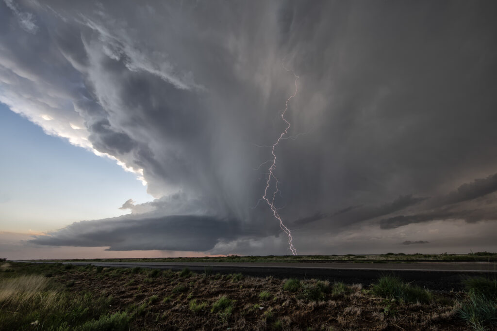
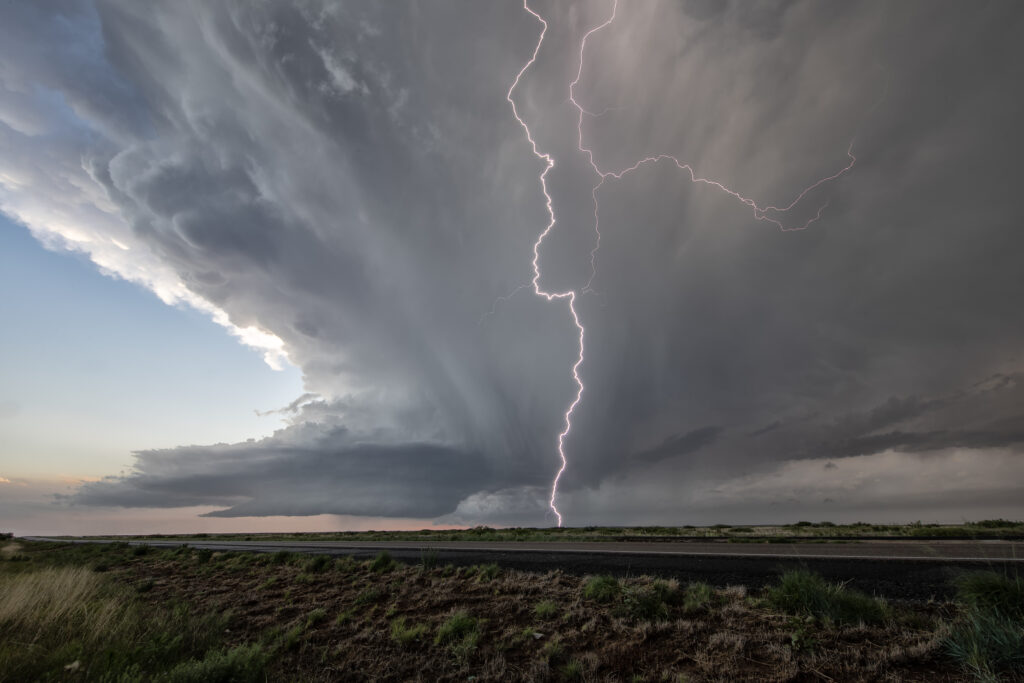
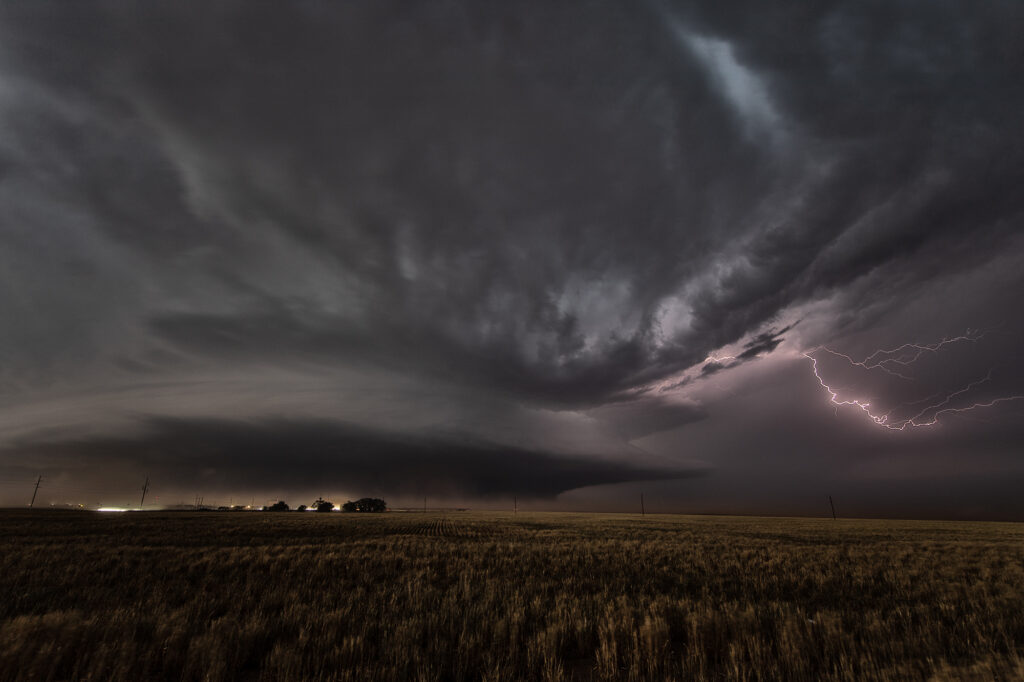
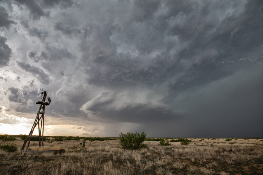
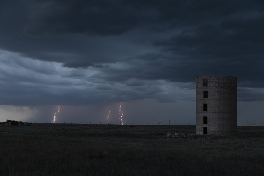
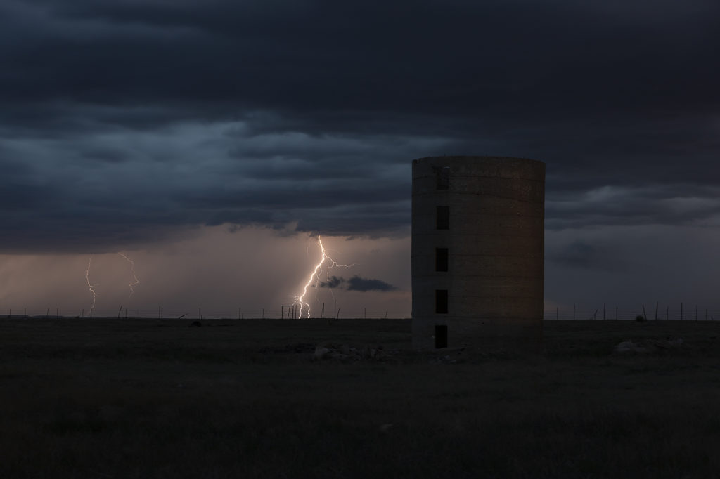
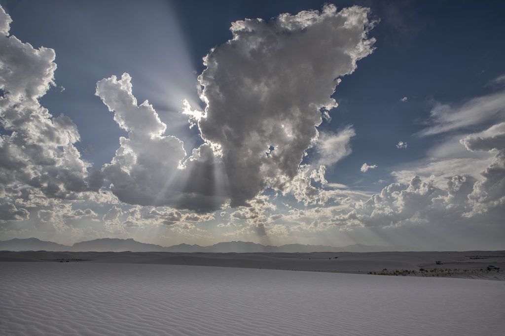
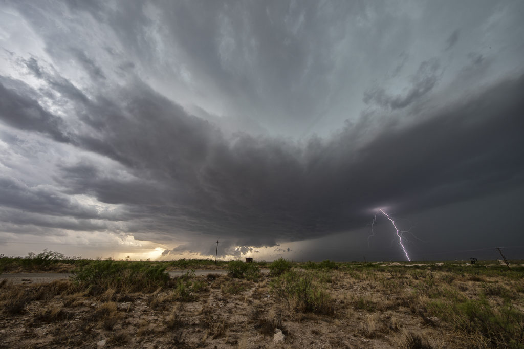
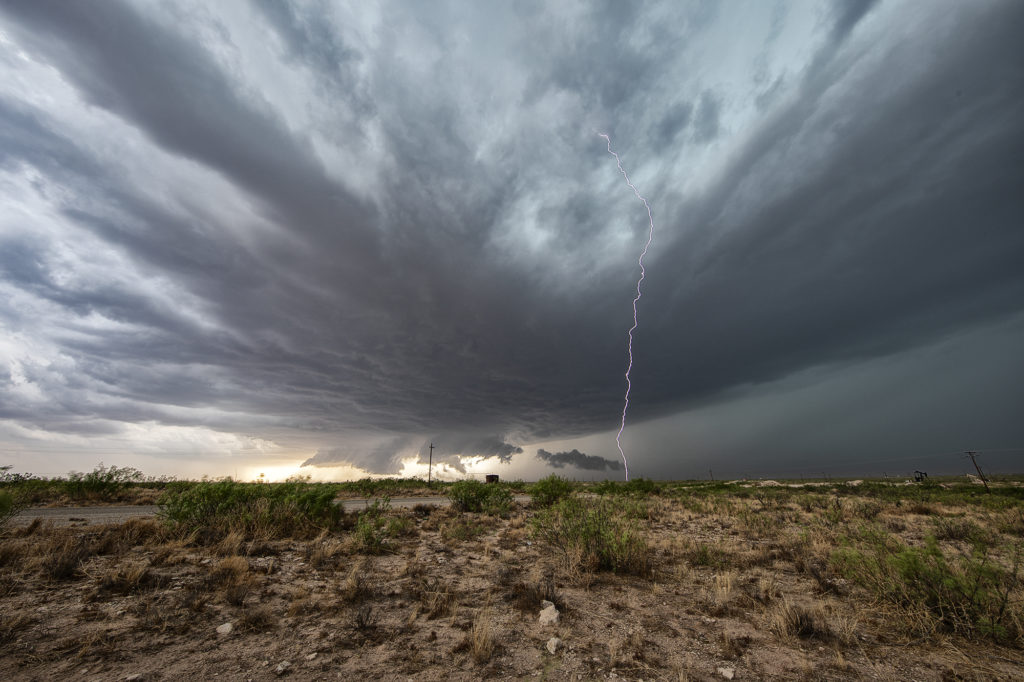
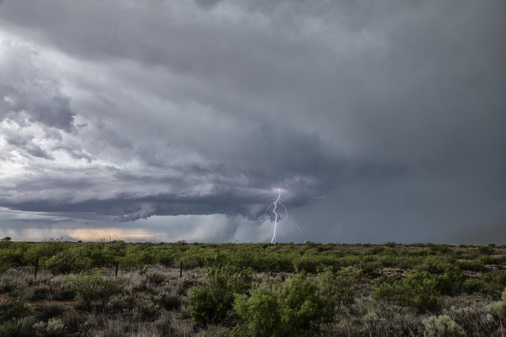
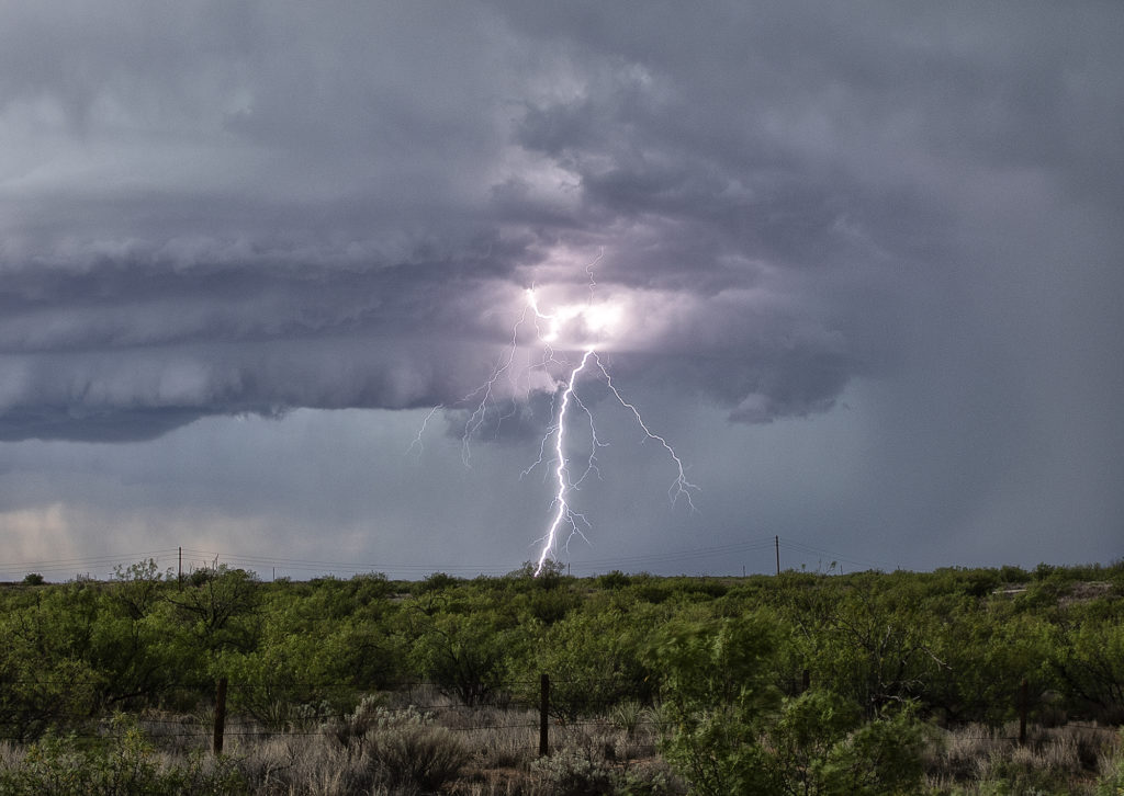
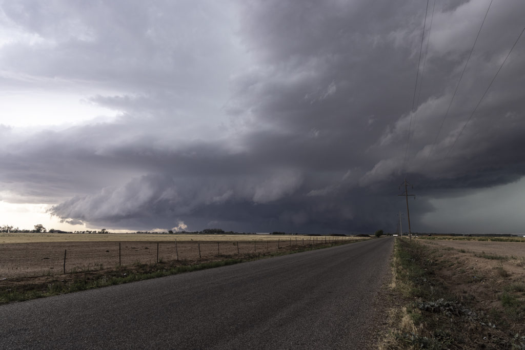
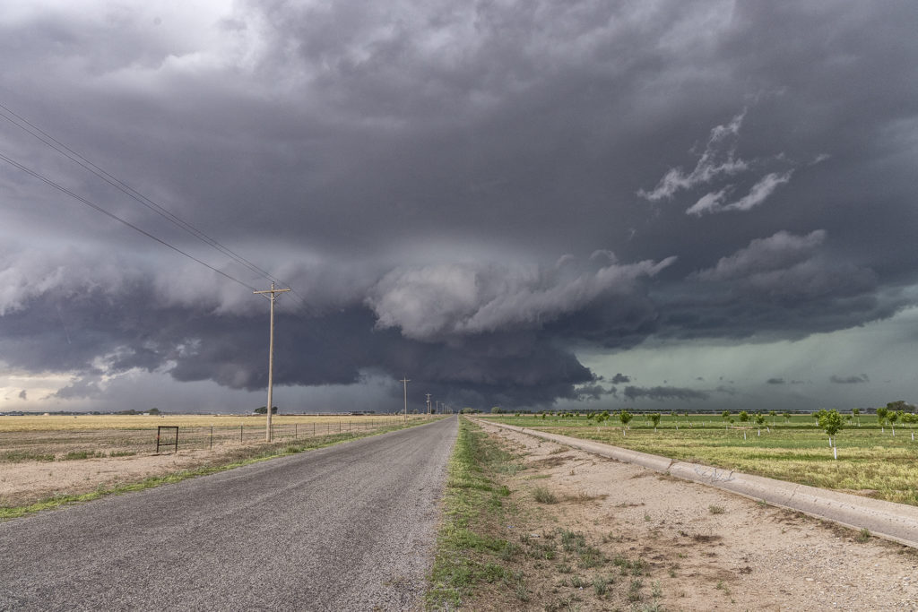
July 15th had a lot going for it. Strong northwest flow aloft would generate good shear with surface southeast winds. High dewpoints in the 60s at high elevations, would also generate a lot of instability. The upslope flow helped develop a well structured supercell near Wagon Mound, New Mexico. This storm was well structured and also produced huge hail baseball sized. The low levels never could tighten up enough to produce a tornado, however the supercell spun southward toward I-40 near Cuervo. It was severe warned for over 4 hours as it moved towards the south. Eventually we let it go as numerous storms blew up around it and thus reduced its ability to continue to maintain its strength. Fun chase over the plains and canyons of northeast New Mexico and fortunately to road network allowed us to continue chasing it all afternoon and early evening.


June 11th Raton Mesa, CO Tornado Warned Supercell

May 11th had a lot going for it. Good upslope flow into the Raton Mesa, decent moisture and instability and great wind shear would set the stage for supercells this day. Storms formed early afternoon and became tornado warned. We blasted west from the Oklahoma panhandle into the mesa in time to watch a supercell get very interesting. Couldn’t confirm any tornadic activity, but it certainly looked like it had potential. This storm also produced baseball sized hail and high winds. It was a treat to photograph and watch spin across the mesa into the Oklahoma/Texas panhandle. Fun day for all the guests who witnessed this beauty! Enjoy the pics!

June 6th White Sands, New Mexico Lightning

There wasn’t a lot of hope on June 6th, so we took the group to White Sands National Park in southern New Mexico for some general thunderstorm formation in hopes of catching some lightning over the dunes. Nature did not disappoint! We arrived to developing storms west of the park. A couple hours later, stormed were forming over the park as outflow from the western and southern storms moved into the area, lifting the air and generating storms, some severe! Nature is such an artist as several lightning strikes occurred over and near the park. A fun day and many of the guests had never been to White Sands. Needless to say, I bet they go back again! Enjoy the photos!

May 31st Roswell, New Mexico Incredible Supercell

May 31st had potential in the western Texas panhandle and southeastern New Mexico. Storms exploded in New Mexico, and a couple became tornado warned. Those clustered and moved into west Texas. A few hours later, more storms formed near Roswell. With good upslope flow, decent moisture and instability, they quickly became severe. One storm, on the southern end of a cluster, became a supercell. The structure was amazing and the electrification was phenomenal! We stayed with it till dark when it weakened and the lightning ceased. One of the prettiest LP supercells of the season to date! Enjoy the pics!


May 24th Eastern New Mexico Tornadic Supercell

What a day! May 24th looked great in the models, and in real time, it was amazing!! Violent supercell thunderstorms congealed into one monster that dropped from Tucumcari, New Mexico southward to Clovis over a several hour period. Insane lightning and incredible storm structure persisted its entire life cycle. It also produced a few tornadoes, of which we caught a couple of them. During the early evening hours, as the storm approached Clovis, the inflow into this supercell was over 60 mph! Just showed the power of this HP storm! As it moved into far west Texas at dusk, the structure was constantly illuminated by incredible lightning. One of the most powerful supercells of 2023 to date, and it was a sight to behold! Enjoy the pics!

July 11th Northeast New Mexico Severe Storms

We weren’t expecting much this day. Modest moisture, CAPE and shear were present, thus we were hoping for a few pulse storms. Thunderstorms formed over the higher terrain of northeast New Mexico and collapsed. Their outflow pushed east and helped developed additional storms on the south side of the Raton Mesa. These storms congealed into a cluster of high wind producing severe storms in far eastern parts of the state and eventually moved into northwest Texas panhandle. Lightning was decent as well.

June 2nd White Sands, New Mexico Fun!

What do you do when storms are not forecast across the plains? We head to scenic areas for some sight seeing and photography. June 2nd took us to White Sands National Park, New Mexico. Storms were forecast over the central New Mexico mountain chains and we hoped they would move towards us over White Sands. The did exactly that, but weren’t producing much lightning. Still a very scenic spot with developing storms around. Made for some stunning photography!

June 1st Southeast New Mexico Powerful Supercell

The first day of June took us towards far southeast New Mexico. A couple supercells developed along the dryline west of Jal and drifted eastward, becoming quite prolific hailstorms. The storm’s structure was very nice and it had a wall cloud throughout it’s life cycle. However, low level rotation was lacking. The cell was an amazing lightning machine producing numerous cgs every minute. As it moved southeast, other storms for and soon a cluster of high based severe storms rolled into southwest Texas. We went to our hotel in Midland and watched as the storm approached from the northwest, with tons of blowing dirt, lightning and hail.

June 2nd Jal, New Mexico Supercell

We weren’t expecting a great show this date as the ingredients just weren’t there. Marginal moisture and weak wind shear would limit the longevity and structure to storms this day, but we did manage to capture a couple of pretty supercells. We started the day in Lubbock, Texas so it wasn’t far to get into position. An old outflow boundary would provide to focus for storms. Due to the steep lapse rates and rapid cooling of the hot boundary layer as air rose aloft, storms became hailers and also were nicely electrified! The cells shown below produced hail the size of golfballs and 80 mph outflow winds, which generated a lot of blowing dirt across west Texas. It was getting late in the season to chase this far south, but you go where you need to. Many days of excessive heat dried up the landscapes which fueled the fire so to speak with intense blowing dirt. Fun day regardless! Enjoy the pics below!


May 30th Roswell, New Mexico Tornadic Supercell

May 30th was the first day of Tour 5 leaving from Denver. It was a long drive to our target of Roswell, NM, but we made it just in time. A tornadic supercell formed west of town and tracked east/southeast. A couple of tornado reports were made and I can’t argue with them. A few spin ups under the updraft occurred as rotation was strong above them. Good CAPE, moisture, and a boundary set the stage for this supercell to form. Nice structure and huge hail also fell from this cell. As it moved east later in the day, it weakened and another supercell formed on it’s outflow. This storm was jaw dropping gorgeous and rolled eastward towards the Texas border in the evening hours. A fantastic day after an extremely long drive, but well worth it! Enjoy the pics!